Sonoran Desert facts for kids
Quick facts for kids Sonoran Desert |
|
|---|---|
|
|
Sonoran desert
|
|
| Ecology | |
| Realm | Nearctic |
| Biome | Deserts and xeric shrublands |
| Borders |
List
|
| Bird species | 246 |
| Mammal species | 120 |
| Geography | |
| Area | 222,998 km2 (86,100 sq mi) |
| Countries | Mexico and United States |
| States | Arizona, California, Baja California, Baja California Sur and Sonora |
| Coordinates | 32°15′N 112°55′W / 32.250°N 112.917°W |
| Rivers | Colorado River |
| Climate type | Hot desert (BWh) |
| Conservation | |
| Conservation status | Relatively Stable/Intact |
| Habitat loss | 10.5% |
| Protected | 39% |
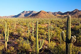
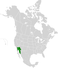
The Sonoran Desert (in Spanish: Desierto de Sonora) is a very hot desert in North America. It covers parts of Mexico and the United States. You can find it in the Mexican states of Sonora, Baja California, and Baja California Sur. It also stretches into Arizona and California in the U.S. This desert is the hottest in Mexico. It covers about 260,000 square kilometers (100,000 square miles).
The Sonoran Desert is special because it has warm winters and two rainy seasons. This is different from other nearby deserts like the Mojave Desert. This unique climate helps many special plants and animals live here. Famous plants include the giant saguaro cactus and the organ pipe cactus.
Contents
Where is the Sonoran Desert?
The Sonoran Desert wraps around the northern part of the Gulf of California. It goes from Baja California Sur in Mexico, north through much of Baja California. It also covers southeastern California and parts of southwestern and southern Arizona. Finally, it reaches western and central Sonora in Mexico.
Mountains called the Peninsular Ranges are to the west. These mountains separate the Sonoran Desert from other areas. To the north, the Sonoran Desert changes into colder deserts. These include the Mojave Desert and Colorado Plateau shrublands.
To the east, you find the Arizona Mountains forests. The Chihuahuan Desert is also to the east. To the south, the desert changes into tropical dry forests. This area is called the Sonoran–Sinaloan transition subtropical dry forest.
Parts of the Sonoran Desert
The Sonoran Desert has several smaller parts. These include the Colorado Desert in California. The Yuma Desert is in southwest Arizona. Some experts also divide the desert into seven areas based on the plants that grow there. Two of these areas, the Vizcaíno and Magdalena regions, are sometimes seen as a separate desert.
In Mexico, a large part of the southern Sonoran Desert is called the Gran Desierto de Altar. It has a special reserve called the El Pinacate y Gran Desierto de Altar Biosphere Reserve. This reserve has 2,000 square kilometers (770 square miles) of desert and mountains. It also has the only active sand dune area in North America.
Here are some of the Sonoran Desert's smaller parts:
- Colorado Desert
- Gran Desierto de Altar
- Lechuguilla Desert
- Tonopah Desert
- Yuha Desert
- Yuma Desert
Climate of the Sonoran Desert
The Sonoran Desert has a hot, dry climate. It is known as the most tropical desert in North America. In the lower areas, it is warm all year. Rain does not fall often, and it is usually less than 90 millimeters (about 3.5 inches) each year. Higher areas in Arizona get more rain, about 100–300 millimeters (4–12 inches) per year. This rain usually comes in two seasons.
Most of the Sonoran Desert has a hot desert climate. Some higher mountains within the desert have a hot semi-arid climate. This means they are a bit less dry.
Plants of the Sonoran Desert
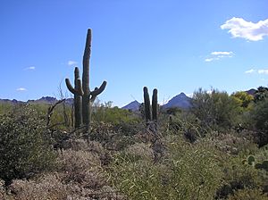
Many plants grow well in the Sonoran Desert's tough conditions. They have special ways to live in the desert heat. Because the desert gets rain in two seasons, it has more plant types than any other desert. You can find plants from the agave family, palm family, and cactus family here. Many of these plants are used as food crops. For example, Mission Garden shows foods grown here for over 4,000 years.
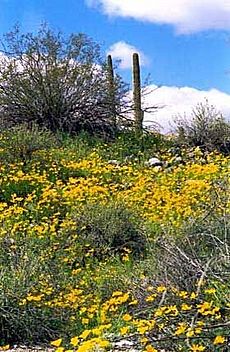
The Sonoran Desert is the only place where the famous saguaro cactus grows naturally. Other cacti found here include cholla, beavertail, and organ pipe. Cacti provide food and homes for many desert animals and birds. Their colorful flowers bloom from late March to June.
Creosote bush and bur sage are common plants on the valley floors. Other shrubs like indigo bush also grow here. Wildflowers include desert sand verbena and desert sunflower.
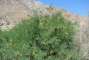
As you go up the hills, you will see trees like velvet mesquite and palo verde. Other trees include desert ironwood and desert willow. The ocotillo is also common. Higher up, you might find whitethorn acacia and jojoba. In the Baja California parts of the desert, you can see cardon cactus and boojum tree.
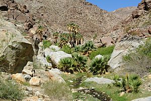
The California fan palm grows in the Colorado Desert part of the Sonoran Desert. It is the only palm tree native to California. You can find it near spring-fed oases. Good places to see them are Anza Borrego Desert State Park and Joshua Tree National Park.
Animals of the Sonoran Desert
The Sonoran Desert is home to many animals. They have learned to live in the hot, dry desert. Some of these animals are the Gila monster, bobcat, and mule deer. You can also find the antelope jackrabbit and greater roadrunner. Snakes like the western diamondback rattlesnake live here too.
The desert has 350 types of birds and over 100 types of reptiles. There are also 30 types of native fish. More than 1,000 types of native bees live here. The area near Tucson is important for jaguars. It is the only place in the United States where jaguars still live.
The Colorado River Delta used to be a very important area for animals. This was because of the Colorado River in the dry desert. But now, dams and river use have made the delta much smaller. Some insects, like the Drosophila mettleri fly, have special ways to survive the heat. This fly can live in the cool, wet soil. This helps it reproduce in the desert.
-
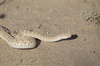
Crotalus cerastes in Puerto Peñasco, Mexico
-
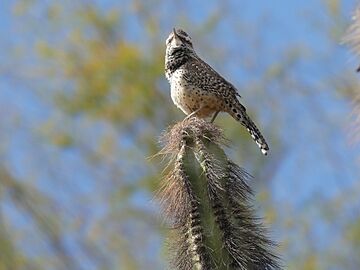
Campylorhynchus brunneicapillus in Phoenix, United States
-
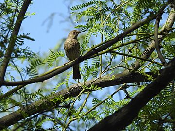
Haemorhous mexicanus in Maricopa County, United States
-
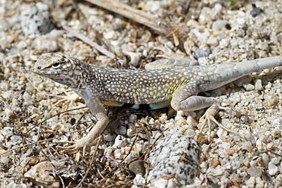
Callisaurus draconoides in Los Cabos, Mexico
-
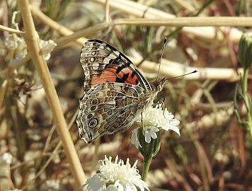
Vanessa cardui in Riverside County, United States
-
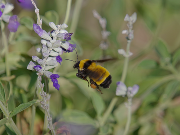
Bombus sonorus in Phoenix, United States
People of the Sonoran Desert
Many different groups of Native American tribes live in the Sonoran Desert. There are over 17 tribes with settlements in Arizona and California. There are also Native American groups in Mexico.
The biggest city in the Sonoran Desert is Phoenix, Arizona. About 4.7 million people live in its metro area. Phoenix is in central Arizona. It is one of the fastest-growing cities in the United States. In 2007, the desert around Phoenix was being built on very quickly.
The next largest cities are Tucson in southern Arizona, with over 1 million people. Mexicali, Baja California in Mexico also has about 1 million people. Hermosillo, Sonora, Mexico, has almost 900,000 people. Ciudad Obregón, Sonora, in the southern desert, has about 375,800 people.
Cities in California
The Coachella Valley is in the California part of the Sonoran Desert. About 365,000 people live there. Famous resort cities like Palm Springs are located here.
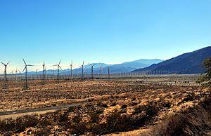
In winter, from November to April, the daytime temperatures are warm. They range from 70°F (21°C) to 90°F (32°C). This makes it a popular place for winter vacations. Because it is warm all year, fruits like mangoes and dates are grown here. The Imperial Valley is nearby and has over 180,000 people. It has a similar climate. Other cities in this area include Indio and El Centro.
Crossing the Border
The Sonoran Desert crosses the Mexico–United States border. It is an important path for people and animals moving between the two countries. The desert's harsh climate makes this journey difficult. People often travel at night to avoid the extreme heat.
Protected Areas in the Desert
Many areas in the Sonoran Desert are protected. These include National Parks and Monuments. There are also wildlife refuges and state parks. These places help protect the desert's plants and animals. They also offer places to learn about nature.
Some protected areas in the Sonoran Desert are:
- Arizona–Sonora Desert Museum
- Sonoran Desert National Monument
- Boyce Thompson Arboretum State Park
- Anza–Borrego Desert State Park
- Organ Pipe Cactus National Monument
- Saguaro National Park
- Joshua Tree National Park
- Reserva de la Biosfera el Pinacate y Gran Desierto de Altar (in Mexico)
- Kofa National Wildlife Refuge
See also
- Chihuahuan Desert
- Mojave Desert
- Spanish missions in the Sonoran Desert
See also
 In Spanish: Desierto de Sonora para niños
 | Victor J. Glover |
 | Yvonne Cagle |
 | Jeanette Epps |
 | Bernard A. Harris Jr. |


