Warren County, Indiana facts for kids
Quick facts for kids
Warren County
|
|
|---|---|
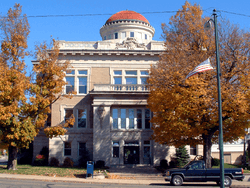
Warren County courthouse in Williamsport
|
|
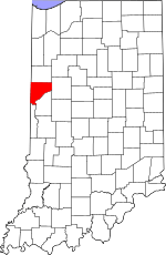
Location within the U.S. state of Indiana
|
|
 Indiana's location within the U.S. |
|
| Country | |
| State | |
| Founded | March 1, 1827 |
| Named for | Joseph Warren |
| Seat | Williamsport |
| Largest town | Williamsport |
| Area | |
| • Total | 366.40 sq mi (949.0 km2) |
| • Land | 364.68 sq mi (944.5 km2) |
| • Water | 1.72 sq mi (4.5 km2) 0.47%% |
| Population
(2020)
|
|
| • Total | 8,440 |
| • Density | 23.035/sq mi (8.894/km2) |
| Time zone | UTC−5 (Eastern) |
| • Summer (DST) | UTC−4 (EDT) |
| Congressional district | 4th |
| Indiana county number 86 | |
Warren County is a special area of land called a county in the state of Indiana. It is located in the western part of Indiana, right between the Illinois state line and the Wabash River. In 2020, about 8,440 people lived here. The main town and center of the county is Williamsport.
Before settlers from Europe arrived in the early 1800s, different Native American tribes lived in this area. Warren County was officially created in 1827. It was the 55th county to be formed in Indiana.
Warren County is one of the most rural counties in Indiana. This means it has a lot of open land and not many big cities. It has the third-smallest population and the fewest people per square mile in the state. There are four towns in the county with about 3,100 people living in them. Many smaller communities are also spread out. The county is divided into 12 areas called townships that help provide local services.
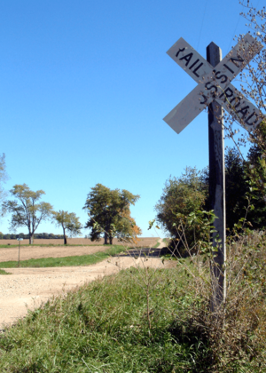
Most of the land in Warren County is used for farming. The northern and western parts have wide-open prairie lands, which are great for growing crops. The farms here are some of the best in Indiana. Closer to the Wabash River in the southeast, the land has more hills, valleys, and forests. Many people in Warren County work in farming, manufacturing, government, education, and health care. Several main roads and one major railroad line cross through the county.
Contents
Discovering Warren County's Past
The land that is now Warren County was once home to the Miami and Kickapoo tribes. Later, the Potawatomi people lived in much of northern Indiana, including this area.
The first non-Native American settler was likely Zachariah Cicott. He was a French-Canadian who traded with the Kickapoo and Potawatomi tribes around 1802. In 1811, General William Henry Harrison marched his army through this area. Cicott helped guide them to the Battle of Tippecanoe. After the War of 1812, Cicott continued trading. He built a log house in 1817 where the town of Independence now stands. Other settlers started to arrive around 1822.
How Warren County Was Formed
The Indiana government officially created Warren County on March 1, 1827. It was named after Joseph Warren, a hero of the American Revolutionary War. He was killed in 1775 at the Battle of Bunker Hill.
The first county seat, or main town for government, was a place called Warrenton. But in 1829, the county seat was moved to Williamsport.
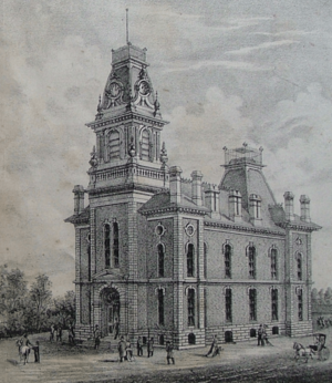
The first courthouse was a log house in Warrenton. When Williamsport became the county seat, a log house there was used. The first building built specifically as a courthouse was finished in 1835. A new, larger courthouse was built in 1872. The third courthouse was built in 1886. It burned down in 1907. The fourth and current Warren County courthouse was finished in 1908.
Native American History and the Trail of Death
As the 1800s continued, the United States government began moving Native American tribes west of the Mississippi River. This was part of a plan called the Indian removal policy. In 1830, a law called the Indian Removal Act was signed. This led to treaties that forced the Potawatomi people to leave Indiana.
About 860 Potawatomi people who did not want to leave were forced to move from Indiana to Kansas. This sad journey became known as the Potawatomi Trail of Death. On September 14, 1838, the group camped near Williamsport. The next day, they camped in the southwestern part of the county before moving into Illinois. More than 40 people, many of them children, died before reaching Kansas. Two children died and were buried at the second campsite in Warren County.
Travel and Trade: Rivers, Canals, and Trains
When Warren County was first formed, the Wabash River was very important for travel and shipping goods. Towns like Attica, Perrysville, and Williamsport grew along the river.
In the 1840s, the Wabash and Erie Canal opened. This canal offered even more ways to ship goods. However, the canal was on the Fountain County side of the river. This caused some towns, like Baltimore, to shrink because they were on the "wrong side" of the river. Some towns, like Williamsport, built special channels to connect to the canal.
Then, in the 1850s, railroads started to be built. Trains began to replace canals for trade. This allowed towns without water connections to grow. The canal was still used until the early 1870s.
The first trains in Warren County ran in 1856. The railroad line entered the county near Williamsport and went west to State Line City. West Lebanon, another town, moved closer to the train station. Other railroads were built over the years, connecting different parts of the county and beyond. Some of these lines were later abandoned due to financial problems or changes in how goods were moved.
One famous passenger train was the Wabash Cannonball. It ran between Detroit, Michigan, and Saint Louis, Missouri. On September 19, 1964, the Cannonball hit a truck in Johnsonville. The truck driver died. The train went off the tracks, and the engine caught fire. The train's driver and fireman were badly hurt, and about half of the 50 passengers were injured. The train stopped running in 1969.
Changes in Population and Life
After growing in the late 1800s, Warren County's population started to shrink in the 1900s. This happened in many rural areas. When cars became popular in the 1920s, people could easily drive to bigger towns, which hurt small local businesses. The Great Depression in the 1930s also made things harder.
After World War II, many people moved to bigger cities for better jobs. This caused small towns to get even smaller. The population also dropped in the 1980s because of problems in farming, like low crop prices.
Fun Times: County Fairs and Healing Waters
The first county fair for both Fountain and Warren counties was held in Independence in 1853. Later, Warren County farmers started their own fair near Pine Village. The fair then moved to West Lebanon and was very successful. Today, the county fair is held in Williamsport and is a 4H fair, which teaches young people about agriculture and life skills.
Near the small town of Kramer, there was once a famous place called the Hotel Mudlavia. It was built in 1890. People from all over the world came to its natural springs, which were believed to have healing powers. Famous people like James Whitcomb Riley stayed there. The hotel burned down in 1920. Later, water from the springs was bottled and sold.
Exploring Warren County's Geography
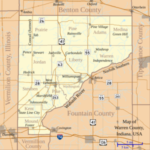
The Wabash River forms the southeastern border of Warren County. This area has many hills and forests. Across the river is Fountain County. To the northwest, the land is mostly flat farmland. This flat land continues into Benton County to the north. The western side of Warren County borders Vermilion County, Illinois. A small southern border is shared with Vermillion County. The state capital, Indianapolis, is about 70 miles to the southeast.
Natural Wonders and Waterways
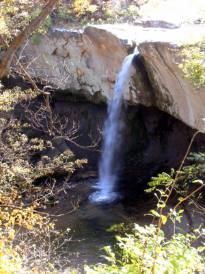
Warren County is home to Williamsport Falls, the highest free-falling waterfall in Indiana. It is right in downtown Williamsport! A stream called Fall Creek drops 90 feet over a sandstone cliff.
Northeast of Independence is the Black Rock Barrens Nature Preserve. This is a rare area with special rocks and many different kinds of plants. Big Pine Creek is the county's largest waterway after the Wabash River. A 10.5-mile part of it is a state natural and scenic river. It flows near Fall Creek Gorge Nature Preserve, which has beautiful cascades and natural potholes.
Warren County has a total area of about 366.40 square miles. Most of this (99.53%) is land, and a small part (0.47%) is water. The land ranges from 480 feet above sea level near the Wabash River to 830 feet in the northeastern part of the county. The land is mostly flat or gently sloped, with good soil for farming. Forests cover about 14% of the county, mainly along rivers. These forests have many different kinds of trees. The only coal mines in the county are in the southeastern part of Steuben Township, near the Wabash River.
Townships and Communities
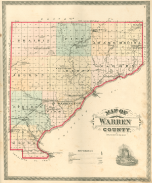
When Warren County was created in 1827, it had four townships: Medina, Warren, Pike, and Mound. Over the years, eight more townships were added. The last two, Kent and Prairie, were created in 1864.
Prairie Township has the fewest people per square mile. It is also the largest township, covering almost 50 square miles, and has no towns. Washington Township has the most people per square mile. It includes Williamsport, the county's largest town, and is only about 20 square miles.
There are four main towns in Warren County:
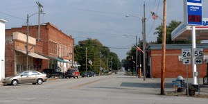
- Williamsport is the largest, with 1,898 people in 2010. It is on the Wabash River.
- West Lebanon is about 5 miles west of Williamsport, with 723 people.
- Pine Village is about 11 miles north of Williamsport, with 217 people.
- State Line City is in the southwestern part of the county, right on the Illinois border. It is the smallest town, with 143 people.
Besides these towns, Warren County has many small communities that are not officially towns. These places often have a few houses, maybe a church, and sometimes a small business. Some examples are Hedrick, Pence, Stewart, Johnsonville, Marshfield, Independence, Green Hill, and Tab.
Some communities that once existed in Warren County have disappeared over time. For example, the river town of Baltimore was once a big trading center but faded when railroads became more important. Warrenton, the first county seat, also disappeared.
Weather and Climate in Warren County
Warren County has a humid continental climate. This means it has cold winters and hot summers. From 1971 to 2000, average temperatures ranged from 26°F in January to 74.3°F in July. The coldest temperature ever recorded was -33°F in 1887, and the hottest was 116°F in 1936. The county gets between 2.27 inches of rain in February and 4.46 inches in May.
Big Weather Events
On April 17, 1922, a tornado hit Warren County. The town of Hedrick was almost completely destroyed, and several people died. From 1950 to 2009, ten tornadoes were reported in Warren County. None caused deaths or injuries, but they did cause over $3 million in property damage.
Warren County was also hit by the Great Blizzard of 1978. This was the worst blizzard ever recorded in Indiana. In late January, over 20 inches of snow fell, and strong winds created snowdrifts as high as 10 feet. Schools were closed for up to 17 days, and some people were stuck in their homes for five days.
Getting Around Warren County
Warren County does not have any major interstate highways running through it. However, Interstate 74 passes very close to the southern border. About 20 miles of federal highways and 86 miles of state highways cross the county. There are also about 550 miles of county roads. About one-third of these county roads are paved, and the rest are gravel or dirt.
U.S. Route 41 comes from the north, goes through the center of Warren County, and crosses the Wabash River. U.S. Route 136 passes through the far southern part of the county.
In the northern part of the county, Indiana State Road 26 starts at the Illinois border and goes through Pine Village. It crosses State Road 55. State Road 28 also crosses the state, connecting West Lebanon and Williamsport.
State Road 63 is a four-lane highway that runs south from U.S. Route 41. It goes towards Terre Haute. A two-lane road, State Road 263, is part of the older State Road 63 route. It goes through West Lebanon and along the river. A small part of State Road 352 is in the far northwestern corner of the county.
Train Lines and Airports
The busiest train line in Warren County is a Norfolk Southern Railway route. It connects Danville, Illinois, with Lafayette. About 45 freight trains use this line every day. It enters Warren County at State Line City and goes through Johnsonville, Marshfield, West Lebanon, and Williamsport.
Two smaller train lines also operate. The Bee Line Railroad is mainly used for farming products. The Vermilion Valley Railroad serves a factory near Covington.
The closest airport is the small Vermilion Regional Airport in Illinois. Purdue University Airport in Tippecanoe County is Indiana's second busiest airport. The largest airport nearby is Indianapolis International Airport, about 90 miles away.
Warren County's Economy
Warren County's economy is supported by about 4,815 workers. In July 2010, the unemployment rate was 8.8%.
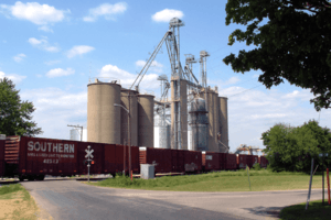
Farming is a very important part of the economy. About 14% of the county's workers are farmers. There are also grain elevators in most towns, which store crops. The farmland in Warren County is very good and produces a lot of crops. In 2009, farmers grew 17.4 million bushels of corn and 3.96 million bushels of soybeans. About 86% of the county's land is used for growing crops.
About 14% of workers have jobs in government, like for state and county services or schools. Manufacturing is the largest industry outside of government, employing about 17% of workers.
Warren County has several factories. Flex-N-Gate makes car parts. In Williamsport, TMF Center makes parts for construction equipment. GL Technologies gets industrial tools, and Kuri-Tec makes industrial hoses. Tru-Flex Metal Hose in West Lebanon makes flexible metal hoses. Dyna-Fab, also in West Lebanon, makes metal parts. St. Vincent Hospital and a nursing home in Williamsport are also important employers. About 9.8% of jobs in the county are in health care and social services.
Nearby cities like Lafayette and Danville, Illinois, also offer jobs and shopping for Warren County residents.
Electricity in the county comes from three companies: Duke Energy, the Warren County Rural Electric Membership Cooperative (REMC), and NIPSCO.
Famous People from Warren County
Many interesting people have connections to Warren County:
- George D. Wagner grew up on a farm near Green Hill. He became a successful farmer and served in the Indiana House of Representatives and Senate. He fought in the Civil War and became a brigadier general. After the war, he practiced law in Williamsport.
- James Frank Hanly moved to Warren County in 1879. He worked as a school teacher and later became a lawyer. He served as Governor of Indiana from 1905 to 1909. He strongly supported prohibition, which was a ban on alcohol. He died in a car accident in 1920.
- Fremont Goodwine was born in West Lafayette in 1857. He went to Purdue University and became a teacher. He later became the superintendent of education for Warren County. He was elected to the state senate and served for 12 years. He lived to be 99 years old.
- Albert Lee Stephens Sr. was born in State Line City in 1874. He became a lawyer and judge in California. In 1935, he was chosen by President Franklin D. Roosevelt to be a United States District Court judge. He later became a chief judge for the United States Court of Appeals. He died in 1965 at age 91.
- Vernon Burge went to school in West Lebanon. He joined the United States Army in 1907. In 1912, he became the first American enlisted soldier to be certified as a military pilot.
- Donald E. Williams also grew up in Green Hill. He studied engineering at Purdue University. He was a pilot during the Vietnam War and later became a NASA astronaut in 1979. He flew on two Space Shuttle missions in the 1980s.
- Stephanie White-McCarty went to Seeger Memorial High School. She was named "Indiana Miss Basketball" in 1995 and set a state scoring record. She played on Purdue University's first NCAA women's basketball championship team in 1999. She then played in the Women's National Basketball Association and is now a basketball coach.
News and Media in Warren County
The first newspaper in Warren County was The Wabash Commercial, started in Williamsport in the 1850s. Its name was changed to The Warren Republican in 1854. Later, another paper called The Warren Review started in 1891. In 1914, these two papers combined to become The Review Republican. It is now known as "Warren County's only newspaper."
West Lebanon also had several newspapers around the time of the Civil War. The most recent was The Gazette, which was printed from the late 1800s to the early 1900s. Pine Village had a newspaper called the Sentinel-News in 1912. The Neighbor is a weekly paper that serves both Fountain and Warren counties.
There are no television or radio stations based in Warren County. However, people in the county can receive TV and radio signals from nearby cities like Lafayette and Terre Haute in Indiana, and Danville and Champaign-Urbana in Illinois.
Warren County's Population
| Historical population | |||
|---|---|---|---|
| Census | Pop. | %± | |
| 1830 | 2,861 | — | |
| 1840 | 5,656 | 97.7% | |
| 1850 | 7,387 | 30.6% | |
| 1860 | 10,057 | 36.1% | |
| 1870 | 10,204 | 1.5% | |
| 1880 | 11,497 | 12.7% | |
| 1890 | 10,955 | −4.7% | |
| 1900 | 11,371 | 3.8% | |
| 1910 | 10,899 | −4.2% | |
| 1920 | 9,699 | −11.0% | |
| 1930 | 9,167 | −5.5% | |
| 1940 | 9,055 | −1.2% | |
| 1950 | 8,535 | −5.7% | |
| 1960 | 8,545 | 0.1% | |
| 1970 | 8,705 | 1.9% | |
| 1980 | 8,976 | 3.1% | |
| 1990 | 8,176 | −8.9% | |
| 2000 | 8,419 | 3.0% | |
| 2010 | 8,508 | 1.1% | |
| 2020 | 8,440 | −0.8% | |
| 2023 (est.) | 8,518 | 0.1% | |
| U.S. Decennial Census 1790–1960 1900–1990 1990–2000 2010–2020 |
|||
In 2010, there were 8,508 people living in Warren County. The county had about 23.3 people per square mile. Most of the people (98.3%) were white. A small number were black, Native American, or Asian. About 0.8% of the population was of Hispanic or Latino background. The main ancestries were German, English, and Irish.
There were 3,337 households in the county. About 31.7% of these households had children under 18 living with them. Most households (59.4%) were married couples. The average age of people in the county was 42.4 years.
The average income for a household in the county was $49,238. For families, the average income was $57,990. About 8.8% of the population lived below the poverty line. This included 13.9% of those under 18 and 6.3% of those aged 65 or older.
See also
 In Spanish: Condado de Warren (Indiana) para niños


