Alamo, California facts for kids
Quick facts for kids
Alamo
|
|
|---|---|
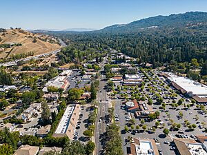
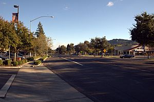
Downtown Alamo
|
|
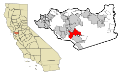
Location in Contra Costa County and the state of California
|
|
| Country | |
| State | |
| County | Contra Costa |
| Area | |
| • Total | 9.82 sq mi (25.42 km2) |
| • Land | 9.82 sq mi (25.42 km2) |
| • Water | 0.00 sq mi (0.00 km2) 0% |
| Elevation | 259 ft (79 m) |
| Population
(2020)
|
|
| • Total | 15,314 |
| • Density | 1,560.11/sq mi (602.38/km2) |
| Time zone | UTC-8 (PST) |
| • Summer (DST) | UTC-7 (PDT) |
| ZIP code |
94507
|
| Area code(s) | 925 |
| FIPS code | 06-00618 |
| GNIS feature IDs | 1657900, 2407707 |
Alamo is a community in Contra Costa County, California, in the United States. Its name comes from the Spanish word Álamo, which means "Poplar tree".
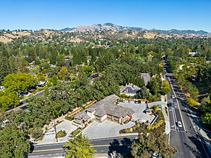
Alamo is a suburb located in the San Francisco Bay Area's East Bay region. It is about 28 miles (45 km) east of San Francisco. Alamo is located between the cities of Walnut Creek and Danville. In 2020, about 15,314 people lived there.
The local police services are provided by the Contra Costa County Office of the Sheriff. Fire and EMS (medical help) are handled by the San Ramon Valley Fire Protection District. Alamo is known for its high average household income. In 2009, citizens voted against making Alamo an official city.
Contents
History of Alamo
Alamo has a long history, going back over 5000 years. The first people to live here were the Tatcan Indians. They were a Bay Miwok tribe. They lived in Alamo in the 1700s.
After a mission was built in 1797, the land around Alamo became a large grazing area for animals. In 1833, a Mexican land grant called Rancho San Ramon was given to Mariano Castro and Bartolo Pacheco. This land included what is now Danville and Alamo.
Later, in 1843, much of the Alamo area was granted to brothers Inocencio and José Romero. This land was called Rancho El Sobrante de San Ramon. However, they lost their ranch in 1857 because of missing paperwork.
In 1847, pioneers Mary Ann and John Jones traveled through Alamo. Mary Ann wrote in her diary about how beautiful the area was. She described the valley and hills covered with thick clover and tall wild oats.
The Jones family came back to Alamo in 1851 after California became a state. John Jones became the first postmaster in 1852. Mary Ann helped start a school and a church. Other early settlers included David Glass and Silas Stone.
The name Alamo comes from the Spanish word for "poplar" or "cottonwood" tree. The area grew quickly because of its good location and climate. Early roads helped bring building materials like redwood to the area.
Over time, farms in Alamo grew many fruits. Almonds, walnuts, pears, and grapes were common. In 1873, Myron Hall helped start the successful walnut industry in Contra Costa County. He grafted Persian walnut cuttings onto local trees.
The Alamo post office is the oldest one in the valley that has been open continuously. It was a very important place for the community to gather and share news.
Geography of Alamo
Alamo is located in Contra Costa County. It is at the northern end of the 20-mile (32 km) long San Ramon Valley. This valley is between two California Coast Ranges — the Las Trampas Ridge to the west and the Diablo Range to the east.
The cities of San Ramon and Danville are also in this valley. To the north of Alamo is Walnut Creek. San Francisco is 28 miles (45 km) to the west. San Jose is 46 miles (74 km) to the south. A few miles east of Alamo is the 3,864-foot (1,178 m) tall Mount Diablo.
The United States Census Bureau says Alamo covers about 9.7 square miles (25 km2) of land. There is no water area.
 |
Lafayette | Walnut Creek | Shell Ridge |  |
| Rossmoor, Moraga | Diablo | |||
| Las Trampas Regional Wilderness | Danville | Diablo, Danville |
Alamo's Climate
Alamo has a warm-summer Mediterranean climate. This means it has hot, dry summers and cool, rainy winters. Summer temperatures can sometimes reach 100°F (38°C) or higher. In winter, frost can happen on clear mornings.
It rains about 42 days a year. During cold winter storms, snow can fall on nearby Mount Diablo. However, it almost never snows in the valley itself.
| Climate data for Alamo, California | |||||||||||||
|---|---|---|---|---|---|---|---|---|---|---|---|---|---|
| Month | Jan | Feb | Mar | Apr | May | Jun | Jul | Aug | Sep | Oct | Nov | Dec | Year |
| Mean daily maximum °F (°C) | 55.5 (13.1) |
60.4 (15.8) |
64.6 (18.1) |
70.1 (21.2) |
74.8 (23.8) |
80.0 (26.7) |
85.6 (29.8) |
84.9 (29.4) |
82.3 (27.9) |
75.3 (24.1) |
64.0 (17.8) |
55.9 (13.3) |
71.1 (21.7) |
| Daily mean °F (°C) | 47.5 (8.6) |
51.1 (10.6) |
54.2 (12.3) |
58.0 (14.4) |
62.3 (16.8) |
66.8 (19.3) |
70.6 (21.4) |
70.4 (21.3) |
68.5 (20.3) |
62.6 (17.0) |
53.9 (12.2) |
47.6 (8.7) |
59.5 (15.3) |
| Mean daily minimum °F (°C) | 39.5 (4.2) |
41.8 (5.4) |
43.9 (6.6) |
45.9 (7.7) |
49.9 (9.9) |
53.5 (11.9) |
55.7 (13.2) |
56.0 (13.3) |
54.6 (12.6) |
49.9 (9.9) |
43.9 (6.6) |
39.4 (4.1) |
47.8 (8.8) |
| Average precipitation inches (mm) | 4.93 (125) |
4.94 (125) |
3.56 (90) |
1.41 (36) |
0.96 (24) |
0.16 (4.1) |
0.02 (0.51) |
0.08 (2.0) |
0.17 (4.3) |
1.23 (31) |
2.89 (73) |
4.61 (117) |
24.98 (634) |
| Source: PRISM Climate Group | |||||||||||||
Parks in Alamo
Alamo has several parks for people to enjoy.
Andrew H. Young Park
This 1-acre park is named after Andrew H. Young. He was an Alamo resident who helped keep the town's charm. He was a World War II veteran and worked to preserve local history and nature.
Livorna Park
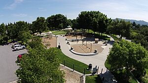
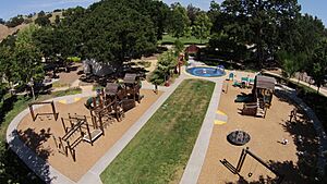
This 4.4-acre park has a large gazebo, a bocce ball court, and a sports court. It also has playgrounds, barbecue areas, and open grassy spaces. During summer, concerts are held here. The park also hosts a children's Easter egg hunt every year.
Rancho Romero School Sports Field and Park
This 5.4-acre park has soccer and softball fields, playgrounds, and restrooms. It is open to the public after school hours.
Alamo School Sports Field
This 2.2-acre park offers soccer and baseball fields, batting cages, and picnic areas. It is open to the public after school hours.
Hap Magee Ranch Park
This 16.3-acre park is on the border of Alamo and Danville. It has historic buildings. It used to be a ranch for longhorn cattle. Before that, it was a summer camp called Camp Swain for orphans from San Francisco. Today, the park has picnic areas, a water play area for kids, and dog parks.
Las Trampas Regional Wilderness
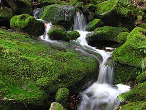
This is a large 5,342-acre (2,162 ha) park located southwest of Alamo. It has many different plants and animals. You can find forested hillsides and areas near rivers here.
Alamo's Geology
The Mount Diablo thrust fault runs through Alamo. This fault causes small tremors about every other month. It has never been known to be dangerous. However, the nearby Hayward Fault is very active.
People of Alamo (Demographics)
| Historical population | |||
|---|---|---|---|
| Census | Pop. | %± | |
| 1960 | 1,791 | — | |
| 1980 | 8,505 | — | |
| 1990 | 12,277 | 44.4% | |
| 2000 | 15,626 | 27.3% | |
| 2010 | 14,570 | −6.8% | |
| 2020 | 15,314 | 5.1% | |
| source: | |||
In 2010, Alamo had a population of 14,570 people. Most of the people living in Alamo were White (86.9%). About 8.2% were Asian, and 5.8% were Hispanic or Latino.
Almost everyone (99.8%) lived in homes. About 25.7% of the population was under 18 years old. The average age in Alamo was 47.7 years. Most homes (91.4%) were owned by the people living in them.
Education in Alamo
Most public schools in Alamo are part of the San Ramon Valley Unified School District. There are two elementary schools and one middle school in Alamo.
- Alamo School: The current Alamo Elementary School opened in 1965. It is the fourth school in Alamo with this name. It has the original school bell from the 1880s in its courtyard. The first Alamo school was built in 1871.
- Rancho Romero Elementary School: This school was first built in 1959. It has been rebuilt and updated over the years. Today, it has 556 students and 25 classrooms.
- Stone Valley Middle School: This is a middle school in Alamo. It has a student-to-teacher ratio of 21 to 1. The school has been recently remodeled. It has about 560 students.
A small part of Alamo is in the Walnut Creek Elementary School District and the Acalanes Union High School District.
Transportation in Alamo
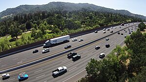
Interstate 680 is the main highway that goes through the San Ramon Valley. It runs north to cities like Walnut Creek and Concord. It also connects to places like Wine Country and Sacramento. Going south, I-680 passes through cities such as Pleasanton and Fremont, and reaches San Jose.
State Highway 24 is another important road. It meets I-680 in Walnut Creek. This highway leads to San Francisco, Oakland, and Berkeley.
The closest train station is the Walnut Creek Bay Area Rapid Transit (BART) station. Local buses, like County Connection routes 21 and 321, provide service along Danville Boulevard in Alamo. They go south to Danville and San Ramon, and north to Walnut Creek, ending at the BART station.
Notable residents
- Brandon Belt - San Francisco Giants MLB player
- Joan Buchanan - Former member of the California State Assembly
- Steven Burd - Former CEO of Safeway Inc.
- Mark Davis - Owner of the Oakland Raiders
- David Duffield - Co-founder of Workday, Inc and PeopleSoft
- Mason Filippi - auto racing driver
- Bret Hedican - Former Anaheim Ducks NHL player
- Greg Kent - Former AFL/NFL player
- Greg Kragen - Former NFL player
- Tony La Russa - MLB manager
- Katherine Langford - Actress
- Vili Helu - rugby union player
- Mark McGwire - Former MLB player
- Mike Moore - Former Oakland Athletics pitcher
- Jason Newsted - Former Metallica bassist
- Greg Sestero - Actor and author
- Ellen Tauscher - Former Congresswoman
- Bree Turner - Actress
- Kristi Yamaguchi - Olympic gold medalist in figure skating
- Tony Eldridge - Film Producer
- Alan Silvestri - American composer and conductor
- Stephen Curry - NBA player for the Golden State Warriors
See also
 In Spanish: Álamo (California) para niños
 | Isaac Myers |
 | D. Hamilton Jackson |
 | A. Philip Randolph |


