
List of Primary State Highways in Washington facts for kids

Marker for PSH 1
|
|
Quick facts for kids Highway names |
|
|---|---|
| Primary: | Primary State Highway X (PSH X) |
| Secondary: | Secondary State Highway X (SSH X) |
| System links | |
| State highways in Washington Interstate • US • State Former PSH • 1964 renumbering • Former SR |
|
.svg)
Primary State Highways (PSH) were important roads in Washington state during the early 1900s. They were the first organized system for numbering roads in the state. These highways were created step-by-step between 1905 and 1937. They were used until 1964, when a new system was put in place.
Primary State Highways also had smaller routes called Secondary State Highways (SSH). These secondary roads often had letters added to their numbers. The old system of primary and secondary highways was replaced by a new system. This new system, called "sign routes" (now "state routes"), made the numbering of highways much more organized.
Contents
- How Washington's Highways Began
- Secondary State Highways (SSH)
- Key Primary State Highways
- Primary State Highway 1
- Primary State Highway 2
- Primary State Highway 3
- Primary State Highway 4
- Primary State Highway 5
- Primary State Highway 6
- Primary State Highway 7
- Primary State Highway 8
- Primary State Highway 9
- Primary State Highway 10
- Primary State Highway 11
- Primary State Highway 12
- Primary State Highway 13
- Primary State Highway 14
- Primary State Highway 15
- Primary State Highway 16
- Primary State Highway 17
- Primary State Highway 18
- Primary State Highway 19
- Primary State Highway 21
- Primary State Highway 22
- Images for kids
How Washington's Highways Began
The very first state road in Washington was planned in 1893. It was meant to cross the Cascade Range, similar to where State Route 20 is today. However, this road wasn't actually finished until 1972! Two more roads were added in 1897. One crossed the Cascades near State Route 410, and another went to Wenatchee.
Setting Up the Highway Department
In 1905, the Washington Highway Department was created. This department was in charge of building and maintaining roads. They named twelve "State Roads," numbered from 1 to 12. A few more roads were added in the following years.
Connecting the Roads
Before 1913, the state roads were often just short, unconnected parts that needed fixing. But in 1913, a connected system was finally planned. Seven main roads were given names and called "primary roads." The older numbered roads became "secondary roads."
In 1923, most state roads got new numbers, but the idea of primary and secondary roads stayed. Also, in 1926, the United States Numbered Highways system was created. Some of these new U.S. Routes overlapped with Washington's State Roads.
The Big Change in 1937
A major update to the highway system happened in 1937. This included a complete renumbering of all the roads. Many "Primary State Highways" were officially named. "Secondary State Highways" were created as smaller branches off the main PSH routes. For example, Primary State Highway 1 was the main Pacific Highway (now Interstate 5). A branch off it, Secondary State Highway 1B, went from Bellingham to the Canadian border (now State Route 539).
U.S. Routes continued to share their numbers with the new State Highways. By 1952, the state started using a new highway sign. This sign was shaped like the head of George Washington, the first U.S. president.
The Modern System Arrives
The primary and secondary state highway systems were replaced in the 1960s. This change happened after the 1962 World's Fair in Seattle. The state legislature decided it was time for a new system.
New highway signs with the updated numbers were first put up in late 1963. They officially took effect in January 1964. The new numbers were designed to work better with existing U.S. Routes and the new Interstate Highways. This helped reduce confusion and avoid duplicate numbers. The old PSH and SSH signs were completely removed by 1970.
Secondary State Highways (SSH)
Secondary State Highways (SSH) were smaller roads that branched off the main Primary State Highways. They were used from 1937 to 1964 and usually had letters added to their numbers, like "1B."
Key Primary State Highways
Here are some of the most important Primary State Highways and what they became:
Primary State Highway 1
|
|
|
|---|---|
| Location: | Vancouver to Canada–United States border |
| Existed: | 1937–1964 |
PSH 1 followed the path of U.S. Route 99. Today, much of this route is covered by Interstate 5. It stretched from Vancouver all the way to the Canadian border near Blaine. It also included a smaller route that is now SR 11.
Primary State Highway 2
|
|
|
|---|---|
| Location: | Seattle to Idaho State Line |
| Existed: | 1937–1964 |
PSH 2 was originally known as the Sunset Highway. This was Washington's first continuous highway that went from east to west, created in 1915. It became State Road 2 in 1923 and then PSH 2 in 1937.
Its route was later used by U.S. Route 10 (now Interstate 90) for part of the way. It also followed parts of U.S. Route 97 and U.S. Route 2. A southern branch of PSH 2 followed what is now Washington State Route 18 from Snoqualmie to Tacoma.
Before the first floating bridge across Lake Washington was built in 1940, the route from Seattle to Issaquah followed what is now SR 900.
Primary State Highway 3
|
|
|
|---|---|
| Location: | Cle Elum to Canada–United States border |
| Existed: | 1937–1964 |
This route followed parts of what are now Interstate 82, U.S. Route 12, U.S. Route 195, SR 27, U.S. Route 2, and U.S. Route 395. It stretched from Ellensburg all the way to the U.S.-Canada border.
PSH 3 was also known as the "Inland Empire Highway." It crossed the Columbia River on the first highway bridge over the middle part of the river. This bridge was located between Kennewick and Pasco.
Primary State Highway 4
|
|
|
|---|---|
| Location: | Tonasket to Wilbur |
| Existed: | 1937–1964 |
This route followed parts of what are now State Route 20 from Tonasket to Republic. It then followed State Route 21 from Republic to Wilbur.
Primary State Highway 5
|
|
|
|---|---|
| Location: | Seattle to Yakima |
| Existed: | 1937–1964 |
PSH 5 started in Seattle and went south along the Green River Valley. It then crossed the Cascade Mountains to meet PSH 3 in Yakima. Part of this route, from Enumclaw to Yakima, was also signed as US 410.
PSH 5 had several branch routes that connected to other towns like Renton and Tacoma. It also had branches leading to Mount Rainier National Park and Cayuse Pass. Some parts, like the White Pass Highway, were not fully built at the time.
When the highways were renumbered in 1964, the main part of PSH 5 became SR 167 (from Seattle to Enumclaw) and SR 410 (from Enumclaw to Yakima). Its branches became various other highways, including SR 7, US 12, SR 165, SR 169, and SR 706.
Primary State Highway 6
|
|
|
|---|---|
| Location: | Spokane to Canada–United States border |
| Existed: | 1937–1964 |
This route followed what is now U.S. Route 2 from Spokane to Newport. It then followed State Route 31 (part of which is now State Route 20) from Newport to the Canadian border.
Primary State Highway 7
|
|
|
|---|---|
| Location: | Ellensburg to Davenport |
| Existed: | 1937–1964 |
This route followed parts of U.S. Route 10/Interstate 90 from Ellensburg to George. It then followed State Route 281 from George to Quincy, and State Route 28 from Quincy to Davenport.
Primary State Highway 8
|
|
|
|---|---|
| Location: | Vancouver to Buena |
| Existed: | 1937–1964 |
Known as the Evergreen Highway, this route followed what is now State Route 14 from Vancouver to Maryhill. It then followed U.S. Route 97 to Toppenish and State Route 22 to Buena.
Primary State Highway 9
|
|
|
|---|---|
| Location: | Olympia to Mud Bay |
| Existed: | 1937–1964 |
This route followed U.S. Route 101 from Olympia to Aberdeen.
Primary State Highway 10
|
|
|
|---|---|
| Location: | Olds Station to Canada–United States border |
| Existed: | 1937–1964 |
This route ran on U.S. Route 97 from the U.S.-Canada border to Wenatchee. It then followed State Route 28 from Wenatchee to Quincy. A smaller branch extended along State Route 17 from Brewster to Coulee City.
Primary State Highway 11
|
|
|
|---|---|
| Location: | Pasco to Spokane |
| Existed: | 1937–1964 |
This route followed U.S. Route 395 from Pasco to Ritzville. It then followed U.S. Route 10/Interstate 90 from Ritzville to Spokane.
Primary State Highway 12
|
|
|
|---|---|
| Location: | Chehalis to Kelso |
| Existed: | 1937–1964 |
This route followed State Route 6 from Chehalis to Raymond. It then followed U.S. Route 101 from Raymond to Johnsons Landing, and State Route 4 from Johnsons Landing to Kelso.
Primary State Highway 13
|
|
|
|---|---|
| Location: | Aberdeen to Raymond |
| Existed: | 1937–1964 |
This route followed U.S. Route 101 in Washington from Aberdeen to Raymond.
Primary State Highway 14
|
|
|
|---|---|
| Location: | Hoodsport, Washington to Tacoma |
| Existed: | 1937–1964 |
This route followed State Route 16 from Hoodsport to Tacoma.
Primary State Highway 15
|
|
|
|---|---|
| Location: | Everett to Peshastin |
| Existed: | 1937–1964 |
This route followed U.S. Route 2 from Everett to Peshastin.
Primary State Highway 16
|
|
|
|---|---|
| Location: | Fredonia to Twisp |
| Existed: | 1937–1964 |
This route followed State Route 20 from Fredonia to Pateros. It then followed State Route 153 from Pateros to Twisp.
Primary State Highway 17
|
|
|
|---|---|
| Location: | Twisp to Marblemount |
| Existed: | 1937–1964 |
This route connected Twisp to Marblemount.
Primary State Highway 18
|
|
|
|---|---|
| Location: | George to Ritzville |
| Existed: | 1937–1964 |
This route followed the path of U.S. Route 10 (now Interstate 90) from George to Ritzville.
Primary State Highway 19
|
|
|
|---|---|
| Location: | Auburn to Bothell |
PSH 19 was a planned route that would have bypassed the Seattle area. It was sometimes called Interstate 605. It was meant to connect Auburn to Bothell.
Primary State Highway 21
|
|
|
|---|---|
| Location: | Kingston to Skokomish, Washington |
| Existed: | 1937–1964 |

This route followed what is now State Route 104 from the Kingston Ferry to the Hood Canal Bridge. It then followed State Route 3 to Belfair. Finally, it followed State Route 106 from Belfair to Skokomish.
Primary State Highway 22
|
|
|
|---|---|
| Location: | Davenport to Canada–United States border |
| Existed: | 1937–1964 |
This route followed what is now Washington State Route 25.
Images for kids
-
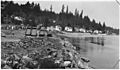
Primary State Highway No. 21, Tidewater Creek to Bremerton Section, 1941
