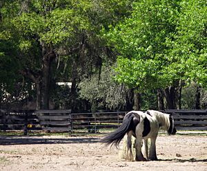
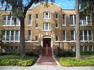
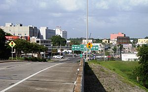
Ocala, Florida facts for kids
Quick facts for kids
Ocala
|
||
|---|---|---|
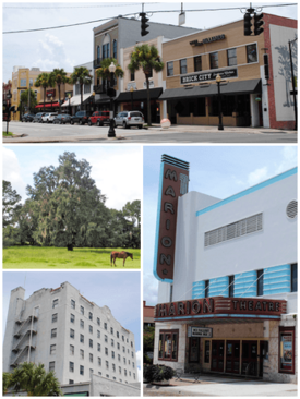
Top, left to right: Downtown Ocala, horse on a farm, Marion Hotel, Marion Theatre
|
||
|
||
| Nickname(s):
"Horse Capital of the World"
"Brick City" |
||
| Motto(s):
"God Be With Us"
|
||
| Country | United States | |
| State | Florida | |
| County | Marion | |
| Founded | 1849 | |
| Incorporated (town) | February 4, 1869 | |
| Incorporated (city) | January 28, 1885 | |
| Government | ||
| • Type | Council–Manager | |
| Area | ||
| • City | 47.79 sq mi (122.42 km2) | |
| • Land | 47.78 sq mi (122.40 km2) | |
| • Water | 0.01 sq mi (0.01 km2) | |
| Elevation | 69 ft (21 m) | |
| Population
(2020)
|
||
| • City | 63,591 | |
| • Estimate
(2022)
|
65,478 | |
| • Rank | US: 586th FL: 43rd |
|
| • Density | 1,386.0/sq mi (535.0/km2) | |
| • Urban | 182,647 (US: 202nd) | |
| • Urban density | 1,460.9/sq mi (564.0/km2) | |
| • Metro | 396,415 (US: 138th) | |
| • Metro density | 249.6/sq mi (96.36/km2) | |
| Time zone | UTC−5 (Eastern (EST)) | |
| • Summer (DST) | UTC−4 (EDT) | |
| ZIP Codes |
34470-34483
|
|
| Area code(s) | 352 | |
| FIPS code | 12-50750 | |
| GNIS feature ID | 0288030 | |
| Sales tax | 7.0% | |
Ocala (/oʊˈkælə/ oh-KAL-ə) is a city in Marion County, Florida, United States. It is also the county seat, which means it's where the main government offices for the county are located. The city is in North Central Florida. In 2020, about 63,591 people lived there. This makes Ocala the 43rd most populated city in Florida. Ocala is the main city in the Ocala metropolitan area, which had a population of 375,908 in 2020.
Ocala is known as the "Horse Capital of the World." This is because it has over 400 farms and training centers for thoroughbred horses. Some popular places to visit include the Ocala National Forest, Silver Springs State Park, Rainbow Springs State Park, the College of Central Florida, and the World Equestrian Center.
Contents
History of Ocala
Ocala gets its name from Ocale. This was a Timucua village and chiefdom (a group of villages led by a chief) in the 1500s. The name likely means "Big Hammock" or "song of admiration." The Spanish explorer Hernando de Soto wrote about Ocale in 1539. He was exploring what is now the southeastern United States. Historians think Ocale was in southwestern Marion County, near the Withlacoochee River.
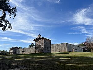
Later, in the late 1700s and early 1800s, Creek people and other Native Americans, along with free and runaway African Americans, found safety in Florida. This led to the formation of the Seminole people. In 1821, the United States took control of Florida from Spain. In 1827, the U.S. Army built Fort King near where Ocala is today. This fort helped separate the Seminole people from new white settlers. Fort King was important during the Second Seminole War. In 1844, it became the first courthouse for Marion County.
The modern city of Ocala started in 1849 around the fort. The area is sometimes called the "Kingdom of the Sun." In the past, large farms called plantations were common. These farms used enslaved people for labor. Ocala was a big center for growing citrus fruits. But a very cold period in 1894–1895, called the Great Freeze, damaged the crops. After the Reconstruction era (a time after the Civil War), several African Americans from Ocala served in Florida's government.
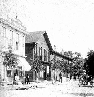
Train service came to Ocala in 1881. This helped the economy grow by making it easier to sell farm products. In 1883, a big fire destroyed much of downtown Ocala. The city decided to rebuild using brick, granite, and steel instead of lumber. By 1888, Ocala was known as "The Brick City."
In 1890, a group called the Farmers' Alliance and Industrial Union held a big meeting in Ocala. This group was a start for the Populist Party. At the meeting, they created a list of goals known as the "Ocala Demands." These goals included:
- Getting rid of national banks.
- Offering low-interest government loans.
- Allowing unlimited coinage of silver (making more money from silver).
- Having the government take back extra railroad lands.
- Creating a graduated income tax (where people with higher incomes pay a higher percentage in taxes).
- Allowing people to directly elect their United States senators.
Many of these ideas later became part of the Populist Party's plan.
In the late 1900s, the Ocala area grew very quickly. It became one of the fastest-growing cities of its size in the country.
Ocala's Historic Places
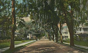
Ocala has a large Historic District with many old homes. This district was created in 1984 to protect these buildings. East Fort King Street has many beautiful examples of Victorian architecture. Several Ocala buildings are listed on the National Register of Historic Places. These include the Coca-Cola Building, the E. C. Smith House, East Hall, the Marion Hotel, Mount Zion A.M.E. Church, the Ritz Historic Inn, and Union Train Station.
The original Fort King site was recognized as a very important historical place in 2004. It is now a National Historic Landmark.
Geography of Ocala
Ocala is located at 29°11′16″N 82°07′50″W / 29.187704°N 82.130613°W.
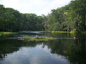
The city covers about 47.79 square miles (123.8 square kilometers) of land. The farms around Ocala are famous for their thoroughbred horses. The land here is similar to the "bluegrass" region of Kentucky. Ocala is also known for Silver Springs. This is where one of the largest artesian spring systems in the world is found. An artesian spring is a natural spring where water flows up from underground without needing a pump. Silver Springs Nature Theme Park was one of Florida's first tourist spots.
The Ocklawaha River is 110 miles (180 km) long. It flows about 10 miles (16 km) east of Ocala. The river flows north from Central Florida and joins the St. Johns River near Palatka.
Marion County is also home to the Ocala National Forest. This forest was created in 1908 and is the second largest national forest in Florida. The Florida Trail, a long hiking path, goes through the Ocala National Forest. Silver Springs State Park was created in 1987. The state bought land around the Silver Springs attraction to protect it. In 2013, the state took over Silver Springs itself and made it part of the park.
Ocala's Climate
Ocala has a humid subtropical climate (Cfa). This means it has hot, humid summers and mild winters.
| Climate data for Ocala, Florida, 1991–2020 normals, extremes 1893–present | |||||||||||||
|---|---|---|---|---|---|---|---|---|---|---|---|---|---|
| Month | Jan | Feb | Mar | Apr | May | Jun | Jul | Aug | Sep | Oct | Nov | Dec | Year |
| Record high °F (°C) | 88 (31) |
90 (32) |
97 (36) |
98 (37) |
102 (39) |
105 (41) |
104 (40) |
103 (39) |
101 (38) |
98 (37) |
94 (34) |
90 (32) |
105 (41) |
| Mean maximum °F (°C) | 81.9 (27.7) |
84.0 (28.9) |
87.3 (30.7) |
90.8 (32.7) |
95.1 (35.1) |
96.8 (36.0) |
96.6 (35.9) |
95.8 (35.4) |
94.2 (34.6) |
90.8 (32.7) |
86.3 (30.2) |
82.3 (27.9) |
98.0 (36.7) |
| Mean daily maximum °F (°C) | 70.6 (21.4) |
73.7 (23.2) |
78.6 (25.9) |
83.9 (28.8) |
88.9 (31.6) |
91.0 (32.8) |
92.0 (33.3) |
91.6 (33.1) |
89.5 (31.9) |
84.3 (29.1) |
77.2 (25.1) |
72.2 (22.3) |
82.8 (28.2) |
| Daily mean °F (°C) | 58.1 (14.5) |
61.0 (16.1) |
65.3 (18.5) |
70.7 (21.5) |
76.4 (24.7) |
80.7 (27.1) |
82.1 (27.8) |
82.0 (27.8) |
79.9 (26.6) |
73.5 (23.1) |
65.4 (18.6) |
60.3 (15.7) |
71.3 (21.8) |
| Mean daily minimum °F (°C) | 45.6 (7.6) |
48.4 (9.1) |
52.1 (11.2) |
57.4 (14.1) |
63.9 (17.7) |
70.4 (21.3) |
72.2 (22.3) |
72.5 (22.5) |
70.3 (21.3) |
62.7 (17.1) |
53.5 (11.9) |
48.3 (9.1) |
59.8 (15.4) |
| Mean minimum °F (°C) | 27.1 (−2.7) |
29.3 (−1.5) |
33.5 (0.8) |
42.7 (5.9) |
52.8 (11.6) |
64.5 (18.1) |
68.6 (20.3) |
68.4 (20.2) |
61.9 (16.6) |
46.4 (8.0) |
35.8 (2.1) |
30.4 (−0.9) |
24.7 (−4.1) |
| Record low °F (°C) | 11 (−12) |
12 (−11) |
23 (−5) |
30 (−1) |
44 (7) |
48 (9) |
58 (14) |
60 (16) |
52 (11) |
32 (0) |
22 (−6) |
15 (−9) |
11 (−12) |
| Average precipitation inches (mm) | 3.38 (86) |
2.94 (75) |
3.68 (93) |
2.22 (56) |
3.53 (90) |
7.41 (188) |
6.94 (176) |
7.07 (180) |
6.49 (165) |
3.21 (82) |
2.09 (53) |
2.68 (68) |
51.64 (1,312) |
| Average precipitation days (≥ 0.01 in) | 8.6 | 7.7 | 7.2 | 6.3 | 6.9 | 15.6 | 16.8 | 18.0 | 13.1 | 8.2 | 6.1 | 6.9 | 121.4 |
| Source: NOAA | |||||||||||||
Ocala's Population and People
| Historical population | |||
|---|---|---|---|
| Census | Pop. | %± | |
| 1850 | 243 | — | |
| 1870 | 600 | — | |
| 1880 | 803 | 33.8% | |
| 1890 | 2,904 | 261.6% | |
| 1900 | 3,380 | 16.4% | |
| 1910 | 4,370 | 29.3% | |
| 1920 | 4,914 | 12.4% | |
| 1930 | 7,281 | 48.2% | |
| 1940 | 8,986 | 23.4% | |
| 1950 | 11,741 | 30.7% | |
| 1960 | 13,598 | 15.8% | |
| 1970 | 22,583 | 66.1% | |
| 1980 | 37,170 | 64.6% | |
| 1990 | 42,045 | 13.1% | |
| 2000 | 45,943 | 9.3% | |
| 2010 | 56,315 | 22.6% | |
| 2020 | 63,591 | 12.9% | |
| 2022 (est.) | 65,478 | 16.3% | |
| U.S. Decennial Census 2020 Census |
|||
Ocala first appeared in the U.S. Census in 1850 with 243 people. The city's population has grown a lot since then.
Recent Census Information
| Race | Pop 2010 | Pop 2020 | % 2010 | % 2020 |
|---|---|---|---|---|
| White (NH) | 35,623 | 35,478 | 63.26% | 55.79% |
| Black or African American (NH) | 11,497 | 11,909 | 20.42% | 18.73% |
| Native American or Alaska Native (NH) | 117 | 104 | 0.21% | 0.16% |
| Asian (NH) | 1,455 | 2,436 | 2.58% | 3.83% |
| Pacific Islander or Native Hawaiian (NH) | 9 | 17 | 0.02% | 0.03% |
| Some other race (NH) | 118 | 255 | 0.21% | 0.40% |
| Two or more races/Multiracial (NH) | 910 | 2,499 | 1.62% | 3.93% |
| Hispanic or Latino (any race) | 6,586 | 10,893 | 11.69% | 17.13% |
| Total | 56,315 | 63,591 | 100.00% | 100.00% |
In 2020, Ocala had 63,591 people. There were 23,893 households (places where people live) and 13,239 families in the city.
Ocala's Economy
The median income for a household in Ocala was $30,888. This means half of the households earned more than this amount, and half earned less. For families, the median income was $38,190. The per capita income (average income per person) was $18,021. About 18.1% of the people in Ocala lived below the poverty line. This includes 28.6% of those under age 18 and 9.8% of those age 65 or older.
Ocala is home to Emergency One. This company designs and builds fire rescue vehicles for the whole world.
Major Employers in Ocala
Here are the largest employers in Ocala, based on a 2022 report:
| # | Employer | Type of Business | # of Employees | Percentage |
|---|---|---|---|---|
| 1 | Marion County Public Schools | Education | 7,000 | 4.70% |
| 2 | Ocala Health | Health Care | 2,712 | 1.82% |
| 3 | AdventHealth Ocala | Health Care | 2,648 | 1.78% |
| 4 | State of Florida | Government | 2,600 | 1.74% |
| 5 | Walmart (5 locations) | Retail | 2,583 | 1.73% |
| 6 | Lockheed Martin | Aerospace | 1,600 | 1.07% |
| 7 | FedEx | E-Commerce | 1,500 | 1.01% |
| 8 | Publix | Retail Grocery | 1,488 | 1.00% |
| 9 | Marion County Board of Commissioners | Government | 1,368 | 0.92% |
| 10 | E-One, Inc. | Utility | 1,200 | 0.81% |
| — | Total employers | — | 24,699 | 16.57% |
Ocala's Culture and Horses
Horses are a very important part of Ocala's culture. The first farm for thoroughbred horses in Florida was started in Marion County in 1943 by Carl G. Rose. Many other horse farms followed, making Ocala a major center for horse breeding. In 1978, a horse named Affirmed, who was bred and trained in Marion County, won all three races in the Triple Crown series (Kentucky Derby, Preakness Stakes, and Belmont Stakes). This made the horse industry in Ocala even more popular.
Ocala is one of only five cities in the world allowed to call itself the "Horse Capital of the World." This is based on how much money the horse industry brings in each year. The horse industry creates about 44,000 jobs. It brings in over $2.2 billion in money every year. Postime Farms in Ocala hosts one of the biggest horse shows in the country called H.I.T.S. (Horses in the Sun). This event lasts about two months and features Dressage (horse dancing) and Jumper (horse jumping) competitions. It brings in about $6 to $7 million for Marion County each year. The show includes over 100 different horse breeds. Other horse events in the area include:
- Mounted shooting (riding horses while shooting targets)
- Endurance rides (long-distance horse riding)
- Barrel races (horses running around barrels)
- Extreme cowboy events
- Jumper shows
- Trick shows
- Parades
- Draft pulls (horses pulling heavy weights)
- Rodeo events
In 2022, Ocala also hosted the first Florida Steeplechase, a horse race with obstacles, at the Florida Horse Park.
Education in Ocala
The public schools in Ocala are managed by the Marion County School Board. Marion County has 30 elementary schools, ten middle schools, and ten public high schools. Here are some of the schools in Ocala:
Elementary Schools
- Anthony Elementary School
- College Park Elementary School
- Dr. N. H. Jones Elementary School
- East Marion Elementary School
- Eighth Street Elementary School
- Evergreen Elementary School (closed in May 2021)
- Greenway Elementary School
- Ward-Highlands Elementary School
- Wyomina Park Elementary School
- Emerald Shores Elementary School
- Fessenden Elementary School
- Fort McCoy School (K–8)
- Hammett Bowen Jr. Elementary School
- Madison Street Academy of Visual and Performing Arts (Magnet)
- Maplewood Elementary School
- Marion Oaks Elementary School
- Oakcrest Elementary School
- Ocala Springs Elementary School
- Reddick-Collier Elementary School
- Saddlewood Elementary School
- Shady Hill Elementary School
- South Ocala Elementary School
- Sparr Elementary School
- Sunrise Elementary School
Middle Schools
- Fort King
- Howard
- Lake Weir Middle School
- Liberty Middle School
- Horizon Academy at Marion Oaks (5–8)
- Osceola Middle School
- North Marion Middle School
High Schools
- Forest High School
- Marion Technical Institute
- Vanguard High School
- West Port High School
- Francis Marion Military Academy (now closed)
- North Marion High School
- Lake Weir High School
Private Schools
- Ambleside School Of Ocala grades K–8
- Blessed Trinity School grades K–9
- Children's Palace East & Academy grades K–2
- The Cornerstone School grades PK–8
- Crossroads Academy grades 3–12
- Grace Academy Grades K–2
- Grace Christian School grades PK–8
- Meadowbrook Academy grades K–12
- Montessori Preparatory School grades K–5
- New Generation School grades K–12
- Ocala Christian Academy grades PK–12
- Ocean's High School grades PK–12
- Promiseland Academy grades K–7
- First Assembly Christian School grades K–12
- The Reading Clinic grades 2–6
- Redeemer Christian School grades K3–12
- The Rock Academy grades PK–9
- The School of the Kingdom grades 1–12
- Shiloh SDA Church School
- Belleview Christian Academy grades PK–12
- St John Lutheran School grades PK–12
- Trinity Catholic grades 9–12
Colleges and Universities
Ocala is home to the College of Central Florida. This college is part of the Florida College System. It is accredited, meaning it meets high standards for education. The college offers:
- Bachelor's degrees in Business and Organizational Management, Early Childhood Education, and Nursing.
- Associate degrees (two-year degrees).
- Certificates for special skills.
The college also has special programs in horse studies, agribusiness (farming business), and managing how goods are moved and stored (logistics and supply chain management).
Ocala also has a campus of Rasmussen College. This is a post secondary (after high school) school that is also accredited. Webster University offers graduate degree programs (degrees you get after a bachelor's degree) in business and counseling at its Ocala campus.
Libraries in Ocala
Three of the eight libraries in the Marion County Public Library System are in Ocala:
- Freedom Public Library
- Marion Oaks Public Library
- Ocala Public Library – This is the main library for the Marion County Public Library System.
Transportation in Ocala
Main Roads
Several important highways go through Ocala:
- Interstate 75 (I-75) runs north and south on the west side of the city.
- U.S. Highway 27 (US 27) runs north and south through Ocala.
- U.S. Route 301 (US 301) is a main north and south road.
- U.S. Highway 441 (US 441) is another main north and south road.
Ocala was also part of the historic Dixie Highway.
 I-75 (Interstate 75) runs north and south across the western edge of the city.
 US 27 runs north and south throughout Ocala.
 US 301 is the main local north and south road through Ocala.
 US 441 is the main local north and south road through Ocala.
 SR 492 runs east and west through the northern part of the city.
 SR 40 runs east and west through Ocala.
 SR 464 runs east and west through the southeastern part of the city.
 SR 200 runs northeast and southwest.
Airport, Bus, and Other Transport
The Ocala International Airport offers general aviation services. This means it handles private planes and smaller flights. Ocala Suntran provides bus service in parts of the city. A main bus stop for Suntran is the old Ocala Union Station. This station used to serve Amtrak trains until 2004. Now, Amtrak serves Ocala with bus connections to Jacksonville and Lakeland.
Ocala also has service from Greyhound Bus Lines. Marion Transit is a special bus service for people with disabilities. It provides public transportation throughout Marion County.
Healthcare in Ocala
Hospitals in Ocala include:
- AdventHealth Ocala
- HCA Florida Ocala Hospital
- HCA Florida West Marion Hospital
Notable People from Ocala
- Antonio Allen, NFL player
- Elizabeth Ashley, actress
- Brittany Bowe, Olympic speed skater
- Daunte Culpepper, NFL quarterback
- Don Garlits, professional drag racer
- Erin Jackson, Olympic gold medalist speed skater
- John Travolta, actor
- Walter Ray Williams Jr., professional PBA bowler
Notable Musical Groups from Ocala
- A Day to Remember, pop-punk/metalcore band
- The Royal Guardsmen, band from the 1960s
- Underoath, metalcore band
Sister Cities
Ocala has two sister cities. These are cities that partner with Ocala to promote cultural ties and understanding:
 Newbridge, County Kildare, in Ireland (since 2008)
 Pisa and San Rossore in Italy (since 2004)
See also
 In Spanish: Ocala para niños
 | May Edward Chinn |
 | Rebecca Cole |
 | Alexa Canady |
 | Dorothy Lavinia Brown |


