Phoenix metropolitan area arterial roads facts for kids
Many important roads in the Phoenix metropolitan area have the same name in different cities. Sometimes, roads even change names or numbers when they cross town borders. This can be a bit confusing! For example, a road called Apache Boulevard in Tempe becomes Main Street in Mesa and then Apache Trail in Apache Junction. Even if a road keeps the same name, like Broadway Road, each town might use different starting points for house numbers.
Contents
- Exploring Arizona Avenue
- Understanding Baseline Road
- Navigating Bell Road
- Discovering Camelback Road
- Driving on Carefree Highway
- Exploring Cave Creek Road
- Understanding Central Avenue
- Traveling on Country Club Drive
- Driving on Elliot Road
- Understanding Ellsworth Road
- Exploring Gilbert Road
- Understanding Grand Avenue
- Driving on Happy Valley Road
- Understanding Indian School Road
- Driving on Lake Pleasant Parkway
- Discovering Mill Avenue
- Driving on Northern Avenue
- Traveling on Power Road
- Driving on Queen Creek Road
- Understanding Riggs Road
- Driving on Rural Road
- Exploring Scottsdale Road
- Driving on Shea Boulevard
- Understanding Sun Valley Parkway
Exploring Arizona Avenue
Quick facts for kids Arizona Avenue |
|
|---|---|
| Location: | Chandler |
| Length: | 10.6 mi (17.06 km) |
Arizona Avenue is a major road that runs north and south in the southeastern part of the Phoenix metropolitan area. It's part of Arizona State Route 87 (SR 87) within the city of Chandler. This entire road is an important part of the National Highway System.
Arizona Avenue starts at Hunt Highway, which is the southern border of Chandler. This spot is also where Maricopa and Pinal counties meet. The road begins as a four-lane highway. Between Riggs Road and Chandler Heights Road, it gets wider to six lanes. After crossing SR 202 (Santan Freeway), it narrows back to four lanes and goes through downtown Chandler. In downtown, you'll see the Chandler Center for the Arts and Chandler High School. The road then becomes six lanes with a middle turn lane. It continues past Elliot Road to the Western Canal. Here, SR 87 keeps going north into Mesa as Country Club Drive.
Understanding Baseline Road
Baseline Road is a very important road that runs east and west. It's named "Baseline" because it follows the main survey line for Arizona. This line starts at a "zero point" on a hill where the Gila and Salt rivers meet. This spot is near Phoenix Raceway.
Baseline Road isn't one continuous road because of natural obstacles. The longest part of it is about 43 miles long. It runs through Maricopa County and Pinal County. There's also another Baseline Road in La Paz County near the Colorado River. Because cities in Arizona are often built on a grid, the name "Baseline Road" is used for different sections.
Where Does Baseline Road Go?
Starting from the east, the road begins in Apache Junction in Pinal County. Here, it's called Baseline Avenue and is a small road in a neighborhood near the Superstition Mountains. The road then starts again and goes west, next to US 60. When it reaches the Maricopa County border, it enters Mesa and becomes Baseline Road. It turns into a major road as it goes through Gilbert and Tempe. In Tempe, it crosses Loop 101 and then Interstate 10. The road continues through south Phoenix and ends in the Gila River Indian Community.
The road reappears west of the Gila River near Perryville Road. It continues west through Buckeye and then through farmlands in western Maricopa County. The very last part of Baseline Road in Maricopa County is past 547th Avenue. Many people like to use Baseline Road because it's easy to navigate and goes through many towns, offering an alternative to the freeways.
Cool Places Along Baseline Road
Some famous places near Baseline Road include Arizona Mills mall and Phoenix International Raceway. Baseline Road also goes through the historic farming area of Laveen.
Bell Road is a major east-west road in northern Phoenix. It's one of the few roads that crosses the Agua Fria River in the northern part of the area. This makes it a key link between growing towns like Surprise and Phoenix. Because of this, the part of Bell Road in Surprise and Sun City is one of the busiest roads in Arizona!
What's the Route of Bell Road?
The main part of Bell Road is about 31 miles long. It starts where Phoenix and Scottsdale meet at Scottsdale Road. East of Scottsdale Road, the road curves southeast and becomes Frank Lloyd Wright Boulevard. Going west, Bell Road crosses State Route 51 and Interstate 17 in Phoenix. It also crosses State Route 101 in Peoria, and U.S. Route 60 and State Route 303 in Surprise. West of the Beardsley Canal, the road curves around White Tank Mountain Regional Park and becomes Sun Valley Parkway in northern Buckeye.
East of 66th Street, Bell Road bends southeast and turns into Frank Lloyd Wright Boulevard at Scottsdale Road. This part of the road was built in the mid-1970s. In this area of Scottsdale, there's a separate part of Bell Road, about 3 miles long, north of Frank Lloyd Wright Boulevard.
Landmarks on Bell Road
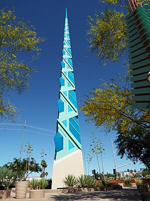
You'll find several notable places on or near Bell Road. These include the Scottsdale Municipal Airport, Turf Paradise, Arrowhead Towne Center, and the Peoria Sports Complex. Bell Road also marks the original boundary of the town of Surprise.
Discovering Camelback Road
Camelback Road is a very well-known street in the Phoenix area. It stretches for about 33 miles from Scottsdale in the east to Litchfield Park in the west. It also runs right through the city of Phoenix. Scottsdale Fashion Square is a popular shopping mall located at Camelback and Scottsdale Roads.
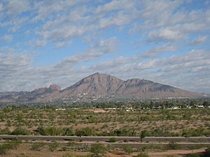
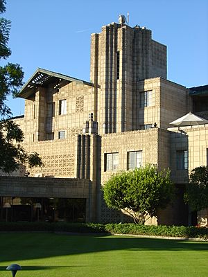
Camelback Road runs just south of Phoenix's famous Camelback Mountain and the Phoenician Resort. Further west, the fancy Biltmore area of Phoenix is along Camelback Road. This includes the Arizona Biltmore Hotel, Biltmore Fashion Park, and a major business area called the Camelback Corridor. In Litchfield Park, Camelback Road passes the historic Wigwam Resort, which was built in 1918. West of Litchfield Park, Camelback Road runs along the southern edge of Luke Air Force Base.
Driving on Carefree Highway
| Carefree Highway | |
|---|---|
| Location: | Peoria–Scottsdale |
| Length: | 42.2 mi (67.91 km) |
Carefree Highway is an east-west road in the northern part of the Phoenix metropolitan area. It starts where Arizona State Route 74 (SR 74) meets Lake Pleasant Parkway in northern Peoria. SR 74 continues west as Lake Pleasant Road. Carefree Highway goes east, crossing Interstate 17 (I-17), which is where SR 74 ends. It continues to Scottsdale Road on the border of Scottsdale and Carefree. This entire road is a key part of the National Highway System. The highway even inspired the famous song by Gordon Lightfoot called "Carefree Highway"!
Carefree Highway begins as a two-lane road in a rural part of Peoria. It goes through open desert in northern Peoria and then into the North Gateway area of Phoenix. Before reaching I-17, it passes the Ben Avery Shooting Facility. After I-17, Carefree Road becomes a four-lane highway. It curves through some mountains before straightening out. It then leaves Phoenix and follows the northern city limit. Carefree Highway then follows the southern border of Cave Creek and briefly enters the town. The road narrows to two lanes and follows the border between Scottsdale and Carefree. It ends at Scottsdale Road, which goes south into Scottsdale, and Tom Darlington Drive, which goes north into Carefree.
Exploring Cave Creek Road
| Cave Creek Road | |
|---|---|
| Location: | Phoenix–Cave Creek |
| Length: | 31.1 mi (50.05 km) |
Cave Creek Road is an important road in the north-central part of the Phoenix metropolitan area. It's part of the National Highway System from its start at Seventh Street in Phoenix up to Carefree Highway on the border of Cave Creek and Carefree. North of that, Cave Creek Road continues as a smaller road through Cave Creek, Carefree, and northern Scottsdale, ending near Camp Creek.
Cave Creek Road starts at a five-way intersection with Seventh Street and Dunlap Road in Phoenix. It heads northeast as a four-lane road with a middle turn lane. It curves north into the Paradise Valley area and crosses another major road that becomes Thunderbird Road to the northwest and Cactus Road to the east. The highway widens to six lanes and goes northeast along Shadow Mountain. It then goes straight north, crossing Bell Road, and becomes a six-lane divided highway at SR 101 (Pima Freeway). Cave Creek Road crosses over the Central Arizona Project aqueduct. It then curves north-northeast toward Cave Creek, narrows to four lanes, and passes through open desert. The main part of the highway ends at Carefree Highway.
Understanding Central Avenue
Central Avenue runs from South Mountain Park to North Mountain in Phoenix. The Central Avenue Corridor, which is roughly from Camelback Road to McDowell Road, is one of the busiest parts of Phoenix. This area is also known as Midtown, Phoenix, located between Downtown and the North-Central and Sunnyslope areas. For most of the Phoenix area, Central Avenue is the "zero" point for all east and west addresses.
Traveling on Country Club Drive
| Country Club Drive | |
|---|---|
| Location: | Mesa |
| Length: | 7.1 mi (11.43 km) |
Country Club Drive is a north-south road in the southeastern part of the Phoenix metropolitan area. It's part of Arizona State Route 87 (SR 87) within the city of Mesa. This entire road is an important part of the National Highway System.
Country Club Drive starts at the Western Canal, which is the southern border of Mesa. Here, SR 87 continues south into Chandler as Arizona Avenue. Country Club Drive heads north as a six-lane road with a middle turn lane. It becomes a divided highway near Baseline Road. North of Baseline Road, it has an interchange with U.S. Route 60 (Superstition Freeway). At the edge of downtown Mesa, Country Club Drive crosses Broadway Road and goes under the Union Pacific Railroad tracks. West of downtown, it crosses Main Street and the Valley Metro Rail light rail line. North of McKellips Road, Country Club Drive has an interchange with SR 202 (Red Mountain Freeway). It ends at SR 87's bridge over the Salt River. SR 87 then continues north as Beeline Highway.
Driving on Elliot Road
| Elliot Road | |
|---|---|
| Location: | Buckeye-Goodyear, Phoenix–Mesa |
Elliot Road is an east-west road in the southeastern part of the Phoenix metropolitan area. It stretches from 44th Street in southern Phoenix east through Tempe, Chandler, Gilbert, and Mesa. It ends at Meridian Road, which is the border between Maricopa and Pinal counties. Part of Elliot Road is a major route in the National Highway System.
Elliot Road starts at 44th Street in the Ahwatukee area of Phoenix. It begins as a four-lane road with a middle turn lane, but it widens to a six-lane divided highway at 48th Street. The road leaves Phoenix and enters Tempe at its interchange with Interstate 10. In Tempe, Elliot Road crosses Rural Road. It then meets SR 101 and enters Chandler, where it narrows to a four-lane road with a middle turn lane. Elliot Road crosses SR 87 (Arizona Avenue) and then a rail line that marks the Chandler-Gilbert border. In Gilbert, it passes the historic Gilbert Elementary School building. At the Eastern Canal, Elliot Road becomes divided again. It continues with two lanes through Power Road, where it enters Mesa. Elliot Road crosses the East Maricopa Floodway and widens to a six-lane divided highway at its interchange with SR 202 (Santan Freeway). The road ends at Meridian Road, which is the eastern border of Mesa.
Understanding Ellsworth Road
| Ellsworth Road | |
|---|---|
| Location: | Queen Creek–Mesa |
Ellsworth Road is a north-south road in the southeastern part of the Phoenix metropolitan area. It goes from Hunt Highway in Queen Creek north to Usery Pass Road, which is north of Mesa.
Ellsworth Road starts in Queen Creek at Hunt Highway. After about two miles, north of Chandler Heights Road, it splits into two different roads: Ellsworth Loop Road and Ellsworth Road. Ellsworth Loop Road is a six-lane highway that goes through Queen Creek Marketplace. Ellsworth Road is a two-lane highway that passes Queen Creek Historical Town Hall and Founders' Park. Both roads also lead to the Queen Creek Library. Ellsworth Road continues until Walnut Road, where Ellsworth Loop Road turns back into Ellsworth Road.
Ellsworth Road continues in Queen Creek for another mile. It then enters Mesa after passing Germann Road, where it becomes a four-lane highway. It passes by Bell Bank Park and crosses Arizona State Route 24 (SR 24; Gateway Freeway). Ellsworth Road continues and has an interchange with U.S. Route 60 (Superstition Freeway). After six more miles, Ellsworth Road ends and continues as Usery Pass Road.
Exploring Gilbert Road
| Gilbert Road | |
|---|---|
| Location: | Chandler–Mesa |
Gilbert Road is a north-south road in the southeastern part of the Phoenix metropolitan area. It stretches from a point on Arizona State Route 87 south of Chandler to Beeline Highway, north of Mesa.
Gilbert Road starts south of Arizona State Route 87. After passing Gila River Resorts and Casino, it continues into Chandler for five miles. After Germann Road, the highway follows the border between Chandler to the west and Gilbert to the east. It has an interchange with Arizona State Route 202 (SR 202; Santan Freeway). After Galveston Street, the highway leaves Chandler and goes fully through Gilbert, passing through Downtown Gilbert. At Baseline Road, the highway enters Mesa and has an interchange with U.S. Route 60 (Superstition Freeway).
Gilbert Road continues through Mesa for seven miles. South of McDowell Road, it has a partial interchange with SR 202 (Red Mountain Freeway), allowing access to and from the west. Access to the other direction of SR 202 is available from McDowell Road. Gilbert Road continues north of Mesa and ends at Beeline Highway.
Understanding Grand Avenue
The part of U.S. Route 60 that enters Phoenix from the northwest is called Grand Avenue. This street cuts through west Phoenix at a 45-degree angle, making it easy to spot on any map! It's the last part of US 60 before it reaches the center of Phoenix. Even though US 60 leaves Grand Avenue at 27th Avenue, Grand Avenue itself continues southeast towards 7th Avenue and Van Buren Street.
Since 2006, the lower part of Grand Avenue, between Roosevelt Street and Van Buren Street, has been getting a new life. Art places, cafes, and small businesses have opened up as old buildings are being fixed up.
On the first and third Fridays of every month, Grand Avenue hosts fun cultural events. Many art galleries and studios are part of the Grand Avenue art scene. Because of this new energy, the Grand Avenue Merchants Association (GAMA) was formed. They want to create an arts, culture, and small business area by reusing old buildings and helping the community. In 2011, Phoenix was chosen to receive help from the U.S. Environmental Protection Agency (EPA) to make the lower Grand Avenue area more environmentally friendly and economically strong.
Driving on Happy Valley Road
| Happy Valley Road | |
|---|---|
| Location: | Surprise–Phoenix |
Happy Valley Road is an east-west road in the northern part of the Phoenix metropolitan area. It goes from 163rd Avenue in Surprise east to Seventh Street in Phoenix. Happy Valley Road is a major part of the National Highway System from SR 303 to Interstate 17 (I-17).
Happy Valley Road starts at 163rd Avenue in Surprise. It travels east for six miles before crossing Loop 303 (Bob Stump Memorial Parkway) in an area west of Peoria. East of Loop 303, Happy Valley Road widens to six lanes and crosses the Agua Fria River into Peoria. The road crosses Lake Pleasant Parkway and passes along Sunrise Mountain before crossing the New River. After entering the Deer Valley area of Phoenix, Happy Valley Road becomes a four-lane road with a middle turn lane. It widens to six lanes, crosses Skunk Creek, and meets I-17 (Arizona Veterans Highway) at a special interchange. Happy Valley Road continues east from I-17 as a six-lane divided highway but then narrows to two lanes east of 19th Street. It crosses the Central Arizona Project aqueduct before curving south and smoothly becoming Seventh Street.
Understanding Indian School Road
Indian School Road runs continuously east and west for about 41 miles. It starts at the Salt River Pima-Maricopa Indian Community on the east and goes to Buckeye and the White Tank Mountain Regional Park on the west. It crosses many major roads like Arizona State Route 101, Arizona State Route 51, Interstate 17, US 60/Grand Avenue, and Arizona State Route 303. The road was named in the early days because it led to the Phoenix Indian School (1890–1991). This school was located where Steele Indian School Park is today.
Famous Spots on Indian School Road
- Arcadia High School: Famous students include Steven Spielberg and Lynda Carter.
- Carl Hayden Veterans Administration Medical Center: Named after a long-serving Arizona Senator.
- Steele Indian School Park: The original site of the Phoenix Indian School. You can still see historic buildings like the Dining Hall (1902) and Memorial Hall (1922).
- Maryvale Mall: Now closed, the site has two schools using former mall buildings. A new Walmart Supercenter was built nearby.
- Verrado High School: A high school located further west.
Driving on Lake Pleasant Parkway
| Lake Pleasant Parkway | |
|---|---|
| Location: | Peoria |
Lake Pleasant Parkway is an important road in the northwestern part of the Phoenix metropolitan area. It goes from the intersection of 83rd Avenue and Beardsley Road west and north to Arizona State Route 74 (SR 74), all within Peoria. The entire length of Lake Pleasant Parkway is a major part of the National Highway System. A two-mile section of 83rd Avenue, south of Lake Pleasant Parkway to Bell Road, is also a key route.
The important part of 83rd Avenue starts at Bell Road, which is the border between Peoria and Glendale. 83rd Avenue goes south into Peoria, where it serves the Peoria Sports Complex. This is where the San Diego Padres and Seattle Mariners baseball teams train in the spring. From Bell Road, 83rd Avenue goes north into Glendale and passes west of Arrowhead Towne Center. This four-lane divided highway crosses over SR 101 without direct access. 83rd Avenue then crosses the New River before reaching Union Hills Drive. The avenue widens to six lanes as it continues into Peoria to Beardsley Road, where it becomes Lake Pleasant Parkway. The parkway curves west, then north. North of Happy Valley Road, the area around the highway gradually changes to open desert. North of its interchange with SR 303, Lake Pleasant Parkway narrows to two lanes and crosses the Central Arizona Project aqueduct. It passes east of Pleasant Valley Airport before ending at SR 74. SR 74 continues west as Lake Pleasant Road and east as Carefree Highway.
Discovering Mill Avenue
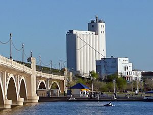
Mill Avenue is a historic street in Tempe. In north Tempe, near Arizona State University, the street is a popular area for shopping and nightlife. It's easy to walk around here! Mill Avenue was originally built around the Hayden Flour Mill, which is still standing today, though it's no longer used. Today, the avenue has many bars, shops, and hosts many fairs and city festivals. A reporter in 2010 described it as a "bohemian commercial strip" next to Arizona State University.
At the northern end of the shopping area, the two Mill Avenue bridges cross the Salt River at Tempe Town Lake. One bridge was finished in 1931, and the other in 1994.
A Look Back at Mill Avenue's History
After Fort McDowell was built in 1865, farmers moved to the Salt River Valley. They improved old irrigation canals built by the Hohokam people and built new ones to bring water to their farms. In 1877, Charles T. Hayden, a businessman, opened a flour mill that used water from the Tempe Irrigating Canal. His family ran the mill for three generations, and it was very important to Tempe's industry.
In 1877, Charles' son, Carl Hayden, who later became a famous congressman and senator, was born in the family home. The Hayden's Ferry Post Office was renamed the Tempe Post Office in 1879. In 1889, a new railroad connected Tempe with Phoenix. Tempe officially became a town in 1894.
In the mid-1900s, the commercial area along Mill Avenue started to decline. However, in 1964, the Grady Gammage Memorial Auditorium, designed by Frank Lloyd Wright, was finished at Mill Avenue and Apache Boulevard on the Arizona State University campus.
In 1971, for Tempe's 100th birthday, Mill Avenue was brought back to life! It became a popular place for entertainment and shopping, attracting people from all over the Phoenix Valley. The Hayden Flour Mill closed in 1997 after 123 years. It's important because it was the oldest continuously used industrial site in the Salt River Valley.
Theaters on Mill Avenue
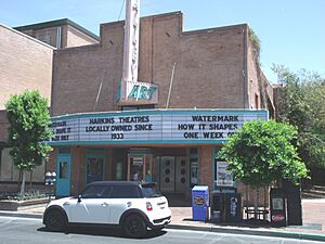
The Valley Art Theater, run by Harkins Theatres, is on Mill Avenue. It's a comfortable single-screen theater that often shows art house and foreign films. The building was built in 1938. AMC Centerpoint, an 11-screen movie theater, is also on the avenue. It was originally owned by Harkins but closed in 2008. AMC reopened it in April 2014.
Driving on Northern Avenue
| Northern Avenue | |
|---|---|
| Location: | Glendale–Phoenix |
Northern Avenue is an east-west road in the northwestern part of the Phoenix metropolitan area. It starts as an extension of Northern Parkway on the border of Glendale and El Mirage. It goes east to Arizona State Route 51 (SR 51) in Phoenix. All of Northern Avenue east of Northern Parkway is a major part of the National Highway System.
Northern Avenue begins as a four-lane divided highway with a wide median. East of El Mirage Road, the lanes come together and cross the Agua Fria River. After the river, Northern Avenue becomes a four-lane road with a middle turn lane. It then follows the border between Glendale and Peoria. East of the New River, the highway meets SR 101 (Agua Fria Freeway) at an interchange. The highway fully enters Glendale west of its intersection with U.S. Route 60 (Grand Avenue). Northern Avenue enters Phoenix and forms the boundary between the North Mountain and Alhambra areas. It meets Interstate 17 (Arizona Veterans Highway) at a special interchange. East of Seventh Street, Northern Avenue forms the boundary between the North Mountain and Camelback East areas. It then curves as it gets closer to the Phoenix Mountains. Northern Avenue ends at an interchange with SR 51 (Piestewa Freeway) on the west side of Piestewa Peak.
Traveling on Power Road
| Power Road | |
|---|---|
| Location: | Chandler Heights–Mesa |
Power Road is a north-south road in the southeastern part of the Phoenix metropolitan area. It goes from Hunt Highway at the Maricopa-Pinal county line in Chandler Heights to the northern city limit of Mesa. There, it continues as Bush Highway. Power Road is a major part of the National Highway System from Riggs Road to Thomas Road in Mesa.
Power Road starts as a two-lane road from Hunt Highway, which is the county line. It goes through Chandler Heights and crosses Riggs Road. North of Riggs Road, the highway mostly follows the border between Queen Creek to the east and Gilbert to the west. South of Ocotillo Road, Power Road widens to a six-lane divided highway. At Pecos Road, the highway leaves Queen Creek and follows the border between Gilbert and Mesa. At Williams Field Road, the lanes of Power Road temporarily split to cross the East Maricopa Floodway. Williams Field Road goes east toward Arizona State University Polytechnic campus and Phoenix–Mesa Gateway Airport.
North of the airport, Power Road has an interchange with Arizona State Route 202 (SR 202; Santan Freeway) and narrows to a four-lane road with a middle turn lane. It crosses Elliot Road and widens to a six-lane divided highway again at a second crossing of the East Maricopa Floodway. Power Road fully enters Mesa at its intersection with Baseline Road. The highway curves and has an interchange with U.S. Route 60 (Superstition Freeway). Power Road temporarily widens to eight lanes as it passes east of Superstition Springs Center. It then becomes a six-lane highway and passes east of Leisure World. North of McDowell Road, the highway has a partial interchange with SR 202 (Red Mountain Freeway). Power Road runs next to the Fannin-McFarland Aqueduct and narrows to four lanes for its last stretch. It ends at the northern city limit of Mesa, where it continues as Bush Highway.
Driving on Queen Creek Road
| Queen Creek Road | |
|---|---|
| Location: | Gila River Indian Community–Queen Creek |
Queen Creek Road is an east-west road in the southeastern part of the Phoenix metropolitan area. It goes from John Wayne Parkway, which is the end of Arizona State Route 347 in the Gila River Indian Community south of Phoenix. It continues east through Chandler and Gilbert to Hawes Road in Queen Creek. It then continues from Ellsworth Road to Meridian Road, after which it becomes Pima Road and goes into San Tan Valley.
Queen Creek Road starts as an extension of John Wayne Parkway. It goes east-west within the Gila River Indian Community and crosses Interstate 10. East of I-10, it's a four-lane highway for two miles. Queen Creek Road widens to six lanes when it crosses into Chandler west of Price Road. It then crosses SR 87 (Arizona Avenue). Shortly after crossing Gilbert, the highway narrows to a four-lane road and continues to Queen Creek, where one section ends at Hawes Road.
Queen Creek Road is not continuous. Another section starts at Ellsworth Road and continues for three more miles until Meridian Road. There, the road becomes Pima Road and crosses the Maricopa-Pinal county line.
Understanding Riggs Road
| Riggs Road | |
|---|---|
| Location: | Gila River Indian Community–Queen Creek |
Riggs Road is an east-west road in the southeastern part of the Phoenix metropolitan area. It goes from Beltline Road in the Gila River Indian Community south of Phoenix east through Sun Lakes, Chandler, and Gilbert to Rittenhouse Road in Queen Creek. Riggs Road is a major part of the National Highway System from Interstate 10 (I-10) east to Ellsworth Road in Queen Creek.
Riggs Road starts as an extension of Beltline Road. This two-lane highway goes east through open desert. It crosses Arizona State Route 347 (SR 347) and has an interchange with I-10. East of I-10, Riggs Road widens to four lanes with a middle turn lane. It leaves the desert at the border of the native reservation and Sun Lakes at 88th Street. After Sun Lakes, the highway enters Chandler and crosses SR 87 (Arizona Avenue), where it widens to a six-lane divided highway. Shortly after entering Gilbert, Riggs Road crosses the East Maricopa Floodway. The middle of the highway becomes a turn lane as it enters Queen Creek. Riggs Road then narrows to four lanes at its intersection with Power Road. Beyond Ellsworth Road, the highway narrows to two lanes and ends at Rittenhouse Road. The road then continues as Combs Road and crosses the Maricopa-Pinal county line.
Driving on Rural Road
| Rural Road | |
|---|---|
| Location: | Chandler–Tempe |
Rural Road is a north-south road in the southeastern part of the Phoenix metropolitan area. It goes from Chandler Boulevard in Chandler north to Rio Salado Parkway in Tempe. There, it continues north as Scottsdale Road. Rural Road is a major part of the National Highway System from Elliot Road north to Rio Salado Parkway within Tempe.
Rural Road starts as a four-lane divided highway at Chandler Boulevard in Chandler. At Ray Road, the highway enters Tempe, passing Corona del Sol High School. It gains a third southbound lane and a middle turn lane. Rural Road gains a third northbound lane at Warner Road and narrows back to four lanes at the Western Canal. The highway widens to a six-lane divided highway at Baseline Road. It then curves and meets U.S. Route 60 (Superstition Freeway) at an interchange. North of the freeway, the highway's middle becomes a turn lane. North of Apache Boulevard, Rural Road passes through the Tempe campus of Arizona State University. Within the campus, the highway crosses the Valley Metro Rail light rail line and becomes a divided highway again. Rural Road ends and Scottsdale Road begins at Rio Salado Boulevard at the northern end of the university campus.
Exploring Scottsdale Road
| Scottsdale Road | |
|---|---|
| Location: | Tempe–Scottsdale |
Scottsdale Road is a north-south road in the northeastern part of the Phoenix metropolitan area. It goes from Rio Salado Parkway in Tempe, where it continues south as Rural Road, north to Carefree Highway in northern Scottsdale. The entire length of Scottsdale Road is a major part of the National Highway System.
Scottsdale Road starts at Rio Salado Parkway at the northern end of the Arizona State University campus. It heads north as a six-lane divided highway and immediately crosses over the Salt River. North of the river, the highway has an interchange with Arizona State Route 202 (SR 202; Red Mountain Freeway). Scottsdale Road leaves Tempe and enters Scottsdale at McKellips Road. Through downtown Scottsdale, two parallel roads, Drinkwater Boulevard and Goldwater Boulevard, split off and rejoin Scottsdale Road. Scottsdale Road has four lanes through downtown, where it crosses Indian School Road. North of downtown Scottsdale, the highway passes along the east side of Paradise Valley and goes through Central Scottsdale, where it crosses Shea Boulevard. North of Cactus Road, Scottsdale Road forms the border between the Paradise Valley area of Phoenix to the west and Scottsdale to the east. The highway passes west of Scottsdale Airport between Thunderbird Road and the intersection with Bell Road and Frank Lloyd Wright Boulevard. Immediately north of that intersection, Scottsdale Road crosses the Central Arizona Project aqueduct. At its interchange with SR 101 (Pima Freeway), the highway becomes a four-lane road with a middle turn lane. Scottsdale Road fully enters Scottsdale and becomes a divided highway shortly before its northern end at a three-way intersection with Carefree Highway. The road continues north into Carefree as Tom Darlington Drive.
Driving on Shea Boulevard
| Shea Boulevard | |
|---|---|
| Location: | Phoenix–Fountain Hills |
| Length: | 19.54 mi (31.45 km) |
Shea Boulevard is an east-west road in the northeastern part of the Phoenix metropolitan area. It stretches about 19.54 miles from 21st Place in Phoenix east through Scottsdale to Arizona State Route 87 (SR 87) just east of Fountain Hills. Shea Boulevard is a major part of the National Highway System from SR 51 east to SR 87.
Shea Boulevard starts at 21st Place in the Paradise Valley area of Phoenix. It heads east as a two-lane suburban road that widens to a four-lane highway with a middle turn lane east of 24th Street. Shea Boulevard passes Shadow Mountain High School and has an interchange with SR 51 (Piestewa Freeway). The highway widens to a six-lane divided highway east of 40th Street. Between Tatum Boulevard and a stream to the east, Shea Boulevard runs along the northern edge of Paradise Valley. The highway enters Scottsdale and passes through the area known as Central Scottsdale or the Shea Corridor. Shea Boulevard crosses Scottsdale Road and has an interchange with SR 101 (Pima Freeway). East of Frank Lloyd Wright Boulevard, which leads to Taliesin West, the highway crosses the Central Arizona Project aqueduct. East of the Mayo Clinic, Shea Boulevard curves and passes through the southern end of the McDowell Mountains into Fountain Hills. There, the road narrows to four lanes at Fountain Hills Boulevard. The highway curves southeast and leaves the town into the Salt River Pima–Maricopa Indian Community before ending at AZ 87 (Beeline Highway).
Understanding Sun Valley Parkway
Sun Valley Parkway is mostly in Buckeye, with a small part extending into Surprise, Arizona. Built in the 1980s, this four-lane divided parkway goes through about 30 miles of what used to be open desert. It's about 35 miles west of downtown Phoenix. It runs north-south from Interstate 10 at exit 109 (Sun Valley Parkway / Palo Verde Road) in Buckeye. After about 12 miles, it turns to become an east-west road. It then leads eastward to Surprise, where it connects to and becomes Bell Road. Bell Road then continues through Surprise and other western suburbs, eventually reaching Phoenix.
New Communities Along Sun Valley Parkway
Several large planned communities are being built along this road in Buckeye. For many years after the road was built, there wasn't much development here. Now, communities like Tartesso and Sun City Festival are being built. Other communities that are being planned include Sun Valley, Sun Valley South, Spurlock Ranch, Elianto, Trillium in Buckeye, and Douglas Ranch.
 | Janet Taylor Pickett |
 | Synthia Saint James |
 | Howardena Pindell |
 | Faith Ringgold |


