Cape Fear (region) facts for kids
Quick facts for kids
Wilmington Metropolitan Area
|
|
|---|---|
| Wilmington, NC Metropolitan Statistical Area | |

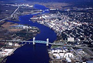
Wilmington with Cape Fear Memorial Bridge
in foreground |
|
| Country | |
| State | |
| Largest city | Wilmington |
| Time zone | UTC−5 (EST) |
| • Summer (DST) | UTC−4 (EDT) |
The Cape Fear region is a special area in North Carolina. It's a coastal plain and Tidewater area, which means it's mostly flat land near the ocean, with rivers affected by the ocean's tides. This region is centered around the city of Wilmington.
The name "Cape Fear" comes from the nearby Cape Fear headland, which is a point of land sticking out into the ocean. The Cape Fear River also flows through this area and empties into the Atlantic Ocean close to the cape. Many people live along the Atlantic beaches and the Atlantic Intracoastal Waterway. The countryside has lots of farms and swampy areas, like the famous Green Swamp. You might also hear this area called "Lower Cape Fear," "Wilmington, NC Metropolitan Statistical Area," "Southeastern North Carolina," or "Azalea Coast." The "Azalea Coast" name comes from the fun North Carolina Azalea Festival held every year in Wilmington.
This region is home to the Port of Wilmington, which is the busiest port in North Carolina. A port is a place where ships load and unload goods. It also has the Military Ocean Terminal Sunny Point, which is the biggest ammunition port in the entire country. This port is very important for the U.S. Army on the East Coast.
Contents
Exploring the Cape Fear Region
The Cape Fear region is located on the Atlantic Coastal Plain. This means it's a flat area of land along the coast. A big part of the region is made up of low-lying wetlands. These are areas where the land is covered by water, like swamps.
Special Places in Nature
One of the most famous wetlands here is the Green Swamp. It's a rare and important habitat for many plants and animals. Guess what special plant lives there? The Venus flytrap! This amazing plant actually eats insects.
Rivers of the Region
The main rivers flowing through the Cape Fear region are the Cape Fear River and the Northeast Cape Fear River. These rivers are quite deep. There are also smaller rivers like the Lockwood Folly River, Brunswick River, and Shallotte River. These smaller rivers are great for boats and help connect small communities.
Counties of Cape Fear
Three main counties make up the heart of the Cape Fear region. These are Brunswick County, New Hanover County, and Pender County.
Growing Population
In the year 2000, these three counties had a total population of about 274,532 people. By 2020, their population had grown to about 440,353 people! This shows how much the area has grown.
| County | 2022 Estimate | 2020 Census |
|---|---|---|
| New Hanover County | 234,921 | 225,702 |
| Brunswick County | 153,064 | 136,693 |
| Pender County | 65,737 | 60,203 |
| Total | 453,722 | 422,598 |
Seasonal Visitors
The towns along the coast are very popular for tourism. This means that during the summer months, many more people visit and stay in the area. The population goes up a lot in the summer and then goes back down in the winter.
Sometimes, other counties like Bladen and Columbus are also considered part of the Cape Fear region.
Communities in the Area
Here are some of the cities, towns, and other communities you can find in the Wilmington, NC Metropolitan Statistical Area:
Cities
- Boiling Spring Lakes
- Northwest
- Southport
- Wilmington (This is the main city!)
Towns
- Atkinson
- Belville
- Bolivia
- Burgaw
- Calabash
- Carolina Beach
- Carolina Shores
- Caswell Beach
- Holden Beach
- Kure Beach
- Leland
- Navassa
- Oak Island
- Ocean Isle Beach
- Sandy Creek
- Shallotte
- St. Helena
- St. James
- Sunset Beach
- Surf City (partially)
- Topsail Beach
- Varnamtown
- Wallace (partially)
- Watha
- Wrightsville Beach
Former Towns
Villages
Census-Designated Places
Unincorporated Places
- Ash
- Charity
- Currie
- Figure Eight
- Montague
- Murphey
- Piney Grove
- Register
- Sloop Point
- Supply
- Winnabow
- Yamacraw
Who Lives Here?
In the year 2000, about 274,532 people lived in the Cape Fear metropolitan area. Most of the people living here were White, followed by African American residents. There were also smaller groups of Native American, Asian, and Pacific Islander people. Some people identified as being from two or more races. A small part of the population was also Hispanic or Latino.
See also
 In Spanish: Región de Cape Fear para niños

