
St. Charles County, Missouri facts for kids
Quick facts for kids
St. Charles County
|
||
|---|---|---|

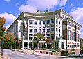
St. Charles County Courthouse in St. Charles
|
||
|
||

Location within the U.S. state of Missouri
|
||
 Missouri's location within the U.S. |
||
| Country | ||
| State | ||
| Founded | October 1, 1812 | |
| Named for | Charles Borromeo | |
| Seat | St. Charles | |
| Largest city | O'Fallon | |
| Area | ||
| • Total | 593 sq mi (1,540 km2) | |
| • Land | 560 sq mi (1,500 km2) | |
| • Water | 32 sq mi (80 km2) 5.4% | |
| Population
(2020)
|
||
| • Total | 405,262 | |
| • Density | 683.4/sq mi (263.87/km2) | |
| Time zone | UTC−6 (Central) | |
| • Summer (DST) | UTC−5 (CDT) | |
| Congressional districts | 2nd, 3rd | |

St. Charles County is located in the central eastern part of Missouri, a state in the United States. As of the 2020 census, about 405,262 people lived here. This makes it the third most populated county in Missouri. The main city, or county seat, is St. Charles.
The county was officially started on October 1, 1812. It was named after Saint Charles Borromeo, who was an important Italian religious leader. St. Charles County is part of the larger St. Louis area, which includes parts of Missouri and Illinois. Many of the cities and towns in the northwestern part of the St. Louis area are found here.
St. Charles County is the wealthiest county in Missouri. It is also one of the fastest-growing counties in the entire country! The county is known for its vineyards and wineries in the Augusta AVA area. This was the first special wine-growing region recognized by the U.S. government in 1980. The rural areas along the Missouri River are also part of a larger wine region called the Missouri Rhineland.
Contents
History of St. Charles County
The area we now call St. Charles County was first known as the District of St. Charles. It didn't have clear boundaries until 1816 to 1818. During these years, other nearby counties were formed, which helped define St. Charles County's limits. The borders of St. Charles County are the same today as they were in 1818.
Geography and Nature

The U.S. Census Bureau reports that St. Charles County covers about 593 square miles. Most of this (560 square miles) is land, and about 32 square miles (5.4%) is water.
The highest point in the county is about 901 feet high. It is located northwest of Augusta, near where Femme Osage Creek begins.
Neighboring Counties
St. Charles County shares borders with several other counties:
- Lincoln County (to the northwest)
- Calhoun County, Illinois (to the north)
- Jersey County, Illinois (to the northeast)
- Madison County, Illinois (to the east)
- St. Louis County (to the southeast)
- Franklin County (to the south)
- Warren County (to the west)
Main Roads and Highways
Many important roads run through St. Charles County, connecting it to other areas:
 Interstate 64: A major highway in the western part of the county. It used to be U.S. Route 40.
 Interstate 70: The main road that goes from east to west through the county. It has many lanes to handle a lot of traffic.
 Interstate 70 Business
 U.S. Route 40
 U.S. Route 61
 U.S. Route 67
 Route 79
 Route 94
 Route 364: A highway in the southern and central parts of the county.
 Route 370: A highway that connects Interstate 70 in St. Charles County to Interstate 270 in St. Louis County.
Protected Natural Areas
Part of the Two Rivers National Wildlife Refuge is located in St. Charles County. This area helps protect wildlife and their habitats.
Weather and Climate
St. Charles County has a varied climate throughout the year. Here's a quick look at the average high and low temperatures and rainfall each month:
|
||||||||||||||||||||||||||||||||||||||||||||||||||||||||||||||||||||||||||||||||||||||||||||||||
People and Population
St. Charles County has grown a lot over the years. Here's how the population has changed:
| Historical population | |||
|---|---|---|---|
| Census | Pop. | %± | |
| 1810 | 3,505 | — | |
| 1820 | 3,970 | 13.3% | |
| 1830 | 4,320 | 8.8% | |
| 1840 | 7,911 | 83.1% | |
| 1850 | 11,454 | 44.8% | |
| 1860 | 16,523 | 44.3% | |
| 1870 | 21,304 | 28.9% | |
| 1880 | 23,065 | 8.3% | |
| 1890 | 22,977 | −0.4% | |
| 1900 | 24,474 | 6.5% | |
| 1910 | 24,695 | 0.9% | |
| 1920 | 22,828 | −7.6% | |
| 1930 | 24,354 | 6.7% | |
| 1940 | 25,562 | 5.0% | |
| 1950 | 29,834 | 16.7% | |
| 1960 | 52,970 | 77.5% | |
| 1970 | 92,954 | 75.5% | |
| 1980 | 144,107 | 55.0% | |
| 1990 | 212,907 | 47.7% | |
| 2000 | 283,883 | 33.3% | |
| 2010 | 360,485 | 27.0% | |
| 2020 | 405,262 | 12.4% | |
| U.S. Decennial Census 1790–1960 1900–1990 1990–2000 2010–2020 |
|||
Population in 2020
In 2020, there were 405,262 people living in St. Charles County. The population density was about 643 people per square mile.
The people living in the county were mostly White (83.8%). Other groups included African American (5.2%), Asian (2.8%), Native American (0.1%), and Pacific Islander (0.1%). About 6.5% of the population identified as being from two or more races. People of Hispanic or Latino background made up 4.0% of the population.
Many families live in St. Charles County. About 40.5% of households had children under 18 living with them. The average household had 2.76 people. The median age of people in the county was 34 years old.
St. Charles County has been one of the fastest-growing areas in Missouri for many decades. This growth is due to a mix of industries, many stores, and some farming. The county is bordered by the Missouri River to the south and east and the Mississippi River to the north. Interstate 70 runs through the middle of the county, making it easy to travel. The county has one small airport, St. Charles County Smartt Airport. Two ferries also cross the Mississippi River from St. Charles County.
Education in St. Charles County
St. Charles County has many schools for students of all ages.
Public Schools
Here are some of the public school districts in the county:
- Fort Zumwalt R-II School District
- Francis Howell R-III School District
- Orchard Farm R-V School District
- St. Charles R-VI School District
- Washington School District
- Wentzville R-IV School District
The public high schools (for grades 9-12) include:
- Fort Zumwalt District:
- Fort Zumwalt East High School (St. Peters)
- Fort Zumwalt North High School (O'Fallon)
- Fort Zumwalt South High School (St. Peters)
- Fort Zumwalt West High School (O'Fallon)
- Francis Howell District:
- Francis Howell Central High School (Cottleville)
- Francis Howell North High School (St. Peters)
- Francis Howell High School (Weldon Spring Heights)
- Orchard Farm District:
- Orchard Farm High School (St. Charles)
- St. Charles District:
- St. Charles High School (St. Charles)
- St. Charles West High School (St. Charles)
- Wentzville District:
- Liberty High School (Lake St. Louis)
- Emil E. Holt High School (Wentzville)
- Timberland High School (Wentzville)
Private Schools
There are also many private schools in St. Charles County, often connected to different religious groups:
- Academy of the Sacred Heart (St. Charles) – (PK-08) – Roman Catholic
- All Saints School (St. Peters) – (K-08) – Roman Catholic
- Assumption Catholic Grade School (O'Fallon) – (K-08) – Roman Catholic
- Christian High School (O'Fallon and St. Peters) – (PK-12) – Non-denominational Christian
- Duchesne High School (St. Charles) – (09-12) – Roman Catholic
- First Baptist Christian Academy (O'Fallon) – (PK-07) – Non-denominational Christian
- Foristell Baptist Academy (Foristell) – (K-09) – Baptist
- Hope Montessori Academy (Lake St. Louis) – (PK-K) – Nonsectarian
- Immaculate Conception Catholic School (Dardenne Prairie) – (K-08) – Roman Catholic
- Immanuel Lutheran School (St. Charles) – (PK-08) – Lutheran
- Immanuel Lutheran School (Wentzville) – (PK-08) – Lutheran
- Liberty Classical School (O'Fallon) – (07-12) – Non-denominational Christian
- Lutheran High School of St. Charles County (St. Peters) – (09-12) – Lutheran
- Messiah Lutheran School (Weldon Spring) – (PK-08) – Lutheran
- Mid Rivers Seventh-day Adventist School (St. Peters) – (03-08) – Seventh-day Adventist
- St. Charles Borromeo (St. Charles) – (K-08) – Roman Catholic
- St. Cletus School (St. Charles) – (K-08) – Roman Catholic
- St. Dominic High School (O'Fallon) – (09-12) – Roman Catholic
- St. Elizabeth St. Robert Regional School (St. Charles) – (PK-08) – Roman Catholic
- St. Joseph School (Cottleville) – (K-08) – Roman Catholic
- St. Joseph School (Wentzville) – (PK-08) – Roman Catholic
- St. Patrick Elementary School (Wentzville) – (K-08) – Roman Catholic
- St. Paul Elementary School (St. Paul) – (PK-08) – Roman Catholic
- St. Peter Catholic School (St. Charles) – (PK-08) – Roman Catholic
- St. Theodore School (Wentzville) – (K-08) – Roman Catholic
- Sts. Joachim & Ann School (St. Charles) – (PK-08) – Roman Catholic
- Trinity Lutheran School (St. Charles) – (01-08) – Lutheran
- Willott Road Christian Academy (St. Peters) – (NS-09) – Baptist
- Zion Lutheran School (St. Charles) – (PK-08) – Lutheran
Higher Education
For students who want to continue their education after high school, St. Charles County has:
- Lindenwood University (St. Charles)
- St. Charles Community College (Cottleville)
Public Libraries
The St. Charles City-County Library District provides books and resources for everyone in the community.
Communities in St. Charles County
St. Charles County is made up of many different cities, villages, and other smaller communities.
Cities
Villages
Census-Designated Place
Other Unincorporated Places
These are smaller communities that are not officially cities or villages:
Islands
Several islands are located within or near St. Charles County:
- Apple Island
- Dresser Island
- Ellis Island
- Howell Island
- Two Branch Island
Subregions of the County
The Westplex Area
The Westplex is a special area within St. Charles County that is west of St. Louis County. It used to be called "The Golden Triangle" because of its shape formed by three major highways: I-70 to the north, Missouri Route 94 to the southeast, and I-64 to the southwest. Most of the growth in St. Charles County happened within this "golden" area.
Today, the Westplex includes several cities and towns:
- St. Charles
- St. Peters
- Weldon Spring
- Cottleville
- Dardenne Prairie
- O'Fallon
- Lake St. Louis
- Wentzville
Images for kids
-
St. Charles County Courthouse in St. Charles
See also
 In Spanish: Condado de Saint Charles para niños
