Sint Eustatius facts for kids
Quick facts for kids
Sint Eustatius
|
|||
|---|---|---|---|
|
Special municipality of the Netherlands
|
|||
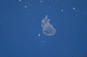
Satellite image of Sint Eustatius
|
|||
|
|||
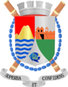
| Motto(s): | |||
| Anthem: "Golden Rock" |
|||
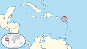
Location of Sint Eustatius (circled in red)
in the Caribbean |
|||
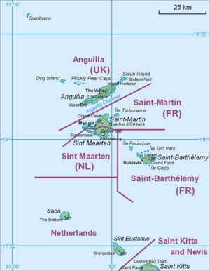
Map showing the location of St. Eustatius relative to Saba and St. Martin
|
|||
| Country | |||
| Overseas region | Caribbean Netherlands | ||
| Incorporated into the Netherlands | 10 October 2010 (dissolution of the Netherlands Antilles) | ||
| Capital (and largest city) |
Oranjestad | ||
| Area | |||
| • Total | 21 km2 (8 sq mi) | ||
| Population
(1 January 2022)
|
|||
| • Total | 3,242 | ||
| • Density | 154/km2 (405/sq mi) | ||
| Demonym(s) | St. Eustatian; Statian | ||
| Languages | |||
| • Official | English • Dutch | ||
| Time zone | UTC−4 (AST) | ||
| Calling code | +599-3 | ||
| ISO 3166 code | BQ-SE, NL-BQ3 | ||
| Currency | United States dollar ($) (USD) | ||
| Internet TLD |
|
||
Sint Eustatius (pronounced "yoo-STAY-shəs"), also known as Statia ("STAY-shə"), is a small island in the Caribbean Sea. It is a special municipality of the Netherlands. This means it's part of the Netherlands, but it has its own local government.
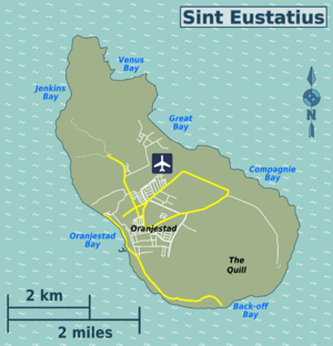
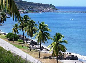
The island is located in the northern Leeward Islands. It is southeast of the Virgin Islands and close to Saint Kitts and Saba. The main town and capital is Oranjestad. Sint Eustatius is about 21 square kilometers (8.1 square miles) in size. You can fly to the island through F. D. Roosevelt Airport.
Sint Eustatius used to be part of the Netherlands Antilles. In 2010, it became a special municipality of the Netherlands. It is one of the islands in the Dutch Caribbean, which also includes Aruba, Bonaire, Curaçao, Saba, and Sint Maarten. Together, Bonaire, Sint Eustatius, and Saba are called the BES Islands or the Caribbean Netherlands.
Contents
What's in a Name?
The name Sint Eustatius comes from Saint Eustace. He was a legendary Christian saint. In Dutch, his name is Sint Eustatius.
Before this name, the island was called Nieuw Zeeland (New Zeeland). This name was given by settlers from Zeeland in the Netherlands in the 1630s. The island was renamed Sint Eustatius soon after. The original name for the island, given by its first people, was Aloi. This means "cashew island" in the Arawak language.
A Look Back in Time
The first people on Sint Eustatius were the Caribs. They are believed to have traveled from South America, moving north through the Lesser Antilles. Signs of their settlements have been found at places like Golden Rock and Orange Bay.
While Christopher Columbus might have seen the island in 1493, the first recorded sighting was in 1595. This was by Sir Francis Drake and Sir John Hawkins. From the 1600s to the early 1800s, Sint Eustatius changed hands many times. It was controlled by the Netherlands, Britain, and France a total of twenty-one times.
In 1625, English and French settlers arrived. In 1629, the French built a wooden fort where Fort Oranje is today. However, both groups left within a few years because there wasn't enough drinking water.
In 1636, the Dutch West India Company took over the island. At that time, it was empty. By 1678, Sint Eustatius, Sint Maarten, and Saba were all managed by the Dutch West India Company. A commander on Sint Eustatius was in charge of all three. The island was important for growing tobacco and sugar. It also played a big role in the trans-Atlantic slave trade.
The "Golden Rock" and Trade
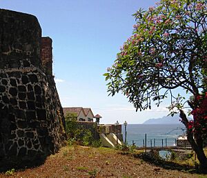
Sint Eustatius became very important to the Dutch West India Company. It was a place where enslaved Africans were brought before being sent to other islands. The ruins of the Waterfort show this past. A two-story building there was used to hold enslaved people. Plantations on the island grew sugarcane, cotton, tobacco, coffee, and indigo, using the labor of enslaved Africans. By 1774, there were 75 plantations on the island.
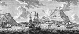
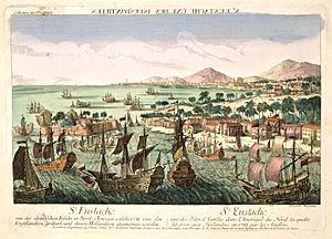
In the 1700s, Sint Eustatius was perfectly located among Danish, British, French, and Spanish territories. It had a large harbor and was a free port from 1756. This meant there were no customs duties (taxes on goods). These factors made it a major hub for trade, including the movement of enslaved people and goods. The island became known as the "Golden Rock" because it was so wealthy.
The "First Salute"
Sint Eustatius sold weapons and ammunition to anyone who would pay. This made it one of the few places where the young United States could get military supplies during the American Revolution. This good relationship led to the famous "First Salute."
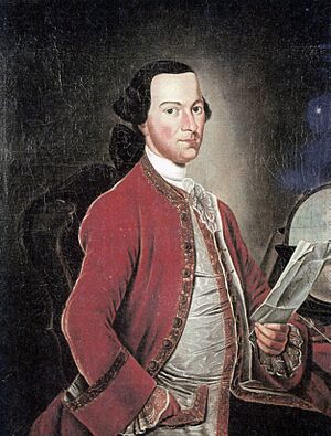
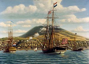
On November 16, 1776, an American ship named the Andrew Doria sailed into the harbor below Fort Oranje. It was flying the flag of the new United States. The ship fired a thirteen-gun salute, one for each of the thirteen American colonies. Governor Johannes de Graaff of Sint Eustatius returned an eleven-gun salute from Fort Oranje. This was a sign of respect between nations. It was the first time a foreign government formally recognized the flag of the United States. The Andrew Doria had come to buy supplies for the American forces. It also carried a copy of the Declaration of Independence for Governor De Graaff.
Years later, on February 27, 1939, U.S. President Franklin D. Roosevelt visited Sint Eustatius. He recognized the importance of the "First Salute." He gave the island a large brass plaque, which is now displayed at Fort Oranje. It reads:
In commemoration to the salute to the flag of the United States, Fired in this fort November 16. 1776, By order of Johannes de Graaff, Governor of Saint Eustatius, In reply to a National Gun-Salute, Fired by the United States Brig of War Andrew Doria, Under Captain Isaiah Robinson of the Continental Navy, Here the sovereignty of the United States of America was first formally acknowledged to a national vessel by a foreign official. Presented by Franklin Delano Roosevelt, President of the United States of America
British Capture in 1781
The British were very upset about the trade between Sint Eustatius and the American colonies. In 1778, a British official said that if Sint Eustatius had disappeared, Britain would have already defeated George Washington. Almost half of all American Revolutionary military supplies came through Sint Eustatius. This trade was a main reason for the Fourth Anglo-Dutch War (1780–1784).
On February 3, 1781, a large British fleet led by Admiral George Brydges Rodney arrived at Sint Eustatius. Governor De Graaff did not know that war had been declared. Rodney demanded that the island surrender. De Graaff had only a few cannons and sixty men, while Rodney had over 1,000 cannons and 3,000 soldiers. De Graaff surrendered, but he fired two shots as a sign of resistance.
Rodney's forces then looted the island. They took everything of value from warehouses and homes. Many merchants, including the Jewish population, were treated very harshly. Some were even exiled from the island. Later, in February 1782, Edmund Burke, a British politician, spoke out against Rodney's actions in Parliament, calling them "a cruelty unheard of in Europe for many years."
Ten months later, the French, who were allies of the Dutch, took the island. The Dutch regained control in 1784. However, the island's economy suffered greatly from the looting and repeated occupations.
Jewish Community on Sint Eustatius
The first records of Jewish people on Sint Eustatius date back to 1660. Many were merchants with strong international trade connections. They owned or co-owned many ships. Some also owned plantations. It's believed that Jewish people made up at least 10% of the island's permanent population.
When the British took the island in 1781, Admiral Rodney specifically targeted the Jewish community. He ordered all adult Jewish men to gather. Thirty-one heads of families were sent away to St. Kitts without warning their families. The remaining seventy-one were held in a building for three days. Rodney also confiscated their warehouses and personal belongings. He even dug up the Jewish cemetery looking for hidden treasures.
The Synagogue and Cemetery
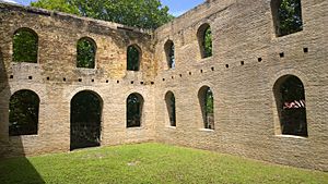
The synagogue, called Honen Dalim (meaning "He who is charitable to the Poor"), was built in 1737. It showed how wealthy and important the Jewish community was on the island. After 1815, with fewer Jewish people on the island, the synagogue slowly fell into ruin.
In 2001, the synagogue's walls were restored. The site also includes a Jewish ritual bath (a mikveh) and an oven used for Passover. A well-kept Jewish cemetery is located next to the Old Church Cemetery in Oranjestad.
Uprising of 1848
After 1848, slavery only existed on Dutch and Danish islands in the Eastern Caribbean. This caused unrest. On June 12, 1848, a group of free and enslaved Africans on Sint Eustatius gathered. They demanded their freedom, more food, and more free time. The local government tried to calm them, but the group continued their demands. The militia (local defense force) was called in. After warnings, they fired on the group, injuring some. The leaders of the uprising were sent away from the island. After this event, some plantation owners on Sint Eustatius started paying their enslaved workers a wage to prevent more uprisings.
End of Slavery
In 1863, slavery was officially ended in the Netherlands. The Dutch were among the last to abolish slavery. After gaining freedom, many formerly enslaved people moved from the plantations to the town. However, trade declined, and the island's economy suffered. Natural disasters, like hurricanes in 1928 and 1929, made the economic decline worse. From about 1795, the population of Sint Eustatius also decreased.
Becoming a Special Municipality
Sint Eustatius became part of the Netherlands Antilles in 1954. Between 2000 and 2005, the islands of the Netherlands Antilles voted on their future. In a vote on April 8, 2005, 77% of Sint Eustatius voters chose to stay within the Netherlands Antilles. However, the other islands decided to leave, which led to the end of the Netherlands Antilles.
Because of this, the island council of Sint Eustatius decided to become a special municipality of the Netherlands, like Saba and Bonaire. This change happened in October 2010. In 2011, the island officially started using the US dollar as its currency.
Island Geography

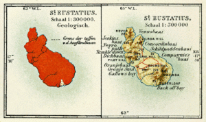
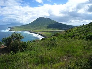
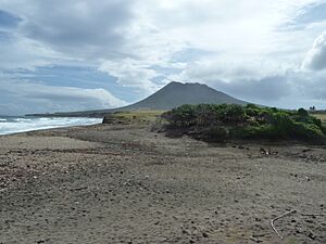
Sint Eustatius is about 10 kilometers (6 miles) long and up to 5 kilometers (3 miles) wide. The island looks like a saddle. To the southeast, there's a 602-meter (1,975-foot) tall dormant volcano called Quill. To the northwest, there are smaller hills like Signal Hill/Little Mountain and Boven Mountain. The Quill's crater is a popular place for tourists to visit. Most of the island's people live in the flat area between these two elevated parts.
Weather and Climate
Sint Eustatius has a tropical monsoon climate. This means it's warm all year round with a wet season. Tropical storms and hurricanes are common. The Atlantic hurricane season runs from June 1 to November 30, with most storms happening in late August and September.
Nature and Wildlife
Because Sint Eustatius is a volcanic island, its beaches have black volcanic sand. These sands, especially at Zeelandia Beach, are very important nesting sites for several endangered sea turtles. These include the green turtle, leatherback, loggerhead, and hawksbill.
Sint Eustatius is also home to one of the last groups of the critically endangered Lesser Antillean iguana. This iguana population was greatly affected by the strong hurricanes in 2017, especially Hurricane Maria, which caused a 25% decline in their numbers.
National Parks
Sint Eustatius has three nature parks: the Sint Eustatius National Marine Park, Quill/Boven National Park, and Miriam Schmidt Botanical Garden. Two of these have national park status. These areas are also important for birds. The St Eustatius National Parks Foundation (STENAPA) manages these parks.
Discovering the Past: Archaeology
Sint Eustatius has many archaeological sites because of its long and busy history. Almost 300 sites have been found. The island is said to have the most archaeological sites for its size anywhere. These sites include ancient settlements, plantations, military areas, trade locations (even shipwrecks), and old town areas like churches and homes.
The St. Eustatius Center for Archaeological Research (SECAR) has been doing archaeological work on the island since 2004. This includes excavations at the Godet African Burial Ground and the Golden Rock African Burial Ground.
In 2021, SECAR faced protests about excavations at the 18th-century Golden Rock burial ground. Many people on Sint Eustatius are of African descent. Community groups felt they were not involved enough in the excavation of their ancestors' burial sites. They asked the government to ensure the community is part of such projects.
People of Sint Eustatius
Population
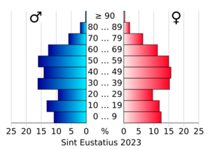
As of January 2022, the population of Sint Eustatius was 3,242 people. This means there are about 154 people per square kilometer.
Languages Spoken
The official language of Sint Eustatius is Dutch. However, English is the language used in daily life and in schools. A local English-based creole language is also spoken informally. More than half of the people on the island speak more than one language. The most common languages are English (92.7%), Dutch (36%), Spanish (33.8%), and Papiamento (20.8%).
Religions
Most people on Sint Eustatius are Christian. The main Christian groups are Methodism (28.6%), Roman Catholicism (23.7%), Seventh-Day Adventist (17.8%), Pentecostalism (7.2%), and Anglicanism (2.6%).
Religion in Sint Eustatius (2018): Protestant (56.2%) Roman Catholic (23.7%) Other Christian denomination or religion (5.2%) No denomination (14.9%)
Economy and Jobs
In the 1700s, Sint Eustatius was the most important Dutch island in the Caribbean. It was a center of great wealth from trading, earning it the nickname "Golden Rock." Many warehouses lined the road along Oranje Bay. Today, most of these warehouses are in ruins, and some are partly underwater.
A French occupation in 1795 marked the beginning of the end for Sint Eustatius's great prosperity.
Today, the government of Sint Eustatius says its economy is stable and set to grow. There is almost no unemployment, and the island has a skilled workforce. The government is the largest employer on the island. The oil terminal, owned by GTI Statia, is the largest private employer.
Energy and Water
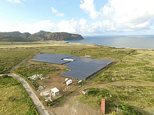
The Statia Utility Company N.V. provides electricity to the island. It also provides drinking water by truck and through a water network in some areas. The island is quickly moving towards green energy. Until 2016, all electricity came from diesel generators. In March 2016, the first part of a solar park started working, providing 23% of the island's electricity. By November 2017, the solar park had 14,345 solar panels. It now provides 40% to 50% of the island's electricity. The solar park also uses large lithium-ion batteries to store energy. On sunny days, the diesel generators can be turned off for most of the day.
Learning and Schools
The Dutch government encourages English-language education on Sint Eustatius and other nearby islands. Sint Eustatius has schools that teach in both English and Dutch.
Gwendoline van Putten School (GVP) is the secondary school on the island. Other schools include Golden Rock School, Gov. de Graaff School, Methodist School, and SDA School.
Sports on Statia
The most popular sports on Sint Eustatius are football, futsal (indoor football), softball, basketball, swimming, and volleyball. Because the island is small, there are not many sports clubs. The Sint Eustatius Volleyball Association is a member of regional volleyball organizations. Sint Eustatius is also a non-active member of the Caribbean zone of Pony Baseball and Softball leagues.
Famous People from Statia
- Antony Beaujon (around 1763–1805), a colonial governor
- Gerald Berkel (born 1969), a politician
- Black Harry (1700s), a Methodist preacher
- Kizzy (born 1979), an artist
- Lolita Euson (1914–1994), a writer and poet
- Ziggi Recado (born 1981), an artist
- Shirma Rouse, a singer
|
See Also
 In Spanish: San Eustaquio para niños
 | May Edward Chinn |
 | Rebecca Cole |
 | Alexa Canady |
 | Dorothy Lavinia Brown |


