Three Sisters (Oregon) facts for kids
Quick facts for kids Three Sisters |
|
|---|---|
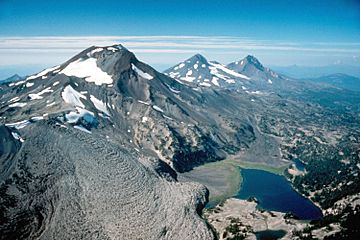
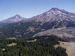
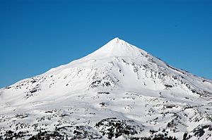
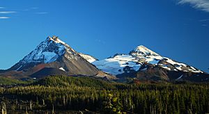
The Three Sisters, looking north
|
|
| Highest point | |
| Elevation |
|
| Prominence | 5,588 feet (1,703 m) (South Sister) |
| Listing | US most prominent peaks, 85th (South Sister) |
| Geography | |
| Location | Lane and Deschutes counties, Oregon, U.S. |
| Parent range | Cascade Range |
| Topo map | USGS South Sister and North Sister |
| Geology | |
| Formed by | Subduction zone volcanism |
| Age of rock | Quaternary |
| Mountain type | Two stratovolcanoes (South, Middle) and one shield volcano (North) |
| Volcanic arc | Cascade Volcanic Arc |
| Last eruption | 440 CE |
| Climbing | |
| Easiest route | Hiking or scrambling, plus glacier travel on some routes |
The Three Sisters are a group of three tall volcanoes in Oregon, USA. They are part of the Cascade Range, which stretches from Canada to Northern California. These mountains are super tall, each over 10,000 feet (3,000 meters) high! They are the third, fourth, and fifth highest peaks in Oregon.
You can find them in the Three Sisters Wilderness area. This is where Lane and Deschutes counties meet. The nearest town, Sisters, is about 10 miles (16 km) away. The area has lots of different plants and animals. It gets a lot of snow, some rain, and temperatures can change a lot between summer and winter. Many people love to hike and climb these mountains, especially South Sister.
Even though they are called the "Three Sisters," each mountain is unique. They have different rock types and eruption histories. North Sister and Middle Sister haven't erupted in over 14,000 years. Scientists think they probably won't erupt again. South Sister last erupted about 2,000 years ago. It could erupt again in the future. If it did, it could affect people living nearby. In 2001, satellites saw the ground near South Sister swelling up. Because of this, the United States Geological Survey (USGS) has added more tools to watch the area closely.
Contents
Exploring the Three Sisters' Location
The Three Sisters are located in Oregon, about 10 miles (16 km) south of the town of Sisters. They mark the border between Lane and Deschutes counties. These peaks are among the tallest in Oregon. They are home to 16 named glaciers. Early settlers called them Faith, Hope, and Charity. Today, we know them as North Sister, Middle Sister, and South Sister.
The Three Sisters Wilderness Area
The Three Sisters Wilderness is a huge protected area. It covers about 281,190 acres (1,137.9 km²). This makes it the second-largest wilderness area in Oregon. It was created by the U.S. Congress in 1964. The wilderness has over 260 miles (420 km) of trails. You can find many forests, lakes, waterfalls, and streams here. The Three Sisters and nearby Broken Top mountain make up a special part called the Alpine Crest Region. This area is known for its glaciers, lakes, and meadows. It rises from about 5,200 feet (1,600 m) to 10,358 feet (3,157 m) high.
How Weather Shapes the Mountains
The weather around the Three Sisters changes a lot. This is because of something called a "rain shadow." Air from the Pacific Ocean rises over the western side of the Cascade Range. As it rises, it cools and drops its moisture as rain or snow. So, the western slopes get a lot of precipitation, from 80 to 125 inches (200 to 320 cm) each year.
Once the air crosses the mountains, it sinks down the eastern side. This makes the air warmer and drier. The eastern slopes get less rain, about 40 to 80 inches (100 to 200 cm) annually. Summers can be hot, reaching 80 to 90 °F (27 to 32 °C). Winters are very cold, sometimes dropping to -20 to -30 °F (-29 to -34 °C).
Glaciers and Lakes of the Three Sisters
The Three Sisters have about 130 snowfields and glaciers. They are found at altitudes from 6,742 to 10,308 feet (2,055 to 3,142 m). Their total surface area is about 10 km² (2,500 acres).
- North Sister: Has the Linn and Villard glaciers to the north and the Thayer Glacier on its eastern side.
- Middle Sister: Has the Renfrew and Hayden glaciers on its northwestern and northeastern slopes. The Diller Glacier is on its southeastern slope.
- Between North and Middle Sister: The Collier Glacier flows to the northwest.
- Between Middle and South Sister: The Irving, Carver, and Skinner glaciers are located here.
- South Sister: Around its summit, you'll find the Prouty, Lewis, Clark, Lost Creek, and Eugene glaciers.
The Collier Glacier is usually thought to be the largest of the Three Sisters' glaciers. However, it has shrunk a lot, losing 64% of its surface area between 1910 and 1994. Some sources say the Prouty Glacier might be larger now.
When glaciers from the Little Ice Age melted, they left behind spaces that filled with water. This created lakes held back by piles of rock and dirt called moraines. These "moraine-dammed lakes" are very common in the Three Sisters Wilderness.
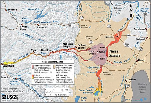
The area has had sudden floods in the past. For example, in 1966, a flash flood happened after an avalanche. Scientists from the USGS found that Carver Lake on South Sister could flood. If its natural dam broke, it could cause a large mudflow. This could be dangerous for visitors and the town of Sisters. Other lakes like Collier Lake and Diller Lake have also had their dams break in the past.
Wildfires and Forest Health
Before people settled here, wildfires often burned through the forests. This was especially true for the ponderosa pine forests on the eastern slopes. For the last 100 years, people have stopped fires. This has caused the forests to become very thick. Now, at higher elevations, they are more likely to have big, dangerous fires in the summer. These fires threaten homes and wildlife.
In recent years, wildfires in the Deschutes National Forest have become larger and more frequent. In 2012, a lightning strike caused a fire that burned 41 square miles (106 km²) in the Three Sisters Wilderness. In 2017, officials closed a large part of the wilderness due to 11 lightning-caused fires. Because of these increasing fires, officials are now planning controlled burns. These "prescribed fires" help protect habitats and reduce the risk of huge wildfires.
The Geology of the Three Sisters
The Three Sisters are part of the High Cascades. This is a chain of volcanoes that runs north to south. These volcanoes, including the Three Sisters, formed because of the Juan de Fuca Plate sliding under the North American Plate. This process is called subduction. It creates chambers of molten rock (magma) deep underground.
Each of the three volcanoes formed at different times. They also got their magma from different sources. The younger two mountains have a lot of a rock type called rhyolite. This is unusual for volcanoes in this area. The Three Sisters are at the front of a special area where the Earth's crust is melting. This melting might be caused by the movement of the Earth's mantle and pressure changes.
The changing climate during the Pleistocene epoch also shaped these mountains. Many ice ages happened, and glaciers carved out parts of the volcanoes.
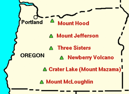
The Three Sisters are in a unique spot. They are surrounded by many other volcanoes, much closer than the usual 40 to 60 miles (64 to 97 km) apart. This area is one of the most active volcanic regions in the Cascades. Most nearby volcanoes have mafic (basaltic) lavas. These lavas are thin and flow easily. South and Middle Sister, however, have a lot of silicic rocks like andesite and rhyodacite. Silicic magma is thick and can cause explosive eruptions.
The region was active between 650,000 and 250,000 years ago. An explosive volcanic area called the Tumalo volcanic center was here. It created cinder cones and lava domes. Cinder cones are built from ash and rock fragments falling from the air. Lava domes are formed when thick, sticky lava oozes out like toothpaste.
The Tumalo volcano also spread ash and rock over the area. This was similar to the eruption of Mount Vesuvius that destroyed Pompeii. Basaltic lava flows from North Sister cover the youngest of these deposits. This shows that North Sister was active more recently than 260,000 years ago.
North Sister: The Oldest Sister
North Sister, sometimes called "Faith," is the oldest of the three. It's also the most worn down by weather and glaciers. You can see zigzagging rock spires between its glaciers. It's a shield volcano built on an even older volcano called Little Brother. North Sister is about 5 miles (8 km) wide and reaches 10,090 feet (3,075 m) high. It's mostly made of a rock called basaltic andesite. This means it has more mafic (thin, flowing) lava than the other two.
The oldest lava flows on North Sister are about 311,000 years old. Its last eruption was probably around 46,000 years ago. North Sister has more dikes (lava that squeezed into cracks in existing rocks) than any other Cascade peak. These dikes and a large volcanic plug (hardened magma in the vent) were exposed by centuries of erosion. The volcano used to be over 11,000 feet (3,400 m) tall. Erosion has worn away a quarter to a third of its original size.
Middle Sister: The Cone-Shaped Sister
Middle Sister, also known as "Hope," is a stratovolcano. It has erupted both thin basaltic lava and thicker lavas like andesite and rhyodacite. It's the smallest and least studied of the three. Middle Sister started erupting 48,000 years ago. Most of its growth happened between 25,000 and 18,000 years ago. One early eruption, about 38,000 years ago, created the rhyolite of Obsidian Cliffs.
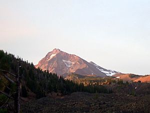
This mountain is cone-shaped and stands 10,052 feet (3,064 m) tall. Its eastern side has been heavily carved by glaciers. The western side is mostly untouched. Middle Sister has the most ice cover of the three. The Hayden and Diller glaciers are still cutting into its east face. The Renfrew Glacier is on its northwestern slope. The large Collier Glacier flows along its north side, also cutting into North Sister. Glaciers from the past have exposed a volcanic plug near the center of Middle Sister.
South Sister: The Tallest Sister
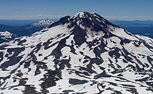
South Sister, or "Charity," is the tallest of the trio at 10,363 feet (3,159 m). Its eruptions have produced a variety of rocks, from basaltic andesite to rhyolite. It's mainly a rhyolitic stratovolcano built on an older shield volcano. Its current shape is less than 50,000 years old. Its last eruption was about 2,000 years ago.
South Sister's early eruptions were mostly rhyolitic. Later, it alternated between dacitic/rhyodacitic and rhyolitic eruptions. About 27,000 years ago, it built a steep cone of andesite. After being quiet for 15,000 years, its lava became more rhyolitic. Around 2,200 years ago, the Rock Mesa eruptive cycle happened. This spread volcanic ash and then thick rhyolite lava flows. Another cycle, the Devils Hill eruptive cycle, followed with explosive ash eruptions and sticky rhyolitic lava. These recent eruptions suggest there's a reservoir of thick magma under South Sister. This could lead to future eruptions.
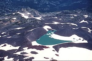
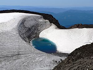
Unlike its sisters, South Sister has a crater at its top that hasn't been worn away. This crater is about 0.25 miles (0.40 km) wide. It holds a small lake called Teardrop Pool. This is the highest lake in Oregon! The cone itself is made of basaltic andesite, along with red and black volcanic rock.
Even though it's relatively young, most of South Sister has been greatly shaped by glaciers. Between 30,000 and 15,000 years ago, ice streams covered its southern sides. Smaller glaciers formed during the Holocene epoch. They advanced and retreated, leaving behind piles of rock and dirt called moraines. The Lewis and Clark glaciers have carved out bowl-shaped valleys called cirques. These have made the crater rim steeper.
Watching for Future Eruptions
Scientists don't think North or Middle Sister will erupt again. However, an eruption from South Sister could be dangerous for people nearby. The immediate danger zone stretches 2 to 10 km (1 to 6 mi) from its top. If it erupted, volcanic ash could fall on the city of Bend. Mudflows and fast-moving hot gas and rock (pyroclastic flows) could rush down the mountain. This would threaten anything in their path. The most likely eruption would involve ash and slow lava flows.
The Three Sisters area doesn't have steam vents (fumaroles). But there are hot springs west of South Sister. Scientists have been watching the area closely since the early 2000s. In 2001, satellite data showed that the ground west of South Sister was lifting up. It rose about 130 mm (5 inches) between 1995 and 2001. This swelling was likely caused by magma or hot water and gases building up 6 to 7 km (4 to 4.3 mi) underground.
Since 2001, the Cascades Volcano Observatory has installed new monitoring stations. These include a GPS station and a seismometer (which detects earthquakes). In 2004, this seismometer detected many small earthquakes, called an earthquake swarm. These hundreds of small quakes stopped after a few days. The rate of ground uplift has generally slowed down since 2001. However, a small increase in uplift started again between 2020 and 2021. More small earthquake swarms were also recorded in 2021 and 2022. Scientists continue to monitor these changes closely.
The Amazing Ecology of the Three Sisters
The plants and animals around the Three Sisters are special. They depend on where they grow in Oregon's Cascade Range.
Western Slopes: Wet Forests
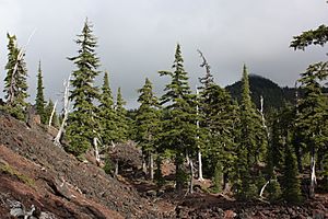
On the western slopes, from 3,000 to 6,500 feet (900 to 2,000 m), it rains a lot. Forests here are mostly Douglas-fir and western hemlock trees. You can also find mountain hemlock, noble fir, and subalpine fir. Smaller plants like vine maple, rhododendron, and huckleberry grow beneath the trees. Douglas-fir trees are common below 3,500 feet (1,100 m). Western hemlock trees are more common higher up.
High Elevations: Subalpine and Alpine Zones
The "timberline" is where trees start to thin out. At the Three Sisters, this is around 6,500 feet (2,000 m). Here, the forest opens up, and you enter the subalpine zone. Mountain hemlock trees are common here. Meadows have plants like sedges, dwarf willows, and colorful lupine and red paintbrush flowers.
Above 7,500 feet (2,300 m) is the alpine zone. This area is harsh, with lots of snow in winter and cold temperatures. You'll find patches of mountain hemlock, subalpine fir, and whitebark pine near the treeline. Wet meadows support various sedges and alpine asters. Near the very tops of the Three Sisters, there's mostly bare rock.
Eastern Slopes: Drier Woodlands
The lower eastern slopes, below 5,200 feet (1,600 m), are drier. These slopes have forests of ponderosa pine trees. Underneath, you might see greenleaf manzanita and antelope bitterbrush. Along streams, you'll find mountain alder, willows, and sedges.
Wildlife of the Three Sisters
The Three Sisters area is home to many animals. Birds like blue grouse and ruffed grouse live here. Small mammals include pikas, chipmunks, and golden-mantled ground squirrels. Larger animals like Columbian black-tailed deer, mule deer, Roosevelt elk, and American black bear also roam the area. Predators such as bobcats, cougars, coyotes, wolverines, martens, badgers, weasels, bald eagles, and several types of hawks can also be found.
Human History and Exploration
Native American people lived in the Three Sisters area for a long time. They were here after the last ice age ended. The Northern Paiute lived to the east, and the Molala to the west. They gathered berries, made baskets, hunted, and crafted tools from obsidian. You can still see some ancient rock art at Devils Hill, south of South Sister.
The first European to see the Three Sisters was explorer Peter Skene Ogden in 1825. He worked for the Hudson's Bay Company. He wrote about "a number of high mountains" south of Mount Hood. A year later, botanist David Douglas also saw the snow-covered peaks. As more settlers came to the Willamette Valley in the 1840s, they likely gave the mountains their individual names. Explorers like Nathaniel Jarvis Wyeth and John Frémont used the Three Sisters as a landmark from the east.
In 1862, Felix and Marion Scott created a route over Scott Pass. This trail connected the Willamette Valley to ranches and gold mines in eastern Oregon. It was later replaced by the McKenzie Pass Road. In 1866, a newspaper reported that one of the Three Sisters showed "fire and smoke."
In the late 1800s, many sheep grazed in eastern Oregon. Shepherds brought large herds to the Three Sisters. By the 1890s, the area was being overgrazed. Even with rules, sheep grazing peaked in 1910. It was finally banned in the 1930s and 1940s.
In 1892, President Grover Cleveland created the Cascades Forest Reserve. This protected a wide strip of land along the Cascade Range. In 1905, the United States Forest Service took over managing the Reserve. It was renamed the Cascade National Forest in 1907. Later, it was split into the Deschutes National Forest and the Willamette National Forest.
Scientists first described most of the Three Sisters glaciers in 1916. The Collier Glacier, between North and Middle Sister, was studied and mapped by Edwin Hodge. Ruth Hopsen Keen took photos of the Collier Glacier for 40 years. Her photos showed how much the glacier had shrunk.
In the 1930s, people wanted to make the Three Sisters a National Monument. To keep control, the Forest Service created a "primitive area" in 1937. This area was expanded in 1938. In 1957, the Forest Service wanted to make it a wilderness area. But they removed a section of old-growth forest, even with protests. The area became part of the National Wilderness Preservation System in 1964. Later, in 1978 and 1984, more land was added back to the Three Sisters Wilderness Area.
Fun Activities at the Three Sisters
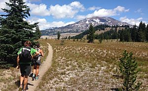
The Three Sisters are a very popular place for hikers and climbers.
- North Sister: This is the most challenging and dangerous climb because of erosion and falling rocks. It's sometimes called the "Beast of the Cascades." One of its smaller peaks, Little Brother, is safer to climb. The first recorded climb of North Sister was in 1857. Today, the common trail is about 11 miles (18 km) round-trip. It gains about 3,165 feet (965 m) in height.
- Middle Sister: You can also climb Middle Sister. The round trip is about 16.4 miles (26.4 km) long. You'll gain about 4,757 feet (1,450 m) in elevation.
- South Sister: This is the easiest of the three to climb. There's a clear trail all the way to the top. The main route is about 12.6 miles (20.3 km) round trip. It goes from 5,446 feet (1,660 m) at the start to 10,363 feet (3,159 m) at the summit. It's a very popular climb in August and September, with up to 400 people visiting each day.
See also
 In Spanish: Three Sisters (Oregón) para niños
 | William L. Dawson |
 | W. E. B. Du Bois |
 | Harry Belafonte |


