
Tropical Storm Erin (2007) facts for kids
| Tropical storm (SSHWS/NWS) | |

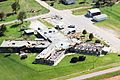
Tropical Storm Erin near landfall
|
|
| Formed | August 14, 2007 |
|---|---|
| Dissipated | August 19, 2007 |
| Highest winds | 1-minute sustained: 40 mph (65 km/h) |
| Lowest pressure | 1003 mbar (hPa); 29.62 inHg |
| Areas affected | Texas, Oklahoma, Midwestern United States |
| Part of the 2007 Atlantic hurricane season | |
Tropical Storm Erin was a tropical storm that hit the United States in 2007. It was the second storm to make landfall in the 2007 Atlantic hurricane season and the fifth storm to be named that year. Erin started as an area of strong thunderstorms in the Gulf of Mexico on August 14.
It grew stronger and became a tropical storm the next day. On August 16, Erin made landfall near Lamar, Texas. The storm managed to stay together as it moved across Texas and then headed north into Oklahoma. Tropical Storm Erin caused a lot of flooding in Texas, making an already bad situation even worse. It also led to the deaths of at least 17 people.
Contents
How Tropical Storm Erin Formed and Moved

On August 9, a group of thunderstorms formed south of Jamaica. This system slowly moved west-northwest. By August 12, it had become a large area of thunderstorms stretching from the western Caribbean Sea to the central Bahamas. The conditions in the atmosphere slowly became better for the storm to grow.
On August 13, a large area of low pressure formed near Cancún, Quintana Roo. On August 14, a special plane called a Hurricane Hunter flew into the system. It found a small center of circulation. Even though it wasn't perfectly clear, the storm was getting more organized. So, early on August 15, the National Hurricane Center named it Tropical Depression Five. It was about 425 miles (685 km) southeast of Brownsville, Texas.
After it formed, the storm was a bit messy. It had a scattered center of circulation. The system moved west-northwest into an area that was perfect for it to get stronger. The water in the Gulf of Mexico was warm, which helps storms grow. The storm's clouds became more organized, with rainbands curving around its center.
Based on reports from the Hurricane Hunters, the National Hurricane Center upgraded the depression to Tropical Storm Erin on August 15. This happened when it was about 250 miles (400 km) east of Brownsville, Texas. As it kept moving northwest, Erin stayed disorganized and didn't get much stronger. On August 16, the storm made landfall near Lamar, Texas. It weakened to a tropical depression shortly after hitting land.

Tropical Depression Erin moved slowly northwest through Texas. It kept an area of thunderstorms near its center. Its widespread rainbands brought moderate to heavy rain. By August 17, the winds had slowed down. On August 18, the system turned north-northeast. Heavy bands of thunderstorms continued to spin around Erin's center.
Early on August 19, after moving into Oklahoma, Erin suddenly got stronger again. Its winds reached 50 mph (80 km/h) west of Oklahoma City. The Norman, Oklahoma National Weather Service said this was like an "inland tropical storm." The system even showed an eye-like feature and produced wind gusts over 80 mph (130 km/h). However, a few hours later, the system started weakening again. By late on August 19, Erin turned into a leftover low-pressure area and disappeared over northeastern Oklahoma.
Preparing for Tropical Storm Erin
| Weather alerts as Tropical Storm Erin made landfall in Texas | |||
|---|---|---|---|
 |
|||
| Tornado Warning | Flash Flood Warning | ||
| Inland Tropical Storm Warning | Tropical Storm Warning | ||
| Flood Warning | Flash Flood Watch | ||
| Small Craft Advisory | |||
As soon as Erin became a tropical depression, the National Hurricane Center issued a tropical storm watch. This watch covered the coast from Freeport, Texas to the United States/Mexico border. At the same time, Mexico also issued a tropical storm watch.
Just before Erin became a tropical storm, the watch in Texas was upgraded to a tropical storm warning. Later on August 15, the warning was extended to San Luis Pass. As Erin made landfall, the warnings were canceled. Instead, several flood watches and warnings were issued for counties across southeastern Texas. When the storm moved into Oklahoma, flood and flash flood warnings were also issued there.
The Governor of Texas, Rick Perry, called on the National Guard. He also moved emergency workers to the areas expected to be hit by the storm. Erin was expected to bring a lot of flooding to the region. This area had already been declared a disaster area on August 7, 2007, because of widespread flooding from the Nueces River. This area was still flooded on August 15, 2007.
Impact of Tropical Storm Erin
Impact in Texas

By midday on August 15, rainbands with strong winds started to affect the Texas coastline. As the storm made landfall, it caused very heavy rainfall. Some areas, like Lockwood, received over 11 inches (280 mm) of rain. This heavy rain caused several bayous (slow-moving streams) in the Houston area to overflow.
Across southeastern Texas, the storm also created several funnel clouds. Near Iah, a small tornado was reported. The wind gusts from Erin were not very strong in Texas. The highest official wind gust was 35 mph (55 km/h) in Palacios. When it moved onto land, the storm also caused a small storm surge. This surge reached about 3.22 feet (0.98 m) at Pleasure Pier and caused minor beach erosion.
In Clear Lake City, heavy rain caused part of a grocery store roof to collapse. Sadly, two workers died because of this. The rain caused moderate flooding in eastern Harris County. More than 400 homes and 40 businesses were flooded. Flooding in the Greater Houston area briefly stopped the METRORail train service. It also closed several state roads. One person drowned after driving into a pond.
Many people needed rescue help. In Comal County, a car accident killed three people. The storm also caused about 20,000 homes and businesses to lose electricity. However, most of these power outages were fixed quickly. In San Antonio, one person was found in a creek. Another person died after driving into a flooded road and being swept into a ditch. In Sisterdale, two people died when they were swept away by floodwaters. In Taylor County, near Abilene, flooding killed one person and forced about 2,000 people to leave their homes.
Impact in Oklahoma
After Tropical Storm Erin unexpectedly got stronger over Oklahoma, it caused a lot of damage there too. Several towns in central Oklahoma were flooded because of the heavy rainfall. Watonga, Kingfisher, and Geary were hit the hardest. Many houses and buildings in these towns were flooded.
Winds in Watonga gusted as high as 82 mph (131 km/h). These strong winds damaged many trees and power lines. They also heavily damaged mobile homes. The entire town of Watonga lost power. About 15,000 customers in the Oklahoma City area also lost electricity. A section of Interstate 40 was closed for a while due to the storm.
One person was found to have drowned in a cellar in Fort Cobb. Another person drowned in Kingfisher. Another death related to the storm happened in Seminole. Three other people died in a car accident near Carnegie that was related to the weather. Another car accident death happened in Okmulgee County, but it's not certain if Erin was the cause.
Impact in Missouri
Even though Erin's main storm system had disappeared, its upper part remained. This caused a lot of rain to fall in Missouri on August 20. The town of Miller received 11.94 inches (303.3 mm) of rain. This was the most rain Missouri had received from a tropical cyclone or its remains since at least 1976.
One person died in Sleeper when they drove into floodwaters. A bridge they were trying to cross had been swept away. Nine water rescues happened along the Interstate 44 highway. This area was most affected by Erin's rainfall.
Related pages
|
Tropical cyclones of the 2007 Atlantic hurricane season |
|||||||||||||||||||||||||||||||||
|
|
||||||||||||||||||||||||||||||||
|
|
|||||||||||||||||||||||||||||||||
Images for kids
-
This nursing home in Caddo County, OK was damaged by strong winds from Tropical Storm Erin on August 20, 2007.

