A roads in Zone 7 of the Great Britain numbering scheme facts for kids
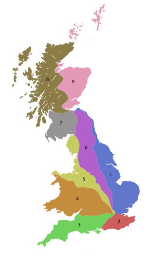
A roads are important routes in Great Britain that help people travel across the country. They are like the main highways that connect towns and cities. Each A road has a special number. Great Britain is divided into different zones for these roads, and this article focuses on the A roads in Zone 7. This zone is located north of the Solway Firth and Eden Estuary, west of the A7, and south of the A8. All the roads in this zone start with the number 7.

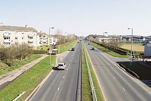
The A726 road in East Kilbride.
Main A Roads in Zone 7
These are the most important A roads in Zone 7, known by their single or double-digit numbers. They connect major towns and cities.
| Road | From | To | Fun Facts |
|---|---|---|---|
| Carlisle | Edinburgh | This road is about 92 miles (148 km) long. It's one of the longest main roads in Scotland! | |
| Ayr | Edinburgh | This road is about 74 miles (119 km) long. | |
| Irvine | Edinburgh | It's around 70 miles (112 km) long. | |
| Hamilton | Galashiels | This road is 63 miles (101 km) long. | |
| Abington | Cumbernauld | This road is 37 miles (60 km) long. | |
| Viewpark | Glasgow | This road used to go all the way to Gretna, but now the M74 motorway does that job. | |
| Gretna | Stranraer | ||
| Dumfries | Kilmarnock | ||
| Portpatrick, Dumfries and Galloway | Glasgow | ||
| Greenock | Monkton | ||
| Ayr | Glasgow Prestwick Airport | At 7.5 miles (12.1 km) long, this is one of the shortest two-digit A roads in the UK! |
Other A Roads in Zone 7
These roads have three or four digits and often connect smaller towns or act as bypasses.
| Road | From | To | Interesting Notes |
|---|---|---|---|
| Sciennes, Edinburgh | New Town, Edinburgh | ||
| Dumfries | Edinburgh | This road's path was changed over time. | |
| St. John's Town of Dalry | Edinburgh | ||
| Peebles | Edinburgh City Bypass junction 6, Lothianburn | This road runs through the Scottish Borders area. | |
| Whitburn | Livingston | ||
| Lanark | Bo'ness | Parts of this road were once other A roads. | |
| Moffat | Selkirk | This road used to go further south to Dumfries. | |
| Lockerbie | Dumfries | ||
| Dumfries | Dalbeattie | ||
| Dumfries | Argrennan | ||
| Crocketford | Newton Stewart | This road passes through New Galloway. | |
| Castle Douglas | Ayr | ||
| Kirkinner | Girvan | ||
| Unused | This road used to run from Dunragit to Sandhead. | ||
| Whiteleys | Drummore | ||
| Stranraer | Stranraer | This road is a loop within Stranraer. | |
| Stranraer | Kirkcolm | ||
| Turnberry | North of Fenwick | This road goes over the famous Electric Brae, where it looks like you're rolling uphill when you're actually going downhill! | |
| Musselburgh | South Gyle | This is the Edinburgh City Bypass, a very important road around the city. | |
| Kirkdean (Peeblesshire) | Broomhouse | ||
| Wishaw | Newmains | ||
| Strathaven | Holytown | ||
| Rutherglen | Hamilton | The number for this road was reused for a different route. | |
| Coatbridge | East Kilbride at A726 | This road is also known as the "Bellshill Bypass" and the "East Kilbride Expressway." | |
| Erskine at A898 and B815 / Newton Mearns at M77 and A77 | Darnley at M77 and A727 / Strathaven at A71 | Part of this road was rerouted in 2006 as the Glasgow Southern Orbital route. | |
| Philipshill, East Kilbride at A726 | Darnley at A726 and M77 | This road number was brought back in 2006 after a new road opened. | |
| Shawfield / Simshill | Parkhead / Gorbals | One part of this road was finished in 2012 for the 2014 Commonwealth Games. Another part passes Hampden Park. | |
| Unused | This number was once used for a road in Glasgow. | ||
| Cathkin Bypass (Whitlawburn) | Gorbals Cross | ||
| Unused | This road used to run through Rutherglen. | ||
| Unused | This road used to be London Road in Glasgow. | ||
| Unused | This road used to run from Fenwick to Ayr. | ||
| Unused | This road used to run from Hurlford to Riccarton. | ||
| Kilmarnock | Lugton | ||
| Braehead | Irvine | This road runs through several towns like Crookston and Barrhead. | |
| Irvine | Paisley | This road has changed its route many times, and new bypasses are still being built! | |
| Ardrossan | Kilwinning | This number was reused for a new route in 2004. | |
| Cardonald | Bearsden | This road includes the Clyde Tunnel in Glasgow, which is a primary route. | |
| Unused | This road used to connect Glasgow Airport to Johnstone. | ||
| Paisley | Renfrew | ||
| Unused | This road used to run from Greenock to Inverkip. | ||
| Lanark | Ravenstruther | ||
| Unused | This road used to run from Strathaven to Kirkfieldbank. | ||
| Dalbeattie | Castle Douglas | ||
| Glasserton | Kirkinner | ||
| Glasserton | Glenluce | ||
| Unused | This road used to run from Dunragit. | ||
| Glasgow | East Kilbride | ||
| Unused | This road used to run from Whithorn to Isle of Whithorn. | ||
| Aird, A75 | Innermessan, A77 | This road helps traffic avoid going through Stranraer. | |
| Thorniewood | Muirhead | This number was once used for a road from Kirkdean to Moffat. | |
| Unused | This road used to run from Carnwath to Kirkdean. | ||
| Unused | This road used to run from Hillington to A736. | ||
| Kirkcudbright | Girthon | ||
| Dumfries | Maxwelltown | This road's number was changed back to its original one. | |
| Unused | This road used to run from Genoch Square to Lochans. | ||
| Unused | This road used to run from Ayr to Mauchline. | ||
| Troon | Kilmarnock | ||
| Largs | Lochwinnoch | ||
| Ibrox | Port Glasgow | ||
| Tongland Bridge | St John's Town of Dalry | ||
| Cambuslang | Carmyle | ||
| Unused | This road used to run from Portpatrick to Portslogan. | ||
| Unused | This road used to run from Ballantrae to Pinwherry. | ||
| Nine Mile Burn | Penicuik | ||
| Unused | This road used to run from Uphall to Mid Calder. | ||
| Bilston | Eskbank | ||
| Unused | This road used to run from Bogue to Balmaclellan. | ||
| Inverkip | Greenock | This road includes parts of what used to be the A8 and A78 roads. | |
| Cardwell Road, Gourock | Gourock Ferry Terminal | This road uses part of an old railway track! | |
| Eskbank | Edinburgh | ||
| Mossend | Newhouse | ||
| Unused | This road used to run from East Kilbride to Burnbank. | ||
| Unused | This road used to run south from the A78 to Monkton. | ||
| Livingston | Bathgate | ||
| Dumfries | Douievale | ||
| Buccleuch St, Dumfries | Dockhead, Dumfries | ||
| Unused | This road was once part of the B7002. | ||
| Boghall | Standhill | This road was once part of the A8 road. | |
| Bothwell | Bothwell | This is a new road created in 2017. |
See Also
- B roads in Zone 7 of the Great Britain numbering scheme
- List of motorways in the United Kingdom
- Transport in Edinburgh#Road network
- Transport in Glasgow#Other Roads
- Transport in Scotland#Road

All content from Kiddle encyclopedia articles (including the article images and facts) can be freely used under Attribution-ShareAlike license, unless stated otherwise. Cite this article:
A roads in Zone 7 of the Great Britain numbering scheme Facts for Kids. Kiddle Encyclopedia.

