
Geography of London facts for kids
London is the biggest city and the capital of the United Kingdom. It's located in the southeast part of Great Britain. The area called Greater London covers about 1,579 square kilometers (610 sq mi). In 2019, about 8.98 million people lived there. A larger area, the London Metropolitan Region, is even bigger, covering 8,382 square kilometers (3,236 sq mi) and home to over 12.6 million people.
London is also a port city on the River Thames, a river that ships can travel on. The Thames has been super important in how the city grew. London first started on the north side of the river, and for a long time, that was the main part of the city. For many centuries, London Bridge was the only bridge across the Thames in the city. But when more bridges were built in the 1700s, London started to spread out in all directions because the land was mostly flat, making it easy to build.
Contents
A 360-Degree View of London

Rivers and Waterways
The River Thames
The River Thames is London's most important river. It flows from west to east through the London area. Many smaller rivers also flow into the Thames. The Thames used to be much wider and shallower than it is today. Now, it has many walls built along its banks.
The Thames is a tidal river up to Teddington Lock. This means its water level goes up and down with the ocean tides. Because of this, London can be at risk of flooding from big storm surges. This risk has grown over time because the sea level is slowly rising due to climate change and because Britain is slowly tilting (the south is sinking a little). To protect the city, the Thames Barrier was built across the river at Woolwich in the 1970s.
Many smaller rivers and streams flow into the Thames within London. Some of these rivers were once big enough to shape the land around them. Today, many of London's smaller rivers now flow underground, hidden beneath the city streets.
Rivers North of the Thames
Some of the larger rivers that flow into the Thames from the north include the Colne, Crane, Brent, Lea, Roding, Rom, and Ingrebourne. Many smaller streams, like the Fleet and Walbrook, now flow underground.
Big rivers like the Lea have shaped the local area in many ways:
- The river and its marshy areas created a natural barrier, making it hard to travel from east to west. The Lea used to be the boundary between the historic areas of Middlesex and Essex.
- The Lea Valley became an important route for transport, including the river itself, canals, and roads.
- The river provided power for many water mills, which were used for factories and other industries.
- In the 1800s and 1900s, the lower Lea area became a major place for factories and industries because of good transport links, flat land, and electricity from riverside power plants. Today, much of that industry has been replaced by warehouses and shops.
- The Lea Valley also became very important for London's water supply, with reservoirs and canals bringing water to the city.
Another important area for canals, railways, and industries was along the River Brent, stretching from the Thames at Brentford. The Colne forms much of the western border of Greater London.
Rivers South of the Thames
Important rivers flowing into the Thames from the south include the Mole, Wandle, Ravensbourne, and the Darent with its tributary the Cray. Some smaller rivers, like the Beverley Brook and Effra, are now mostly underground.
The Wandle River Valley was a busy industrial area in south London, similar to the Lea Valley in the north. Many of the smaller rivers in the south also once had mills powered by their water.
Canals
Many canals were built in London in the late 1700s and early 1800s. They were originally used to transport goods, like coal and timber, around the city. Today, most of these canals are used for leisure activities like boating.
Canals North of the Thames
Canal building started with improvements to the Lea and Stort as early as 1424. This led to the River Lee Navigation and Bow Back Rivers, which connected the industrial Lea Valley to the Port of London. The Limehouse Cut (1760) provided a shorter way to the Thames.
The Grand Junction Canal (later called the Grand Union) connected London to the Midlands starting in 1798. An arm of this canal opened in 1801, leading to a large basin at Paddington. This basin was later linked to the Thames by the Regent's Canal, completed in 1820. The Regent's Canal also connected to the Lea system. Many industries grew up along the Regent's Canal.
Canals South of the Thames
The former Grand Surrey Canal (1807) was planned to run from the Thames at Rotherhithe to Mitcham, but it only reached Camberwell. It closed in 1970 and has since been filled in. It connected to the Croydon Canal (1809), which closed in 1836.
Further away, canals like the Kennet & Avon Canal and the Wey and Arun Canal once connected London to places like Bristol and the south coast.
Islands in the Thames
Here are some of the larger islands in the River Thames within London:
- Chiswick Eyot
- Eel Pie Island
- Isle of Dogs (which includes areas like Millwall and Cubitt Town)
London's Landscape
London sits in a natural bowl-shaped area called the London Basin. Most of the city is built on younger layers of rock and soil. The center of this basin is dominated by the Thames Valley, which forms a flat area running from west to east. This flat area is bordered by slightly higher terraces of land. Other important river valleys include those of the Colne, Crane, Brent, Lea, Wandle, and Ravensbourne, which flow towards the Thames.
There are a few noticeable hills in Greater London, but none are very high (only a few hundred feet). These hills haven't stopped the city from growing in all directions, which is why London is roughly circular in shape.
Hills in the City of London
The small hills in the very old part of London, the City of London, are Ludgate Hill, Corn Hill, and Tower Hill. These hills probably helped decide where the first city was built, but they are very small, and most of central London is quite flat.
North London Hills
To the north of the city, there's a ridge of higher ground that includes famous spots like Hampstead Heath and Highgate Hill. This ridge continues east to form Crouch Hill and Queen's Wood. Smaller hills like Primrose Hill and Parliament Hill are also part of this area.
Further north, another ridge (a bit under 100 meters high) runs from Muswell Hill to Church End, Finchley and north to Whetstone. This area was once covered by glaciers, marking the furthest south the ice sheets reached. Other smaller hills in this area include Dollis Hill and Alexandra Palace.
Even further north, there are more ridges that form the "Grim's Dyke Ridge," including Mill Hill, Totteridge, Arkley, and Stanmore Commons.
Much of east and northeast London is on the flat floodplain of the Thames. Notable features here include the artificial Beckton Alps. Higher parts of Epping Forest also have small hills.
South London Hills
In south London, the chalk bedrock comes close to the surface in areas like Lewisham and Greenwich. This has created a noticeable ridge that includes Shooter's Hill, Greenwich Park, and Blackheath. West of the Ravensbourne river valley, this ridge continues as Telegraph Hill, Nunhead, and Honor Oak. Further south, Crystal Palace and Sydenham Hill are also on higher ground.
In southwest London, the lower flat areas of the Thames end sharply at a noticeable bluff against Richmond Hill. Higher ground across northern Wimbledon and the Norwood Ridge is also present, separated by the valley of Beverley Brook, which divides Richmond Park from Wimbledon Common.
London's Climate
The climate in London is similar to the rest of the UK: it has warm summers, cool winters, and rain throughout the year. It often has light to strong winds. London has what's called a temperate maritime climate. This means it's influenced by the ocean, so it doesn't have extreme temperatures.
Temperatures tend to be warmer in the very center of London. This is mainly because of the "urban heat island" effect, where buildings and roads absorb and release heat, making cities warmer than the countryside. Also, central London is generally the lowest part of the region.
In winter, daytime temperatures are usually around 8°C (46°F). They can sometimes be as high as 16°C (61°F) or as low as -7.4°C (19°F). Nighttime temperatures are usually just above freezing, and London typically has frosts on 25 to 45 nights a year. The lowest temperature ever officially recorded in the London area was -16.1°C (3°F) at Northolt in January 1962.
In summer, daytime temperatures are usually around 23°C (73°F). The warmest day of the year at Heathrow Airport typically reaches about 31.6°C (89°F). Kew Gardens holds the record for London's highest temperature at 38.1°C (100.6°F). In the summer of 2018, there was a hosepipe ban in London because of high temperatures and a lack of rain. Experts are concerned that London might face water shortages in the future due to climate change. It's important for everyone to help save water!
Sunshine generally increases towards the west of London. Heathrow and Kew usually get over 1,600 hours of sunshine each year. The sunniest year on record at Heathrow was 2003, with just over 2,003 hours of sunshine.
Here are some weather details from different parts of London:
| Climate data for Heathrow Airport, elevation: 25 m (82 ft), 1991–2020 normals, extremes 1948–present | |||||||||||||
|---|---|---|---|---|---|---|---|---|---|---|---|---|---|
| Month | Jan | Feb | Mar | Apr | May | Jun | Jul | Aug | Sep | Oct | Nov | Dec | Year |
| Record high °C (°F) | 16.0 (60.8) |
20.1 (68.2) |
22.8 (73.0) |
27.4 (81.3) |
31.8 (89.2) |
34.8 (94.6) |
37.9 (100.2) |
37.9 (100.2) |
31.3 (88.3) |
28.8 (83.8) |
18.6 (65.5) |
16.6 (61.9) |
37.9 (100.2) |
| Mean daily maximum °C (°F) | 8.4 (47.1) |
9.0 (48.2) |
11.7 (53.1) |
15.0 (59.0) |
18.4 (65.1) |
21.6 (70.9) |
23.9 (75.0) |
23.4 (74.1) |
20.2 (68.4) |
15.8 (60.4) |
11.5 (52.7) |
8.8 (47.8) |
15.7 (60.3) |
| Daily mean °C (°F) | 5.6 (42.1) |
5.8 (42.4) |
7.9 (46.2) |
10.5 (50.9) |
13.7 (56.7) |
16.8 (62.2) |
19.0 (66.2) |
18.7 (65.7) |
15.9 (60.6) |
12.3 (54.1) |
8.4 (47.1) |
5.9 (42.6) |
11.7 (53.1) |
| Mean daily minimum °C (°F) | 2.7 (36.9) |
2.7 (36.9) |
4.1 (39.4) |
6.0 (42.8) |
9.1 (48.4) |
12.0 (53.6) |
14.2 (57.6) |
14.1 (57.4) |
11.6 (52.9) |
8.8 (47.8) |
5.3 (41.5) |
3.1 (37.6) |
7.8 (46.0) |
| Record low °C (°F) | −13.2 (8.2) |
−9.6 (14.7) |
−5.1 (22.8) |
−2.6 (27.3) |
−0.9 (30.4) |
1.5 (34.7) |
5.6 (42.1) |
5.9 (42.6) |
1.8 (35.2) |
−3.3 (26.1) |
−7.0 (19.4) |
−11.8 (10.8) |
−13.2 (8.2) |
| Average precipitation mm (inches) | 58.8 (2.31) |
45.0 (1.77) |
38.8 (1.53) |
42.3 (1.67) |
45.9 (1.81) |
47.3 (1.86) |
45.8 (1.80) |
52.8 (2.08) |
49.6 (1.95) |
65.1 (2.56) |
66.6 (2.62) |
57.1 (2.25) |
615.0 (24.21) |
| Average precipitation days (≥ 1.0 mm) | 11.5 | 9.5 | 8.5 | 8.8 | 8.0 | 8.3 | 7.9 | 8.4 | 7.9 | 10.8 | 11.2 | 10.8 | 111.7 |
| Mean monthly sunshine hours | 61.1 | 78.8 | 124.5 | 176.7 | 207.5 | 208.4 | 217.8 | 202.1 | 157.1 | 115.2 | 70.7 | 55.0 | 1,674.8 |
| Source 1: Met Office | |||||||||||||
| Source 2: KNMI | |||||||||||||
| Climate data for Kew Gardens, elevation: 6 m (20 ft), 1991–2020 normals, extremes 1901–present | |||||||||||||
|---|---|---|---|---|---|---|---|---|---|---|---|---|---|
| Month | Jan | Feb | Mar | Apr | May | Jun | Jul | Aug | Sep | Oct | Nov | Dec | Year |
| Record high °C (°F) | 16.1 (61.0) |
21.2 (70.2) |
24.5 (76.1) |
29.1 (84.4) |
30.6 (87.1) |
34.2 (93.6) |
35.0 (95.0) |
38.1 (100.6) |
33.3 (91.9) |
27.8 (82.0) |
18.9 (66.0) |
15.7 (60.3) |
38.1 (100.6) |
| Mean daily maximum °C (°F) | 8.6 (47.5) |
9.2 (48.6) |
11.9 (53.4) |
15.1 (59.2) |
18.4 (65.1) |
21.4 (70.5) |
23.8 (74.8) |
23.4 (74.1) |
20.3 (68.5) |
16.0 (60.8) |
11.6 (52.9) |
8.9 (48.0) |
15.7 (60.3) |
| Daily mean °C (°F) | 5.3 (41.5) |
5.6 (42.1) |
7.7 (45.9) |
10.1 (50.2) |
13.3 (55.9) |
16.2 (61.2) |
18.5 (65.3) |
18.2 (64.8) |
15.4 (59.7) |
11.9 (53.4) |
8.0 (46.4) |
5.6 (42.1) |
11.3 (52.3) |
| Mean daily minimum °C (°F) | 2.0 (35.6) |
2.0 (35.6) |
3.5 (38.3) |
5.1 (41.2) |
8.2 (46.8) |
11.0 (51.8) |
13.2 (55.8) |
13.0 (55.4) |
10.5 (50.9) |
7.8 (46.0) |
4.3 (39.7) |
2.3 (36.1) |
6.9 (44.4) |
| Record low °C (°F) | −12.8 (9.0) |
−11.7 (10.9) |
−8.3 (17.1) |
−2.1 (28.2) |
−3.1 (26.4) |
−0.6 (30.9) |
3.9 (39.0) |
2.1 (35.8) |
1.4 (34.5) |
−3.9 (25.0) |
−7.1 (19.2) |
−11.7 (10.9) |
−12.8 (9.0) |
| Average precipitation mm (inches) | 59.9 (2.36) |
45.4 (1.79) |
39.0 (1.54) |
43.6 (1.72) |
44.6 (1.76) |
49.7 (1.96) |
45.2 (1.78) |
55.1 (2.17) |
51.9 (2.04) |
67.9 (2.67) |
66.0 (2.60) |
59.2 (2.33) |
627.5 (24.70) |
| Average precipitation days (≥ 1.0 mm) | 11.8 | 9.9 | 8.9 | 8.6 | 8.3 | 8.5 | 7.6 | 8.4 | 8.4 | 10.9 | 11.3 | 11.2 | 113.8 |
| Mean monthly sunshine hours | 60.2 | 80.7 | 128.0 | 181.0 | 213.4 | 209.8 | 221.9 | 206.5 | 152.0 | 117.4 | 69.7 | 52.7 | 1,693.2 |
| Source: Met Office | |||||||||||||
| Climate data for Hampstead, elevation: 137 m (449 ft), 1991–2020 normals, extremes 1960–present | |||||||||||||
|---|---|---|---|---|---|---|---|---|---|---|---|---|---|
| Month | Jan | Feb | Mar | Apr | May | Jun | Jul | Aug | Sep | Oct | Nov | Dec | Year |
| Record high °C (°F) | 15.7 (60.3) |
18.3 (64.9) |
23.1 (73.6) |
26.6 (79.9) |
29.8 (85.6) |
33.7 (92.7) |
34.4 (93.9) |
37.4 (99.3) |
29.4 (84.9) |
28.3 (82.9) |
17.9 (64.2) |
15.3 (59.5) |
37.4 (99.3) |
| Mean daily maximum °C (°F) | 7.5 (45.5) |
8.1 (46.6) |
10.9 (51.6) |
14.1 (57.4) |
17.3 (63.1) |
20.4 (68.7) |
22.7 (72.9) |
22.3 (72.1) |
19.1 (66.4) |
14.8 (58.6) |
10.6 (51.1) |
7.8 (46.0) |
14.7 (58.5) |
| Daily mean °C (°F) | 4.9 (40.8) |
5.2 (41.4) |
7.3 (45.1) |
9.8 (49.6) |
12.8 (55.0) |
15.8 (60.4) |
18.0 (64.4) |
17.8 (64.0) |
15.1 (59.2) |
11.6 (52.9) |
7.8 (46.0) |
5.3 (41.5) |
10.9 (51.6) |
| Mean daily minimum °C (°F) | 2.3 (36.1) |
2.3 (36.1) |
3.7 (38.7) |
5.5 (41.9) |
8.3 (46.9) |
11.2 (52.2) |
13.3 (55.9) |
13.4 (56.1) |
11.1 (52.0) |
8.3 (46.9) |
5.0 (41.0) |
2.7 (36.9) |
7.3 (45.1) |
| Record low °C (°F) | −10.8 (12.6) |
−12.2 (10.0) |
−6.9 (19.6) |
−3.2 (26.2) |
−0.6 (30.9) |
1.8 (35.2) |
5.6 (42.1) |
4.7 (40.5) |
2.4 (36.3) |
−2.4 (27.7) |
−5.8 (21.6) |
−8.4 (16.9) |
−12.2 (10.0) |
| Average precipitation mm (inches) | 69.5 (2.74) |
51.4 (2.02) |
42.8 (1.69) |
49.6 (1.95) |
50.5 (1.99) |
58.5 (2.30) |
50.5 (1.99) |
67.7 (2.67) |
59.1 (2.33) |
78.6 (3.09) |
75.7 (2.98) |
68.3 (2.69) |
722.1 (28.43) |
| Average precipitation days (≥ 1.0 mm) | 12.1 | 10.7 | 9.1 | 9.1 | 8.5 | 8.7 | 8.4 | 9.3 | 9.0 | 11.0 | 11.9 | 11.9 | 119.6 |
| Mean monthly sunshine hours | 60.0 | 76.1 | 114.2 | 155.2 | 199.2 | 193.7 | 199.8 | 188.3 | 145.5 | 106.3 | 67.2 | 54.0 | 1,559.4 |
| Source 1: Met Office | |||||||||||||
| Source 2: KNMI | |||||||||||||
| Climate data for RAF Northolt, elevation: 40 m (131 ft), 1991–2020 normals | |||||||||||||
|---|---|---|---|---|---|---|---|---|---|---|---|---|---|
| Month | Jan | Feb | Mar | Apr | May | Jun | Jul | Aug | Sep | Oct | Nov | Dec | Year |
| Mean daily maximum °C (°F) | 8.2 (46.8) |
8.8 (47.8) |
11.6 (52.9) |
14.8 (58.6) |
18.1 (64.6) |
21.2 (70.2) |
23.5 (74.3) |
23.1 (73.6) |
20.0 (68.0) |
15.6 (60.1) |
11.3 (52.3) |
8.6 (47.5) |
15.4 (59.7) |
| Daily mean °C (°F) | 5.1 (41.2) |
5.4 (41.7) |
7.6 (45.7) |
10.0 (50.0) |
13.2 (55.8) |
16.2 (61.2) |
18.4 (65.1) |
18.1 (64.6) |
15.3 (59.5) |
11.8 (53.2) |
7.9 (46.2) |
5.5 (41.9) |
11.2 (52.2) |
| Mean daily minimum °C (°F) | 2.0 (35.6) |
2.0 (35.6) |
3.5 (38.3) |
5.2 (41.4) |
8.3 (46.9) |
11.3 (52.3) |
13.4 (56.1) |
13.2 (55.8) |
10.6 (51.1) |
7.9 (46.2) |
4.5 (40.1) |
2.3 (36.1) |
7.0 (44.6) |
| Average precipitation mm (inches) | 62.9 (2.48) |
49.1 (1.93) |
42.4 (1.67) |
45.6 (1.80) |
51.8 (2.04) |
50.2 (1.98) |
48.6 (1.91) |
56.6 (2.23) |
51.4 (2.02) |
70.2 (2.76) |
71.4 (2.81) |
63.1 (2.48) |
663.3 (26.11) |
| Average precipitation days (≥ 1.0 mm) | 11.6 | 10.1 | 9.1 | 9.4 | 8.6 | 8.6 | 8.1 | 9.4 | 8.5 | 10.7 | 11.6 | 11.3 | 117.0 |
| Source: Met Office | |||||||||||||
| Climate data for London (Greenwich) | |||||||||||||
|---|---|---|---|---|---|---|---|---|---|---|---|---|---|
| Month | Jan | Feb | Mar | Apr | May | Jun | Jul | Aug | Sep | Oct | Nov | Dec | Year |
| Record high °C (°F) | 14.0 (57.2) |
19.7 (67.5) |
21.0 (69.8) |
26.9 (80.4) |
31.0 (87.8) |
35.0 (95.0) |
35.5 (95.9) |
37.5 (99.5) |
30.0 (86.0) |
28.8 (83.8) |
19.9 (67.8) |
15.0 (59.0) |
37.5 (99.5) |
| Mean daily maximum °C (°F) | 8.3 (46.9) |
8.5 (47.3) |
11.4 (52.5) |
14.2 (57.6) |
17.7 (63.9) |
20.7 (69.3) |
23.2 (73.8) |
22.9 (73.2) |
20.1 (68.2) |
15.6 (60.1) |
11.4 (52.5) |
8.6 (47.5) |
15.2 (59.4) |
| Mean daily minimum °C (°F) | 2.6 (36.7) |
2.4 (36.3) |
4.1 (39.4) |
5.4 (41.7) |
8.4 (47.1) |
11.5 (52.7) |
13.9 (57.0) |
13.7 (56.7) |
11.2 (52.2) |
8.3 (46.9) |
5.1 (41.2) |
2.8 (37.0) |
7.5 (45.5) |
| Record low °C (°F) | −10.0 (14.0) |
−9.0 (15.8) |
−8.0 (17.6) |
−2.0 (28.4) |
−1.0 (30.2) |
5.0 (41.0) |
7.0 (44.6) |
6.0 (42.8) |
3.0 (37.4) |
−4.0 (24.8) |
−5.0 (23.0) |
−7.0 (19.4) |
−10.0 (14.0) |
| Average precipitation mm (inches) | 51.6 (2.03) |
38.2 (1.50) |
40.5 (1.59) |
45.0 (1.77) |
46.5 (1.83) |
47.3 (1.86) |
41.1 (1.62) |
51.6 (2.03) |
50.4 (1.98) |
68.8 (2.71) |
58.0 (2.28) |
53.0 (2.09) |
591.8 (23.30) |
| Average rainy days (≥ 1.0 mm) | 10.8 | 8.5 | 9.6 | 9.4 | 9.0 | 8.3 | 8.0 | 7.6 | 8.5 | 10.7 | 10.1 | 9.9 | 110.4 |
| Average snowy days | 4 | 4 | 3 | 1 | 0 | 0 | 0 | 0 | 0 | 0 | 1 | 3 | 16 |
| Average relative humidity (%) | 81.0 | 76.0 | 69.0 | 64.0 | 62.0 | 60.0 | 60.0 | 62.0 | 67.0 | 73.0 | 78.0 | 82.0 | 69.5 |
| Mean monthly sunshine hours | 49.9 | 71.4 | 107.1 | 159.8 | 181.2 | 181.0 | 192.1 | 195.1 | 138.9 | 108.1 | 58.5 | 37.4 | 1,480.5 |
| Source 1: Record highs and lows from BBC Weather, except August and February maximum from Met Office | |||||||||||||
| Source 2: All other data from Met Office, except for humidity and snow data which are from NOAA | |||||||||||||
| Climate data for London (Heathrow airport 1981−2010) | |||||||||||||
|---|---|---|---|---|---|---|---|---|---|---|---|---|---|
| Month | Jan | Feb | Mar | Apr | May | Jun | Jul | Aug | Sep | Oct | Nov | Dec | Year |
| Mean daily maximum °C (°F) | 8.1 (46.6) |
8.4 (47.1) |
11.3 (52.3) |
14.2 (57.6) |
17.9 (64.2) |
21.0 (69.8) |
23.5 (74.3) |
23.2 (73.8) |
19.9 (67.8) |
15.5 (59.9) |
11.1 (52.0) |
8.3 (46.9) |
15.2 (59.4) |
| Mean daily minimum °C (°F) | 2.3 (36.1) |
2.1 (35.8) |
3.9 (39.0) |
5.5 (41.9) |
8.7 (47.7) |
11.7 (53.1) |
13.9 (57.0) |
13.7 (56.7) |
11.4 (52.5) |
8.4 (47.1) |
4.9 (40.8) |
2.7 (36.9) |
7.4 (45.4) |
| Average precipitation mm (inches) | 55.2 (2.17) |
40.9 (1.61) |
41.6 (1.64) |
43.7 (1.72) |
49.4 (1.94) |
45.1 (1.78) |
44.5 (1.75) |
49.5 (1.95) |
49.1 (1.93) |
68.5 (2.70) |
59.0 (2.32) |
55.2 (2.17) |
601.7 (23.68) |
| Average rainy days (≥ 1.0 mm) | 11.1 | 8.5 | 9.3 | 9.1 | 8.8 | 8.2 | 7.7 | 7.5 | 8.1 | 10.8 | 10.3 | 10.2 | 109.6 |
| Mean monthly sunshine hours | 61.5 | 77.9 | 114.6 | 168.7 | 198.5 | 204.3 | 212.0 | 204.7 | 149.3 | 116.5 | 72.6 | 52.0 | 1,632.6 |
| Source: Met Office | |||||||||||||
Images for kids
-
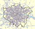
Outline of the London region
-
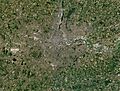
Satellite image by Sentinel-2 satellite


