
Iqaluit facts for kids
Quick facts for kids
Iqaluit
ᐃᖃᓗᐃᑦ (Inuktitut syllabics)
|
|||
|---|---|---|---|
|
City
|
|||

From top left: Cityscape from Joamie Hill, Iqaluit waterfront, Aurora borealis at night, Iqaluit Airport, St. Jude's Anglican Cathedral
|
|||
|
|||

Iqaluit
Location in Nunavut

Iqaluit
Location in Canada
|
|||
| Country | Canada | ||
| Territory | Nunavut | ||
| Region | Qikiqtaaluk | ||
| Electoral districts | Iqaluit-Manirajak Iqaluit-Niaqunnguu Iqaluit-Sinaa Iqaluit-Tasiluk |
||
| Settled | 1942 | ||
| Village status | 1974 | ||
| Town status | 1980 | ||
| City status | 19 April 2001 | ||
| Founded by | Nakasuk | ||
| Government | |||
| • Type | Iqaluit City Council | ||
| Area
(2021)
|
|||
| • Total | 51.58 km2 (19.92 sq mi) | ||
| • Population Centre | 10.48 km2 (4.05 sq mi) | ||
| Elevation | 30 m (110 ft) | ||
| Population
(2021)
|
|||
| • Total | 7,429 | ||
| • Density | 144.0/km2 (373/sq mi) | ||
| • Population Centre | 7,082 | ||
| • Population Centre density | 667.0/km2 (1,728/sq mi) | ||
| Demonym(s) | Iqalummiut | ||
| Time zone | UTC−05:00 (EST) | ||
| • Summer (DST) | UTC−04:00 (EDT) | ||
| Canadian Postal code |
X0A 0A1, X0A 0H0, X0A 1H0, X0A 2H0, X0A 3H0
|
||
| Area code(s) | 867 | ||
| Telephone Exchanges | 222 (mobile), 975, 979 | ||
| NTS Map | 25N10 Hill Island | ||
| GNBC Code | OATRP | ||


Iqaluit (pronounced ee-KAL-oo-it) is the capital city of Nunavut, a Canadian territory. It is the largest community in Nunavut and its only city. From 1942 to 1987, it was called Frobisher Bay. This name came from the large bay where the city is located. Iqaluit is the northernmost city in Canada. Its traditional Inuktitut name was brought back in 1987.
In 1999, Iqaluit became the capital of Nunavut. This happened after the Northwest Territories was divided into two separate territories. Before this, Iqaluit was a small city. It was not well known outside the Canadian Arctic. Its population and economy did not grow much. This is because the city is very isolated. It depends a lot on expensive supplies brought in from elsewhere. Like the rest of Nunavut, Iqaluit has no roads or railways connecting it to the rest of Canada. It only has ship connections for part of the year. The city has a polar climate. This means it is very cold. This is due to the cold, deep waters of the Labrador Current near Baffin Island. Iqaluit is cold even though it is south of the Arctic Circle.
In 2021, the population of Iqaluit was 7,429 people. This was a small decrease from 2016. Iqaluit has the smallest population of any capital city in Canada. People who live in Iqaluit are called Iqalummiut.
Contents
- Exploring Iqaluit's Past
- Iqaluit's Location and Environment
- City Layout and Attractions
- Iqaluit's Population and People
- Learning and Education in Iqaluit
- City Services and Facilities
- Getting Around Iqaluit
- Staying Connected: Communications and Media
- Famous People from Iqaluit
- Images for kids
- See also
Exploring Iqaluit's Past
Iqaluit has been a traditional fishing spot for thousands of years. Inuit people and those who came before them, like the Paleo-Eskimo and Thule, used this area. The name Iqaluit comes from the Inuktitut language. It means "place of many fish".
How World War II Shaped Iqaluit
During World War II, many non-Inuit people came to the area. In 1942, the United States built the Frobisher Bay Air Base here. They leased the land from the Government of Canada. This base was a stop-over and refuelling site. It helped short-range aircraft get to Europe for the war.
Iqaluit's first permanent resident was Nakasuk. He was an Inuk guide. He helped the United States Army Air Forces choose a good spot for a landing strip. This wartime airstrip was called Crystal Two. It was part of the Crimson Route. Today, it is still used as the Iqaluit Airport.
The Inuit had always used this area as a campsite and fishing spot. They called it Iqaluit. The US and Canadian authorities named it Frobisher Bay. This was after the large body of water it borders.

In 1949, after the war, the Hudson's Bay Company moved its operations. They moved to the nearby valley of Niaqunngut, also called Apex. This allowed them to use the airfield. In the mid-1950s, the population of Frobisher Bay grew quickly. This was during the building of the Distant Early Warning Line (DEW line). This was a system of radar stations for defence.
Hundreds of construction workers, military staff, and administrators moved to the community. Most were not Inuit. Many Inuit also moved there. They wanted jobs and medical care from the base. By 1957, 489 of the town's 1,200 residents were Inuit. After 1959, the Canadian government started permanent services in Frobisher Bay. These included full-time doctors, a school, and social services. The Inuit population grew fast. The government encouraged Inuit to live permanently in communities with government services.
From Military Base to Capital City
The American military left Iqaluit in 1963. Their new intercontinental ballistic missiles (ICBMs) made the DEW line and Arctic airbases less important. Canada continued to run an administrative and logistical centre for the eastern Arctic at Frobisher Bay.
In 1964, the first local elections were held for a community council. In 1979, the first mayor was elected. The Inuksuk High School was founded in the early 1970s. This showed the government's commitment to Iqaluit as an administrative centre. At that time, it was the only high school in a huge part of Canada.
On January 1, 1987, the name of the town changed from "Frobisher Bay" to "Iqaluit". This matched the name the Inuit people had always used. In 1995, the people of the future Nunavut territory voted. They chose Iqaluit (over Rankin Inlet) to be the capital. On April 19, 2001, Iqaluit officially became a city.
Canada chose Iqaluit to host the 2010 meeting of the Group of Seven finance ministers. This meeting took place on February 5–6. Hosting this international meeting put a strain on the northern communication systems. It required extra investment to make it work.
Iqaluit's Key Historical Dates
- 1576 – Englishman Martin Frobisher sailed into Frobisher Bay. He thought he had found a route to China. He held the first Anglican church service in North America here.
- 1861 – Charles Francis Hall, an American, explored the waters of Koojesse Inlet. He named it after his Inuit guide.
- 1942 – The United States Army Air Forces chose this area for a major air base. It supported war efforts in Europe.
- 1949 – The Hudson's Bay Company (HBC) moved its trading post to nearby Apex.
- 1955 – Frobisher Bay became the centre for building the US/Canada DEW Line. Many Inuit settled here for services.
- 1958 – Telephone service was started by Bell Canada.
- 1963 – The United States military left, causing some population loss.
- 1964 – The first community council was formed. The population was 900.
- 1970 – Frobisher Bay was officially recognized as a settlement.
- 1974 – Frobisher Bay became a village.
- 1976 – Inuit proposed a separate Nunavut Territory to the government.
- 1979 – Bryan Pearson was elected as the first mayor.
- 1980 – Frobisher Bay became a town.
- 1982 – The Government of Canada agreed to create Nunavut.
- 1987 – Frobisher Bay was renamed Iqaluit. This is its original Inuktitut name, meaning "place of (many) fish".
- 1993 – The Nunavut Land Claims Agreement was signed in Iqaluit.
- 1995 – Nunavut residents chose Iqaluit as the capital.
- April 1, 1999 – The Territory of Nunavut was officially created.
- April 19, 2001 – Iqaluit became a city.
- 2002 – Iqaluit and Nuuk, Greenland, co-hosted the first Arctic Winter Games. The Arctic Winter Games Arena was built in Iqaluit for this event.
- February 5, 2010 – Canada chose Iqaluit to host the finance meeting for the 2010 Group of Seven summit.
- July 29, 2022 – Pope Francis visited Iqaluit. He met with former residential school students. He was the first Pope to visit Nunavut.
Iqaluit's Location and Environment
.jpg)
Iqaluit is Canada's northernmost city. It is located at 63 degrees north of the Equator. The city sits in the Everett Mountains. These mountains rise from Koojesse Inlet, which is part of Frobisher Bay. This is on the southeast side of Baffin Island. Iqaluit is east of Nunavut's mainland and northeast of Hudson Bay.
Understanding Iqaluit's Climate
.jpg)
Iqaluit has a tundra climate. This is typical of the Arctic region, even though it is outside the Arctic Circle. The city has long, cold winters and short, cool summers. The average monthly temperatures are below freezing for eight months of the year.
Iqaluit gets just over 400 mm (16 inches) of precipitation each year. This is wetter than many other places in the Arctic Archipelago. Summer is the wettest season. Winter temperatures are similar to other northern communities like Yellowknife. However, summer temperatures are much colder in Iqaluit. This is because of its location near the cold waters of the Baffin Island Current. This means that the tree line is much further south in eastern Canada.
Even though it is north of the natural tree line, some small black spruce trees grow here. They are protected by snowdrifts in winter. There are also a few shrubs, like the Arctic willow. The Arctic willow can spread out about 7.6 metres (25 feet) wide. But it only grows about 15 cm (6 inches) tall.
Iqaluit's climate is also colder than places at the same latitude that are affected by the Gulf Stream. For example, the city of Trondheim in Norway is much milder.
The coldest temperature ever recorded in Iqaluit was -45.6 °C (-50.1 °F) on February 10, 1967. The warmest temperature was 26.8 °C (80.2 °F) on July 21, 2008.
| Climate data for Iqaluit (Iqaluit Airport) WMO ID: 71909; coordinates 63°45′N 68°33′W / 63.750°N 68.550°W; elevation: 33.5 m (110 ft); 1991–2020 normals, extremes 1946–present |
|||||||||||||
|---|---|---|---|---|---|---|---|---|---|---|---|---|---|
| Month | Jan | Feb | Mar | Apr | May | Jun | Jul | Aug | Sep | Oct | Nov | Dec | Year |
| Record high humidex | 3.3 | 5.2 | 4.3 | 6.8 | 13.3 | 21.7 | 27.8 | 27.6 | 18.8 | 8.6 | 4.8 | 3.4 | 27.8 |
| Record high °C (°F) | 3.9 (39.0) |
5.7 (42.3) |
4.2 (39.6) |
7.2 (45.0) |
13.3 (55.9) |
22.7 (72.9) |
26.8 (80.2) |
25.5 (77.9) |
18.4 (65.1) |
9.1 (48.4) |
5.6 (42.1) |
3.8 (38.8) |
26.8 (80.2) |
| Mean daily maximum °C (°F) | −22.0 (−7.6) |
−22.9 (−9.2) |
−17.6 (0.3) |
−8.9 (16.0) |
−0.3 (31.5) |
7.0 (44.6) |
12.0 (53.6) |
11.1 (52.0) |
5.6 (42.1) |
−0.5 (31.1) |
−7.5 (18.5) |
−14.7 (5.5) |
−4.9 (23.2) |
| Daily mean °C (°F) | −26.0 (−14.8) |
−27.0 (−16.6) |
−22.4 (−8.3) |
−13.5 (7.7) |
−3.2 (26.2) |
3.9 (39.0) |
8.1 (46.6) |
7.5 (45.5) |
2.9 (37.2) |
−3.2 (26.2) |
−11.1 (12.0) |
−18.9 (−2.0) |
−8.6 (16.5) |
| Mean daily minimum °C (°F) | −29.9 (−21.8) |
−31.0 (−23.8) |
−27.2 (−17.0) |
−18.1 (−0.6) |
−6.1 (21.0) |
0.7 (33.3) |
4.2 (39.6) |
3.8 (38.8) |
0.2 (32.4) |
−5.8 (21.6) |
−14.7 (5.5) |
−23.0 (−9.4) |
−12.2 (10.0) |
| Record low °C (°F) | −45.0 (−49.0) |
−45.6 (−50.1) |
−44.7 (−48.5) |
−34.2 (−29.6) |
−26.1 (−15.0) |
−10.2 (13.6) |
−2.8 (27.0) |
−2.5 (27.5) |
−12.8 (9.0) |
−27.1 (−16.8) |
−36.2 (−33.2) |
−43.4 (−46.1) |
−45.6 (−50.1) |
| Record low wind chill | −65.4 | −65.6 | −62.1 | −53.1 | −36.0 | −18.8 | −7.2 | −8.6 | −18.6 | −42.9 | −56.8 | −60.1 | −65.6 |
| Average precipitation mm (inches) | 16.3 (0.64) |
14.0 (0.55) |
21.4 (0.84) |
22.7 (0.89) |
21.0 (0.83) |
48.7 (1.92) |
39.8 (1.57) |
61.7 (2.43) |
50.8 (2.00) |
30.2 (1.19) |
18.5 (0.73) |
16.2 (0.64) |
361.2 (14.22) |
| Average rainfall mm (inches) | 0.4 (0.02) |
0.1 (0.00) |
0.0 (0.0) |
0.0 (0.0) |
3.3 (0.13) |
46.1 (1.81) |
44.4 (1.75) |
65.5 (2.58) |
43.9 (1.73) |
12.3 (0.48) |
0.7 (0.03) |
0.0 (0.0) |
216.6 (8.53) |
| Average snowfall cm (inches) | 19.4 (7.6) |
15.1 (5.9) |
20.6 (8.1) |
23.8 (9.4) |
23.0 (9.1) |
3.8 (1.5) |
0.0 (0.0) |
0.1 (0.0) |
8.5 (3.3) |
21.1 (8.3) |
25.9 (10.2) |
28.8 (11.3) |
190.0 (74.8) |
| Average precipitation days (≥ 0.2 mm) | 12.1 | 10.7 | 12.4 | 12.8 | 10.6 | 12.3 | 12.4 | 14.3 | 15.7 | 13.2 | 12.5 | 12.8 | 151.5 |
| Average rainy days (≥ 0.2 mm) | 0.06 | 0.06 | 0.06 | 0.06 | 1.7 | 10.7 | 13.1 | 14.8 | 13.2 | 3.8 | 0.24 | 0.0 | 57.7 |
| Average snowy days (≥ 0.2 cm) | 10.1 | 8.8 | 8.7 | 9.6 | 8.7 | 2.1 | 0.06 | 0.12 | 3.7 | 9.8 | 11.9 | 12.7 | 86.3 |
| Average relative humidity (%) (at 3pm) | 68.1 | 67.6 | 68.9 | 74.6 | 77.3 | 74.6 | 72.9 | 73.5 | 75.2 | 78.7 | 78.4 | 74.3 | 73.7 |
| Mean monthly sunshine hours | 32.4 | 94.0 | 172.2 | 216.5 | 180.5 | 200.2 | 236.8 | 156.8 | 87.9 | 51.4 | 35.6 | 12.6 | 1,476.8 |
| Percent possible sunshine | 18.5 | 39.0 | 47.4 | 48.2 | 31.9 | 32.5 | 39.3 | 31.0 | 22.4 | 16.8 | 17.7 | 8.9 | 29.5 |
| Average ultraviolet index | 0 | 0 | 1 | 2 | 4 | 4 | 4 | 3 | 2 | 1 | 0 | 0 | 2 |
| Source 1: Environment and Climate Change Canada (Bright Sunshine 1981–2010) | |||||||||||||
| Source 2: Weather Atlas | |||||||||||||
City Layout and Attractions

Iqaluit's Neighbourhoods
- Downtown (central area)
- Happy Valley (north)
- Lake Subdivision (north) – a place where people live
- Lower Base (south)
- Lower Iqaluit (southeast)
- North 40 (northwest) – located north of the airport
- Plateau Subdivision (northwest) – another residential area
- Road To Nowhere (north)
- Tundra Valley (west)
- Tundra Ridge (west) – home to two schools and a youth centre
- West 40 (southwest) – a commercial area

Apex: A Nearby Community
Apex (Niaqunngut) is a small community. It is about 5 km (3 miles) southeast of Iqaluit's centre. It is officially part of the City of Iqaluit. Apex is on a small peninsula. It separates Koojesse Inlet from Tarr Inlet. In Apex, you can find a women's shelter, a church, and a primary school (Nanook Elementary School). There is also a design shop and a bed and breakfast. Apex was where most Inuit lived when Iqaluit was a military site. At that time, only people working at the base were allowed in Iqaluit.
Buildings and Places to See

Many buildings in Iqaluit are built to be practical. They are designed to save money on materials. They also keep heat in and stand up to the cold climate. Older buildings include military barracks from the 1950s. There are also fibreglass block buildings from the 1970s, like the Nakasuk School. Some old Hudson's Bay Company buildings in Apex have been restored.
The Nunavut Legislative Assembly Building is special. It has a colourful interior. It is decorated with beautiful Inuit art. A new legislative building is being planned outside the city on Apex Road.

Another unique building was St. Jude's Anglican Cathedral. It was shaped like an igloo. The altar was built by church members. It looked like a traditional Inuit sled. The cross was made of two crossed narwhal tusks. In 2005, a fire badly damaged the Cathedral. It was torn down in 2006. A new cathedral, also shaped like an igloo, was completed in 2010. The inside was finished in 2011, and it opened on June 3, 2012. This unique igloo-shaped building is a landmark and tourist attraction. It is also very important for the people of Iqaluit.
The distinctive blue and white Inuksuk High School sits on a ridge overlooking the city. It has four square sections joined together. From above, it looks like a cloverleaf.
The city also has the Nunatta Sunakkutaangit Museum. It has a large collection of Inuit and Arctic items. The museum is in a restored Hudson's Bay Company building. It was moved to Iqaluit from its original spot on Apex Beach.

Just west of Iqaluit is the Sylvia Grinnell Territorial Park. This park features the valley of the Sylvia Grinnell River. There is a small visitor's centre on a hill. It offers views of waterfalls, tidal flats, and traditional fishing sites.
Nearby, on an island, is the Qaummaarviit Territorial Park. This site has a long Inuit history. Many artifacts have been found here. These include the remains of 11 semi-buried sod houses.
Further away, across Frobisher Bay, are the Katannilik Territorial Park Reserve and the Soper River. The Soper River is a Canadian Heritage River. It forms a park corridor. This links Iqaluit to Kimmirut (formerly Lake Harbour) along old travel routes. Frobisher Bay stretches for almost 110 km (70 miles) to the east. It has hills, glaciers, and traditional campsites. It opens into the Davis Strait, which separates Nunavut from Greenland.
Iqaluit has an annual spring festival called Toonik Tyme. It combines traditional Inuit activities with modern events. The Alianait Music and Arts Festival is held for a week every June 21. This festival brings in Canadian and international artists.
Iqaluit's Population and People
| Federal census population history of Iqaluit | ||
|---|---|---|
| Year | Pop. | ±% |
| 1971 | 2,050 | — |
| 1976 | 2,320 | +13.2% |
| 1981 | 2,333 | +0.6% |
| 1986 | 2,947 | +26.3% |
| 1991 | 3,552 | +20.5% |
| 1996 | 4,220 | +18.8% |
| 2001 | 5,236 | +24.1% |
| 2006 | 6,184 | +18.1% |
| 2011 | 6,699 | +8.3% |
| 2016 | 7,740 | +15.5% |
| 2021 | 7,429 | −4.0% |
| Source: Statistics Canada |
||
In the 2021 Canadian census, Iqaluit had a population of 7,429 people. This was a 4.0 percent decrease from 2016. The city has a land area of 51.58 square kilometres (19.92 sq mi). This means it had a population density of 144.0 people per square kilometre in 2021.
The average home in Iqaluit has about 2.8 people. The average family has 1.4 children living at home. The average household income after taxes in Iqaluit is quite high, at $98,921. This is almost double the national average. The average income for an individual is also high, at $60,688.
Iqaluit has a young population. The average age is 30.1 years old. This is more than 10 years younger than the national average of 40.6 years old.
For adults over 25:
- 75.7% have a high school education.
- 59.8% have gone to post-secondary school.
- 24.3% do not have a certificate, diploma, or degree.
In 2021, 750 people living in Iqaluit were immigrants. This means they were born outside Canada. This is 10.3% of the total population. The top countries of origin for immigrants were the Philippines, Cameroon, and the United Kingdom.
Who Lives in Iqaluit?
As of 2016, Iqaluit has the most Inuit people of all Canadian cities with populations over 5,000. There were 3,900 Inuit, making up 59.1 percent of the population.
| Panethnic group | 2021 | 2016 | 2011 | 2006 | 2001 | |||||
|---|---|---|---|---|---|---|---|---|---|---|
| Pop. | % | Pop. | % | Pop. | % | Pop. | % | Pop. | % | |
| Indigenous | 4,055 | 55.47% | 4,505 | 59.35% | 4,040 | 61.21% | 3,650 | 59.98% | 3,065 | 59% |
| European | 2,350 | 32.15% | 2,500 | 32.94% | 2,265 | 34.32% | 2,235 | 36.73% | 2,030 | 39.08% |
| African | 395 | 5.4% | 225 | 2.96% | 70 | 1.06% | 45 | 0.74% | 25 | 0.48% |
| Southeast Asian | 235 | 3.21% | 165 | 2.17% | 70 | 1.06% | 35 | 0.58% | 15 | 0.29% |
| South Asian | 100 | 1.37% | 65 | 0.86% | 55 | 0.83% | 30 | 0.49% | 15 | 0.29% |
| East Asian | 55 | 0.75% | 60 | 0.79% | 60 | 0.91% | 65 | 1.07% | 25 | 0.48% |
| Latin American | 40 | 0.55% | 25 | 0.33% | 15 | 0.23% | 10 | 0.16% | 10 | 0.19% |
| Middle Eastern | 35 | 0.48% | 30 | 0.4% | 10 | 0.15% | 10 | 0.16% | 10 | 0.19% |
| Other | 40 | 0.55% | 10 | 0.13% | 10 | 0.15% | 10 | 0.16% | 0 | 0% |
| Total responses | 7,310 | 98.4% | 7,590 | 98.06% | 6,600 | 98.52% | 6,085 | 98.4% | 5,195 | 99.22% |
| Total population | 7,429 | 100% | 7,740 | 100% | 6,699 | 100% | 6,184 | 100% | 5,236 | 100% |
| Note: Totals greater than 100% due to multiple origin responses | ||||||||||


Languages Spoken in Iqaluit
In Iqaluit, there isn't one main "mother tongue". About 45.4 percent of people said their first language was English. The same percentage, 45.4 percent, said their first language was Inuktitut. English is spoken by 97.2 percent of Iqaluit residents. However, only 53.1 percent can speak Inuktitut. French is the first language for 4.8 percent of the population. The same number of people can speak French.
Religious Beliefs in Iqaluit
According to the 2021 census, the main religious groups in Iqaluit include:
- Christianity (54.4%)
- No religion (41.9%)
- Islam (1.2%)
- Indigenous Spirituality (0.7%)
- Hinduism (0.4%)
- Judaism (0.3%)
- Buddhism (0.1%)
- Other religions (1.0%)
Learning and Education in Iqaluit


The Qikiqtani School Operations manages five schools in the area. Nanook Elementary School in Apex, Nakasuk School, and Joamie Ilinniarvik School teach kindergarten to grade 5. Aqsarniit Ilinniarvik School teaches grades 6 to 8. Inuksuk High School teaches grades 9 to 12.
The Commission scolaire francophone du Nunavut runs École des Trois-Soleils. This school offers kindergarten to grade 12 in French.
For higher education, there are two places: Nunavut Arctic College (Nunatta Campus) and Akitsiraq Law School.
City Services and Facilities
Emergency Services in Iqaluit


The city provides emergency services like fire and ambulance from one station. The emergency vehicle fleet includes fire engines, a ladder truck, staff vehicles, and ambulances.
Iqaluit Airport Emergency Services handles fire services at the airport. Their fleet includes special airport fire trucks.
The Royal Canadian Mounted Police (RCMP) provides policing in Iqaluit. The city is home to their divisional headquarters.
Medical Care in Iqaluit
The Qikiqtani General Hospital is the main healthcare facility in the city. There is also a Family Practice Clinic. It offers primary care services by Nurse Practitioners. Iqaluit also has two dental clinics.
Sports and Recreation
Iqaluit has many sports facilities. These include two arenas, the Arctic Winter Games Arena and Arnaitok. There is also the Iqaluit Aquaplex, a curling rink, and a disc golf course. You can find a fitness centre, a golf course, outdoor basketball courts, and soccer nets. In winter, there are seasonal outdoor ice rinks. The city also has a shooting range and a skatepark.
Waste and Water Management
The city's services are under pressure because of growth. Waste from the city goes into an open-air dump. This dump is located south of the city.
Even though the city has water treatment facilities, raw sewage is often dumped into nearby Frobisher Bay.
The dump has reached its limit. The city plans to open a second dump 9 km (5.6 miles) north of the city. Iqaluit does not have a recycling program. All recyclable materials go into the waste stream.
In October 2021, Iqaluit residents faced a water crisis. Their tap water was found to be contaminated with fuel. The fuel leaked from an old underground tank into the water supply. This led to a state of emergency. Residents had to use bottled water or water from nearby rivers. This situation showed the challenges of providing safe water in remote Arctic communities.
Getting Around Iqaluit
Iqaluit is the smallest Canadian capital by population. It is the only capital not connected to other towns by a highway. Since it's on an island, you can usually only reach Iqaluit by plane. You can also get there by boat when the ice conditions allow.
.jpg)
The Iqaluit Airport is a modern facility. Its runway is long enough for most modern jet aircraft. A new, larger passenger terminal was finished in 2018.
Canadian North flies to Iqaluit from Ottawa, Yellowknife, and other Nunavut communities. Local airlines provide air charters and air ambulance services.
Iqaluit's runway was shared with the Royal Canadian Air Force. The airport is also a centre for cold-weather testing of new aircraft. For example, the Airbus A380 was tested here in 2006.
A deep-sea port opened in Iqaluit in July 2023. It took five years to build. The port has a fixed dock, mooring space, and a cargo area. It also has a ramp for barges and a fuel system.

Iqaluit has a local road system. It only stretches from Apex to the Sylvia Grinnell Territorial Park. This is about 1 km (0.6 miles) west of town. Iqaluit does not have public bus transportation anymore. However, there is citywide taxi service. More cars are being used, sometimes causing small traffic jams. But snowmobiles are still the most popular way to get around. This is because of the high cost of shipping cars and the rough roads. All-terrain vehicles are also common. Snowmobiles are used for travel within the city and nearby areas. In winter, dog sleds are still used, mostly for fun.
Most main roads in Iqaluit are paved. But smaller roads are gravel. Roads do not have traffic lights. They use stop signs to control intersections.
People and businesses often use building numbers to identify their locations. Around 2003, street names were created. But building numbers are still commonly used. Iqaluit is the only Canadian capital city without traffic signals.
Staying Connected: Communications and Media
Phone and Internet Services
Northwestel provides landline phone services in Iqaluit. Cell service is available from Ice Wireless, Bell Mobility, and Qiniq.
Internet service is offered by Northwestel, Ice Wireless, Qiniq, Xplornet, and Meshnet. Meshnet Community WiFi offers free and paid internet access in most parts of the city. Free services include access to Isuma.tv and other resources.
News and Radio

Iqaluit has two weekly newspapers:
- Nunatsiaq News
- News/North
Here are the radio stations you can listen to in Iqaluit:
| Frequency | Call sign | Branding | Format | Owner | Notes |
|---|---|---|---|---|---|
| AM 1230 & FM 91.1 | CFFB | CBC Radio One | Talk radio, public radio | Canadian Broadcasting Corporation | Broadcasts in English and Inuktitut |
| FM 88.3 | CBM-FM-3 | CBC Music | Assorted music, public radio | Canadian Broadcasting Corporation | Rebroadcasts CBM-FM (Montreal) |
| FM 89.7 | VF9132 | Yle Radio Suomi | Assorted music, sports, news and phone-in programming | Yleisradio Oy | |
| FM 93.3 | CIQA-FM | Weatheradio Canada | Weather radio | Meteorological Service of Canada | Rebroadcasts VEV284 (Iqaluit Airport) |
| FM 99.9 | CKIQ-FM | Ice FM | Classic rock | Northern Lights Entertainment | |
| FM 103.5 | CKGC-FM | Capital FM | Oldies | Northern Lights Entertainment | |
| FM 107.3 | CFRT-FM | 107.3 CFRT | Community radio | Association des Francophones du Nunavut | French language community radio |
Television Channels
Here are the television channels available in Iqaluit:
| OTA channel | Call sign | Network | Notes |
|---|---|---|---|
| 4.1 | CH8106 | Yle TV1 | |
| 6.1 | CH7729 | Yle TV2 | |
| 8.1 | CH0283 | Uvagut TV | |
| 10.1 | CH4161 | Aboriginal Peoples Television Network | Eastern Time Zone feed |
| 12.1 | CH2260 | Ici Radio-Canada Télé | Community-owned rebroadcaster of CBFT-DT (Montreal) |
| 17.1 | CH4584 | CBC North | Community-owned broadcaster of CFYK-DT (Yellowknife, Northwest Territories) |
| 35.1 | CH0977 | Legislative Assembly of Nunavut and the Northwest Territories | Called “Legislative Television” |
| 47.1 | CH9112 | Independent station | Called “Isuma Local Media” |
Iqaluit used to have CFFB-TV channel 8, a CBC Television/CBC North repeater. It closed on July 31, 2012, due to budget cuts.
Famous People from Iqaluit
- Eva Aariak, a politician and former Premier of Nunavut.
- Alexander Fathoullin, a speed skater.
- Ann Meekitjuk Hanson, former Commissioner of Nunavut.
- Kenn Harper, a grocer, historian, and businessman.
- Lucie Idlout, a rock singer and songwriter.
- Matty McNair, an explorer born in the US.
- Mosha Michael, a filmmaker.
- Simonie Michael, the first Inuk elected to the Legislative Assembly of the Northwest Territories in 1966.
- Nakasuk, the founder of Iqaluit.
- Paul Okalik, a lawyer and politician. He was the first Premier of Nunavut.
- Abe Okpik, a politician who helped Inuit get family names instead of disc numbers.
- Dennis Patterson, a politician and former Premier of the NWT.
- Bryan Pearson, a politician and the first mayor of Iqaluit.
- Ed Picco, a politician.
- Annabella Piugattuk, an actress.
- Elisapee Sheutiapik, a former politician and mayor.
- Enooyaq Sudlovenick, a marine biologist.
- Hunter Tootoo, a politician and former speaker of the Nunavut Legislative Assembly.
- Sheila Watt-Cloutier, a politician, environmental activist, and Nobel nominee.
Images for kids
-
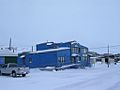
Offices for the Nunatsiaq News.
-
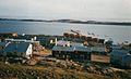
Harbour view
-
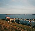
Harbour view


See also
 In Spanish: Iqaluit para niños
