Lake Keowee facts for kids
Quick facts for kids Lake Keowee |
|
|---|---|
 |
|
| Location | Oconee / Pickens counties, South Carolina, United States |
| Coordinates | 34°48′00″N 82°53′12″W / 34.80000°N 82.88667°W |
| Type | Reservoir |
| Primary inflows | Keowee River Little River Whitewater Thompson Toxaway Lake Jocassee |
| Primary outflows | Keowee River Seneca River Savannah River |
| Basin countries | United States |
| Max. length | 26 miles (42 km) |
| Max. width | 3 miles (4.8 km) |
| Surface area | 18,500 acres (75 km2) |
| Average depth | 53 feet (16 m) |
| Max. depth | 297 ft (91 m) |
| Shore length1 | 387 miles (623 km) |
| Surface elevation | 800 feet (240 m) |
| Settlements | Arial, Clemson, Dacusville, Easley, Liberty, Pickens, Salem, Seneca, Walhalla, and Westminster |
| 1 Shore length is not a well-defined measure. | |
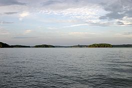
Lake Keowee is a large, man-made lake in South Carolina, United States. It was created to help Duke Energy make electricity and for people to enjoy outdoor activities. The lake is about 26 miles long and 3 miles wide. Its average depth is 54 feet, and it has about 300 miles of shoreline. Lake Keowee is about 800 feet above sea level.
Building the lake started in 1971. Workers built two big dams on the Keowee and Little Rivers. The project covered a huge area, about 18,372 acres. The lake collects water from the Keowee River, Little River, and other streams. The water flowing out of the dams forms the Seneca River, which then flows into the larger Savannah River.
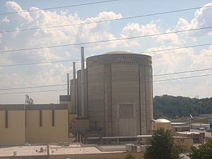
Lake Keowee's water helps cool Duke Energy's three nuclear reactors at the Oconee Nuclear Generating Station. The dams also create hydroelectricity, which is power made from moving water. The Keowee Hydro Station makes 158 megawatts of power. People love Lake Keowee for fishing, boating, swimming, sailing, and kayaking. The lake is known for its very clean water.
The name Keowee comes from a Cherokee word. It means "place of the mulberries." A historic Cherokee town called Keowee Town used to be on the Keowee River. It was the biggest of the Cherokee Lower Towns in South Carolina long ago. Both the town and the old Keowee River were covered by water when Lake Keowee was made. Before the lake was built, archaeologists dug up thousands of old items and found signs of human and animal remains. There was also a traditional burial ground at the town site.
Contents
History of Lake Keowee
The Cherokee people and their ancestors lived in this area for a very long time. They had a settlement called Keowee Town along the Keowee River. This town was important to the Eastern Cherokee.
Early Settlements and Conflicts
In 1753, European settlers built Fort Prince George across the river from Keowee Town. In 1760, during a time of tension, British forces destroyed Keowee Town. During the American Revolutionary War, most Cherokee sided with the British. They hoped to push American settlers off their lands.
After the British lost a battle in 1776, the Cherokee in the Carolinas asked for peace. The Treaty of Dewitt's Corner was signed in 1777. It set a new border between the Cherokee and European Americans. The Cherokee gave up most of their lands in what are now Oconee, Pickens, Anderson, and Greenville counties.
Later treaties, like the Hopewell Treaty of 1785, confirmed these borders. They also allowed the Cherokee to use hunting grounds in the mountains. In 1816, the Cherokee sold this last piece of land to the United States for $5,000. They then moved further west into Georgia.
Relocation of the Cherokee People
The land that became Lake Keowee was no longer disputed. However, the Indian Removal Act of 1830 forced most Cherokee to leave the Southeast. This included those from Georgia and Alabama. Many Cherokee were forced to move west of the Mississippi River to Indian Territory (now Oklahoma). This difficult journey became known as the Trail of Tears. Sadly, historians believe that up to 4,000 of 16,000 Cherokee died from sickness, cold, and hunger during this move.
Building the Lake: A Modern Project
Around 1963, a company began buying land along the Keowee River. Their goal was to develop land and timber. Later, Duke Power Company bought 83,400 acres from another company and private owners. In the mid-1960s, Duke Power looked for ways to provide more electricity to the growing southeastern region.
They planned to buy inexpensive land and create artificial lakes. These lakes would help cool nuclear power plants. They would also generate power from falling water using hydroelectric methods. This project was partly inspired by successful projects like the Tennessee Valley Authority. In 1965, Duke Energy announced plans for a huge power complex. It was called the Keowee-Toxaway project and would cost about $700 million.
Since the project would flood a large area, including important historical sites, Duke Energy hired archaeologists. They worked with the University of South Carolina to dig up many sites. This included the old colonial fort and the Cherokee site of Keowee Town. Thousands of artifacts were found, such as pottery, beads, and human and animal remains.
The massive project to build the dams then began. Large areas of forest were cleared. Trees were cut down and sold for lumber. Some wooded areas were burned to make way for bulldozers. Other areas were dug deeper to make the lake deeper. This would give it enough water for cooling.
The first phase involved building dams on the Keowee and Little rivers to create Lake Keowee. Another dam on the Jocassee River created Lake Jocassee. This first phase cost about $83 million. South Carolina Governor Robert McNair set off a dynamite charge at the groundbreaking ceremony in April 1967.
The dam on the Keowee River was the longest. It was 3,500 feet long and 800 feet wide at its base. Both Lake Keowee and Lake Jocassee get water from the Whitewater, Thompson, and Toxaway rivers. Also, the Lake Jocassee hydro station sends water into Lake Keowee. Water started flowing into Lake Keowee in December 1973.
How Lake Keowee Generates Power
The Keowee dam has two units that make hydroelectric power. They can generate 40 megawatts, which is enough electricity for about 7,000 homes. A long tunnel was also built to move water. This tunnel is 800 feet long and 33.5 feet wide. It can hold a lot of water, with an average flow of 1,000 cubic feet per second.
To cool the nuclear reactors, a special structure called the Oconee skimmer wall was built. This wall separates the plant's water intake canal from the rest of the lake. The skimmer takes cool lake water from about 150 feet deep. This depth is good because it can still get water during a drought. It's also not so deep that mud might block the water intake.
Duke Energy closed the gates of the Keowee dam on April 2, 1970. This began the final stage of filling the lake. The lake reached a depth of 150 feet. The Keowee hydro station started working commercially on April 17, 1971.
The Oconee Nuclear Station was finished and started working in 1973. It is about 8 miles from the towns of Salem and Seneca. Since it began, the station has produced over 500 million megawatt-hours of electricity. This makes it the first nuclear station in the country to reach this milestone. It can generate 2.6 million kilowatts of power, enough for 1.9 million homes.
In 1996, some concerns were raised about how Duke and other nuclear power companies refueled their plants. The Nuclear Regulatory Commission (NRC) investigated. Changes were made, which improved the cooling system. In 2011, the NRC renewed the station's license for another 20 years.
Managing Lake Keowee
Since Duke Energy built and uses the lake for power, they have a lot of control over it. They manage the dams, the lake itself, and the shoreline. This includes docks and walls around the lake. They are also responsible for the land around the lake up to a certain height.
The Federal Energy Regulatory Commission (FERC) watches over Duke Energy's management. They make sure the public can access the lake. This was a condition when the project was first approved. Duke Energy is also the largest taxpayer in Oconee County. Builders and developers often need written permission from Duke Energy before making big changes near the lake.
Duke Energy works with state and federal groups to manage the area. For example, they talk with the United States Army Corps of Engineers about lake levels. They also sponsor clean-up events to keep the lake free of trash.
Community Involvement
People who live near Lake Keowee formed a group called the Friends Of Lake Keowee Society (FOLKS). It started in 1993 to represent the interests of lake residents. They focus on environmental and recreational issues. FOLKS monitors the lake's water quality. Their "Island Keeper Program" helps reduce litter.
The group has also tried to stop some proposed developments. For example, in 2011, developers wanted to build a restaurant, store, and fueling station. FOLKS members spoke at a public meeting to share community concerns. FOLKS worries that too many houses or buildings might spoil the lake's natural beauty. They are concerned about overcrowding, light pollution, noise pollution, and stormwater runoff. Large developments cause the most concern.
County officials also have a say in what happens around the lake. For instance, they worried that a planned 12-story condominium building might change the lake's "skyline."
Geography and Climate
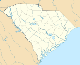
Lake Keowee is mostly in Oconee County, in the northwestern part of South Carolina. This area is near the Blue Ridge Mountains. Parts of the lake also reach into Pickens County, which is next to Oconee County.
The lake is within a few hundred miles of several major southeastern cities. These include Charleston (250 miles), Columbia (136 miles), Greenville (35 miles), Charlotte (127 miles), Raleigh-Durham (269 miles), Atlanta (145 miles), Augusta (135 miles), and Savannah (247 miles). The winters are usually mild, and the summers are temperate.
Recreational Activities at Lake Keowee
Lake Keowee offers many fun activities for visitors and residents.
- Public Parks. The Keowee-Toxaway State Park is located at the north end of the lake. There are other parks around the lake too.
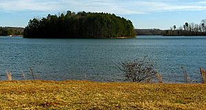
- Campgrounds. The 1,000-acre Keowee-Toxaway State Park was created by Duke Energy and the state of South Carolina. It includes three smaller parks: Mile Creek Park (155 acres), South Cove Park (40 acres), and High Falls Park (44 acres). Another 373 acres, called Eastotoe Park, is managed as a wildlife preserve. Duke Energy also made six extra boat access points. Some islands in the lake can be visited during the day. However, overnight camping, fires, littering, and building on them are not allowed.
- Boating. Lake Keowee has a marina for people who live nearby. There have been some boating accidents on the lake. To help boaters, county officials built a floating bathroom. This helps keep the shoreline clean and protects water quality.
- Water Sports. The lake is a great place for many water sports, like waterskiing.
- Fishing. The lake is home to three types of bass: largemouth, smallmouth, and spotted. You can also find crappie, bluegill, yellow perch, catfish, brown trout, and rainbow trout.
- Swimming. The lake's clean water makes it perfect for swimming.
Lake Keowee's Physical Features
- Area. Lake Keowee covers about 18,500 acres. It has 300 miles of shoreline. The lake's full water level is around 800 feet. It is 23 miles long and 3 miles wide at its widest point. The average depth is 54 feet.
- Drinking Water. The lake provides drinking water to Greenville, Seneca, and nearby areas.
- Cleanliness. Lake Keowee is known for its excellent water quality. One community on the lake, Keowee Key, sends treated wastewater directly into the lake. This is done under strict rules set by the South Carolina Department of Health and Environmental Control. Other communities use different ways to handle wastewater, like special filtration systems.
Commercial Activity Around Lake Keowee
Real Estate Development
The area around Lake Keowee has attracted many real estate developers. They have built various facilities. One developer is working with Pickens County to build a "recreation complex." This complex will have cabins, boat rentals, restaurants, RV parking, campsites, fishing piers, a swimming beach, and boat docks.
Since the 1970s, the area has grown a lot. There are now 110 communities along the lake's 300 miles of shoreline. These communities have 10,000 building lots, with 2,000 houses. Many of these houses are large "multistory mansions." Some facilities include dog parks, pet-friendly trails, and open spaces. The area is becoming popular for people who are retiring or looking for a weekend getaway. Developers have even built a mountain-top golf course nearby.
Getting approval for large developments is a detailed process. Permissions are needed from Duke Energy officials, community residents, the Federal Energy Regulatory Commission, and 14 state and resource agencies. The Eastern Band of Cherokee Indians also needs to give approval.
Vacation Homes
Many homes around the lake are built for retirement or for people who love lake activities. Many residents own boats. Summer weekends are very busy with boaters. One family shared their experience:
Summer weekends on the lake are busy, but during the week you might only see four or five boats go by all day. ... We'll see kayaks and a few sailboats, but mostly it's motorboats on the lake. Our kids water-ski and wakeboard. We also have three dogs, and within the first five minutes of arriving they are in the lake, too. The house, more than anything, has been a gathering place for our family. We do a lot of entertaining there, from hosting Tom's parents' 50th wedding anniversary party to birthday celebrations. Our son is getting married soon, and the reception will be at the house. Even when not entertaining, we are there almost every weekend in the summer. Tom is a golfer, but I can sit out on the deck looking out on the lake all day.
—report in 2007 in The New York Times
Some notable people have homes overlooking the lake. For example, the CEO of the INSP network built a large home there. A charity also bought a home for a wounded marine.
Education Near Lake Keowee
There are several schools located near Lake Keowee. These include Clemson University, Tri-County Technical College, and Anderson University.
 | Aaron Henry |
 | T. R. M. Howard |
 | Jesse Jackson |


