List of outlying islands of Scotland facts for kids
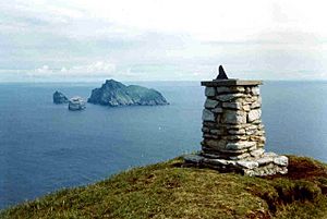
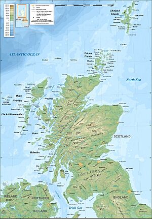
The outlying islands of Scotland are special islands that are not part of the main island groups like the Hebrides or the Northern Isles. Most of these islands are not lived on today, and few people ever lived there. However, Hirta was home to people from the Neolithic age (Stone Age) until 1930. Also, Stroma had people living on it until the 1970s, and then lighthouse keepers until 1996. Many other outlying islands have lighthouses, but none of them have people working there anymore.
An island is defined here as "land surrounded by seawater every day." This means even if it's connected at low tide, it counts as an island. Some islands inside sea lochs, like Eilean Bàn, are usually listed with the List of Inner Hebrides to keep things simple.
Contents
Scotland's Main Outlying Islands
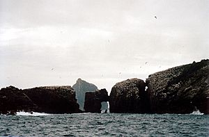
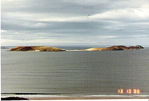
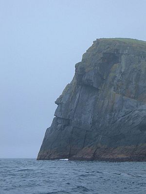
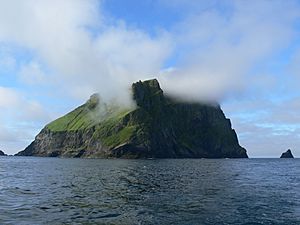
Several small groups of outlying islands exist. The most famous is the St Kilda group. It lies about 64 kilometres (40 miles) west-northwest of North Uist. St Kilda is a World Heritage Site because of its amazing nature and history.
St Kilda and Its Tall Stacks
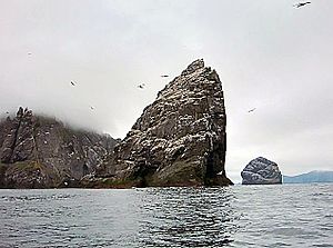
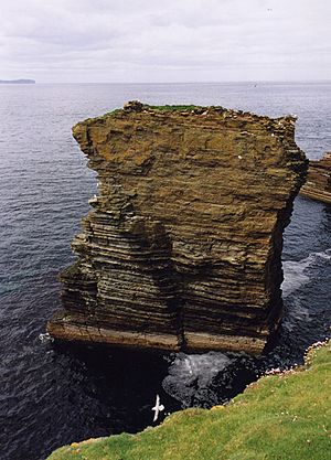
One of the islands in St Kilda is Stac an Armin. It is 196 metres (643 feet) tall, making it the highest sea stack (a tall rock column in the sea) in the British Isles. In 1840, the last great auk (a large, flightless bird) seen in the British Isles was caught here.
Mysteries of the Flannan Isles
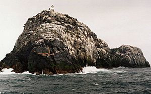
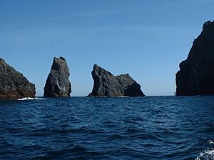
East of St Kilda are the Flannan Isles. Here, all three lighthouse keepers mysteriously disappeared in December 1900. No one ever found out what happened to them.
Remote Northern Outliers
Further north and east are Sula Sgeir and North Rona. These islands have strong connections to the Outer Hebrides. North Rona is about 71 kilometres (44 miles) north-northeast of the Butt of Lewis. It is the most remote island in the British Isles that people have lived on for a long time. It is also the closest part of Scotland to the Faroe Islands. Sule Skerry and Sule Stack are even further east and are part of Orkney.
Islands Near the Mainland
The islands along Scotland's north coast are far from big towns. However, most of them are quite close to the mainland. There is a small group of larger islands near Tongue Bay. The biggest island on this coast is Stroma, located in the Pentland Firth between Caithness and Orkney.
Innis Mhòr in the Dornoch Firth is the largest of a few small islands off the coast of Easter Ross. Further south, you'll find Inchcape off the coast of Angus. Mugdrum is the only important island in the Firth of Tay. In the Solway Firth, which is Scotland's southwestern border, there are islands like the Islands of Fleet in Wigtown Bay.
Tiny Uninhabited Islets
Most of the smaller islands around the main ones are not well-known. No one has lived on them permanently in modern times. Still, some have interesting histories. For example, Castle Mestag off Stroma is the ruin of an old fort. You could only reach it by a drawbridge! Some islets are called "storm washed." This means that even though they are partly above the sea, big waves wash over them during storms, making them impossible to live on.
Rockall: A Disputed Rock
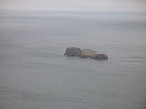
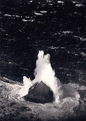
Finally, there is the very remote Rockall. It is about 367 kilometres (228 miles) west of North Uist. Rockall is a tiny rocky island in the North Atlantic Ocean. Some people call it "the most isolated small rock in the oceans of the world." In 1972, it was declared part of Scotland. However, other countries like Ireland, Denmark, and Iceland disagree. Its legal status is still debated.
| Island | Group | Area (hectares) | Height (metres) | Lighthouse | Last Inhabited | Nearby Islets |
|---|---|---|---|---|---|---|
| Ardwall Isle | Islands of Fleet | 22 | 34 | No | 18th century? | Old Man of Fleet |
| Barlocco Isle | Islands of Fleet | 10 | 10 | No | Unlikely | The Three Brethren |
| Big Scare | Solway Firth | 0.9 | 21 | No | Very unlikely | Little Scares (3) |
| Boreray | St Kilda | 77 | 384 | No | Iron Age? | An t-Sail, Sgarbhstac |
| Bròna Cleit | Flannan Isles | 1 | 20 | No | Very unlikely | None |
| Dùn | St Kilda | 32 | 178 | No | Unknown | Hamalan, Giasgeir, Sgeir Cul an Rubha, Sgeir Mhòr |
| Eilean a' Ghobha | Flannan Isles | 8 | 57 | No | Very unlikely | None |
| Eilean Choraidh | Loch Eriboll | 26 | 26 | No | 1930s | A' chlèit |
| Eilean Hoan | Loch Eriboll | 28 | 25 | No | Early 1800s | A' Ghoil-sgeir, An Cruachan, An Dubh-sgeir, Eilean Clùimhrig, Pocan Smoo |
| Eilean Mòr | Flannan Isles | 17.5 | 88 | Yes | 1971 | Deirc na Sgeir, Làmh à Sgeir Beag, Làmh an Sgeir Mòire |
| Eilean nan Ròn | Tongue Bay | 138 | 76 | No | 1930s or 40s | An Innis, Eilean Iosal, Meall Thailm |
| Eilean Taighe | Flannan Isles | 11 | 59 | No | Unknown | Gealtaire Beag, Gealtaire Mòr, Hamasgeir |
| Hestan Island | Solway Firth | 11 | 54 | Yes | Unknown | None |
| Hirta | St Kilda | 670 | 430 | No | 1930 | An Torc, Bradastac, Mina Stac, Sgeir Domhnuill, Sgeir nan Sgarbh |
| Inchcape | Angus coast | 0.61 | 0 | Yes | 1988 | None |
| Innis Mhòr | Easter Ross | 26 | 4.9 | No | Shifting sands | None |
| Little Ross | Solway Firth | 7 | 35 | Yes | Unlikely | Sugarloaf |
| Mugdrum | Firth of Tay | 32 | 4 | No | Unlikely | None |
| Murray's Isles | Islands of Fleet | 1 | 5 | No | Unlikely | Horse Mark |
| Neave Island | Tongue Bay | 30 | 70 | No | Unknown | Stac an Fhamhair |
| North Rona | North west | 109 | 108 | No | 1885 | Gealldraig Mhòr, Lòba Sgeir |
| Rabbit Islands | Tongue Bay | 32 | 45 | No | Unknown | Dubh Sgeir-Mhòr, Eilean á Chaoil, Eilean Creagach, Sgeir an Òir, Talmine Island |
| Roaireim | Flannan Isles | 5 | 52 | No | Very unlikely | None |
| Rockall | North Atlantic | 0.0624 | 21.4 | No | Storm washed | Hasselwood Rock, Helen's Reef |
| Rough Island | Solway Firth | 8 | 24 | No | Unlikely | Craig Roan, Spring Stones |
| Sgeir Toman | Flannan Isles | 4 | 43 | No | Very unlikely | Sgeir Righinn |
| Soay | St Kilda | 99 | 378 | No | Unlikely | Am Plastair, Sgeir Mac Righ Lochlainn, Stac Biorach, Stac Dona, Stac Soay. |
| Soraigh | Flannan Isles | 6 | 41 | No | Very unlikely | None |
| Stac an Armin | St Kilda | 9 | 196 | No | Never inhabited | None |
| Stac Lee | St Kilda | 2.3 | 172 | No | Never inhabited | None |
| Stac Levenish | St Kilda | 2.42 | 62 | No | Never inhabited | Na Bodhan |
| Stroma | Caithness | 375 | 53 | Yes | 1996 | Castle Mestag |
| Sula Sgeir | North west | 15 | 70 | Yes | Storm washed | Bogha Córr, Grallsgeir |
| Sule Skerry | Orkney | 16 | 12 | Yes | 1982 | None |
| Sule Stack | Orkney | 2.9 | 36 | No | Storm washed | None |
Smaller Islets Off the Mainland
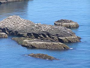
Here are some other smaller islands and rocks found along Scotland's coasts:
- Solway Firth: Inch
- North coast (from west to east): Stac an Dunain, Duslic, Stack Clò Kearvaig, An Garbh-eilean, Na Glas Leacan, Eilean Dubh, Clach Bheag na Faraid, Clach Mhòr na Faraid, Àigeach, Eilean Polsain, Boursa Island, Glas-eilean Mòr, Garbh-eilean, Wester Clett, Middle Clett, Easter Clett, Little Clett, Clett.
- East coast:
- North Moray Firth (from north to south): The Knee, Stacks of Duncansby, Stack o' Brough, South Stack, The Stacks, Eilean na h-Aibhne, Three Kings.
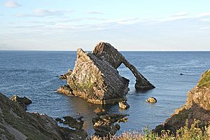
- South Moray Firth (from west to east): Covesea Skerries, Halliman Skerries, Boar's Head Rock, West Muck, East Muck, Craigenroan, Bow Fiddle Rock, Collie Rocks, Craigandargity.
- Kinnaird Head to the Bullers of Buchan: The Ron, The Skerry, Miekle Mackie, Miekle Donnon, Little Donnon, Craig Snow, Meikle Dumeath, Little Dumeath.
- Bullers of Buchan to Girdle Ness: Dunbuy, The Donnons, Skellyis of Harrol.
- Girdle Ness to Buddon Ness: Craiglethy, Craigmaroinn, May Craig.
Other than Mugdrum in the Firth of Tay and the Islands of the Forth, there are no true islands on the east coast of Scotland south of Buddon Ness.
Islands Exposed at Low Tide
There are many smaller islands and skerries (rocky islets) around mainland Scotland that only appear when the tide is low. Craiglethy is part of the Fowlsheugh nature reserve, which is a protected area for wildlife.
The Three Kings, off the coast of Easter Ross near Balintore, are also known as Creag Harail or Harold's Rock. A legend says that three sons of a Danish prince were shipwrecked here while trying to get revenge for their sister. They gave these rocks their name. Their graves were supposedly marked by carved stones in places like Nigg and Shandwick.
See also
- List of Outer Hebrides
- Inner Hebrides
- List of Orkney islands
- List of Shetland islands
- Islands of the Clyde
- Islands of the Forth
- List of islands of Scotland
- Scottish island names
- List of islands of the British Isles
- Fair Isle in Shetland, the most remote inhabited island in the United Kingdom, which lies 38 kilometres (24 miles) south-west of the Mainland.
- Foula in Shetland, which lies 22 kilometres (14 miles) west of the Mainland.
 | Toni Morrison |
 | Barack Obama |
 | Martin Luther King Jr. |
 | Ralph Bunche |


