List of Outer Hebrides facts for kids
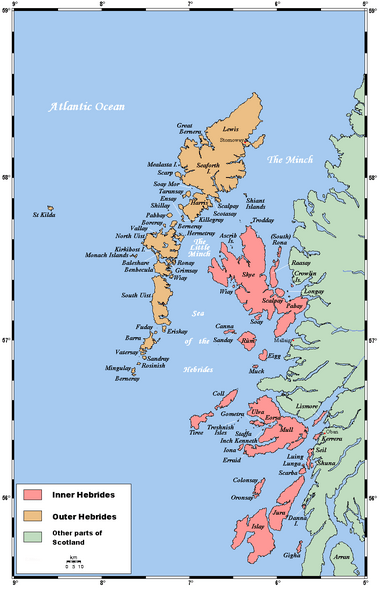
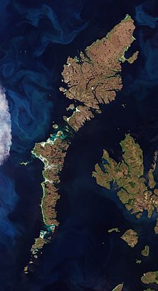
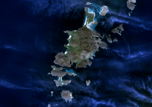
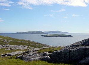
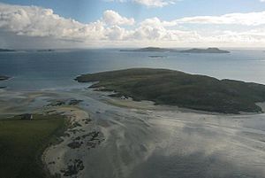
The Outer Hebrides are a long chain of over 100 islands and small rocky islets. They are located about 70 kilometers (43 miles) west of mainland Scotland. This group of islands is also known as the Western Isles.
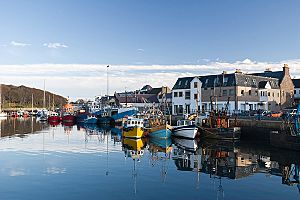
There are 15 islands in this chain where people live. Lewis and Harris is the biggest island in Scotland. It's the third largest in the British Isles, after Great Britain and Ireland. Lewis and Harris are often called two separate islands, but they are actually connected by land. The biggest town in the Outer Hebrides is Stornoway, located on Lewis.
South of Lewis and Harris are the islands of the Uists and Benbecula. These islands were connected by special roads called causeways between 1940 and 1960. These causeways made it much easier for people to travel between the islands. Further south, you'll find Barra and the smaller Barra Isles. The very end of this chain is Barra Head.
The islands on Scotland's west coast are all called the Hebrides. The Outer Hebrides are separated from the Inner Hebrides by a stretch of water called The Minch in the north and the Sea of the Hebrides in the south. The Outer Hebrides are managed by a local council called Comhairle nan Eilean Siar. In 2001, about 26,502 people lived there.
The Outer Hebrides have a strong history of speaking Scottish Gaelic (Gàidhlig). Even though fewer people speak it now, in 2001, more than half the people on each island could speak Gaelic. This meant there were over 15,842 Gaelic speakers across all the islands. Today, the main ways people make a living are through tourism, crofting (small-scale farming), fishing, and weaving. Weaving includes making the famous Harris tweed fabric. The islands face strong winds and tides, so there are many lighthouses to help ships navigate safely.
Contents
Which Islands Have People Living On Them?
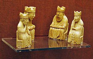
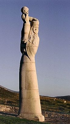
In 2011, the total number of people living on the inhabited islands of the Outer Hebrides was 27,684. The highest mountains on these islands have names that come from both Gaelic and Old Norse languages. This shows how important both cultures were in the past. We don't have many old things from the Viking times, but the Lewis chessmen are a cool exception!
Many islands are now connected by causeways and bridges. This makes travel much easier. For example, Great Bernera and Scalpay have bridges to Lewis and Harris. Baleshare and Berneray are linked to North Uist. Eriskay is connected to South Uist, and Vatersay is connected to Barra. This means all the islands where people live are now connected to at least one other island by a road!
Here is a list of the islands where people live:
| Island | Gaelic name | Group | Area (ha) | Population | Highest point | Height (m) |
|---|---|---|---|---|---|---|
| Baleshare | Am Baile Sear | Uists and Benbecula | 910 | 58 | 12 | |
| Barra | Barraigh | Barra | 5875 | 1174 | Heaval | 383 |
| Benbecula | Beinn nam Fadhla | Uists and Benbecula | 8203 | 1303 | Ruaval | 124 |
| Berneray | Beàrnaraigh | Uists and Benbecula | 1010 | 138 | Beinn Shleibhe | 93 |
| Eriskay | Èirisgeigh | Uists and Benbecula | 703 | 143 | Ben Scrien | 185 |
| Flodaigh | Flodaigh | Uists and Benbecula | 145 | 7 | 20 | |
| Fraoch-eilean | Fraoch-eilean | Uists and Benbecula | 55 | 0? | Cnoc Mor | 11 |
| Great Bernera | Beàrnaraigh Mòr | Lewis (Loch Ròg) | 2122 | 252 | 87 | |
| Grimsay (North) | Griomasaigh | Uists and Benbecula | 833 | 169 | 22 | |
| Grimsay (South) | Griomasaigh | Uists and Benbecula | 117 | 20 | 20 | |
| Lewis and Harris | Leòdhas agus na Hearadh | Lewis and Harris | 217898 | 21031 | Clisham | 799 |
| North Uist | Uibhist a Tuath | Uists and Benbecula | 30305 | 1254 | Eaval | 347 |
| Scalpay | Sgalpaigh na Hearadh | Harris | 653 | 291 | Beinn Scorabhaig | 104 |
| South Uist | Uibhist a Deas | Uists and Benbecula | 32026 | 1754 | Beinn Mhòr | 620 |
| Vatersay | Bhatarsaigh | Barra | 960 | 90 | Theiseabhal Mòr | 190 |
Some islands like Ensay, Kisimul Castle and Eilean na Cille are listed as inhabited. However, no one was living on them during the 2001 or 2011 population counts.
What About Islands Without People?
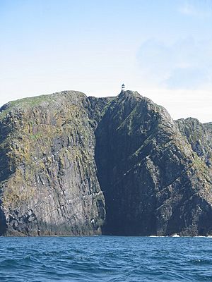
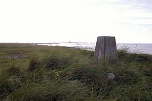
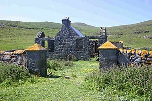
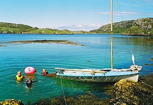
This section lists islands that are larger than 25 hectares (about 37 acres) but don't have people living on them anymore. Many of these islands were once home to people during different times in history, like the Stone Age or Viking Age.
During the 1800s and 1900s, many remote islands in Scotland were left empty. People started to feel that these distant islands didn't have the important services needed for a modern life.
Some of these uninhabited islands are still famous today. The "Mingulay Boat Song" was written after the island of Mingulay was abandoned in 1938. The island of Taransay was used for the BBC television show Castaway 2000. Other islands have played a part in Scottish history. For example, in 1746, Bonnie Prince Charlie hid on Eilean Liubhaird for four days while the Royal Navy searched for him.
Here is a list of some uninhabited islands:
| Island | Gaelic name | Group | Area (ha) | Last inhabited | Highest point | Height (m) |
|---|---|---|---|---|---|---|
| Barra Head or Berneray | Beàrnaraigh Cheann Bharraigh | Barra Isles | 204 | 1980 | Sotan | 193 |
| Boreray | Boraraigh | North Uist | 198 | 1960s | Mullach Mòr | 56 |
| Calbhaigh | Calbhaigh | South Uist | 26 | Unknown | 10 | |
| Ceabhaigh | Ceabhaigh | Lewis (Loch Ròg) | 25 | Unknown | 20 | |
| Ceallasaigh Beag | Ceallasaigh Beag | Loch Maddy | 55 | Unknown | 10 | |
| Ceallasaigh Mòr | Ceallasaigh Mòr | Loch Maddy | 55 | Unknown | 10 | |
| Ceann Ear | An Ceann Ear | Monach Islands | 203 | 1931–33 | 17 | |
| Ceann Iar | An Ceann Iar | Monach Islands | 154 | 1931–33 | Cnoc Bharr | 19 |
| Eilean Chaluim Chille | Eilean Chaluim Chille | Lewis (Loch Erisort) | 85 | Post-16th century | Creag Mhor | 43 |
| Eilean Chearstaidh | Eilean Chearstaigh | Lewis (Loch Ròg) | 77 | No census records | 37 | |
| Eileanan Iasgaich | Eileanan Iasgaich | South Uist | 50 | No census records | 20 | |
| Eilean Liubhaird | Eilean Liubhaird | Lewis (Loch Sealg) | 125 | Early 19th century | 76 | |
| Eilean Mhealasta | Eilean Mhealasta | Lewis (Park) | 124 | 1823 | Cnoc Àrd | 77 |
| Eilean Mhuire | Eilean Mhuire | Shiant Islands | 30 | 18th century | 90 | |
| Ensay | Easaigh | Sound of Harris | 186 | 1971 | 49 | |
| Fiaraidh | Fiaraigh | Sound of Barra | 41 | No record of habitation | 30 | |
| Flodaigh | Flodaigh | Lewis (Loch Ròg) | 39 | 1827 | 48 | |
| Flodaigh Mòr | Flodaigh Mòr | North Uist | 58 | No census records | 28 | |
| Flodday | Flodaigh | Barra Isles | 35 | Inhabitation unlikely | 43 | |
| Flodday | Flodaigh | Sound of Barra | 40 | 1851 | 41 | |
| Fodragaigh | Fodragaigh | Benbecula | 25 | Unknown | 10 | |
| Fuaigh Beag | Fuaigh Beag | Lewis (Loch Ròg) | 35 | 1827 | 48 | |
| Fuaigh Mòr | Fuaigh Mòr | Lewis (Loch Ròg) | 84 | 1840s | Mullach na Beinne | 67 |
| Fuday | Fuideigh | Sound of Barra | 232 | 1901 | Mullach Neacail | 89 |
| Fuiay | Fuidheigh | Sound of Barra | 84 | Mid-19th century | 107 | |
| Garbh Eilean | Garbh Eilean | Shiant Islands | 143 | 1901 | Mullach Buidhe | 160 |
| Gighay | Gioghaigh | Sound of Barra | 96 | Early 19th century | Mullach a' Chàrnain | 95 |
| Groaigh | Groaigh | Sound of Harris | 28 | Unknown | 26 | |
| Hellisay | Theiliseigh | Sound of Barra | 142 | 1890 | Beinn a' Chàrnain | 72 |
| Hermetray | Theàrnatraigh | Sound of Harris | 72 | 1840s | Compass Knoll | 35 |
| Killegray | Ceileagraigh | Sound of Harris | 176 | 1970s | 45 | |
| Kirkibost | Eilean Chirceboist | North Uist | 205 | Unknown | 10 | |
| Lingeigh | Lingeigh | Barra Isles | 27 | Inhabitation unlikely | 83 | |
| Little Bernera | Beàrnaraigh Beag | Lewis (Loch Ròg) | 138 | 1861 | Tordal | 41 |
| Mingulay | Miùghalaigh | Barra Isles | 640 | 1912 | Càrnan | 273 |
| Muldoanich | Maol Dòmhnaich | Barra Isles | 78 | No census records | Maol Dòmhnaich | 153 |
| Orosay | Orasaigh | Sound of Barra | c. 30 | Unknown | 38 | |
| Oronsay | Orasaigh | North Uist | 85 | 19th century | 25 | |
| Pabbay | Pabaigh | Barra Isles | 250 | 1911–20 | An Tobha | 171 |
| Pabbay | Pabaigh | Harris | 820 | 1970s | Beinn a' Chàrnain | 196 |
| Pabaigh Mòr | Pabaigh Mòr | Lewis (Loch Ròg) | 101 | 1827 | Beinn Mhòr | 68 |
| Ronay | Rònaigh | North Uist | 563 | 1920s | Beinn á Charnain | 115 |
| Sandray | Sanndraigh | Barra Isles | 385 | 1934 | Carn Ghaltair | 207 |
| Scarp | An Sgarp | Harris | 1045 | 1971 | Sròn Romul | 308 |
| Seaforth Island | Eilean Shìophoirt | Lewis (Loch Seaforth) | 273 | No record of habitation | 217 | |
| Sgeotasaigh | Sgeotasaigh | Harris (East Loch Tarbert) | 49 | 1921 | 57 | |
| Sibhinis | Sibhinis | Monach Islands | 28 | Unknown | 15 | |
| Shillay | Siolaigh | North Uist | 47 | No evidence of habitation | 79 | |
| Soay Mor | Sòdhaigh Mòr | Harris | 45 | 1890s | 37 | |
| Stromay | Stròmaigh | Sound of Harris | 66 | Unknown | 16 | |
| Stockinish Island | Eilean Stocainis | Harris | 49 | No record of habitation | 44 | |
| Stuley | Stulaigh | South Uist | 45 | 19th century? | 40 | |
| Sursaigh | Sursaigh | Sound of Harris | 30 | Unknown | 27 | |
| Tahay | Taghaigh | Sound of Harris | 53 | 1850s | 65 | |
| Taransay | Tarasaigh | Harris | 1475 | 1974 | Ben Raah | 267 |
| Trialabreac | Trialabreac | Benbecula | 25 | Unknown | 20 | |
| Torogaigh | Torogaigh | Sound of Harris | 28 | Unknown | 13 | |
| Vacsay | Bhacasaigh | Lewis (Loch Ròg) | 41 | 1869 | 34 | |
| Vallay | Bhàlaigh | North Uist | 260 | 19th century? | Ceann Uachdarach | 38 |
| Wiay | Fuidheigh | Benbecula | 375 | 1901 | Beinn a' Tuath | 102 |
The Eileanan Chearabhaigh are a group of small islands off the east coast of Benbecula. Their size changes with the tides.
Smaller Islets and Rocks
The main islands are surrounded by many smaller islands, tidal islets (only separated at high tide), and skerries (rocks only seen at low tide). Most of these are very small and have never had people living on them.
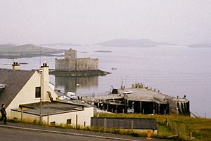
However, some are quite famous! The islet where Kisimul Castle stands is the ancient home of the Clan MacNeil. Shillay in the Monach Isles had a lighthouse with staff until 1942. The tiny Beasts of Holm, off the east coast of Lewis, were where the ship Iolaire sank in 1919. This was one of the worst sea disasters in the UK during the 1900s.
Calvay in the Sound of Barra inspired the 1947 novel Whiskey Galore. This happened after the ship SS Politician got stuck there with a lot of whisky on board!
Many Gaelic names for islands are used again and again. For example, ay, aigh, or aidh usually comes from the Norse word øy, meaning "island". Eilean (plural: eileanan) also means "island". Beag and mòr mean "little" and "big". Sgeir means "skerry" and refers to rocks that are underwater at high tide. Dubh means "black", dearg means "red", and glas means "grey" or "green".
Island Groups

The Outer Hebrides have several smaller groups of islands within them. These include:
| Name | Location |
|---|---|
| Barra Isles (or Bishop's Isles) | South of Barra |
| Flannan Isles | 32 kilometers (20 miles) west of Lewis |
| Monach Islands | 9 kilometers (5.6 miles) west of North Uist |
| Shiant Islands | 7 kilometers (4.3 miles) southeast of Harris |
The St Kilda group is located 64 kilometers (40 miles) west-northwest of North Uist.
See also
 In Spanish: Anexo:Islas del archipiélago de las Hébridas Exteriores para niños
- History of the Outer Hebrides
- Flora and fauna of the Outer Hebrides
- Religion in the Outer Hebrides
- List of places in the Western Isles
- Inner Hebrides
- List of Orkney islands
- Churchill Barriers
- List of Shetland islands
- Islands of the Clyde
- Islands of the Forth
- List of islands of Scotland
- List of islands of the British Isles
- North Sea islands
- Rockall
 | Ernest Everett Just |
 | Mary Jackson |
 | Emmett Chappelle |
 | Marie Maynard Daly |


