Islands of the Clyde facts for kids
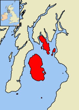
The Islands of the Firth of Clyde are a group of islands located in the Firth of Clyde, a large sea inlet in Scotland. They are found between the areas of Ayrshire and Argyll and Bute. There are about 40 islands and small rocky islets here. However, only four of them have people living on them. These are Arran, Bute, Great Cumbrae, and Holy Island. These larger islands have special ferry routes to connect them to the mainland.
Unlike other Scottish island groups, none of these islands are connected to each other or to the mainland by bridges. The area has interesting geology (how the Earth is made) and geomorphology (how landforms are shaped). The climate is mild and damp because of the Atlantic Ocean. The islands are also home to a variety of wildlife, including some very rare trees. People have lived on the larger islands since ancient times, even before written history. Over the centuries, the islands were influenced by different kingdoms and cultures, including the Vikings. Eventually, they became part of the Kingdom of Scotland.
Contents
Exploring the Islands' Geology and Geography
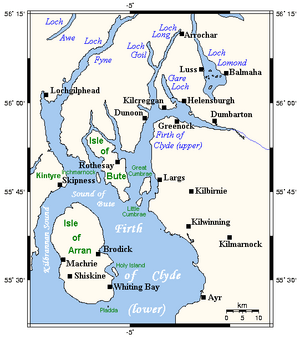
The Highland Boundary Fault is a major geological line that runs through Scotland. It passes by Bute and the northern part of Arran. This means some islands are in the Scottish Highlands and some are in the Scottish Lowlands. Arran is often called "Scotland in miniature" because its geology is so similar to the rest of Scotland. Geologists love to visit Arran to study its unique rocks, like volcanic rocks and layered rocks. In 1787, a famous geologist named James Hutton discovered an important geological feature here called an unconformity. This spot is now very famous in the study of geology.
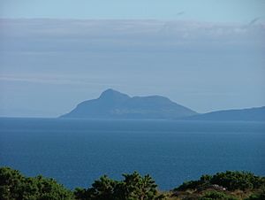
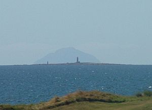
Ailsa Craig, an island about 25 kilometers (15 miles) south of Arran, is known for a special type of granite called "Ailsite." This granite is used to make curling stones. In fact, most curling stones used around the world are made from Ailsa Craig granite!
Like the rest of Scotland, the Firth of Clyde area was covered by huge ice sheets during the Pleistocene ice ages. This ice shaped the landscape a lot. When the ice melted, sea levels changed, and the land slowly rose. This created raised beaches and cliffs along the coast.
The islands have different types of soil because of their varied geology. Bute has the most fertile land. In some areas, especially in the south and west, you can find sandy areas called machair near the coast.
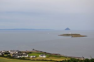
The Firth of Clyde is north of the Irish Sea and has many long, narrow inlets called sea lochs. Some of these include Loch Goil, Loch Long, and Loch Fyne. The seabed in the Firth can be very deep. For example, it's 320 meters (1,050 feet) deep between Arran and Bute, even though they are only 8 kilometers (5 miles) apart. Many lighthouses, like those on Ailsa Craig and Pladda, help ships navigate safely.
The Islands' Climate
The Firth of Clyde is quite far north, at the same latitude as parts of Canada. However, the North Atlantic Current (an extension of the Gulf Stream) makes the winter weather much milder. This means the area has a mild and damp oceanic climate.
Temperatures are generally cool. In January, the average is about 6°C (43°F), and in July, it's about 14°C (57°F). Snow rarely stays on the ground at sea level, and there are fewer frosts than on the mainland. Most islands on Scotland's west coast get a lot of rain. Bute and the Cumbraes get about 1,300 millimeters (51 inches) of rain each year, while northern Arran gets about 1,900 millimeters (75 inches). The mountains on Arran get even more rain, over 2,550 millimeters (100 inches) annually. May, June, and July are the sunniest months. Southern Bute often has more sunny days than other areas.
A Look at History
Ancient Times
People first arrived in the Firth of Clyde area around 4,000 BC, during the Mesolithic period (Middle Stone Age). They likely came from Ireland. Later, more people arrived during the Neolithic period (New Stone Age). There's evidence that the Firth of Clyde was an important route for people settling in mainland Scotland during this time.
The people living in western Scotland back then built a special type of stone burial chamber called Clyde cairns. About 100 of these have been found, mostly on Arran, Bute, and Kintyre. These were used to bury the dead. They were rectangular stone structures with a small chamber inside and a forecourt area for ceremonies. A cairn on Arran has been dated to about 3160 BC, but it might be even older.
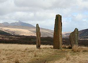
The area also has many standing stones from prehistoric times. On Machrie Moor in Arran, there are six stone circles. You can also find standing stones on Great Cumbrae and Bute.
Later, during the Bronze Age, people built different types of burial sites called cists. These can be found on Inchmarnock. Not much evidence of settlements from this period has been found. However, a notable piece of jewelry, the "Queen of the Inch necklace," made of jet, was found on Bute and dates to around 2000 BC.
During the early Iron Age, the Brythonic culture was strong here. There is no evidence that the Romans ever occupied these islands.
Early Scottish Rule
Starting in the 2nd century AD, people from Ireland began to influence the region. By the 6th century, Gaels had formed the kingdom of Dál Riata here. These Gaels spoke a form of Gaelic, which is still spoken in the Hebrides today. During this time, Christianity slowly replaced older beliefs like Druidism.
The kingdom of Dál Riata thrived until the Vikings started raiding in the late 8th century. The islands closer to modern Ayrshire probably remained part of the Kingdom of Strathclyde. The main islands became part of the new Kingdom of Alba, founded by Kenneth MacAlpin.
Viking Influence
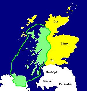
From the 9th to the 13th centuries, the Islands of the Clyde were a border area between the Norse (Viking) Suðreyjar and Scotland. Many of them were controlled by the Norse.
In the late 1100s and early 1200s, the islands might have been a power base for Somhairle mac Giolla Brighde and his family. During this time, the islands also started to come under the control of the Steward of Scotland and the growing Clan Stewart.
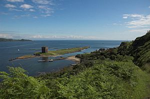
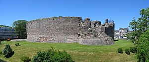
This expansion of Scottish power led to a Norwegian invasion in 1230, during which they captured Rothesay Castle. In 1263, Norwegian troops led by King Haakon IV again captured Rothesay Castle. However, the Battle of Largs, fought between Scottish and Norwegian forces on the shores of the Firth of Clyde, did not have a clear winner.
This battle ultimately weakened Norway's power in Scotland. King Haakon went back to Orkney and died there in December 1263. After his death, the Treaty of Perth in 1266 officially gave all rights to the islands to the Kingdom of Scotland.
Modern Scotland
Since the Treaty of Perth in 1266, all the Islands of the Clyde have been part of Scotland.
In the early medieval period, these islands were part of the Diocese of Sodor and Man, based on the Isle of Man. After 1387, the main church for the islands moved north to Skye and then to Iona. This continued until the Scottish Reformation in the 16th century, when Scotland separated from the Catholic Church.
The mid-1700s brought big changes. New ways of transport, industry, and farming ended old ways of life. The Battle of Culloden in 1746 marked the end of the clan system. These changes improved life for some but caused hardship for others.
In the late 1700s and early 1800s, Alexander, the 10th Duke of Hamilton, started a controversial farming program called the Highland Clearances. This had a terrible effect on many people on Arran. Whole villages were emptied, and the island's Gaelic culture was badly damaged. A memorial was later built at Lamlash to remember the farmers who were forced off the island.
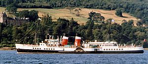
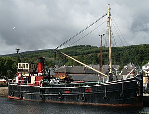
From the 1850s to the late 1900s, cargo ships called "Clyde Puffers" were very important for the islands. They carried goods to and from the islands. In 1889, the Caledonian Steam Packet Company (CSP) started operating steamer services. They soon grew by taking over other companies. Many islands became popular tourist resorts for people from Glasgow who wanted to holiday "Doon the Watter" (down the water).
In 1973, CSP and another company, MacBraynes, joined their operations to form Caledonian MacBrayne. This government-owned company still runs ferries to Great Cumbrae, Arran, and Bute today. Private companies also operate services, like from Arran to Holy Isle.
Politically, from 1890 to 1975, most of the islands were part of the traditional County of Bute. Since 1975, the islands have been divided between two modern council areas: Argyll and Bute and North Ayrshire. Only Ailsa Craig and Lady Isle are in South Ayrshire.
Islands of the Firth of Clyde
This table lists the nine islands in the Firth of Clyde that are larger than 40 hectares (about 100 acres). It shows how many people live on them and lists smaller, nearby islets. In 2001, six islands had people living on them, but by 2011, Davaar and Sanda no longer had permanent residents.
| Island | Gaelic Name | Location | Area (ha) | Population | Last inhabited | Highest point | Height (m) | Surrounding islets |
|---|---|---|---|---|---|---|---|---|
| Ailsa Craig | Creag Ealasaid | South Ayrshire | 99 | 0 | 1980s | The Cairn | 338 | None |
| Arran | Arainn | Arran | 43201 | 4629 | – | Goat Fell | 874 | Eilean na h-Àirde Bàine, Hamilton Isle, Pladda |
| Bute | Bòid | Bute | 12217 | 6498 | – | Windy Hill | 278 | The Burnt Islands: Eilean Mòr, Eilean Fraoich and Eilean Buidhe, Eilean Dearg, Eilean Dubh, Sgat Beag and Sgat Mòr |
| Davaar | Eilean Dà Bhàrr | Kintyre | 52 | 0 | – | 115 | None | |
| Great Cumbrae | Cumaradh Mòr | Bute | 1168 | 1376 | – | The Glaidstane | 127 | The Clach, The Eileans, The Leug, The Spoig |
| Holy Island | Eilean Mo Laise | Arran | 253 | 31 | – | Mullach Mòr | 314 | None |
| Inchmarnock | Innis Mheàrnaig | Bute | 253 | 0 | 1980s | 60 | None | |
| Little Cumbrae | Cumaradh Beag | Bute | 313 | 0 | 1990s | Lighthouse Hill | 123 | The Broad Islands, Castle Island, Trail Isle |
| Sanda | Àbhainn | Kintyre | 127 | 0 | – | 123 | Glunimore Island, Henrietta Reef, Scart Rocks, Paterson's Rock, Sheep Island |
Outlying Islands
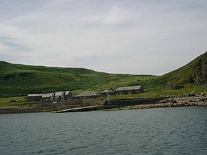
Some small islets are located further away from the main islands.
There are two islets in Gare Loch: Green Island and Perch Rock. Gare Loch is home to the Faslane Naval Base, where the UK's nuclear submarines are located.
Several islets are found in the Kilbrannan Sound, which is between Arran and the Kintyre peninsula. These include An Struthlag, Cour Island, Eilean Carrach (near Carradale), Eilean Carrach (near Skipness), Eilean Grianain, Eilean Sunadale, Gull Isle, Island Ross, and Thorn Isle.
A Norse saga tells a story about the Kintyre peninsula. In the late 11th century, King Magnus Barefoot of Norway wanted to expand his land. He made a deal with a Scottish king that he could claim any land a ship could sail around. Magnus then had one of his longships dragged across the 1.5-kilometer (1-mile) wide strip of land at the northern tip of Kintyre. He steered the ship himself. He then claimed that dragging the ship across was like "sailing around" the peninsula. Because of this clever move, he claimed Kintyre, and it remained under Norse rule for over a decade.
There are also several islets and skerries in Loch Fyne, Scotland's longest sea loch. These include Duncuan Island, Eilean Ardgaddan, Eilean a' Bhuic, Eilean Aoghainn, Eilean a' Chomhraig, Eilean an Dúnain, Eilean Buidhe (Ardmarnock), Eilean Buidhe (Portavadie), Eilean Fraoch, Eilean Math-ghamhna, Eilean Mór, Glas Eilean, Heather Island, Inverneil Island, Kilbride Island, and Liath Eilean.
Near Horse Isle in North Ayrshire, there are several islets: Broad Rock, East Islet, Halftide Rock, High Rock, and North Islet.
Lady Isle is off the coast near Troon. It once had a chapel and a good water spring. However, in 1821, a fire burned the grass, and strong winds blew away much of the island's soil, making it impossible for animals to graze there.
Loch Goil and Loch Long, which are fjord-like inlets in the northern part of the firth, do not have any islands.
Places with "Island" in Their Name That Are Not Islands
Some places along the Firth of Clyde have "island" in their name (eilean means "island" in Gaelic) but are not actually islands. These include: Eilean na Beithe (Portavadie), Eilean Beag (Cove), Eilean Dubh (Dalchenna, Loch Fyne), Eilean nan Gabhar (Melldalloch, Kyles of Bute), Barmore Island (north of Tarbert, Kintyre), Eilean Aoidh (south of Portavadie), Eilean Leathan (Kilbrannan Sound, south of Torrisdale Bay), and Island Muller (Kilbrannan Sound, north of Campbeltown).
Natural History: Plants and Animals
Around the Firth of Clyde, you can find animals like red deer, red squirrels, badgers, otters, adders, and common lizards. In the Firth itself, there are harbour porpoises, basking sharks, and different kinds of dolphins. Davaar is home to a group of wild goats.
More than 200 bird species have been seen in the area. These include the black guillemot, the eider, the peregrine falcon, and the golden eagle. Sadly, some birds, like the rock ptarmigan and the red-billed chough, are no longer found breeding on Arran.
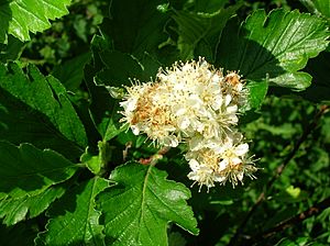
Arran is special because it has three very rare tree species known as Arran Whitebeams. These are the Scottish or Arran whitebeam, the cut-leaved whitebeam, and the Catacol whitebeam. All of them are found only in one valley called Gleann Diomhan. They are among the most endangered tree species in the world. In 1980, only a few hundred mature trees of the Scottish and cut-leaved whitebeams were counted. Animals grazing and insect damage are stopping new trees from growing. The Catacol whitebeam was only discovered in 2007, and only two specimens have been found, so efforts are being made to protect them.
What's in a Name? Etymology
The Roman historian Tacitus mentioned the Clota, which means the Clyde. This name likely comes from an old British word, Clouta, which became Clut in Old Welsh. It probably means "wash" or "the strongly flowing one," perhaps referring to a river goddess.
The origin of the name "Bute" is also uncertain. The Norse name for it was Bót, an Old Irish word for "fire," which might refer to signal fires. The meaning of "Arran" is not clear either. Some suggest it comes from a British word meaning "high place," while others think it might be even older than Celtic languages.
| Island | Derivation | Language | Meaning | Modern Gaelic name | Alternative Derivations |
|---|---|---|---|---|---|
| Arran | Possibly Aran | Brythonic | high place | Arainn | Possibly pre-Celtic |
| Bute | Bót (see above) | Norse or Gaelic | Possibly "fire isle" | Eilean Bhòid or Bód | Possibly from Brythonic budh for "corn" and previously known as Rothesay meaning "Roderick's island" |
| Davaar | Eilean Dà Bhàrr | Gaelic | Barr's island | Eilean Dà Bhàrr | |
| Great Cumbrae | Cymri | English/Brythonic | place of the Brythonic people | Cumaradh Mòr | Gaelic literally means "place of the Cymric people". Previously known in English as Great or Greater Cumray. |
| Holy Island | – | English | Refers to Molaise of Leighlin | Eilean Mo Laise | Previously known as "Lamlash", the English name was adopted in 1830 when the Arran village took this name. In Gaelic, the island is also known as "An t-Eilean Àrd" (the high island). |
| Sanda | Sandtange or Havin | Old Norse or Danish | sandspit or anchorage | Àbhainn | Also known as "Sanda Island" |
 | Stephanie Wilson |
 | Charles Bolden |
 | Ronald McNair |
 | Frederick D. Gregory |


