Pittston, Pennsylvania facts for kids
Quick facts for kids
Pittston, Pennsylvania
|
|||
|---|---|---|---|
|
City
|
|||
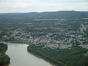
Pittston in September 2011
|
|||
|
|||
| Nickname(s):
"The Quality Tomato Capital of the World"
|
|||
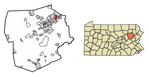
Location of Pittston in Luzerne County, Pennsylvania
|
|||
| Country | United States | ||
| State | Pennsylvania | ||
| County | Luzerne | ||
| Region | Greater Pittston | ||
| Settled | 1770 | ||
| Incorporated (borough) | April 30, 1853 | ||
| Incorporated (city) | December 10, 1894 | ||
| Government | |||
| • Type | City Council | ||
| Area | |||
| • Total | 1.71 sq mi (4.44 km2) | ||
| • Land | 1.53 sq mi (3.96 km2) | ||
| • Water | 0.18 sq mi (0.48 km2) | ||
| Elevation | 653 ft (199 m) | ||
| Population
(2020)
|
|||
| • Total | 7,591 | ||
| • Density | 4,961.44/sq mi (1,915.03/km2) | ||
| Time zone | UTC-5 (Eastern (EST)) | ||
| • Summer (DST) | UTC-4 (EDT) | ||
| Zip Codes |
18640-18644
|
||
| Area code(s) | 570 & 272 | ||
| FIPS code | 42-61048 | ||
Pittston is a city in Luzerne County, Pennsylvania, United States. It sits in the Wyoming Valley on the east side of the Susquehanna River. The Lackawanna River is on its south side. Pittston is about halfway between Wilkes-Barre and Scranton. It is also about 68.7 miles (110.6 km) north of Allentown. New York City is about 129.2 miles (207.9 km) northwest.
In 2020, Pittston had a population of 7,591 people. This makes it Luzerne County's fourth-largest city. In 1920, its population was much higher, reaching 18,497. The city has three main parts: Downtown Pittston, the Oregon Section, and the Junction. Pittston City is the center of the Greater Pittston region. This larger area covers 65.35 square miles and had a population of 48,020 in 2010.
The city was named after William Pitt the Elder, a British leader. It was first settled around 1770 by people from Connecticut. Back then, it was called "Pittstown." Pittston became well-known in the late 1800s and early 1900s. This was because of its active anthracite coal mining industry. Many European immigrants came to work in the mines.
Contents
History of Pittston
Revolutionary War Times
During the American Revolutionary War, the Wyoming Valley became a place of fighting. On July 3, 1778, British soldiers and about 500 Iroquois attacked. They killed about 300 American Patriot soldiers at the Battle of Wyoming.
A group of soldiers built and held a fort in Pittston. They were led by Captain Jeremiah Blanchard. The fort was given up on July 4, 1778, the day after the Battle of Wyoming. It was later partly burned. In 1780, the Pittston Fort was taken back, fixed, and made stronger. Patriots controlled it until the Treaty of Paris in 1783. This treaty mostly ended the war. Today, a marker shows where the fort once stood.
Becoming a City
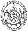
In 1853, Pittston separated from Pittston Township. It officially became a borough. John Hosie was the first leader, called a burgess. Later, on December 10, 1894, Pittston became a city. Thomas J. Maloney was the city's first mayor from 1894 to 1898. In the late 1890s, Pittston's borders were very large. They stretched from Scranton to Wilkes-Barre. But because of money and other disagreements, the area was divided. This created several smaller townships and boroughs in the Greater Pittston area.
Coal Mining and Its Impact
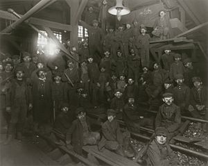
Pittston is in Pennsylvania's Coal Region. The first anthracite coal was found in the Wyoming Valley around 1770. The first mine opened near Pittston in 1775. In the 1830s, a new canal made Pittston important for the coal industry. Money from mining and moving coal led to Pittston becoming a separate borough. The coal and railroad industries brought thousands of immigrants to Pittston. This made it a diverse place with many different ethnic neighborhoods. Pittston's population grew quickly in the late 1800s and early 1900s.
The anthracite coal mining industry often used child labor in the early 1900s. The National Child Labor Committee worked to stop this. They hired a photographer named Lewis Hine. Many of Hine's pictures showed children working in mines around Pittston between 1908 and 1912. These powerful photos helped lead to new child labor laws across the country.
Mining Accidents
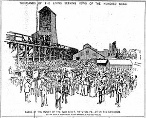
Coal mining was a very important industry in Pittston for many years. But there were also terrible accidents. The first big tragedy was the Twin Shaft disaster. It happened at the Newton Coal Company near the city's railroad junction. On June 28, 1896, 90 miners were working deep underground. At 3:00 AM, the mine roof suddenly collapsed. The shock was so strong it was felt for miles. Almost every building in Pittston shook. This collapse killed 58 miners, including the city's mayor at the time.
Anthracite coal mining stayed a big industry in the Greater Pittston area until the Knox Mine disaster. This event largely ended the industry in Northeastern Pennsylvania. On January 22, 1959, the frozen Susquehanna River broke through the roof of the River Slope Mine. This happened at the Knox Coal Company in nearby Port Griffith. Billions of gallons of river water flooded the connected mines. It took three days to plug the huge hole in the riverbed. Workers dumped large railroad cars, smaller mine cars, and other things into the whirlpool.
Sixty-nine miners escaped, but twelve miners died. Their bodies were never found. One miner, Myron Thomas, bravely led 26 miners to safety. Another group of six men was led by Pacifico "Joe" Stella of Pittston. Amedeo Pancotti was in this group. He made an amazing climb out of the Eagle Air Shaft to the surface. For his bravery, he received the Carnegie Medal for Heroism.
On November 27, 1942, an old coal mine, unused since 1868, collapsed. This caused the ground over half a square mile of Pittston to crack and sink. The largest crack was five feet wide and 150 feet long. It was so deep you couldn't see the bottom. Two hundred homes were damaged. Sidewalks broke, and gas and water pipes snapped. Water flooded the streets and cellars. Since 1942, government groups have looked into 149 mine-related ground collapses in the city.
Economic Changes
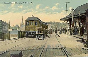
Pittston became an active railroad hub because of its mining and factories. The Lehigh Valley Railroad had a station in downtown Pittston. It was torn down in 1964 during city improvements. Pittston also had a station on the historic Lackawanna and Wyoming Valley Railroad, known as the Laurel Line.
Besides coal mining, Pittston had many other industries in the 1800s and 1900s. These included metals, plastics, paper products, apparel, electrical equipment, and beverages. The Pittston Stove Company, started in 1864, made stoves for heating and cooking. The Pittston Brewing Company made Glennon's Beer from 1873 to 1948.
From the 1930s to the 1980s, Pittston became a national center for clothing manufacturing. Thousands of workers, mostly women, worked in many factories. Most were members of the International Ladies' Garment Workers' Union (ILGWU). They fought for better pay, safer workplaces, and employee rights.
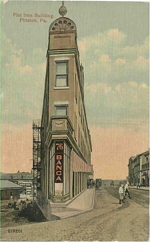
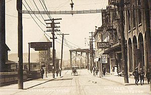
Main Street was a busy downtown area until the 1970s. It had clothing stores, shoe stores, jewelers, JC Penneys, Kresge's, Woolworth's, drug stores, restaurants, movie theaters, and banks. Many old commercial buildings were torn down in the 1960s. By the late 1900s, most of the city's factories closed. Stores downtown also closed. Pittston, like many old industrial cities, saw its population shrink and its downtown decline.
On March 15, 1993, two Pittston firefighters, John Lombardo and Len Insalaco, died fighting a fire on Main Street. A monument was built downtown to remember them. The nearby Water Street Bridge was renamed in their honor.
Pittston in the 21st Century
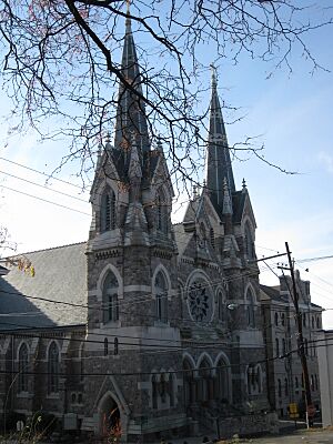
For many years, the tall spires of the city's churches stood out in the skyline. Many Catholic churches were built to serve the different ethnic groups in Pittston. For example, the Irish had St. John the Evangelist. The Slovaks had St. John the Baptist. The Lithuanians had St. Casimir's. The Germans had St. Mary Assumption. The Italians had St. Rocco's and Our Lady of Mount Carmel. There is also a Carpatho-Rusyn Byzantine Catholic Church, St. Michael's.
Since 2004, the Diocese of Scranton has closed many churches and private schools. This is due to fewer people living in the area and fewer students. Saint John the Baptist Elementary School closed in 2004. Seton Catholic High School closed in 2007. St. Mary's Assumption School closed in 2011.
In 2009, Mayor Joseph P. Keating left office. The city council then chose the first female mayor in the city's history, Donna McFadden-Connors. She served until 2010. Then, Jason C. Klush became the youngest mayor in the city's history.
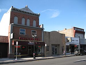
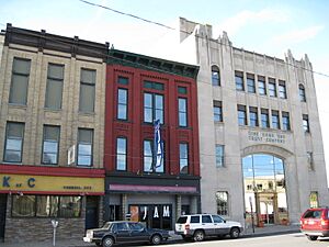
Pittston is now working to improve its economy. The downtown area has been updated with new sidewalks, trees, and street lights. Older buildings are being torn down. New buildings like condominiums, restaurants, bars, and stores are being built.
Downtown Improvements
In 2005, a plan for a condo complex was made for Pittston City. It was built near Riverfront Park. After a few years, the condos were finished and opened.
In December 2009, several buildings on William Street were torn down. These included St. John the Baptist Church and School. A memorial green space now sits where the school once stood. A monument was also built to remember the school and church. They served the Slovak community for over 100 years.
In 2008, under Mayor Joseph P. Keating, the city improved the downtown sidewalks. They now have a brick design. Black street lights and sign posts were also added to make downtown look nicer. Trees were planted too. Since 2008, more downtown improvements have happened. Older buildings are being demolished. Newer buildings like condominiums, restaurants, bars, and stores are being built. In 2015, the Pittston Parks and Recreation Committee suggested painting the city's fire hydrants. Local artists started painting them in 2016.
Geography of Pittston
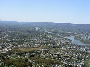
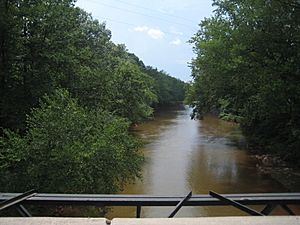
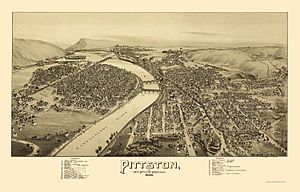
Pittston is part of the Wyoming Valley. It is on the east side of the Susquehanna River and the south side of the Lackawanna River. It is about halfway between Wilkes-Barre and Scranton. The city has a total area of 1.7 square miles (4.4 km2). Most of this is land, with a small part being water.
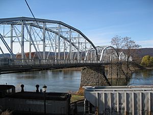
The city has three sections: the Oregon Section, the Downtown, and the Junction. The Oregon Section is a neighborhood on high ground overlooking the Susquehanna River. The Downtown is in the central part of Pittston. U.S. Route 11 goes through this area. Two bridges cross the Susquehanna River here. They connect Downtown Pittston with West Pittston. Most of the city's businesses and tall buildings are in Downtown. The land gets higher as you move east from the river. The northernmost part of the city is called the Junction. It is named after the railroad junction that runs through it. This area has mostly suburbs on steep hills. These hills overlook both the Susquehanna and Lackawanna Rivers. The Lackawanna River forms Pittston's northern border.
The area around Pittston is called Greater Pittston. It includes several nearby towns and townships. Pittston has a hot-summer humid continental climate. This means it has warm summers and cold winters.
Population and People
| Historical population | |||
|---|---|---|---|
| Census | Pop. | %± | |
| 1860 | 3,682 | — | |
| 1870 | 6,760 | 83.6% | |
| 1880 | 7,472 | 10.5% | |
| 1890 | 10,302 | 37.9% | |
| 1900 | 12,556 | 21.9% | |
| 1910 | 16,267 | 29.6% | |
| 1920 | 18,497 | 13.7% | |
| 1930 | 18,246 | −1.4% | |
| 1940 | 17,828 | −2.3% | |
| 1950 | 15,012 | −15.8% | |
| 1960 | 12,407 | −17.4% | |
| 1970 | 11,113 | −10.4% | |
| 1980 | 9,930 | −10.6% | |
| 1990 | 9,400 | −5.3% | |
| 2000 | 8,104 | −13.8% | |
| 2010 | 7,739 | −4.5% | |
| 2020 | 7,591 | −1.9% | |
| Sources: | |||
In 2010, there were 7,739 people living in Pittston. Most of the people were White (95%). There were also smaller groups of Black, Native American, and Asian people. About 2.7% of the population was Hispanic or Latino.
In 2015, the most common backgrounds in the city were: Italian (26.6%), Irish (18.9%), Polish (13.6%), and German (13.2%). Other backgrounds included English, Slovak, Russian, Lithuanian, Greek, and Arab.
The average age in the city was 41 years old. About 23.1% of the population was 19 or younger. The median income for a household was $35,918. About 17.8% of people lived below the poverty line.
Arts and Culture
Tomato Festival Fun
Pittston calls itself "The Quality Tomato Capital of the World." You can see pictures of tomatoes all over the city. Street signs have tomatoes on them. Tomatoes are also painted on buildings and roads. There is even a large tomato statue downtown.
Since 1983, the Pittston Tomato Festival has been held every year. It takes place on South Main Street in Downtown Pittston. This festival celebrates the city's history of growing tomatoes. Nearly fifty thousand people come to the four-day event each year. There is food from local vendors, live entertainment, games, rides, arts and crafts, and bingo. People also enjoy the home-grown Pittston tomatoes. The festival also has a beauty pageant and a tomato tasting contest. There's a contest for the best-looking and ugliest tomato. A 5 km run goes through the city. There are even tomato fights and a parade. In 2011, Parade Magazine wrote about the Pittston Tomato Festival.
Education in Pittston
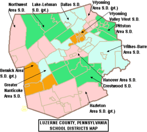
Public Schools
Pittston is part of the Pittston Area School District. This district also includes several nearby townships and boroughs.
The Pittston Area School District has four schools:
- Pittston Area Primary Center – Hughestown (Grades: K-1)
- Pittston Area Intermediate Center – Pittston (Grades: 2–4)
- Martin L. Mattei Middle School – Pittston (Grades: 5–8)
- Pittston Area Senior High School – Yatesville (Grades: 9–12)
Private Schools
One private school in the area is Holy Rosary in Duryea. Many Catholic schools in the Greater Pittston area have closed. This is because of less funding and fewer students.
Getting Around Pittston
Highways
U.S. Route 11 goes through Pittston City. Interstate 81 passes near Pittston. It goes north to Binghamton and south to Harrisburg. Pittston is also close to the Northeast Extension of the Pennsylvania Turnpike, Interstate 476. This road connects to Allentown and Philadelphia.
Air Travel
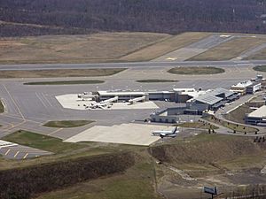
The Wilkes-Barre/Scranton International Airport is in Pittston Township. Eight international airlines serve this airport. It has hosted Air Force One when the president visits the region. Since 2002, the airport has offered more direct flights across the nation. These are provided by Allegiant, Delta, United, and American.
Bus Services
Pittston has bus services from the Luzerne County Transportation Authority and COLTS. These buses serve the city and other communities in Luzerne County and Lackawanna County. Martz Trailways also provides bus services from Pittston. You can travel to places like Philadelphia, New York City, and Atlantic City.
Train Services
Reading Blue Mountain and Northern Railroad, Norfolk Southern Railway, and Luzerne & Susquehanna Railroad provide freight train service. This is for goods and materials in Pittston and Pittston Township. There is a plan for a commuter train from Scranton to New York City. On May 27, 2023, the Reading, Blue Mountain & Northern opened a new station. It offers passenger service to Jim Thorpe on weekends.
Famous People from Pittston
- Banana Joe, radio personality
- Blackbear, singer and music producer
- Charles Calvin Bowman, mayor and U.S. Representative
- James Joseph Brown, mining inventor
- Lou Butera, World Champion pool player
- Jimmy Cefalo, football player
- J. Harold Flannery, U.S. Representative
- Dan Gordon, animator and director
- George Gordon, animator and director
- Gerry Granahan, singer and music producer
- Hughie Jennings, Hall of Fame baseball player and manager
- Shawn Klush, Elvis tribute artist
- John D. MacArthur, businessman and giver
- Tommy McMillan, baseball player
- Ray Musto, U.S. Representative
- John H. Newton, U.S. Navy Vice Admiral
- Jay Parini, professor and author
- Thomas Tigue, state legislator
- Charley Trippi, football player
- Faustin E. Wirkus, US Marine Corps Sergeant and King of Gonâve Island
See also
 In Spanish: Pittston (Pensilvania) para niños
 | Stephanie Wilson |
 | Charles Bolden |
 | Ronald McNair |
 | Frederick D. Gregory |


