Province of Rovigo facts for kids
Quick facts for kids
Province of Rovigo
Rovigo
|
|
|---|---|
 |
|
| Country | |
| Region | Veneto |
| Capital | Rovigo |
| Area | |
| • Total | 1,789 km2 (691 sq mi) |
| Population | |
| • Total | 244,625 |
| • Density | 136.7/km2 (354/sq mi) |
| Postal Code |
45100, 45010-45039
|
| Telephone prefix |
0425, 0426
|
| ISTAT | 029 |
| Vehicle registration | RO |
| No. of communes | 50 |
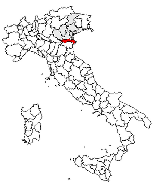
The Province of Rovigo (called Provincia di Rovigo in Italian) is a special area, or province, located in the Veneto region of Italy. Its main city and capital is Rovigo.
This province shares its borders with other provinces: Verona, Padua, and Venice to the north. To the south, it borders the province of Ferrara. To the west, you'll find the province of Mantua, and to the east, it meets the Adriatic Sea.
Contents
Geography and People
The Province of Rovigo is mostly a flat area. It is also known as Polesine. The land here is very low, ranging from 2 meters (about 6.5 feet) below sea level to 15 meters (about 49 feet) above it.
The province covers an area of about 1,789 square kilometers (691 square miles). In 2005, about 244,625 people lived here.
Rivers and Land Formation
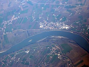
The northern border of the province follows the Adige river. This river flows from Badia Polesine all the way to the sea. The southern border follows the Po river, from Melara to the sea.
The province also includes the entire delta of the Po river. A delta is where a river splits into many smaller channels before reaching the sea.
The land in Rovigo is quite new. It was formed over time by soil and sediment carried by the rivers. Because of this, the land can sometimes sink a little. This sinking happens naturally, but also due to human activities like drainage and taking water or gas from underground.
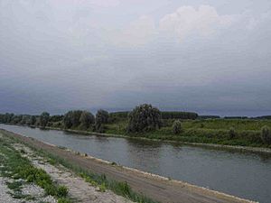
The Canal Bianco is another important river that flows through the province. Many canals have been dug here to help drain water. This is because the Po and Adige are two of Italy's biggest rivers, bringing a lot of water to the area.
Climate and Towns
The climate in Rovigo is a mild continental type. This means it has warm, humid summers and often foggy winters. Rain usually falls in spring and autumn.
There are 50 small towns or villages, called comuni, in the province. Here are some of the main ones by population (as of 2011):
| Comune | Population |
|---|---|
| Rovigo | 52,099 |
| Adria | 20,069 |
| Porto Viro | 14,470 |
| Lendinara | 12,006 |
| Occhiobello | 11,849 |
| Badia Polesine | 10,780 |
| Porto Tolle | 9,976 |
| Taglio di Po | 8,445 |
| Rosolina | 6,510 |
| Villadose | 5,185 |
Sometimes, young people from Rovigo move to bigger cities in Veneto or other parts of Italy to find more job opportunities. This can lead to an older population in the province.
Getting Around
A major highway called the SS434 "Transpolesana" is planned to cross most of the province. Currently, it connects Verona with Rovigo.
The A13 motorway, which links Bologna and Padua, also passes through the area. Another important road is the SS309 "Romea" State Road, connecting Venice with Ravenna.
History of Rovigo Province
The land of the Province of Rovigo has a long history.
Early Settlements
The first people to settle here were the Greeks. They founded a colony called Adria around 12th-11th centuries BC. Later, in the 6th and 5th centuries BC, the Etruscans and Venetians lived in the area. After them came the powerful Romans.
Medieval Times
During the Middle Ages, the region was ruled by the House of Este. This family was part of the Duchy of Ferrara. At that time, Rovigo was not a single administrative unit. Instead, there were several local governments, called Podesteria, on both sides of the Po river.
Venetian Rule and Modern Borders
After a conflict called the War of Ferrara in 1484, the Republic of Venice took control of the northern part of Polesine. The Venetians made Rovigo the capital of this new "territory." This was the first time the area had a single administrative unit, which can be seen as the beginning of the Province of Rovigo.
Its borders were not exactly as they are today. The Canal Bianco river usually marked the border, but some areas like Polesella, Guarda Veneta, Adria, and the Po delta were part of the Venetian territory of Rovigo.
In 1815, after the Congress of Vienna, all the lands north of the Po river became part of the Kingdom of Lombardy-Venetia. This is when the province got its modern-day borders.
Economy and Jobs
The Province of Rovigo has a strong agriculture sector. Farmers here grow a lot of wheat, maize, rice, and sugar beets. They also grow grapes, apples, pears, peaches, tomatoes, and other vegetables.
There are many small and medium-sized factories in the city of Rovigo and other towns. These factories mainly focus on:
- food processing (like sugar refineries)
- metalworking
- carpentry
- textile production
- construction and construction materials
In the wetlands of the Po delta, many Aquaculture farms raise fish and other water animals.
The province also has some popular holiday villages. These include Rosolina Mare, Rosa Pineta, and Albarella Island (Isola di Albarella). People come here to enjoy their vacations.
Po River Delta and Nature Park
The eastern part of the province is where the Po river forms its delta. This is a large area where the river splits into many smaller channels, each with its own name.
The Po delta is a very important natural area. It is protected by law as a national nature park. This park helps to preserve the unique plants and animals that live in this special watery environment.
| Provinces of Veneto |
|---|
| Belluno | Padua | Rovigo | Treviso | Venice | Verona | Vicenza |
See also
 In Spanish: Provincia de Rovigo para niños
 | Ernest Everett Just |
 | Mary Jackson |
 | Emmett Chappelle |
 | Marie Maynard Daly |


