Tippecanoe County, Indiana facts for kids
Quick facts for kids
Tippecanoe County
|
|
|---|---|

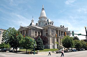
Tippecanoe County Courthouse in Lafayette, Indiana
|
|

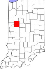
Location within the U.S. state of Indiana
|
|
 Indiana's location within the U.S. |
|
| Country | |
| State | |
| Founded | March 1, 1826 |
| Named for | Kethtippecanoogi ("Place of the Succor Fish People" in Miami) |
| Seat | Lafayette |
| Largest city | Lafayette |
| Area | |
| • Total | 503.24 sq mi (1,303.4 km2) |
| • Land | 499.81 sq mi (1,294.5 km2) |
| • Water | 3.44 sq mi (8.9 km2) 0.68%% |
| Population
(2020)
|
|
| • Total | 186,251 |
| • Density | 370.104/sq mi (142.8978/km2) |
| Time zone | UTC−5 (Eastern) |
| • Summer (DST) | UTC−4 (EDT) |
| Congressional district | 4th |
| Indiana county number 79 | |
Tippecanoe County is a county in the west-central part of Indiana. It's about 22 miles east of the Illinois state line. The county is also less than 50 miles from the Indianapolis area.
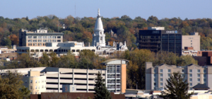
In 2020, about 186,251 people lived here. The main city and county seat is Lafayette. Tippecanoe County was created on March 1, 1826. Its name comes from a Miami people term. It means "place of the buffalo fish people."
This county is famous for a few things. It's home to Purdue University. It's also known for the 1811 Battle of Tippecanoe. The beautiful Tippecanoe County Courthouse, built in 1881, is also a well-known landmark. Tippecanoe County is part of the Lafayette Metropolitan Statistical Area.
Contents
A Look at Tippecanoe County's Past
The history of Tippecanoe County goes back a long time. It includes six main periods. First, it was Native American land for thousands of years. This included the Mississippian culture. Then, the French took over in the 1670s. This was part of New France.
After the French and Indian War, the British controlled the area starting in 1763. Later, it became part of the United States Northwest Territory in 1787. In 1800, it was part of the Indiana Territory. Finally, it became part of the State of Indiana in 1816. The county officially started in 1826.
The first European explorers arrived in the 1670s. The French built the first lasting settlement, Fort Ouiatenon, in 1717. The city of Lafayette was planned in 1825. Purdue University was founded later in 1869.
Geography of Tippecanoe County
Tippecanoe County covers about 503 square miles. Most of this area, about 499 square miles, is land. The rest, about 3.44 square miles, is water. The highest point in the county is in Lauramie Township.
Neighboring Counties
Tippecanoe County shares borders with several other counties:
- White County (to the north)
- Carroll County (to the northeast)
- Clinton County (to the east)
- Montgomery County (to the south)
- Fountain County (to the southwest)
- Warren County (to the west)
- Benton County (to the northwest)
Towns and Cities in Tippecanoe County
Cities
- Lafayette
- West Lafayette (home of Purdue University)
Towns
- Battle Ground
- Clarks Hill
- Dayton
- Otterbein (east half)
- Shadeland
Census-Designated Places
These are areas that are like towns but not officially incorporated.
Other Small Communities
These are smaller, unincorporated places.
County Townships

Townships are smaller local government areas within the county.
- Fairfield
- Jackson
- Lauramie
- Perry
- Randolph
- Sheffield
- Shelby
- Tippecanoe
- Union
- Wabash
- Washington
- Wayne
- Wea
Weather and Climate
| Weather chart for Lafayette, Indiana | |||||||||||||||||||||||||||||||||||||||||||||||
|---|---|---|---|---|---|---|---|---|---|---|---|---|---|---|---|---|---|---|---|---|---|---|---|---|---|---|---|---|---|---|---|---|---|---|---|---|---|---|---|---|---|---|---|---|---|---|---|
| J | F | M | A | M | J | J | A | S | O | N | D | ||||||||||||||||||||||||||||||||||||
|
1.8
33
17
|
1.6
39
22
|
2.9
50
31
|
3.5
62
40
|
3.9
74
51
|
4.2
83
60
|
3.8
86
65
|
3.9
84
63
|
2.7
78
55
|
2.6
66
43
|
2.8
51
34
|
2.6
38
23
|
||||||||||||||||||||||||||||||||||||
| temperatures in °F precipitation totals in inches source: The Weather Channel |
|||||||||||||||||||||||||||||||||||||||||||||||
|
Metric conversion
|
|||||||||||||||||||||||||||||||||||||||||||||||
In Lafayette, the average low temperature in January is about 17°F. The average high in July is about 86°F. The coldest temperature ever recorded was -23°F in January 1985. The hottest was 105°F in June 1988.
Rainfall changes throughout the year. February usually has the least rain, about 1.58 inches. June tends to be the wettest, with about 4.24 inches of rain.
Getting Around Tippecanoe County
Major Roads
Several important roads pass through Tippecanoe County.
 Interstate 65
 U.S. Route 52
 U.S. Route 231
 Indiana State Road 25
 Indiana State Road 26
 Indiana State Road 28
 Indiana State Road 38
 Indiana State Road 43
 Indiana State Road 225
Train Lines
Three different train lines cross in Tippecanoe County. All of them go through the Lafayette area. CSX Transportation has a line running north to south. Norfolk Southern Railway has a line from southwest to northeast. The Kankakee, Beaverville and Southern Railroad has a daily service line. It runs from the northwest to the southeast.
The Amtrak Cardinal train stops at the Lafayette Station. It stops three times a week. This is the only passenger train service in the Lafayette area.
Airport
The county has one public airport. It's called Purdue University Airport (LAF). It's located in West Lafayette, Indiana.
People of Tippecanoe County
| Historical population | |||
|---|---|---|---|
| Census | Pop. | %± | |
| 1830 | 7,187 | — | |
| 1840 | 13,724 | 91.0% | |
| 1850 | 19,377 | 41.2% | |
| 1860 | 25,726 | 32.8% | |
| 1870 | 33,515 | 30.3% | |
| 1880 | 35,966 | 7.3% | |
| 1890 | 35,078 | −2.5% | |
| 1900 | 38,659 | 10.2% | |
| 1910 | 40,063 | 3.6% | |
| 1920 | 42,813 | 6.9% | |
| 1930 | 47,535 | 11.0% | |
| 1940 | 51,020 | 7.3% | |
| 1950 | 74,473 | 46.0% | |
| 1960 | 89,122 | 19.7% | |
| 1970 | 109,378 | 22.7% | |
| 1980 | 121,702 | 11.3% | |
| 1990 | 130,598 | 7.3% | |
| 2000 | 148,955 | 14.1% | |
| 2010 | 172,780 | 16.0% | |
| 2020 | 186,251 | 7.8% | |
| 2023 (est.) | 188,792 | 9.3% | |
| U.S. Decennial Census 1790-1960 1900-1990 1990-2000 2010 |
|||
In 2010, there were 172,780 people living in Tippecanoe County. There were 65,532 households. About 28.5% of households had children under 18. About 42.4% were married couples.
The average age of people in the county was 27.7 years. The average household had 2.42 people. The average family had 3.02 people.
Learning and Education
Public schools in the countryside and suburbs of Tippecanoe County are run by the Tippecanoe School Corporation. Schools in the cities are managed by either the Lafayette School Corporation or West Lafayette Community School Corporation.
Libraries
- Tippecanoe County Public Library
- West Lafayette Public Library
Colleges and Universities
- Purdue University
- Ivy Tech Community College of Indiana
High Schools
- TSC - Elston Alternative Education Center
- LCSS - Lafayette Central Catholic Jr/Sr High School
- LSC - Lafayette Jefferson High School
- LSC - Lafayette Oakland High School
- TSC - McCutcheon High School (south Lafayette suburbs)
- WLCSC - West Lafayette Junior-Senior High School
- TSC - Harrison High School (north Lafayette/West Lafayette suburbs)
Middle Schools/Junior High Schools
- Lafayette Sunnyside Middle School
- Lafayette Tecumseh Junior High School
- TSC (Harrison) Battle Ground Middle School
- TSC (Harrison) East Tipp Middle School
- TSC (Harrison) Klondike Middle School
- TSC (McCutcheon) Southwestern Middle School
- TSC (McCutcheon) Wainwright Middle School
- TSC (McCutcheon) Wea Ridge Middle School
- West Lafayette Junior-Senior High School
Elementary Schools
- Lafayette Edgelea Elementary School
- Lafayette Glen Acres Elementary School
- Lafayette Miami Elementary School
- Lafayette Miller Elementary School
- Lafayette Murdock Elementary School
- Lafayette (charter) New Community School
- Lafayette Vinton Elementary School
- TSC (Harrison) Battle Ground Elementary School
- TSC (Harrison) Burnett Creek Elementary School
- TSC (Harrison) Hershey Elementary School
- TSC (Harrison) Klondike Elementary School
- TSC (McCutcheon) Dayton Elementary School
- TSC (McCutcheon) James Cole Elementary School
- TSC (McCutcheon) Mayflower Mill Elementary School
- TSC (McCutcheon) Mintonye Elementary School
- TSC (McCutcheon) Wea Ridge Elementary School
- TSC (McCutcheon) Woodland Elementary School
- TSC (Harrison/McCutcheon) Wyandotte Elementary School
- West Lafayette Elementary School
- West Lafayette Intermediate School
Private Schools
- Apostolic Christian Academy
- Concord School
- Faith Christian School
- First Assembly Christian Academy
- Highland Christian School k-8
- Lafayette Catholic Schools k-12
- Lafayette Christian School k-8
- Lafayette Faith Baptist
- Lighthouse Baptist Christian Academy
- Pleasantview Christian School
- St Boniface 4-6
- St James Lutheran k-8
- St Mary Cathedral Elementary K-3
Tippecanoe County's Economy
The economy of Tippecanoe County is mostly based in its two biggest cities: Lafayette and West Lafayette. Purdue University is the largest employer in the county.
Many other people work for private companies and businesses. Some major employers include Subaru-Indiana Automotive, Wabash National, Caterpillar, Fairfield Manufacturing, Franciscan Health Lafayette, Alcoa, State Farm, and Indiana University Health Arnett Hospital.
Famous People from Tippecanoe County
- Jesse Lloyd
See also
 In Spanish: Condado de Tippecanoe para niños


