Volcanic history of the Northern Cordilleran Volcanic Province facts for kids
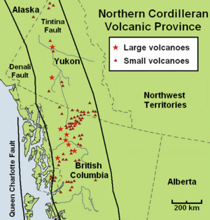
The volcanic history of the Northern Cordilleran Volcanic Province tells the story of volcanoes in northwestern British Columbia, central Yukon, and eastern Alaska. This area is part of the Western Cordillera in North America. For millions of years, the North American Plate has been slowly cracking and pulling apart here. This pulling apart has created many volcanoes across the Northern Cordilleran Volcanic Province for at least the last 20 million years. Sometimes, these volcanoes have even erupted in more recent times.
Over its 20-million-year history, the Northern Cordilleran Volcanic Province has mostly produced a type of lava called alkaline lava, like alkaline basalts. You can find other unique alkaline rocks here too, such as nephelinite and basanite. Some lavas like phonolite, trachyte, and comendite are also present. Scientists believe these lavas formed when basalt magma changed deep inside the Earth. An area where the Earth's crust is pulling apart, like this province, helps create large underground magma chambers. These chambers allow the magma to change over a long time.
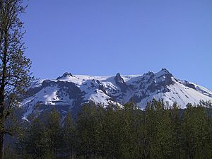
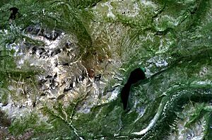
In the last 15 million years, at least four huge volcanoes have grown in this part of North America. These include Hoodoo Mountain, the Mount Edziza volcanic complex, Level Mountain, and Heart Peaks. Most of them are in northwestern British Columbia. The Mount Edziza volcanic complex is especially famous. It is 7.5 million years old and has erupted more than 20 times in the last 10,000 years! Today, the only activity in the Northern Cordilleran Volcanic Province is occasional earthquakes and bubbling hot springs. However, there's a high chance that volcanoes could erupt again, which could be dangerous for people and homes in the area.
Contents
How Many Volcanoes Erupted?
More than 100 eruptions have happened in the last 20 million years. These eruptions have created many different types of volcanoes. These include tall, cone-shaped stratovolcanoes, wide and flat shield volcanoes, dome-shaped lava domes, and small, steep-sided cinder cones. There are also some rarer types, like tuyas. Large volcanoes in this region can sleep for hundreds or thousands of years between eruptions. This means the biggest risks from volcanoes are not always obvious.
Volcanoes older than 14 million years are mostly in the northern part of the province. Those between nine and four million years old are found only in the middle. The Northern Cordilleran Volcanic Province has at least three types of volcanic areas:
- Large lava plateaus, like those at the Mount Edziza volcanic complex.
- Polygenetic volcanoes (volcanoes that erupt many times), like Hoodoo Mountain.
- Monogenetic volcanoes (volcanoes that erupt only once), like the basaltic cinder cones found everywhere.
When these volcanoes erupt, fast-moving pyroclastic flows, hot lava flows, and landslides can destroy areas up to 10 kilometers (6 miles) away. mudflows made of volcanic ash and rock can flood valleys far downstream. Ash falling from explosive eruptions can stop human activities hundreds of kilometers away. Clouds of fine volcanic ash can even damage jet aircraft far from the eruption.
Scientists have seen that volcanic activity has slowed down in the last few million years. From eight to four million years ago, eruptions happened more often than they do now. The most lava was produced between seven and five million years ago. This was linked to the Pacific Plate and North American Plate pulling apart. Then, between four and three million years ago, volcanic activity paused. The most recent period of volcanic activity started two million years ago and continues today. It's caused by nearby areas pulling apart, even though the Pacific and North American plates are mostly pushing together.
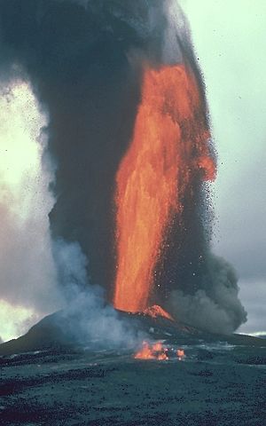
The rate of volcanism in the Northern Cordilleran Volcanic Province is much lower than in the Cascade Volcanic Arc or Hawaiian volcanoes. However, geologists are careful when studying these patterns. This is because ice from the last glacial period has worn away many older volcanoes. Also, many volcanoes have not been accurately dated. Lava fountains can happen in the Northern Cordilleran Volcanic Province about every 100 years.
Large basaltic shield volcanoes in the central Northern Cordilleran Volcanic Province form huge lava plateaus. These are the biggest volcanoes in the area. They are generally larger and last longer than volcanoes in nearby areas, like the stratovolcanoes of the Cascade and Aleutian arcs. For example, Mount Shasta in the Cascade Arc and Mount Veniaminof in the Aleutian Arc are both huge. But their volumes are less than half of Level Mountain and Edziza shield complexes.
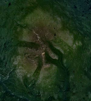
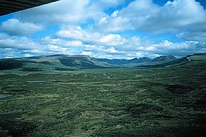
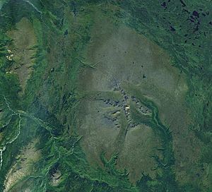
The massive Level Mountain shield volcano covers an area of 1,800 square kilometers (690 sq mi). It has a volume of more than 860 cubic kilometers (210 cu mi). This makes it the largest and longest-lived volcano in the Northern Cordilleran Volcanic Province. To the south, the Mount Edziza volcanic complex is the second largest. It covers 1,000 square kilometers (390 sq mi) and has a volume of 670 cubic kilometers (160 cu mi). Just west of Level Mountain is Heart Peaks, the third largest. It covers 275 square kilometers (106 sq mi). There are also remains of a shield volcano called Maitland Volcano in the western Cassiar Mountains. It once covered more than 900 square kilometers (350 sq mi).
All the most recent known eruptions have happened in British Columbia. However, there is some evidence of volcanic activity in Yukon in the last thousand years. The two most recent eruptions were lava flows at Tseax Cone in the 1700s and at The Volcano in 1904.
When Volcanic Activity Began
The first volcanic activity in the Northern Cordilleran Volcanic Province happened 20 million years ago. It was not very frequent and produced small amounts of volcanic material. This quiet period ended when the huge Level Mountain shield volcano began to form 15 million years ago. This 1,800-square-kilometer (690 sq mi) shield volcano forms a wide lava plateau. It is 70 kilometers (43 mi) long and 45 kilometers (28 mi) wide, with an average thickness of 750 meters (2,460 ft). Most of the lava flows were ropy `pāhoehoe` lava, which means the lava was very fluid and flowed easily.
When the Mount Edziza volcanic complex started to form 7.5 million years ago, volcanic activity in the province increased again. The early activity at Mount Edziza, seven million years ago, built Armadillo Peak. This is the oldest and most central of the four main volcanoes in the complex. Its 2,194-meter (7,198 ft) summit has 180-meter (590 ft) thick lava flows. These flows formed a lava lake inside a caldera six million years ago. A massive stratovolcano also formed on top of the Level Mountain shield volcano between 7.1 and 5.3 million years ago. This happened during a time of increased volcanism when thick lavas erupted. This stratovolcano has a volume of 860 cubic kilometers (210 cu mi) and had several vents, some over 2,500 meters (8,200 ft) high. Glaciers and streams have since cut the stratovolcano into valleys and ridges, forming the Level Mountain Range.
Volcanoes from 5.3 to 1.6 Million Years Ago
In northern British Columbia, you can find parts of an old shield volcano in the western Cassiar Mountains. This volcano, called Maitland Volcano, erupted between five and four million years ago. Thin lava flows covered the landscape. What's left of this volcano includes 14 volcanic plugs and scattered lava flows.
At the southern end of the Mount Edziza volcanic complex, the Spectrum Range formed three to 2.5 million years ago. This nearly circular lava dome is up to 650 meters (2,130 ft) thick and more than 10 kilometers (6 mi) wide. It has a basaltic shield volcano at its base. Over time, erosion has cut deep valleys into the Spectrum Range. These valleys show large lava flows and even faults from a hidden 4.5-kilometer (2.8 mi) wide caldera.
Several lava domes also formed in the Level Mountain Range between 4.5 and 2.5 million years ago. These domes pushed into the core of the 860-cubic-kilometer (210 cu mi) stratovolcano. Erosion has also created V-shaped canyons in the lava plateau.
Volcanoes from 1.6 Million to 10,000 Years Ago
During the Pleistocene epoch, from 1.6 million to 10,000 years ago, volcanoes in the Northern Cordilleran Volcanic Province often interacted with glacial ice. This included the huge Cordilleran Ice Sheet. This volcano-ice connection can be seen in three different types of landscapes.
One type of volcano-ice interaction created tuyas, like Tuya Butte, on the Tanzilla Plateau in northern British Columbia. This area was likely a place where the Cordilleran Ice Sheet grew. Volcanic eruptions on the Tanzilla Plateau during the Pleistocene were basaltic subglacial eruptions, meaning they happened under the ice. These tuyas are distinctive flat-topped, steep-sided volcanoes, often more than 100 meters (330 ft) tall.
A second type of volcano-ice interaction happened in the Cassiar Mountains, Skeena Mountains, and Boundary Ranges. Volcanic activity here was also mostly basaltic. But the high mountains in these areas greatly affected how glaciers and subglacial volcanoes formed. Even when buried by the Cordilleran Ice Sheet, the ice movement was shaped by deep valleys. So, the remains of these subglacial volcanoes are small and scattered.
The third type of volcano-ice interaction is found at three specific volcanoes: Level Mountain, the Mount Edziza volcanic complex, and Hoodoo Mountain. All three are wide enough to have their own ice caps. These ice caps likely changed how the larger Cordilleran Ice Sheet flowed. At Mount Edziza and Level Mountain, their heat might have affected the movement of the Cordilleran Ice Sheet, much like the Grímsvötn caldera in Iceland. The Edziza complex has many subglacial products, but also, like Hoodoo Mountain and Level Mountain, some of the largest deposits of a special type of subglacial volcanic rock.
Just northwest of Level Mountain, the Heart Peaks shield volcano rises 1,025 meters (3,363 ft) above the Nahlin Plateau. Its summit is topped with rhyolitic lava domes. Heart Peaks is made of flat-lying basaltic lava flows and pyroclastic rocks. Its most recent eruption was mostly during the Pleistocene.
Ne Ch'e Ddhawa, an extinct volcano in central Yukon, is 300 meters (980 ft) tall. It erupted under the Cordilleran Ice Sheet between 0.8 and one million years ago. This eruption created special volcanic rocks like `hyaloclastite` `tuff`s and `breccia`s.
In northwestern British Columbia, Hoodoo Mountain began forming at least 100,000 years ago, mostly under the Cordilleran Ice Sheet. More than 90% of Hoodoo Mountain formed during this time. It is made mostly of layered lava flows and `hyaloclastite`s. On its northern side is the smaller Little Bear Mountain, another tuya that also formed during the Pleistocene.
Ice Peak began to form when the Cordilleran Ice Sheet started to melt away from the Mount Edziza volcanic complex 1.6 million years ago. It is a stratovolcano that grew when large parts of the Edziza lava plateau were free of ice. Volcanic activity at Ice Peak produced lava flows and pyroclastic rocks. These mixed with meltwater to create debris flows. As Ice Peak grew, lava spread to its sides, forming meltwater lakes. Mount Edziza, a steep-sided stratovolcano, began to form a million years ago. Its smooth sides are only slightly cut by erosion. It has a circular 2,700-meter (8,900 ft) summit ridge around a 2-kilometer (1.2 mi) wide ice-filled caldera. Subglacial eruptions around Mount Edziza and Ice Peak also built up piles of `pillow lava` and `hyaloclastite`.
Prindle Volcano, the northernmost volcano in the Northern Cordilleran Volcanic Province, formed in Alaska during the Pleistocene. It is a small cinder cone with a 90-meter (300 ft) deep crater. A 11.2-kilometer (7.0 mi) long lava flow extends from its crater.
The Tuya Volcanic Field in northern British Columbia is full of tuyas. These flat-topped, steep-sided volcanoes formed when magma pushed into and melted a vertical pipe in the ice sheet. At least six volcanoes formed under the ice near Tuya Lake, including Ash Mountain, South Tuya, Tuya Butte, and Mathews Tuya.
Volcanoes in the Last 10,000 Years
Many eruptions have happened since the start of the Holocene epoch 10,000 years ago. This was when the huge Cordilleran Ice Sheet quickly melted away. Most of these recent eruptions have been in British Columbia, with fewer in Yukon.
Early in the Holocene, Hoodoo Mountain erupted lava flows with clear lava channels on its sides. These areas are not covered by glaciers, suggesting the last eruption happened when there was no ice. These lava flows came from the mountain's flat summit and vents on its sides. Geologists don't always agree on the exact dates, with some saying 9,000 years ago and others as recently as 7,000 years ago.
At the southern end of the province, near the border of British Columbia and the Alaska Panhandle, lava flows and eight small volcanoes form the Iskut-Unuk River Cones. Lava flows here date back 70,000 years, but the eight volcanoes likely formed between 9,000 and a few hundred years ago. At least five volcanoes sent lava 20 kilometers (12 mi) down the Iskut and Unuk River valleys. The other three volcanoes formed when glacial ice was next to the vents, creating `scoria`, `pillow lava`, and `hyaloclastite breccia`. The most recent eruption in this area was at The Volcano (also called Lava Fork volcano) in 1904. This was the most recent volcanic eruption in Canada.
North of the Pelly and Yukon rivers, Volcano Mountain in central Yukon is a cinder cone with lava flows. It is the youngest volcano in the Fort Selkirk Volcanic Field. Lava flows came from cracks on its side. These flows are made of `olivine nephelinite`, a rare type of lava that comes from deep inside the Earth. The lava flows at Volcano Mountain look fresh and seem to be only a few hundred years old. However, dating of lake sediments suggests they could be much older. So, the exact age of the most recent eruptions at Volcano Mountain is unknown.
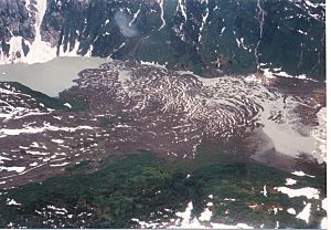
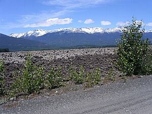
At the very southern end of the Northern Cordilleran Volcanic Province, Tseax Cone sits in a valley east of the Tseax River. This young cinder cone was the source of a large basalt lava flow around 1750 and 1775. The lava flowed into the Tseax River, blocking it and forming Lava Lake. The lava then traveled 11 kilometers (6.8 mi) north to the Nass River, filling the valley for another 10 kilometers (6.2 mi). The entire lava flow was 22.5 kilometers (14.0 mi) long.
Local Nisga'a legends tell of a long period of trouble from the volcano. Two Nisga'a villages were destroyed, and at least 2,000 Nisga'a people died from volcanic gases and poisonous smoke, likely carbon dioxide. This is Canada's worst known natural disaster from a volcano. It is also the only eruption in Canada where First Nations legends have been proven true. Today, Tseax Cone rests quietly in Nisga'a Memorial Lava Bed Provincial Park.
More than 20 eruptions have happened at the Mount Edziza volcanic complex in the last 10,000 years. These include Mess Lake Cone, Kana Cone, Eve Cone, and many others. These cinder cones formed no later than the year 700. They were built on top of older lava fields. The Desolation Lava Field is the largest area of young lava flows, covering 150 square kilometers (58 sq mi). The longest lava flow is 12 kilometers (7.5 mi).
Two well-preserved reddish-brown cinder cones top a small shield volcano at the Alligator Lake volcanic complex in southcentral Yukon. These cones are likely younger than the last glaciers in the area. They both erupted at the same time, producing lava flows that extend north. The lava flows from the northeast cone are the largest, reaching 6 kilometers (3.7 mi) long and 10 kilometers (6.2 mi) wide at the end.
Miners reported an eruption in the Atlin Volcanic Field on November 8, 1898. They said they could work at night because of the glow from the eruption. A newspaper report from December 1, 1898, said a volcano was erupting about 80 kilometers (50 mi) south of Gladys Lake. However, no evidence for this eruption has been found.
Thick volcanic ash deposits are found at Crow Lagoon in northwestern British Columbia. These came from an unknown volcanic vent nearby. The age of these deposits is not known, but they formed during the Holocene epoch.
In the Pleistocene Tuya Volcanic Field, you can see small shield volcanoes and cinder cones that formed after the glaciers melted. At least one of these volcanoes is from the Holocene. Gabrielse Cone is 1,600 meters (5,200 ft) tall and 400 meters (1,300 ft) wide. It is mostly made of loose volcanic rock with a 30-meter (98 ft) deep crater at its top. A basaltic lava flow extends more than 400 meters (1,300 ft) from the volcano. There is no proof Gabrielse Cone formed during or before the Cordilleran Ice Sheet. This means it is definitely younger than 11,000 years and formed in the Holocene epoch.
Recent Activity and Future Dangers
At least five volcanoes have had earthquake activity since 1985: Mount Edziza volcanic complex, Castle Rock, Hoodoo Mountain, Crow Lagoon, and The Volcano. This earthquake data suggests that these volcanoes still have active magma chambers. This means they could erupt again in the future. While we can't be completely sure, these signs suggest some volcanoes in the Northern Cordilleran Volcanic Province are potentially active. Their dangers could be serious.
The most dangerous volcanoes in the Northern Cordilleran Volcanic Province are Edziza and Hoodoo. A large `pumice` deposit at Edziza shows it has a history of big explosive eruptions. These eruptions produce lava rich in silica, similar to the most powerful eruptions on Earth. A large explosive eruption at Edziza could create a huge eruption column that would affect parts of the Pacific Northwest. Similarly, high eruption columns from Hoodoo Mountain would disrupt air travel between Canada, Alaska, and Asia.
The flat top of Hoodoo Mountain is covered by an ice cap more than 100 meters (330 ft) thick. An eruption from Hoodoo's summit would melt a lot of this ice. This would create large floods and lahars (volcanic mudflows). These would have a big impact on nearby river valleys, like the Iskut River. The Iskut River is important for salmon, logging, and mining. Edziza and Hoodoo Mountain are two of the three most dangerous volcanoes in Western Canada that have been active in the last 10,000 years. The other is the Mount Meager massif in British Columbia, which had a huge eruption 2,350 years ago.
Lava flows in the Northern Cordilleran Volcanic Province are among the least dangerous, even though they can destroy property in their path. This is because lava usually moves slowly enough for people to get out of the way. However, this depends on how thick the lava is. Lava flows can also cause other problems, like destroying buildings and releasing volcanic gases. Forest fires started by lava flows are also possible in this part of Canada. The typical lava fountains here are usually linked to lava flows. But they don't usually reach heights of more than a few hundred meters. So, the dangers from lava fountains are only right next to the erupting volcano.
Right now, no volcanoes in the Northern Cordilleran Volcanic Province are watched closely enough by the Geological Survey of Canada to know how active their magma chambers are. There is a network of seismographs (earthquake monitors) in place. But they are too far away to give a good idea of what's happening under the volcanoes. They might detect an increase in activity if a volcano becomes very restless, but this might only give a warning for a large eruption. It might only detect activity once a volcano has already started erupting.
The Interagency Volcanic Event Notification Plan is Canada's emergency plan for volcanoes. It tells different agencies how to respond to a volcanic eruption in Canada, near its borders, or one that could affect Canada. It mainly focuses on aviation safety because jet aircraft can quickly fly into areas with volcanic ash. The program tells all affected agencies what to do. Airplanes are rerouted away from dangerous ash, and people on the ground are warned about possible ash fall.
 | James Van Der Zee |
 | Alma Thomas |
 | Ellis Wilson |
 | Margaret Taylor-Burroughs |


