London Borough of Camden facts for kids
Quick facts for kids
London Borough of Camden
|
|||
|---|---|---|---|
|
|||
|
|||
| Motto(s):
Non sibi, sed toti
(Not for self, but for all) |
|||
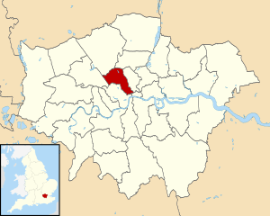
Camden shown within Greater London
|
|||
| Country | United Kingdom | ||
| Part of the UK | England | ||
| Region | London | ||
| County | Greater London | ||
| Created | 1 April 1965 | ||
| Main Office | 5 Pancras Square, King's Cross, London | ||
| Government | |||
| • Type | London borough council | ||
| • Body | Camden London Borough Council | ||
| Area | |||
| • Total | 8.4 sq mi (21.8 km2) | ||
| Area rank | 317th (of 326) | ||
| Population
(2020)
|
|||
| • Total | 270,0291 | ||
| • Rank | 57th (of 326) | ||
| • Density | 27,030/sq mi (10,436/km2) | ||
| • Density rank | 7th (of 326) | ||
| Time zone | UTC (GMT) | ||
| • Summer (DST) | UTC+1 (BST) | ||
| Postcodes |
EC, N, NW, W, WC
|
||
| Area code(s) | 020 | ||
| GSS code | E09000007 | ||
| Police | Metropolitan Police | ||
| 1 There are concerns about the accuracy of this data | |||
The London Borough of Camden is a part of Inner London, England. It is located about 1.4 miles (2.3 km) north of Charing Cross. The borough was created on April 1, 1965. It includes areas that used to be separate boroughs like Holborn, St Pancras, and Hampstead.
Camden shares parts of the West End with the City of Westminster to the south. It also borders the City of London. The southern areas are busy with shops and cultural places. In the middle, you'll find lively areas like Camden Town and Kentish Town. The northern part has green, residential areas around Hampstead Heath.
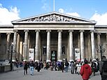
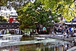
Some famous places in Camden include The British Museum, The British Library, and the views from Parliament Hill. You can also visit the London Zoo, the BT Tower, The Roundhouse music venue, and Camden Market. In 2021, Camden had a population of 210,136 people. The local government is called Camden London Borough Council.
Contents
History of Camden
The area that is now Camden was once part of Middlesex county. From 1856, the Metropolitan Board of Works managed services for London. In 1889, this area became the County of London.
Before 1900, local government was handled by different parish groups. These included Hampstead, St Pancras, and the Holborn District. In 1900, these were changed into larger areas called metropolitan boroughs. These were the Metropolitan Borough of Hampstead, the Metropolitan Borough of St Pancras, and the Metropolitan Borough of Holborn.
The London Borough of Camden was formed in 1965. This happened under the London Government Act 1963. It brought together the three metropolitan boroughs of Hampstead, Holborn, and St Pancras. These older boroughs were then closed down.
The name "Camden" was suggested by Alderman Room and Mr Wilson. They were traveling through Camden Town when they thought of it. Other names were considered, like "Fleet," after an underground river. But "Camden" was chosen because it was short, simple, and already known in the area. The name "Camden Town" comes from Charles Pratt, 1st Earl Camden. He owned and developed land there in the 1790s.
Geography and Economy
Camden has many different areas. The northern part, which was once Hampstead, includes Belsize Park and part of Kilburn. Most of the modern borough was once St Pancras. This includes places like Camden Town, Kentish Town, Gospel Oak, Somers Town, King's Cross, and parts of Highgate.
The southern part of Camden was once the Borough of Holborn. This area includes Bloomsbury and St Giles.
Camden has a strong economy. It is the seventh largest economy in the UK. Many big companies have their main offices here. For example, Google is building a large headquarters in King's Cross. Camden Town Brewery is another successful business in the borough.
In the very south, Lincoln's Inn Fields is close to the River Thames. The northern parts of Camden are less crowded. These include Hampstead, Hampstead Heath, and Kentish Town. There are many parks and open spaces in Camden.
Camden borders several other London boroughs. These include City of Westminster and City of London to the south. To the west is Brent. Barnet and Haringey are to the north. Islington is to the east.
Population and People
In 1801, the areas that make up Camden had a population of 96,795. This number grew quickly during the 1800s. It reached 270,197 by the mid-1800s. When railways arrived, population growth slowed down. Many people moved to Camden for new jobs. However, others lost their homes because of new train stations and railway lines.
The population reached its highest point in the 1890s, with 376,500 people. After this, efforts began to clear crowded areas around St Pancras and Holborn.
After World War II, more public housing was built. This was for Londoners who lost their homes in the war. Many people also moved out of London to new towns. The population kept falling until the early 1980s, reaching 161,100. Now, the population is growing again. This is due to new homes being built in former industrial areas, especially around Kings Cross.
The 2001 census counted Camden's population as 198,000. This was later updated to 202,600. In 2019, the population was estimated to be 270,000.
Ethnic Backgrounds
Camden is a diverse borough with people from many different ethnic backgrounds. The table below shows the ethnic groups of residents from the 2001, 2011, and 2021 censuses.
| Ethnic group | Year | |||||||||||||
|---|---|---|---|---|---|---|---|---|---|---|---|---|---|---|
| 1966 estimations | 1971 estimations | 1981 estimations | 1991 census | 2001 census | 2011 census | 2021 census | ||||||||
| Number | % | Number | % | Number | % | Number | % | Number | % | Number | % | Number | % | |
| White: Total | – | 94.5% | – | 92.2% | 161,478 | 88.2% | 149,490 | 82.3% | 144,896 | 73.17% | 146,055 | 66.29% | 125,064 | 59.6% |
| White: British | – | – | – | – | – | – | – | – | 104,390 | 52.72% | 96,937 | 43.99% | 74,348 | 35.4% |
| White: Irish | – | 7.7% | – | – | – | – | – | – | 9,149 | 4.62% | 7,053 | 3.20% | 5,325 | 2.5% |
| White: Gypsy or Irish Traveller | – | – | – | – | – | – | – | – | – | – | 167 | 0.08% | 128 | 0.1% |
| White: Roma | – | – | – | – | – | – | – | – | – | – | – | – | 978 | 0.5% |
| White: Other | – | – | – | – | – | – | – | – | 31,357 | 15.84% | 41,898 | 19.02% | 44,285 | 21.1% |
| Asian or Asian British: Total | 2.7% | – | – | 10,612 | 5.8% | 17,180 | 9.5% | 24,021 | 12.13% | 35,446 | 16.09% | 38,042 | 18.1% | |
| Asian or Asian British: Indian | – | – | – | – | 2,442 | 2,974 | 4,574 | 2.31% | 6,083 | 2.76% | 6,952 | 3.3% | ||
| Asian or Asian British: Pakistani | – | – | – | – | 608 | 796 | 1,250 | 0.63% | 1,489 | 0.68% | 1,610 | 0.8% | ||
| Asian or Asian British: Bangladeshi | – | – | – | – | 2,765 | 1.5% | 6,718 | 12,569 | 6.35% | 12,503 | 5.67% | 14,356 | 6.8% | |
| Asian or Asian British: Chinese | – | – | – | – | 2,271 | 2,652 | 3,470 | 1.75% | 6,493 | 2.95% | 6,728 | 3.2% | ||
| Asian or Asian British: Other Asian | – | – | – | – | 2,526 | 4,040 | 2,158 | 1.09% | 8,878 | 4.03% | 8,396 | 4.0% | ||
| Black or Black British: Total | 2.8% | – | – | 7,385 | 4% | 9,809 | 5.4% | 16,374 | 8.27% | 18,060 | 8.20% | 18,892 | 9.1% | |
| Black or Black British: African | – | 1.3% | – | – | 3,196 | 1.7% | 4,664 | 11,795 | 5.96% | 10,802 | 4.90% | 14,191 | 6.8% | |
| Black or Black British: Caribbean | – | 1.5% | – | – | 2,762 | 1.5% | 3,279 | 3,635 | 1.84% | 3,496 | 1.59% | 2,703 | 1.3% | |
| Black or Black British: Other Black | – | – | – | – | 1,427 | 1,866 | 944 | 0.48% | 3,762 | 1.71% | 1,998 | 1.0% | ||
| Mixed or British Mixed: Total | – | – | – | – | – | – | – | – | 7,429 | 3.75% | 12,322 | 5.59% | 13,938 | 6.6% |
| Mixed: White and Black Caribbean | – | – | – | – | – | – | – | – | 1,654 | 0.84% | 2,494 | 1.13% | 2,558 | 1.2% |
| Mixed: White and Black African | – | – | – | – | – | – | – | – | 1,224 | 0.62% | 1,800 | 0.82% | 2,059 | 1.0% |
| Mixed: White and Asian | – | – | – | – | – | – | – | – | 1,983 | 1.00% | 3,880 | 1.76% | 4,243 | 2.0% |
| Mixed: Other Mixed | – | – | – | – | – | – | – | – | 2,568 | 1.30% | 4,148 | 1.88% | 5,078 | 2.4% |
| Other: Total | – | – | – | – | 3,768 | 5,220 | 5,300 | 2.68% | 8,455 | 3.84% | 14,200 | 6.8% | ||
| Other: Arab | – | – | – | – | – | – | – | – | – | – | 3,432 | 1.56% | 4,417 | 2.1% |
| Other: Any other ethnic group | – | – | – | – | – | – | – | – | – | – | 5,023 | 2.28% | 9,783 | 4.7% |
| Ethnic minority: Total | – | 5.5% | – | 7.8% | 21,765 | 11.8% | 32,209 | 17.7% | 53,124 | 26.83% | 74,283 | 33.71% | 85,072 | 40.4% |
| Total | – | 100% | – | 100% | 183,243 | 100% | 181,699 | 100% | 198,020 | 100% | 220,338 | 100% | 210,136 | 100% |
|
||||||||||||||||||||||||||||||||||||||||||||||||||||||||||||||||||||||||||||||
Religious Beliefs
The table below shows the religious identities of people living in Camden. This data comes from the 2001, 2011, and 2021 censuses.
| Religion | 2001 | 2011 | 2021 | |||
|---|---|---|---|---|---|---|
| Number | % | Number | % | Number | % | |
| Holds religious beliefs | 134,545 | 67.9 | 118,949 | 54.0 | 118,581 | 56.4 |
| Christian | 93,259 | 47.1 | 74,821 | 34.0 | 65,980 | 31.4 |
| Muslim | 22,906 | 11.6 | 26,643 | 12.1 | 33,830 | 16.1 |
| Jewish | 11,153 | 5.6 | 9,823 | 4.5 | 10,079 | 4.8 |
| Hindu | 3,031 | 1.5 | 3,141 | 1.4 | 3,991 | 1.9 |
| Sikh | 443 | 0.2 | 465 | 0.2 | 487 | 0.2 |
| Buddhist | 2,595 | 1.3 | 2,789 | 1.3 | 2,410 | 1.1 |
| Other religion | 1,161 | 0.6 | 1,267 | 0.6 | 1,842 | 0.9 |
| No religion | 43,609 | 22.0 | 56,113 | 25.5 | 72,776 | 34.6 |
| Religion not stated | 19,866 | 10.0 | 45,276 | 20.5 | 18,743 | 8.9 |
| Total population | 198,020 | 100.0 | 220,338 | 100.0 | 210,100 | 100.0 |
| Note: The number of residents in the "Religion not stated" category in 2011 was overestimated due to an error processing the 2011 census data | ||||||
Famous Places and Parks
Camden is known for its many green spaces and famous attractions.
Parks and Green Spaces
London is famous for its parks, and Camden has many important ones.
- Hampstead Heath is well-known for its amazing views of London, especially from Parliament Hill. It is also famous for its wild nature and ponds.
- Camden shares Regents Park with Westminster. The views from Primrose Hill in Regent's Park are also very popular.
Popular Attractions
Here are some of the many interesting places to visit in Camden:
- Bloomsbury Theatre
- BT Tower
- Camden Arts Centre
- Camden Market
- Parts of Covent Garden
- Dickens House
- Dominion Theatre
- Euston station
- Foundling Museum
- Freud Museum
- Grant Museum of Zoology
- Gray's Inn
- Hampstead Heath
- Hatton Garden
- Highgate Cemetery
- Jewish Museum London
- Keats' House
- Kenwood House
- King's Cross railway station
- Lincoln's Inn
- London Zoo
- The Roundhouse
- Russell Square
- Shaftesbury Theatre
- Sir John Soane's Museum
- St. Pancras Library
- St Pancras railway station
- Wellcome Collection
Education in Camden
The Borough of Camden has many schools and universities. In recent years, important institutions have moved to Camden or plan to. These include Central Saint Martins and the Francis Crick Institute. Moorfields Eye Hospital also plans to move here.
Schools and Universities
The London Borough of Camden manages local education through its Children, Schools and Families department. Some of London's best universities and teaching places are in Camden.
- University College London has its main campus here.
- Part of the London School of Economics campus is near Lincoln's Inn Fields.
- Central Saint Martins is also located in Camden.
- The Architectural Association
- Birkbeck, University of London
- The British Library
- British Medical Association
- The British Museum
- Cancer Research UK
- Fordham University (London Centre)
- Friends House
- Great Ormond Street Hospital
- Goodenough College
- London School of Hygiene & Tropical Medicine
- New York University (NYU London)
- National Hospital for Neurology and Neurosurgery
- Royal Academy of Dramatic Art
- Royal Central School of Speech and Drama
- Royal College of Physicians
- Royal College of Surgeons
- Royal Veterinary College (Camden Campus)
- School of Oriental and African Studies
- Slade School of Fine Art
- University College Hospital
- The University of Law
- Wellcome Trust
Public Services
Camden provides important public services for its residents.
Police Services
The Metropolitan Police Service patrols Camden. There are two main police stations in Holborn and Kentish Town. Other contact points are available around the borough. Kentish Town Police Station is open 24 hours a day.
Hampstead Heath has its own police force, the Hampstead Heath Constabulary. They handle daily issues on the Heath. However, serious crimes are passed to the Metropolitan Police.
Camden also has a large presence of British Transport Police (BTP). This is because of the many London Underground lines and major railway stations. BTP is in charge of policing Great Britain's railway network.
Fire Services
The London Fire Brigade operates three fire stations in Camden. These are located in Euston, Kentish Town, and West Hampstead. These stations have fire engines and rescue equipment.
Public Libraries
Camden is home to the British Library, a very important national library. The borough also has many local libraries for residents.
- Swiss Cottage Library
- Holborn Library
- Camden Town Library
- Kentish Town Library
- Pancras Square Library
- West Hampstead Library
- Kilburn Library
- Highgate Library
- Queens Crescent Library
There are also community libraries, such as Keats community library.
Transportation in Camden
Camden is very important for London's transport system. It has three of the capital's biggest train stations. These stations are all located along Euston Road.
The train stations were built on Euston Road to protect the West End from too much railway development.
Train Services
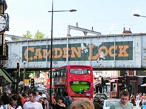
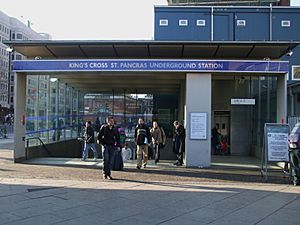
Camden has three major train terminals:
These stations connect Camden to many parts of England, Scotland, France, Belgium, and the Netherlands.
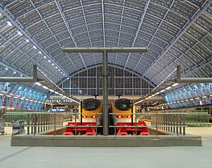
Since 2007, St Pancras International has been the new home for Eurostar trains. This has led to a major redevelopment of the area around King's Cross.
London Overground trains also run through Camden. They serve stations like Camden Road, Kentish Town West, and Hampstead Heath.
Thameslink services stop at St Pancras, Kentish Town, and West Hampstead Thameslink. The Thameslink network is currently being expanded. This will connect more places in Southern and Eastern England to Camden.
Underground (Tube) Services
The London Borough of Camden has 18 London Underground stations. Eight of the eleven tube lines serve the borough.
The main train stations are served by two Underground stations: Euston and King's Cross St Pancras. These stations are on the Circle, Hammersmith & City, Metropolitan, Northern, Piccadilly, and Victoria lines.
Other parts of Camden are served by the Central, Jubilee, and Elizabeth line.
Other Underground stations in Camden include: Euston Square, Warren Street, Goodge Street, Tottenham Court Road, Holborn, Russell Square, Chancery Lane, Mornington Crescent, Camden Town, Chalk Farm, Belsize Park, Hampstead, West Hampstead, Finchley Road, Swiss Cottage, and Kentish Town.
Future Transport Plans
The proposed High Speed 2 (HS2) railway line will end at Euston Station. This line will connect London to northern England. The planned Crossrail 2 line would also serve Euston and Tottenham Court Road Underground stations. These projects aim to handle the expected increase in passengers at Euston.
Bus Services
All bus services in Camden are run by Transport for London. Buses serve every neighborhood in the borough.
Transport Facts
In 2011, a census found how residents traveled to work:
- 21.5% used the Underground, metro, or light rail.
- 9.2% walked.
- 9.2% used a bus or minibus.
- 6.3% drove a car or van.
- 5.2% worked mainly from home.
- 4.1% used a train.
- 4.1% rode a bicycle.
The census also showed that 61% of households in Camden did not own a car. 32% had one car, and 7% had two or more cars. There were about 46,000 cars owned by Camden residents.
Speed Limits
Since December 16, 2013, Camden Council has set a speed limit of 20 miles per hour (32 km/h) across most of the borough. This is to make roads safer for people walking and cycling. Some main roads managed by Transport for London still have higher speed limits.
See also
 In Spanish: Camden (Londres) para niños


