
Georgetown County, South Carolina facts for kids
Quick facts for kids
Georgetown County
|
|||
|---|---|---|---|

Georgetown County Courthouse
|
|||
|
|||

Location within the U.S. state of South Carolina
|
|||
 South Carolina's location within the U.S. |
|||
| Country | |||
| State | |||
| Founded | 1800 | ||
| Named for | King George III | ||
| Seat | Georgetown | ||
| Largest community | Murrells Inlet | ||
| Area | |||
| • Total | 1,034.83 sq mi (2,680.2 km2) | ||
| • Land | 813.61 sq mi (2,107.2 km2) | ||
| • Water | 221.22 sq mi (573.0 km2) 21.38% | ||
| Population
(2020)
|
|||
| • Total | 63,404 | ||
| • Estimate
(2023)
|
65,731 | ||
| • Density | 77.93/sq mi (30.09/km2) | ||
| Time zone | UTC−5 (Eastern) | ||
| • Summer (DST) | UTC−4 (EDT) | ||
| Congressional district | 7th | ||

Georgetown County is a county located in the sunny state of South Carolina, USA. In 2020, about 63,404 people lived here. The main town, or county seat, is Georgetown. The county was officially started in 1769 and is named after George III of the United Kingdom, who was a king.
Georgetown County is part of the Murrells Inlet area. It's also included in the larger Myrtle Beach and Conway region.
Contents
History of Georgetown County
The story of Georgetown County is linked to how South Carolina grew. Back in 1768, the Province of South Carolina changed its many small counties. It created seven larger areas called "districts." These districts had special courts and officials to handle local issues.
George Town was one of these seven important court locations. It gave its name to the Georgetown District. This district stayed important through the American Revolution.
Later, in 1785, 34 smaller counties were created across the state. Four of these were inside the Georgetown District. But these smaller counties were removed in 1798. By 1800, all the big districts were changed into counties. This is why Georgetown County officially dates its start to the year 1800.
After the American Civil War, in 1868, the districts were renamed counties. So, Georgetown District became Georgetown County. The county is named after its main town, Georgetown. This town was named around 1734 for George III of the United Kingdom, who was a prince at the time. Today, the biggest community in the county is Murrells Inlet.
The county's economy has always been helped by its good transportation and port. This makes it a good place for trade.
Geography and Nature
Georgetown County covers about 1,035 square miles. Most of this (about 814 square miles) is land, and the rest (about 221 square miles) is water.
Many rivers flow through Georgetown County. These include the Great Pee Dee River, the Waccamaw River, Black River, and Sampit River. All these rivers flow into Winyah Bay. The Santee River forms the county's southern border and flows straight into the Atlantic Ocean. The Intracoastal Waterway, a water highway for boats, also crosses the county and Winyah Bay. These rivers and the bay have been very important for people settling and developing the area. The town of Georgetown has an excellent seaport and harbor.
Georgetown County has four main types of areas:
- The Atlantic Coastline: This area is also called Waccamaw Neck. It includes towns like Murrells Inlet, Litchfield, Pawleys Island, and DeBordieu. It's part of "The Grand Strand", a famous beach area that goes up to Myrtle Beach. This part of the Grand Strand used to be quiet, but now it's growing fast with new buildings. Some older beach houses are being replaced by bigger ones. DeBordieu is a private community with gates.
It's important to save some wild areas here. They are vital homes for migratory birds that fly along the Atlantic Flyway. Huntington Beach State Park protects some of the coastline and marshes. Nearby, Brookgreen Gardens is a historic rice plantation that now has beautiful gardens, a nature center, and outdoor sculptures. It's a popular place for visitors.
The University of South Carolina and Clemson University have a research site at Hobcaw Barony on Waccamaw Neck. The islands near Winyah Bay are protected as the "Tom Yawkey Wildlife Center Heritage Preserve." This area is special because it has the most northern natural groups of South Carolina's state tree, the sabal palmetto.
- The Riverfronts: These areas haven't changed much recently. They were once used for rice plantations. After the American Civil War, when slave labor was no longer used, the plantations slowly stopped growing rice. Today, these areas are mostly wild and can often only be reached by boat. You can still see old earthworks like dikes and water gates that were used for growing rice. Some plantation houses remain, and a few have been turned into inns or new communities. You might spot great blue herons, alligators, and even bald eagles along the waterways. Fishing is a popular activity here.
There's a small community on Sandy Island in the Pee Dee River that can only be reached by boat. The people living there are descendants of former slaves who worked on the island's plantations. They are working to protect their island from new development. The U.S. government has bought land along the rivers to create the Waccamaw National Wildlife Refuge. This refuge helps protect these wild areas. Its visitor center is in Yauhannah.
- Georgetown City: Georgetown is a small, historic city founded a long time ago. It's a popular place for tourists and a busy port for shrimp boats. Many people who travel south for the winter, called "snowbirds", stop their yachts at the docks in spring and fall as they travel along the Intracoastal Waterway.
- Inland Rural Areas: These areas are not very populated. Some higher areas are good for agriculture (farming) or forestry (growing trees for wood). Several unique round depressions called Carolina bays are found here. Scientists think they might be craters from a meteor shower. These areas are full of different kinds of plants and animals, which means they have high biodiversity. Carvers Bay, the largest one, was badly damaged during World War II when it was used for bombing practice. Draining the bay has also harmed its environment.
National Protected Areas
State and Local Protected Areas/Sites
- Baruch-North Island Reserve
- Bellefield House
- Black River Cypress Preserve
- Brookgreen Gardens
- Friendfield Village
- Georgetown Historic District
- Hobcaw House
- Huntington Beach State Park
- Mansfield Plantation
- Murrells Inlet Historic District
- North Santee Bar Seabird Sanctuary
- Pee Dee River Rice Planters Historic District
- Samworth Wildlife Management Area
- Santee-Delta Wildlife Management Area
- Tom Yawkey Wildlife Center Heritage Preserve
- Wee Tee State Forest (part)
Major Water Bodies
- Atlantic Ocean (North Atlantic Ocean)
- Black Mingo Swamp
- Black River
- Great Pee Dee River
- Intracoastal Waterway
- Little Pee Dee River
- Little River
- Long Bay
- Murrells Inlet
- North Santee River
- Sampit River
- Santee River
- South Santee River
- Waccamaw River
- Wadmacon Creek
- Winyah Bay
Adjacent Counties
- Horry County – northeast
- Marion County – north
- Williamsburg County – northwest
- Berkeley County – west
- Charleston County – southwest
Major Highways
 US 17
US 17
US 17 Alt.
US 17 Bus.
US 17 Conn. US 521

US 521 Bus. US 701
 SC 41
SC 41
SC 41 Bus. SC 51
SC 51 SC 261
 SC 513
Major Infrastructure
- Georgetown Airport
- Port of Georgetown
Population and People
| Historical population | |||
|---|---|---|---|
| Census | Pop. | %± | |
| 1790 | 22,122 | — | |
| 1800 | 22,938 | 3.7% | |
| 1810 | 15,679 | −31.6% | |
| 1820 | 17,603 | 12.3% | |
| 1830 | 19,943 | 13.3% | |
| 1840 | 18,274 | −8.4% | |
| 1850 | 20,647 | 13.0% | |
| 1860 | 21,305 | 3.2% | |
| 1870 | 16,161 | −24.1% | |
| 1880 | 19,613 | 21.4% | |
| 1890 | 20,857 | 6.3% | |
| 1900 | 22,846 | 9.5% | |
| 1910 | 22,270 | −2.5% | |
| 1920 | 21,716 | −2.5% | |
| 1930 | 21,738 | 0.1% | |
| 1940 | 26,352 | 21.2% | |
| 1950 | 31,762 | 20.5% | |
| 1960 | 34,798 | 9.6% | |
| 1970 | 33,500 | −3.7% | |
| 1980 | 42,461 | 26.7% | |
| 1990 | 46,302 | 9.0% | |
| 2000 | 55,797 | 20.5% | |
| 2010 | 60,158 | 7.8% | |
| 2020 | 63,404 | 5.4% | |
| 2023 (est.) | 65,731 | 9.3% | |
| U.S. Decennial Census 1790–1960 1900–1990 1990–2000 2010 2020 |
|||
2020 Census Information
| Race | Num. | Perc. |
|---|---|---|
| White (non-Hispanic) | 41,186 | 64.96% |
| Black or African American (non-Hispanic) | 18,051 | 28.47% |
| Native American | 111 | 0.18% |
| Asian | 258 | 0.41% |
| Pacific Islander | 27 | 0.04% |
| Other/Mixed | 1,546 | 2.44% |
| Hispanic or Latino | 2,225 | 3.51% |
In 2020, there were 63,404 people living in Georgetown County. These people lived in 25,498 households, and 17,334 of these were families.
2010 Census Information
Back in 2010, there were 60,158 people living in the county. The population density was about 74 people per square mile. The county had 33,672 housing units.
Most people (63.2%) were white, and 33.6% were Black or African American. About 3.1% of the population was of Hispanic or Latino origin. The average age of people in the county was about 45.4 years old.
Economy and Jobs
In 2022, the total value of all goods and services produced in Georgetown County, called the GDP, was about $3.3 billion. This means the county's economy is quite active! The unemployment rate, which shows how many people are looking for jobs, has been between 2.4% and 4.9% from 2022 to 2024.
Some of the biggest employers in Georgetown County are:
- AGRU
- Food Lion
- International Paper
- ScribeAmerica
- Walmart
Here's a look at the different types of jobs in Georgetown County and how much they pay:
| Industry | Number of Jobs | Job Percentage (%) | Average Yearly Pay ($) |
|---|---|---|---|
| Hotels and Restaurants | 4,463 | 18.4 | 26,000 |
| Office Support and Waste Services | 1,248 | 5.2 | 40,664 |
| Farming, Forestry, Fishing, and Hunting | 421 | 1.7 | 48,360 |
| Arts, Entertainment, and Fun | 1,420 | 5.9 | 25,532 |
| Construction | 1,358 | 5.6 | 55,016 |
| Money and Insurance | 1,204 | 5.0 | 66,144 |
| Health Care and Social Help | 3,727 | 15.4 | 52,364 |
| Information (like media and data) | 114 | 0.5 | 67,444 |
| Company Management | 78 | 0.3 | 118,924 |
| Manufacturing (making things) | 2,374 | 9.8 | 77,948 |
| Other Services (not government) | 641 | 2.6 | 36,556 |
| Professional, Science, and Tech Services | 1,074 | 4.4 | 62,140 |
| Public Administration (government jobs) | 1,272 | 5.3 | 49,556 |
| Real Estate and Rentals | 697 | 2.9 | 39,780 |
| Retail Trade (stores) | 2,969 | 12.3 | 32,448 |
| Transportation and Storage | 550 | 2.3 | 53,196 |
| Utilities (like electricity and water) | 263 | 1.1 | 86,580 |
| Wholesale Trade (selling to businesses) | 340 | 1.4 | 65,988 |
| Total | 24,213 | 100.0% | 46,531 |
Communities in Georgetown County
City
- Georgetown (the main town, or county seat)
Towns
- Andrews (partly in Williamsburg County)
- Pawleys Island
Census-Designated Places
- Murrells Inlet (the largest community)
- Garden City (mostly in Horry County)
Unincorporated Communities
- Belle Isle
- DeBordieu
- Graves
- Hopewell (partly in Williamsburg County)
- Kensington
- Litchfield Beach
- Maryville
- North Santee
- Oatland
- Plantersville
- Pleasant Hill
- Prince George
- Sampit
- Sandy Island
- Spring Gully
- Yauhannah
Images for kids
-
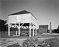
Winnowing house, Mansfield Plantation, Georgetown County
-
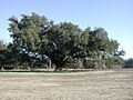
Quercus virginica, Live oak in winter. A pasture in Georgetown County.
-
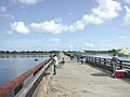
Fishing the Pee Dee off the old US 17 bridge near Georgetown
-
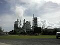
International Paper Company on the Sampit River. It is the largest employer in Georgetown County.


See also
 In Spanish: Condado de Georgetown para niños
