Nodaway County, Missouri facts for kids
Quick facts for kids
Nodaway County
|
|
|---|---|
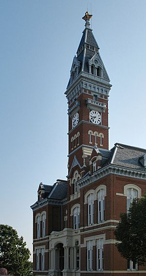
Nodaway County Courthouse
|
|
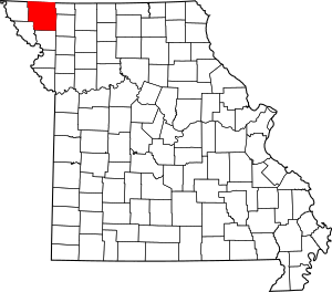
Location within the U.S. state of Missouri
|
|
 Missouri's location within the U.S. |
|
| Country | |
| State | |
| Founded | February 14, 1845 |
| Named for | Nodaway River |
| Seat | Maryville |
| Largest city | Maryville |
| Area | |
| • Total | 878 sq mi (2,270 km2) |
| • Land | 877 sq mi (2,270 km2) |
| • Water | 0.9 sq mi (2 km2) 0.1% |
| Population
(2020)
|
|
| • Total | 21,241 |
| • Density | 24.192/sq mi (9.341/km2) |
| Time zone | UTC−6 (Central) |
| • Summer (DST) | UTC−5 (CDT) |
| Congressional district | 6th |
Nodaway County is a county located in the northwest part of Missouri. In 2020, about 21,241 people lived here. Its main city and county seat is Maryville. The county was created on February 14, 1845, and is named after the Nodaway River. It is the largest county added to Missouri in the 1836 Platte Purchase. Nodaway County is also the fifth-largest county in Missouri by land area.
The county is part of the Maryville, MO Micropolitan Statistical Area. This means Maryville is a central city for the smaller towns around it.
Contents
History
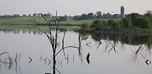
Nodaway County has a long and interesting history, especially with farming. It was home to famous horse trainers Ben Jones and Jimmy Jones. Their horses won six Kentucky Derby races and two Triple Crowns!
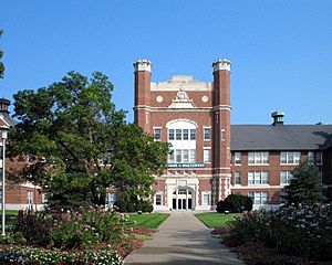
The county is also home to Northwest Missouri State University. The university's campus was designed to look like the beautiful grounds of the 1904 St. Louis World's Fair. In 1993, the state of Missouri officially named Northwest as the Missouri Arboretum. An arboretum is like a botanical garden, but for trees. The university's football team has even played in five national championship games, winning three of them!
Did you know that U.S. Supreme Court Justice Clarence Thomas once studied to become a priest at Conception Seminary College in Nodaway County? Also, the Benedictine Sisters of Perpetual Adoration convent in nearby Clyde has a huge collection of 550 relics (special items) of saints. It's the largest collection in the country!
Nodaway County is in Tornado Alley, a region where tornadoes are common. Many tornadoes have hit the county. One very strong F4 tornado on March 29, 1979, completely destroyed the town of Braddyville, Iowa, just across the county line. Tornadoes have also damaged two of the county's biggest buildings: the Administration Building at Northwest Missouri State University and Conception Abbey. The 1881 Hopkins tornado was one of the first ever recorded F5 tornadoes, which are the strongest kind.
The early life in Nodaway County was written about by Homer Croy. He was a writer from the county who wrote many books, articles, and even helped create films and Broadway shows in the 1920s and 1930s.
What's in a Name?
The name "Nodaway" has a few possible meanings. Some say it comes from a Pottawatomie word meaning "placid" (peaceful). Others say it's from a Dakota Sioux name meaning "crossed without a canoe." It might also come from different tribal names for "snake."
Geography
Nodaway County covers about 878 square miles. Most of this is land (877 square miles), with a small amount of water (0.9 square miles). It's the fifth-largest county in Missouri by land area. Iowa is to the north of Nodaway County.
The county has rolling hills and three important rivers. The Nodaway River, which the county is named after, flows through the western part. The One Hundred and Two River divides the county in half. The Platte River runs through the eastern part. Mozingo Lake is a large lake about 5 miles east of Maryville.
Nodaway County is also home to two wind farms. These farms use many tall wind turbines to create electricity from the wind. The Tenaska Clear Creek Energy Center and the White Cloud Wind Farm are both located near Maryville.
Neighboring Counties
- Page County, Iowa (northwest)
- Taylor County, Iowa (north)
- Worth County (northeast)
- Gentry County (southeast)
- Andrew County (south)
- Holt County (southwest)
- Atchison County (west)
Population Information
| Historical population | |||
|---|---|---|---|
| Census | Pop. | %± | |
| 1850 | 2,318 | — | |
| 1860 | 5,232 | 125.7% | |
| 1870 | 14,751 | 181.9% | |
| 1880 | 29,544 | 100.3% | |
| 1890 | 30,914 | 4.6% | |
| 1900 | 32,938 | 6.5% | |
| 1910 | 28,833 | −12.5% | |
| 1920 | 27,744 | −3.8% | |
| 1930 | 26,371 | −4.9% | |
| 1940 | 25,556 | −3.1% | |
| 1950 | 24,033 | −6.0% | |
| 1960 | 22,215 | −7.6% | |
| 1970 | 22,467 | 1.1% | |
| 1980 | 21,196 | −5.7% | |
| 1990 | 21,709 | 2.4% | |
| 2000 | 21,912 | 0.9% | |
| 2010 | 23,370 | 6.7% | |
| 2020 | 21,241 | −9.1% | |
| U.S. Decennial Census 1790-1960 1900-1990 1990-2000 2010 |
|||
In 2000, there were about 21,912 people living in Nodaway County. Most people (over 96%) were White. There were also smaller groups of Black or African American, Native American, and Asian people. About 0.71% of the population was Hispanic or Latino.
The average age of people in the county was 30 years old.
2020 Census
Here's a look at the different groups of people living in Nodaway County in 2020:
| Race | Num. | Perc. |
|---|---|---|
| White (NH) | 19,290 | 90.8% |
| Black or African American (NH) | 363 | 1.7% |
| Native American (NH) | 31 | 0.15% |
| Asian (NH) | 390 | 1.84% |
| Pacific Islander (NH) | 2 | 0.01% |
| Other/Mixed (NH) | 738 | 3.5% |
| Hispanic or Latino | 427 | 2% |
Getting Around
Main Roads
Bus Service
- Jefferson Lines
Airports
Nodaway County has two airports near Maryville: Northwest Missouri Regional Airport and Rankin Airport. These airports are for smaller planes and private flights, not for big commercial airlines.
Education
Public Schools
- Jefferson C-123 School District – Conception Junction
- Jefferson Elementary School (Grades PK-6)
- Jefferson High School (Grades 7-12)
- Maryville R-II School District – Maryville
- Maryville Early Childhood Center (Preschool)
- Eugene Field Elementary School (Grades K-4)
- Maryville Middle School (Grades 5-8)
- Maryville High School (Grades 9-12)
- Nodaway-Holt R-VII School District – Graham
- Nodaway-Holt Elementary School (Grades K-6)
- Nodaway-Holt Junior/Senior High School (Grades 7-12)
- North Nodaway County R-VI School District – Hopkins
- North Nodaway County Elementary School (Grades PK-5)
- North Nodaway County Junior/Senior High School (Grades 6-12)
- Northeast Nodaway County R-V School District – Ravenwood
- Parnell Elementary School (Grades PK-6)
- Northeast Nodaway County High School (Grades 7-12)
- South Nodaway County R-IV School District – Barnard
- South Nodaway County Elementary School (Grades PK-6)
- South Nodaway County High School (Grades 7-12)
- West Nodaway County R-I School District – Burlington Junction
- West Nodaway County Elementary School (Grades PK-6)
- West Nodaway County High School (Grades 7-12)
Private Schools
Colleges and Universities
- Northwest Missouri State University – Maryville – This is a public university where students can earn four-year degrees.
Public Libraries
- Maryville Public Library
Places to Visit
- Bilby Ranch Lake Conversation Area
- Benedictine Sisters of Perpetual Adoration
- Conception Abbey
- Maryville Treatment Center
- Missouri State Arboretum
- Mozingo Lake
- Nodaway County Historical Society Museum
Local Media
The county has four radio stations that broadcast from Maryville:
- KNIM - 1580 - AM
- KVVL - 97.1 - FM
- KXCV - 90.5 - FM
- KZLX-FM - 106.7 - FM
Towns and Villages
Cities
Villages
Census-Designated Places
These are areas that are like towns but not officially incorporated as cities or villages.
Places That No Longer Exist
- Allison
- Bedison
- Bell Grove
- Dawsonville
- Fairview
- Gaynor
- Orrsburg
- Prairie Park
- Possum Walk
- Pumpkin Center
- Roseberry
- Xenia
- Whitecloud
Famous People from Nodaway County
- Sarah Caldwell (1924-2006) - A famous American opera conductor and director.
- Dale Carnegie (1888-1955) - The author of the very popular book How to Win Friends and Influence People.
- Homer Croy (1883-1965) - A writer and screenwriter who wrote many stories about life in Maryville.
- Albert David (1902-1945) - A brave soldier who won the Medal of Honor during World War II.
- Forrest C. Donnell (1884–1980) - Born in Quitman, he became the Republican Governor of Missouri and later a U.S. Senator.
- Herbert Hoover (1874–1964) - He was a President of the United States! While not a true resident, he owned a farm near Graham.
- Ben A. Jones (1882-1961) and his son Horace A. "Jimmy" Jones (1906-2001) - These famous horse trainers had a farm near Parnell. They trained horses that won six Kentucky Derby races and two Triple Crowns! You can see many items from their racing days at the Nodaway County Historical Society Museum.
- Henry L. Jost (1873–1950) - He became the Mayor of Kansas City. He arrived in Hopkins as a child on an "orphan train."
- Albert P. Morehouse (1835–1891) - A Maryville resident who became the Governor of Missouri.
- Harley Race (1943-2019) - A well-known professional wrestler.
- Jerry Wallace (1928-2008) - A popular country singer and actor.
See also
 In Spanish: Condado de Nodaway para niños


