
Oxnard, California facts for kids
Quick facts for kids
Oxnard, California
|
||
|---|---|---|
.jpg) .jpg) .jpg) Clockwise: Channel Islands Harbor; Carnegie Art Museum; hotel at the beach
|
||
|
|
||
| Nickname(s):
Gateway to the Channel Islands, The Nard
|
||

Location in Ventura County and the state of California
|
||

Oxnard, California
Location in California

Oxnard, California
Location in the United States
|
||
| Country | United States | |
| State | California | |
| County | Ventura | |
| Region | Oxnard Plain | |
| Incorporated | June 30, 1903 | |
| Named for | Henry T. Oxnard | |
| Government | ||
| • Type | Council–manager | |
| Area | ||
| • City | 39.14 sq mi (101.38 km2) | |
| • Land | 26.53 sq mi (68.70 km2) | |
| • Water | 12.62 sq mi (32.68 km2) 31.41% | |
| Elevation | 52 ft (16 m) | |
| Population
(2020)
|
||
| • City | 202,063 | |
| • Rank | 1st in Ventura County 22nd in California 126th in the United States |
|
| • Density | 7,616.40/sq mi (2,940.71/km2) | |
| • Urban | 376,117 (US: 109th) | |
| • Urban density | 4,909.7/sq mi (1,895.6/km2) | |
| • Metro | 843,843 (US: 71st) | |
| Time zone | UTC−8 (Pacific) | |
| • Summer (DST) | UTC−7 (PDT) | |
| ZIP Codes |
93030–93036
|
|
| Area codes | 805 and 820 | |
| FIPS code | 06-54652 | |
| GNIS feature IDs | 1652766, 2411347 | |
Oxnard (![]() i/ˈɒksnɑːrd/) is a city in Ventura County, California. It is on California's Central Coast. Oxnard is the largest city in Ventura County. It is also the 22nd largest city in California. The city was officially formed in 1903. Oxnard is about 60 miles (97 km) northwest of downtown Los Angeles.
i/ˈɒksnɑːrd/) is a city in Ventura County, California. It is on California's Central Coast. Oxnard is the largest city in Ventura County. It is also the 22nd largest city in California. The city was officially formed in 1903. Oxnard is about 60 miles (97 km) northwest of downtown Los Angeles.
The city is located on the Oxnard Plain. This area has very rich farmland. Farmers grow strawberries, lima beans, and other vegetables here. Oxnard is also a big transportation center in Southern California. You can find Amtrak, Union Pacific, and Metrolink trains here. Greyhound buses also stop in Oxnard. The city has a small airport called Oxnard Airport (OXR). There are also important connections to nearby oil fields. These are the Oxnard Oil Field and the West Montalvo Oil Field.
In 2020, Oxnard had a population of 202,063 people. Many of its residents are of Latino heritage. It is the most populated city in the Oxnard–Thousand Oaks–Ventura, CA Metropolitan Statistical Area.
Contents
History of Oxnard


Before Europeans arrived, the Chumash Native Americans lived here. The first European explorer was Juan Rodríguez Cabrillo. He claimed the area for Spain in 1542. Later, during the mission period, Mission San Buenaventura used the land for raising cattle.
Ranching became popular among Californio settlers. But they lost their power when California became a U.S. state in 1850. Around that time, American farmers moved in. They grew crops like barley and lima beans.
Henry T. Oxnard was a businessman. He founded the American Crystal Sugar Company. He and his brothers built a large sugar beet factory in Chino, California. They decided to build another $2 million factory near Port Hueneme. A new town grew around this factory. It is now known as the Henry T. Oxnard Historic District. Henry Oxnard wanted to name the town zachari, which means "sugar" in Greek. But he got frustrated and named it after himself instead.
A railroad station was built in 1898 to serve the factory. This brought many Chinese, Japanese, and Mexican workers. The Oxnard brothers sold their factories in 1899. The Oxnard factory worked from 1899 until 1959.

Oxnard became a city in California on June 30, 1903. The public library opened in 1907. Before and during World War II, naval bases were built nearby. These were Point Mugu and Port Hueneme. They were important because this was the only major port between Port of Los Angeles and San Francisco Bay. These bases helped the defense and communications industries grow.
In the mid-1900s, Oxnard grew outside its downtown area. New homes, businesses, and a new harbor called Channel Islands Harbor were built. Martin V. ("Bud") Smith was a very important developer. He helped build many projects. These included the Wagon Wheel Junction, the Topa Financial Plaza towers, and the Channel Islands Harbor. He also developed hotels, restaurants, and shopping centers.
Geography and Climate of Oxnard
Oxnard is on the Oxnard Plain. This area has very rich soil. The city has beaches, sand dunes, wetlands, and creeks. The Santa Clara River also runs through the area. These places are home to many important plants and animals. Most native plants inside the city have been replaced by farms and buildings. The endangered Ventura Marsh Milkvetch still grows here.
Rivers and Waterways
The Santa Clara River is a natural border between Oxnard and the city of Ventura. Smaller streams like Sespe Creek and Piru Creek flow into this river.
Geology and Earthquakes
Oxnard is in an area where Earth's plates are moving. This means there can be earthquakes. The San Andreas Fault is about 40 miles (64 km) away.
The Oak Ridge Fault runs through Oxnard. It goes from the Santa Susana Mountains to the Santa Barbara Channel. This fault causes earthquakes in the area. A big earthquake in 1994, the 1994 Northridge earthquake, happened on a part of this fault. The coastline of Oxnard could also be affected by a tsunami.
Oxnard's Climate
Oxnard has a Mediterranean climate. This means it has mild, wet winters and warm, dry summers. Ocean breezes keep the city cooler in summer and warmer in winter. The average temperature is about 61°F (16°C). The weather is usually mild and sunny. Oxnard gets about 15.62 inches (39.7 cm) of rain each year.
| Climate data for Oxnard, California (Oxnard Airport), 1991–2020 normals, extremes 1923–present | |||||||||||||
|---|---|---|---|---|---|---|---|---|---|---|---|---|---|
| Month | Jan | Feb | Mar | Apr | May | Jun | Jul | Aug | Sep | Oct | Nov | Dec | Year |
| Record high °F (°C) | 94 (34) |
91 (33) |
94 (34) |
100 (38) |
98 (37) |
102 (39) |
96 (36) |
97 (36) |
105 (41) |
104 (40) |
98 (37) |
96 (36) |
105 (41) |
| Mean maximum °F (°C) | 81.7 (27.6) |
80.8 (27.1) |
82.7 (28.2) |
85.3 (29.6) |
80.6 (27.0) |
80.3 (26.8) |
83.0 (28.3) |
84.1 (28.9) |
87.6 (30.9) |
92.3 (33.5) |
86.6 (30.3) |
79.6 (26.4) |
94.8 (34.9) |
| Mean daily maximum °F (°C) | 65.9 (18.8) |
65.4 (18.6) |
65.6 (18.7) |
66.6 (19.2) |
68.0 (20.0) |
69.5 (20.8) |
72.9 (22.7) |
73.5 (23.1) |
73.5 (23.1) |
73.5 (23.1) |
70.0 (21.1) |
65.9 (18.8) |
69.2 (20.7) |
| Daily mean °F (°C) | 56.0 (13.3) |
56.6 (13.7) |
57.4 (14.1) |
58.5 (14.7) |
61.2 (16.2) |
63.7 (17.6) |
66.7 (19.3) |
67.1 (19.5) |
66.6 (19.2) |
64.5 (18.1) |
60.1 (15.6) |
56.4 (13.6) |
61.2 (16.2) |
| Mean daily minimum °F (°C) | 46.1 (7.8) |
47.7 (8.7) |
49.3 (9.6) |
50.5 (10.3) |
54.3 (12.4) |
57.9 (14.4) |
60.6 (15.9) |
60.6 (15.9) |
59.7 (15.4) |
55.4 (13.0) |
50.1 (10.1) |
46.9 (8.3) |
53.3 (11.8) |
| Mean minimum °F (°C) | 37.8 (3.2) |
38.4 (3.6) |
40.4 (4.7) |
43.1 (6.2) |
47.4 (8.6) |
50.8 (10.4) |
54.5 (12.5) |
54.5 (12.5) |
52.6 (11.4) |
47.7 (8.7) |
41.6 (5.3) |
37.4 (3.0) |
35.8 (2.1) |
| Record low °F (°C) | 26 (−3) |
28 (−2) |
31 (−1) |
31 (−1) |
34 (1) |
37 (3) |
42 (6) |
43 (6) |
40 (4) |
35 (2) |
28 (−2) |
28 (−2) |
26 (−3) |
| Average precipitation inches (mm) | 2.92 (74) |
3.26 (83) |
2.30 (58) |
0.69 (18) |
0.34 (8.6) |
0.06 (1.5) |
0.02 (0.51) |
0.01 (0.25) |
0.08 (2.0) |
0.46 (12) |
0.71 (18) |
2.08 (53) |
12.93 (328.86) |
| Average precipitation days (≥ 0.01 in) | 5.9 | 6.6 | 5.6 | 3.7 | 2.3 | 1.1 | 0.8 | 0.9 | 2.3 | 4.5 | 4.6 | 5.7 | 44.0 |
| Source 1: NOAA | |||||||||||||
| Source 2: National Weather Service | |||||||||||||
Wildlife and Local Ecology
Oxnard has important natural areas. These include coastal sage scrub and Coastal Dune Scrub. Most native plants have been cleared for farming and buildings. Small mammals like squirrels, raccoons, and skunks are common. Coyotes hunt these smaller animals. Birds and small mammals can also be food for stray pets.
Environmental Concerns
Oxnard has several power plants along its coast. These plants provide energy for nearby counties. Some plants use ocean water for cooling. The city also has environmental concerns due to farming. Farmers use Pesticides on crops like strawberries. Oxnard is a top producer of strawberries.
City Architecture and Design
Oxnard has many different building styles. Some old ranch homes are Victorian or Italian style. The Henry T. Oxnard Historic District has homes built before 1925. These include Craftsman and Revival styles.
Oxnard has a mix of neighborhoods and city areas. Most buildings are one or two stories tall. The two tallest buildings in Ventura County are in Oxnard. They are part of the Topa Financial Plaza. The city is surrounded by farms and the Pacific Ocean. The Santa Clara River is also nearby.
Ormond Beach is a beach along the Oxnard coast. It is about two miles long. The beach is next to the Ormond Wetlands. It is a great place for birdwatching. The area used to have marshes and lagoons.
Population of Oxnard
| Historical population | |||
|---|---|---|---|
| Census | Pop. | %± | |
| 1910 | 2,555 | — | |
| 1920 | 4,417 | 72.9% | |
| 1930 | 6,285 | 42.3% | |
| 1940 | 8,519 | 35.5% | |
| 1950 | 21,567 | 153.2% | |
| 1960 | 40,265 | 86.7% | |
| 1970 | 71,225 | 76.9% | |
| 1980 | 108,195 | 51.9% | |
| 1990 | 142,216 | 31.4% | |
| 2000 | 170,358 | 19.8% | |
| 2010 | 197,899 | 16.2% | |
| 2020 | 202,063 | 2.1% | |
| 2023 (est.) | 197,477 | −0.2% | |
| U.S. Decennial Census | |||
Population in 2020
| Race / Ethnicity (NH = Non-Hispanic) | Pop 2000 | Pop 2010 | Pop 2020 | % 2000 | % 2010 | % 2020 |
|---|---|---|---|---|---|---|
| White alone (NH) | 35,049 | 29,410 | 26,415 | 20.57% | 14.86% | 13.07% |
| Black or African American alone (NH) | 5,923 | 4,754 | 4,235 | 3.48% | 2.40% | 2.10% |
| Native American or Alaska Native alone (NH) | 597 | 424 | 392 | 0.35% | 0.21% | 0.19% |
| Asian alone (NH) | 12,257 | 14,084 | 14,987 | 7.19% | 7.12% | 7.42% |
| Pacific Islander alone (NH) | 562 | 537 | 489 | 0.33% | 0.27% | 0.24% |
| Other race alone (NH) | 182 | 230 | 772 | 0.11% | 0.12% | 0.38% |
| Mixed race or Multiracial (NH) | 2,981 | 2,909 | 3,789 | 1.75% | 1.47% | 1.88% |
| Hispanic or Latino (any race) | 112,807 | 145,551 | 150,984 | 66.22% | 73.55% | 74.72% |
| Total | 170,358 | 197,889 | 202,063 | 100.00% | 100.00% | 100.00% |
Population in 2010
The 2010 United States Census showed Oxnard had 197,899 people. The city had 49,797 households. About half of these households (51.8%) had children under 18. The average household had 3.95 people. The average family had 4.20 people.
The population was spread out by age. About 29.8% were under 18. About 12.1% were aged 18 to 24. The median age was 29.9 years. For every 100 females, there were 103 males.
Oxnard's Economy
Oxnard's economy includes several important areas. These are defense, international trade, farming, manufacturing, and tourism. Oxnard is a manufacturing hub in the Greater Los Angeles Area. The Port of Hueneme is a major commercial port. It helps move goods for trade with countries around the Pacific Rim. Companies like Del Monte Foods, Chiquita, and BMW use this port.
Other important industries include finance and transportation. The city also has a high-tech industry. Energy, especially petroleum, is also important. Two large oil fields are under the city. These are the Oxnard Oil Field and the West Montalvo Oil Field.
Here are some of the top employers in Oxnard:
| # | Employer | # of Employees |
|---|---|---|
| 1 | Oxnard School District | 3,870 |
| 2 | Reiter | 2,447 |
| 3 | City of Oxnard | 1,960 |
| 4 | CommonSpirit Health | 1,933 |
| 5 | Procter & Gamble | 1,898 |
| 6 | St. John's Regional Medical Center | 1,500 |
| 7 | Haas Automation | 1,390 |
| 8 | Oxnard Union High School District | 1,203 |
| 9 | Spatz Laboratories | 1,117 |
| 10 | Raypak | 557 |
Many major companies have their main offices in Oxnard. These include Haas Automation, Seminis, and Raypak. Procter & Gamble and Sysco have their West Coast operations here. In 2022, an Amazon center opened in Oxnard. It serves Ventura, Santa Barbara, and San Luis Obispo counties.
Farming and Strawberries

The Oxnard Plain is famous for its strawberries. The USDA says Oxnard is California's biggest strawberry producer. It provides about one-third of the state's strawberries. Strawberries are planted from late September to late October. Harvesting happens from mid-December to mid-July. The busiest time for harvesting is April to June. During this time, up to 10 million baskets of strawberries are shipped daily. California grows over 85% of U.S. strawberries. The U.S. grows a quarter of all strawberries worldwide.
Oxnard hosts the annual California Strawberry Festival. It has vendors and many foods made with strawberries. You can find strawberry nachos, strawberry pizza, and strawberry sundaes.
Oil Fields in Oxnard
Oxnard is located near two large active oil fields. These are the Oxnard Oil Field and the West Montalvo Oil Field. The Oxnard Refinery processes oil from these fields.
Arts and Culture in Oxnard

Oxnard has several cultural places. These include the Carnegie Art Museum. It was started in 1907 as the public library. The Channel Islands Maritime Museum is also here. The Henry T. Oxnard Historic District is near downtown. It shows how the city began.
Heritage Square in downtown has old Victorian and Craftsman houses. These homes belonged to Oxnard's first ranching families. Heritage Square is home to the Petit Playhouse and the Elite Theatre Company. The Oxnard Performing Arts and Convention Center hosts the New West Symphony.
Oxnard also has the Oxnard Independent Film Festival. The annual Channel Islands Tall Ships Festival is another event. Herzog Winery is in Oxnard, along with other wine tasting rooms. In late July, the annual Salsa Festival takes place downtown. It features salsa tasting, local bands, and food vendors.
Sports in Oxnard
The Dallas Cowboys football team holds their pre-season training camp in Oxnard. They train at River Ridge Field. The New Orleans Saints also trained here in 2011. The Los Angeles Raiders trained at River Ridge in the 1980s and 90s.
In 2016, the Los Angeles Rams (an NFL team) chose Oxnard for their team activities. The city council approved the Rams using the River Ridge Playing Fields. River Ridge Golf Course has two 18-hole courses.
Education in Oxnard
Oxnard has 54 public schools. They teach over 53,000 students from kindergarten to 12th grade.
Elementary and Junior High Schools
Four different school districts serve Oxnard. They manage schools for students from kindergarten to 8th grade:
- Hueneme School District: Serves 7,600 students at 11 schools.
- Oxnard School District: Serves 18,000 students at 21 schools.
- Ocean View Elementary School District: Serves 3,000 students at six schools.
- Rio School District: Serves 5,000 students at eight schools.
The Roman Catholic Archdiocese of Los Angeles also runs three private K-8 schools and one high school in Oxnard.
High Schools in Oxnard

All public high schools in Oxnard are part of the Oxnard Union High School District (OUHSD). This district teaches 20,000 students. High schools in Oxnard include Channel Islands High School, Hueneme High School, Oxnard High School, and Pacifica High School. Rio Mesa High School is also part of the district. A new high school, Del Sol High School, is being built.
Santa Clara High School is a private Catholic high school.
Colleges and Universities

Oxnard has Oxnard College. Nearby is California State University Channel Islands. Other universities also have campuses in Oxnard. These include California Lutheran University and University of Phoenix.
Oxnard Public Library
The city has a free public library system. There are three locations: the Downtown Main Library, the Colonia Branch Library, and the South Oxnard Branch Library. Some libraries have a Homework Center.
Transportation in Oxnard
Roads and Highways
The Ventura Freeway (US 101) is the main highway in Oxnard. It connects the city to Ventura and Santa Barbara to the northwest. It also connects to Los Angeles to the southeast. The Pacific Coast Highway (State Route 1) goes south along the coast to Malibu. Highway 34 (Fifth Street) connects downtown Oxnard to Camarillo.
Port of Hueneme
The Port of Hueneme is south of Oxnard. It is run by the United States Navy and the Oxnard Harbor District. It is the only deep-water port between the Port of Long Beach and the Port of San Francisco. It is also the only military deep-water port between San Diego Bay and Puget Sound.
The Port of Hueneme is a key place for shipping goods. It handles cars, pineapples, and bananas. Farm products like onions, strawberries, and flowers are also shipped from here. The U.S. Navy has a base here. It is home to the "Seabees".
Channel Islands Harbor
Channel Islands Harbor is a place for recreational boating and commercial fishing. It is called the "Gateway to the Channel Islands." This is because boats leave from here to go to the islands. Both this harbor and Ventura Harbor are important for fishing.
Oxnard Airport
Oxnard Airport is a general aviation airport in the city. It is owned by Ventura County. It does not currently have commercial airline service.
Public Transportation

The Oxnard Transit Center is a major hub for public transport.
Train Services
- Metrolink: Provides commuter train service to Los Angeles on weekdays.
- Amtrak: Offers daily train service to Los Angeles and San Diego. Some trains go north to San Luis Obispo. The Coast Starlight train also stops here.
Bus Services
- Gold Coast Transit District: Runs local bus service in Oxnard and nearby cities. Its main hub is the Oxnard Transit Center.
- VCTC Intercity: Operates buses that connect to the San Fernando Valley and Santa Barbara.
Notable People from Oxnard
Authors
- Gilbert, Jaime, and Mario Hernandez: They created the comic book Love and Rockets.
- Michele Serros: An American author and writer for the George Lopez TV show.
Musicians and Singers
- Ritchie Blackmore: Guitarist for Deep Purple.
- Sonny Bono & Cher: Famous pop duo and TV stars. They had a beach home in Oxnard Shores.
- Dave Grohl: Musician.
- Madlib: A record producer and musician known for his work in jazz and hip-hop.
- Anderson .Paak: A rapper, singer, and drummer.
- Shirley Verrett: An opera singer.
Scholars and Scientists
- William Bright: A linguist who studied Native American and South Asian languages.
- Robert P. Sharp: An expert on the geology of Earth and Mars. He was born and raised in Oxnard.
Businesspeople
- Martin V. ("Bud") Smith: A major developer and giver to charity in the Oxnard area.
- Stanley Clark Meston: An architect famous for designing the original golden arches of McDonald's restaurants. He was born in Oxnard.
Actors and TV Personalities
- Walter Brennan: An actor who won three Academy Awards. He died in Oxnard.
- Miles Brown: An actor known for his role on the sitcom Black-ish.
- John Carradine: An actor who lived in Oxnard for many years.
- Brad Garrett: An actor born in Oxnard.
- Isiah Mustafa: Known as the "Old Spice Guy" and a former NFL player.
Athletes and Sportspeople
- The Bryan brothers: Professional tennis doubles players.
- Tony Ferguson: A professional mixed martial artist.
- Mikey Garcia: A boxer.
- Robert Garcia: A retired professional boxer and former champion.
- Herculez Gomez: A soccer player.
- Jim Hall: A race car driver and car owner who won the Indianapolis 500 twice.
- Lemuel Clarence "Bud" Houser: A track athlete who won many Olympic gold medals.
- Marion Jones: An athlete and multiple Olympic gold medalist.
- Victor Ortíz: A professional boxer.
- Corey Pavin: A professional golfer who won the 1995 U.S. Open.
- Terry Pendleton: A retired baseball player and 1991 National League MVP.
- Fernando Vargas: A retired boxer and two-time boxing champion.
- Dmitri Young: A baseball player.
Sister City

Oxnard is a sister city with ![]() Ocotlán, Jalisco in Mexico. This connection was celebrated with a special flag around 1976.
Ocotlán, Jalisco in Mexico. This connection was celebrated with a special flag around 1976.
Images for kids
-
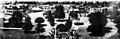
Downtown Oxnard, early 1900s
-
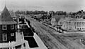
Oxnard, 1908. The public library is at the right.
See also
 In Spanish: Oxnard para niños
