
Ste. Genevieve County, Missouri facts for kids
Quick facts for kids
Ste. Genevieve County
|
|
|---|---|

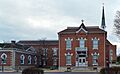
Ste. Genevieve County Courthouse
|
|

Location within the U.S. state of Missouri
|
|
 Missouri's location within the U.S. |
|
| Country | |
| State | |
| Founded | October 1, 1812 |
| Named for | Saint Genevieve |
| Seat | Ste. Genevieve |
| Largest city | Ste. Genevieve |
| Area | |
| • Total | 507 sq mi (1,310 km2) |
| • Land | 499 sq mi (1,290 km2) |
| • Water | 7.6 sq mi (20 km2) 1.5% |
| Population
(2020)
|
|
| • Total | 18,479 |
| • Density | 36.45/sq mi (14.073/km2) |
| Time zone | UTC−6 (Central) |
| • Summer (DST) | UTC−5 (CDT) |
| Congressional district | 8th |
Ste. Genevieve County is a county in the eastern part of Missouri. It is often called Sainte Genevieve County. In 2020, about 18,479 people lived there. The biggest city and the main government center is Ste. Genevieve. The county officially started on October 1, 1812. It is named after Saint Genevieve, who is the patron saint of Paris, France.
Ste. Genevieve County is home to Ste. Genevieve city. This city was the first permanent settlement west of the Mississippi River. It was also one of the first French colonial villages in the mid-Mississippi Valley. It is one of the few places where a special French language, called Paw Paw French, is still spoken.
Contents
History of Ste. Genevieve County
Ste. Genevieve County is on the west side of the Mississippi River. It is about 60 miles (97 km) south of St. Louis. Ste. Genevieve is the main town and the county seat. About 5,000 people live there.
When Was Ste. Genevieve Founded?
Ste. Genevieve was the first lasting settlement in Missouri. The exact year it was founded is not fully clear. Many people believe it was founded in 1735. This date is supported by early settlers' families and old history books.
However, some historians, like Dr. Carl J. Ekberg, think it was closer to 1750. They base this on old letters, maps, and church records. So, Ste. Genevieve is about 250 years old.
Early French Control
The village of Ste. Genevieve was first part of what was called the Illinois Country. This was a large area claimed by the French. It stretched from the mouth of the Ohio River north to the Great Lakes. It also included the valleys of the Mississippi, Missouri, and Ohio rivers.
The French government for this area was in New Orleans. Later, what is now Missouri became part of the Upper Louisiana Territory. French explorers and settlers were in the Ste. Genevieve area very early in the 1700s.
Why Ste. Genevieve Was Important
Salt was very important long ago. People used it to keep food fresh and to cure animal hides. Early French settlers quickly found salt springs near Ste. Genevieve. These springs were on Saline Creek.
Exploring for minerals also brought people like Renault and La Motte to the area. Some of the first lead mines were named after La Motte. These mines were in nearby Madison County.
Farming was probably the biggest reason Ste. Genevieve grew. Across the Mississippi River, in places like Fort de Chartres and Kaskaskia, there was a need for more farmland. A large, fertile area called the "Grand Champ" (Big Field) was across the river. The "Old Town" of Ste. Genevieve was first built here. It was about three miles south of where Ste. Genevieve is today.
Moving the Town
Ste. Genevieve was first a smaller community connected to older French towns. These towns were on the east side of the Mississippi River. They included Cahokia, Kaskaskia, and Prairie du Rocher. The rich farmland by the river attracted many early French pioneers to Ste. Genevieve.
All official business for Ste. Genevieve was done in Kaskaskia until about 1766. That's when the first leader, Philippe de Rocheblave, came to Ste. Genevieve. More French people moved to the village from the east side of the river. They wanted to escape British rule after France lost the Seven Years' War.
The town moved to its current higher spot after terrible floods in 1785. One person said that the old village had about 50 or 60 houses. The floodwaters covered the houses, reaching 12 to 15 feet deep in many places. The Mississippi River was the main way to travel for many years. It helped people move goods and travel up and down the river. The first ferry service between Ste. Genevieve and Illinois started around 1800.
Native Americans and New Settlers
When Missouri was first settled, the Osage Native Americans lived between the Osage River and the Mississippi. They were related to the Sioux and were not friendly with the white settlers. Around 1787, the Spanish government, which then owned the land, brought in Shawnee and Delaware Native Americans. These tribes were friendly with the French and helped protect settlers from the Osage.
After the French settled Ste. Genevieve, the first English-speaking American settlers arrived around 1788. They came upriver from places like Cape Girardeau. After the American Revolutionary War, more Americans started moving into the Ste. Genevieve area around 1794. They came from states like Pennsylvania, Virginia, Kentucky, and Tennessee.
This flow of new settlers increased in the early 1800s. In 1800, France took back Louisiana from Spain. Then, in 1803, Napoleon Bonaparte sold it to the United States. This was known as the Louisiana Purchase. U.S. officials took control in 1804. Ste. Genevieve County was formed in 1812. It was one of the first counties in the Louisiana Territory. It is bordered by the Mississippi River to the east, Jefferson County to the north, St. Francois County to the west, and Perry County to the south.
Around 1840, German Catholics began settling near New Offenburg and Zell. Soon after, German Lutherans also moved into Ste. Genevieve from Perry County. However, even by 1930, most people in Ste. Genevieve were Catholic.
Geography of Ste. Genevieve County
The county covers a total area of 507 square miles (1,313 km²). About 499 square miles (1,292 km²) of this is land. The remaining 7.6 square miles (20 km²) is water, which is about 1.5% of the total area. The northeastern edge of the county is formed by the Mississippi River, which separates it from Illinois.
Neighboring Counties
- Jefferson County (northwest)
- Monroe County, Illinois (northeast)
- Randolph County, Illinois (east)
- Perry County (southeast)
- St. Francois County (southwest)
Main Roads in Ste. Genevieve County
 Interstate 55
 U.S. Route 61
 Route 32
Protected Natural Areas
- Mark Twain National Forest (part of it is in the county)
Hills and Mountains
- Haney Hill
- Mertell Hill
- Pikes Peak
- St. Francois Mountains
Valleys and Hollows
- Bidwell Hollow
- Corn Hollow
- Henry Hollow
- Lick Hollow
- Morrison Hollow
- Snell Hollow
- Staples Hollow
- Wolf Hollow
Population and People
| Historical population | |||
|---|---|---|---|
| Census | Pop. | %± | |
| 1820 | 4,962 | — | |
| 1830 | 2,186 | −55.9% | |
| 1840 | 3,148 | 44.0% | |
| 1850 | 5,313 | 68.8% | |
| 1860 | 8,029 | 51.1% | |
| 1870 | 8,384 | 4.4% | |
| 1880 | 10,390 | 23.9% | |
| 1890 | 9,883 | −4.9% | |
| 1900 | 10,359 | 4.8% | |
| 1910 | 10,607 | 2.4% | |
| 1920 | 9,809 | −7.5% | |
| 1930 | 10,097 | 2.9% | |
| 1940 | 10,905 | 8.0% | |
| 1950 | 11,237 | 3.0% | |
| 1960 | 12,116 | 7.8% | |
| 1970 | 12,867 | 6.2% | |
| 1980 | 15,180 | 18.0% | |
| 1990 | 16,037 | 5.6% | |
| 2000 | 17,842 | 11.3% | |
| 2010 | 18,145 | 1.7% | |
| 2020 | 18,479 | 1.8% | |
| U.S. Decennial Census 1790-1960 1900-1990 1990-2000 2010-2015 2020 |
|||
In 2000, there were 17,842 people living in the county. There were 6,586 households and 4,926 families. The population density was about 36 people per square mile (14 people/km²).
Most people in the county were White (98.03%). About 0.72% were Black or African American. About 0.74% of the population was Hispanic or Latino.
In terms of age, 26.60% of the people were under 18. About 14.50% were 65 years or older. The average age was 38 years old. For every 100 females, there were about 101 males.
The average income for a household in the county was $48,764. For a family, it was $56,170. About 8.20% of the population lived below the poverty line. This included 11.30% of those under 18.
2020 Census Information
| Race | Num. | Perc. |
|---|---|---|
| White (NH) | 17,127 | 92.7% |
| Black or African American (NH) | 320 | 1.73% |
| Native American (NH) | 54 | 0.3% |
| Asian (NH) | 29 | 0.16% |
| Pacific Islander (NH) | 2 | 0.01% |
| Other/Mixed (NH) | 678 | 3.67% |
| Hispanic or Latino | 269 | 1.46% |
Education in Ste. Genevieve County
Most adults (73.8%) aged 25 and older in Ste. Genevieve County have a high school diploma or higher. About 8.1% have a bachelor's degree or higher.
Public Schools
- Ste. Genevieve County R-II School District - Ste. Genevieve
- Bloomsdale Elementary School - Bloomsdale (Grades K-5)
- Ste. Genevieve Elementary School (Grades K-5)
- Ste. Genevieve Middle School (Grades 6-8)
- Ste. Genevieve High School (Grades 9-12)
Private Schools
- Sacred Heart School - St. Mary (Grades K-5) - Catholic
- St. Agnes Catholic Elementary School - Bloomsdale (Grades PK-8) - Catholic
- St. Joseph Elementary School - Ste. Genevieve (Grades PK-5) - Catholic
- Valle Catholic Schools - Ste. Genevieve (Grades K-12) - Catholic
- Valle Catholic Grade School (Grades K-8)
- Valle Catholic High School (Grades 9-12)
Public Library
- Sainte Genevieve County Library
Communities in Ste. Genevieve County
Cities
- Bloomsdale
- St. Mary
- Ste. Genevieve (county seat)
Census-Designated Places (CDPs)
These are areas that are like towns but are not officially incorporated as cities.
- Goose Creek Lake
- Grayhawk
- Ozora
- Weingarten
Unincorporated Communities
These are smaller communities that are not part of any city or CDP.
Ghost Towns
These are towns that no longer exist or are abandoned.
Townships
Townships are smaller divisions within a county.
- Beauvais
- Jackson
- Ste. Genevieve
- Saline
- Union
Images for kids
-
Ste. Genevieve County Courthouse
See also
 In Spanish: Condado de Sainte Geneviève para niños
