Lincoln, Nebraska facts for kids
Quick facts for kids
Lincoln
|
|||
|---|---|---|---|
|
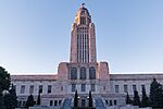
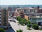
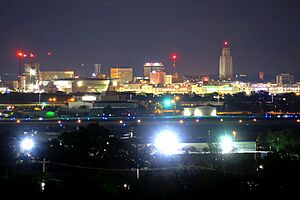
Downtown Lincoln skyline
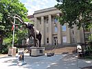
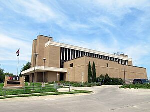
University of Nebraska State Museum
|
|||
|
|||
| Nickname(s):
Star City
|
|||
| Country | |||
| State | |||
| County | Lancaster | ||
| Founded | 1856 (Lancaster) | ||
| Renamed | July 29, 1869 (Lincoln) | ||
| Incorporated | April 1, 1869 | ||
| Named for | Abraham Lincoln | ||
| Government | |||
| • Type | Strong mayor–council | ||
| Area | |||
| • State capital city | 100.45 sq mi (260.16 km2) | ||
| • Land | 99.09 sq mi (256.63 km2) | ||
| • Water | 1.36 sq mi (3.52 km2) 1.4% | ||
| • Urban | 94.17 sq mi (243.9 km2) | ||
| • Metro | 1,422.269 sq mi (3,683.660 km2) | ||
| • CSA | 2,282.229 sq mi (5,910.95 km2) | ||
| Elevation | 1,201 ft (366 m) | ||
| Population
(2020)
|
|||
| • State capital city | 291,082 | ||
| • Estimate
(2023)
|
294,757 | ||
| • Density | 2,937.67/sq mi (1,134.24/km2) | ||
| • Urban | 291,217 (US: 139th) | ||
| • Urban density | 3,092.3/sq mi (1,193.9/km2) | ||
| • Metro | 342,117 (US: 152nd) | ||
| • Metro density | 240.5/sq mi (92.9/km2) | ||
| • CSA | 363,733 (US: 104th) | ||
| • CSA density | 159.4/sq mi (61.5/km2) | ||
| Demonym(s) | Lincolnite | ||
| GDP | |||
| • Metro | $25.459 billion (2022) | ||
| Time zone | UTC−6 (CST) | ||
| • Summer (DST) | UTC−5 (CDT) | ||
| ZIP code(s) |
68501-68510, 68512, 68514, 68516-68517, 68520-68524, 68526-68529, 68531, 68542, 68544, 68583, 68588
|
||
| Area codes | 402, 531 | ||
| FIPS code | 31-28000 | ||
| GNIS feature ID | 837279 | ||
| Website | lincoln.ne.gov | ||
| α. ^ Area, city density, metro population/density and CSA population/density as of the 2021 estimate. β. Urban population/density as of the 2020 Census. |
|||
Lincoln is the capital city of Nebraska, a state in the United States. It is also the main city of Lancaster County. The city covers about 100 square miles (260 km²) and had an estimated population of 294,757 people in 2023. Lincoln is the second-largest city in Nebraska and the 71st-largest in the U.S. It is an important center for business and culture for the wider Lincoln area, which includes over 361,000 people.
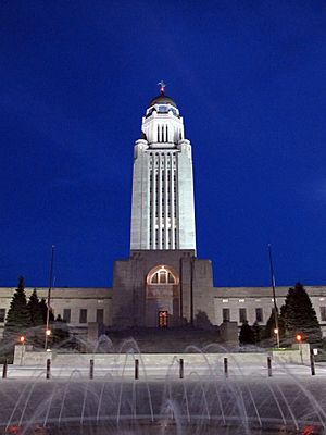
Lincoln started as a village called Lancaster in 1856. It was built on salt marshes. Later, it was renamed after President Abraham Lincoln and became Nebraska's state capital in 1869. The impressive Nebraska State Capitol building was finished in 1932. It is the second-tallest capitol building in the country. Because Lincoln is the state capital, the government is a major employer here. The University of Nebraska was also founded in Lincoln in 1869. It is the largest university in Nebraska and a big employer in the city. Other important jobs are in services and manufacturing, including a growing high-tech industry. This area is sometimes called the "Midwest Silicon Prairie".
Since the 1970s, the U.S. Department of State has called Lincoln a "refugee-friendly" city. This means it welcomes people who have had to leave their home countries. By 2000, it was the 12th-largest place for refugees to settle in the U.S. Many people from Vietnam, the Karen people (from Myanmar), Sudan, and the Yazidi people (from Iraq) have made Lincoln their new home. In the 2018–19 school year, Lincoln Public Schools helped about 3,000 students from 150 countries who spoke 125 different languages.
History of Lincoln
Who Lived Here First?
Before settlers moved west, the land was covered with buffalo grass. Plains Indian tribes lived and hunted along Salt Creek. The Pawnee lived in villages along the Platte River. The Great Sioux Nation used Nebraska for hunting. They did not have long-term settlements here. Sometimes, a buffalo could still be seen in Lincoln in the 1860s.
How Lincoln Was Founded
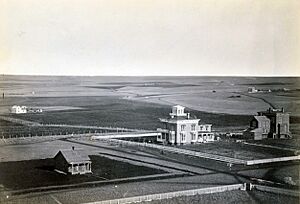
Lincoln began in 1856 as a village called Lancaster. It became the main town of the new Lancaster County in 1859. The village was built near Salt Creek. Early settlers came because there was a lot of salt. But later, salt from Kansas became cheaper.
Captain W. T. Donovan and his family settled here in 1856. In 1859, the settlers chose Lancaster as the county seat. After the Homestead Act of 1862, more people moved to the area. The first official map of the town was made on August 6, 1864.
By late 1868, Lancaster had about 500 people. The town was renamed Lincoln and became a city on April 1, 1869. In 1869, the University of Nebraska was started in Lincoln. It received a large land grant. The first university building began construction that same year.
Becoming the State Capital
Nebraska became a state on March 1, 1867. Before this, the capital of the Nebraska Territory was Omaha. Most people in the territory lived south of the Platte River. The state legislature decided to move the capital south of the river.
To try and stop the move, an Omaha senator suggested naming the new capital after President Abraham Lincoln. Many people south of the Platte River had supported the Confederacy in the Civil War. The senator thought they would not vote for a city named after Lincoln. But the plan failed, and the vote to move the capital passed in 1867.
The new law created a Capital Commission to choose the exact spot. On July 18, 1867, the Commission visited different places. They chose Lancaster because of its salt flats. Lancaster only had about 30 residents then. The Commission made a new, larger map for Lincoln. To pay for the new capital building, they sold land lots.
More people started to arrive, and Lincoln's population grew. The first Nebraska State Capitol building was finished on December 1, 1868. It was a two-story building made of local stone. The Kennard house, built in 1869, is the oldest building still standing from Lincoln's original layout.
In 1888, a new capitol building was built because the first one was not strong enough. A third capitol building started construction in 1922. Bertram G. Goodhue was chosen as the architect. By 1924, the first part was done, and state offices moved in. The old capitol building was torn down in 1925. The new capitol was built in four stages, finishing in 1932. It is the second-tallest capitol building in the U.S.
How Lincoln Grew and Expanded
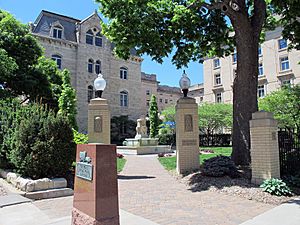
In the 1890s, a worldwide economic slowdown caused Lincoln's population to drop. But then it started to grow again. Many German immigrants from Russia settled in the North Bottoms area. As Lincoln grew, it started to add nearby towns. Normal was the first town added in 1919. Bethany Heights was added in 1922. In 1926, University Place joined Lincoln. College View was added in 1929. Union College, a Seventh-day Adventist school, was founded in College View in 1891. In 1930, Lincoln also added Havelock.
Trains helped Lincoln grow a lot. The first train arrived in Lincoln on June 26, 1870. More railroads like the Midland Pacific (1871) and the Atchison and Nebraska (1872) soon followed. The Union Pacific started service in 1877. By 1892, Lincoln became a major train hub.
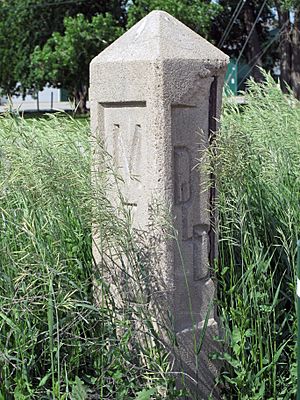
As cars became popular, better roads were needed. In 1911, the Omaha-Lincoln-Denver Highway (O-L-D) was created through Lincoln. The goal was to make travel easier across Nebraska. In 1920, this highway became part of the Detroit-Lincoln-Denver Highway (D-L-D). This highway aimed to connect Detroit to Denver. By the mid-1920s, it was a 1,700-mile (2,700 km) highway through six states. Businesses grew along the route to serve travelers. In 1926, it became part of the Federal Highway System, known as U.S. Route 38.
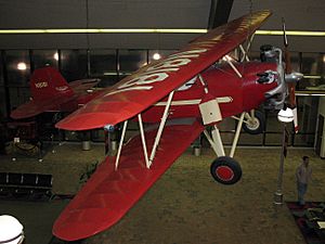
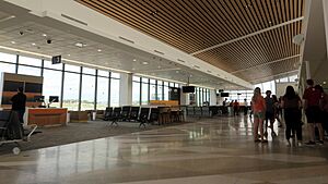
In the early days of flying, Lincoln had three airports. Union Airport opened in 1920. The Lincoln Flying School was founded by E.J. Sias. Charles Lindbergh was a student there in 1922. Another airport, Arrow Airport, was used for making and testing planes like the Arrow Sport. An Arrow Sport plane is now on display at the Lincoln Airport.
As travel by train, car, and plane increased, businesses thrived. Lincoln's population grew by 38.2% from 1920 to 1930. In 1930, the city's small airport was named Lindbergh Field for a short time. It was a stop for United Airlines and for mail delivery.
In 1942, the Lincoln Army Airfield was built. During World War II, the U.S. Army trained many aviation mechanics there. The Army closed the base in 1945. But the Air Force reopened it in 1952 during the Korean War. In 1966, after the Air Force left, Lincoln took over the airfield. It became the Lincoln Municipal Airport, and later the Lincoln Airport.
In 1966, Lincoln also added the town of West Lincoln. West Lincoln had voted against joining Lincoln. But a new state law in 1965 allowed cities to add nearby areas without a vote.
Modern Growth and Changes
From 1959 to 1984, many stores moved from downtown Lincoln to the Gateway Shopping Mall. This mall opened in 1960. By 1984, most of Lincoln's sales tax money came from near the mall. This caused downtown to decline.
In 1969, Nebraska passed laws for urban renewal. Lincoln started projects to improve and beautify the city. Many old buildings were torn down. New buildings like the Sheldon Memorial Art Gallery and the First National Bank Building were built.
In 1974, Kawasaki Heavy Industries opened a factory in Lincoln to make motorcycles. Lincoln's first woman mayor, Helen Boosalis, was elected in 1975. She strongly supported downtown improvements. In 1979, the Centrum, a downtown shopping mall with a parking garage, opened.
After the Vietnam War ended in 1975, many Vietnamese refugees came to Lincoln. They created a large community along 27th Street. Lincoln was named a "Refugee Friendly" city. By 2000, Lincoln was the 12th-largest place for refugees to settle in the U.S. As of 2011, Lincoln had the second-largest Karen (from Myanmar) population in the U.S. Many people from Sudan and Iraq have also settled here. In recent years, Lincoln has had the largest Yazidi (from Iraq) population in the U.S. The number of immigrant and refugee students in Lincoln Public Schools grew by 52% from 2014 to 2017.
From 1990 to 2000, Lincoln's population grew a lot. New homes and businesses were built. New housing developments appeared in south Lincoln. The Southpointe Pavilions shopping center was also built.
In 2001, Westfield America Trust bought Gateway Mall. They made a $45 million makeover in 2005. In 2012, the mall was sold again and renamed Gateway Mall.
In 2015, ALLO Communications announced it would bring very fast fiber internet to the city. Construction began in 2016. This was one of the largest building projects in the U.S. In 2017, Lincoln was named a Smart Gigabit Community.
In 2022, Lincoln adopted a new city flag. It was designed by Ed Mejia, an artist from El Salvador. The flag shows the Lincoln skyline.
Geography of Lincoln
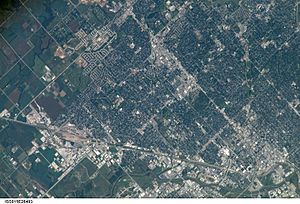
Lincoln covers about 99 square miles (256 km²) of land and 1.3 square miles (3.5 km²) of water.
Lincoln is one of the few large cities in Nebraska not located along the Platte River or the Missouri River. The city was first built near Salt Creek and the flat, salty wetlands. As the city grew, it expanded into the surrounding gently rolling hills. Lincoln's growth northward has affected the home of the endangered Salt Creek tiger beetle.
Lincoln's Metropolitan Area
The Lincoln Metropolitan Statistical Area includes Lancaster County and Seward County. Seward County was added in 2003. Lincoln is also part of the Lincoln-Beatrice Combined Statistical Area. This area includes the city of Beatrice in Gage County. This combined area is home to 363,733 people (2021 estimate). It is the 104th-largest combined statistical area in the U.S.
Neighborhoods in Lincoln
Lincoln has both old and new neighborhoods. Some neighborhoods used to be small towns that Lincoln later added, like University Place (1926), Bethany (1922), College View (1929), Havelock (1930), and West Lincoln (1966). There are several Historic Districts near downtown. Newer neighborhoods are mostly in the south and east. As of 2013, Lincoln had 45 registered neighborhood groups.
The downtown area has seen a lot of new homes built recently. In 2010, there were 1,200 people living downtown. By 2016, there were 3,000 people. This means demand for housing has grown faster than supply. Home prices and rent costs have gone up.
Lincoln's Climate
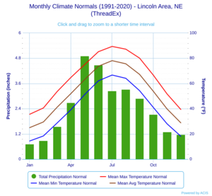
Lincoln is in the Great Plains, far from mountains or large bodies of water. This means it has a very changeable four-season climate. Winters are cold, and summers are hot. Most rain falls in the warmer months, often with thunderstorms and sometimes tornadoes.
Lincoln gets about 26 inches (66 cm) of snow each winter. But the amount of snow can vary a lot, from 7.2 inches (18 cm) to 55.5 inches (141 cm). Freezing temperatures usually occur from October 7 to April 25. This allows for a growing season of 164 days.
The average daily temperature ranges from 25.0°F (-3.9°C) in January to 78.1°F (25.6°C) in July. Lincoln can have very cold winters and very hot summers. Temperatures can drop to 0°F (-18°C) or lower about 10 days a year. It can reach 90°F (32°C) or higher about 42 days a year. The highest temperature ever recorded was 115°F (46°C) in July 1936. The lowest was -33°F (-36°C) in January 1974.
In May 2019, an EF2 tornado hit parts of western Lincoln. Luckily, no major injuries happened.
| Climate data for Lincoln Airport, Nebraska, 1991–2020 normals, extremes 1887–present | |||||||||||||
|---|---|---|---|---|---|---|---|---|---|---|---|---|---|
| Month | Jan | Feb | Mar | Apr | May | Jun | Jul | Aug | Sep | Oct | Nov | Dec | Year |
| Record high °F (°C) | 73 (23) |
83 (28) |
91 (33) |
97 (36) |
104 (40) |
108 (42) |
115 (46) |
110 (43) |
106 (41) |
98 (37) |
85 (29) |
75 (24) |
115 (46) |
| Mean maximum °F (°C) | 58.9 (14.9) |
64.9 (18.3) |
77.9 (25.5) |
86.5 (30.3) |
91.9 (33.3) |
96.6 (35.9) |
100.1 (37.8) |
98.6 (37.0) |
94.6 (34.8) |
86.9 (30.5) |
73.4 (23.0) |
60.7 (15.9) |
101.7 (38.7) |
| Mean daily maximum °F (°C) | 35.6 (2.0) |
40.6 (4.8) |
53.6 (12.0) |
64.8 (18.2) |
75.0 (23.9) |
85.2 (29.6) |
89.4 (31.9) |
87.2 (30.7) |
80.1 (26.7) |
66.6 (19.2) |
51.7 (10.9) |
39.4 (4.1) |
64.1 (17.8) |
| Daily mean °F (°C) | 25.0 (−3.9) |
29.5 (−1.4) |
41.2 (5.1) |
52.0 (11.1) |
63.1 (17.3) |
73.7 (23.2) |
78.1 (25.6) |
75.6 (24.2) |
67.2 (19.6) |
53.8 (12.1) |
39.8 (4.3) |
28.8 (−1.8) |
52.3 (11.3) |
| Mean daily minimum °F (°C) | 14.4 (−9.8) |
18.4 (−7.6) |
28.7 (−1.8) |
39.2 (4.0) |
51.2 (10.7) |
62.1 (16.7) |
66.7 (19.3) |
64.1 (17.8) |
54.3 (12.4) |
41.0 (5.0) |
28.0 (−2.2) |
18.2 (−7.7) |
40.5 (4.7) |
| Mean minimum °F (°C) | −7.7 (−22.1) |
−2.4 (−19.1) |
7.5 (−13.6) |
21.2 (−6.0) |
34.7 (1.5) |
47.9 (8.8) |
54.0 (12.2) |
51.2 (10.7) |
37.4 (3.0) |
22.7 (−5.2) |
10.7 (−11.8) |
−2.5 (−19.2) |
−11.7 (−24.3) |
| Record low °F (°C) | −33 (−36) |
−31 (−35) |
−19 (−28) |
3 (−16) |
24 (−4) |
39 (4) |
45 (7) |
39 (4) |
26 (−3) |
3 (−16) |
−15 (−26) |
−27 (−33) |
−33 (−36) |
| Average precipitation inches (mm) | 0.73 (19) |
0.89 (23) |
1.55 (39) |
2.69 (68) |
4.91 (125) |
4.48 (114) |
3.25 (83) |
3.32 (84) |
2.90 (74) |
2.14 (54) |
1.30 (33) |
1.18 (30) |
29.34 (745) |
| Average snowfall inches (cm) | 6.5 (17) |
7.1 (18) |
3.4 (8.6) |
1.2 (3.0) |
0.1 (0.25) |
0.0 (0.0) |
0.0 (0.0) |
0.0 (0.0) |
0.0 (0.0) |
0.9 (2.3) |
1.5 (3.8) |
5.3 (13) |
26.0 (66) |
| Average precipitation days (≥ 0.01 in) | 5.9 | 6.1 | 8.1 | 9.7 | 11.8 | 10.4 | 8.9 | 8.8 | 7.2 | 7.1 | 5.4 | 5.9 | 95.3 |
| Average snowy days (≥ 0.1 in) | 5.0 | 4.5 | 2.2 | 0.6 | 0.1 | 0.0 | 0.0 | 0.0 | 0.0 | 0.3 | 1.4 | 3.8 | 17.9 |
| Average relative humidity (%) | 70.3 | 72.5 | 69.1 | 63.6 | 66.9 | 65.2 | 65.4 | 68.9 | 70.1 | 67.1 | 71.5 | 73.1 | 68.6 |
| Average dew point °F (°C) | 13.3 (−10.4) |
18.7 (−7.4) |
28.2 (−2.1) |
37.9 (3.3) |
50.2 (10.1) |
59.2 (15.1) |
64.2 (17.9) |
63.0 (17.2) |
54.1 (12.3) |
41.4 (5.2) |
28.9 (−1.7) |
17.1 (−8.3) |
39.7 (4.3) |
| Mean monthly sunshine hours | 176.8 | 167.6 | 211.9 | 236.4 | 273.3 | 314.4 | 329.9 | 294.9 | 236.4 | 216.9 | 156.4 | 146.8 | 2,761.7 |
| Percent possible sunshine | 59 | 56 | 57 | 59 | 61 | 70 | 72 | 69 | 63 | 63 | 52 | 51 | 52 |
| Source: NOAA (relative humidity, dew point and sun 1961–1990) | |||||||||||||
People of Lincoln
| Historical population | |||
|---|---|---|---|
| Census | Pop. | %± | |
| 1870 | 2,441 | — | |
| 1880 | 13,003 | 432.7% | |
| 1890 | 55,164 | 324.2% | |
| 1900 | 40,169 | −27.2% | |
| 1910 | 43,973 | 9.5% | |
| 1920 | 54,948 | 25.0% | |
| 1930 | 75,933 | 38.2% | |
| 1940 | 81,984 | 8.0% | |
| 1950 | 98,884 | 20.6% | |
| 1960 | 128,521 | 30.0% | |
| 1970 | 149,518 | 16.3% | |
| 1980 | 171,932 | 15.0% | |
| 1990 | 191,972 | 11.7% | |
| 2000 | 225,581 | 17.5% | |
| 2010 | 258,379 | 14.5% | |
| 2020 | 291,082 | 12.7% | |
| 2023 (est.) | 294,757 | 14.1% | |
| U.S. Decennial Census | |||
Lincoln is the second-largest city in Nebraska. In the 1970s, the U.S. government called Lincoln a refugee-friendly city. This was because it had a stable economy, good schools, and a good size. Since then, many refugees from Vietnam and other countries have settled in Lincoln. In 2013, Lincoln was named one of the "Top Ten Most Welcoming Cities in America."
Lincoln's Population in 2020
| Race / Ethnicity (NH = Non-Hispanic) | Pop 2000 | Pop 2010 | Pop 2020 | % 2000 | % 2010 | % 2020 |
|---|---|---|---|---|---|---|
| White (NH) | 198,087 | 214,739 | 222,749 | 87.81% | 83.11% | 76.52% |
| Black or African American (NH) | 6,803 | 9,541 | 13,224 | 3.02% | 3.69% | 4.54% |
| Native American or Alaska Native (NH) | 1,354 | 1,611 | 1,644 | 0.60% | 0.62% | 0.56% |
| Asian (NH) | 7,006 | 9,711 | 13,765 | 3.11% | 3.76% | 4.73% |
| Pacific Islander or Native Hawaiian (NH) | 127 | 128 | 162 | 0.06% | 0.05% | 0.06% |
| Some other race (NH) | 326 | 353 | 1,282 | 0.14% | 0.14% | 0.44% |
| Mixed race or Multiracial (NH) | 3,724 | 6,114 | 13,322 | 1.65% | 2.37% | 4.58% |
| Hispanic or Latino (any race) | 8,154 | 16,182 | 24,934 | 3.61% | 6.26% | 8.57% |
| Total | 225,581 | 258,379 | 291,082 | 100.00% | 100.00% | 100.00% |
The 2020 United States census counted 291,082 people in Lincoln. There were 115,930 households. The population density was about 2,937 people per square mile (1,134 per km²).
The racial makeup of Lincoln was mostly white (78.66%). There were also African American (4.67%), Native American (0.89%), Asian (4.77%), and Pacific Islander (0.07%) residents. About 7.45% of people were of two or more races. People of Hispanic or Latino background made up 8.57% of the population.
About 21.9% of the people were under 18 years old. The median age was 32.9 years. This means half the people were younger than 32.9 and half were older.
Lincoln's Economy
Lincoln's economy is like many medium-sized American cities. Most jobs are in service and manufacturing. The government and the University of Nebraska are big employers. Other important industries include finance, insurance, publishing, and technology. There are also jobs in healthcare, education, and transportation.
In October 2021, the unemployment rate in Lincoln was very low, at 1.3%. This means most people who wanted jobs had them. Because of this, wages have been growing quickly.
One of the largest employers is Bryan Health, which runs two major hospitals. Healthcare jobs make up a big part of Lincoln's employment.
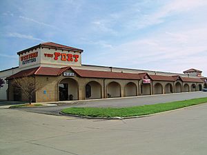
Many national businesses started in Lincoln. These include student lender Nelnet, Ameritas, Assurity, Fort Western Stores, CliffsNotes, and HobbyTown USA. Several popular restaurant chains also began here, like Amigos/Kings Classic, Runza Restaurants, and Valentino's.
The Lincoln area is part of the "Midwest Silicon Prairie". This term refers to areas with a growing high-tech industry. The city also has a growing craft brewing industry. Forbes magazine ranked Lincoln as one of the best places for business and careers.
Major Employers in Lincoln
Here are some of the biggest employers in Lincoln:
| # | Employer | # of Employees |
|---|---|---|
| 1 | State of Nebraska | 8,300 |
| 2 | Lincoln Public Schools | 7,780 |
| 3 | University of Nebraska-Lincoln | 7,500 |
| 4 | Bryan Health | 4,900 |
| 5 | US Government | 3,300 |
| 6 | City of Lincoln | 2,766 |
| 7 | Kawasaki Motors Mfg. Corp. | 2,450 |
| 8 | Saint Elizabeth Regional Medical Center | 1,825 |
| 9 | B&R Stores, Inc. | 1,800 |
| 10 | Duncan Aviation | 1,750 |
| 11 | Madonna Rehabilitation Hospital | 1,500 |
| 12 | Burlington Northern Railroad | 1,450 |
Cars and Technology in Lincoln
In 1974, Kawasaki opened a motorcycle assembly plant in Lincoln. This plant puts together parts made in Japan to create finished motorcycles for North America. Today, Kawasaki Motors Manufacturing Corp. (KMM) also makes All-Terrain Vehicles, Utility Vehicles, Personal Watercraft, and even passenger rail cars.
Kawasaki is one of Lincoln's largest private employers. It has over 2,400 employees and a very large manufacturing space.
Military Presence
The Nebraska Air and Army National Guard have their main headquarters in Lincoln. The Lincoln Airport used to be the Lincoln Air Force Base during the early Cold War. Now, the Nebraska National Guard shares facilities with the airport.
Arts and Culture in Lincoln
Since Pinnacle Bank Arena opened in 2013, Lincoln's music scene has grown a lot. Some people even call it a "Music City." You can find live music at Pinnacle Bank Arena, Bourbon Theatre, Duffy's Tavern, and the Zoo Bar. The Pla-Mor Ballroom is a classic place for music and dancing. Pinewood Bowl hosts concerts and plays in the summer.
The Lied Center brings Broadway shows, concerts, and guest speakers to Lincoln. It is also home to the Lincoln Symphony Orchestra. Students at the University of Nebraska–Lincoln (UNL) perform plays in the Temple Building. Community theater groups perform at the Lincoln Community Playhouse.
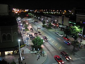
Lincoln has many art galleries, including the Sheldon Museum of Art. For movies, Marcus Theatres has 32 screens at four locations. The University of Nebraska's Mary Riepma Ross Media Arts Center shows independent and foreign films. The downtown area of O Street is Lincoln's biggest area for bars and nightclubs.
Lincoln is the hometown of the music group Zager and Evans, famous for their song "In the Year 2525". Other musical groups from Lincoln include Remedy Drive and Matthew Sweet. Maroon 5 guitarist James Valentine also grew up in Lincoln.
In 2012, U.S. News & World Report listed Lincoln as one of the 10 best places to retire in the United States.
Yearly Cultural Events
Lincoln has many annual events. Some have changed over time, but new traditions have also started. Current yearly events include:
- The Lincoln National Guard Marathon and Half-Marathon in May.
- Celebrate Lincoln in early June.
- The Uncle Sam Jam around July 3.
- Boo at the Zoo in October.
A very popular event is the Haymarket Farmers' Market, which runs from May to October in the Historic Haymarket area.
Things to See and Do in Lincoln
Some popular places to visit in Lincoln are:
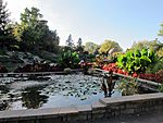
- The Sunken Gardens.
- Basketball games at Pinnacle Bank Arena.
- The Lincoln Children's Zoo.
- The dairy store at UNL's East Campus.
- Mueller Planetarium on the UNL city campus.
- The Nebraska State Capitol, which is also the tallest building in Lincoln, offers tours.
The Speedway Motors Museum of American Speed shows off items important to racing and car history. The National Museum of Roller Skating teaches about the history of roller skating. In late 2016, Lonely Planet listed Lincoln as one of the "Best in the U.S." destinations for 2017.
Lincoln's City Flag
In 2022, Lincoln adopted a new city flag. The flag was designed by Ed Mejia, who won a contest. The design shows the Lincoln skyline rising from a flat horizon. It was inspired by art deco and native artwork inside the Capitol building.
Sports in Lincoln
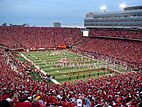
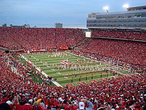
Lincoln is home to the University of Nebraska's sports teams, called the Cornhuskers. The university has 22 men's and women's teams in 14 NCAA Division I sports. Nebraska football started in 1890. Of the top college football teams, Nebraska is one of only nine to have won 900 or more games. Famous coaches include Tom Osborne and Bob Devaney. The university's indoor arena, the Bob Devaney Sports Center, is named after Coach Devaney.
Other sports teams include:
- The Nebraska Wesleyan Prairie Wolves (NCAA Division III).
- The Lincoln Saltdogs, an independent minor league baseball team.
- The Lincoln Stars, a junior ice hockey team.
- The No Coast Derby Girls, a roller derby team.
The Lincoln Airpark hosts the SCCA Solo Nationals car racing event every September.
Parks and Recreation in Lincoln
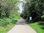
Lincoln has a large park system. There are over 131 individual parks. These parks are connected by a 248-mile (400 km) system of walking and biking trails. There are also 2.3 miles (3.7 km) of bike lanes and 1.3 miles (2.1 km) of cycle tracks. The MoPac Trail is a trail for biking, horseback riding, and walking. It runs for 27 miles (43 km) from the University of Nebraska campus eastward.
Some of the larger parks include:
- Antelope Park, which has the Bicentennial Cascade Fountain, Hamann Rose Garden, Lincoln Children's Zoo, and Veterans Memorial Garden.
- Holmes Park.
- Pioneers Park, which includes the Pioneers Park Nature Center.
Other notable parks are Sunken Gardens, Union Plaza, and Wilderness Park. There are also many smaller neighborhood parks throughout the city. Lincoln has five public recreation centers, nine outdoor public pools, and five public golf courses.
Education in Lincoln
Schools for Kids (K-12)
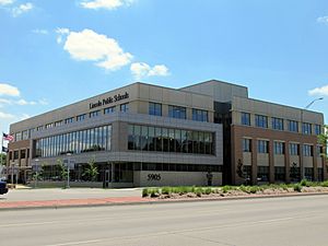
Lincoln Public Schools (LPS) is the public school district for most of the city. It has eight traditional high schools:
- Lincoln High
- Lincoln East
- Lincoln Northeast
- Northwest
- Lincoln North Star
- Lincoln Southeast
- Lincoln Southwest
- Standing Bear
LPS also has special high school programs like the Arts and Humanities Focus Program and the Science Focus Program (Zoo School).
Some parts of Lincoln are in other school districts, like Norris School District 160 and Waverly School District 145.
There are also several private elementary and middle schools. Lincoln's private high schools are College View Academy, Lincoln Christian, Lincoln Lutheran, Parkview Christian School, and Pius X High School.
Colleges and Universities
Lincoln has twelve colleges and universities. The University of Nebraska–Lincoln is the largest university in Nebraska. In 2018, it had over 25,000 students. Many international students from over 135 countries attend UNL.
Nebraska Wesleyan University teaches a liberal arts education. It has about 1,900 students. U.S. News & World Report ranked it as the #1 liberal arts college in Nebraska in 2002. Union College is a private Seventh-day Adventist college.
Bryan College of Health Sciences offers degrees in nursing and other health jobs. Other universities like Bellevue University and Concordia University have locations in Lincoln. There are also schools for hair design and cosmetology.
Southeast Community College is a two-year college system. It has three campuses in Lincoln. Many students go there to complete general education classes before transferring to a four-year university like the University of Nebraska–Lincoln.
Media in Lincoln
TV Stations
Lincoln has several TV stations:
- KSNB-TV (Channel 4) - NBC/MyNetworkTV shows.
- KLKN (Channel 8) – ABC shows.
- KOLN (Channel 10) – CBS shows.
- KUON (Channel 12) – PBS shows. This is the main station for Nebraska Public Media.
- KFXL (Channel 15) – Fox shows.
The headquarters of Nebraska Public Media, which is part of PBS and National Public Radio, are in Lincoln.
Radio Stations
There are 18 radio stations in Lincoln. Many areas also get radio signals from Omaha.
Some FM stations include:
- KLCV (88.5) – Religious talk
- KZUM (89.3) – Independent Community Radio
- KRNU (90.3) – Alternative / College radio UNL
- KUCV (91.1) – National Public Radio
- K220GT (91.9) – Contemporary Christian
- K233AN (94.5) – Top 40
- KNNA-LP (95.7) – Christian
- K255CS (98.9) – Christian
- KFOR (101.5) – News/Talk
- KLMS (103.3) – Hot AC
- KIBZ (104.1) – Rock / Alternative
- KLNC (105.3) – Classic Rock
- KFRX (106.3) – Top-40
- K294DJ (106.7) – Christian
- KBBK (107.3) – Hot AC
- KJTM-LP (107.9) – Contemporary Christian
Some AM stations include:
- KFOR (1240) – News/Talk
- KLIN (1400) – News/Talk
- KLMS (1480) – HOT AC
Newspapers and Magazines
The Lincoln Journal Star is Lincoln's main daily newspaper. The Daily Nebraskan is the official monthly magazine for the University of Nebraska–Lincoln. The DailyER is the university's satirical paper. Other university papers include the Reveille (Nebraska Wesleyan University) and the Clocktower (Union College).
How to Get Around Lincoln
Major Roads
Interstate 80 runs through Lincoln. It connects the city to San Francisco in the west and New York City in the east. Other highways serving Lincoln are Interstate 180, U.S. Route 6, U.S. Highway 34, and U.S. Highway 77. Nebraska Highway 2 is an important route for trucks connecting Lincoln to the Kansas City area.
Public Transportation
StarTran is Lincoln's public bus system. It has 67 full-sized buses and 13 smaller vans. The system has 18 bus routes, including a circular route downtown. In 2017–18, over 2.4 million people rode StarTran buses.
StarTran also offers a special van service called VANLNK. It's a shared-ride service for people who need door-to-door transport within Lincoln. These vans are smaller and can help people with disabilities.
Travel Between Cities
The Lincoln Airport (LNK) has daily flights to Chicago O'Hare International Airport and Denver International Airport. The airport was even an emergency landing site for the NASA Space Shuttle because of its very long runway.
For bus service between cities, Lincoln is served by Express Arrow and Burlington Trailways. Megabus also offers bus service to Chicago, with stops in Omaha and other cities.
Amtrak provides train service to Lincoln station. The California Zephyr train runs daily in both directions between Chicago and Emeryville, California.
Freight Trains
Freight trains travel through Lincoln on lines owned by BNSF Railway and Union Pacific Railroad. Lincoln also has its own local railway, the Omaha, Lincoln and Beatrice Railway Company.
Biking in Lincoln
Lincoln has a bike-sharing program called BikeLNK. It started in 2018 with 19 stations and 100 bicycles. These are located downtown and around the UNL campuses. In 2019, more stations and bikes were added. Lincoln also has commercial pedicabs (bicycle taxis) that operate downtown.
How People Commute
In 2016, most working people in Lincoln (80.5%) drove alone to work. About 9.6% carpooled. Only 1.1% used public transportation, and 3.1% walked. About 2.4% used other ways to get around, like bikes or ride-sharing services (like Lyft and Uber). About 3.3% worked from home.
In 2016, only 5.8% of households in Lincoln did not own a car. This is lower than the national average of 8.7%. On average, Lincoln households had 1.78 cars.
Utilities in Lincoln
Power in Lincoln is provided by the Lincoln Electric System (LES). LES serves Lincoln and some nearby communities. LES is a public utility, which means it's owned by the city. Its electricity rates are among the lowest in the country. LES gets its power from oil and gas (35%), renewable sources (34%), and coal (31%). Renewable energy has increased with a large solar energy farm and two wind turbines.
Water in Lincoln comes from the Lincoln Water System. Most of Lincoln's water comes from wells along the Platte River near Ashland, Nebraska. The city also manages the Lincoln Wastewater System.
Natural gas is provided by Black Hills Energy.
Telephone service in Lincoln has a long history. The Lincoln Telephone & Telegraph Company was founded in 1880. It was the first in the U.S. to use a rotary dial telephone exchange in 1904. It also piloted the first 911 emergency system in the nation in 1968. Today, Windstream Communications provides telephone service. Spectrum offers telephone service over their cable network. ALLO Communications also provides telephone, television, and internet service through its fiber network.
See also
 In Spanish: Lincoln (Nebraska) para niños


