Leyton facts for kids
Quick facts for kids Leyton |
|
|---|---|
| Town | |
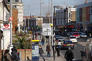 High Road, Leyton |
|
| Population | 14,184 (2011 Census. Ward) |
| OS grid reference | TQ375865 |
| London borough | |
| Ceremonial county | Greater London |
| Region | |
| Country | England |
| Sovereign state | United Kingdom |
| Post town | LONDON |
| Postcode district | E10, E15, E20 |
| Dialling code | 020 |
| Police | Metropolitan |
| Fire | London |
| Ambulance | London |
| EU Parliament | London |
| UK Parliament |
|
| London Assembly |
|
Leyton (/ˈleɪtən/) is a town in East London, England. It is part of the London Borough of Waltham Forest. Leyton is next to Walthamstow in the north, Leytonstone in the east, and Stratford in the south. Across the River Lea to the west are Clapton, Hackney Wick, and Homerton.
The area is home to New Spitalfields Market and Leyton Orient Football Club. Part of the Queen Elizabeth Olympic Park is also here. Most of Leyton has terraced houses built between 1870 and 1910. There are also some newer housing areas. Leyton is about 10 kilometers (6.2 miles) north-east of Charing Cross, a famous spot in central London.
Historically, Leyton was a parish in Essex. It grew quickly in the late 1800s, becoming a suburb of London. It joined the Metropolitan Police District in 1839 and the London postal district in 1856. In 1965, Leyton became part of the London Borough of Waltham Forest within Greater London.
Today, Leyton is one of England's most ethnically diverse areas. About 69% of its residents are from non-British backgrounds. It used to be a working-class area. Now, it is changing a lot with new buildings and people moving in.
Contents
Leyton's Past
People hunted in Leyton a very long time ago. Tools from the Paleolithic age and old bones have been found here. A Roman cemetery and the remains of a Roman villa were also discovered. Since Anglo-Saxon times, Leyton has been part of Essex. The name "Leyton" means "settlement (tun) on the River Lea". In the Domesday Book, it was called Leintun, and had a population of 43.
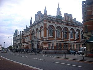
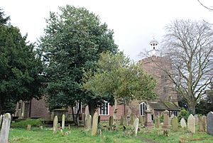
The old parish church, St Mary the Virgin, was mostly rebuilt in the 1600s. The parish of Leyton also included Leytonstone. In 1894, Leyton became an Urban District. In 1926, it became a Municipal Borough. In 1965, the Municipal Borough of Leyton joined with Walthamstow and Chingford. Together, they formed the London Borough of Waltham Forest.
The main road through Leyton is the High Road. It was once an old path to Waltham Abbey. At the top of the High Road, there is a crossroads called Bakers Arms. It was named after a public house that is now closed. The pub got its name from almshouses built in 1857 for bakers.
In the 1600s and 1700s, Leyton was a nice place for rich merchants and bankers to live. About 50 to 60 wealthy families had homes here in 1766. Leyton changed from a farming area to an industrial and residential suburb because of the railway. The first train station opened at Lea Bridge Station in 1840. Then, Low Leyton (now Leyton Underground) opened in 1856. Finally, Leyton Midland Road opened in 1894.
Not all green spaces were lost. About 80 hectares (200 acres) of Epping Forest in Leyton were saved in 1878. In 1897, the Leyton Council bought land for a park near the town hall. It opened in 1903 as Coronation Gardens, named after King Edward VII's coronation. In 1905, the council bought Leyton Marshes for a recreation ground.
During World War I, about 1,300 houses were damaged by Zeppelin raids. By the 1920s, Leyton was a busy industrial area. It was known for making neckties and for its Thermos factory. During the Blitz in World War II, Leyton was a target. This was because it was close to the London Docks and Temple Mills rail yard. The rail yard is now smaller. Part of it is a shopping area called 'Leyton Mills'. The rest is a depot for high-speed Eurostar trains.
After World War Two, Leyton's industries declined. But like much of east London, Leyton has seen many new projects. Parks have been improved, and new small parks and gardens have been made. Many tall buildings have been taken down. A clock tower was built in the Lea Bridge Road area for the new millennium. A large piece of street art was added at Baker's Arms. Before the 2012 London Olympic Games, the council spent money to improve shops on Leyton High Road. The Olympics also helped to improve pavements and street furniture.
Leyton's Location
Leyton is in the Lower Lea Valley. The River Lea forms its western border. The land rises from low marshland near the river to over 27 meters (90 feet) at Whipps Cross. This is on the southern edge of Epping Forest. The A12 (M11 link road), built in the 1990s, cuts through Leyton. Most of the area is on the north-west side of this busy road.
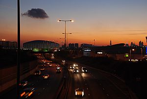
The High Road Leyton bridge over the A12 offers great views of the Olympic Park. It also offers views of skyscrapers further west. Leyton borders Walthamstow along Lea Bridge Road. It also borders parts of the London Borough of Hackney across the River Lea.
Parts of Leyton
- Bakers Arms
- Leyton
- Lea Bridge
- Grove Green
- Temple Mills
People of Leyton
Leyton is a very diverse area. It has three electoral wards with a total population of 42,061. Between 61% and 69% of residents are from Black, Asian, or other ethnic minority backgrounds. This is higher than the average for the whole borough. Many people here come from Russia, North Africa, Ghana, Nigeria, Jamaica, Ireland, Portugal, Cyprus, and Italy. More recent arrivals are from South Africa, Bosnia, Serbia, and Poland.
More than half of Leyton's population is under 30 years old. It is also very multicultural. Only 34% of the people are recorded as White British. This is the lowest percentage in Waltham Forest.
Leyton used to be a traditional, working-class area. But in recent years, it has become more expensive. Many young professionals and university-educated people are moving to Leyton. This has led to gentrification. In July 2015, Vogue (magazine) magazine said: "All eyes are on Leyton and Stratford [right now]." Many people who cannot afford homes in nearby Hackney are moving to Waltham Forest. This has made Waltham Forest one of the fastest-rising boroughs for house prices since 2013.
Things to Do in Leyton
The New Spitalfields Market moved to Leyton in 1991. It is the UK's top market for exotic fruits and vegetables.
Leyton has two main shopping areas. One is a large retail park at Leyton Mills, near the station. It has a big, 24-hour Asda supermarket and other stores. At the north end of town, Baker's Arms has traditional shops along Lea Bridge Road and the High Road, including a Tesco.
The local police station is at Boreham Close. It moved there in December 2012.
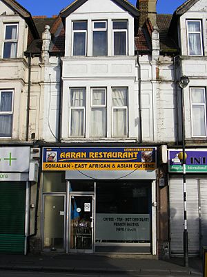
Leyton's restaurants offer many different types of food. You can find Turkish, Portuguese, Polish, Indian, Mauritian, Somali, and Cypriot food. There are also many fast-food places, cafes, and bakeries.
Leyton is next to the Hackney Marshes. This is one of London's largest open green spaces. A bridge from Leyton Jubilee Park crosses to the marshes. Leyton Jubilee Park was made by joining two playing fields. This was to celebrate 60 years of Queen Elizabeth II's reign.
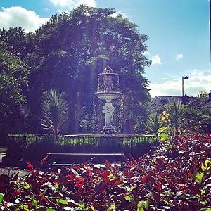
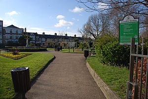
Coronation Gardens is a major park in the center of Leyton. It was built in 1902 to celebrate King Edward VII's coronation. It has a fountain, pretty gardens, a bandstand, and a children's maze.
On the High Road, near Baker's Arms, there is a gym and the Leyton Leisure Centre swimming pool. It reopened in October 2013 after being renovated.
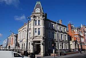
Leyton has two public libraries. One is on the High Road next to the old Town Hall. The other is on Lea Bridge Road and has modern computer facilities.
The London Borough of Waltham Forest also runs Brooks Farm. This is a city farm in Skelton Lane Park, near Leyton Midland Road station. It is free to visit. You can see pigs, sheep, cows, horses, and llamas there.
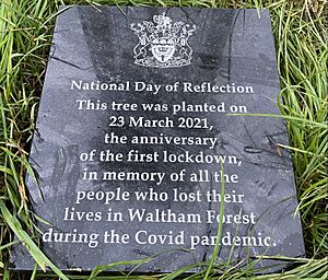
In 2018, Ive Farm Fields was improved. It now has floodlit sports pitches, a running track, volleyball courts, and walking paths. A memorial plaque and tree have been placed in Jubilee Park. This is to remember those who died in Waltham Forest during the Covid pandemic.
Homes in Leyton
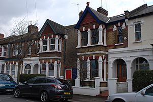
Most homes in Leyton are Victorian and Edwardian terraced houses. They were built between 1870 and 1910. This was during Leyton's fast growth from a small village. These homes have from two to seven bedrooms. Because of this, the area is popular with families.
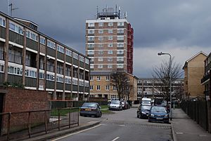
Leyton has seen a lot of new building and changes for many years. This is also happening in nearby areas like Hackney, Bow, Clapton, and Stratford. Leyton's skyline is not as tall as other parts of east London. Tall housing estates used to be common. But many residents did not like them, and they were not built well. The Oliver Close and Cathall Road estates were completely rebuilt in the early 2000s. The Avenue Road Estate was also redeveloped.
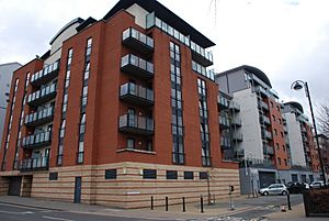
The last large tall estate, the Beaumont Road Estate, began to be taken down in 2006. It has now been almost completely rebuilt. The only 20-story tower block left in Waltham Forest is Northwood Tower in Walthamstow. However, smaller 10-story blocks from the 1960s, like Slade Tower in the Leyton Grange estate, are still around. Many modern apartment buildings have also been built since the late 1990s. This includes flats at the Leyton Orient Football Club's Brisbane Road stadium. More new homes are planned near Coronation Gardens and the Stadium. About 750 new homes will be built by 2027.
Sports in Leyton
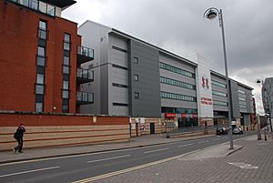
Leyton is home to the football club, Leyton Orient F.C.. Many residents see the club as a very important part of Leyton. Orient moved to Brisbane Road, Leyton, in 1936. The stadium has been rebuilt and changed its name several times. It is now called the Gaughan Group Stadium. Leyton Orient reached the top division of English football in 1962. They currently play in League One.
Leyton F.C. was founded in 1868. It played at the Leyton Stadium until 2011. Leyton FC later joined with Walthamstow Pennant FC in 1995. They changed their name to Leyton Pennant FC. In 1994, they changed their name again to Waltham Forest FC.
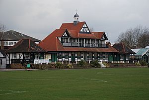
Leyton also has a cricket pitch and pavilion. This was once the home of Essex County Cricket Club. In 1886, the club bought Leyton Cricket Ground. It was their main ground until 1933, but they played there until 1977. The pavilion is a Grade II listed building. It is now part of Leyton Youth Centre.
The Lee Valley Ice Centre is home to the Lea Valley Lions Ice Hockey Club. They play in the English National Ice Hockey League.
Leyton is next to the Olympic Park for the 2012 Olympic Games. Athletes used the training facilities at the Waltham Forest Pool & Track to get ready for the Games.
The Lee Valley VeloPark is also in Leyton. It has a 6,000-seat indoor velodrome for track cycling. It also has a 6,000-seat outdoor BMX racing track. The Lee Valley Tennis and Hockey centers at Eton Manor opened to the public in late 2013. This area is a valuable green space for local communities. It is a place for jogging, playing, and family picnics.
Schools in Leyton
Leyton has several secondary schools. These include George Mitchell School, Lammas School, and Norlington School. There is also a college, Leyton Sixth Form College. It is one of the first sixth form colleges in Southern England to get a license. It is also known as the best college in London for sports.
Getting Around Leyton
Leyton is on the Central line of the London Underground. The station is at the southern end of the High Road. There is also a London Overground station at Midland Road. This station is on the Gospel Oak to Barking line.
Many bus routes serve Leyton, including 55, 56, 58, 69, 97, 158, 339, W14, and W15. Night bus routes N26 and N205 also run here.
You can ride a bicycle to Central London from Lea Bridge Road. Just follow the London Cycle Network Route 9 through Hackney and Shoreditch.
Famous People from Leyton
- Benik Afobe (born 1993) – Football player
- Harry Beck (1902–1974) – Creator of the London Underground Map
- Jack Cornwell VC – Born in Leyton in 1900, died in 1916
- Bobby Crush (born 1954) – Pop pianist and actor
- Iron Maiden (1975) – Heavy metal band
- Curtis Davies (born 1985) – Football player
- John Lill – Musician (born 1944)
- Thomas Lodge (1558–1625) – Author, poet, and playwright
- Frank Muir (1920–1998) – Writer and TV/radio personality
- John Henry Pepper (1821–1900) – Scientist and inventor of Pepper's ghost
- Sir Thomas Roe – English diplomat, born in Leyton in 1581
- Cardinal Nicholas Wiseman (1802–1865) – First Archbishop of Westminster, lived in Leyton
Filming Locations in Leyton
- Leyton Orient's Brisbane Road Stadium has been used for filming movies. These include the 1995 film I.D., the 2008 drama Incendiary, and the 1967 thriller Robbery.
- Leyton Fire Station on Church Road was used for outside shots of the fictional Blackwall Fire Station. This was for the ITV drama London's Burning (1988–2002).
Sports Clubs in Leyton
- Leyton Football Club
- Leyton Orient Football Club
- Lee Valley Lions
See also
 In Spanish: Leyton para niños
 | Dorothy Vaughan |
 | Charles Henry Turner |
 | Hildrus Poindexter |
 | Henry Cecil McBay |


