List of National Historic Landmarks in Oregon facts for kids
Oregon is home to many amazing places that are super important to the history of the United States. These special spots are called National Historic Landmarks (NHLs). The National Park Service, which is part of the U.S. government, helps decide which places get this important title.
NHLs can be buildings, structures, whole neighborhoods, or even objects that tell a big story about our country. Oregon has 17 of these landmarks. Two of them actually stretch into other states! Sadly, one place that used to be an NHL in Oregon was removed from the list after it was destroyed.
Contents
What Makes a Place a National Historic Landmark?
The National Park Service helps decide which places become NHLs. They look for properties that are very important to the history of the entire United States.
Being an NHL helps protect these special places. It can mean they get tax benefits, special grants, or help to keep them safe. Sometimes, owners might not want their property to be an NHL. If that happens, the government can still say it's 'eligible' for the title.
NHLs are also part of a bigger list called the National Register of Historic Places (NRHP). The main difference is that NHLs are important to the *whole country*. Other NRHP sites might be important just to a *state* or *local area*. In Oregon, only a small number of places on the NRHP are also NHLs – less than 1%!
Oregon's National Historic Landmarks
| Landmark name | Image | Date designated | Location | County | Description | |
|---|---|---|---|---|---|---|
| 1 | Bonneville Dam Historic District |
(#86000727) |
Bonneville 45°38′29″N 121°56′41″W / 45.64138°N 121.9446°W |
Multnomah and Skamania (Washington) | This huge dam was built in the 1930s on the Columbia River. It was the first hydroelectric dam big enough to create 500,000 kilowatts of power! The landmark area includes the dam, its powerhouses, the navigation lock for boats, and the fish ladder that helps salmon swim upstream. | |
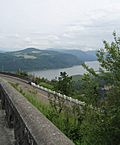
| 2 | Columbia River Highway |
(#83004168) |
Troutdale to Mosier 45°37′27″N 121°44′51″W / 45.62429°N 121.7474°W |
Multnomah, Hood River, and Wasco | Built between 1913 and 1922, this was the very first scenic highway in the United States. It was designed to show off the beautiful Columbia River Gorge. It's also a great example of early road engineering. | |
| 3 | Crater Lake Superintendent's Residence |
(#87001347) |
Crater Lake National Park 42°54′03″N 122°08′16″W / 42.90076°N 122.1377°W |
Klamath | This house was built in the 1930s in Crater Lake National Park. It's a great example of the "rustic" style used by the National Park Service. It's the only building from that time that still looks almost exactly like it did when it was new. | |
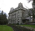
| 4 | Deady and Villard Halls, University of Oregon |
(#72001082) |
Eugene 44°02′48″N 123°04′35″W / 44.04655°N 123.0764°W |
Lane | These two buildings, finished in 1876 and 1886, were the first and second buildings of the University of Oregon. They show different architectural styles from that time. Villard Hall is one of the few old university buildings left in the Western United States. | |
| 5 | Fort Astoria Site |
(#66000639) |
Astoria 46°11′16″N 123°49′39″W / 46.18789°N 123.8275°W |
Clatsop | John Jacob Astor built this fort in 1811 to try and join the fur trade in the Pacific Northwest. It became very important for the United States' claim to the Oregon Country. Astor later sold the fort to a British company in 1813. | |
| 6 | Fort Rock Cave |
(#66000641) |
Fort Rock 43°21′22″N 121°03′13″W / 43.35612777777778°N 121.05361111111111°W |
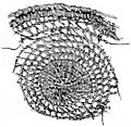
Lake | Archeologists found "Fort Rock sandals" here. These are the oldest handmade items ever found in the Americas! They show that early Native Americans were skilled at weaving over 11,000 years ago. | |
| 7 | Jacksonville Historic District |
(#66000950) |
Jacksonville 42°18′45″N 122°58′04″W / 42.31255°N 122.9678°W |
Jackson | Jacksonville started as a gold mining town in 1852. It became the main business center for southern Oregon. The town has many old buildings from 1850 to 1890 that are still in great shape. This makes it a unique example of an old commercial town. | |
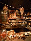
| 8 | Kam Wah Chung Company Building |
(#73001575) |
John Day 44°25′07″N 118°57′25″W / 44.418688°N 118.956922°W |
Grant | This building is the most famous example of a Chinese general store and herb shop in the United States. It shows how Chinese immigrants helped build the western United States after the Civil War. | |
| 9 | Lightship WAL-604, "Columbia" |
(#89002463) |
Astoria 46°11′25″N 123°49′27″W / 46.19029°N 123.8242°W |
Clatsop | The WAL-604 was the last lightship to serve at the mouth of the Columbia River. It was retired in 1979. Built in 1950, it's the best-preserved example of the last generation of U.S. Coast Guard lightships. | |
| 10 | Lower Klamath National Wildlife Refuge |
(#66000238) |
Dorris, California 41°56′48″N 121°39′57″W / 41.9466°N 121.6659°W |
Klamath and Siskiyou (California) | This wildlife refuge was created in 1908. It was the first large area of public land set aside to protect wildlife. It shows the challenges of balancing protecting nature with other needs, like farming. | |
| 11 | Oregon Caves Chateau |
(#87001346) |
Oregon Caves National Monument 42°05′54″N 123°24′27″W / 42.09841°N 123.40757°W |
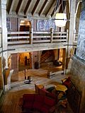
Josephine | This beautiful building was constructed in 1934 near the Oregon Caves National Monument. It has a rustic style with bark-covered walls and stone. It fits perfectly into its natural setting and still looks very much like it did when it was built. | |
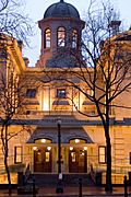
| 12 | Pioneer Courthouse |
(#73001582) |
Portland 45°31′08″N 122°40′40″W / 45.51886°N 122.6779°W |
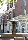
Multnomah | Built in 1875, this was one of the first grand buildings in the Pacific Northwest. It has been a U.S. courthouse, a customs house, and a post office. It has been carefully restored several times. | |
| 13 | Skidmore/Old Town Historic District |
(#75001597) |
Portland 45°31′21″N 122°40′18″W / 45.52242°N 122.6718°W |
Multnomah | This is one of the most impressive historic business areas on the West Coast. It's where Portland first started and grew. The buildings, built in the mid-to-late 1800s, show many different Victorian architectural styles. Many have cool cast-iron fronts. | |
| 14 | Sunken Village Archeological Site |
(#89002455) |
Sauvie Island 45°41′49″N 122°50′20″W / 45.69702777777778°N 122.83897499999999°W |
Multnomah | This site holds the remains of an old Chinookan village from the 1200s to the 1700s. The items found here are very well preserved. The Chinookan people were skilled hunters and traders. They had a large population but left few physical traces, making this site very special. | |
| 15 | Timberline Lodge |
(#73001572) |
Government Camp 45°19′52″N 121°42′41″W / 45.33115°N 121.7113°W |
Clackamas | President Franklin D. Roosevelt officially opened this lodge in 1937. It's located high up on Mount Hood. It's known as the best example of "mountain architecture" from the 1930s, built by the Works Progress Administration. | |
| 16 | Wallowa Lake Site |
(#89001082) |
Joseph 45°20′11″N 117°13′20″W / 45.336360°N 117.222204°W |
Wallowa | This area near Wallowa Lake was a very important traditional campground for the Nez Perce tribe. Even after Chief Joseph and his people were forced to leave, its cultural importance remained. It's also the final resting place of Old Chief Joseph. | |
| 17 | Aubrey Watzek House |
(#74001715) |
Portland 45°30′56″N 122°43′39″W / 45.51558°N 122.7275°W |
Multnomah | This house was designed by John Yeon in 1937 for a lumber businessman. It mixed a modern architectural style called "International Style" with local Oregon ideas. This created a unique "Northwest Style" of architecture. |
Former National Historic Landmark
Sometimes, a place can lose its NHL status. This usually happens if the site is destroyed or changed too much.
| Site name | Image | Date designated | Date withdrawn | Locality | County | Description | |
|---|---|---|---|---|---|---|---|
| 1 | Samuel Elmore Cannery |  |
November 13, 1966 | July 16, 1993 | Astoria 46°11′30″N 123°50′45″W / 46.19167°N 123.84583°W |
Clatsop | This building was home to the "Bumble Bee" tuna brand. It was the longest-running salmon canning factory in the United States, operating from 1898 to 1980. The canned salmon industry was very important to the Northwest's economy for many years. When salmon became harder to find, the cannery started canning tuna in the 1930s. The building was planned to be torn down in 1991 because it was falling apart, and it burned down in 1993. |
See also
- Historic preservation
- List of U.S. National Historic Landmarks by state
- Lists of Oregon-related topics
- National Register of Historic Places listings in Oregon
 | Stephanie Wilson |
 | Charles Bolden |
 | Ronald McNair |
 | Frederick D. Gregory |


