This is a list of shipwrecks found near the coast of Massachusetts. Shipwrecks are the remains of ships that have sunk or been destroyed at sea. Massachusetts has a long coastline with many hidden dangers like shifting sandbars and strong storms. Because of this, many ships have been lost here over hundreds of years.
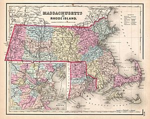
Map of Massachusetts and Rhode Island, 1857
Shipwrecks by County
Barnstable County
The coastline of Cape Cod, from Chatham to Provincetown, is sometimes called an "ocean graveyard." This is because of its dangerous, hidden, and constantly moving sandbars. Over 3,000 shipwrecks have happened in this fifty-mile stretch of sea!
| Ship |
Flag |
Sunk date |
Notes |
Coordinates |
| Alva |
|
25 July 1892 |
A fancy luxury yacht. It crashed into another ship, the H. F. Dimock, in thick fog near Chatham. |
|
| Aransas |
|
7 May 1905 |
A passenger ship that crashed into a schooner barge, the Glendower, in fog near Chatham. |
|
| USS Bancroft |
 United States Navy United States Navy |
July 1945 |
A US Navy destroyer that sank after crashing into another ship off Cape Cod. |
|
| Dixie Sword |
|
12 February 1942 |
A cargo ship that sank in a storm near Monomoy Island. Some people think it might have been hit by a torpedo. |
41°32′58″N 69°58′50″W / 41.54944°N 69.98056°W / 41.54944; -69.98056 (Dixie Sword) |
| Emmy Rose |
|
November 23, 2020 |
An 82-foot fishing boat lost in a storm. It sank about 20 miles northeast of Provincetown, Massachusetts. All four crew members are believed to have died. |
|
| General Greene |
 United States Coast Guard United States Coast Guard |
6 March 1960 |
A United States Coast Guard Cutter. It was blown onto a beach at Sandwich during a storm after its engines stopped working. |
|
| Horatio Hall |
|
10 March 1909 |
A steamship that crashed in fog with another freighter, the H. F. Dimock. This happened 3 miles east of Chatham. |
|
| James Longstreet |
 United States United States |
|
A Liberty ship that got stuck in 1943. It was later used for target practice until 1971. |
41°49′53.27″N 70°02′39.28″W / 41.8314639°N 70.0442444°W / 41.8314639; -70.0442444 (SS James Longstreet) |
| Kate Harding |
|
30 November 1892 |
A bark that was pushed onto the beach in a storm. This happened near Cape Cod Light. |
| Montclair |
|
4 March 1927 |
A schooner that got stuck off Nauset Light during a storm. |
|
| Monticello |
United States |
Unknown |
A ship that was part of the US Navy during the Quasi-War. It was later taken out of service and wrecked off Cape Cod. |
42°07′34″N 69°44′56″W / 42.126°N 69.749°W / 42.126; -69.749 (USS Merrimack (1798)) |
| Paul Palmer |
United States |
15 June 1913 |
A schooner that caught fire and sank off Provincetown. |
|
| Peace and Prosperity |
|
2 January 1784 |
A brig that was shipwrecked off Truro. Important papers and money for Dartmouth College were lost in this wreck. |
|
| Pendleton |
United States |
18 February 1952 |
A large oil tanker that broke in half during a storm. This happened 1 mile east of Monomoy Island. |
41°35′10″N 69°57′45″W / 41.58611°N 69.96250°W / 41.58611; -69.96250 (Pendleton) |
| HMS Somerset |
 Royal Navy Royal Navy |
2 November 1778 |
A large British warship that got stuck in a storm off Provincetown. |
42°4′34″N 70°8′53″W / 42.07611°N 70.14806°W / 42.07611; -70.14806 (HMS Somerset) |
| USS Thresher |
 United States Navy United States Navy |
10 April 1963 |
The first submarine of its kind. It sank during deep-diving tests after water got inside. All 129 people on board were lost. |
|
| Whydah Gally |
Pirate |
26 April 1717 |
The main ship of the famous pirate "Black Sam" Bellamy. It sank in a storm off Marconi Beach. Bellamy and most of his crew died. |
41°53′31″N 69°57′34″W / 41.89194°N 69.95944°W / 41.89194; -69.95944 (Whydah Gally) |
Bristol County
| Ship |
Flag |
Sunk date |
Notes |
Coordinates |
| Angela |
|
4 March 1971 |
A cement barge that broke free from its towline in a storm. It then got stuck on a reef off Westport. |
41°27′40″N 71°02′02″W / 41.46111°N 71.03389°W / 41.46111; -71.03389 (Angela) |
| City of Taunton |
United States |
1930s |
A steamship that was pulled onto the beach at Somerset and left there. |
41°42′39″N 71°10′33″W / 41.71083°N 71.17583°W / 41.71083; -71.17583 (City of Taunton (ship)) |
| Colonel William B. Cowin |
|
17 December 1941 |
A ferry that hit Hens and Chickens Reef off Westport and sank quickly. |
41°28.3′N 70°58.8′W / 41.4717°N 70.9800°W / 41.4717; -70.9800 (Colonel Willam B. Cowlin) |
| Hilda Garston |
|
20 February 1961 |
A dredger (a ship that clears sand from the seabed) that hit a reef off Westport. |
41°16.4′N 71°02.1′W / 41.2733°N 71.0350°W / 41.2733; -71.0350 (Hilda Garston) |
| USS Yankee |
 United States Navy United States Navy |
23 September 1908 |
A steamboat that sank in Buzzards Bay while being pulled by another boat. |
|
Dukes County
| Ship |
Flag |
Sunk date |
Notes |
Coordinates |
| Ardandhu |
|
23 January 1900 |
A cargo ship that crashed into another steamer, the Herman Winter, in fog in Vineyard Sound. |
41°26′30″N 70°48′00″W / 41.44167°N 70.80000°W / 41.44167; -70.80000 (Ardandhu) |
| City of Columbus |
United States |
18 January 1884 |
A steamboat that ran aground on Devil's Bridge, a dangerous spot off Aquinnah. |
41°21′36″N 70°50′55″W / 41.36000°N 70.84861°W / 41.36000; -70.84861 (SS City of Columbus) |
| Dynafuel |
United States |
15 November 1963 |
An oil tanker that crashed with a Norwegian freighter, Fernview. This happened northwest of Pasque Island. |
41°28′18″N 70°51′12″W / 41.47167°N 70.85333°W / 41.47167; -70.85333 (Dynafuel) |
| Herman Winter |
|
7 March 1944 |
A steamship that got stuck on Devils Bridge reef, off Martha's Vineyard. |
41°20′57″N 70°50′50″W / 41.34917°N 70.84722°W / 41.34917; -70.84722 (Herman Winter) |
| John S. Dwight |
|
6 April 1923 |
A rum runner (a ship illegally carrying alcohol) that was purposely sunk south of Nashawena Island. |
41°23′26″N 70°52′36″W / 41.39056°N 70.87667°W / 41.39056; -70.87667 (John S. Dwight) |
| Leonardo |
|
24 November 2019 |
A 57-foot scallop fishing boat that flipped over and sank during a big storm. This happened off Martha's Vineyard. Only one person survived, and three crew members were lost. |
|
| Mertie B. Crowley |
|
23 January 1910 |
A schooner that ran aground on Wasque Shoal, off Martha's Vineyard. |
|
| Nantucket |
United States |
7 August 1859 |
A whaler (a ship that hunts whales) that was wrecked on Nashawena Island. |
|
| USS Valor |
United States Navy |
29 June 1944 |
A US Navy minesweeper (a ship that removes sea mines). It was sunk by another US Navy ship, the USS Richard W. Suesens, off Cuttyhunk. |
41°28′N 70°57′W / 41.467°N 70.950°W / 41.467; -70.950 (USS Valor (AMc-108)) |
Essex County
| Ship |
Flag |
Sunk date |
Notes |
Coordinates |
| Ada K. Damon |
United States |
26 December 1909 |
A large fishing schooner that wrecked on Crane Beach in Ipswich, Massachusetts. |
42°41′28.14″N 70°46′58.14″W / 42.6911500°N 70.7828167°W / 42.6911500; -70.7828167 (Ada K. Damon (1871)) |
| USS Albert Gallatin |
United States Navy |
6 January 1892 |
A US Navy cutter that got stuck on Boo Hoo Ledge off Manchester. |
42°33′50″N 70°44′52″W / 42.56389°N 70.74778°W / 42.56389; -70.74778 (USS Albert Gallatin (1871)) |
| Alice M. Colburn |
|
3 January 1923 |
A schooner that ran aground and broke apart in a storm off Manchester. |
|
| Alma A. E. Holmes |
United States |
10 October 1914 |
A schooner that crashed with the steamer Belfast off Marblehead. |
42°26′6″N 70°44′54″W / 42.43500°N 70.74833°W / 42.43500; -70.74833 (Alma A. E. Holmes (ship)) |
| California |
|
15 September 1955 |
A fishing trawler that ran aground on a rocky ledge off Rockport. |
42°40′25″N 70°34′19″W / 42.67361°N 70.57194°W / 42.67361; -70.57194 (California (trawler)) |
| Charles S. Haight |
|
1946 |
A cargo ship that got stuck on a ledge off Rockport. |
42°40′38″N 70°35′03″W / 42.67722°N 70.58417°W / 42.67722; -70.58417 (Charles S. Haight) |
| Chelsea |
|
10 February 1957 |
An oil tanker that got stuck on the Sandy Bay Breakwater northeast of Thatcher Island. |
42°38′52″N 70°34′11″W / 42.64778°N 70.56972°W / 42.64778; -70.56972 (Chelsea (ship)) |
| Chester A. Poling |
|
10 January 1977 |
An oil tanker that broke in half during a storm. This happened southwest of Eastern Point Light. |
|
| Edward Rich |
|
30 August 1899 |
A schooner that hit the Sandy Bay Breakwater off Rockport in fog. |
42°40′39″N 70°35′25″W / 42.67750°N 70.59028°W / 42.67750; -70.59028 (Edward Rich) |
| Ellenora Van Dusen |
|
20 September 1900 |
A schooner that caught fire and sank in Gloucester Harbor. |
|
| Frank A. Palmer |
United States |
17 December 1902 |
A schooner that crashed with another ship, Louise B. Crary, off Gloucester. |
|
| USS Grouse |
United States Navy |
21 September 1963 |
A US Navy minesweeper that ran aground off Rockport. |
42°40′24″N 70°34′29″W / 42.67333°N 70.57472°W / 42.67333; -70.57472 (USS Grouse (AMS-15)) |
| Herbert |
|
5 August 1924 |
A lighter (a type of barge) that was hit by the steamer City of Gloucester in fog. It was anchored off Nahant. |
42°25′05″N 70°51′25″W / 42.41806°N 70.85694°W / 42.41806; -70.85694 (Herbert) |
| Jennie M. Carter |
|
13 April 1894 |
A schooner that crashed into a jetty in a storm off Salisbury. |
|
| Joffre |
United States |
9 August 1947 |
A schooner that caught fire and sank off Gloucester. Its wreck was found in 2006. |
|
| Lamartine |
United States |
17 May 1893 |
A schooner that sank in a storm off Gloucester. Its wreck was found in 2004. |
|
| Louise B. Crary |
United States |
1902 |
A schooner that crashed with the Frank A. Palmer off Gloucester. |
|
| Margaret |
United States |
7 January 1796 |
A ship that used to trade furs. It was wrecked on Gooseberry Rocks, near Gooseberry Island. |
|
| Monohansett |
United States |
June 1904 |
A paddle steamer that sank off Salem Harbor. |
|
| USS New Hampshire |
United States Navy |
26 July 1922 |
A US Navy training ship. It caught fire and sank in the Hudson River in 1921. It was raised and sold for scrap, but caught fire again and sank while being towed off Manchester. |
43°4′18″N 70°45′47″W / 43.07167°N 70.76306°W / 43.07167; -70.76306 (USS New Hampshire (1864)) |
| USS Nezinscot |
United States Navy |
11 August 1907 |
A navy tugboat that flipped over and sank off Cape Ann. This happened when its cargo shifted in rough seas. Four of the nine crew members died. |
|
| Nina T |
|
September 1997 |
A fishing trawler that was purposely sunk off Gloucester. |
42°34.133′N 70°40.522′W / 42.568883°N 70.675367°W / 42.568883; -70.675367 (Nina T) |
| Northern Voyager |
|
1997 |
A factory ship that sank during sea tests after being repaired. This happened 2.5 miles east of Eastern Point Light. |
42°34.451′N 070°36.295′W / 42.574183°N 70.604917°W / 42.574183; -70.604917 (Northern Voyager) |
| Portland |
United States |
27 November 1898 |
A steamship that sank off Cape Ann during a huge storm known as the Portland Gale. |
|
Nantucket County
| Ship |
Flag |
Sunk date |
Notes |
Coordinates |
| Alice M. Lawrence |
|
5 December 1914 |
A schooner that got stuck on Tuckernuck Shoal in Nantucket Sound. It actually grounded on top of the wreck of another ship, the French Van Gilder.  |
41°24′13″N 70°13′00″W / 41.40361°N 70.21667°W / 41.40361; -70.21667 (Alice M. Lawrence) |
| Andrea Doria |
 Italy Italy |
26 July 1956 |
A famous Italian ocean liner that flipped over and sank after crashing with another ship, the Stockholm. |
40°29′24″N 69°51′2″W / 40.49000°N 69.85056°W / 40.49000; -69.85056 (SS Andrea Doria) |
| Argo Merchant |
 Liberia Liberia |
December 1976 |
An oil tanker that ran aground 25 miles southeast of Nantucket, Massachusetts. This caused a large oil spill. |
41°01′59″N 69°27′00″W / 41.033°N 69.45°W / 41.033; -69.45 (MV Argo Merchant) |
| Edward E. Briry |
|
15 December 1917 |
A schooner that sank in a strong wind storm 6 miles northeast of Great Point Light. |
|
| Fort Mercer |
|
18 February 1952 |
An oil tanker that broke in half in rough seas southeast of Nantucket. |
|
| French Van Gilder |
|
29 March 1885 |
A schooner that got stuck on Tuckernuck Shoal in Nantucket Sound. |
41°24.1′N 70°13′W / 41.4017°N 70.217°W / 41.4017; -70.217 (French Van Gilder) |
| Jennie French Potter |
|
18 May 1909 |
A schooner that ran aground on Halfmoon Shoal in Nantucket Sound. |
41°28′28″N 70°16′38″W / 41.47444°N 70.27722°W / 41.47444; -70.27722 (Jennie French Potter) |
| Kershaw |
|
1 June 1928 |
A cargo ship that crashed with the liner President Garfield northeast of East Chop Light. |
41°28.9′N 70°31.9′W / 41.4817°N 70.5317°W / 41.4817; -70.5317 (Kershaw) |
| LV-58 |
United States |
11 December 1905 |
A lightvessel (a ship that acts like a lighthouse). It started leaking and sank while being towed off Nantucket. |
|
| LV-117 |
United States |
15 May 1934 |
A lightvessel that was hit by the huge ship RMS Olympic off Nantucket. |
40°37′2″N 69°37′6″W / 40.61722°N 69.61833°W / 40.61722; -69.61833 (United States lightship LV-117) |
| North American |
United States |
4 September 1967 |
A steamboat that sank while being towed off Nantucket. |
42°11′00″N 87°39′00″W / 42.18333°N 87.65000°W / 42.18333; -87.65000 (SS North American) |
| Pemberton |
|
13 February 1907 |
A schooner that caught fire and sank northeast of Nobska Light. |
41°30′59″N 70°37′41″W / 41.51639°N 70.62806°W / 41.51639; -70.62806 (Pemberton) |
| RawFaith |
United States |
8 December 2010 |
A special galleon (an old type of sailing ship) that sank off Nantucket. |
|
| RMS Republic |
 United Kingdom United Kingdom |
24 January 1909 |
A steam-powered ocean liner that crashed with another ship, the Florida, south of Nantucket Island. |
40°26′03″N 69°46′0″W / 40.43417°N 69.76667°W / 40.43417; -69.76667 (RMS Republic) |
| Stephano |
 United Kingdom United Kingdom |
8 October 1916 |
This ship was hit by a German submarine, U-53, and sank. This happened 2.5 miles east-north-east of Nantucket. |
|
| U-550 |
 Kriegsmarine Kriegsmarine |
16 April 1944 |
A German U-boat (submarine) that was sunk by a US Navy ship, USS Joyce, off Nantucket. |
40°09′N 69°44′W / 40.150°N 69.733°W / 40.150; -69.733 (German submarine U-550) |
| Unnamed crane barge |
|
1 November 1963 |
A crane barge that sank in Nantucket Sound. |
41°26′03″N 70°13′28″W / 41.43417°N 70.22444°W / 41.43417; -70.22444 (Barge & Crane) |
Plymouth County
| Ship |
Flag |
Sunk date |
Notes |
Coordinates |
| Ann |
United States |
28 January 1805 |
A brig that was pushed ashore at Duxbury Beach during a big snowstorm in 1805. The crew was saved. |
|
| Ceres |
|
28 January 1805 |
A new ship that went ashore on Salt House Beach off Marshfield and Duxbury in the Blizzard of 1805. |
|
| Columbia |
|
March 1792 |
A ship that got stuck on High Pines, a part of Duxbury beach. Fourteen men were lost, but two were saved. |
|
| Columbia |
United States |
26 November 1898 |
A schooner that was blown onto the beach at Scituate during the Portland Gale. |
| Delaware |
|
27 November 1898 |
A barge that sank off Scituate during the Portland Gale. |
|
| Edna G. |
United States |
June 1988 |
A fishing vessel that sank near Stellwagen Bank. |
|
| Favorite |
|
28 January 1805 |
A ship that was badly damaged off Rocky Point, Plymouth, in the Blizzard of 1805. Much of its cargo was saved. |
|
| Forest Queen |
|
29 February 1853 |
A cargo ship that got stuck off Second Cliff Beach, Scituate, in a storm. |
|
| Franklin |
|
October 1804 |
A schooner wrecked off High Pines, Duxbury, during the Snow Hurricane of 1804. |
|
| General Arnold |
|
25 December 1778 |
An American brig that shipwrecked in Plymouth Bay during the Revolutionary War in a blizzard. Many men died from the cold. |
|
| Henry Endicott |
|
18 September 1939 |
A schooner that sank southeast of Manomet. It was being towed in rough seas. |
41°54′30″N 70°29′08″W / 41.90833°N 70.48556°W / 41.90833; -70.48556 (Henry Endicott) |
| Hibernia |
|
28 January 1805 |
A ship that went ashore near Plymouth in the Blizzard of 1805. It broke apart, and the captain and almost all the crew were lost. |
|
| Kenwood |
|
4 February 1926 |
A schooner that was blown onto rocks in a strong wind storm. This happened north of Cedar Point, Scituate. |
|
| Mars |
|
13 September 1942 |
A tugboat that crashed with the tanker Bidwell east of Manomet. |
41°56′16″N 70°29′33″W / 41.93778°N 70.49250°W / 41.93778; -70.49250 (Mars) |
| USS Mohave |
United States Navy |
13 February 1928 |
A US Navy fleet tug that hit a hidden rock ledge near Nantasket Beach. |
42°18′18″N 70°50′52″W / 42.30500°N 70.84778°W / 42.30500; -70.84778 (USS Mohave (AT-15)) |
| Nancy |
|
20 February 1927 |
A schooner that was pulled by its anchor onto Nantasket Beach in a storm. |
|
| Pemberton |
|
13 February 1907 |
A coal schooner barge that burned and sank near Nobska Light, Woods Hole. |
|
| Prudence |
|
5 December 1800 |
A sloop that was pushed ashore off High Pines Ledge on Duxbury Beach. The captain and his son were found dead. |
|
| Rodney |
 Great Britain Great Britain |
25 November 1792 |
A ship that shipwrecked on Duxbury beach during a severe snowstorm. No one died, and the crew was saved. |
|
| Success |
United States |
December 1811 |
A brig that wrecked on Brant Rock, Marshfield. The captain, mate, and four seamen died. |
|
| Unknown sloop |
|
16 November 1766 |
A sloop lost off Duxbury. All three people on board died. |
|
| Unknown sloop |
United States |
28 October 1767 |
A sloop from Connecticut that sank off Duxbury. Everyone on board was lost. |
|
| Unknown sloop |
United States |
28 October 1767 |
A sloop from North Carolina that went ashore near Marshfield. The ship was lost, but its cargo was saved. |
|
| Unknown sloop |
|
9 December 1786 |
A sloop that ran ashore on Duxbury Beach during "The Great Snow of 1786." |
|
| Unknown sloop |
|
10 April 1801 |
A sloop wrecked off Duxbury Beach. Three men died, and two were saved. |
|
| Unknown schooner |
|
28 January 1805 |
A schooner that wrecked near Rocky Point, Plymouth, in the Blizzard of 1805. It broke into pieces, and everyone on board was feared lost. |
|
| Unknown vessel |
|
14 December 1767 |
A ship that was pushed ashore in Duxbury during a snowstorm. |
|
Suffolk County
| Ship |
Flag |
Sunk date |
Notes |
Coordinates |
| Baleen |
|
1 November 1975 |
A tugboat that sank in Boston Harbor. It was being towed after a fire on board. |
42°23′05″N 70°44′02″W / 42.38472°N 70.73389°W / 42.38472; -70.73389 (Baleen (ship)) |
| City of Salisbury |
|
22 April 1938 |
A cargo ship that hit a rocky ledge in fog and broke apart in Boston Harbor. |
42°22′26″N 70°51′35″W / 42.37389°N 70.85972°W / 42.37389; -70.85972 (City of Salisbury (ship)) |
| Coyote |
|
1932 |
A steamboat that was purposely sunk outside Boston Harbor. |
42°22′06″N 70°43′06″W / 42.36833°N 70.71833°W / 42.36833; -70.71833 (Coyote) |
| Davis Palmer |
|
26 December 1909 |
A schooner that hit Graves Ledge in Boston Harbor. |
42°22′19″N 70°55′29″W / 42.37194°N 70.92472°W / 42.37194; -70.92472 (Davis Palmer) |
| King Philip |
|
7 April 1935 |
A steamboat that sank while docked. It was later raised and purposely sunk in Boston Harbor. |
|
| Kiowa |
|
26 December 1903 |
A cargo ship that was hit by another steamer, the Admiral Dewy, in a snowstorm. It was anchored southeast of Boston Light. |
42°19′19″N 70°51′52″W / 42.32194°N 70.86444°W / 42.32194; -70.86444 (Kiowa) |
| Mary E. O'Hara |
|
21 January 1941 |
A fishing vessel that crashed with a barge, the Winifred Sheridan, in Boston Harbor. |
42°23′00″N 70°55′00″W / 42.38333°N 70.91667°W / 42.38333; -70.91667 (Mary E. O'Hara) |
| Maritana |
United States |
3 November 1861 |
A commercial ship that accidentally hit Shag Rocks in Boston Harbor during bad weather. It was then torn apart by the waves. |
|


