Turkmenistan facts for kids
Quick facts for kids
Turkmenistan
Türkmenistan (Turkmen)
|
|
|---|---|
|
Motto:
Türkmenistan Bitaraplygyň watanydyr "Turkmenistan is the motherland of Neutrality" |
|
|
Anthem:
Garaşsyz Bitarap Türkmenistanyň Döwlet Gimni "National Anthem of Independent Neutral Turkmenistan" |
|
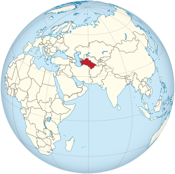
Location of Turkmenistan (red)
|
|
| Capital and largest city
|
Ashgabat 37°58′N 58°20′E / 37.967°N 58.333°E |
| Official languages | Turkmen |
| Ethnic groups
(2012)
|
|
| Religion
(2020)
|
|
| Demonym(s) | Turkmenistani Turkmen |
| Government | Unitary presidential republic under a totalitarian hereditary dictatorship |
| Serdar Berdimuhamedow | |
| Raşit Meredow | |
|
• Chairman of the People's Council
|
Gurbanguly Berdimuhamedow |
| Legislature | Assembly |
| Establishment | |
| 13 May 1925 | |
|
• Declared independence from the Soviet Union
|
22 August 1990 |
|
• Recognized
|
26 December 1991 |
|
• Current constitution
|
18 May 1992 |
| Area | |
|
• Total
|
491,210 km2 (189,660 sq mi) (52nd) |
|
• Water
|
24,069 km2 (9,293 sq mi) |
|
• Water (%)
|
4.9 |
| Population | |
|
• 2022 census
|
7,057,841 |
|
• Density
|
14.4/km2 (37.3/sq mi) (221st) |
| GDP (PPP) | 2023 estimate |
|
• Total
|
|
|
• Per capita
|
|
| GDP (nominal) | 2023 estimate |
|
• Total
|
|
|
• Per capita
|
|
| Gini (1998) | 40.8 medium |
| HDI (2022) | high · 94th |
| Currency | Manat (TMT) |
| Time zone | UTC+05 (TMT) |
| Driving side | right |
| Calling code | +993 |
| ISO 3166 code | TM |
| Internet TLD | .tm |
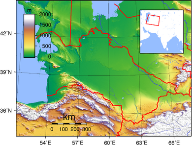
Turkmenistan is a country in Central Asia. It does not have a coastline on the ocean. It is surrounded by Kazakhstan to the northwest, Uzbekistan to the north and east, Afghanistan to the southeast, and Iran to the south. To the west is the Caspian Sea.
Ashgabat is the capital and largest city. Turkmenistan is one of six independent countries where people speak Turkic languages. With over 7 million people, it is the 35th most populated country in Asia. It has the smallest population among the Central Asian republics. It is also one of the least crowded countries in Asia.
Turkmenistan has been a pathway for many different empires and cultures for a long time. Merv, an ancient oasis city, was once one of the biggest cities in the world. It was also an important city in the Muslim world and a key stop on the famous Silk Road. In 1881, the Russian Empire took control of Turkmenistan. Later, in 1925, it became a part of the Soviet Union as the Turkmen Soviet Socialist Republic. Turkmenistan became independent when the Soviet Union broke apart in 1991.
Since gaining independence, Turkmenistan has been led by strong governments. These include Saparmurat Niyazov until 2006, then Gurbanguly Berdimuhamedow, and now his son Serdar Berdimuhamedow. The country has faced some criticism for its lack of press and religious freedoms.
Turkmenistan has the world's fifth largest amount of natural gas. Most of the country is covered by the Karakum Desert. From 1993 to 2019, people in Turkmenistan received free electricity, water, and natural gas from the government. Turkmenistan is a member of the United Nations. It is also an observer in the Organisation of Turkic States.
Contents
Understanding the Name of Turkmenistan
The name Turkmenistan comes from two parts. Türkmen refers to the Turkmen people. The second part, -stan, is a Persian word meaning "place of" or "country".
Some people think the word "Turkmen" means "pure Turks" or "the Turkish Turks." This is because the suffix "-men" might make the word stronger. Other ideas suggest it means "almost Turk."
Old Muslim writers said the name came from "Türk" and "iman," which means "faith" in Arabic. This idea is linked to a time in 971 when many people became Muslims.
When Turkmenistan became independent from the Soviet Union in 1991, its new name, Türkmenistan, was officially adopted.
A Look at Turkmenistan's Past
Early History and Turkic Tribes
Long ago, people from the Indo-Iranian groups lived in Turkmenistan. Its written history began when the Achaemenid Empire of Ancient Iran took control. Many centuries later, around 800 AD, Turkic-speaking Oghuz tribes moved into Central Asia from Mongolia. These Oghuz tribes became the main ancestors of the modern Turkmen people.
In the 10th century, the name "Turkmen" was first used for Oghuz groups who became Muslims. They started living in what is now Turkmenistan. They were part of the Seljuk Empire, which was also made up of Oghuz groups. These groups helped spread Turkic culture as they moved west.
Turkmen Independence and Empires
In the 12th century, Turkmen tribes helped to overthrow the Seljuk Empire. Later, in the 13th century, the Mongols took over the northern areas where Turkmens lived. This caused the Turkmens to spread south and form new tribal groups.
Between the 16th and 18th centuries, the nomadic Turkmen tribes often split and joined together. They were very independent and were known for being fierce. By the 1500s, most of these tribes were loosely controlled by two Uzbek kingdoms, Khiva and Bukhoro. Turkmen soldiers were important in the Uzbek armies. In the 1800s, the Yomud Turkmen group caused trouble with raids and rebellions. This led to them being scattered by the Uzbek rulers.
In 1855, the Teke Turkmen tribe, led by Gowshut-Khan, defeated an army from the Khanate of Khiva. In 1861, they also defeated an invading Persian army.

Russian Control and Soviet Era
Russian forces began to take over Turkmen land in the late 1800s. They started from their base at Krasnovodsk (now Türkmenbaşy) on the Caspian Sea. They eventually defeated the Uzbek kingdoms. In 1879, the Russian forces were defeated by the Teke Turkmens in their first attempt to conquer the Ahal area. However, in 1881, the last major resistance in Turkmen territory was crushed at the Battle of Geok Tepe. Soon after, Turkmenistan became part of the Russian Empire.
In 1916, World War I led to a revolt against forced military service across Russian Central Asia, including Turkmenistan. After the Russian Revolution of 1917, Turkmen forces joined others in the Basmachi rebellion against the new Soviet Union. In 1924, the Turkmen Soviet Socialist Republic was formed. By the late 1930s, the Soviet government changed farming methods, which ended the nomadic way of life in Turkmenistan. Moscow then controlled all political life. A big earthquake in Ashgabat in 1948 killed over 110,000 people.
Independence and Modern Turkmenistan
For the next 50 years, Turkmenistan played its role within the Soviet Union. It stayed out of major world events. Even the big changes in Russia in the late 1980s did not affect it much. However, in 1990, the government of Turkmenistan declared its independence. This was a response to feeling used by Moscow.
Turkmenistan was not fully ready for independence. Its leader, Saparmurat Niyazov, even preferred to keep the Soviet Union together. But in October 1991, the Soviet Union broke apart. This forced him to hold a vote, and the people approved independence. On December 26, 1991, the Soviet Union officially ended. Niyazov remained the leader of Turkmenistan. He replaced communism with a unique type of nationalism. He also created a strong public image for himself. In 1999, laws were changed so he did not need to run for re-election, making him president for life.
When Niyazov died in 2006, there was no clear successor. Deputy Prime Minister Gurbanguly Berdimuhamedow became the temporary leader. He then won a special election in 2007. He won two more elections in 2012 and 2017 with a very high percentage of votes. His son, Serdar Berdimuhamedow, won an election in 2022. This created a political family leadership in Turkmenistan. On March 19, 2022, Serdar Berdimuhamedov became the new president.
How Turkmenistan is Governed
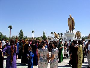
Turkmenistan is a presidential republic. This means the President is both the head of the country and the head of the government. Under former President Niyazov, only one political party was allowed. However, in September 2008, a new Constitution was approved. This new constitution allowed for more political parties to be formed.
The Law-Making Bodies
Turkmenistan has a law-making body called the Assembly (Mejlis). Since January 2023, it has 125 members. These members are chosen for five-year terms.
There is also the People's Council of Turkmenistan (Halk Maslahaty). This council has top constitutional power. Its leader is chosen by the president and is called the "National Leader." State media calls the People's Council the "supreme organ of government authority."
The Justice System
The courts in Turkmenistan are not fully independent. The president chooses all judges, including the head of the Supreme Court. The president can also remove them with the Parliament's approval. This means the president has strong control over the justice system.
Turkmenistan's Land and Climate
Geography and Landscape
Turkmenistan is a large country, about 488,100 square kilometers (188,456 square miles). This makes it the 52nd largest country in the world. It is a bit smaller than Spain.
More than 80% of the country is covered by the Karakum Desert. The middle of the country is mostly flat desert land. Turkmenistan has mountains to the south and east. The Kopet Dag mountain range is along the southwestern border. The highest point in Turkmenistan is Ayrybaba, which is 3,137 meters (10,292 feet) high.
Major rivers include the Amu Darya, the Murghab River, and the Tejen River.
The Turkmen coast along the Caspian Sea is 1,748 kilometers (1,086 miles) long. The Caspian Sea is a large lake with no natural connection to the ocean.
Important cities include Aşgabat, Türkmenbaşy, Balkanabat, Daşoguz, Türkmenabat, and Mary.
Climate and Environment
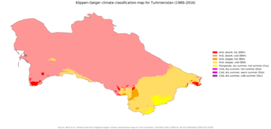
Turkmenistan has a dry desert climate. It is far from the open sea. Mountains to the south block moist air. This leads to low rainfall, few clouds, and high evaporation. Winters are mild and dry. Most rain falls between January and May. The Kopet Dag mountains get the most rain.
The Karakum Desert is one of the driest deserts. Some areas get only 12 millimeters (0.47 inches) of rain each year. The highest temperature recorded in Ashgabat was 48.0 °C (118.4 °F). Turkmenistan gets 235–240 sunny days per year.
Turkmenistan has different natural areas, including steppes, woodlands, and deserts.
Regions of Turkmenistan
Turkmenistan is divided into five provinces, called welayatlar. It also has one capital city district. These provinces are further divided into smaller areas called districts.
| Division | Capital city | Area (km²) | Population (2022) |
|---|---|---|---|
| Ashgabat City | Ashgabat | 470 | 1,030,063 |
| Ahal Province | Arkadag | 97,160 | 886,845 |
| Balkan Province | Balkanabat | 139,270 | 529,895 |
| Daşoguz Province | Daşoguz | 73,430 | 1,550,354 |
| Lebap Province | Türkmenabat | 93,730 | 1,447,298 |
| Mary Province | Mary | 87,150 | 1,613,386 |
Turkmenistan's Economy
Natural Resources and Economic Approach
Turkmenistan has the world's fourth largest amount of natural gas. It also has a lot of oil. The country has been careful with its economic changes. It uses money from gas and cotton sales to support its economy. In 2019, the unemployment rate was about 4.27%.
From 1998 to 2002, Turkmenistan faced challenges because it did not have enough ways to export its natural gas. Also, it had a lot of short-term debt. However, the value of its exports grew a lot because oil and gas prices went up. Later, when prices for oil, gas, and cotton fell in 2014, the country's income from exports dropped. This caused trade deficits from 2015 to 2017.
Some reports have raised concerns about how Turkmenistan manages its money. A lot of its money is kept in special funds outside the main budget.
From 2003 to 2019, citizens received free electricity, natural gas, water, and salt. Each person was allowed a certain amount of these services for free each month. However, these free services ended on January 1, 2019, and people now pay for them.
Natural Gas and Export Routes
As of May 2011, the Galkynysh Gas Field was thought to have the second largest amount of gas in the world. The Turkmenistan Natural Gas Company controls gas extraction. Gas production is a very important part of the country's economy. In 2009, Turkmenistan started to find new ways to export its raw materials.
Before 1958, gas was mostly found with oil in western Turkmenistan. In 1958, the first gas wells were drilled. More oil and gas fields were found in the Karakum Desert between 1959 and 1965. The gas industry really started when the Ojak gas field opened in 1966. By 1989, Turkmenistan was producing 90 billion cubic meters of natural gas. The Soviet Union exported much of this gas to western Europe.
After independence, gas extraction dropped because Turkmenistan was limited to old pipelines controlled by Russia. On January 1, 2016, Russia stopped buying natural gas from Turkmenistan. Russia started buying again in April 2019, but in smaller amounts.
In 1997, the first gas pipeline to a foreign country after independence was built to Iran. It was 140 kilometers long. Turkmenistan stopped sending gas to Iran on January 1, 2017, due to payment issues.
In December 2009, the first part of the pipeline to China opened. This gave Turkmenistan a second big market for its gas. By 2015, Turkmenistan was sending up to 35 billion cubic meters of gas to China each year. China is the biggest buyer of gas from Turkmenistan. This makes China Turkmenistan's main source of income from outside the country.
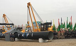
The Turkmenistan government is still working on building the Turkmenistan–Afghanistan–Pakistan–India Pipeline, also known as TAPI. This pipeline is expected to cost $25 billion. Turkmenistan's part of the pipeline was finished in 2019. The parts in Afghanistan and Pakistan are still being built.
Oil Production
Oil has been known to exist in western Turkmenistan since the 1700s. People in the 1800s extracted oil near the surface. Commercial oil drilling started in the 1890s. Oil production grew with new fields found in the 1900s. By 1970, over 14 million tons of oil were produced each year. In 2019, oil production was 9.8 million tons.
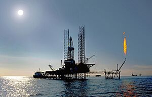
Most oil wells are in the western lowlands. This area also produces natural gas. Many oil fields are found there. Oil is also produced from wells in the Caspian Sea. Most oil is extracted by the Turkmenistan State Company. Much of the oil is refined in Turkmenistan's own refineries. Some oil is sent by ship across the Caspian Sea to Europe.
In January 2021, Azerbaijan and Turkmenistan agreed to work together on an oil field in the Caspian Sea. This field, now called Dostluk (meaning "friendship"), could have a lot of oil and gas.
Energy Production
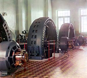
Turkmenistan's first power plant was built in 1909. It started working fully in 1913. Until 1957, most electricity came from small local generators.
In 1957, Soviet leaders created a special group for power generation. By 1979, all rural areas of Turkmenistan had electricity. A big power plant in Mary started being built in 1969. By 1987, it reached its full power capacity.
As of 2010, Turkmenistan had eight major power plants that use natural gas. In 2011, Turkmenistan produced 18.27 billion kWh of electricity. It exported 2.5 billion kWh of this. In 2018, electricity production was over 21 billion kilowatt-hours.
New power plants have been built since 2013. The Mary-3 power plant, finished in 2018, produces a lot of electricity. It is meant to help export more electricity to Afghanistan and Pakistan. Another plant, the Zerger power plant, was finished in 2021. It is also mainly for exporting electricity. The Ahal power plant was built to power Ashgabat and the Olympic Village.
Turkmenistan exports electricity to other Central Asian countries and neighbors to the south. In 2019, Turkmenistan generated over 22.5 billion kilowatt-hours of electricity.
Farming and Agriculture
After independence in 1991, old collective farms became "farmers associations." Almost all crops need irrigation because the climate is very dry. The main crops are wheat and cotton.
Turkmenistan is the world's tenth largest producer of cotton. Cotton production started in the Murghab Valley after the Russian Empire took control of Merv in 1884. Some human rights groups have reported that government workers, like teachers and doctors, are sometimes required to pick cotton. They might lose their jobs if they refuse.
In 2020, Turkmenistan produced about 1.5 million tons of raw cotton. The country uses many tractors and other machines for farming. Before October 2018, Turkmenistan exported raw cotton to many countries. Since 2019, the government has focused on exporting cotton yarn and finished clothes.
Tourism in Turkmenistan
In 2019, Turkmenistan had 14,438 foreign tourists. Tourism has not grown much, even with the creation of the Awaza tourist area on the Caspian Sea. Everyone needs a visa to enter Turkmenistan. To get a tourist visa, most people need help from a local travel agency.
Tourists can visit historical places like Daşoguz, Konye-Urgench, Nisa, Ancient Merv, and Mary. They can also enjoy beach tours in Avaza.
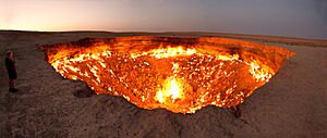
In January 2022, President Gurbanguly Berdimuhamedow ordered that the fire at the Darvaza gas crater should be put out. This crater is a popular tourist spot, sometimes called the "Gateway to Hell." The fire is a concern for the environment and health. It is also part of efforts to export more gas. Some believe a Soviet drilling operation in 1971 caused the fire. However, no one truly knows how it started.
Getting Around Turkmenistan
Roads and Cars
Before the 1917 Russian Revolution, there were only three cars in Turkmenistan, all in Ashgabat. There were no roads between towns. After the revolution, dirt roads were made to connect important places. In 1887–1888, the Gaudan Highway was built between Ashgabat and the Persian border. This helped with trade.
City bus service started in Ashgabat in 1925 with five routes. Taxi service began in 1938. The road network grew in the 1970s with new highways connecting major cities.
The main west-east road is the M37 highway. It links the Turkmenbashy International Seaport to the border with Afghanistan. The main north-south road is the Ashgabat-Dashoguz Automobile Road, built in the 2000s.
A new toll motorway is being built between Ashgabat and Turkmenabat. It will be 600 kilometers long.
Air Travel
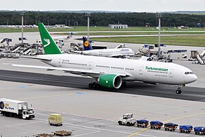
Air service began in 1927 with a route between Çärjew (Turkmenabat) and Tashauz (Dashoguz). They used German and Soviet planes that could carry four passengers. In 1932, an airport was built in Ashgabat for passengers and cargo.
Airports in major cities like Ashgabat, Dashoguz, Mary, Turkmenabat, and Türkmenbaşy have regular domestic flights. Usually, international flights are only at Ashgabat. However, during the COVID-19 pandemic, international flights used Turkmenabat.
State-owned Turkmenistan Airlines is the only airline in Turkmenistan. Its planes are from Boeing and Bombardier Aerospace. More than two thousand passengers fly daily within the country. Turkmenistan Air has regular international flights to many cities around the world.
New international airports were opened in Turkmenabat in 2018 and in Kerki in 2021.
Sea Travel
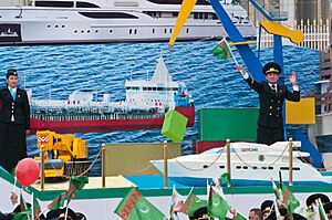
Since 1962, the Turkmenbashy International Seaport has had a passenger ferry to Baku, Azerbaijan. It also has rail ferries to other ports on the Caspian Sea. In recent years, more oil is being transported by tanker ships.
In May 2018, a big expansion of the Turkmenbashy seaport was finished. This project cost $1.5 billion. The expansion added 17 million tons of capacity each year. The ferry and passenger terminals can now serve 300,000 passengers and 75,000 vehicles each year.
Train Travel
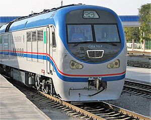
The first train line in Turkmenistan was built in 1880. By 1886, it reached Çärjew. In 1887, a wooden train bridge was built over the Amu Darya river. The line continued to Samarkand and Tashkent. Train service in Turkmenistan started as part of the Russian Empire's Trans-Caspian railway.
After the dissolution of the Soviet Union, the train network was taken over by the state-owned Türkmendemirýollary. The total length of railways is 3,181 kilometers. Only domestic passenger service is available, except for special tour trains. The railway carries about 5.5 million passengers and nearly 24 million tons of goods each year.
Turkmen Railways is building a train line in Afghanistan. This line will connect Serhetabat to Herat.
People and Culture of Turkmenistan
Population and Languages
The last full census was published in 1995. Later census results have been kept secret. However, a total number for the 2022 census was released. Most people in Turkmenistan are ethnic Turkmens. There are also many Uzbeks and Russians. Smaller groups include Kazakhs, Tatars, and Ukrainians.
The percentage of ethnic Russians in Turkmenistan dropped from 18.6% in 1939 to 9.5% in 1989. In 2003, about 85% of the population was Turkmen, 5% Uzbek, and 4% Russian. By 2021, the number of Russians was estimated at 100,000.
The official language of Turkmenistan is Turkmen. This language is similar to Azerbaijani and Turkish. Since the late 1900s, the government has tried to reduce the use of the Russian language. In 1993, they switched to the Latin alphabet. In 1996, Russian lost its status as the main language for communication between different ethnic groups. In 1999, 72% of the population spoke Turkmen.
Religions in Turkmenistan
Most people in Turkmenistan are Muslims, making up 93% of the population. About 6% of the people follow the Eastern Orthodox Church. The remaining 1% follow other religions or no religion.
Turkmen Culture and Traditions
The Turkmen people have traditionally been nomads and skilled horse riders. Even today, after the Soviet Union ended, it has been hard to get Turkmens to live in cities. They were not a single nation until they were brought together by Joseph Stalin in the 1930s. Turkmen people are divided into clans. Each clan has its own way of speaking and dressing.
Turkmens are famous for making beautiful knotted Turkmen carpets. These carpets are colorful and show the differences between the various Turkmen clans. People in the region also build yurts. These are round houses with dome roofs, made from a wooden frame covered with felt. Horses are very important in Turkmenistan. They are used for horse racing and a sport called horseback fighting.
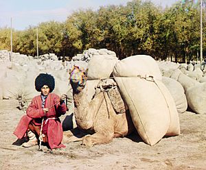
Turkmen men wear traditional telpek hats. These are large hats made of black or white sheepskin. Their traditional clothes include these hats and red robes over white shirts. Women wear long dresses over narrow trousers. Their trousers have embroidery at the ankle. Women's headdresses often have silver jewelry with semi-precious stones.
Celebrations and Holidays
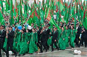
Turkmenistan celebrates several holidays. Some are celebrated internationally, like New Year's Day, Nowruz, Eid al-Fitr, and Eid al-Adha. Turkmenistan also has its own special holidays, such as Melon Day, Turkmen Woman's Day, and the Day of Remembrance for Saparmurat Niyazov.
Learning and Education
Education is available for everyone and is required up to the secondary level. Under former President Niyazov, schooling was 9 years long. President Berdimuhamedov brought back 10-year education in 2007. Since 2013, general education in Turkmenistan has three stages and lasts 12 years. This includes elementary school (grades 1–3), high school (grades 4–8), and secondary school (grades 9–12).
At the end of the 2019–20 school year, almost 80,000 Turkmen students finished high school. About 12,242 of these students went on to universities in Turkmenistan. Another 9,063 went to vocational colleges. Around 95,000 Turkmen students were studying in universities outside the country in 2019.
Buildings and Architecture
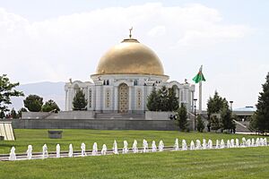
Modern Turkmen architecture combines new styles with traditional elements. Many new buildings, especially in Ashgabat, are covered with white marble. Big projects like Turkmenistan Tower, Bagt köşgi, Alem Cultural and Entertainment Center, and Ashgabat Flagpole have changed the city's look. They help show Turkmenistan's identity as a modern city.
Sports and Games
The most popular sport in Turkmenistan is football. The national team has never played in the FIFA World Cup. However, they have been in the AFC Asian Cup twice, in 2004 and 2019. They did not get past the first round in either tournament. Another popular sport is archery. Turkmenistan holds local competitions for archery. Turkmenistan has hosted international sports events, including the 2017 Asian Indoor and Martial Arts Games and the 2018 World Weightlifting Championships.
Images for kids
See also
 In Spanish: Turkmenistán para niños


