San Luis Obispo County, California facts for kids
Quick facts for kids
San Luis Obispo County
|
|||||
|---|---|---|---|---|---|
| County of San Luis Obispo | |||||
|
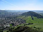
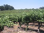
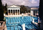
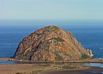
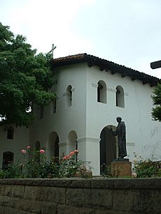
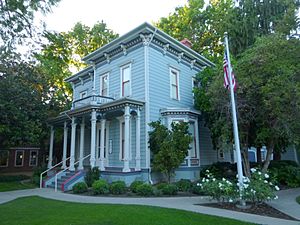
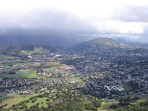
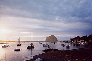
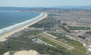
Images, from top down, left to right: Cerro San Luis (Mountain) in San Luis Obispo, a vineyard in Paso Robles, Pismo Beach, Mission San Miguel Arcángel, Neptune Pool at Hearst Castle, Morro Rock
|
|||||
|
|||||
| Motto(s):
"Not For Ourselves Alone"
|
|||||
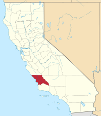
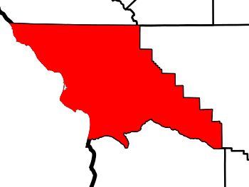
Location in the state of California
|
|||||
| Country | United States | ||||
| State | California | ||||
| Region | California Central Coast | ||||
| Incorporated | February 18, 1850 | ||||
| Named for | Saint Louis, Bishop of Toulouse | ||||
| County seat | San Luis Obispo | ||||
| Largest city (Population) | San Luis Obispo | ||||
| Largest city (Area) | Atascadero | ||||
| Government | |||||
| • Type | Council–Administration | ||||
| • Body | San Luis Obispo County Board of Supervisors | ||||
| Area | |||||
| • Total | 3,616 sq mi (9,370 km2) | ||||
| • Land | 3,299 sq mi (8,540 km2) | ||||
| • Water | 317 sq mi (820 km2) | ||||
| Highest elevation | 5,109 ft (1,557 m) | ||||
| Population
(2020)
|
|||||
| • Total | 282,424 | ||||
| • Density | 86/sq mi (33/km2) | ||||
| GDP | |||||
| • Total | $21.713 billion (2022) | ||||
| Time zone | UTC-8 (Pacific Time Zone) | ||||
| • Summer (DST) | UTC-7 (Pacific Daylight Time) | ||||
| Area code(s) | 805 | ||||
| Congressional district | 24th | ||||
| Website | https://www.slocounty.ca.gov/ | ||||
San Luis Obispo County is a county located on the Central Coast of California. In 2020, about 282,424 people lived here. The main city and county seat is San Luis Obispo.
Junípero Serra started the Mission San Luis Obispo de Tolosa in 1772. The city of San Luis Obispo grew around this mission. The county has many small towns spread along its beautiful beaches, coastal hills, and mountains. This area is great for fishing, farming, and tourism.
California Polytechnic State University is a large school in the county with almost 20,000 students. Tourism is very popular, especially visiting the many wineries. Grapes and other farm products are a big part of the local economy. San Luis Obispo County is the third largest producer of wine in California. Only Sonoma and Napa counties make more wine. Strawberries are the biggest farm crop grown here.
The town of San Simeon is near Hearst Castle, a famous mansion built by newspaper publisher William Randolph Hearst. Other towns along the coast include Cambria, Cayucos, Morro Bay, and Los Osos -Baywood Park. These towns are northwest of San Luis Obispo city. To the south are Avila Beach and the "Five Cities" area. This area includes Pismo Beach, Grover Beach, Arroyo Grande, Oceano, and Halcyon. Inland, cities like Paso Robles, Templeton, and Atascadero are found along the Salinas River. This is also where the Paso Robles wine region is located.
Contents
History of San Luis Obispo County
The Chumash people lived in San Luis Obispo County long before others arrived. They had important settlements in coastal areas like Morro Bay and Los Osos thousands of years ago.
The Mission San Luis Obispo de Tolosa was founded on September 1, 1772. It was built in the area that is now the city of San Luis Obispo. The mission, city, and county are all named after Saint Louis of Toulouse. He was a young bishop from Toulouse in 1297.
San Luis Obispo County was one of the first counties created in California. This happened in 1850 when California became a state. The Salinas River Valley stretches north from the county. This area is famous from several books by John Steinbeck.
Geography and Climate
San Luis Obispo County covers about 3,616 square miles. Most of this area, about 3,299 square miles, is land. The remaining 317 square miles is water.
Local Climate Types
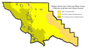
San Luis Obispo County has three main types of climate.
- A dry, cool steppe climate (BSk) is found mostly in the eastern parts of the county.
- A hot-summer Mediterranean climate (Csa) is common in central areas, like Paso Robles.
- The rest of the county has a warm-summer Mediterranean climate (Csb). This climate, along with the varied landscapes, can remind visitors of places in Europe.
Neighboring Areas
San Luis Obispo County shares borders with:
- Monterey County to the north.
- Kings County to the northeast.
- Kern County to the east.
- Santa Barbara County to the south.
- The Pacific Ocean to the west.
Protected Natural Areas
The county is home to several important protected natural areas:
- Carrizo Plain National Monument (part of it)
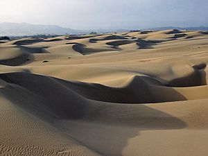
- Guadalupe-Nipomo Dunes National Wildlife Refuge (part of it)
- Los Padres National Forest (part of it)
Protected Ocean Areas
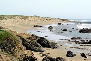
There are also special areas in the ocean near the county that are protected:
- Cambria State Marine Conservation Area
- Chumash Heritage National Marine Sanctuary
- Morro Bay State Marine Recreational Management Area and Morro Bay State Marine Reserve
- Piedras Blancas State Marine Reserve and Marine Conservation Area
- Point Buchon State Marine Reserve and Marine Conservation Area
- White Rock (Cambria) State Marine Conservation Area
Population and People
| Historical population | |||
|---|---|---|---|
| Census | Pop. | %± | |
| 1850 | 336 | — | |
| 1860 | 1,782 | 430.4% | |
| 1870 | 4,772 | 167.8% | |
| 1880 | 9,142 | 91.6% | |
| 1890 | 16,072 | 75.8% | |
| 1900 | 16,637 | 3.5% | |
| 1910 | 19,383 | 16.5% | |
| 1920 | 21,893 | 12.9% | |
| 1930 | 29,613 | 35.3% | |
| 1940 | 33,246 | 12.3% | |
| 1950 | 51,417 | 54.7% | |
| 1960 | 81,044 | 57.6% | |
| 1970 | 105,690 | 30.4% | |
| 1980 | 155,435 | 47.1% | |
| 1990 | 217,162 | 39.7% | |
| 2000 | 246,681 | 13.6% | |
| 2010 | 269,637 | 9.3% | |
| 2020 | 282,424 | 4.7% | |
| 2023 (est.) | 281,639 | 4.5% | |
| U.S. Decennial Census 1790–1960 1900–1990 1990–2000 2010 2020 |
|||
Population in 2020
In 2020, San Luis Obispo County had a population of 282,424 people.
- About 65% of the people were White (not Hispanic or Latino).
- About 24% of the people were Hispanic or Latino (of any race).
- Other groups included Asian (3.5%), Black or African American (1.5%), and Native American (0.4%).
- About 4.8% of people identified as being of two or more races.
Economy and Jobs
The economy of San Luis Obispo County mainly relies on three things:
- California Polytechnic State University, with nearly 20,000 students.
- Tourism, which brings many visitors to the area.
- Agriculture, which is farming and growing crops.
The county's economy is mostly based on service jobs, like those in hotels, restaurants, and shops. These jobs make up about 38% of all jobs. Government jobs account for about 20.7%, and manufacturing jobs are about 6%.
San Luis Obispo County is the third largest producer of wine in California. Only Sonoma and Napa counties produce more wine. Wine grapes are the second biggest farm crop, after strawberries. The wine industry also helps tourism grow, as many people visit to explore the wine country.
In 2018, the county was a leader in growing hemp for research. This shows how important agriculture is to the area.
Fire Protection Services
| Agency overview | |
|---|---|
| Annual calls | Approximately 20,000 |
| Annual budget | 25 million |
| Facilities and equipment | |
| Battalions | 5 |
| Stations | 21 |
| Engines | 17 - first run 5 - reserve |
| Rescues | 2 |
| Tenders | 3 |
| HAZMAT | 1 |
| USAR | 2 |
| Airport crash | 2 |
| Wildland | 2 - type 3 |
| Light and air | 1 |
The San Luis Obispo County Fire Department provides fire protection and emergency services. They work with CAL FIRE and have been doing so since 1930. This department helps areas like Los Osos, Oceano, and Avila Beach. The city of San Luis Obispo has its own fire department.
Transportation and Travel
Main Highways
 U.S. Route 101
 State Route 1
 State Route 33
 State Route 41
 State Route 46
 State Route 58
 State Route 166
 State Route 227
 State Route 229
Public Transport Options
You can travel around San Luis Obispo County using public transportation.
- Amtrak trains and Greyhound Lines buses offer ways to travel between cities.
- The San Luis Obispo Regional Transit Authority (SLORTA) provides bus service across the county. This includes routes along US 101 and to towns like Morro Bay, Los Osos, Cambria, and San Simeon.
- The cities of San Luis Obispo, Atascadero, and Paso Robles have their own local bus services. These services connect with the SLORTA routes.
- FlixBus also offers bus services from the San Luis Obispo Railroad Museum.
Airports in the County
San Luis Obispo County has a few airports:
- San Luis Obispo County Regional Airport (SBP) is just south of San Luis Obispo city. You can find commercial flights here.
- Paso Robles Municipal Airport (PRB) is northeast of Paso Robles city. It is home to the California Highway Patrol, CAL-FIRE, and the Estrella Warbirds Museum.
- Oceano County Airport (L52) is located on the coast in the "Five Cities" area.
Communities in San Luis Obispo County
Cities in the County
- Arroyo Grande
- Atascadero
- Grover Beach
- Morro Bay
- Paso Robles
- Pismo Beach
- San Luis Obispo (This is the county seat, meaning it's the main city for county government.)
Other Communities (Unincorporated)
- Avila Beach
- Baywood Park
- Blacklake
- California Polytechnic State University
- California Valley
- Callender
- Cambria
- Cayucos
- Creston
- Cholame
- Edna
- Garden Farms
- Halcyon
- Harmony
- Lake Nacimiento
- Los Berros
- Los Osos
- Los Ranchos
- Nipomo
- Oak Shores
- Oceano
- Pozo
- San Miguel
- San Simeon
- Santa Margarita
- Shandon
- Templeton
- Whitley Gardens
- Woodlands
Population Ranking of Communities
The following table shows the population of cities and towns in San Luis Obispo County, based on the 2020 census.
† county seat
| Rank | City/Town/etc. | Type | Population (2020 Census) |
|---|---|---|---|
| 1 | † San Luis Obispo | City | 47,063 |
| 2 | Paso Robles (El Paso de Robles) | City | 31,490 |
| 3 | Atascadero | City | 29,773 |
| 4 | Arroyo Grande | City | 18,441 |
| 5 | Nipomo | CDP | 18,176 |
| 6 | Los Osos | CDP | 14,465 |
| 7 | Grover Beach | City | 12,701 |
| 8 | Morro Bay | City | 10,757 |
| 9 | Templeton | CDP | 8,386 |
| 10 | Pismo Beach | City | 8,072 |
| 11 | Oceano | CDP | 7,183 |
| 12 | Cambria | CDP | 5,678 |
| 13 | San Miguel | CDP | 3,172 |
| 14 | Lake Nacimiento | CDP | 2,956 |
| 15 | Cayucos | CDP | 2,505 |
| 16 | Woodlands | CDP | 1,933 |
| 17 | Avila Beach | CDP | 1,576 |
| 18 | Los Ranchos | CDP | 1,516 |
| 19 | Santa Margarita | CDP | 1,291 |
| 20 | Callender | CDP | 1,282 |
| 21 | Shandon | CDP | 1,168 |
| 22 | Blacklake | CDP | 1,016 |
| 23 | Los Berros | CDP | 623 |
| 24 | Garden Farms | CDP | 449 |
| 25 | San Simeon | CDP | 445 |
| 26 | Whitley Gardens | CDP | 325 |
| 27 | Oak Shores | CDP | 316 |
| 28 | Edna | CDP | 184 |
| 29 | Creston | CDP | 98 |
Images for kids
-
A pair of Bat stars near Los Osos.
See also
 In Spanish: Condado de San Luis Obispo para niños
 | Kyle Baker |
 | Joseph Yoakum |
 | Laura Wheeler Waring |
 | Henry Ossawa Tanner |


