Transportation in Boston facts for kids
Transportation in Boston is how people and goods move around the city of Boston, Massachusetts. It includes roads, subways, trains, planes, and boats. The Massachusetts Port Authority (Massport) runs the Port of Boston, which handles big ships, and Logan International Airport, where planes take off and land.
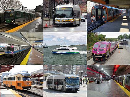
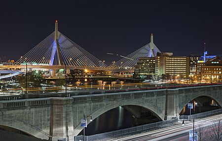
The Massachusetts Bay Transportation Authority (MBTA), often called "the T," operates buses, subways, local trains, and water ferries. Amtrak provides train service to other big cities in the Northeastern United States. A large bus station at South Station serves many bus companies that travel between cities. Boston also has major highways, I-90 and I-93. Their intersection was part of a huge project called the Big Dig.
Contents
Road Travel
Boston's Roads
Most of Boston's streets are not in a straight grid pattern, except for areas like Back Bay. Many smaller towns joined Boston over time. This means some street names are repeated across the city.
Highways around Boston include two main ring roads: Interstate 495 and Route 128. Several highways also spread out from the city like spokes on a wheel. These include:
- Interstate 93: Goes north into New Hampshire and south to the Braintree Split.
- Interstate 90 (the Massachusetts Turnpike): Connects Boston with Worcester and Springfield.
- United States Route 1: Crosses the Tobin Bridge and goes north to Newburyport.
- Storrow Drive: A fast road along the Charles River that links downtown Boston to the Route 2 area.
- Massachusetts Route 2: Serves towns northwest of Boston like Lexington and Concord.
- Massachusetts Route 3: Connects Boston with Cape Cod.
- United States Route 3: A separate highway serving towns like Lowell and Burlington.
- Interstate 95: Connects Boston to Rhode Island through I-93.
In the early 1990s, traffic on the elevated parts of I-93 was very heavy. There were many accidents. For many years, driving in Boston was difficult because of the Big Dig. This was a huge project that cost about $14 billion. It was the most expensive road project in US history.
After more than 15 years, the Big Dig finished. It helped for a while, but traffic jams soon returned. Boston is still one of the most crowded cities for drivers in the US. Many one-way streets and changing traffic rules make a GPS navigation system very helpful.
Walking and Biking
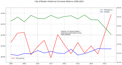
Boston is known as "America's Walking City." It is ranked as one of the most walkable cities in the US. Many people walk or bike because the city is not very big. In 2000, over 13% of Boston workers walked to their jobs. This was the highest percentage among major US cities.
Biking is also popular for fun and for getting to work. Some roads have bike paths, but there are few separate paths. The Minuteman Bikeway and Charles River bike paths are popular. The Emerald Necklace park system also offers nice routes for cyclists. Many MBTA riders use bikes to get to a station. More bike racks and storage have been added.
In 2006, Bicycling magazine said Boston was one of the worst cities for cycling. This was due to bad roads and few bike lanes. However, since 2007, Mayor Thomas Menino started the Boston Bikes program. It has added bike lanes and racks. The city has also made it easier for office buildings to have showers for bikers.
There are groups like Critical Mass and MassBike that support cyclists in Boston. The LivableStreets Alliance also works for better biking and walking in the area.
Maps and Guides
The Boston regional Metropolitan Area Planning Council (MAPC) gives out a free "Greater Boston Cycling & Walking Map." You can also find it online.
Rubel BikeMaps also publishes maps and books about biking in Boston. It is important to use the newest versions because bike paths are always changing.
Today, many people use online mapping services like Google Maps on their phones. The MBTA shares its train and bus location data. This means many apps can show you when your bus or train will arrive. Google Maps even shows maps of subway stations underground.
Buses
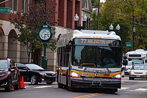
The MBTA has 162 bus routes in the Boston area. About 375,000 trips are made by bus each day. This makes it the seventh-busiest bus system in the country. Some routes use trackless trolleys, which are buses powered by overhead electric lines. These mainly run in Cambridge.
A bus ride costs $1.70 with a CharlieCard or $2 with cash. You can also buy monthly passes. The MBTA also has a bus rapid transit (BRT) line called the Silver Line. It tries to be faster than regular buses. Some parts of the Silver Line use special bus lanes or tunnels.
Massport runs the Logan Express. This is a fast bus service from Logan International Airport to parking lots outside the city. Many private bus services also connect Boston to its suburbs. Colleges and hospitals also have their own shuttle buses.
Parking
Boston was founded in 1630, long before cars existed. So, the city was not built for parking. Parking is very hard to find and expensive. Some parking spots have sold for over $160,000!
The city has a resident permit parking program. This saves street parking for people who live in certain neighborhoods. But even with permits, parking can be scarce. Parking meters cost $1.25 per hour.
The number of public parking spots downtown has been limited since the 1970s. This is part of a plan to help with air pollution.
The MBTA has many large park and ride lots near its subway and train lines. These are great places for visitors to leave their cars. Then they can use public transport to see the city without parking worries.
Train Travel
Boston has two main train networks. One is the MBTA's "T" system. It includes light rail (like streetcars) and traditional subway lines. The other network is for longer-distance trains. It includes commuter trains, intercity passenger trains, and freight trains.
The two networks are mostly separate. But they sometimes run next to each other. You can switch between subway and commuter trains at some stations.
Subway System
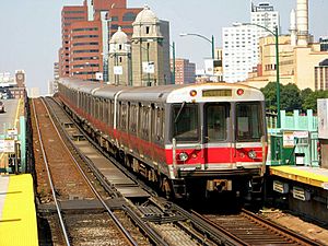
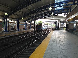
Boston has the oldest subway system in North America. The first underground streetcar ran in 1897. Today, the Massachusetts Bay Transportation Authority (MBTA) owns and runs the whole subway system.
In the 1960s, the MBTA created its famous "T" logo. Today, Bostonians call their subway system "the T." It is the fourth busiest in the country. About 273,000 trips are made on its heavy rail lines each day.
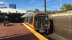
A one-way subway ride costs $2.40. You can also buy monthly passes or visitor passes. There are four subway lines in Boston: the Red Line, Green Line, Orange Line, and Blue Line. Each color has a special meaning:
- Blue Line: Runs under Boston Harbor.
- Red Line: Used to end at Harvard University, whose color is red.
- Orange Line: Used to run along Washington Street, once called Orange Street.
- Green Line: Runs through green park areas like the Emerald Necklace.
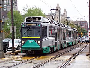
The Green Line is actually four different lines (B, C, D, and E). They all start together but then split into different directions. So, you need to make sure you get on the right Green Line train when leaving downtown. The Red Line also splits, with trains going to either Braintree or Ashmont.
Most of Boston's subway system uses a third rail for power. But parts of the Blue Line and all of the Green Line use overhead lines. The Green Line and Ashmont–Mattapan High Speed Line are technically light-rail services. They use smaller streetcars instead of large subway cars. The Ashmont–Mattapan line uses classic "PCC" trolleys.
The MBTA has screens at stations that show when the next two trains will arrive. You can also find real-time train and bus information online using many different apps.
Elevated Sections
Even though the first subway was underground, many later parts were built as elevated railways. Today, most of these elevated sections have been replaced by tunnels or cuts. The only remaining elevated structures are parts of the Green Line and a short section of the Red Line near Charles-MGH.
In the past, these elevated lines existed:
- Causeway Street Elevated (closed 2004)
- Washington Street Elevated (closed 1987)
- Charlestown Elevated (closed 1975)
- Atlantic Avenue Elevated (closed 1938)
Common Rail Network
This network is different from the subway. It is owned by the MBTA and other freight companies. Commuter trains are run by Keolis Commuter Services for the MBTA. Amtrak runs intercity passenger trains. Freight trains are run by various companies.
Commuter Rail
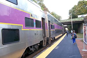
The MBTA commuter rail system brings people into Boston from towns as far away as Worcester and Providence. About 125,000 trips are made on the commuter rail each day. This makes it the fifth-busiest commuter rail system in the country.
Boston has two main train stations: North Station and South Station. Trains from the north end at North Station. Trains from the south and west end at South Station. There is no direct train connection between North Station and South Station. You usually need to take two different subway lines to switch between them.
Intercity Rail
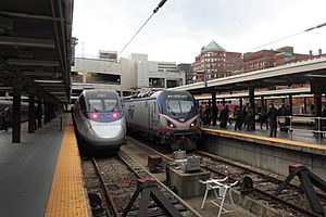
Boston has four intercity train services, all run by Amtrak. The Acela and Northeast Regional trains go to Washington, D.C., stopping in cities like New York City and Philadelphia. A branch of the Lake Shore Limited goes to Chicago. The Downeaster goes to Brunswick, Maine.
Most of these trains end at South Station. The Downeaster ends at North Station. If you need to switch between North and South Station, you can use the subway. Amtrak suggests taking a taxi if you have a lot of luggage.
Freight Rail
CSX is the main freight train company in Boston. It uses its own lines and also shares tracks with the MBTA. Another important freight company is Pan Am Railways (PAR). It runs lines north and west of Boston.
There are only a few train freight customers left in Boston. These include a chemical company and food distribution centers.
Water Travel
Port of Boston
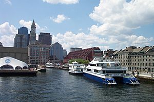
The Port of Boston is a major seaport and the biggest port in Massachusetts. It was very important for Boston's growth in the past. The original port was in what is now downtown Boston. But now, that area is used for other things. The US Coast Guard still has a base there. Many ferries and tourist boats also use it.
Today, the main cargo areas are in Charlestown, East Boston, South Boston, and Everett. In 2011, the port handled over 11.5 million tons of cargo. This included many shipping containers. It also handles oil, natural gas, cars, and other goods.
The Black Falcon Cruise Terminal in South Boston was updated in 2010. In 2012, it served over 380,000 cruise passengers.
Passenger Boat Services
The MBTA Boat system has several ferry routes on Boston Harbor. One route connects downtown to the Boston Navy Yard in Charlestown. Other routes are for commuters. They link downtown to towns like Hingham and Hull. Some services also connect to Logan International Airport. Private companies run all these services for the MBTA.
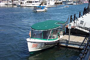
Outside the MBTA system, there are seasonal ferries to the Boston Harbor Islands. You can also take ferries to Salem and Provincetown. Water taxis offer on-demand rides from the downtown waterfront and Logan Airport.
Several companies offer tourist boat rides on the harbor and the Charles River. Other companies have "duck tours." These use special vehicles that can drive on streets and float on water! A unique Boston experience is riding the human-powered Swan Boats in the city's Public Garden.
Public Transportation Facts
On average, people in Boston spend 83 minutes commuting by public transit on a weekday. About 29% of riders travel for more than two hours each day. People wait about 15 minutes at a stop or station. About 24% of riders wait for over 20 minutes. The average distance people travel in one trip is 7 kilometers (about 4.3 miles).
Air Travel
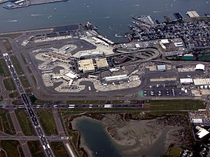
Boston's main airport is Logan International Airport (BOS). It is in East Boston, right across the harbor from downtown. Massport runs Logan Airport, which has many flights to places all over the world.
Logan Airport is connected to downtown by several tunnels. The Silver Line bus connects the airport terminals to South Station. There are also shuttle buses between the terminals and the Blue Line Airport station.
To help with crowding at Logan, Massport also runs two other airports in eastern Massachusetts:
- L.G. Hanscom Field
- Worcester Regional Airport
Massport also works with two other airports outside Massachusetts as "reliever" airports:
- T. F. Green Airport in Providence, Rhode Island
- Manchester-Boston Regional Airport in Manchester, New Hampshire
Around 2010, the MBTA commuter rail started new train service from T.F. Green Airport to Boston.
There are also smaller airports for private planes in the Boston area.
Since the September 11, 2001 attacks, security has been very strict at Boston's airports. Because Boston is the closest major US port to Europe, it is often used for emergency landings for planes flying to the US.
Boston Vision Zero Plan
In 2015, Mayor Marty Walsh announced that Boston would join a worldwide program called Vision Zero. This plan aims to stop all deaths caused by transportation. This includes deaths of people walking, driving, or biking.
Since 2015, Boston has made changes to improve safety. These include a citywide speed limit of 25 miles per hour. They also created "Neighborhood Slow Streets." These are tools to make cars slow down in neighborhoods. Pedestrian deaths have gone down from 82 in 2017 to 57 in 2019. Cyclist deaths also dropped from 10 in 2017 to just 3 in 2019.
Boston wants to spend more money on this plan. They plan for more slow streets, speed bumps, and curb extensions. They aim to have zero vehicle crash deaths by 2030. The Boston Transportation Department also wants to focus on safety near schools.
|
 | Delilah Pierce |
 | Gordon Parks |
 | Augusta Savage |
 | Charles Ethan Porter |


