
List of British heritage and private railways facts for kids
<mapframe text="Interactive map of standard gauge heritage railways in Great Britain." latitude="53.9583" longitude="-1.0803" zoom="5" width="300" height="300" align="right"> { "type": "FeatureCollection", "generator": "overpass-ide", "copyright": "The data included in this document is from www.openstreetmap.org. The data is made available under ODbL.", "timestamp": "2019-05-11T13:19:02Z", "features": [ { "type": "Feature", "properties": { "@id": "relation/5494016", "name": "Strathspey Railway", "railway": "preserved", "start_date": "1863-08-03", "type": "route" }, "geometry": { "type": "LineString", "coordinates": [ [ -3.8283, 57.1904 ], [ -3.8283, 57.1905 ], [ -3.8281, 57.1907 ], [ -3.8278, 57.1913 ], [ -3.8275, 57.1918 ], [ -3.8272, 57.1922 ], [ -3.8269, 57.1926 ], [ -3.8267, 57.1929 ], [ -3.8265, 57.1931 ], [ -3.8264, 57.1933 ], [ -3.8260, 57.1937 ], [ -3.8258, 57.1939 ], [ -3.8256, 57.1941 ], [ -3.8254, 57.1943 ], [ -3.8235, 57.1964 ], [ -3.8211, 57.1990 ], [ -3.8197, 57.2004 ], [ -3.8191, 57.2011 ], [ -3.8185, 57.2018 ], [ -3.8172, 57.2031 ], [ -3.8167, 57.2036 ], [ -3.8163, 57.2041 ], [ -3.8162, 57.2043 ], [ -3.8147, 57.2058 ], [ -3.8132, 57.2074 ], [ -3.8117, 57.2091 ], [ -3.8112, 57.2096 ], [ -3.8107, 57.2100 ], [ -3.8095, 57.2112 ], [ -3.8092, 57.2115 ], [ -3.8086, 57.2119 ], [ -3.8082, 57.2123 ], [ -3.8078, 57.2126 ], [ -3.8064, 57.2135 ], [ -3.8043, 57.2149 ], [ -3.7999, 57.2179 ], [ -3.7959, 57.2207 ], [ -3.7915, 57.2237 ], [ -3.7896, 57.2251 ], [ -3.7879, 57.2263 ], [ -3.7870, 57.2271 ], [ -3.7860, 57.2280 ], [ -3.7850, 57.2290 ], [ -3.7840, 57.2301 ], [ -3.7834, 57.2307 ], [ -3.7828, 57.2313 ], [ -3.7823, 57.2316 ], [ -3.7819, 57.2320 ], [ -3.7816, 57.2322 ], [ -3.7813, 57.2324 ], [ -3.7811, 57.2325 ], [ -3.7807, 57.2328 ], [ -3.7800, 57.2332 ], [ -3.7795, 57.2335 ], [ -3.7783, 57.2341 ], [ -3.7775, 57.2344 ], [ -3.7766, 57.2348 ], [ -3.7757, 57.2351 ], [ -3.7751, 57.2353 ], [ -3.7744, 57.2355 ], [ -3.7732, 57.2359 ], [ -3.7719, 57.2363 ], [ -3.7664, 57.2380 ], [ -3.7654, 57.2383 ], [ -3.7646, 57.2385 ], [ -3.7639, 57.2388 ], [ -3.7633, 57.2390 ], [ -3.7626, 57.2393 ], [ -3.7620, 57.2395 ], [ -3.7610, 57.2400 ], [ -3.7602, 57.2405 ], [ -3.7592, 57.2410 ], [ -3.7582, 57.2416 ], [ -3.7575, 57.2421 ], [ -3.7567, 57.2427 ], [ -3.7561, 57.2432 ], [ -3.7558, 57.2435 ], [ -3.7556, 57.2437 ], [ -3.7554, 57.2439 ], [ -3.7552, 57.2440 ], [ -3.7551, 57.2442 ], [ -3.7547, 57.2446 ], [ -3.7546, 57.2448 ], [ -3.7542, 57.2452 ], [ -3.7541, 57.2453 ], [ -3.7539, 57.2455 ], [ -3.7536, 57.2459 ], [ -3.7533, 57.2465 ], [ -3.7532, 57.2466 ], [ -3.7530, 57.2470 ], [ -3.7528, 57.2473 ], [ -3.7525, 57.2481 ], [ -3.7522, 57.2489 ], [ -3.7521, 57.2493 ], [ -3.7519, 57.2497 ], [ -3.7518, 57.2502 ], [ -3.7517, 57.2504 ], [ -3.7516, 57.2506 ], [ -3.7516, 57.2508 ], [ -3.7514, 57.2510 ], [ -3.7513, 57.2512 ], [ -3.7511, 57.2516 ], [ -3.7510, 57.2519 ], [ -3.7507, 57.2522 ], [ -3.7505, 57.2526 ], [ -3.7502, 57.2530 ], [ -3.7500, 57.2532 ], [ -3.7498, 57.2534 ], [ -3.7495, 57.2537 ], [ -3.7492, 57.2540 ], [ -3.7491, 57.2541 ], [ -3.7489, 57.2543 ], [ -3.7486, 57.2546 ], [ -3.7480, 57.2550 ], [ -3.7472, 57.2556 ], [ -3.7468, 57.2559 ], [ -3.7464, 57.2561 ], [ -3.7452, 57.2568 ], [ -3.7442, 57.2574 ], [ -3.7431, 57.2579 ], [ -3.7375, 57.2611 ], [ -3.7344, 57.2628 ], [ -3.7334, 57.2633 ], [ -3.7324, 57.2639 ], [ -3.7302, 57.2649 ], [ -3.7283, 57.2659 ], [ -3.7274, 57.2663 ], [ -3.7265, 57.2667 ], [ -3.7252, 57.2672 ], [ -3.7240, 57.2678 ], [ -3.7221, 57.2685 ], [ -3.7209, 57.2690 ], [ -3.7198, 57.2694 ], [ -3.7188, 57.2698 ], [ -3.7179, 57.2701 ], [ -3.7165, 57.2706 ], [ -3.7152, 57.2710 ], [ -3.7133, 57.2716 ], [ -3.7113, 57.2722 ], [ -3.7076, 57.2734 ], [ -3.7040, 57.2745 ], [ -3.7028, 57.2749 ], [ -3.7017, 57.2752 ], [ -3.7008, 57.2754 ], [ -3.7000, 57.2757 ], [ -3.6987, 57.2760 ], [ -3.6973, 57.2764 ], [ -3.6961, 57.2767 ], [ -3.6935, 57.2773 ], [ -3.6934, 57.2773 ], [ -3.6933, 57.2774 ], [ -3.6903, 57.2781 ], [ -3.6887, 57.2786 ], [ -3.6870, 57.2790 ], [ -3.6861, 57.2792 ], [ -3.6851, 57.2795 ], [ -3.6845, 57.2796 ], [ -3.6839, 57.2797 ], [ -3.6832, 57.2799 ], [ -3.6825, 57.2800 ], [ -3.6818, 57.2801 ], [ -3.6810, 57.2803 ], [ -3.6804, 57.2803 ], [ -3.6799, 57.2804 ], [ -3.6791, 57.2805 ], [ -3.6784, 57.2806 ], [ -3.6779, 57.2806 ], [ -3.6773, 57.2807 ], [ -3.6766, 57.2807 ], [ -3.6759, 57.2808 ], [ -3.6744, 57.2809 ], [ -3.6739, 57.2809 ], [ -3.6733, 57.2810 ], [ -3.6729, 57.2811 ], [ -3.6725, 57.2811 ], [ -3.6721, 57.2812 ], [ -3.6717, 57.2813 ], [ -3.6712, 57.2814 ], [ -3.6708, 57.2815 ], [ -3.6705, 57.2816 ], [ -3.6700, 57.2818 ], [ -3.6693, 57.2821 ], [ -3.6687, 57.2824 ], [ -3.6682, 57.2826 ], [ -3.6677, 57.2829 ], [ -3.6671, 57.2834 ], [ -3.6667, 57.2837 ], [ -3.6663, 57.2841 ], [ -3.6662, 57.2842 ], [ -3.6660, 57.2845 ], [ -3.6657, 57.2849 ], [ -3.6654, 57.2854 ], [ -3.6652, 57.2862 ], [ -3.6651, 57.2865 ], [ -3.6651, 57.2867 ], [ -3.6650, 57.2871 ], [ -3.6649, 57.2874 ], [ -3.6647, 57.2880 ], [ -3.6645, 57.2888 ], [ -3.6641, 57.2899 ], [ -3.6638, 57.2905 ], [ -3.6635, 57.2911 ], [ -3.6632, 57.2916 ], [ -3.6629, 57.2922 ], [ -3.6624, 57.2928 ], [ -3.6620, 57.2934 ], [ -3.6615, 57.2939 ], [ -3.6610, 57.2944 ], [ -3.6605, 57.2949 ], [ -3.6600, 57.2954 ], [ -3.6588, 57.2964 ], [ -3.6578, 57.2971 ], [ -3.6563, 57.2980 ] ] }, "id": "relation/5494016" }, { "type": "Feature", "properties": { "@id": "way/105910739", "designation": "Sheffield & District Society of Model & Experimental Engineers Ltd", "name": "Abbeydale Miniature Railway", "railway": "preserved", "tourism": "attraction" }, "geometry": { "type": "Polygon", "coordinates": [ [ [ -1.5189, 53.3306 ], [ -1.5189, 53.3306 ], [ -1.5193, 53.3305 ], [ -1.5193, 53.3304 ], [ -1.5193, 53.3303 ], [ -1.5192, 53.3302 ], [ -1.5192, 53.3302 ], [ -1.5192, 53.3301 ], [ -1.5192, 53.3301 ], [ -1.5190, 53.3299 ], [ -1.5189, 53.3298 ], [ -1.5182, 53.3295 ], [ -1.5180, 53.3294 ], [ -1.5180, 53.3294 ], [ -1.5176, 53.3300 ], [ -1.5189, 53.3306 ] ] ] }, "id": "way/105910739" }, { "type": "Feature", "properties": { "@id": "way/204327234", "building": "shed", "railway": "preserved", "service": "siding" }, "geometry": { "type": "Polygon", "coordinates": [ [ [ -0.7245, 54.4327 ], [ -0.7245, 54.4327 ], [ -0.7243, 54.4329 ], [ -0.7245, 54.4330 ], [ -0.7246, 54.4328 ], [ -0.7245, 54.4327 ] ] ] }, "id": "way/204327234" }, { "type": "Feature", "properties": { "@id": "way/284422223", "railway": "preserved", "tourism": "attraction" }, "geometry": { "type": "Polygon", "coordinates": [ [ [ -3.2741, 51.3923 ], [ -3.2746, 51.3922 ], [ -3.2748, 51.3922 ], [ -3.2748, 51.3922 ], [ -3.2748, 51.3922 ], [ -3.2741, 51.3922 ], [ -3.2741, 51.3923 ], [ -3.2741, 51.3923 ] ] ] }, "id": "way/284422223" }, { "type": "Feature", "properties": { "@id": "way/309594243", "area": "yes", "name": "Swithland Sidings", "railway": "preserved", "service": "siding" }, "geometry": { "type": "Polygon", "coordinates": [ [ [ -1.1674, 52.7140 ], [ -1.1660, 52.7128 ], [ -1.1646, 52.7116 ], [ -1.1649, 52.7123 ], [ -1.1655, 52.7132 ], [ -1.1662, 52.7139 ], [ -1.1664, 52.7144 ], [ -1.1667, 52.7143 ], [ -1.1671, 52.7141 ], [ -1.1674, 52.7140 ] ] ] }, "id": "way/309594243" }, { "type": "Feature", "properties": { "@id": "way/319922343", "area": "yes", "name": "SKLR Kemsley Down", "railway": "preserved" }, "geometry": { "type": "Polygon", "coordinates": [ [ [ 0.7578, 51.3615 ], [ 0.7578, 51.3615 ], [ 0.7575, 51.3616 ], [ 0.7575, 51.3617 ], [ 0.7573, 51.3617 ], [ 0.7576, 51.3622 ], [ 0.7571, 51.3624 ], [ 0.7571, 51.3624 ], [ 0.7564, 51.3614 ], [ 0.7564, 51.3614 ], [ 0.7568, 51.3613 ], [ 0.7569, 51.3612 ], [ 0.7569, 51.3613 ], [ 0.7572, 51.3611 ], [ 0.7574, 51.3612 ], [ 0.7579, 51.3614 ], [ 0.7578, 51.3615 ] ] ] }, "id": "way/319922343" }, { "type": "Feature", "properties": { "@id": "way/552611494", "landuse": "railway", "railway": "preserved" }, "geometry": { "type": "Polygon", "coordinates": [ [ [ -1.1679, 50.7023 ], [ -1.1683, 50.7018 ], [ -1.1681, 50.7016 ], [ -1.1680, 50.7018 ], [ -1.1672, 50.7022 ], [ -1.1650, 50.7031 ], [ -1.1650, 50.7031 ], [ -1.1649, 50.7032 ], [ -1.1639, 50.7036 ], [ -1.1638, 50.7036 ], [ -1.1625, 50.7043 ], [ -1.1612, 50.7051 ], [ -1.1613, 50.7052 ], [ -1.1613, 50.7052 ], [ -1.1624, 50.7045 ], [ -1.1630, 50.7042 ], [ -1.1637, 50.7038 ], [ -1.1638, 50.7037 ], [ -1.1639, 50.7037 ], [ -1.1645, 50.7035 ], [ -1.1650, 50.7032 ], [ -1.1651, 50.7032 ], [ -1.1658, 50.7029 ], [ -1.1677, 50.7022 ], [ -1.1679, 50.7023 ] ] ] }, "id": "way/552611494" }, { "type": "Feature", "properties": { "@id": "way/552611514", "landuse": "railway", "railway": "preserved" }, "geometry": { "type": "Polygon", "coordinates": [ [ [ -1.1613, 50.7052 ], [ -1.1612, 50.7051 ], [ -1.1612, 50.7052 ], [ -1.1592, 50.7065 ], [ -1.1578, 50.7073 ], [ -1.1571, 50.7078 ], [ -1.1565, 50.7082 ], [ -1.1561, 50.7085 ], [ -1.1557, 50.7088 ], [ -1.1554, 50.7092 ], [ -1.1552, 50.7097 ], [ -1.1551, 50.7100 ], [ -1.1550, 50.7104 ], [ -1.1552, 50.7104 ], [ -1.1553, 50.7100 ], [ -1.1556, 50.7095 ], [ -1.1556, 50.7092 ], [ -1.1560, 50.7088 ], [ -1.1562, 50.7085 ], [ -1.1567, 50.7082 ], [ -1.1575, 50.7077 ], [ -1.1593, 50.7065 ], [ -1.1604, 50.7058 ], [ -1.1613, 50.7052 ] ] ] }, "id": "way/552611514" }, { "type": "Feature", "properties": { "@id": "way/552611515", "landuse": "railway", "railway": "preserved" }, "geometry": { "type": "Polygon", "coordinates": [ [ [ -1.1564, 50.7129 ], [ -1.1561, 50.7126 ], [ -1.1557, 50.7120 ], [ -1.1554, 50.7115 ], [ -1.1553, 50.7111 ], [ -1.1552, 50.7108 ], [ -1.1552, 50.7104 ], [ -1.1550, 50.7104 ], [ -1.1550, 50.7108 ], [ -1.1550, 50.7109 ], [ -1.1550, 50.7110 ], [ -1.1548, 50.7110 ], [ -1.1549, 50.7111 ], [ -1.1549, 50.7111 ], [ -1.1550, 50.7114 ], [ -1.1551, 50.7114 ], [ -1.1553, 50.7118 ], [ -1.1554, 50.7119 ], [ -1.1555, 50.7121 ], [ -1.1560, 50.7126 ], [ -1.1563, 50.7129 ], [ -1.1564, 50.7129 ] ] ] }, "id": "way/552611515" }, { "type": "Feature", "properties": { "@id": "way/552611516", "landuse": "railway", "railway": "preserved" }, "geometry": { "type": "Polygon", "coordinates": [ [ [ -1.1688, 50.7016 ], [ -1.1710, 50.7002 ], [ -1.1723, 50.6994 ], [ -1.1727, 50.6991 ], [ -1.1725, 50.6991 ], [ -1.1716, 50.6995 ], [ -1.1714, 50.6997 ], [ -1.1711, 50.6999 ], [ -1.1708, 50.7001 ], [ -1.1702, 50.7005 ], [ -1.1694, 50.7011 ], [ -1.1687, 50.7015 ], [ -1.1688, 50.7016 ] ] ] }, "id": "way/552611516" }, { "type": "Feature", "properties": { "@id": "way/3032463", "electrified": "no", "gauge": "1435", "name": "Swanage Railway", "railway": "preserved", "service": "spur" }, "geometry": { "type": "LineString", "coordinates": [ [ -2.0560, 50.6394 ], [ -2.0559, 50.6392 ], [ -2.0556, 50.6389 ], [ -2.0553, 50.6386 ], [ -2.0549, 50.6382 ], [ -2.0544, 50.6379 ], [ -2.0536, 50.6373 ], [ -2.0527, 50.6367 ], [ -2.0525, 50.6366 ], [ -2.0501, 50.6349 ], [ -2.0498, 50.6346 ], [ -2.0494, 50.6342 ] ] }, "id": "way/3032463" }, { "type": "Feature", "properties": { "@id": "way/3992867", "railway": "preserved" }, "geometry": { "type": "LineString", "coordinates": [ [ -1.1958, 52.7691 ], [ -1.1957, 52.7683 ], [ -1.1955, 52.7671 ] ] }, "id": "way/3992867" }, { "type": "Feature", "properties": { "@id": "way/3992869", "railway": "preserved", "source": "Bing" }, "geometry": { "type": "LineString", "coordinates": [ [ -1.1877, 52.7405 ], [ -1.1876, 52.7402 ], [ -1.1874, 52.7395 ], [ -1.1873, 52.7393 ], [ -1.1872, 52.7388 ], [ -1.1869, 52.7377 ] ] }, "id": "way/3992869" }, { "type": "Feature", "properties": { "@id": "way/4016197", "layer": "-1", "name": "Greet Tunnel", "railway": "preserved", "tunnel": "yes" }, "geometry": { "type": "LineString", "coordinates": [ [ -1.9689, 51.9696 ], [ -1.9716, 51.9716 ], [ -1.9734, 51.9725 ], [ -1.9757, 51.9734 ] ] }, "id": "way/4016197" }, { "type": "Feature", "properties": { "@id": "way/4016362", "name": "Severn Valley Railway", "railway": "preserved", "source": "NPE;Bing" }, "geometry": { "type": "LineString", "coordinates": [ [ -2.2427, 52.3774 ], [ -2.2425, 52.3775 ], [ -2.2425, 52.3776 ], [ -2.2424, 52.3777 ], [ -2.2422, 52.3779 ], [ -2.2421, 52.3782 ], [ -2.2419, 52.3784 ], [ -2.2417, 52.3789 ], [ -2.2414, 52.3793 ], [ -2.2411, 52.3800 ], [ -2.2409, 52.3803 ], [ -2.2408, 52.3804 ], [ -2.2407, 52.3806 ], [ -2.2407, 52.3807 ], [ -2.2406, 52.3809 ], [ -2.2405, 52.3811 ], [ -2.2404, 52.3812 ], [ -2.2404, 52.3813 ], [ -2.2404, 52.3815 ], [ -2.2404, 52.3818 ], [ -2.2403, 52.3820 ], [ -2.2398, 52.3839 ], [ -2.2398, 52.3841 ] ] }, "id": "way/4016362" }, { "type": "Feature", "properties": { "@id": "way/4016382", "gauge": "1435", "name": "Severn Valley Railway", "railway": "preserved", "source": "bing" }, "geometry": { "type": "LineString", "coordinates": [ [ -2.3223, 52.3876 ], [ -2.3233, 52.3894 ], [ -2.3241, 52.3909 ], [ -2.3245, 52.3914 ], [ -2.3246, 52.3916 ], [ -2.3249, 52.3920 ], [ -2.3253, 52.3925 ], [ -2.3257, 52.3929 ], [ -2.3259, 52.3931 ], [ -2.3262, 52.3934 ], [ -2.3265, 52.3937 ], [ -2.3269, 52.3941 ], [ -2.3272, 52.3944 ], [ -2.3274, 52.3946 ], [ -2.3277, 52.3949 ], [ -2.3280, 52.3952 ], [ -2.3283, 52.3956 ], [ -2.3285, 52.3958 ], [ -2.3286, 52.3960 ], [ -2.3288, 52.3964 ], [ -2.3291, 52.3969 ], [ -2.3293, 52.3973 ], [ -2.3298, 52.3982 ], [ -2.3299, 52.3985 ], [ -2.3301, 52.3990 ], [ -2.3303, 52.3998 ], [ -2.3304, 52.4001 ], [ -2.3305, 52.4004 ], [ -2.3305, 52.4008 ], [ -2.3305, 52.4010 ], [ -2.3304, 52.4013 ], [ -2.3304, 52.4015 ], [ -2.3301, 52.4023 ], [ -2.3301, 52.4024 ], [ -2.3300, 52.4027 ], [ -2.3300, 52.4029 ], [ -2.3300, 52.4031 ], [ -2.3300, 52.4032 ], [ -2.3300, 52.4035 ], [ -2.3301, 52.4037 ], [ -2.3301, 52.4039 ], [ -2.3302, 52.4041 ], [ -2.3303, 52.4043 ], [ -2.3305, 52.4046 ], [ -2.3307, 52.4048 ], [ -2.3310, 52.4052 ], [ -2.3312, 52.4053 ], [ -2.3314, 52.4056 ], [ -2.3317, 52.4058 ], [ -2.3320, 52.4060 ], [ -2.3325, 52.4064 ], [ -2.3329, 52.4066 ], [ -2.3333, 52.4068 ], [ -2.3337, 52.4070 ], [ -2.3341, 52.4071 ], [ -2.3347, 52.4074 ], [ -2.3351, 52.4075 ], [ -2.3355, 52.4076 ], [ -2.3360, 52.4077 ], [ -2.3363, 52.4078 ], [ -2.3383, 52.4080 ], [ -2.3389, 52.4081 ], [ -2.3396, 52.4083 ], [ -2.3404, 52.4085 ], [ -2.3409, 52.4086 ], [ -2.3413, 52.4088 ], [ -2.3418, 52.4089 ], [ -2.3422, 52.4091 ], [ -2.3427, 52.4094 ], [ -2.3431, 52.4096 ], [ -2.3434, 52.4098 ], [ -2.3438, 52.4101 ], [ -2.3442, 52.4105 ] ] }, "id": "way/4016382" }, { "type": "Feature", "properties": { "@id": "way/4016399", "gauge": "1435", "name": "Severn Valley Railway", "railway": "preserved", "source": "bing" }, "geometry": { "type": "LineString", "coordinates": [ [ -2.3613, 52.4216 ], [ -2.3615, 52.4218 ], [ -2.3620, 52.4223 ], [ -2.3622, 52.4225 ], [ -2.3624, 52.4227 ], [ -2.3625, 52.4229 ], [ -2.3627, 52.4232 ], [ -2.3630, 52.4236 ], [ -2.3632, 52.4240 ], [ -2.3635, 52.4246 ], [ -2.3637, 52.4249 ], [ -2.3640, 52.4253 ], [ -2.3643, 52.4259 ] ] }, "id": "way/4016399" }, { "type": "Feature", "properties": { "@id": "way/4016401", "gauge": "1435", "name": "Severn Valley Railway", "operator": "Severn Valley Railway PLC", "railway": "preserved", "source": "bing" }, "geometry": { "type": "LineString", "coordinates": [ [ -2.3910, 52.4924 ], [ -2.3916, 52.4926 ], [ -2.3924, 52.4929 ], [ -2.3929, 52.4931 ], [ -2.3932, 52.4932 ], [ -2.3937, 52.4934 ], [ -2.3940, 52.4936 ], [ -2.3944, 52.4938 ], [ -2.3946, 52.4939 ], [ -2.3949, 52.4941 ], [ -2.3955, 52.4945 ], [ -2.3957, 52.4947 ], [ -2.3959, 52.4948 ], [ -2.3962, 52.4952 ], [ -2.3964, 52.4954 ] ] }, "id": "way/4016401" }, { "type": "Feature", "properties": { "@id": "way/4081160", "name": "Keighley and Worth Valley Railway", "railway": "preserved", "source": "OS 1:25k" }, "geometry": { "type": "LineString", "coordinates": [ [ -1.9527, 53.8147 ], [ -1.9525, 53.8148 ], [ -1.9525, 53.8149 ], [ -1.9522, 53.8153 ], [ -1.9520, 53.8154 ], [ -1.9517, 53.8156 ], [ -1.9513, 53.8159 ], [ -1.9504, 53.8163 ], [ -1.9502, 53.8164 ], [ -1.9497, 53.8166 ], [ -1.9495, 53.8167 ], [ -1.9488, 53.8171 ], [ -1.9483, 53.8174 ], [ -1.9479, 53.8177 ], [ -1.9475, 53.8181 ], [ -1.9472, 53.8186 ], [ -1.9469, 53.8191 ], [ -1.9467, 53.8197 ], [ -1.9466, 53.8201 ] ] }, "id": "way/4081160" }, { "type": "Feature", "properties": { "@id": "way/4136733", "railway": "preserved", "usage": "tourism" }, "geometry": { "type": "LineString", "coordinates": [ [ -2.7590, 50.7108 ], [ -2.7588, 50.7109 ], [ -2.7587, 50.7110 ], [ -2.7585, 50.7113 ] ] }, "id": "way/4136733" }, { "type": "Feature", "properties": { "@id": "way/4307887", "railway": "preserved" }, "geometry": { "type": "LineString", "coordinates": [ [ -2.4751, 51.4381 ], [ -2.4748, 51.4385 ], [ -2.4745, 51.4387 ], [ -2.4738, 51.4393 ], [ -2.4736, 51.4394 ], [ -2.4729, 51.4399 ], [ -2.4726, 51.4401 ], [ -2.4723, 51.4403 ], [ -2.4701, 51.4414 ], [ -2.4694, 51.4418 ], [ -2.4691, 51.4420 ], [ -2.4686, 51.4423 ], [ -2.4681, 51.4427 ], [ -2.4680, 51.4428 ], [ -2.4677, 51.4431 ], [ -2.4674, 51.4433 ], [ -2.4671, 51.4436 ], [ -2.4669, 51.4439 ], [ -2.4666, 51.4443 ], [ -2.4665, 51.4445 ], [ -2.4664, 51.4446 ] ] }, "id": "way/4307887" }, { "type": "Feature", "properties": { "@id": "way/4308575", "layer": "1", "name": "Great Central Railway", "railway": "preserved" }, "geometry": { "type": "LineString", "coordinates": [ [ -1.1727, 52.7170 ], [ -1.1700, 52.7155 ], [ -1.1695, 52.7152 ], [ -1.1689, 52.7148 ], [ -1.1685, 52.7145 ], [ -1.1679, 52.7141 ] ] }, "id": "way/4308575" }, { "type": "Feature", "properties": { "@id": "way/4313351", "bridge": "yes", "layer": "1", "name": "GWR extension to Stratford upon Avon", "railway": "preserved" }, "geometry": { "type": "LineString", "coordinates": [ [ -1.8765, 52.0401 ], [ -1.8764, 52.0402 ] ] }, "id": "way/4313351" }, { "type": "Feature", "properties": { "@id": "way/4313354", "railway": "preserved" }, "geometry": { "type": "LineString", "coordinates": [ [ -1.8729, 52.0425 ], [ -1.8725, 52.0427 ], [ -1.8721, 52.0430 ], [ -1.8709, 52.0438 ], [ -1.8700, 52.0446 ], [ -1.8677, 52.0463 ] ] }, "id": "way/4313354" }, { "type": "Feature", "properties": { "@id": "way/4317405", "electrified": "no", "name": "Mid Hants Railway", "railway": "preserved", "source": "npe" }, "geometry": { "type": "LineString", "coordinates": [ [ -1.1675, 51.0881 ], [ -1.1666, 51.0882 ], [ -1.1654, 51.0883 ], [ -1.1638, 51.0884 ] ] }, "id": "way/4317405" }, { "type": "Feature", "properties": { "@id": "way/4352844", "name": "Keith and Dufftown Railway", "railway": "preserved", "source": "OS_OpenData_StreetView" }, "geometry": { "type": "LineString", "coordinates": [ [ -2.9557, 57.5469 ], [ -2.9553, 57.5463 ], [ -2.9551, 57.5460 ], [ -2.9550, 57.5457 ], [ -2.9549, 57.5454 ], [ -2.9549, 57.5451 ], [ -2.9549, 57.5448 ] ] }, "id": "way/4352844" }, { "type": "Feature", "properties": { "@id": "way/4352845", "name": "Keith and Dufftown Railway", "railway": "preserved", "source": "NPE" }, "geometry": { "type": "LineString", "coordinates": [ [ -3.0022, 57.5013 ], [ -3.0038, 57.5005 ], [ -3.0055, 57.4995 ], [ -3.0077, 57.4982 ], [ -3.0086, 57.4977 ], [ -3.0097, 57.4971 ], [ -3.0114, 57.4964 ], [ -3.0116, 57.4963 ], [ -3.0116, 57.4963 ] ] }, "id": "way/4352845" }, { "type": "Feature", "properties": { "@id": "way/4354255", "name": "GWR extension to Broadway", "railway": "preserved" }, "geometry": { "type": "LineString", "coordinates": [ [ -1.8966, 52.0299 ], [ -1.8950, 52.0308 ], [ -1.8940, 52.0314 ], [ -1.8912, 52.0327 ], [ -1.8851, 52.0356 ], [ -1.8833, 52.0365 ], [ -1.8827, 52.0368 ], [ -1.8807, 52.0378 ] ] }, "id": "way/4354255" }, { "type": "Feature", "properties": { "@id": "way/4354256", "bridge": "yes", "layer": "1", "name": "GWR extension to Broadway", "railway": "preserved" }, "geometry": { "type": "LineString", "coordinates": [ [ -1.8969, 52.0297 ], [ -1.8966, 52.0299 ] ] }, "id": "way/4354256" }, { "type": "Feature", "properties": { "@id": "way/4354259", "railway": "preserved" }, "geometry": { "type": "LineString", "coordinates": [ [ -1.8764, 52.0402 ], [ -1.8744, 52.0415 ], [ -1.8733, 52.0422 ], [ -1.8731, 52.0423 ], [ -1.8730, 52.0424 ] ] }, "id": "way/4354259" }, { "type": "Feature", "properties": { "@id": "way/4354260", "bridge": "yes", "railway": "preserved" }, "geometry": { "type": "LineString", "coordinates": [ [ -1.8730, 52.0424 ], [ -1.8729, 52.0425 ] ] }, "id": "way/4354260" }, { "type": "Feature", "properties": { "@id": "way/4407361", "layer": "0", "name": "Great Central Railway", "railway": "preserved" }, "geometry": { "type": "LineString", "coordinates": [ [ -1.1327, 52.6706 ], [ -1.1328, 52.6701 ], [ -1.1328, 52.6696 ], [ -1.1330, 52.6689 ], [ -1.1331, 52.6685 ], [ -1.1332, 52.6679 ], [ -1.1333, 52.6678 ], [ -1.1334, 52.6675 ] ] }, "id": "way/4407361" }, { "type": "Feature", "properties": { "@id": "way/4413833", "name": "East Lancashire Railway", "railway": "preserved" }, "geometry": { "type": "LineString", "coordinates": [ [ -2.3008, 53.5923 ], [ -2.3003, 53.5929 ], [ -2.2998, 53.5935 ] ] }, "id": "way/4413833" }, { "type": "Feature", "properties": { "@id": "way/4476062", "historic:name": "Ashby & Nuneaton Joint Railway", "historic:start_date": "1873", "name": "Battlefield Line Railway", "railway": "preserved" }, "geometry": { "type": "LineString", "coordinates": [ [ -1.4408, 52.6544 ], [ -1.4407, 52.6541 ], [ -1.4406, 52.6537 ], [ -1.4406, 52.6533 ], [ -1.4406, 52.6519 ], [ -1.4407, 52.6510 ], [ -1.4407, 52.6500 ], [ -1.4408, 52.6492 ], [ -1.4408, 52.6481 ], [ -1.4408, 52.6476 ], [ -1.4407, 52.6471 ], [ -1.4407, 52.6467 ], [ -1.4406, 52.6463 ], [ -1.4403, 52.6456 ], [ -1.4402, 52.6452 ], [ -1.4400, 52.6449 ], [ -1.4396, 52.6441 ], [ -1.4390, 52.6434 ], [ -1.4385, 52.6427 ], [ -1.4379, 52.6421 ], [ -1.4370, 52.6414 ], [ -1.4366, 52.6410 ], [ -1.4361, 52.6407 ], [ -1.4353, 52.6402 ], [ -1.4348, 52.6400 ], [ -1.4344, 52.6397 ], [ -1.4339, 52.6395 ], [ -1.4333, 52.6392 ], [ -1.4323, 52.6388 ], [ -1.4311, 52.6383 ], [ -1.4299, 52.6378 ], [ -1.4293, 52.6376 ], [ -1.4287, 52.6373 ], [ -1.4281, 52.6370 ], [ -1.4275, 52.6367 ], [ -1.4270, 52.6363 ], [ -1.4264, 52.6360 ], [ -1.4259, 52.6356 ], [ -1.4254, 52.6353 ], [ -1.4249, 52.6349 ], [ -1.4244, 52.6345 ], [ -1.4236, 52.6337 ], [ -1.4232, 52.6332 ], [ -1.4228, 52.6328 ], [ -1.4224, 52.6323 ], [ -1.4221, 52.6318 ], [ -1.4216, 52.6308 ], [ -1.4213, 52.6303 ], [ -1.4210, 52.6296 ], [ -1.4208, 52.6289 ], [ -1.4207, 52.6284 ], [ -1.4206, 52.6279 ], [ -1.4206, 52.6273 ], [ -1.4206, 52.6265 ], [ -1.4206, 52.6260 ], [ -1.4208, 52.6254 ], [ -1.4210, 52.6247 ], [ -1.4214, 52.6236 ], [ -1.4214, 52.6235 ], [ -1.4227, 52.6203 ], [ -1.4234, 52.6186 ], [ -1.4237, 52.6178 ], [ -1.4240, 52.6170 ], [ -1.4242, 52.6161 ], [ -1.4243, 52.6157 ], [ -1.4244, 52.6152 ], [ -1.4245, 52.6145 ], [ -1.4245, 52.6139 ], [ -1.4244, 52.6127 ], [ -1.4243, 52.6120 ], [ -1.4241, 52.6115 ], [ -1.4239, 52.6108 ], [ -1.4237, 52.6101 ], [ -1.4233, 52.6095 ], [ -1.4230, 52.6089 ], [ -1.4227, 52.6083 ], [ -1.4223, 52.6078 ], [ -1.4215, 52.6067 ], [ -1.4209, 52.6061 ], [ -1.4206, 52.6058 ], [ -1.4203, 52.6055 ] ] }, "id": "way/4476062" }, { "type": "Feature", "properties": { "@id": "way/4476167", "historic:name": "Ashby & Nuneaton Joint Railway", "historic:start_date": "1873", "name": "Battlefield Line Railway", "railway": "preserved" }, "geometry": { "type": "LineString", "coordinates": [ [ -1.4412, 52.6557 ], [ -1.4416, 52.6563 ], [ -1.4416, 52.6564 ], [ -1.4419, 52.6569 ] ] }, "id": "way/4476167" }, { "type": "Feature", "properties": { "@id": "way/4570357", "name": "Gloucestershire Warwickshire Railway", "railway": "preserved" }, "geometry": { "type": "LineString", "coordinates": [ [ -1.9285, 51.9893 ], [ -1.9285, 51.9882 ], [ -1.9285, 51.9879 ], [ -1.9285, 51.9874 ], [ -1.9286, 51.9868 ], [ -1.9287, 51.9853 ], [ -1.9287, 51.9848 ], [ -1.9288, 51.9840 ], [ -1.9289, 51.9831 ], [ -1.9289, 51.9827 ], [ -1.9289, 51.9822 ], [ -1.9290, 51.9819 ], [ -1.9292, 51.9812 ] ] }, "id": "way/4570357" }, { "type": "Feature", "properties": { "@id": "way/4573768", "description": "Single-line working passing place", "electrified": "no", "gauge": "1435", "railway": "preserved", "source": "Bing", "tracks": "1" }, "geometry": { "type": "LineString", "coordinates": [ [ -1.9474, 53.9731 ], [ -1.9477, 53.9731 ], [ -1.9479, 53.9731 ], [ -1.9481, 53.9731 ], [ -1.9512, 53.9735 ], [ -1.9515, 53.9736 ], [ -1.9519, 53.9736 ], [ -1.9521, 53.9737 ] ] }, "id": "way/4573768" }, { "type": "Feature", "properties": { "@id": "way/4581602", "name": "Epping Ongar Railway", "railway": "preserved", "source": "yahoo", "tracks": "1" }, "geometry": { "type": "LineString", "coordinates": [ [ 0.1892, 51.7114 ], [ 0.1865, 51.7114 ], [ 0.1829, 51.7114 ], [ 0.1800, 51.7114 ], [ 0.1766, 51.7114 ], [ 0.1735, 51.7114 ], [ 0.1704, 51.7114 ], [ 0.1677, 51.7114 ], [ 0.1673, 51.7114 ], [ 0.1659, 51.7114 ], [ 0.1647, 51.7114 ], [ 0.1630, 51.7114 ], [ 0.1621, 51.7113 ], [ 0.1616, 51.7113 ] ] }, "id": "way/4581602" }, { "type": "Feature", "properties": { "@id": "way/4661268", "layer": "-1", "name": "Sharpthorne Tunnel", "railway": "preserved", "source": "NPE;OS_OpenData_StreetView", "tunnel": "yes" }, "geometry": { "type": "LineString", "coordinates": [ [ -0.0441, 51.0770 ], [ -0.0443, 51.0761 ], [ -0.0444, 51.0757 ], [ -0.0449, 51.0738 ], [ -0.0456, 51.0711 ] ] }, "id": "way/4661268" }, { "type": "Feature", "properties": { "@id": "way/4661269", "name": "Bluebell Railway", "railway": "preserved", "source": "npe;OS_OpenData_StreetView" }, "geometry": { "type": "LineString", "coordinates": [ [ -0.0449, 51.0462 ], [ -0.0457, 51.0452 ], [ -0.0466, 51.0441 ], [ -0.0473, 51.0430 ], [ -0.0473, 51.0428 ] ] }, "id": "way/4661269" }, { "type": "Feature", "properties": { "@id": "way/4661270", "railway": "preserved", "source": "NPE;OS_OpenData_StreetView" }, "geometry": { "type": "LineString", "coordinates": [ [ -0.0437, 51.0782 ], [ -0.0441, 51.0770 ] ] }, "id": "way/4661270" }, { "type": "Feature", "properties": { "@id": "way/4662419", "name": "Spa Valley Railway", "railway": "preserved" }, "geometry": { "type": "LineString", "coordinates": [ [ 0.2535, 51.1236 ], [ 0.2531, 51.1236 ], [ 0.2515, 51.1235 ], [ 0.2515, 51.1235 ], [ 0.2512, 51.1235 ] ] }, "id": "way/4662419" }, { "type": "Feature", "properties": { "@id": "way/4674591", "electrified": "no", "gauge": "1435", "name": "Swanage Railway", "railway": "preserved", "service": "spur" }, "geometry": { "type": "LineString", "coordinates": [ [ -2.0830, 50.6504 ], [ -2.0824, 50.6502 ], [ -2.0817, 50.6500 ], [ -2.0811, 50.6499 ], [ -2.0805, 50.6498 ], [ -2.0799, 50.6497 ], [ -2.0792, 50.6496 ], [ -2.0786, 50.6495 ], [ -2.0779, 50.6495 ], [ -2.0773, 50.6495 ], [ -2.0768, 50.6495 ], [ -2.0762, 50.6495 ], [ -2.0755, 50.6495 ], [ -2.0750, 50.6496 ], [ -2.0743, 50.6495 ], [ -2.0735, 50.6495 ], [ -2.0728, 50.6494 ], [ -2.0721, 50.6493 ], [ -2.0715, 50.6492 ], [ -2.0710, 50.6490 ], [ -2.0705, 50.6489 ], [ -2.0697, 50.6487 ], [ -2.0692, 50.6485 ], [ -2.0687, 50.6483 ], [ -2.0682, 50.6481 ], [ -2.0674, 50.6477 ], [ -2.0670, 50.6475 ], [ -2.0666, 50.6473 ], [ -2.0662, 50.6471 ], [ -2.0658, 50.6469 ], [ -2.0646, 50.6462 ], [ -2.0641, 50.6458 ], [ -2.0640, 50.6458 ], [ -2.0635, 50.6454 ], [ -2.0631, 50.6451 ], [ -2.0628, 50.6450 ], [ -2.0626, 50.6448 ], [ -2.0610, 50.6442 ], [ -2.0607, 50.6440 ], [ -2.0604, 50.6439 ], [ -2.0601, 50.6437 ], [ -2.0595, 50.6434 ], [ -2.0590, 50.6431 ], [ -2.0584, 50.6425 ], [ -2.0582, 50.6424 ], [ -2.0577, 50.6418 ] ] }, "id": "way/4674591" }, { "type": "Feature", "properties": { "@id": "way/4715041", "railway": "preserved", "source": "landsat and npe" }, "geometry": { "type": "LineString", "coordinates": [ [ -2.2083, 53.5894 ], [ -2.2086, 53.5894 ], [ -2.2087, 53.5894 ], [ -2.2089, 53.5894 ], [ -2.2091, 53.5894 ], [ -2.2093, 53.5894 ], [ -2.2096, 53.5894 ], [ -2.2098, 53.5894 ], [ -2.2100, 53.5894 ], [ -2.2102, 53.5894 ], [ -2.2104, 53.5893 ], [ -2.2107, 53.5893 ], [ -2.2109, 53.5892 ], [ -2.2112, 53.5892 ], [ -2.2119, 53.5889 ], [ -2.2127, 53.5887 ], [ -2.2133, 53.5886 ], [ -2.2137, 53.5885 ], [ -2.2143, 53.5883 ], [ -2.2147, 53.5882 ], [ -2.2152, 53.5881 ], [ -2.2158, 53.5880 ], [ -2.2164, 53.5879 ], [ -2.2169, 53.5879 ], [ -2.2178, 53.5878 ], [ -2.2185, 53.5877 ], [ -2.2192, 53.5876 ], [ -2.2197, 53.5876 ], [ -2.2204, 53.5875 ] ] }, "id": "way/4715041" }, { "type": "Feature", "properties": { "@id": "way/4793235", "name": "Eden Valley Railway", "railway": "preserved" }, "geometry": { "type": "LineString", "coordinates": [ [ -2.3849, 54.5368 ], [ -2.3854, 54.5371 ], [ -2.3858, 54.5372 ], [ -2.3868, 54.5377 ], [ -2.3874, 54.5379 ], [ -2.3884, 54.5382 ], [ -2.3898, 54.5385 ], [ -2.3912, 54.5389 ], [ -2.3930, 54.5393 ], [ -2.3948, 54.5398 ], [ -2.3996, 54.5410 ], [ -2.4005, 54.5413 ], [ -2.4013, 54.5415 ], [ -2.4021, 54.5418 ], [ -2.4029, 54.5421 ], [ -2.4038, 54.5426 ], [ -2.4046, 54.5429 ], [ -2.4074, 54.5439 ], [ -2.4125, 54.5457 ], [ -2.4126, 54.5457 ] ] }, "id": "way/4793235" }, { "type": "Feature", "properties": { "@id": "way/4946927", "railway": "preserved", "service": "siding" }, "geometry": { "type": "LineString", "coordinates": [ [ -2.3086, 53.5837 ], [ -2.3084, 53.5839 ], [ -2.3082, 53.5841 ], [ -2.3081, 53.5843 ], [ -2.3077, 53.5848 ] ] }, "id": "way/4946927" }, { "type": "Feature", "properties": { "@id": "way/4946932", "railway": "preserved" }, "geometry": { "type": "LineString", "coordinates": [ [ -2.3008, 53.5923 ], [ -2.3013, 53.5917 ], [ -2.3016, 53.5914 ], [ -2.3017, 53.5912 ], [ -2.3019, 53.5910 ], [ -2.3019, 53.5909 ], [ -2.3019, 53.5908 ], [ -2.3019, 53.5907 ], [ -2.3019, 53.5906 ], [ -2.3018, 53.5905 ], [ -2.3018, 53.5904 ], [ -2.3017, 53.5903 ], [ -2.3016, 53.5902 ], [ -2.3015, 53.5901 ], [ -2.3013, 53.5900 ], [ -2.3012, 53.5899 ], [ -2.3010, 53.5898 ], [ -2.3009, 53.5897 ], [ -2.3008, 53.5897 ], [ -2.3005, 53.5895 ], [ -2.3003, 53.5895 ], [ -2.3000, 53.5893 ], [ -2.2997, 53.5893 ], [ -2.2994, 53.5892 ], [ -2.2991, 53.5891 ], [ -2.2988, 53.5890 ] ] }, "id": "way/4946932" }, { "type": "Feature", "properties": { "@id": "way/4946987", "bridge": "yes", "layer": "2", "railway": "preserved", "source": "landsat and npe" }, "geometry": { "type": "LineString", "coordinates": [ [ -2.2724, 53.5870 ], [ -2.2737, 53.5871 ] ] }, "id": "way/4946987" }, { "type": "Feature", "properties": { "@id": "way/4946989", "railway": "preserved", "source": "landsat and npe" }, "geometry": { "type": "LineString", "coordinates": [ [ -2.2737, 53.5871 ], [ -2.2746, 53.5871 ], [ -2.2756, 53.5871 ], [ -2.2772, 53.5873 ] ] }, "id": "way/4946989" }, { "type": "Feature", "properties": { "@id": "way/4946993", "railway": "preserved", "source": "landsat and npe" }, "geometry": { "type": "LineString", "coordinates": [ [ -2.2787, 53.5874 ], [ -2.2811, 53.5876 ], [ -2.2819, 53.5876 ], [ -2.2827, 53.5877 ], [ -2.2848, 53.5878 ], [ -2.2865, 53.5880 ], [ -2.2886, 53.5881 ], [ -2.2889, 53.5881 ], [ -2.2895, 53.5882 ], [ -2.2901, 53.5881 ], [ -2.2907, 53.5881 ], [ -2.2911, 53.5882 ], [ -2.2915, 53.5882 ], [ -2.2920, 53.5882 ], [ -2.2939, 53.5884 ], [ -2.2949, 53.5884 ], [ -2.2957, 53.5885 ], [ -2.2960, 53.5885 ], [ -2.2966, 53.5886 ], [ -2.2971, 53.5887 ], [ -2.2983, 53.5889 ] ] }, "id": "way/4946993" }, { "type": "Feature", "properties": { "@id": "way/4946994", "bridge": "viaduct", "layer": "1", "railway": "preserved", "source": "landsat and npe" }, "geometry": { "type": "LineString", "coordinates": [ [ -2.2772, 53.5873 ], [ -2.2787, 53.5874 ] ] }, "id": "way/4946994" }, { "type": "Feature", "properties": { "@id": "way/4953809", "name": "Nene Valley Railway", "railway": "preserved", "source": "OS_OpenData_StreetView", "start_date": "1847" }, "geometry": { "type": "LineString", "coordinates": [ [ -0.4099, 52.5608 ], [ -0.4096, 52.5609 ], [ -0.4090, 52.5614 ], [ -0.4089, 52.5615 ], [ -0.4081, 52.5620 ], [ -0.4078, 52.5622 ], [ -0.4074, 52.5625 ], [ -0.4069, 52.5627 ], [ -0.4061, 52.5631 ], [ -0.4057, 52.5633 ], [ -0.4050, 52.5636 ], [ -0.4045, 52.5638 ], [ -0.4039, 52.5639 ] ] }, "id": "way/4953809" }, { "type": "Feature", "properties": { "@id": "way/4953870", "name": "Nene Valley Railway (Main Line Link)", "railway": "preserved", "source": "OS_OpenData_StreetView" }, "geometry": { "type": "LineString", "coordinates": [ [ -0.2811, 52.5598 ], [ -0.2808, 52.5598 ], [ -0.2806, 52.5599 ], [ -0.2804, 52.5599 ], [ -0.2803, 52.5599 ], [ -0.2801, 52.5600 ], [ -0.2797, 52.5601 ], [ -0.2793, 52.5602 ], [ -0.2791, 52.5603 ], [ -0.2788, 52.5604 ], [ -0.2784, 52.5606 ], [ -0.2781, 52.5607 ], [ -0.2778, 52.5608 ], [ -0.2774, 52.5610 ], [ -0.2771, 52.5611 ], [ -0.2767, 52.5613 ], [ -0.2764, 52.5615 ], [ -0.2759, 52.5617 ], [ -0.2755, 52.5619 ], [ -0.2752, 52.5621 ], [ -0.2750, 52.5622 ], [ -0.2747, 52.5624 ], [ -0.2744, 52.5625 ], [ -0.2743, 52.5626 ], [ -0.2738, 52.5628 ], [ -0.2737, 52.5628 ], [ -0.2736, 52.5629 ], [ -0.2736, 52.5629 ], [ -0.2733, 52.5630 ], [ -0.2731, 52.5630 ], [ -0.2728, 52.5631 ], [ -0.2726, 52.5631 ], [ -0.2725, 52.5632 ], [ -0.2721, 52.5632 ], [ -0.2718, 52.5633 ], [ -0.2716, 52.5633 ], [ -0.2714, 52.5633 ], [ -0.2712, 52.5633 ], [ -0.2710, 52.5633 ], [ -0.2708, 52.5633 ], [ -0.2706, 52.5633 ], [ -0.2703, 52.5633 ], [ -0.2700, 52.5633 ], [ -0.2697, 52.5633 ], [ -0.2694, 52.5632 ], [ -0.2690, 52.5632 ], [ -0.2687, 52.5631 ], [ -0.2685, 52.5631 ], [ -0.2682, 52.5630 ], [ -0.2679, 52.5629 ], [ -0.2677, 52.5628 ], [ -0.2674, 52.5627 ], [ -0.2672, 52.5627 ], [ -0.2670, 52.5626 ], [ -0.2649, 52.5615 ], [ -0.2641, 52.5612 ], [ -0.2595, 52.5589 ], [ -0.2585, 52.5584 ], [ -0.2535, 52.5560 ] ] }, "id": "way/4953870" }, { "type": "Feature", "properties": { "@id": "way/5229955", "railway": "preserved", "tracks": "1", "usage": "tourism" }, "geometry": { "type": "LineString", "coordinates": [ [ -1.6569, 54.8834 ], [ -1.6568, 54.8834 ], [ -1.6565, 54.8834 ], [ -1.6560, 54.8833 ], [ -1.6557, 54.8833 ], [ -1.6556, 54.8833 ], [ -1.6555, 54.8833 ], [ -1.6554, 54.8833 ], [ -1.6552, 54.8833 ], [ -1.6550, 54.8833 ], [ -1.6546, 54.8833 ], [ -1.6542, 54.8833 ], [ -1.6537, 54.8833 ], [ -1.6533, 54.8833 ], [ -1.6529, 54.8833 ], [ -1.6528, 54.8834 ] ] }, "id": "way/5229955" }, { "type": "Feature", "properties": { "@id": "way/5846832", "electrified": "no", "name": "Mid Hants Watercress Railway", "railway": "preserved" }, "geometry": { "type": "LineString", "coordinates": [ [ -0.9837, 51.1411 ], [ -0.9831, 51.1414 ], [ -0.9824, 51.1418 ], [ -0.9820, 51.1420 ], [ -0.9803, 51.1429 ], [ -0.9794, 51.1434 ], [ -0.9789, 51.1436 ], [ -0.9780, 51.1439 ], [ -0.9769, 51.1441 ], [ -0.9759, 51.1445 ], [ -0.9755, 51.1447 ], [ -0.9748, 51.1449 ], [ -0.9740, 51.1454 ], [ -0.9736, 51.1456 ], [ -0.9725, 51.1464 ], [ -0.9710, 51.1476 ] ] }, "id": "way/5846832" }, { "type": "Feature", "properties": { "@id": "way/5846834", "bridge": "yes", "electrified": "no", "layer": "1", "name": "Mid Hants Railway", "railway": "preserved", "source": "npe" }, "geometry": { "type": "LineString", "coordinates": [ [ -1.1638, 51.0884 ], [ -1.1635, 51.0884 ] ] }, "id": "way/5846834" }, { "type": "Feature", "properties": { "@id": "way/5973053", "name": "Avon Valley Railway", "railway": "preserved", "website": "http://www.avonvalleyrailway.co.uk/" }, "geometry": { "type": "LineString", "coordinates": [ [ -2.4565, 51.4141 ], [ -2.4568, 51.4146 ], [ -2.4569, 51.4146 ], [ -2.4570, 51.4147 ], [ -2.4571, 51.4148 ], [ -2.4574, 51.4151 ], [ -2.4578, 51.4155 ], [ -2.4583, 51.4160 ], [ -2.4588, 51.4165 ] ] }, "id": "way/5973053" }, { "type": "Feature", "properties": { "@id": "way/5973054", "bridge": "yes", "layer": "1", "railway": "preserved" }, "geometry": { "type": "LineString", "coordinates": [ [ -2.4753, 51.4379 ], [ -2.4751, 51.4381 ] ] }, "id": "way/5973054" }, { "type": "Feature", "properties": { "@id": "way/9395396", "bridge": "yes", "electrified": "no", "end:date": "1937", "gauge": "597", "layer": "1", "name": "Welsh Highland Railway", "name:bridge": "Pont Tros-y-Gol", "name:cy": "Rheilffordd Eryri", "name:en": "Welsh Highland Railway", "name:ru": "Валлийская нагорная железная дорога", "railway": "preserved", "ref": "UB32.48", "source": "gps survey", "start_date": "1922", "start_date_2": "18 August 2003", "usage": "tourism" }, "geometry": { "type": "LineString", "coordinates": [ [ -4.1824, 53.0902 ], [ -4.1827, 53.0904 ] ] }, "id": "way/9395396" }, { "type": "Feature", "properties": { "@id": "way/10063014", "name": "Wensleydale Railway", "railway": "preserved" }, "geometry": { "type": "LineString", "coordinates": [ [ -1.5585, 54.3066 ], [ -1.5605, 54.3056 ], [ -1.5620, 54.3047 ], [ -1.5629, 54.3043 ], [ -1.5629, 54.3043 ], [ -1.5648, 54.3032 ], [ -1.5661, 54.3025 ] ] }, "id": "way/10063014" }, { "type": "Feature", "properties": { "@id": "way/10494737", "alt_name": "Bowaters Paper Railway", "name": "Sittingbourne and Kemsley Light Railway", "note": "Aligned with a surveyed point, but I think that the route might need a little correction.", "railway": "preserved", "source": "npe, survey", "usage": "tourism" }, "geometry": { "type": "LineString", "coordinates": [ [ 0.7330, 51.3448 ], [ 0.7332, 51.3449 ], [ 0.7333, 51.3449 ], [ 0.7334, 51.3450 ], [ 0.7335, 51.3450 ], [ 0.7336, 51.3451 ], [ 0.7336, 51.3452 ], [ 0.7336, 51.3452 ], [ 0.7336, 51.3453 ], [ 0.7337, 51.3453 ], [ 0.7337, 51.3454 ], [ 0.7337, 51.3455 ], [ 0.7336, 51.3456 ] ] }, "id": "way/10494737" }, { "type": "Feature", "properties": { "@id": "way/11676119", "electrified": "no", "gauge": "1435", "name": "Mid-Norfolk Railway", "railway": "preserved", "source": "OS_OpenData_StreetView", "start_date": "1847-02-15", "url": "http://www.mnr.org.uk/" }, "geometry": { "type": "LineString", "coordinates": [ [ 1.0518, 52.5910 ], [ 1.0514, 52.5912 ], [ 1.0511, 52.5914 ], [ 1.0494, 52.5921 ], [ 1.0479, 52.5927 ], [ 1.0473, 52.5930 ], [ 1.0455, 52.5937 ], [ 1.0449, 52.5940 ], [ 1.0441, 52.5944 ], [ 1.0430, 52.5951 ], [ 1.0426, 52.5953 ] ] }, "id": "way/11676119" }, { "type": "Feature", "properties": { "@id": "way/11676120", "electrified": "no", "gauge": "1435", "name": "Mid-Norfolk Railway", "railway": "preserved", "source": "NPE", "start_date": "1847-02-15", "url": "http://www.mnr.org.uk/" }, "geometry": { "type": "LineString", "coordinates": [ [ 1.0009, 52.6248 ], [ 0.9994, 52.6254 ], [ 0.9986, 52.6257 ], [ 0.9977, 52.6261 ], [ 0.9970, 52.6264 ], [ 0.9964, 52.6267 ] ] }, "id": "way/11676120" }, { "type": "Feature", "properties": { "@id": "way/11676124", "electrified": "no", "gauge": "1435", "name": "Mid-Norfolk Railway", "railway": "preserved", "source": "OS_OpenData_StreetView", "start_date": "1857", "url": "http://www.mnr.org.uk/" }, "geometry": { "type": "LineString", "coordinates": [ [ 0.9477, 52.6790 ], [ 0.9476, 52.6793 ], [ 0.9476, 52.6798 ], [ 0.9476, 52.6805 ], [ 0.9476, 52.6808 ], [ 0.9476, 52.6820 ], [ 0.9477, 52.6825 ], [ 0.9478, 52.6836 ], [ 0.9480, 52.6844 ], [ 0.9483, 52.6855 ], [ 0.9485, 52.6859 ], [ 0.9486, 52.6864 ], [ 0.9493, 52.6882 ], [ 0.9507, 52.6915 ], [ 0.9512, 52.6927 ], [ 0.9515, 52.6937 ], [ 0.9516, 52.6948 ], [ 0.9517, 52.6954 ], [ 0.9517, 52.6961 ], [ 0.9516, 52.6972 ], [ 0.9515, 52.6982 ], [ 0.9512, 52.6992 ], [ 0.9509, 52.7000 ], [ 0.9504, 52.7011 ], [ 0.9497, 52.7021 ], [ 0.9487, 52.7037 ], [ 0.9482, 52.7045 ], [ 0.9478, 52.7054 ], [ 0.9474, 52.7063 ], [ 0.9470, 52.7073 ], [ 0.9467, 52.7082 ], [ 0.9464, 52.7093 ], [ 0.9462, 52.7103 ], [ 0.9461, 52.7116 ], [ 0.9460, 52.7121 ], [ 0.9460, 52.7128 ], [ 0.9460, 52.7141 ] ] }, "id": "way/11676124" }, { "type": "Feature", "properties": { "@id": "way/12366703", "name": "Great Central Railway", "railway": "preserved" }, "geometry": { "type": "LineString", "coordinates": [ [ -1.1958, 52.7691 ], [ -1.1959, 52.7699 ], [ -1.1960, 52.7704 ], [ -1.1960, 52.7710 ] ] }, "id": "way/12366703" }, { "type": "Feature", "properties": { "@id": "way/13652746", "name": "Bo'ness and Kinneil Railway", "railway": "preserved", "source": "bing" }, "geometry": { "type": "LineString", "coordinates": [ [ -3.6601, 55.9781 ], [ -3.6594, 55.9780 ], [ -3.6575, 55.9777 ], [ -3.6564, 55.9775 ], [ -3.6559, 55.9774 ], [ -3.6555, 55.9774 ], [ -3.6548, 55.9775 ], [ -3.6544, 55.9775 ], [ -3.6538, 55.9777 ], [ -3.6534, 55.9778 ], [ -3.6532, 55.9779 ], [ -3.6528, 55.9782 ] ] }, "id": "way/13652746" }, { "type": "Feature", "properties": { "@id": "way/15242946", "name": "Bristol Harbour Railway", "railway": "preserved" }, "geometry": { "type": "LineString", "coordinates": [ [ -2.6011, 51.4470 ], [ -2.6007, 51.4469 ], [ -2.6003, 51.4470 ], [ -2.6000, 51.4470 ], [ -2.5997, 51.4471 ], [ -2.5995, 51.4471 ], [ -2.5992, 51.4472 ], [ -2.5990, 51.4472 ], [ -2.5988, 51.4473 ] ] }, "id": "way/15242946" }, { "type": "Feature", "properties": { "@id": "way/15242950", "railway": "preserved", "usage": "tourism" }, "geometry": { "type": "LineString", "coordinates": [ [ -2.5967, 51.4483 ], [ -2.5968, 51.4483 ], [ -2.5969, 51.4483 ], [ -2.5969, 51.4483 ], [ -2.5970, 51.4483 ], [ -2.5971, 51.4482 ], [ -2.5973, 51.4481 ] ] }, "id": "way/15242950" }, { "type": "Feature", "properties": { "@id": "way/15242991", "railway": "preserved", "usage": "tourism" }, "geometry": { "type": "LineString", "coordinates": [ [ -2.6022, 51.4471 ], [ -2.6030, 51.4473 ], [ -2.6041, 51.4476 ], [ -2.6045, 51.4477 ], [ -2.6048, 51.4478 ], [ -2.6055, 51.4481 ], [ -2.6062, 51.4483 ], [ -2.6064, 51.4484 ] ] }, "id": "way/15242991" }, { "type": "Feature", "properties": { "@id": "way/15242999", "railway": "preserved" }, "geometry": { "type": "LineString", "coordinates": [ [ -2.5940, 51.4476 ], [ -2.5927, 51.4476 ] ] }, "id": "way/15242999" }, { "type": "Feature", "properties": { "@id": "way/18487424", "layer": "-1", "name": "Bo'ness and Kinneil Railway", "railway": "preserved", "source": "landsat/npe", "tunnel": "yes" }, "geometry": { "type": "LineString", "coordinates": [ [ -3.6547, 55.9853 ], [ -3.6549, 55.9858 ] ] }, "id": "way/18487424" }, { "type": "Feature", "properties": { "@id": "way/18487427", "name": "Bo'ness and Kinneil Railway", "railway": "preserved", "source": "landsat/npe" }, "geometry": { "type": "LineString", "coordinates": [ [ -3.6549, 55.9858 ], [ -3.6562, 55.9882 ] ] }, "id": "way/18487427" }, { "type": "Feature", "properties": { "@id": "way/22896423", "description": "2007 Preserved Railway of the year", "electrified": "no", "gauge": "1435", "name": "South Devon Railway", "railway": "preserved", "service": "siding", "usage": "yard" }, "geometry": { "type": "LineString", "coordinates": [ [ -3.7688, 50.4853 ], [ -3.7689, 50.4846 ], [ -3.7690, 50.4843 ], [ -3.7691, 50.4842 ], [ -3.7691, 50.4841 ], [ -3.7691, 50.4839 ], [ -3.7690, 50.4838 ], [ -3.7690, 50.4837 ], [ -3.7690, 50.4837 ], [ -3.7689, 50.4835 ] ] }, "id": "way/22896423" }, { "type": "Feature", "properties": { "@id": "way/22922640", "bridge": "yes", "electrified": "no", "gauge": "1435", "layer": "1", "passenger": "local", "railway": "preserved", "usage": "tourism" }, "geometry": { "type": "LineString", "coordinates": [ [ -3.5597, 50.4211 ], [ -3.5596, 50.4209 ] ] }, "id": "way/22922640" }, { "type": "Feature", "properties": { "@id": "way/22923127", "electrified": "no", "gauge": "1435", "passenger": "local", "railway": "preserved", "usage": "tourism" }, "geometry": { "type": "LineString", "coordinates": [ [ -3.5596, 50.4209 ], [ -3.5595, 50.4207 ], [ -3.5594, 50.4205 ], [ -3.5592, 50.4203 ], [ -3.5591, 50.4200 ], [ -3.5589, 50.4198 ], [ -3.5587, 50.4196 ], [ -3.5586, 50.4195 ], [ -3.5581, 50.4190 ], [ -3.5579, 50.4188 ], [ -3.5577, 50.4186 ], [ -3.5576, 50.4184 ], [ -3.5575, 50.4182 ], [ -3.5574, 50.4180 ], [ -3.5573, 50.4178 ], [ -3.5573, 50.4176 ], [ -3.5573, 50.4174 ], [ -3.5573, 50.4171 ], [ -3.5573, 50.4167 ], [ -3.5573, 50.4164 ], [ -3.5573, 50.4161 ], [ -3.5573, 50.4159 ], [ -3.5573, 50.4156 ], [ -3.5572, 50.4154 ], [ -3.5572, 50.4152 ], [ -3.5571, 50.4150 ], [ -3.5570, 50.4149 ], [ -3.5569, 50.4146 ], [ -3.5567, 50.4143 ], [ -3.5565, 50.4142 ], [ -3.5564, 50.4140 ] ] }, "id": "way/22923127" }, { "type": "Feature", "properties": { "@id": "way/22927278", "gauge": "1435", "name": "Branch Line", "railway": "preserved", "railway:preserved": "yes", "source": "Bing" }, "geometry": { "type": "LineString", "coordinates": [ [ -1.2457, 51.6180 ], [ -1.2460, 51.6175 ], [ -1.2461, 51.6173 ], [ -1.2461, 51.6172 ], [ -1.2461, 51.6171 ], [ -1.2462, 51.6169 ], [ -1.2463, 51.6167 ], [ -1.2463, 51.6165 ], [ -1.2464, 51.6160 ] ] }, "id": "way/22927278" }, { "type": "Feature", "properties": { "@id": "way/23007410", "bridge": "yes", "layer": "1", "railway": "preserved", "source": "landsat" }, "geometry": { "type": "LineString", "coordinates": [ [ -2.4951, 51.1813 ], [ -2.4950, 51.1814 ] ] }, "id": "way/23007410" }, { "type": "Feature", "properties": { "@id": "way/23007411", "designation": "Main Line", "railway": "preserved" }, "geometry": { "type": "LineString", "coordinates": [ [ -2.4950, 51.1814 ], [ -2.4905, 51.1823 ], [ -2.4853, 51.1835 ], [ -2.4839, 51.1838 ], [ -2.4826, 51.1841 ], [ -2.4813, 51.1844 ], [ -2.4806, 51.1845 ], [ -2.4803, 51.1846 ], [ -2.4799, 51.1847 ], [ -2.4794, 51.1848 ], [ -2.4792, 51.1848 ], [ -2.4785, 51.1849 ], [ -2.4777, 51.1851 ], [ -2.4769, 51.1852 ], [ -2.4760, 51.1854 ], [ -2.4755, 51.1854 ] ] }, "id": "way/23007411" }, { "type": "Feature", "properties": { "@id": "way/23022448", "bridge": "viaduct", "electrified": "no", "engineer": "Isambard Kingdom Brunel", "gauge": "1435", "layer": "1", "name": "Hookhills Viaduct", "passenger": "local", "railway": "preserved", "usage": "tourism" }, "geometry": { "type": "LineString", "coordinates": [ [ -3.5600, 50.4030 ], [ -3.5599, 50.4028 ], [ -3.5589, 50.4021 ] ] }, "id": "way/23022448" }, { "type": "Feature", "properties": { "@id": "way/23022449", "electrified": "no", "gauge": "1435", "passenger": "local", "railway": "preserved", "usage": "tourism" }, "geometry": { "type": "LineString", "coordinates": [ [ -3.5589, 50.4021 ], [ -3.5584, 50.4017 ], [ -3.5579, 50.4013 ], [ -3.5574, 50.4010 ], [ -3.5571, 50.4008 ], [ -3.5568, 50.4005 ], [ -3.5566, 50.4002 ], [ -3.5563, 50.3999 ], [ -3.5562, 50.3997 ], [ -3.5561, 50.3995 ], [ -3.5560, 50.3993 ], [ -3.5560, 50.3991 ], [ -3.5560, 50.3989 ], [ -3.5559, 50.3986 ], [ -3.5559, 50.3984 ], [ -3.5559, 50.3981 ], [ -3.5560, 50.3977 ], [ -3.5561, 50.3974 ], [ -3.5563, 50.3971 ], [ -3.5563, 50.3970 ], [ -3.5565, 50.3968 ], [ -3.5566, 50.3966 ], [ -3.5567, 50.3965 ], [ -3.5569, 50.3962 ], [ -3.5573, 50.3958 ], [ -3.5576, 50.3955 ], [ -3.5579, 50.3953 ], [ -3.5583, 50.3950 ], [ -3.5587, 50.3948 ], [ -3.5593, 50.3945 ], [ -3.5598, 50.3943 ], [ -3.5604, 50.3940 ], [ -3.5607, 50.3939 ] ] }, "id": "way/23022449" }, { "type": "Feature", "properties": { "@id": "way/23027198", "description": "2007 Preserved Railway of the year", "electrified": "no", "embankment": "yes", "gauge": "1435", "layer": "1", "name": "South Devon Railway", "passenger": "local", "railway": "preserved", "usage": "tourism" }, "geometry": { "type": "LineString", "coordinates": [ [ -3.7682, 50.4818 ], [ -3.7680, 50.4817 ], [ -3.7679, 50.4815 ] ] }, "id": "way/23027198" }, { "type": "Feature", "properties": { "@id": "way/23030121", "bridge": "yes", "electrified": "no", "gauge": "1435", "layer": "1", "passenger": "local", "railway": "preserved", "usage": "tourism" }, "geometry": { "type": "LineString", "coordinates": [ [ -3.5564, 50.4140 ], [ -3.5563, 50.4139 ] ] }, "id": "way/23030121" }, { "type": "Feature", "properties": { "@id": "way/23031101", "bridge": "yes", "electrified": "no", "gauge": "1435", "layer": "1", "name": "Broadsands Viaduct", "passenger": "local", "railway": "preserved", "usage": "tourism" }, "geometry": { "type": "LineString", "coordinates": [ [ -3.5610, 50.4041 ], [ -3.5610, 50.4041 ] ] }, "id": "way/23031101" }, { "type": "Feature", "properties": { "@id": "way/23031102", "bridge": "viaduct", "electrified": "no", "gauge": "1435", "layer": "1", "passenger": "local", "railway": "preserved", "usage": "tourism" }, "geometry": { "type": "LineString", "coordinates": [ [ -3.5584, 50.4081 ], [ -3.5591, 50.4076 ] ] }, "id": "way/23031102" }, { "type": "Feature", "properties": { "@id": "way/23031103", "electrified": "no", "gauge": "1435", "passenger": "local", "railway": "preserved", "usage": "tourism" }, "geometry": { "type": "LineString", "coordinates": [ [ -3.5591, 50.4076 ], [ -3.5596, 50.4073 ], [ -3.5601, 50.4070 ], [ -3.5604, 50.4067 ], [ -3.5607, 50.4064 ], [ -3.5608, 50.4061 ], [ -3.5610, 50.4058 ], [ -3.5611, 50.4056 ], [ -3.5611, 50.4053 ] ] }, "id": "way/23031103" }, { "type": "Feature", "properties": { "@id": "way/23031104", "electrified": "no", "gauge": "1435", "passenger": "local", "railway": "preserved", "usage": "tourism" }, "geometry": { "type": "LineString", "coordinates": [ [ -3.5610, 50.4041 ], [ -3.5608, 50.4038 ], [ -3.5606, 50.4036 ], [ -3.5604, 50.4034 ], [ -3.5602, 50.4032 ], [ -3.5600, 50.4030 ] ] }, "id": "way/23031104" }, { "type": "Feature", "properties": { "@id": "way/23031429", "electrified": "no", "gauge": "1435", "passenger": "local", "railway": "preserved", "usage": "tourism" }, "geometry": { "type": "LineString", "coordinates": [ [ -3.5563, 50.4139 ], [ -3.5560, 50.4136 ], [ -3.5558, 50.4134 ], [ -3.5557, 50.4132 ], [ -3.5556, 50.4130 ], [ -3.5555, 50.4128 ], [ -3.5554, 50.4127 ], [ -3.5554, 50.4124 ], [ -3.5554, 50.4122 ], [ -3.5554, 50.4120 ], [ -3.5554, 50.4119 ], [ -3.5554, 50.4117 ], [ -3.5555, 50.4115 ], [ -3.5556, 50.4113 ], [ -3.5558, 50.4110 ], [ -3.5559, 50.4109 ], [ -3.5561, 50.4105 ], [ -3.5562, 50.4103 ], [ -3.5567, 50.4097 ], [ -3.5569, 50.4094 ], [ -3.5572, 50.4090 ], [ -3.5575, 50.4087 ], [ -3.5579, 50.4084 ], [ -3.5584, 50.4081 ] ] }, "id": "way/23031429" }, { "type": "Feature", "properties": { "@id": "way/23040803", "electrified": "no", "gauge": "1435", "name": "South Devon Railway", "railway": "preserved", "service": "siding", "usage": "yard" }, "geometry": { "type": "LineString", "coordinates": [ [ -3.7688, 50.4841 ], [ -3.7684, 50.4833 ], [ -3.7684, 50.4832 ], [ -3.7684, 50.4831 ], [ -3.7684, 50.4831 ], [ -3.7684, 50.4830 ] ] }, "id": "way/23040803" }, { "type": "Feature", "properties": { "@id": "way/23040810", "bridge": "yes", "electrified": "no", "gauge": "1435", "layer": "1", "name": "South Devon Railway", "passenger": "local", "railway": "preserved", "usage": "tourism" }, "geometry": { "type": "LineString", "coordinates": [ [ -3.7612, 50.4778 ], [ -3.7607, 50.4774 ] ] }, "id": "way/23040810" }, { "type": "Feature", "properties": { "@id": "way/23040811", "electrified": "no", "embankment": "yes", "gauge": "1435", "layer": "1", "name": "South Devon Railway", "passenger": "local", "railway": "preserved", "usage": "tourism" }, "geometry": { "type": "LineString", "coordinates": [ [ -3.7615, 50.4780 ], [ -3.7612, 50.4778 ] ] }, "id": "way/23040811" }, { "type": "Feature", "properties": { "@id": "way/23208492", "cutting": "yes", "electrified": "no", "gauge": "1435", "layer": "-1", "passenger": "local", "railway": "preserved", "usage": "tourism" }, "geometry": { "type": "LineString", "coordinates": [ [ -3.5765, 50.3813 ], [ -3.5766, 50.3810 ], [ -3.5768, 50.3808 ], [ -3.5770, 50.3805 ] ] }, "id": "way/23208492" }, { "type": "Feature", "properties": { "@id": "way/23261655", "name": "Ecclesbourne Valley Railway", "railway": "preserved" }, "geometry": { "type": "LineString", "coordinates": [ [ -1.5686, 53.0821 ], [ -1.5686, 53.0812 ], [ -1.5686, 53.0809 ], [ -1.5685, 53.0808 ], [ -1.5687, 53.0799 ], [ -1.5688, 53.0795 ], [ -1.5691, 53.0786 ], [ -1.5698, 53.0774 ], [ -1.5699, 53.0773 ], [ -1.5705, 53.0766 ], [ -1.5709, 53.0762 ], [ -1.5711, 53.0760 ], [ -1.5715, 53.0756 ], [ -1.5721, 53.0751 ], [ -1.5726, 53.0746 ], [ -1.5738, 53.0734 ], [ -1.5749, 53.0723 ], [ -1.5754, 53.0717 ], [ -1.5758, 53.0712 ], [ -1.5763, 53.0701 ], [ -1.5765, 53.0692 ], [ -1.5765, 53.0683 ], [ -1.5764, 53.0678 ] ] }, "id": "way/23261655" }, { "type": "Feature", "properties": { "@id": "way/23261667", "name": "Ecclesbourne Valley Railway", "railway": "preserved", "source": "Unknown;View from path" }, "geometry": { "type": "LineString", "coordinates": [ [ -1.5764, 53.0678 ], [ -1.5762, 53.0668 ] ] }, "id": "way/23261667" }, { "type": "Feature", "properties": { "@id": "way/23261733", "name": "Ecclesbourne Valley Railway", "railway": "preserved" }, "geometry": { "type": "LineString", "coordinates": [ [ -1.5724, 53.0511 ], [ -1.5722, 53.0505 ], [ -1.5720, 53.0497 ], [ -1.5718, 53.0484 ], [ -1.5717, 53.0479 ], [ -1.5718, 53.0465 ], [ -1.5719, 53.0452 ], [ -1.5720, 53.0439 ], [ -1.5720, 53.0434 ], [ -1.5719, 53.0430 ] ] }, "id": "way/23261733" }, { "type": "Feature", "properties": { "@id": "way/23261743", "name": "Ecclesbourne Valley Railway", "railway": "preserved" }, "geometry": { "type": "LineString", "coordinates": [ [ -1.5679, 53.0336 ], [ -1.5673, 53.0329 ], [ -1.5659, 53.0307 ], [ -1.5654, 53.0300 ], [ -1.5649, 53.0293 ], [ -1.5640, 53.0282 ], [ -1.5621, 53.0264 ], [ -1.5605, 53.0253 ], [ -1.5590, 53.0243 ], [ -1.5576, 53.0236 ], [ -1.5559, 53.0227 ], [ -1.5525, 53.0209 ], [ -1.5487, 53.0189 ], [ -1.5474, 53.0183 ], [ -1.5468, 53.0180 ], [ -1.5449, 53.0170 ], [ -1.5429, 53.0157 ], [ -1.5420, 53.0151 ], [ -1.5414, 53.0147 ], [ -1.5398, 53.0131 ], [ -1.5396, 53.0129 ], [ -1.5396, 53.0129 ], [ -1.5396, 53.0129 ] ] }, "id": "way/23261743" }, { "type": "Feature", "properties": { "@id": "way/23261751", "name": "Ecclesbourne Valley Railway", "railway": "preserved" }, "geometry": { "type": "LineString", "coordinates": [ [ -1.5354, 53.0069 ], [ -1.5338, 53.0053 ], [ -1.5323, 53.0041 ], [ -1.5304, 53.0030 ], [ -1.5282, 53.0018 ], [ -1.5264, 53.0010 ], [ -1.5245, 53.0004 ] ] }, "id": "way/23261751" }, { "type": "Feature", "properties": { "@id": "way/23261772", "name": "Ecclesbourne Valley Railway", "railway": "preserved" }, "geometry": { "type": "LineString", "coordinates": [ [ -1.5245, 53.0004 ], [ -1.5241, 53.0002 ], [ -1.5213, 52.9995 ], [ -1.5159, 52.9981 ], [ -1.5122, 52.9971 ], [ -1.5116, 52.9969 ], [ -1.5099, 52.9964 ], [ -1.5074, 52.9955 ], [ -1.5044, 52.9942 ], [ -1.5017, 52.9929 ], [ -1.4956, 52.9901 ], [ -1.4948, 52.9898 ], [ -1.4942, 52.9896 ], [ -1.4934, 52.9893 ], [ -1.4921, 52.9891 ], [ -1.4913, 52.9889 ], [ -1.4900, 52.9888 ] ] }, "id": "way/23261772" }, { "type": "Feature", "properties": { "@id": "way/23287024", "bridge": "yes", "electrified": "no", "layer": "1", "railway": "preserved", "source": "npe" }, "geometry": { "type": "LineString", "coordinates": [ [ -1.0685, 51.1050 ], [ -1.0681, 51.1052 ] ] }, "id": "way/23287024" }, { "type": "Feature", "properties": { "@id": "way/23287025", "electrified": "no", "layer": "1", "name": "Mid Hants Railway", "railway": "preserved", "source": "npe" }, "geometry": { "type": "LineString", "coordinates": [ [ -1.0681, 51.1052 ], [ -1.0528, 51.1109 ] ] }, "id": "way/23287025" }, { "type": "Feature", "properties": { "@id": "way/23287031", "bridge": "yes", "electrified": "no", "layer": "1", "name": "Mid Hants Railway", "railway": "preserved", "source": "npe" }, "geometry": { "type": "LineString", "coordinates": [ [ -1.0528, 51.1109 ], [ -1.0525, 51.1110 ] ] }, "id": "way/23287031" }, { "type": "Feature", "properties": { "@id": "way/23287034", "electrified": "no", "railway": "preserved", "source": "npe" }, "geometry": { "type": "LineString", "coordinates": [ [ -1.0525, 51.1110 ], [ -1.0458, 51.1134 ], [ -1.0445, 51.1139 ], [ -1.0437, 51.1142 ], [ -1.0416, 51.1147 ], [ -1.0385, 51.1151 ], [ -1.0353, 51.1158 ], [ -1.0316, 51.1174 ], [ -1.0291, 51.1187 ], [ -1.0268, 51.1196 ], [ -1.0239, 51.1205 ], [ -1.0219, 51.1214 ], [ -1.0207, 51.1220 ], [ -1.0194, 51.1229 ], [ -1.0178, 51.1243 ] ] }, "id": "way/23287034" }, { "type": "Feature", "properties": { "@id": "way/23407075", "name": "Kent and East Sussex Railway", "railway": "preserved", "source": "survey", "website": "https://kesr.org.uk/" }, "geometry": { "type": "LineString", "coordinates": [ [ 0.5389, 50.9967 ], [ 0.5395, 50.9967 ], [ 0.5401, 50.9968 ], [ 0.5405, 50.9968 ], [ 0.5421, 50.9970 ], [ 0.5437, 50.9971 ] ] }, "id": "way/23407075" }, { "type": "Feature", "properties": { "@id": "way/23414094", "bridge": "yes", "layer": "1", "name": "Bluebell Railway", "railway": "preserved", "source": "npe" }, "geometry": { "type": "LineString", "coordinates": [ [ -0.0425, 51.0819 ], [ -0.0427, 51.0816 ] ] }, "id": "way/23414094" }, { "type": "Feature", "properties": { "@id": "way/23414095", "railway": "preserved", "source": "npe" }, "geometry": { "type": "LineString", "coordinates": [ [ -0.0427, 51.0816 ], [ -0.0429, 51.0810 ], [ -0.0432, 51.0799 ], [ -0.0436, 51.0788 ], [ -0.0437, 51.0782 ] ] }, "id": "way/23414095" }, { "type": "Feature", "properties": { "@id": "way/23463639", "name": "Wensleydale Railway", "railway": "preserved" }, "geometry": { "type": "LineString", "coordinates": [ [ -1.8327, 54.3079 ], [ -1.8336, 54.3080 ], [ -1.8344, 54.3080 ], [ -1.8352, 54.3081 ], [ -1.8366, 54.3083 ], [ -1.8385, 54.3086 ], [ -1.8407, 54.3089 ], [ -1.8427, 54.3092 ], [ -1.8446, 54.3094 ], [ -1.8466, 54.3098 ], [ -1.8489, 54.3101 ], [ -1.8508, 54.3104 ], [ -1.8529, 54.3106 ], [ -1.8549, 54.3108 ], [ -1.8571, 54.3110 ], [ -1.8592, 54.3111 ], [ -1.8610, 54.3113 ], [ -1.8628, 54.3114 ], [ -1.8648, 54.3115 ], [ -1.8667, 54.3116 ], [ -1.8696, 54.3116 ], [ -1.8715, 54.3115 ], [ -1.8742, 54.3112 ], [ -1.8764, 54.3109 ], [ -1.8785, 54.3109 ], [ -1.8794, 54.3109 ], [ -1.8807, 54.3110 ], [ -1.8831, 54.3111 ], [ -1.8853, 54.3113 ], [ -1.8879, 54.3116 ], [ -1.8899, 54.3117 ], [ -1.8918, 54.3119 ], [ -1.8944, 54.3122 ], [ -1.8966, 54.3125 ], [ -1.8986, 54.3128 ], [ -1.9003, 54.3132 ], [ -1.9020, 54.3136 ], [ -1.9028, 54.3138 ], [ -1.9038, 54.3140 ], [ -1.9057, 54.3145 ], [ -1.9077, 54.3150 ] ] }, "id": "way/23463639" }, { "type": "Feature", "properties": { "@id": "way/23463640", "bridge": "viaduct", "layer": "1", "name": "Wensleydale Railway", "railway": "preserved" }, "geometry": { "type": "LineString", "coordinates": [ [ -1.8324, 54.3079 ], [ -1.8327, 54.3079 ] ] }, "id": "way/23463640" }, { "type": "Feature", "properties": { "@id": "way/23463733", "bridge": "viaduct", "layer": "1", "name": "Wensleydale Railway", "railway": "preserved" }, "geometry": { "type": "LineString", "coordinates": [ [ -1.7774, 54.3061 ], [ -1.7779, 54.3061 ] ] }, "id": "way/23463733" }, { "type": "Feature", "properties": { "@id": "way/23463734", "name": "Wensleydale Railway", "railway": "preserved" }, "geometry": { "type": "LineString", "coordinates": [ [ -1.7779, 54.3061 ], [ -1.7796, 54.3061 ], [ -1.7808, 54.3061 ], [ -1.7821, 54.3060 ], [ -1.7833, 54.3059 ], [ -1.7842, 54.3059 ], [ -1.7849, 54.3060 ], [ -1.7857, 54.3060 ], [ -1.7864, 54.3060 ], [ -1.7871, 54.3061 ], [ -1.7875, 54.3062 ], [ -1.7894, 54.3064 ], [ -1.7902, 54.3065 ], [ -1.7909, 54.3065 ], [ -1.7918, 54.3066 ], [ -1.7925, 54.3066 ], [ -1.7932, 54.3065 ], [ -1.7940, 54.3065 ], [ -1.7948, 54.3064 ], [ -1.7954, 54.3064 ], [ -1.7963, 54.3062 ], [ -1.7971, 54.3061 ], [ -1.7981, 54.3059 ], [ -1.7992, 54.3057 ], [ -1.8003, 54.3055 ], [ -1.8012, 54.3055 ], [ -1.8022, 54.3055 ], [ -1.8029, 54.3055 ], [ -1.8034, 54.3056 ], [ -1.8039, 54.3056 ], [ -1.8044, 54.3057 ], [ -1.8049, 54.3058 ], [ -1.8054, 54.3059 ], [ -1.8064, 54.3061 ], [ -1.8073, 54.3063 ], [ -1.8075, 54.3064 ], [ -1.8089, 54.3069 ], [ -1.8100, 54.3072 ], [ -1.8112, 54.3075 ], [ -1.8116, 54.3076 ], [ -1.8122, 54.3077 ], [ -1.8133, 54.3079 ], [ -1.8143, 54.3080 ], [ -1.8154, 54.3081 ], [ -1.8166, 54.3082 ], [ -1.8198, 54.3082 ], [ -1.8209, 54.3081 ], [ -1.8221, 54.3081 ], [ -1.8240, 54.3081 ] ] }, "id": "way/23463734" }, { "type": "Feature", "properties": { "@id": "way/23619535", "name": "Caledonian Railway", "railway": "preserved", "source": "OS_OpenData_StreetView" }, "geometry": { "type": "LineString", "coordinates": [ [ -2.6526, 56.7316 ], [ -2.6520, 56.7316 ], [ -2.6507, 56.7315 ], [ -2.6499, 56.7315 ], [ -2.6489, 56.7314 ], [ -2.6482, 56.7313 ], [ -2.6457, 56.7309 ], [ -2.6430, 56.7305 ], [ -2.6427, 56.7304 ], [ -2.6405, 56.7301 ] ] }, "id": "way/23619535" }, { "type": "Feature", "properties": { "@id": "way/23619536", "bridge": "yes", "layer": "1", "name": "Caledonian Railway", "railway": "preserved", "source": "NPE" }, "geometry": { "type": "LineString", "coordinates": [ [ -2.6405, 56.7301 ], [ -2.6399, 56.7300 ] ] }, "id": "way/23619536" }, { "type": "Feature", "properties": { "@id": "way/23619537", "name": "Caledonian Railway", "railway": "preserved", "source": "NPE" }, "geometry": { "type": "LineString", "coordinates": [ [ -2.6399, 56.7300 ], [ -2.6378, 56.7297 ], [ -2.6364, 56.7294 ], [ -2.6350, 56.7292 ], [ -2.6338, 56.7290 ], [ -2.6326, 56.7287 ], [ -2.6320, 56.7286 ], [ -2.6314, 56.7284 ], [ -2.6306, 56.7282 ], [ -2.6293, 56.7279 ], [ -2.6277, 56.7275 ], [ -2.6250, 56.7267 ], [ -2.6227, 56.7261 ], [ -2.6198, 56.7252 ], [ -2.6183, 56.7248 ], [ -2.6173, 56.7246 ], [ -2.6160, 56.7243 ], [ -2.6146, 56.7240 ], [ -2.6132, 56.7238 ], [ -2.6126, 56.7237 ], [ -2.6121, 56.7236 ], [ -2.6109, 56.7235 ], [ -2.6099, 56.7234 ], [ -2.6087, 56.7234 ], [ -2.6047, 56.7232 ] ] }, "id": "way/23619537" }, { "type": "Feature", "properties": { "@id": "way/23619539", "bridge": "yes", "heritage": "yes", "layer": "1", "name": "Caledonian Railway", "railway": "preserved", "source": "NPE", "wikidata": "Q56615459" }, "geometry": { "type": "LineString", "coordinates": [ [ -2.6047, 56.7232 ], [ -2.6043, 56.7232 ] ] }, "id": "way/23619539" }, { "type": "Feature", "properties": { "@id": "way/23619540", "name": "Caledonian Railway", "railway": "preserved", "source": "NPE" }, "geometry": { "type": "LineString", "coordinates": [ [ -2.6043, 56.7232 ], [ -2.6016, 56.7231 ], [ -2.5965, 56.7228 ], [ -2.5922, 56.7227 ], [ -2.5912, 56.7226 ], [ -2.5886, 56.7225 ], [ -2.5871, 56.7224 ], [ -2.5860, 56.7224 ], [ -2.5850, 56.7223 ], [ -2.5839, 56.7221 ], [ -2.5826, 56.7219 ], [ -2.5813, 56.7217 ], [ -2.5792, 56.7213 ], [ -2.5770, 56.7209 ], [ -2.5754, 56.7206 ], [ -2.5743, 56.7204 ], [ -2.5734, 56.7203 ], [ -2.5709, 56.7200 ], [ -2.5699, 56.7199 ], [ -2.5681, 56.7196 ], [ -2.5666, 56.7194 ], [ -2.5649, 56.7191 ] ] }, "id": "way/23619540" }, { "type": "Feature", "properties": { "@id": "way/23619660", "bridge": "yes", "layer": "1", "name": "Caledonian Railway", "railway": "preserved", "source": "NPE" }, "geometry": { "type": "LineString", "coordinates": [ [ -2.5649, 56.7191 ], [ -2.5643, 56.7190 ] ] }, "id": "way/23619660" }, { "type": "Feature", "properties": { "@id": "way/23619662", "name": "Caledonian Railway", "railway": "preserved", "source": "NPE" }, "geometry": { "type": "LineString", "coordinates": [ [ -2.5643, 56.7190 ], [ -2.5606, 56.7183 ], [ -2.5596, 56.7181 ], [ -2.5588, 56.7180 ], [ -2.5578, 56.7179 ], [ -2.5569, 56.7178 ], [ -2.5560, 56.7178 ], [ -2.5552, 56.7179 ], [ -2.5544, 56.7179 ], [ -2.5540, 56.7179 ], [ -2.5532, 56.7179 ], [ -2.5527, 56.7180 ], [ -2.5517, 56.7183 ], [ -2.5501, 56.7187 ], [ -2.5485, 56.7190 ], [ -2.5462, 56.7194 ] ] }, "id": "way/23619662" }, { "type": "Feature", "properties": { "@id": "way/23739574", "name": "Chinnor and Princes Risborough Railway", "old_name": "Watlington and Princess Risborough Railway", "railway": "preserved", "railway:preserved": "yes", "source": "npe" }, "geometry": { "type": "LineString", "coordinates": [ [ -0.8715, 51.7180 ], [ -0.8724, 51.7174 ], [ -0.8733, 51.7168 ], [ -0.8743, 51.7161 ], [ -0.8745, 51.7159 ], [ -0.8751, 51.7155 ], [ -0.8757, 51.7151 ], [ -0.8762, 51.7149 ], [ -0.8772, 51.7143 ], [ -0.8781, 51.7138 ] ] }, "id": "way/23739574" }, { "type": "Feature", "properties": { "@id": "way/23739576", "name": "Chinnor and Princes Risborough Railway", "old_name": "Watlington and Princess Risborough Railway", "railway": "preserved", "railway:preserved": "yes", "source": "npe" }, "geometry": { "type": "LineString", "coordinates": [ [ -0.8545, 51.7246 ], [ -0.8555, 51.7248 ], [ -0.8576, 51.7252 ], [ -0.8583, 51.7253 ], [ -0.8588, 51.7254 ], [ -0.8592, 51.7254 ], [ -0.8596, 51.7253 ], [ -0.8600, 51.7253 ], [ -0.8604, 51.7252 ], [ -0.8605, 51.7252 ], [ -0.8608, 51.7251 ], [ -0.8611, 51.7250 ], [ -0.8613, 51.7249 ], [ -0.8615, 51.7248 ], [ -0.8617, 51.7247 ], [ -0.8620, 51.7245 ], [ -0.8627, 51.7240 ], [ -0.8632, 51.7237 ], [ -0.8641, 51.7231 ], [ -0.8650, 51.7224 ], [ -0.8660, 51.7218 ], [ -0.8663, 51.7216 ], [ -0.8672, 51.7209 ], [ -0.8680, 51.7203 ], [ -0.8691, 51.7196 ], [ -0.8705, 51.7186 ], [ -0.8713, 51.7181 ] ] }, "id": "way/23739576" }, { "type": "Feature", "properties": { "@id": "way/23739578", "bridge": "yes", "layer": "1", "name": "Chinnor and Princes Risborough Railway", "old_name": "Watlington and Princess Risborough Railway", "railway": "preserved", "railway:preserved": "yes", "source": "npe" }, "geometry": { "type": "LineString", "coordinates": [ [ -0.8781, 51.7138 ], [ -0.8783, 51.7137 ], [ -0.8787, 51.7135 ], [ -0.8788, 51.7134 ], [ -0.8794, 51.7131 ] ] }, "id": "way/23739578" }, { "type": "Feature", "properties": { "@id": "way/23739588", "name": "Chinnor and Princes Risborough Railway", "old_name": "Watlington and Princess Risborough Railway", "railway": "preserved", "railway:preserved": "yes", "source": "npe" }, "geometry": { "type": "LineString", "coordinates": [ [ -0.8794, 51.7131 ], [ -0.8796, 51.7130 ], [ -0.8801, 51.7127 ], [ -0.8805, 51.7125 ], [ -0.8815, 51.7119 ], [ -0.8861, 51.7093 ], [ -0.8879, 51.7083 ], [ -0.8895, 51.7074 ], [ -0.8901, 51.7071 ], [ -0.8912, 51.7065 ], [ -0.8921, 51.7060 ], [ -0.8927, 51.7056 ], [ -0.8933, 51.7054 ], [ -0.8943, 51.7049 ], [ -0.8963, 51.7041 ], [ -0.9017, 51.7018 ], [ -0.9021, 51.7016 ], [ -0.9023, 51.7015 ], [ -0.9023, 51.7015 ], [ -0.9028, 51.7012 ], [ -0.9031, 51.7010 ], [ -0.9035, 51.7008 ], [ -0.9039, 51.7004 ], [ -0.9041, 51.7002 ], [ -0.9043, 51.7000 ], [ -0.9047, 51.6996 ], [ -0.9051, 51.6991 ], [ -0.9055, 51.6986 ], [ -0.9055, 51.6986 ], [ -0.9057, 51.6985 ], [ -0.9058, 51.6984 ], [ -0.9059, 51.6983 ], [ -0.9060, 51.6981 ], [ -0.9062, 51.6980 ], [ -0.9063, 51.6980 ], [ -0.9063, 51.6979 ] ] }, "id": "way/23739588" }, { "type": "Feature", "properties": { "@id": "way/23750694", "electrified": "no", "gauge": "1435", "name": "South Devon Railway", "passenger": "local", "railway": "preserved", "usage": "tourism" }, "geometry": { "type": "LineString", "coordinates": [ [ -3.7607, 50.4774 ], [ -3.7592, 50.4762 ], [ -3.7591, 50.4761 ], [ -3.7588, 50.4759 ], [ -3.7587, 50.4758 ], [ -3.7584, 50.4755 ], [ -3.7582, 50.4753 ] ] }, "id": "way/23750694" }, { "type": "Feature", "properties": { "@id": "way/23816221", "electrified": "no", "gauge": "1435", "layer": "-1", "passenger": "local", "railway": "preserved", "tunnel": "yes", "tunnel:name": "Greenway Tunnel", "usage": "tourism" }, "geometry": { "type": "LineString", "coordinates": [ [ -3.5765, 50.3813 ], [ -3.5763, 50.3816 ], [ -3.5758, 50.3826 ], [ -3.5751, 50.3840 ], [ -3.5748, 50.3846 ], [ -3.5745, 50.3851 ] ] }, "id": "way/23816221" }, { "type": "Feature", "properties": { "@id": "way/23964801", "bridge": "yes", "layer": "1", "railway": "preserved" }, "geometry": { "type": "LineString", "coordinates": [ [ -1.5679, 53.0337 ], [ -1.5679, 53.0336 ] ] }, "id": "way/23964801" }, { "type": "Feature", "properties": { "@id": "way/23964805", "name": "Ecclesbourne Valley Railway", "railway": "preserved" }, "geometry": { "type": "LineString", "coordinates": [ [ -1.5719, 53.0430 ], [ -1.5719, 53.0424 ], [ -1.5716, 53.0414 ], [ -1.5712, 53.0403 ], [ -1.5704, 53.0385 ], [ -1.5697, 53.0369 ], [ -1.5693, 53.0360 ], [ -1.5691, 53.0356 ], [ -1.5690, 53.0354 ], [ -1.5679, 53.0337 ] ] }, "id": "way/23964805" }, { "type": "Feature", "properties": { "@id": "way/23964806", "bridge": "yes", "layer": "1", "railway": "preserved" }, "geometry": { "type": "LineString", "coordinates": [ [ -1.5719, 53.0430 ], [ -1.5719, 53.0430 ] ] }, "id": "way/23964806" }, { "type": "Feature", "properties": { "@id": "way/24239935", "name": "Ecclesbourne Valley Railway", "railway": "preserved" }, "geometry": { "type": "LineString", "coordinates": [ [ -1.5395, 53.0127 ], [ -1.5384, 53.0114 ], [ -1.5374, 53.0098 ], [ -1.5363, 53.0080 ], [ -1.5354, 53.0069 ] ] }, "id": "way/24239935" }, { "type": "Feature", "properties": { "@id": "way/24239936", "bridge": "yes", "fixme": "Needs survey", "layer": "1", "railway": "preserved" }, "geometry": { "type": "LineString", "coordinates": [ [ -1.5396, 53.0129 ], [ -1.5395, 53.0127 ] ] }, "id": "way/24239936" }, { "type": "Feature", "properties": { "@id": "way/24254686", "electrified": "no", "gauge": "1435", "name": "Llangollen Railway", "note": "Llangollen Railway Corwen extension", "railway": "preserved", "source": "NPE" }, "geometry": { "type": "LineString", "coordinates": [ [ -3.3211, 52.9795 ], [ -3.3211, 52.9795 ], [ -3.3207, 52.9797 ], [ -3.3201, 52.9801 ], [ -3.3197, 52.9804 ], [ -3.3191, 52.9806 ], [ -3.3186, 52.9809 ], [ -3.3180, 52.9811 ], [ -3.3178, 52.9811 ], [ -3.3171, 52.9814 ], [ -3.3167, 52.9815 ], [ -3.3166, 52.9815 ], [ -3.3163, 52.9815 ], [ -3.3159, 52.9816 ], [ -3.3155, 52.9817 ], [ -3.3151, 52.9817 ], [ -3.3147, 52.9817 ], [ -3.3143, 52.9818 ], [ -3.3139, 52.9818 ], [ -3.3132, 52.9818 ], [ -3.3127, 52.9818 ], [ -3.3123, 52.9817 ], [ -3.3120, 52.9817 ], [ -3.3116, 52.9816 ], [ -3.3111, 52.9815 ], [ -3.3109, 52.9815 ], [ -3.3106, 52.9814 ], [ -3.3102, 52.9813 ], [ -3.3100, 52.9813 ], [ -3.3094, 52.9811 ], [ -3.3087, 52.9809 ], [ -3.3073, 52.9803 ], [ -3.3055, 52.9792 ], [ -3.3032, 52.9786 ], [ -3.2993, 52.9786 ], [ -3.2948, 52.9784 ], [ -3.2854, 52.9786 ], [ -3.2839, 52.9785 ], [ -3.2811, 52.9779 ], [ -3.2769, 52.9760 ], [ -3.2759, 52.9756 ], [ -3.2740, 52.9754 ], [ -3.2723, 52.9755 ], [ -3.2700, 52.9760 ], [ -3.2690, 52.9764 ], [ -3.2683, 52.9765 ], [ -3.2679, 52.9766 ], [ -3.2676, 52.9766 ], [ -3.2669, 52.9766 ], [ -3.2662, 52.9767 ], [ -3.2656, 52.9766 ], [ -3.2649, 52.9765 ], [ -3.2634, 52.9761 ], [ -3.2627, 52.9759 ], [ -3.2620, 52.9758 ], [ -3.2612, 52.9758 ], [ -3.2607, 52.9758 ], [ -3.2601, 52.9759 ], [ -3.2596, 52.9760 ], [ -3.2592, 52.9761 ], [ -3.2584, 52.9764 ], [ -3.2576, 52.9769 ], [ -3.2571, 52.9776 ], [ -3.2566, 52.9786 ], [ -3.2563, 52.9792 ], [ -3.2558, 52.9797 ], [ -3.2549, 52.9802 ], [ -3.2538, 52.9806 ], [ -3.2523, 52.9810 ], [ -3.2506, 52.9811 ], [ -3.2498, 52.9811 ], [ -3.2490, 52.9810 ], [ -3.2475, 52.9806 ], [ -3.2462, 52.9800 ], [ -3.2448, 52.9793 ], [ -3.2429, 52.9783 ], [ -3.2402, 52.9774 ], [ -3.2379, 52.9763 ], [ -3.2360, 52.9748 ], [ -3.2343, 52.9740 ], [ -3.2326, 52.9734 ], [ -3.2309, 52.9729 ], [ -3.2299, 52.9727 ], [ -3.2293, 52.9727 ], [ -3.2287, 52.9726 ], [ -3.2279, 52.9725 ], [ -3.2272, 52.9725 ], [ -3.2265, 52.9726 ], [ -3.2256, 52.9727 ], [ -3.2252, 52.9727 ], [ -3.2247, 52.9727 ], [ -3.2238, 52.9729 ], [ -3.2228, 52.9729 ], [ -3.2223, 52.9730 ], [ -3.2213, 52.9732 ], [ -3.2207, 52.9735 ], [ -3.2199, 52.9739 ], [ -3.2195, 52.9743 ], [ -3.2193, 52.9747 ], [ -3.2190, 52.9754 ], [ -3.2190, 52.9759 ], [ -3.2190, 52.9763 ], [ -3.2188, 52.9767 ], [ -3.2187, 52.9770 ], [ -3.2185, 52.9773 ] ] }, "id": "way/24254686" }, { "type": "Feature", "properties": { "@id": "way/24254687", "electrified": "no", "gauge": "1435", "layer": "-1", "name": "Llangollen Railway", "railway": "preserved", "source": "NPE", "tunnel": "yes" }, "geometry": { "type": "LineString", "coordinates": [ [ -3.2185, 52.9773 ], [ -3.2180, 52.9777 ], [ -3.2176, 52.9780 ], [ -3.2171, 52.9782 ], [ -3.2165, 52.9784 ], [ -3.2159, 52.9786 ], [ -3.2152, 52.9787 ], [ -3.2143, 52.9788 ], [ -3.2130, 52.9790 ], [ -3.2117, 52.9791 ], [ -3.2107, 52.9792 ], [ -3.2099, 52.9794 ] ] }, "id": "way/24254687" }, { "type": "Feature", "properties": { "@id": "way/24323541", "bridge": "yes", "layer": "1", "railway": "preserved" }, "geometry": { "type": "LineString", "coordinates": [ [ -2.3656, 54.4649 ], [ -2.3655, 54.4648 ] ] }, "id": "way/24323541" }, { "type": "Feature", "properties": { "@id": "way/24348239", "name": "Cambrian Railways Trust", "railway": "preserved" }, "geometry": { "type": "LineString", "coordinates": [ [ -3.0632, 52.8088 ], [ -3.0639, 52.8078 ], [ -3.0651, 52.8063 ], [ -3.0668, 52.8040 ], [ -3.0675, 52.8030 ], [ -3.0681, 52.8019 ], [ -3.0688, 52.8004 ], [ -3.0696, 52.7987 ], [ -3.0698, 52.7984 ] ] }, "id": "way/24348239" }, { "type": "Feature", "properties": { "@id": "way/24466722", "designation": "Middleton Light Railway", "electrified": "no", "railway": "preserved", "source": "survey" }, "geometry": { "type": "LineString", "coordinates": [ [ -1.5359, 53.7611 ], [ -1.5361, 53.7612 ], [ -1.5364, 53.7615 ], [ -1.5370, 53.7618 ], [ -1.5378, 53.7624 ], [ -1.5382, 53.7628 ], [ -1.5384, 53.7631 ], [ -1.5386, 53.7635 ], [ -1.5389, 53.7645 ], [ -1.5392, 53.7657 ], [ -1.5400, 53.7680 ], [ -1.5401, 53.7685 ], [ -1.5400, 53.7691 ], [ -1.5399, 53.7695 ], [ -1.5397, 53.7708 ], [ -1.5396, 53.7713 ], [ -1.5395, 53.7718 ] ] }, "id": "way/24466722" }, { "type": "Feature", "properties": { "@id": "way/24467507", "name": "Midland Railway Centre", "railway": "preserved", "source": "NPE" }, "geometry": { "type": "LineString", "coordinates": [ [ -1.3429, 53.0660 ], [ -1.3431, 53.0658 ], [ -1.3434, 53.0657 ], [ -1.3437, 53.0655 ], [ -1.3441, 53.0653 ], [ -1.3445, 53.0652 ], [ -1.3450, 53.0651 ], [ -1.3455, 53.0650 ], [ -1.3466, 53.0649 ], [ -1.3469, 53.0648 ], [ -1.3485, 53.0645 ] ] }, "id": "way/24467507" }, { "type": "Feature", "properties": { "@id": "way/24467508", "name": "Midland Railway Centre", "railway": "preserved", "source": "NPE" }, "geometry": { "type": "LineString", "coordinates": [ [ -1.3439, 53.0622 ], [ -1.3438, 53.0624 ], [ -1.3438, 53.0625 ], [ -1.3438, 53.0628 ], [ -1.3440, 53.0632 ], [ -1.3441, 53.0634 ] ] }, "id": "way/24467508" }, { "type": "Feature", "properties": { "@id": "way/24594700", "name": "Ecclesbourne Valley Railway", "railway": "preserved", "source": "View from bridge" }, "geometry": { "type": "LineString", "coordinates": [ [ -1.5730, 53.0903 ], [ -1.5729, 53.0902 ], [ -1.5714, 53.0889 ], [ -1.5709, 53.0885 ], [ -1.5705, 53.0882 ], [ -1.5704, 53.0881 ], [ -1.5704, 53.0880 ], [ -1.5704, 53.0880 ], [ -1.5703, 53.0879 ], [ -1.5701, 53.0876 ], [ -1.5698, 53.0872 ], [ -1.5694, 53.0861 ], [ -1.5690, 53.0848 ], [ -1.5688, 53.0839 ], [ -1.5685, 53.0825 ] ] }, "id": "way/24594700" }, { "type": "Feature", "properties": { "@id": "way/25069691", "electrified": "no", "gauge": "1435", "passenger": "local", "railway": "preserved", "usage": "tourism" }, "geometry": { "type": "LineString", "coordinates": [ [ -3.5653, 50.4322 ], [ -3.5653, 50.4324 ], [ -3.5652, 50.4325 ], [ -3.5652, 50.4326 ], [ -3.5651, 50.4328 ], [ -3.5650, 50.4331 ], [ -3.5649, 50.4335 ], [ -3.5647, 50.4341 ], [ -3.5645, 50.4345 ], [ -3.5645, 50.4348 ] ] }, "id": "way/25069691" }, { "type": "Feature", "properties": { "@id": "way/25102527", "railway": "preserved", "source": "Bing" }, "geometry": { "type": "LineString", "coordinates": [ [ -1.3877, 52.7247 ], [ -1.3871, 52.7255 ], [ -1.3867, 52.7259 ], [ -1.3865, 52.7260 ], [ -1.3862, 52.7262 ], [ -1.3860, 52.7263 ], [ -1.3856, 52.7264 ], [ -1.3854, 52.7265 ], [ -1.3852, 52.7265 ], [ -1.3850, 52.7265 ], [ -1.3847, 52.7265 ], [ -1.3843, 52.7265 ], [ -1.3828, 52.7263 ], [ -1.3826, 52.7263 ], [ -1.3825, 52.7263 ], [ -1.3820, 52.7263 ], [ -1.3817, 52.7263 ], [ -1.3815, 52.7262 ], [ -1.3808, 52.7261 ], [ -1.3806, 52.7261 ], [ -1.3797, 52.7259 ], [ -1.3787, 52.7257 ], [ -1.3784, 52.7256 ], [ -1.3783, 52.7256 ], [ -1.3781, 52.7255 ], [ -1.3750, 52.7245 ] ] }, "id": "way/25102527" }, { "type": "Feature", "properties": { "@id": "way/25153213", "layer": "1", "railway": "preserved" }, "geometry": { "type": "LineString", "coordinates": [ [ -1.1770, 52.7196 ], [ -1.1765, 52.7192 ], [ -1.1762, 52.7190 ] ] }, "id": "way/25153213" }, { "type": "Feature", "properties": { "@id": "way/25212941", "electrified": "no", "gauge": "1435", "name": "Plym Valley Railway", "passenger": "local", "railway": "preserved" }, "geometry": { "type": "LineString", "coordinates": [ [ -4.0819, 50.3939 ], [ -4.0820, 50.3941 ], [ -4.0822, 50.3946 ], [ -4.0825, 50.3950 ], [ -4.0832, 50.3963 ], [ -4.0836, 50.3973 ], [ -4.0843, 50.3986 ], [ -4.0851, 50.3995 ] ] }, "id": "way/25212941" }, { "type": "Feature", "properties": { "@id": "way/25819142", "electrified": "no", "gauge": "1435", "name": "Bodmin & Wenford Railway", "passenger": "local", "railway": "preserved", "source": "OS OpenData StreetView", "usage": "branch" }, "geometry": { "type": "LineString", "coordinates": [ [ -4.7156, 50.4643 ], [ -4.7155, 50.4641 ], [ -4.7154, 50.4639 ], [ -4.7154, 50.4637 ], [ -4.7155, 50.4635 ], [ -4.7155, 50.4633 ], [ -4.7156, 50.4631 ], [ -4.7157, 50.4629 ], [ -4.7159, 50.4627 ], [ -4.7162, 50.4625 ], [ -4.7165, 50.4623 ], [ -4.7169, 50.4622 ], [ -4.7174, 50.4620 ], [ -4.7190, 50.4614 ] ] }, "id": "way/25819142" }, { "type": "Feature", "properties": { "@id": "way/27036461", "gauge": "610", "name": "Groudle Glen Railway", "railway": "preserved", "website": "http://www.groudleglenrailway.com/", "wikipedia": "en:Groudle Glen Railway" }, "geometry": { "type": "LineString", "coordinates": [ [ -4.4178, 54.1772 ], [ -4.4177, 54.1772 ], [ -4.4176, 54.1773 ], [ -4.4175, 54.1773 ], [ -4.4174, 54.1774 ], [ -4.4172, 54.1774 ] ] }, "id": "way/27036461" }, { "type": "Feature", "properties": { "@id": "way/27196037", "name": "Foxfield Light Railway", "railway": "preserved", "source": "OS_OpenData_StreetView" }, "geometry": { "type": "LineString", "coordinates": [ [ -2.0714, 52.9710 ], [ -2.0719, 52.9712 ], [ -2.0720, 52.9713 ], [ -2.0725, 52.9716 ] ] }, "id": "way/27196037" }, { "type": "Feature", "properties": { "@id": "way/27552642", "created_by": "JOSM", "electrified": "no", "layer": "-1", "railway": "preserved", "tunnel": "yes" }, "geometry": { "type": "LineString", "coordinates": [ [ -1.5395, 53.7718 ], [ -1.5394, 53.7724 ] ] }, "id": "way/27552642" }, { "type": "Feature", "properties": { "@id": "way/27552643", "created_by": "JOSM", "electrified": "no", "railway": "preserved", "source": "survey" }, "geometry": { "type": "LineString", "coordinates": [ [ -1.5394, 53.7724 ], [ -1.5393, 53.7728 ], [ -1.5393, 53.7728 ] ] }, "id": "way/27552643" }, { "type": "Feature", "properties": { "@id": "way/27661652", "name": "Colne Valley Railway", "railway": "preserved", "start_date": "1862-05-26" }, "geometry": { "type": "LineString", "coordinates": [ [ 0.5757, 51.9978 ], [ 0.5761, 51.9977 ], [ 0.5763, 51.9976 ], [ 0.5765, 51.9976 ], [ 0.5767, 51.9975 ], [ 0.5771, 51.9974 ], [ 0.5774, 51.9973 ], [ 0.5777, 51.9972 ], [ 0.5779, 51.9972 ], [ 0.5783, 51.9970 ], [ 0.5788, 51.9969 ], [ 0.5791, 51.9967 ], [ 0.5796, 51.9966 ], [ 0.5799, 51.9965 ], [ 0.5801, 51.9964 ], [ 0.5805, 51.9962 ], [ 0.5813, 51.9959 ], [ 0.5818, 51.9957 ], [ 0.5823, 51.9955 ], [ 0.5829, 51.9953 ] ] }, "id": "way/27661652" }, { "type": "Feature", "properties": { "@id": "way/27716703", "layer": "-1", "name": "Nene Valley Railway", "railway": "preserved", "source": "OS_OpenData_StreetView", "start_date": "1847", "tunnel": "yes" }, "geometry": { "type": "LineString", "coordinates": [ [ -0.4039, 52.5639 ], [ -0.3963, 52.5663 ] ] }, "id": "way/27716703" }, { "type": "Feature", "properties": { "@id": "way/27716704", "name": "Nene Valley Railway", "railway": "preserved", "source": "OS_OpenData_StreetView", "start_date": "1847" }, "geometry": { "type": "LineString", "coordinates": [ [ -0.3963, 52.5663 ], [ -0.3962, 52.5663 ], [ -0.3950, 52.5666 ], [ -0.3936, 52.5671 ], [ -0.3932, 52.5672 ], [ -0.3917, 52.5676 ], [ -0.3901, 52.5681 ], [ -0.3892, 52.5684 ], [ -0.3887, 52.5685 ], [ -0.3886, 52.5685 ] ] }, "id": "way/27716704" }, { "type": "Feature", "properties": { "@id": "way/27930431", "bridge": "viaduct", "layer": "1", "name": "Liverpool & Manchester Railway", "railway": "preserved" }, "geometry": { "type": "LineString", "coordinates": [ [ -2.2560, 53.4773 ], [ -2.2561, 53.4774 ], [ -2.2563, 53.4774 ], [ -2.2564, 53.4774 ], [ -2.2565, 53.4775 ], [ -2.2567, 53.4775 ], [ -2.2579, 53.4777 ], [ -2.2580, 53.4777 ], [ -2.2581, 53.4778 ], [ -2.2581, 53.4778 ] ] }, "id": "way/27930431" }, { "type": "Feature", "properties": { "@id": "way/28081126", "bridge": "viaduct", "layer": "1", "name": "Keighley and Worth Valley Railway", "railway": "preserved", "source": "OS 1:25k" }, "geometry": { "type": "LineString", "coordinates": [ [ -1.9047, 53.8636 ], [ -1.9044, 53.8638 ], [ -1.9041, 53.8640 ] ] }, "id": "way/28081126" }, { "type": "Feature", "properties": { "@id": "way/28081127", "name": "Keighley and Worth Valley Railway", "railway": "preserved", "source": "OS 1:25k" }, "geometry": { "type": "LineString", "coordinates": [ [ -1.9041, 53.8640 ], [ -1.9037, 53.8642 ], [ -1.9033, 53.8644 ] ] }, "id": "way/28081127" }, { "type": "Feature", "properties": { "@id": "way/28283448", "name": "Cholsey & Wallingford Railway", "railway": "preserved" }, "geometry": { "type": "LineString", "coordinates": [ [ -1.1354, 51.5977 ], [ -1.1354, 51.5976 ], [ -1.1355, 51.5974 ], [ -1.1356, 51.5969 ], [ -1.1356, 51.5963 ], [ -1.1357, 51.5961 ], [ -1.1358, 51.5957 ], [ -1.1358, 51.5956 ], [ -1.1359, 51.5953 ], [ -1.1364, 51.5942 ], [ -1.1368, 51.5935 ], [ -1.1373, 51.5929 ], [ -1.1383, 51.5918 ], [ -1.1384, 51.5917 ], [ -1.1390, 51.5911 ], [ -1.1395, 51.5907 ], [ -1.1398, 51.5904 ], [ -1.1403, 51.5900 ], [ -1.1413, 51.5893 ], [ -1.1424, 51.5886 ], [ -1.1436, 51.5880 ], [ -1.1465, 51.5868 ], [ -1.1470, 51.5865 ], [ -1.1478, 51.5861 ], [ -1.1487, 51.5855 ], [ -1.1497, 51.5849 ], [ -1.1502, 51.5845 ], [ -1.1508, 51.5840 ], [ -1.1509, 51.5839 ], [ -1.1530, 51.5817 ], [ -1.1534, 51.5813 ], [ -1.1557, 51.5791 ], [ -1.1564, 51.5784 ], [ -1.1574, 51.5777 ], [ -1.1576, 51.5775 ], [ -1.1592, 51.5764 ], [ -1.1594, 51.5762 ], [ -1.1604, 51.5755 ], [ -1.1608, 51.5751 ], [ -1.1610, 51.5748 ], [ -1.1611, 51.5746 ], [ -1.1613, 51.5744 ], [ -1.1613, 51.5740 ], [ -1.1614, 51.5738 ], [ -1.1614, 51.5735 ] ] }, "id": "way/28283448" }, { "type": "Feature", "properties": { "@id": "way/28449535", "description": "Single track", "name": "Weardale Railway", "railway": "preserved" }, "geometry": { "type": "LineString", "coordinates": [ [ -1.7379, 54.6717 ], [ -1.7373, 54.6709 ], [ -1.7360, 54.6696 ], [ -1.7348, 54.6688 ], [ -1.7334, 54.6680 ], [ -1.7315, 54.6673 ], [ -1.7290, 54.6667 ], [ -1.7262, 54.6662 ], [ -1.7223, 54.6656 ], [ -1.7161, 54.6646 ], [ -1.7133, 54.6639 ], [ -1.7107, 54.6631 ], [ -1.7052, 54.6613 ], [ -1.6997, 54.6594 ], [ -1.6973, 54.6588 ], [ -1.6917, 54.6578 ], [ -1.6870, 54.6571 ], [ -1.6837, 54.6570 ], [ -1.6815, 54.6570 ], [ -1.6811, 54.6571 ], [ -1.6785, 54.6572 ], [ -1.6778, 54.6572 ], [ -1.6771, 54.6572 ] ] }, "id": "way/28449535" }, { "type": "Feature", "properties": { "@id": "way/28449538", "bridge": "yes", "description": "Single track", "layer": "2", "name": "Weardale Railway", "railway": "preserved" }, "geometry": { "type": "LineString", "coordinates": [ [ -1.7387, 54.6731 ], [ -1.7384, 54.6724 ], [ -1.7382, 54.6721 ], [ -1.7379, 54.6717 ] ] }, "id": "way/28449538" }, { "type": "Feature", "properties": { "@id": "way/28840955", "railway": "preserved", "usage": "tourism" }, "geometry": { "type": "LineString", "coordinates": [ [ -1.6655, 54.8882 ], [ -1.6654, 54.8882 ], [ -1.6653, 54.8883 ], [ -1.6652, 54.8883 ], [ -1.6651, 54.8884 ], [ -1.6650, 54.8884 ], [ -1.6649, 54.8885 ], [ -1.6647, 54.8885 ], [ -1.6640, 54.8887 ], [ -1.6636, 54.8889 ], [ -1.6633, 54.8890 ], [ -1.6630, 54.8891 ], [ -1.6627, 54.8892 ], [ -1.6625, 54.8892 ], [ -1.6622, 54.8893 ], [ -1.6619, 54.8894 ], [ -1.6616, 54.8895 ], [ -1.6615, 54.8896 ], [ -1.6614, 54.8896 ], [ -1.6612, 54.8896 ], [ -1.6611, 54.8897 ], [ -1.6609, 54.8897 ], [ -1.6608, 54.8897 ], [ -1.6607, 54.8897 ], [ -1.6606, 54.8897 ], [ -1.6605, 54.8897 ], [ -1.6604, 54.8897 ], [ -1.6603, 54.8897 ], [ -1.6602, 54.8897 ], [ -1.6600, 54.8897 ], [ -1.6599, 54.8897 ], [ -1.6597, 54.8897 ], [ -1.6596, 54.8896 ], [ -1.6595, 54.8896 ], [ -1.6593, 54.8896 ], [ -1.6592, 54.8895 ], [ -1.6590, 54.8895 ], [ -1.6590, 54.8894 ], [ -1.6587, 54.8893 ], [ -1.6586, 54.8892 ], [ -1.6583, 54.8891 ], [ -1.6578, 54.8889 ] ] }, "id": "way/28840955" }, { "type": "Feature", "properties": { "@id": "way/28928893", "gauge": "597", "name": "Launceston Steam Railway", "railway": "preserved" }, "geometry": { "type": "LineString", "coordinates": [ [ -4.4071, 50.6405 ], [ -4.4067, 50.6405 ], [ -4.4060, 50.6405 ], [ -4.4056, 50.6405 ], [ -4.4053, 50.6405 ], [ -4.4033, 50.6403 ], [ -4.4021, 50.6402 ], [ -4.3995, 50.6399 ], [ -4.3978, 50.6398 ], [ -4.3965, 50.6398 ], [ -4.3959, 50.6398 ], [ -4.3945, 50.6398 ], [ -4.3936, 50.6397 ], [ -4.3917, 50.6395 ], [ -4.3902, 50.6393 ], [ -4.3883, 50.6390 ], [ -4.3868, 50.6388 ], [ -4.3856, 50.6388 ], [ -4.3843, 50.6389 ], [ -4.3834, 50.6391 ], [ -4.3824, 50.6393 ], [ -4.3811, 50.6398 ], [ -4.3774, 50.6411 ], [ -4.3756, 50.6414 ], [ -4.3743, 50.6415 ], [ -4.3733, 50.6415 ], [ -4.3724, 50.6414 ], [ -4.3715, 50.6413 ] ] }, "id": "way/28928893" }, { "type": "Feature", "properties": { "@id": "way/28943324", "FIXME": "OS_OpenData_Streetview shows this active line?", "name": "The Bluebell Railway", "railway": "preserved", "source": "NPE;OS_OpenData_StreetView" }, "geometry": { "type": "LineString", "coordinates": [ [ -0.0012, 50.9956 ], [ -0.0004, 50.9942 ], [ -0.0003, 50.9941 ], [ -0.0002, 50.9939 ], [ 0.0001, 50.9933 ], [ 0.0001, 50.9932 ], [ 0.0003, 50.9929 ] ] }, "id": "way/28943324" }, { "type": "Feature", "properties": { "@id": "way/28943920", "name": "Rother Valley Railway", "note": "assumptions made - worth checking with RVR", "railway": "preserved", "source": "Bing" }, "geometry": { "type": "LineString", "coordinates": [ [ 0.4698, 50.9850 ], [ 0.4695, 50.9855 ], [ 0.4694, 50.9857 ], [ 0.4693, 50.9859 ], [ 0.4691, 50.9863 ], [ 0.4690, 50.9865 ], [ 0.4688, 50.9868 ], [ 0.4688, 50.9869 ], [ 0.4688, 50.9871 ], [ 0.4688, 50.9873 ], [ 0.4689, 50.9874 ], [ 0.4690, 50.9875 ], [ 0.4692, 50.9877 ], [ 0.4695, 50.9880 ], [ 0.4698, 50.9881 ], [ 0.4700, 50.9882 ], [ 0.4707, 50.9884 ], [ 0.4713, 50.9885 ], [ 0.4727, 50.9888 ], [ 0.4751, 50.9893 ] ] }, "id": "way/28943920" }, { "type": "Feature", "properties": { "@id": "way/28962036", "electrified": "no", "name": "East Kent Railway", "name_1": "Golgotha Tunnel", "railway": "preserved", "source": "npe", "tunnel": "yes", "usage": "tourism" }, "geometry": { "type": "LineString", "coordinates": [ [ 1.2454, 51.1948 ], [ 1.2400, 51.1928 ] ] }, "id": "way/28962036" }, { "type": "Feature", "properties": { "@id": "way/28962104", "electrified": "no", "name": "East Kent Railway", "railway": "preserved", "source": "npe", "usage": "tourism" }, "geometry": { "type": "LineString", "coordinates": [ [ 1.2400, 51.1928 ], [ 1.2388, 51.1924 ], [ 1.2383, 51.1922 ], [ 1.2377, 51.1920 ], [ 1.2372, 51.1919 ], [ 1.2370, 51.1919 ], [ 1.2368, 51.1918 ], [ 1.2365, 51.1918 ], [ 1.2361, 51.1917 ], [ 1.2357, 51.1916 ], [ 1.2353, 51.1916 ], [ 1.2349, 51.1915 ], [ 1.2345, 51.1915 ], [ 1.2330, 51.1915 ], [ 1.2327, 51.1914 ], [ 1.2324, 51.1913 ], [ 1.2321, 51.1912 ], [ 1.2318, 51.1910 ], [ 1.2314, 51.1906 ], [ 1.2312, 51.1904 ], [ 1.2310, 51.1902 ], [ 1.2302, 51.1892 ] ] }, "id": "way/28962104" }, { "type": "Feature", "properties": { "@id": "way/28970718", "name": "Gloucestershire Warwickshire Railway", "railway": "preserved" }, "geometry": { "type": "LineString", "coordinates": [ [ -2.0697, 51.9235 ], [ -2.0701, 51.9233 ], [ -2.0709, 51.9229 ], [ -2.0719, 51.9225 ], [ -2.0731, 51.9220 ], [ -2.0740, 51.9215 ], [ -2.0747, 51.9212 ], [ -2.0750, 51.9211 ], [ -2.0758, 51.9207 ] ] }, "id": "way/28970718" }, { "type": "Feature", "properties": { "@id": "way/28973448", "alt_name": "Cheddleton Tunnel", "layer": "-1", "name": "Leekbrook Tunnel", "railway": "preserved", "source": "NPE", "tunnel": "yes" }, "geometry": { "type": "LineString", "coordinates": [ [ -2.0300, 53.0729 ], [ -2.0300, 53.0773 ] ] }, "id": "way/28973448" }, { "type": "Feature", "properties": { "@id": "way/28973449", "name": "Churnet Valley Railway", "railway": "preserved", "source": "NPE" }, "geometry": { "type": "LineString", "coordinates": [ [ -2.0300, 53.0773 ], [ -2.0298, 53.0790 ], [ -2.0297, 53.0798 ], [ -2.0295, 53.0808 ], [ -2.0294, 53.0812 ], [ -2.0294, 53.0814 ], [ -2.0293, 53.0816 ], [ -2.0293, 53.0820 ] ] }, "id": "way/28973449" }, { "type": "Feature", "properties": { "@id": "way/28973734", "bridge": "yes", "layer": "1", "name": "Moorland & City Railways (Waterhouse Branch)", "proposed:railway": "rail", "railway": "preserved", "source": "Bing", "website": "http://www.mcrailways.co.uk/" }, "geometry": { "type": "LineString", "coordinates": [ [ -2.0238, 53.0842 ], [ -2.0237, 53.0842 ] ] }, "id": "way/28973734" }, { "type": "Feature", "properties": { "@id": "way/29254901", "railway": "preserved", "source": "landsat" }, "geometry": { "type": "LineString", "coordinates": [ [ -2.5200, 51.1801 ], [ -2.5196, 51.1801 ], [ -2.5191, 51.1801 ], [ -2.5187, 51.1801 ], [ -2.5179, 51.1801 ], [ -2.5173, 51.1801 ], [ -2.5163, 51.1799 ], [ -2.5158, 51.1798 ], [ -2.5148, 51.1797 ], [ -2.5141, 51.1796 ], [ -2.5135, 51.1795 ], [ -2.5127, 51.1796 ], [ -2.5121, 51.1796 ], [ -2.5109, 51.1797 ], [ -2.5090, 51.1801 ], [ -2.5084, 51.1801 ], [ -2.5070, 51.1802 ], [ -2.5058, 51.1802 ], [ -2.5037, 51.1801 ], [ -2.5032, 51.1801 ], [ -2.5024, 51.1802 ], [ -2.5009, 51.1803 ], [ -2.4993, 51.1806 ], [ -2.4977, 51.1809 ], [ -2.4951, 51.1813 ] ] }, "id": "way/29254901" }, { "type": "Feature", "properties": { "@id": "way/29420826", "railway": "preserved", "service": "yard" }, "geometry": { "type": "LineString", "coordinates": [ [ -1.1472, 52.8850 ], [ -1.1476, 52.8849 ], [ -1.1479, 52.8848 ], [ -1.1482, 52.8848 ], [ -1.1484, 52.8848 ], [ -1.1481, 52.8848 ] ] }, "id": "way/29420826" }, { "type": "Feature", "properties": { "@id": "way/29420832", "railway": "preserved", "service": "yard" }, "geometry": { "type": "LineString", "coordinates": [ [ -1.1476, 52.8847 ], [ -1.1489, 52.8848 ], [ -1.1492, 52.8848 ], [ -1.1495, 52.8848 ], [ -1.1498, 52.8848 ], [ -1.1504, 52.8848 ], [ -1.1506, 52.8848 ], [ -1.1510, 52.8848 ], [ -1.1514, 52.8848 ] ] }, "id": "way/29420832" }, { "type": "Feature", "properties": { "@id": "way/29420834", "railway": "preserved", "service": "yard" }, "geometry": { "type": "LineString", "coordinates": [ [ -1.1472, 52.8849 ], [ -1.1474, 52.8849 ], [ -1.1477, 52.8848 ], [ -1.1479, 52.8848 ], [ -1.1482, 52.8848 ] ] }, "id": "way/29420834" }, { "type": "Feature", "properties": { "@id": "way/29420838", "railway": "preserved", "service": "yard" }, "geometry": { "type": "LineString", "coordinates": [ [ -1.1471, 52.8849 ], [ -1.1477, 52.8848 ], [ -1.1478, 52.8848 ], [ -1.1481, 52.8848 ] ] }, "id": "way/29420838" }, { "type": "Feature", "properties": { "@id": "way/29420841", "railway": "preserved", "service": "yard" }, "geometry": { "type": "LineString", "coordinates": [ [ -1.1477, 52.8849 ], [ -1.1487, 52.8850 ], [ -1.1489, 52.8850 ], [ -1.1492, 52.8850 ], [ -1.1494, 52.8850 ], [ -1.1497, 52.8850 ], [ -1.1501, 52.8850 ], [ -1.1505, 52.8850 ], [ -1.1509, 52.8849 ], [ -1.1512, 52.8849 ], [ -1.1516, 52.8849 ] ] }, "id": "way/29420841" }, { "type": "Feature", "properties": { "@id": "way/29420855", "railway": "preserved", "service": "siding" }, "geometry": { "type": "LineString", "coordinates": [ [ -1.1486, 52.8847 ], [ -1.1489, 52.8847 ], [ -1.1496, 52.8848 ], [ -1.1499, 52.8848 ], [ -1.1504, 52.8848 ] ] }, "id": "way/29420855" }, { "type": "Feature", "properties": { "@id": "way/29421313", "name": "Great Central Railway", "railway": "preserved" }, "geometry": { "type": "LineString", "coordinates": [ [ -1.1595, 52.8921 ], [ -1.1596, 52.8917 ], [ -1.1599, 52.8911 ], [ -1.1604, 52.8901 ], [ -1.1608, 52.8891 ], [ -1.1618, 52.8871 ], [ -1.1636, 52.8831 ], [ -1.1654, 52.8795 ], [ -1.1699, 52.8699 ] ] }, "id": "way/29421313" }, { "type": "Feature", "properties": { "@id": "way/29421570", "railway": "preserved" }, "geometry": { "type": "LineString", "coordinates": [ [ -1.1474, 52.8845 ], [ -1.1504, 52.8847 ], [ -1.1507, 52.8847 ], [ -1.1514, 52.8848 ] ] }, "id": "way/29421570" }, { "type": "Feature", "properties": { "@id": "way/30424584", "electrified": "no", "gauge": "1435", "railway": "preserved", "usage": "branch" }, "geometry": { "type": "LineString", "coordinates": [ [ -3.5736, 50.3675 ], [ -3.5734, 50.3672 ], [ -3.5733, 50.3669 ], [ -3.5733, 50.3668 ], [ -3.5733, 50.3666 ], [ -3.5733, 50.3663 ], [ -3.5735, 50.3658 ], [ -3.5741, 50.3651 ], [ -3.5747, 50.3645 ], [ -3.5750, 50.3642 ], [ -3.5752, 50.3639 ], [ -3.5753, 50.3636 ], [ -3.5753, 50.3634 ], [ -3.5753, 50.3630 ], [ -3.5753, 50.3628 ], [ -3.5752, 50.3625 ], [ -3.5750, 50.3621 ], [ -3.5748, 50.3618 ], [ -3.5745, 50.3615 ], [ -3.5742, 50.3612 ], [ -3.5739, 50.3608 ], [ -3.5731, 50.3600 ], [ -3.5728, 50.3598 ], [ -3.5725, 50.3595 ], [ -3.5723, 50.3593 ], [ -3.5721, 50.3590 ], [ -3.5719, 50.3588 ], [ -3.5715, 50.3584 ], [ -3.5713, 50.3581 ], [ -3.5710, 50.3578 ], [ -3.5708, 50.3575 ], [ -3.5706, 50.3572 ], [ -3.5705, 50.3571 ], [ -3.5704, 50.3570 ], [ -3.5703, 50.3567 ], [ -3.5702, 50.3563 ], [ -3.5701, 50.3561 ], [ -3.5700, 50.3557 ], [ -3.5700, 50.3556 ], [ -3.5700, 50.3554 ], [ -3.5700, 50.3552 ], [ -3.5699, 50.3550 ], [ -3.5700, 50.3547 ], [ -3.5700, 50.3543 ], [ -3.5700, 50.3539 ], [ -3.5700, 50.3536 ], [ -3.5701, 50.3534 ], [ -3.5701, 50.3532 ], [ -3.5702, 50.3528 ], [ -3.5702, 50.3524 ], [ -3.5702, 50.3521 ], [ -3.5702, 50.3518 ], [ -3.5702, 50.3515 ], [ -3.5702, 50.3515 ] ] }, "id": "way/30424584" }, { "type": "Feature", "properties": { "@id": "way/30561421", "railway": "preserved", "source": "local_knowledge" }, "geometry": { "type": "LineString", "coordinates": [ [ -1.1613, 51.5730 ], [ -1.1611, 51.5727 ], [ -1.1610, 51.5725 ], [ -1.1609, 51.5724 ], [ -1.1605, 51.5720 ], [ -1.1602, 51.5717 ], [ -1.1599, 51.5714 ], [ -1.1596, 51.5712 ], [ -1.1592, 51.5710 ], [ -1.1588, 51.5707 ], [ -1.1585, 51.5705 ], [ -1.1582, 51.5703 ], [ -1.1582, 51.5702 ] ] }, "id": "way/30561421" }, { "type": "Feature", "properties": { "@id": "way/30689883", "description": "Single track", "name": "Weardale Railway", "railway": "preserved" }, "geometry": { "type": "LineString", "coordinates": [ [ -1.7733, 54.6746 ], [ -1.7717, 54.6748 ], [ -1.7701, 54.6752 ], [ -1.7690, 54.6755 ], [ -1.7677, 54.6760 ], [ -1.7673, 54.6761 ], [ -1.7672, 54.6762 ], [ -1.7669, 54.6763 ], [ -1.7632, 54.6780 ], [ -1.7623, 54.6784 ], [ -1.7602, 54.6791 ], [ -1.7597, 54.6792 ], [ -1.7580, 54.6796 ], [ -1.7568, 54.6798 ], [ -1.7559, 54.6800 ], [ -1.7519, 54.6807 ], [ -1.7479, 54.6813 ], [ -1.7475, 54.6814 ], [ -1.7472, 54.6814 ], [ -1.7469, 54.6815 ], [ -1.7465, 54.6815 ], [ -1.7462, 54.6815 ], [ -1.7459, 54.6815 ], [ -1.7455, 54.6814 ], [ -1.7452, 54.6814 ], [ -1.7449, 54.6814 ], [ -1.7445, 54.6813 ], [ -1.7442, 54.6812 ], [ -1.7439, 54.6811 ], [ -1.7437, 54.6810 ], [ -1.7434, 54.6809 ], [ -1.7432, 54.6808 ], [ -1.7429, 54.6806 ], [ -1.7427, 54.6805 ], [ -1.7425, 54.6803 ], [ -1.7423, 54.6802 ], [ -1.7422, 54.6800 ], [ -1.7420, 54.6798 ], [ -1.7419, 54.6796 ], [ -1.7392, 54.6743 ], [ -1.7387, 54.6731 ] ] }, "id": "way/30689883" }, { "type": "Feature", "properties": { "@id": "way/30689885", "bridge": "viaduct", "description": "Single track", "layer": "1", "name": "Weardale Railway", "railway": "preserved" }, "geometry": { "type": "LineString", "coordinates": [ [ -1.7737, 54.6746 ], [ -1.7733, 54.6746 ] ] }, "id": "way/30689885" }, { "type": "Feature", "properties": { "@id": "way/30972145", "electrified": "no", "gauge": "1435", "name": "Mid-Norfolk Railway", "railway": "preserved", "source": "OS_OpenData_StreetView", "start_date": "1847-02-15", "url": "http://www.mnr.org.uk/" }, "geometry": { "type": "LineString", "coordinates": [ [ 0.9597, 52.6524 ], [ 0.9595, 52.6526 ], [ 0.9589, 52.6531 ], [ 0.9585, 52.6535 ], [ 0.9580, 52.6539 ], [ 0.9574, 52.6546 ], [ 0.9570, 52.6551 ], [ 0.9566, 52.6557 ], [ 0.9563, 52.6562 ], [ 0.9559, 52.6567 ], [ 0.9556, 52.6573 ], [ 0.9553, 52.6581 ], [ 0.9550, 52.6588 ], [ 0.9546, 52.6597 ], [ 0.9541, 52.6612 ], [ 0.9538, 52.6619 ], [ 0.9533, 52.6634 ], [ 0.9530, 52.6640 ], [ 0.9525, 52.6655 ], [ 0.9522, 52.6662 ], [ 0.9515, 52.6680 ], [ 0.9513, 52.6687 ], [ 0.9506, 52.6705 ], [ 0.9500, 52.6721 ], [ 0.9499, 52.6723 ], [ 0.9498, 52.6727 ], [ 0.9496, 52.6731 ], [ 0.9495, 52.6734 ], [ 0.9494, 52.6737 ], [ 0.9491, 52.6743 ], [ 0.9489, 52.6749 ], [ 0.9488, 52.6750 ], [ 0.9482, 52.6760 ], [ 0.9479, 52.6766 ], [ 0.9478, 52.6770 ], [ 0.9478, 52.6772 ], [ 0.9477, 52.6775 ], [ 0.9477, 52.6779 ], [ 0.9477, 52.6790 ] ] }, "id": "way/30972145" }, { "type": "Feature", "properties": { "@id": "way/31129606", "bridge": "yes", "layer": "1", "railway": "preserved" }, "geometry": { "type": "LineString", "coordinates": [ [ -2.4761, 51.4303 ], [ -2.4762, 51.4304 ] ] }, "id": "way/31129606" }, { "type": "Feature", "properties": { "@id": "way/31129607", "railway": "preserved" }, "geometry": { "type": "LineString", "coordinates": [ [ -2.4762, 51.4304 ], [ -2.4763, 51.4305 ], [ -2.4765, 51.4308 ], [ -2.4766, 51.4311 ], [ -2.4768, 51.4316 ], [ -2.4769, 51.4320 ], [ -2.4769, 51.4321 ], [ -2.4770, 51.4326 ], [ -2.4771, 51.4329 ], [ -2.4771, 51.4331 ], [ -2.4771, 51.4334 ], [ -2.4771, 51.4336 ], [ -2.4771, 51.4338 ], [ -2.4771, 51.4343 ], [ -2.4770, 51.4347 ], [ -2.4768, 51.4353 ], [ -2.4767, 51.4358 ], [ -2.4764, 51.4363 ], [ -2.4762, 51.4366 ], [ -2.4761, 51.4369 ], [ -2.4757, 51.4373 ], [ -2.4755, 51.4377 ], [ -2.4753, 51.4379 ] ] }, "id": "way/31129607" }, { "type": "Feature", "properties": { "@id": "way/31284731", "layer": "-1", "railway": "preserved" }, "geometry": { "type": "LineString", "coordinates": [ [ -2.3063, 53.6856 ], [ -2.3056, 53.6863 ], [ -2.3053, 53.6865 ] ] }, "id": "way/31284731" }, { "type": "Feature", "properties": { "@id": "way/31284732", "railway": "preserved" }, "geometry": { "type": "LineString", "coordinates": [ [ -2.3053, 53.6865 ], [ -2.3051, 53.6868 ], [ -2.3046, 53.6873 ], [ -2.3044, 53.6875 ] ] }, "id": "way/31284732" }, { "type": "Feature", "properties": { "@id": "way/31730164", "bridge": "yes", "electrified": "no", "gauge": "1435", "layer": "1", "name": "North Yorkshire Moors Railway", "railway": "preserved", "source": "OS_OpenData_StreetView;bing", "tracks": "1", "url": "http://www.northyorkshiremoorsrailway.com/", "usage": "tourism" }, "geometry": { "type": "LineString", "coordinates": [ [ -0.6987, 54.3826 ], [ -0.6989, 54.3828 ] ] }, "id": "way/31730164" }, { "type": "Feature", "properties": { "@id": "way/31730166", "electrified": "no", "embankment": "yes", "gauge": "1435", "name": "North Yorkshire Moors Railway", "railway": "preserved", "source": "OS_OpenData_StreetView;bing", "tracks": "1", "url": "http://www.northyorkshiremoorsrailway.com/", "usage": "tourism" }, "geometry": { "type": "LineString", "coordinates": [ [ -0.6989, 54.3828 ], [ -0.7001, 54.3846 ] ] }, "id": "way/31730166" }, { "type": "Feature", "properties": { "@id": "way/31730261", "electrified": "no", "gauge": "1435", "name": "North Yorkshire Moors Railway", "passenger": "yes", "passenger_lines": "1", "railway": "preserved", "source": "OS_OpenData_StreetView;bing", "tracks": "1", "url": "http://www.northyorkshiremoorsrailway.com/", "usage": "tourism" }, "geometry": { "type": "LineString", "coordinates": [ [ -0.7250, 54.4348 ], [ -0.7250, 54.4350 ], [ -0.7249, 54.4353 ] ] }, "id": "way/31730261" }, { "type": "Feature", "properties": { "@id": "way/31730262", "electrified": "no", "gauge": "1435", "layer": "-1", "name": "North Yorkshire Moors Railway", "passenger": "yes", "passenger_lines": "1", "railway": "preserved", "source": "OS_OpenData_StreetView;bing", "tracks": "1", "tunnel": "yes", "url": "http://www.northyorkshiremoorsrailway.com/", "usage": "tourism" }, "geometry": { "type": "LineString", "coordinates": [ [ -0.7251, 54.4336 ], [ -0.7250, 54.4348 ] ] }, "id": "way/31730262" }, { "type": "Feature", "properties": { "@id": "way/31741340", "gauge": "1435", "name": "North Yorkshire Moors Railway", "railway": "preserved", "source": "OS_OpenData_StreetView;bing", "tracks": "1", "url": "http://www.northyorkshiremoorsrailway.com/", "usage": "tourism" }, "geometry": { "type": "LineString", "coordinates": [ [ -0.7145, 54.4070 ], [ -0.7147, 54.4072 ] ] }, "id": "way/31741340" }, { "type": "Feature", "properties": { "@id": "way/31741342", "bridge": "yes", "gauge": "1435", "layer": "1", "name": "North Yorkshire Moors Railway", "railway": "preserved", "source": "OS_OpenData_StreetView;bing", "tracks": "1", "url": "http://www.northyorkshiremoorsrailway.com/", "usage": "tourism" }, "geometry": { "type": "LineString", "coordinates": [ [ -0.7141, 54.4067 ], [ -0.7145, 54.4070 ] ] }, "id": "way/31741342" }, { "type": "Feature", "properties": { "@id": "way/31741737", "electrified": "no", "gauge": "1435", "name": "North Yorkshire Moors Railway", "passenger": "yes", "passenger_lines": "1", "railway": "preserved", "source": "OS_OpenData_StreetView;bing", "tracks": "1", "url": "http://www.northyorkshiremoorsrailway.com/", "usage": "tourism" }, "geometry": { "type": "LineString", "coordinates": [ [ -0.7249, 54.4356 ], [ -0.7249, 54.4359 ], [ -0.7249, 54.4360 ], [ -0.7248, 54.4363 ], [ -0.7248, 54.4364 ], [ -0.7247, 54.4366 ], [ -0.7241, 54.4382 ], [ -0.7240, 54.4387 ] ] }, "id": "way/31741737" }, { "type": "Feature", "properties": { "@id": "way/31741738", "bridge": "yes", "electrified": "no", "gauge": "1435", "layer": "1", "name": "North Yorkshire Moors Railway", "passenger": "yes", "passenger_lines": "1", "railway": "preserved", "source": "OS_OpenData_StreetView;bing", "tracks": "1", "url": "http://www.northyorkshiremoorsrailway.com/", "usage": "tourism" }, "geometry": { "type": "LineString", "coordinates": [ [ -0.7249, 54.4353 ], [ -0.7249, 54.4356 ] ] }, "id": "way/31741738" }, { "type": "Feature", "properties": { "@id": "way/31764484", "bridge": "yes", "layer": "1", "name": "North Yorkshire Moors Railway", "railway": "preserved", "source": "OS_OpenData_StreetView;bing", "url": "http://www.northyorkshiremoorsrailway.com/" }, "geometry": { "type": "LineString", "coordinates": [ [ -0.7075, 54.3959 ], [ -0.7077, 54.3961 ] ] }, "id": "way/31764484" }, { "type": "Feature", "properties": { "@id": "way/31764487", "electrified": "no", "gauge": "1435", "name": "North Yorkshire Moors Railway", "railway": "preserved", "source": "OS_OpenData_StreetView;bing", "tracks": "1", "url": "http://www.northyorkshiremoorsrailway.com/", "usage": "tourism" }, "geometry": { "type": "LineString", "coordinates": [ [ -0.7077, 54.3961 ], [ -0.7082, 54.3966 ], [ -0.7084, 54.3967 ], [ -0.7087, 54.3970 ], [ -0.7090, 54.3973 ] ] }, "id": "way/31764487" }, { "type": "Feature", "properties": { "@id": "way/31764501", "electrified": "no", "gauge": "1435", "name": "North Yorkshire Moors Railway", "railway": "preserved", "source": "OS_OpenData_StreetView;bing", "tracks": "1", "url": "http://www.northyorkshiremoorsrailway.com/", "usage": "tourism" }, "geometry": { "type": "LineString", "coordinates": [ [ -0.7093, 54.3976 ], [ -0.7100, 54.3983 ], [ -0.7107, 54.3990 ], [ -0.7109, 54.3992 ], [ -0.7113, 54.3996 ] ] }, "id": "way/31764501" }, { "type": "Feature", "properties": { "@id": "way/31764503", "bridge": "yes", "electrified": "no", "gauge": "1435", "layer": "1", "name": "North Yorkshire Moors Railway", "railway": "preserved", "source": "OS_OpenData_StreetView;bing", "tracks": "1", "url": "http://www.northyorkshiremoorsrailway.com/", "usage": "tourism" }, "geometry": { "type": "LineString", "coordinates": [ [ -0.7090, 54.3973 ], [ -0.7093, 54.3976 ] ] }, "id": "way/31764503" }, { "type": "Feature", "properties": { "@id": "way/32702787", "name": "Telford Steam Railway", "railway": "preserved", "source": "OS_OpenData_StreetView", "usage": "tourism" }, "geometry": { "type": "LineString", "coordinates": [ [ -2.4800, 52.6718 ], [ -2.4798, 52.6710 ], [ -2.4797, 52.6707 ], [ -2.4797, 52.6704 ], [ -2.4797, 52.6702 ], [ -2.4797, 52.6698 ], [ -2.4797, 52.6698 ], [ -2.4798, 52.6696 ], [ -2.4798, 52.6694 ] ] }, "id": "way/32702787" }, { "type": "Feature", "properties": { "@id": "way/32793138", "bridge": "yes", "electrified": "no", "gauge": "1435", "layer": "2", "railway": "preserved", "start_date": "1847-02-15", "url": "http://www.mnr.org.uk/" }, "geometry": { "type": "LineString", "coordinates": [ [ 1.0233, 52.6115 ], [ 1.0231, 52.6116 ] ] }, "id": "way/32793138" }, { "type": "Feature", "properties": { "@id": "way/32793139", "electrified": "no", "gauge": "1435", "name": "Mid-Norfolk Railway", "railway": "preserved", "source": "OS_OpenData_StreetView", "start_date": "1847-02-15", "url": "http://www.mnr.org.uk/" }, "geometry": { "type": "LineString", "coordinates": [ [ 1.0231, 52.6116 ], [ 1.0204, 52.6132 ] ] }, "id": "way/32793139" }, { "type": "Feature", "properties": { "@id": "way/33873248", "electrified": "no", "railway": "preserved" }, "geometry": { "type": "LineString", "coordinates": [ [ -1.5393, 53.7728 ], [ -1.5392, 53.7730 ], [ -1.5392, 53.7734 ], [ -1.5391, 53.7737 ], [ -1.5391, 53.7738 ], [ -1.5390, 53.7740 ], [ -1.5390, 53.7741 ], [ -1.5390, 53.7741 ], [ -1.5388, 53.7744 ], [ -1.5386, 53.7746 ], [ -1.5384, 53.7751 ] ] }, "id": "way/33873248" }, { "type": "Feature", "properties": { "@id": "way/33873249", "electrified": "no", "railway": "preserved", "service": "spur", "source": "survey" }, "geometry": { "type": "LineString", "coordinates": [ [ -1.5397, 53.7708 ], [ -1.5397, 53.7711 ], [ -1.5397, 53.7713 ], [ -1.5401, 53.7721 ], [ -1.5401, 53.7722 ] ] }, "id": "way/33873249" }, { "type": "Feature", "properties": { "@id": "way/33873250", "electrified": "no", "railway": "preserved", "service": "siding", "source": "survey" }, "geometry": { "type": "LineString", "coordinates": [ [ -1.5370, 53.7618 ], [ -1.5366, 53.7617 ], [ -1.5362, 53.7614 ], [ -1.5361, 53.7612 ] ] }, "id": "way/33873250" }, { "type": "Feature", "properties": { "@id": "way/34144112", "bridge": "yes", "layer": "1", "railway": "preserved" }, "geometry": { "type": "LineString", "coordinates": [ [ -2.3166, 53.6571 ], [ -2.3166, 53.6573 ], [ -2.3166, 53.6575 ] ] }, "id": "way/34144112" }, { "type": "Feature", "properties": { "@id": "way/34144114", "railway": "preserved" }, "geometry": { "type": "LineString", "coordinates": [ [ -2.3166, 53.6575 ], [ -2.3166, 53.6577 ], [ -2.3167, 53.6580 ], [ -2.3167, 53.6582 ], [ -2.3168, 53.6584 ], [ -2.3168, 53.6585 ], [ -2.3170, 53.6590 ] ] }, "id": "way/34144114" }, { "type": "Feature", "properties": { "@id": "way/34144118", "bridge": "yes", "created_by": "Potlatch 0.10e", "layer": "1", "railway": "preserved" }, "geometry": { "type": "LineString", "coordinates": [ [ -2.3191, 53.6683 ], [ -2.3194, 53.6688 ] ] }, "id": "way/34144118" }, { "type": "Feature", "properties": { "@id": "way/34144119", "railway": "preserved" }, "geometry": { "type": "LineString", "coordinates": [ [ -2.3194, 53.6688 ], [ -2.3195, 53.6690 ], [ -2.3197, 53.6697 ], [ -2.3198, 53.6702 ], [ -2.3198, 53.6707 ], [ -2.3198, 53.6711 ], [ -2.3197, 53.6715 ], [ -2.3196, 53.6722 ], [ -2.3195, 53.6725 ], [ -2.3193, 53.6729 ], [ -2.3191, 53.6732 ], [ -2.3189, 53.6736 ], [ -2.3184, 53.6742 ], [ -2.3158, 53.6769 ], [ -2.3153, 53.6774 ], [ -2.3148, 53.6779 ], [ -2.3139, 53.6788 ], [ -2.3135, 53.6792 ] ] }, "id": "way/34144119" }, { "type": "Feature", "properties": { "@id": "way/34144126", "bridge": "yes", "created_by": "Potlatch 0.10e", "layer": "1", "railway": "preserved" }, "geometry": { "type": "LineString", "coordinates": [ [ -2.2966, 53.6964 ], [ -2.2962, 53.6966 ] ] }, "id": "way/34144126" }, { "type": "Feature", "properties": { "@id": "way/34144127", "railway": "preserved" }, "geometry": { "type": "LineString", "coordinates": [ [ -2.2962, 53.6966 ], [ -2.2957, 53.6969 ], [ -2.2950, 53.6973 ], [ -2.2946, 53.6975 ], [ -2.2943, 53.6977 ], [ -2.2942, 53.6977 ], [ -2.2940, 53.6978 ], [ -2.2937, 53.6979 ], [ -2.2934, 53.6981 ], [ -2.2929, 53.6982 ], [ -2.2923, 53.6984 ], [ -2.2918, 53.6986 ], [ -2.2914, 53.6987 ], [ -2.2909, 53.6988 ], [ -2.2906, 53.6989 ], [ -2.2902, 53.6989 ] ] }, "id": "way/34144127" }, { "type": "Feature", "properties": { "@id": "way/34144128", "bridge": "viaduct", "layer": "1", "railway": "preserved" }, "geometry": { "type": "LineString", "coordinates": [ [ -2.3135, 53.6792 ], [ -2.3131, 53.6796 ] ] }, "id": "way/34144128" }, { "type": "Feature", "properties": { "@id": "way/34144129", "railway": "preserved" }, "geometry": { "type": "LineString", "coordinates": [ [ -2.3131, 53.6796 ], [ -2.3125, 53.6801 ], [ -2.3120, 53.6805 ], [ -2.3110, 53.6813 ] ] }, "id": "way/34144129" }, { "type": "Feature", "properties": { "@id": "way/34144130", "bridge": "yes", "layer": "1", "railway": "preserved" }, "geometry": { "type": "LineString", "coordinates": [ [ -2.3110, 53.6813 ], [ -2.3108, 53.6814 ], [ -2.3107, 53.6815 ], [ -2.3106, 53.6816 ] ] }, "id": "way/34144130" }, { "type": "Feature", "properties": { "@id": "way/34144132", "railway": "preserved" }, "geometry": { "type": "LineString", "coordinates": [ [ -2.3106, 53.6816 ], [ -2.3101, 53.6820 ], [ -2.3090, 53.6831 ], [ -2.3088, 53.6832 ], [ -2.3082, 53.6838 ], [ -2.3069, 53.6850 ], [ -2.3063, 53.6856 ] ] }, "id": "way/34144132" }, { "type": "Feature", "properties": { "@id": "way/34352664", "railway": "preserved" }, "geometry": { "type": "LineString", "coordinates": [ [ -2.3024, 53.6105 ], [ -2.3027, 53.6108 ], [ -2.3033, 53.6113 ], [ -2.3040, 53.6120 ], [ -2.3049, 53.6127 ], [ -2.3056, 53.6133 ], [ -2.3062, 53.6139 ], [ -2.3066, 53.6144 ], [ -2.3070, 53.6149 ], [ -2.3073, 53.6153 ], [ -2.3076, 53.6158 ], [ -2.3080, 53.6164 ], [ -2.3085, 53.6173 ], [ -2.3088, 53.6179 ], [ -2.3090, 53.6183 ], [ -2.3091, 53.6188 ], [ -2.3092, 53.6191 ] ] }, "id": "way/34352664" }, { "type": "Feature", "properties": { "@id": "way/34352666", "bridge": "yes", "created_by": "Potlatch 0.10e", "railway": "preserved" }, "geometry": { "type": "LineString", "coordinates": [ [ -2.3021, 53.6101 ], [ -2.3024, 53.6105 ] ] }, "id": "way/34352666" }, { "type": "Feature", "properties": { "@id": "way/34352713", "created_by": "Potlatch 0.10e", "railway": "preserved" }, "geometry": { "type": "LineString", "coordinates": [ [ -2.3011, 53.6089 ], [ -2.3016, 53.6095 ], [ -2.3021, 53.6101 ] ] }, "id": "way/34352713" }, { "type": "Feature", "properties": { "@id": "way/34352742", "bridge": "yes", "created_by": "Potlatch 0.10e", "railway": "preserved" }, "geometry": { "type": "LineString", "coordinates": [ [ -2.3006, 53.6081 ], [ -2.3011, 53.6089 ] ] }, "id": "way/34352742" }, { "type": "Feature", "properties": { "@id": "way/34784857", "bridge": "yes", "layer": "1", "railway": "preserved" }, "geometry": { "type": "LineString", "coordinates": [ [ -2.4588, 51.4165 ], [ -2.4590, 51.4167 ], [ -2.4592, 51.4169 ] ] }, "id": "way/34784857" }, { "type": "Feature", "properties": { "@id": "way/34784858", "embankment": "yes", "gauge": "1435", "railway": "preserved" }, "geometry": { "type": "LineString", "coordinates": [ [ -2.4592, 51.4169 ], [ -2.4602, 51.4178 ] ] }, "id": "way/34784858" }, { "type": "Feature", "properties": { "@id": "way/34856176", "name": "Avon Valley Railway", "railway": "preserved", "website": "http://www.avonvalleyrailway.co.uk/" }, "geometry": { "type": "LineString", "coordinates": [ [ -2.4762, 51.4304 ], [ -2.4762, 51.4304 ] ] }, "id": "way/34856176" }, { "type": "Feature", "properties": { "@id": "way/34856178", "name": "Avon Valley Railway", "railway": "preserved", "service": "yard", "website": "http://www.avonvalleyrailway.co.uk/" }, "geometry": { "type": "LineString", "coordinates": [ [ -2.4765, 51.4314 ], [ -2.4766, 51.4316 ], [ -2.4768, 51.4319 ], [ -2.4768, 51.4321 ], [ -2.4769, 51.4323 ], [ -2.4770, 51.4326 ] ] }, "id": "way/34856178" }, { "type": "Feature", "properties": { "@id": "way/34856182", "name": "Avon Valley Railway", "railway": "preserved", "service": "yard", "website": "http://www.avonvalleyrailway.co.uk/" }, "geometry": { "type": "LineString", "coordinates": [ [ -2.4771, 51.4331 ], [ -2.4770, 51.4328 ], [ -2.4770, 51.4326 ], [ -2.4769, 51.4324 ], [ -2.4768, 51.4323 ], [ -2.4767, 51.4319 ], [ -2.4766, 51.4318 ] ] }, "id": "way/34856182" }, { "type": "Feature", "properties": { "@id": "way/34856184", "name": "Avon Valley Railway", "railway": "preserved", "service": "yard", "website": "http://www.avonvalleyrailway.co.uk/" }, "geometry": { "type": "LineString", "coordinates": [ [ -2.4769, 51.4324 ], [ -2.4768, 51.4322 ], [ -2.4764, 51.4317 ] ] }, "id": "way/34856184" }, { "type": "Feature", "properties": { "@id": "way/34856185", "gauge": "1435", "name": "Avon Valley Railway", "railway": "preserved", "service": "yard", "website": "http://www.avonvalleyrailway.co.uk/" }, "geometry": { "type": "LineString", "coordinates": [ [ -2.4770, 51.4332 ], [ -2.4770, 51.4331 ], [ -2.4770, 51.4328 ], [ -2.4769, 51.4327 ], [ -2.4769, 51.4325 ], [ -2.4768, 51.4324 ], [ -2.4768, 51.4323 ], [ -2.4764, 51.4317 ] ] }, "id": "way/34856185" }, { "type": "Feature", "properties": { "@id": "way/34856186", "name": "Avon Valley Railway", "railway": "preserved", "service": "yard", "website": "http://www.avonvalleyrailway.co.uk/" }, "geometry": { "type": "LineString", "coordinates": [ [ -2.4770, 51.4331 ], [ -2.4768, 51.4327 ] ] }, "id": "way/34856186" }, { "type": "Feature", "properties": { "@id": "way/35081828", "bridge": "yes", "layer": "1", "name": "Midland Railway Centre", "railway": "preserved", "source": "NPE" }, "geometry": { "type": "LineString", "coordinates": [ [ -1.3807, 53.0634 ], [ -1.3808, 53.0635 ] ] }, "id": "way/35081828" }, { "type": "Feature", "properties": { "@id": "way/35081829", "name": "Midland Railway – Butterley", "railway": "preserved", "source": "NPE", "wikidata": "Q6842428", "wikipedia": "en:Midland Railway – Butterley" }, "geometry": { "type": "LineString", "coordinates": [ [ -1.3808, 53.0635 ], [ -1.3813, 53.0636 ], [ -1.3822, 53.0637 ], [ -1.3826, 53.0638 ], [ -1.3830, 53.0638 ], [ -1.3836, 53.0639 ], [ -1.3842, 53.0639 ], [ -1.3845, 53.0639 ], [ -1.3850, 53.0639 ], [ -1.3853, 53.0639 ], [ -1.3856, 53.0638 ], [ -1.3860, 53.0638 ], [ -1.3863, 53.0638 ], [ -1.3867, 53.0637 ], [ -1.3872, 53.0636 ], [ -1.3884, 53.0634 ], [ -1.3890, 53.0632 ], [ -1.3894, 53.0632 ], [ -1.3897, 53.0631 ], [ -1.3906, 53.0630 ], [ -1.3911, 53.0630 ], [ -1.3916, 53.0629 ], [ -1.3920, 53.0629 ], [ -1.3923, 53.0629 ], [ -1.3929, 53.0629 ], [ -1.3935, 53.0629 ], [ -1.3939, 53.0629 ], [ -1.3948, 53.0630 ], [ -1.3958, 53.0631 ], [ -1.3968, 53.0632 ], [ -1.3973, 53.0633 ], [ -1.3980, 53.0633 ], [ -1.3988, 53.0633 ], [ -1.3989, 53.0633 ], [ -1.3999, 53.0633 ], [ -1.4001, 53.0633 ], [ -1.4008, 53.0633 ], [ -1.4016, 53.0633 ], [ -1.4022, 53.0632 ], [ -1.4028, 53.0632 ], [ -1.4035, 53.0632 ], [ -1.4041, 53.0632 ] ] }, "id": "way/35081829" }, { "type": "Feature", "properties": { "@id": "way/35336232", "bridge": "yes", "created_by": "Potlatch 0.10f", "layer": "1", "railway": "preserved" }, "geometry": { "type": "LineString", "coordinates": [ [ -2.0133, 51.9702 ], [ -2.0134, 51.9702 ] ] }, "id": "way/35336232" }, { "type": "Feature", "properties": { "@id": "way/35336233", "railway": "preserved" }, "geometry": { "type": "LineString", "coordinates": [ [ -2.0134, 51.9702 ], [ -2.0153, 51.9700 ], [ -2.0168, 51.9699 ] ] }, "id": "way/35336233" }, { "type": "Feature", "properties": { "@id": "way/35730993", "bridge": "yes", "created_by": "Potlatch 0.10f", "layer": "1", "railway": "preserved" }, "geometry": { "type": "LineString", "coordinates": [ [ -2.0500, 51.9485 ], [ -2.0502, 51.9478 ] ] }, "id": "way/35730993" }, { "type": "Feature", "properties": { "@id": "way/35730994", "name": "Gloucestershire Warwickshire Railway", "railway": "preserved" }, "geometry": { "type": "LineString", "coordinates": [ [ -2.0502, 51.9478 ], [ -2.0505, 51.9470 ], [ -2.0505, 51.9469 ], [ -2.0508, 51.9462 ], [ -2.0510, 51.9457 ], [ -2.0511, 51.9453 ], [ -2.0514, 51.9441 ], [ -2.0514, 51.9439 ], [ -2.0515, 51.9429 ], [ -2.0516, 51.9419 ], [ -2.0516, 51.9417 ], [ -2.0518, 51.9394 ], [ -2.0519, 51.9375 ], [ -2.0520, 51.9363 ], [ -2.0525, 51.9343 ], [ -2.0530, 51.9333 ], [ -2.0531, 51.9331 ], [ -2.0539, 51.9322 ], [ -2.0546, 51.9314 ], [ -2.0557, 51.9304 ], [ -2.0574, 51.9292 ], [ -2.0598, 51.9280 ], [ -2.0604, 51.9277 ], [ -2.0639, 51.9262 ], [ -2.0678, 51.9243 ] ] }, "id": "way/35730994" }, { "type": "Feature", "properties": { "@id": "way/35979002", "bridge": "viaduct", "layer": "1", "name": "Keighley and Worth Valley Railway", "railway": "preserved", "source": "OS 1:25k" }, "geometry": { "type": "LineString", "coordinates": [ [ -1.9003, 53.8658 ], [ -1.9002, 53.8660 ] ] }, "id": "way/35979002" }, { "type": "Feature", "properties": { "@id": "way/35979003", "name": "Keighley and Worth Valley Railway", "note": "seems out from nearby GPS surveys", "railway": "preserved", "source": "npe" }, "geometry": { "type": "LineString", "coordinates": [ [ -1.9002, 53.8660 ], [ -1.9002, 53.8661 ], [ -1.9002, 53.8662 ], [ -1.9001, 53.8664 ], [ -1.9002, 53.8665 ], [ -1.9002, 53.8666 ] ] }, "id": "way/35979003" }, { "type": "Feature", "properties": { "@id": "way/36136973", "bridge": "yes", "electrified": "no", "gauge": "1435", "layer": "1", "name": "Lllangollen Railway", "railway": "preserved", "source": "NPE" }, "geometry": { "type": "LineString", "coordinates": [ [ -3.1971, 52.9798 ], [ -3.1966, 52.9798 ], [ -3.1961, 52.9798 ], [ -3.1957, 52.9798 ], [ -3.1955, 52.9799 ] ] }, "id": "way/36136973" }, { "type": "Feature", "properties": { "@id": "way/36138162", "bridge": "yes", "electrified": "no", "gauge": "1435", "layer": "1", "name": "Lllangollen Railway", "railway": "preserved", "source": "NPE" }, "geometry": { "type": "LineString", "coordinates": [ [ -3.1822, 52.9823 ], [ -3.1816, 52.9821 ], [ -3.1810, 52.9817 ] ] }, "id": "way/36138162" }, { "type": "Feature", "properties": { "@id": "way/36917597", "railway": "preserved" }, "geometry": { "type": "LineString", "coordinates": [ [ -4.0319, 55.8678 ], [ -4.0309, 55.8676 ], [ -4.0303, 55.8674 ], [ -4.0297, 55.8672 ], [ -4.0294, 55.8670 ] ] }, "id": "way/36917597" }, { "type": "Feature", "properties": { "@id": "way/36961236", "alt_name": "Watercress Line", "electrified": "no", "layer": "1", "name": "Mid Hants Railway", "railway": "preserved", "source": "npe" }, "geometry": { "type": "LineString", "coordinates": [ [ -1.1635, 51.0884 ], [ -1.1619, 51.0883 ], [ -1.1617, 51.0883 ], [ -1.1601, 51.0882 ], [ -1.1596, 51.0882 ], [ -1.1589, 51.0881 ], [ -1.1576, 51.0879 ], [ -1.1558, 51.0878 ], [ -1.1541, 51.0878 ], [ -1.1526, 51.0879 ], [ -1.1510, 51.0882 ], [ -1.1503, 51.0883 ], [ -1.1499, 51.0884 ] ] }, "id": "way/36961236" }, { "type": "Feature", "properties": { "@id": "way/36964160", "name": "Kent and East Sussex Railway", "railway": "preserved", "source": "npe" }, "geometry": { "type": "LineString", "coordinates": [ [ 0.6851, 51.0703 ], [ 0.6858, 51.0705 ], [ 0.6864, 51.0708 ], [ 0.6868, 51.0710 ], [ 0.6871, 51.0712 ], [ 0.6875, 51.0716 ] ] }, "id": "way/36964160" }, { "type": "Feature", "properties": { "@id": "way/36993663", "name": "Bluebell Railway", "railway": "preserved", "source": "npe" }, "geometry": { "type": "LineString", "coordinates": [ [ -0.0484, 51.1031 ], [ -0.0483, 51.1026 ], [ -0.0481, 51.1023 ] ] }, "id": "way/36993663" }, { "type": "Feature", "properties": { "@id": "way/36995720", "name": "Spa Valley Railway", "railway": "preserved" }, "geometry": { "type": "LineString", "coordinates": [ [ 0.1881, 51.1123 ], [ 0.1878, 51.1120 ], [ 0.1877, 51.1119 ], [ 0.1870, 51.1111 ], [ 0.1866, 51.1106 ], [ 0.1863, 51.1100 ] ] }, "id": "way/36995720" }, { "type": "Feature", "properties": { "@id": "way/36996101", "bridge": "yes", "layer": "1", "name": "Chinnor and Princes Risborough Railway", "old_name": "Watlington and Princess Risborough Railway", "railway": "preserved", "railway:preserved": "yes", "source": "npe" }, "geometry": { "type": "LineString", "coordinates": [ [ -0.8715, 51.7180 ], [ -0.8713, 51.7181 ] ] }, "id": "way/36996101" }, { "type": "Feature", "properties": { "@id": "way/36996498", "created_by": "Potlatch 0.10f", "name": "Dean Forest Railway", "railway": "preserved" }, "geometry": { "type": "LineString", "coordinates": [ [ -2.5308, 51.7155 ], [ -2.5300, 51.7154 ] ] }, "id": "way/36996498" }, { "type": "Feature", "properties": { "@id": "way/36996638", "name": "Dean Forest Railway", "railway": "preserved" }, "geometry": { "type": "LineString", "coordinates": [ [ -2.5566, 51.7685 ], [ -2.5564, 51.7683 ], [ -2.5563, 51.7682 ], [ -2.5561, 51.7680 ], [ -2.5559, 51.7677 ], [ -2.5558, 51.7675 ], [ -2.5557, 51.7673 ], [ -2.5557, 51.7670 ], [ -2.5557, 51.7668 ] ] }, "id": "way/36996638" }, { "type": "Feature", "properties": { "@id": "way/36997707", "name": "Chinnor and Princes Risborough Railway", "old_name": "Watlington and Princess Risborough Railway", "railway": "preserved", "railway:preserved": "yes", "source": "OS_OpenData_StreetView" }, "geometry": { "type": "LineString", "coordinates": [ [ -0.9063, 51.6979 ], [ -0.9063, 51.6979 ], [ -0.9063, 51.6979 ], [ -0.9064, 51.6978 ], [ -0.9064, 51.6978 ], [ -0.9066, 51.6977 ], [ -0.9069, 51.6974 ], [ -0.9094, 51.6955 ], [ -0.9100, 51.6950 ], [ -0.9114, 51.6939 ] ] }, "id": "way/36997707" }, { "type": "Feature", "properties": { "@id": "way/37001806", "electrified": "no", "railway": "preserved", "service": "spur", "source": "NPE" }, "geometry": { "type": "LineString", "coordinates": [ [ 1.2283, 51.1909 ], [ 1.2284, 51.1907 ], [ 1.2286, 51.1905 ], [ 1.2290, 51.1901 ], [ 1.2292, 51.1900 ], [ 1.2293, 51.1899 ], [ 1.2295, 51.1899 ], [ 1.2297, 51.1899 ], [ 1.2298, 51.1899 ], [ 1.2300, 51.1899 ], [ 1.2302, 51.1899 ], [ 1.2303, 51.1899 ], [ 1.2304, 51.1899 ], [ 1.2306, 51.1900 ], [ 1.2308, 51.1901 ], [ 1.2310, 51.1902 ], [ 1.2312, 51.1904 ] ] }, "id": "way/37001806" }, { "type": "Feature", "properties": { "@id": "way/37056585", "name": "Gloucestershire Warwickshire Railway", "railway": "preserved" }, "geometry": { "type": "LineString", "coordinates": [ [ -2.0678, 51.9243 ], [ -2.0682, 51.9242 ], [ -2.0691, 51.9238 ], [ -2.0697, 51.9235 ] ] }, "id": "way/37056585" }, { "type": "Feature", "properties": { "@id": "way/37081688", "railway": "preserved", "service": "yard" }, "geometry": { "type": "LineString", "coordinates": [ [ -1.1470, 52.8845 ], [ -1.1487, 52.8846 ], [ -1.1493, 52.8847 ], [ -1.1496, 52.8847 ], [ -1.1501, 52.8848 ], [ -1.1506, 52.8848 ], [ -1.1510, 52.8848 ] ] }, "id": "way/37081688" }, { "type": "Feature", "properties": { "@id": "way/37101552", "gauge": "1435", "name": "Severn Valley Railway", "railway": "preserved", "source": "OS OpenData", "tourism": "heritage_steam_railway" }, "geometry": { "type": "LineString", "coordinates": [ [ -2.2779, 52.3685 ], [ -2.2784, 52.3685 ], [ -2.2790, 52.3684 ], [ -2.2798, 52.3684 ], [ -2.2804, 52.3683 ], [ -2.2811, 52.3683 ], [ -2.2825, 52.3683 ], [ -2.2835, 52.3683 ], [ -2.2849, 52.3684 ], [ -2.2855, 52.3684 ], [ -2.2862, 52.3685 ], [ -2.2867, 52.3685 ], [ -2.2871, 52.3686 ], [ -2.2883, 52.3687 ], [ -2.2886, 52.3688 ] ] }, "id": "way/37101552" }, { "type": "Feature", "properties": { "@id": "way/37101556", "layer": "-1", "name": "Severn Valley Railway", "railway": "preserved", "source": "OS OpenData", "tunnel": "yes", "tunnel:name": "Bewdley Tunnel" }, "geometry": { "type": "LineString", "coordinates": [ [ -2.2717, 52.3696 ], [ -2.2750, 52.3690 ], [ -2.2758, 52.3688 ], [ -2.2764, 52.3687 ], [ -2.2769, 52.3687 ], [ -2.2774, 52.3686 ], [ -2.2779, 52.3685 ] ] }, "id": "way/37101556" }, { "type": "Feature", "properties": { "@id": "way/37255863", "railway": "preserved" }, "geometry": { "type": "LineString", "coordinates": [ [ -2.0380, 51.9672 ], [ -2.0384, 51.9670 ], [ -2.0388, 51.9668 ], [ -2.0400, 51.9663 ], [ -2.0404, 51.9661 ], [ -2.0412, 51.9655 ], [ -2.0421, 51.9649 ], [ -2.0430, 51.9642 ], [ -2.0436, 51.9636 ], [ -2.0442, 51.9628 ], [ -2.0446, 51.9622 ] ] }, "id": "way/37255863" }, { "type": "Feature", "properties": { "@id": "way/37256394", "name": "Tanfield Railway", "railway": "preserved", "source": "OS 1:25k" }, "geometry": { "type": "LineString", "coordinates": [ [ -1.6765, 54.9110 ], [ -1.6769, 54.9115 ], [ -1.6776, 54.9125 ], [ -1.6780, 54.9130 ], [ -1.6781, 54.9133 ], [ -1.6781, 54.9135 ], [ -1.6780, 54.9146 ], [ -1.6778, 54.9156 ], [ -1.6777, 54.9160 ], [ -1.6775, 54.9165 ], [ -1.6768, 54.9180 ], [ -1.6766, 54.9184 ], [ -1.6763, 54.9191 ], [ -1.6760, 54.9196 ], [ -1.6757, 54.9199 ], [ -1.6753, 54.9203 ] ] }, "id": "way/37256394" }, { "type": "Feature", "properties": { "@id": "way/37614627", "name": "North Norfolk Railway", "railway": "preserved", "source": "gps survey", "start_date": "1887" }, "geometry": { "type": "LineString", "coordinates": [ [ 1.2082, 52.9417 ], [ 1.2062, 52.9419 ], [ 1.2056, 52.9420 ], [ 1.2038, 52.9422 ], [ 1.2023, 52.9424 ], [ 1.2004, 52.9426 ], [ 1.1995, 52.9427 ], [ 1.1979, 52.9428 ], [ 1.1936, 52.9433 ], [ 1.1919, 52.9435 ], [ 1.1903, 52.9435 ], [ 1.1873, 52.9435 ], [ 1.1800, 52.9435 ], [ 1.1754, 52.9434 ], [ 1.1729, 52.9434 ], [ 1.1706, 52.9432 ], [ 1.1674, 52.9425 ] ] }, "id": "way/37614627" }, { "type": "Feature", "properties": { "@id": "way/37627175", "embankment": "yes", "name": "North Norfolk Railway", "railway": "preserved", "source": "gps survey", "start_date": "1887" }, "geometry": { "type": "LineString", "coordinates": [ [ 1.1630, 52.9408 ], [ 1.1622, 52.9403 ], [ 1.1610, 52.9396 ], [ 1.1600, 52.9388 ] ] }, "id": "way/37627175" }, { "type": "Feature", "properties": { "@id": "way/37627176", "bridge": "yes", "layer": "1", "name": "North Norfolk Railway", "railway": "preserved", "source": "gps survey", "start_date": "1887" }, "geometry": { "type": "LineString", "coordinates": [ [ 1.1634, 52.9410 ], [ 1.1630, 52.9408 ] ] }, "id": "way/37627176" }, { "type": "Feature", "properties": { "@id": "way/37627182", "embankment": "yes", "name": "North Norfolk Railway", "railway": "preserved", "source": "gps survey", "start_date": "1887" }, "geometry": { "type": "LineString", "coordinates": [ [ 1.1674, 52.9425 ], [ 1.1654, 52.9419 ], [ 1.1634, 52.9410 ] ] }, "id": "way/37627182" }, { "type": "Feature", "properties": { "@id": "way/37627184", "alt_name": "Poppy Line", "name": "North Norfolk Railway", "railway": "preserved", "source": "gps survey", "start_date": "1887" }, "geometry": { "type": "LineString", "coordinates": [ [ 1.1600, 52.9388 ], [ 1.1565, 52.9359 ], [ 1.1548, 52.9347 ], [ 1.1539, 52.9342 ], [ 1.1534, 52.9339 ], [ 1.1528, 52.9336 ], [ 1.1523, 52.9334 ], [ 1.1514, 52.9331 ], [ 1.1504, 52.9329 ], [ 1.1496, 52.9327 ], [ 1.1487, 52.9325 ], [ 1.1478, 52.9324 ], [ 1.1471, 52.9324 ], [ 1.1464, 52.9324 ], [ 1.1459, 52.9324 ], [ 1.1437, 52.9324 ], [ 1.1395, 52.9320 ], [ 1.1379, 52.9320 ], [ 1.1350, 52.9320 ], [ 1.1340, 52.9319 ], [ 1.1330, 52.9317 ], [ 1.1324, 52.9316 ], [ 1.1318, 52.9315 ], [ 1.1312, 52.9313 ], [ 1.1305, 52.9311 ], [ 1.1261, 52.9295 ], [ 1.1232, 52.9284 ], [ 1.1206, 52.9275 ], [ 1.1182, 52.9265 ], [ 1.1176, 52.9261 ], [ 1.1170, 52.9257 ], [ 1.1165, 52.9253 ], [ 1.1156, 52.9244 ], [ 1.1152, 52.9240 ], [ 1.1149, 52.9235 ], [ 1.1145, 52.9228 ], [ 1.1143, 52.9221 ], [ 1.1142, 52.9213 ], [ 1.1139, 52.9189 ], [ 1.1138, 52.9173 ], [ 1.1138, 52.9171 ], [ 1.1137, 52.9162 ], [ 1.1135, 52.9144 ] ] }, "id": "way/37627184" }, { "type": "Feature", "properties": { "@id": "way/37655368", "name": "Midland Railway Centre", "railway": "preserved", "source": "NPE" }, "geometry": { "type": "LineString", "coordinates": [ [ -1.3492, 53.0644 ], [ -1.3515, 53.0640 ], [ -1.3526, 53.0638 ], [ -1.3537, 53.0635 ], [ -1.3568, 53.0620 ], [ -1.3590, 53.0608 ], [ -1.3601, 53.0602 ], [ -1.3607, 53.0599 ], [ -1.3621, 53.0594 ], [ -1.3634, 53.0590 ], [ -1.3639, 53.0588 ], [ -1.3642, 53.0587 ], [ -1.3657, 53.0584 ], [ -1.3669, 53.0583 ], [ -1.3686, 53.0583 ], [ -1.3693, 53.0583 ], [ -1.3703, 53.0584 ], [ -1.3710, 53.0586 ], [ -1.3720, 53.0588 ], [ -1.3729, 53.0591 ], [ -1.3736, 53.0594 ], [ -1.3746, 53.0599 ], [ -1.3759, 53.0608 ] ] }, "id": "way/37655368" }, { "type": "Feature", "properties": { "@id": "way/37655370", "bridge": "yes", "created_by": "Potlatch 0.10", "layer": "1", "name": "Midland Railway Centre", "railway": "preserved", "source": "NPE" }, "geometry": { "type": "LineString", "coordinates": [ [ -1.3489, 53.0645 ], [ -1.3492, 53.0644 ] ] }, "id": "way/37655370" }, { "type": "Feature", "properties": { "@id": "way/37676343", "railway": "preserved", "source": "gps survey", "tracks": "1" }, "geometry": { "type": "LineString", "coordinates": [ [ 1.2082, 52.9417 ], [ 1.2086, 52.9417 ], [ 1.2089, 52.9416 ], [ 1.2095, 52.9415 ], [ 1.2095, 52.9415 ], [ 1.2099, 52.9415 ], [ 1.2102, 52.9414 ], [ 1.2102, 52.9414 ] ] }, "id": "way/37676343" }, { "type": "Feature", "properties": { "@id": "way/37721130", "bridge": "yes", "gauge": "1435", "layer": "2", "name": "Severn Valley Railway", "railway": "preserved", "source": "bing" }, "geometry": { "type": "LineString", "coordinates": [ [ -2.3769, 52.4746 ], [ -2.3769, 52.4748 ] ] }, "id": "way/37721130" }, { "type": "Feature", "properties": { "@id": "way/37721131", "gauge": "1435", "name": "Severn Valley Railway", "railway": "preserved", "source": "bing" }, "geometry": { "type": "LineString", "coordinates": [ [ -2.3769, 52.4748 ], [ -2.3767, 52.4751 ], [ -2.3766, 52.4755 ], [ -2.3765, 52.4759 ], [ -2.3765, 52.4760 ], [ -2.3765, 52.4763 ], [ -2.3765, 52.4765 ], [ -2.3765, 52.4769 ], [ -2.3766, 52.4772 ], [ -2.3766, 52.4776 ], [ -2.3767, 52.4779 ], [ -2.3768, 52.4782 ], [ -2.3770, 52.4785 ], [ -2.3775, 52.4797 ], [ -2.3779, 52.4807 ], [ -2.3779, 52.4807 ], [ -2.3784, 52.4817 ], [ -2.3785, 52.4822 ], [ -2.3789, 52.4829 ], [ -2.3795, 52.4844 ], [ -2.3796, 52.4847 ], [ -2.3797, 52.4849 ] ] }, "id": "way/37721131" }, { "type": "Feature", "properties": { "@id": "way/37807683", "bridge": "yes", "layer": "1", "name": "Moorland & City Railways (Waterhouse Branch)", "note": "MCR suggests opened late 2010", "proposed:railway": "rail", "railway": "preserved", "source": "NPE", "website": "http://www.mcrailways.co.uk/" }, "geometry": { "type": "LineString", "coordinates": [ [ -2.0276, 53.0840 ], [ -2.0275, 53.0841 ] ] }, "id": "way/37807683" }, { "type": "Feature", "properties": { "@id": "way/37807684", "name": "Moorland & City Railways (Waterhouse Branch)", "note": "MCR suggests opened late 2010", "proposed:railway": "rail", "railway": "preserved", "source": "NPE", "website": "http://www.mcrailways.co.uk/" }, "geometry": { "type": "LineString", "coordinates": [ [ -2.0275, 53.0841 ], [ -2.0273, 53.0842 ], [ -2.0269, 53.0842 ], [ -2.0264, 53.0843 ], [ -2.0259, 53.0844 ], [ -2.0253, 53.0843 ], [ -2.0238, 53.0842 ] ] }, "id": "way/37807684" }, { "type": "Feature", "properties": { "@id": "way/37838814", "railway": "preserved", "source": "Bing" }, "geometry": { "type": "LineString", "coordinates": [ [ -1.6312, 54.6243 ], [ -1.6317, 54.6244 ], [ -1.6319, 54.6245 ], [ -1.6320, 54.6245 ], [ -1.6323, 54.6247 ], [ -1.6326, 54.6249 ], [ -1.6330, 54.6251 ], [ -1.6333, 54.6252 ], [ -1.6336, 54.6253 ], [ -1.6337, 54.6253 ], [ -1.6342, 54.6254 ], [ -1.6351, 54.6256 ], [ -1.6361, 54.6258 ], [ -1.6365, 54.6259 ], [ -1.6368, 54.6259 ], [ -1.6376, 54.6261 ], [ -1.6385, 54.6262 ], [ -1.6395, 54.6262 ], [ -1.6399, 54.6263 ], [ -1.6404, 54.6263 ], [ -1.6406, 54.6263 ], [ -1.6409, 54.6264 ], [ -1.6411, 54.6264 ], [ -1.6417, 54.6267 ] ] }, "id": "way/37838814" }, { "type": "Feature", "properties": { "@id": "way/38167177", "alt_name": "Poppy Line", "name": "North Norfolk Railway", "railway": "preserved", "source": "gps survey", "start_date": "1887" }, "geometry": { "type": "LineString", "coordinates": [ [ 1.1135, 52.9144 ], [ 1.1134, 52.9132 ], [ 1.1134, 52.9129 ], [ 1.1133, 52.9125 ] ] }, "id": "way/38167177" }, { "type": "Feature", "properties": { "@id": "way/38546872", "name": "Northampton & Lamport Railway", "railway": "preserved" }, "geometry": { "type": "LineString", "coordinates": [ [ -0.9214, 52.2812 ], [ -0.9214, 52.2813 ], [ -0.9213, 52.2815 ], [ -0.9208, 52.2832 ], [ -0.9207, 52.2835 ], [ -0.9207, 52.2835 ], [ -0.9206, 52.2838 ], [ -0.9205, 52.2841 ], [ -0.9203, 52.2846 ], [ -0.9202, 52.2849 ], [ -0.9202, 52.2851 ], [ -0.9201, 52.2855 ], [ -0.9200, 52.2860 ], [ -0.9199, 52.2866 ] ] }, "id": "way/38546872" }, { "type": "Feature", "properties": { "@id": "way/38931445", "embankment": "yes", "railway": "preserved" }, "geometry": { "type": "LineString", "coordinates": [ [ -1.9920, 51.9726 ], [ -1.9948, 51.9723 ] ] }, "id": "way/38931445" }, { "type": "Feature", "properties": { "@id": "way/38931446", "bridge": "yes", "created_by": "Potlatch 0.10f", "layer": "1", "railway": "preserved" }, "geometry": { "type": "LineString", "coordinates": [ [ -1.9917, 51.9727 ], [ -1.9920, 51.9726 ] ] }, "id": "way/38931446" }, { "type": "Feature", "properties": { "@id": "way/38962197", "name": "Lhen Coan Station", "railway": "preserved" }, "geometry": { "type": "LineString", "coordinates": [ [ -4.4251, 54.1785 ], [ -4.4255, 54.1786 ], [ -4.4260, 54.1787 ], [ -4.4264, 54.1788 ], [ -4.4267, 54.1788 ], [ -4.4270, 54.1788 ] ] }, "id": "way/38962197" }, { "type": "Feature", "properties": { "@id": "way/38962200", "railway": "preserved" }, "geometry": { "type": "LineString", "coordinates": [ [ -4.4206, 54.1759 ], [ -4.4204, 54.1759 ], [ -4.4201, 54.1760 ], [ -4.4199, 54.1760 ] ] }, "id": "way/38962200" }, { "type": "Feature", "properties": { "@id": "way/39187470", "gauge": "550", "name": "Great Laxey Mine Railway", "railway": "preserved", "wikipedia": "en:Great Laxey Mine Railway" }, "geometry": { "type": "LineString", "coordinates": [ [ -4.4069, 54.2364 ], [ -4.4066, 54.2360 ], [ -4.4065, 54.2360 ], [ -4.4065, 54.2360 ], [ -4.4065, 54.2360 ], [ -4.4062, 54.2355 ], [ -4.4060, 54.2352 ], [ -4.4057, 54.2349 ], [ -4.4056, 54.2348 ], [ -4.4055, 54.2347 ], [ -4.4055, 54.2347 ], [ -4.4055, 54.2347 ], [ -4.4054, 54.2346 ], [ -4.4054, 54.2346 ], [ -4.4054, 54.2346 ], [ -4.4054, 54.2346 ], [ -4.4053, 54.2344 ] ] }, "id": "way/39187470" }, { "type": "Feature", "properties": { "@id": "way/39187471", "gauge": "550", "name": "Great Laxey Steam Railway", "railway": "preserved" }, "geometry": { "type": "LineString", "coordinates": [ [ -4.4050, 54.2339 ], [ -4.4050, 54.2339 ], [ -4.4049, 54.2339 ], [ -4.4049, 54.2339 ], [ -4.4049, 54.2338 ], [ -4.4048, 54.2338 ], [ -4.4047, 54.2337 ], [ -4.4046, 54.2336 ] ] }, "id": "way/39187471" }, { "type": "Feature", "properties": { "@id": "way/39187472", "gauge": "550", "name": "Great Laxey Steam Railway", "railway": "preserved" }, "geometry": { "type": "LineString", "coordinates": [ [ -4.4050, 54.2339 ], [ -4.4050, 54.2339 ], [ -4.4050, 54.2339 ], [ -4.4050, 54.2339 ], [ -4.4050, 54.2339 ], [ -4.4050, 54.2339 ], [ -4.4050, 54.2339 ], [ -4.4050, 54.2339 ], [ -4.4050, 54.2338 ], [ -4.4050, 54.2338 ], [ -4.4053, 54.2338 ], [ -4.4054, 54.2338 ] ] }, "id": "way/39187472" }, { "type": "Feature", "properties": { "@id": "way/39187473", "gauge": "550", "layer": "-1", "name": "Great Laxey Mine Railway", "railway": "preserved", "tunnel": "yes", "wikipedia": "en:Great Laxey Mine Railway" }, "geometry": { "type": "LineString", "coordinates": [ [ -4.4053, 54.2344 ], [ -4.4050, 54.2339 ] ] }, "id": "way/39187473" }, { "type": "Feature", "properties": { "@id": "way/39358423", "bridge": "yes", "layer": "1", "railway": "preserved" }, "geometry": { "type": "LineString", "coordinates": [ [ -2.4602, 51.4178 ], [ -2.4605, 51.4180 ] ] }, "id": "way/39358423" }, { "type": "Feature", "properties": { "@id": "way/39358424", "embankment": "yes", "name": "Avon Valley Railway", "railway": "preserved", "website": "http://www.avonvalleyrailway.co.uk/" }, "geometry": { "type": "LineString", "coordinates": [ [ -2.4605, 51.4180 ], [ -2.4609, 51.4184 ], [ -2.4614, 51.4187 ], [ -2.4619, 51.4191 ] ] }, "id": "way/39358424" }, { "type": "Feature", "properties": { "@id": "way/39461457", "bridge": "yes", "gauge": "1435", "layer": "1", "name": "Severn Valley Railway", "operator": "Severn Valley Railway PLC", "railway": "preserved", "source": "bing" }, "geometry": { "type": "LineString", "coordinates": [ [ -2.4194, 52.5274 ], [ -2.4194, 52.5276 ] ] }, "id": "way/39461457" }, { "type": "Feature", "properties": { "@id": "way/39461458", "gauge": "1435", "name": "Severn Valley Railway", "operator": "Severn Valley Railway PLC", "railway": "preserved", "source": "bing" }, "geometry": { "type": "LineString", "coordinates": [ [ -2.4194, 52.5276 ], [ -2.4194, 52.5278 ], [ -2.4196, 52.5283 ] ] }, "id": "way/39461458" }, { "type": "Feature", "properties": { "@id": "way/39461459", "bridge": "yes", "gauge": "1435", "layer": "1", "name": "Severn Valley Railway", "operator": "Severn Valley Railway PLC", "railway": "preserved", "source": "bing" }, "geometry": { "type": "LineString", "coordinates": [ [ -2.4196, 52.5283 ], [ -2.4197, 52.5287 ] ] }, "id": "way/39461459" }, { "type": "Feature", "properties": { "@id": "way/39461460", "gauge": "1435", "name": "Severn Valley Railway", "operator": "Severn Valley Railway PLC", "railway": "preserved", "source": "bing" }, "geometry": { "type": "LineString", "coordinates": [ [ -2.4197, 52.5287 ], [ -2.4200, 52.5295 ], [ -2.4202, 52.5299 ], [ -2.4208, 52.5306 ], [ -2.4210, 52.5309 ], [ -2.4213, 52.5313 ], [ -2.4215, 52.5316 ] ] }, "id": "way/39461460" }, { "type": "Feature", "properties": { "@id": "way/39763136", "name": "Churnet Valley Railway", "railway": "preserved" }, "geometry": { "type": "LineString", "coordinates": [ [ -1.9634, 53.0208 ], [ -1.9628, 53.0203 ], [ -1.9627, 53.0201 ], [ -1.9624, 53.0198 ], [ -1.9618, 53.0191 ], [ -1.9616, 53.0188 ], [ -1.9615, 53.0186 ], [ -1.9613, 53.0184 ] ] }, "id": "way/39763136" }, { "type": "Feature", "properties": { "@id": "way/39832694", "bridge": "viaduct", "layer": "1", "name": "Great Central Railway", "railway": "preserved" }, "geometry": { "type": "LineString", "coordinates": [ [ -1.1988, 52.7916 ], [ -1.1980, 52.7909 ], [ -1.1966, 52.7896 ], [ -1.1958, 52.7887 ], [ -1.1949, 52.7874 ] ] }, "id": "way/39832694" }, { "type": "Feature", "properties": { "@id": "way/39832695", "embankment": "yes", "name": "Great Central Railway", "railway": "preserved" }, "geometry": { "type": "LineString", "coordinates": [ [ -1.1949, 52.7874 ], [ -1.1940, 52.7859 ], [ -1.1934, 52.7842 ], [ -1.1932, 52.7827 ], [ -1.1933, 52.7812 ], [ -1.1935, 52.7802 ] ] }, "id": "way/39832695" }, { "type": "Feature", "properties": { "@id": "way/39888724", "name": "Cholsey & Wallingford Railway", "railway": "preserved" }, "geometry": { "type": "LineString", "coordinates": [ [ -1.1614, 51.5733 ], [ -1.1613, 51.5730 ] ] }, "id": "way/39888724" }, { "type": "Feature", "properties": { "@id": "way/39888725", "bridge": "yes", "layer": "1", "name": "Cholsey & Wallingford Railway", "railway": "preserved" }, "geometry": { "type": "LineString", "coordinates": [ [ -1.1614, 51.5735 ], [ -1.1614, 51.5733 ] ] }, "id": "way/39888725" }, { "type": "Feature", "properties": { "@id": "way/39891014", "electrified": "no", "name": "Churnet Valley Railway", "railway": "preserved", "usage": "tourism" }, "geometry": { "type": "LineString", "coordinates": [ [ -1.9634, 53.0208 ], [ -1.9638, 53.0211 ], [ -1.9645, 53.0215 ], [ -1.9651, 53.0219 ], [ -1.9656, 53.0221 ], [ -1.9658, 53.0222 ], [ -1.9660, 53.0223 ], [ -1.9662, 53.0224 ], [ -1.9665, 53.0225 ], [ -1.9670, 53.0227 ], [ -1.9675, 53.0228 ], [ -1.9679, 53.0229 ], [ -1.9683, 53.0230 ], [ -1.9686, 53.0231 ], [ -1.9689, 53.0232 ], [ -1.9693, 53.0233 ], [ -1.9697, 53.0234 ], [ -1.9705, 53.0237 ], [ -1.9711, 53.0239 ], [ -1.9717, 53.0242 ], [ -1.9722, 53.0244 ], [ -1.9724, 53.0245 ], [ -1.9727, 53.0246 ], [ -1.9734, 53.0250 ], [ -1.9742, 53.0254 ], [ -1.9745, 53.0256 ], [ -1.9748, 53.0258 ], [ -1.9751, 53.0260 ], [ -1.9754, 53.0262 ], [ -1.9756, 53.0263 ], [ -1.9759, 53.0265 ], [ -1.9762, 53.0268 ], [ -1.9766, 53.0271 ], [ -1.9770, 53.0275 ], [ -1.9774, 53.0278 ], [ -1.9778, 53.0282 ], [ -1.9781, 53.0284 ], [ -1.9784, 53.0286 ], [ -1.9787, 53.0289 ], [ -1.9790, 53.0290 ], [ -1.9791, 53.0291 ] ] }, "id": "way/39891014" }, { "type": "Feature", "properties": { "@id": "way/40775482", "electrified": "no", "gauge": "1435", "name": "South Devon Railway", "passenger": "local", "railway": "preserved", "usage": "tourism" }, "geometry": { "type": "LineString", "coordinates": [ [ -3.7652, 50.4800 ], [ -3.7648, 50.4798 ], [ -3.7645, 50.4797 ], [ -3.7639, 50.4795 ], [ -3.7637, 50.4794 ], [ -3.7635, 50.4793 ], [ -3.7632, 50.4792 ], [ -3.7631, 50.4791 ], [ -3.7630, 50.4790 ], [ -3.7628, 50.4790 ], [ -3.7627, 50.4789 ], [ -3.7625, 50.4788 ], [ -3.7623, 50.4787 ], [ -3.7620, 50.4784 ], [ -3.7617, 50.4782 ], [ -3.7615, 50.4780 ] ] }, "id": "way/40775482" }, { "type": "Feature", "properties": { "@id": "way/40775500", "cutting": "yes", "electrified": "no", "gauge": "1435", "name": "South Devon Railway", "passenger": "local", "railway": "preserved", "usage": "tourism" }, "geometry": { "type": "LineString", "coordinates": [ [ -3.7672, 50.4809 ], [ -3.7668, 50.4807 ], [ -3.7665, 50.4805 ], [ -3.7662, 50.4804 ], [ -3.7657, 50.4802 ], [ -3.7652, 50.4800 ] ] }, "id": "way/40775500" }, { "type": "Feature", "properties": { "@id": "way/41362433", "bridge": "yes", "layer": "1", "name": "Gloucestershire Warwickshire Railway", "railway": "preserved" }, "geometry": { "type": "LineString", "coordinates": [ [ -1.9302, 51.9787 ], [ -1.9306, 51.9781 ] ] }, "id": "way/41362433" }, { "type": "Feature", "properties": { "@id": "way/41362434", "name": "Gloucestershire Warwickshire Railway", "railway": "preserved" }, "geometry": { "type": "LineString", "coordinates": [ [ -1.9306, 51.9781 ], [ -1.9321, 51.9761 ], [ -1.9333, 51.9752 ], [ -1.9338, 51.9747 ], [ -1.9353, 51.9736 ], [ -1.9368, 51.9728 ], [ -1.9386, 51.9719 ], [ -1.9428, 51.9702 ], [ -1.9445, 51.9695 ] ] }, "id": "way/41362434" }, { "type": "Feature", "properties": { "@id": "way/41456950", "electrified": "no", "name": "Mid Hants Watercress Railway", "railway": "preserved" }, "geometry": { "type": "LineString", "coordinates": [ [ -0.9709, 51.1478 ], [ -0.9702, 51.1485 ], [ -0.9694, 51.1493 ], [ -0.9686, 51.1502 ], [ -0.9680, 51.1509 ], [ -0.9677, 51.1512 ] ] }, "id": "way/41456950" }, { "type": "Feature", "properties": { "@id": "way/41456951", "bridge": "yes", "electrified": "no", "layer": "1", "level": "1", "railway": "preserved" }, "geometry": { "type": "LineString", "coordinates": [ [ -0.9710, 51.1476 ], [ -0.9709, 51.1478 ] ] }, "id": "way/41456951" }, { "type": "Feature", "properties": { "@id": "way/41646518", "railway": "preserved", "service": "siding" }, "geometry": { "type": "LineString", "coordinates": [ [ -1.9558, 52.6645 ], [ -1.9551, 52.6639 ], [ -1.9547, 52.6637 ], [ -1.9541, 52.6632 ], [ -1.9538, 52.6630 ], [ -1.9537, 52.6629 ] ] }, "id": "way/41646518" }, { "type": "Feature", "properties": { "@id": "way/44007665", "electrified": "no", "gauge": "1435", "name": "South Devon Railway", "passenger": "local", "railway": "preserved", "service": "yard", "usage": "tourism" }, "geometry": { "type": "LineString", "coordinates": [ [ -3.6857, 50.4395 ], [ -3.6857, 50.4393 ], [ -3.6857, 50.4391 ], [ -3.6858, 50.4389 ], [ -3.6859, 50.4386 ], [ -3.6859, 50.4385 ], [ -3.6860, 50.4384 ] ] }, "id": "way/44007665" }, { "type": "Feature", "properties": { "@id": "way/44007713", "electrified": "no", "gauge": "1435", "name": "South Devon Railway", "railway": "preserved", "service": "yard" }, "geometry": { "type": "LineString", "coordinates": [ [ -3.6859, 50.4395 ], [ -3.6859, 50.4398 ], [ -3.6859, 50.4399 ], [ -3.6859, 50.4402 ], [ -3.6860, 50.4404 ], [ -3.6861, 50.4405 ], [ -3.6861, 50.4406 ], [ -3.6861, 50.4407 ], [ -3.6863, 50.4409 ], [ -3.6864, 50.4410 ] ] }, "id": "way/44007713" }, { "type": "Feature", "properties": { "@id": "way/44014357", "bridge": "yes", "description": "2007 Preserved Railway of the year", "electrified": "no", "gauge": "1435", "layer": "1", "name": "South Devon Railway", "passenger": "local", "railway": "preserved", "usage": "tourism" }, "geometry": { "type": "LineString", "coordinates": [ [ -3.7682, 50.4819 ], [ -3.7682, 50.4818 ] ] }, "id": "way/44014357" }, { "type": "Feature", "properties": { "@id": "way/44014573", "electrified": "no", "embankment": "yes", "gauge": "1435", "name": "South Devon Railway", "passenger": "local", "railway": "preserved", "usage": "tourism" }, "geometry": { "type": "LineString", "coordinates": [ [ -3.7677, 50.4814 ], [ -3.7676, 50.4812 ] ] }, "id": "way/44014573" }, { "type": "Feature", "properties": { "@id": "way/44014574", "bridge": "yes", "description": "2007 Preserved Railway of the year", "electrified": "no", "gauge": "1435", "layer": "1", "name": "South Devon Railway", "passenger": "local", "railway": "preserved", "usage": "tourism" }, "geometry": { "type": "LineString", "coordinates": [ [ -3.7679, 50.4815 ], [ -3.7677, 50.4814 ] ] }, "id": "way/44014574" }, { "type": "Feature", "properties": { "@id": "way/44994784", "bridge": "yes", "layer": "1", "name": "Keith and Dufftown Railway", "railway": "preserved", "source": "OS 1:25k" }, "geometry": { "type": "LineString", "coordinates": [ [ -2.9960, 57.5226 ], [ -2.9962, 57.5223 ] ] }, "id": "way/44994784" }, { "type": "Feature", "properties": { "@id": "way/44994788", "name": "Keith and Dufftown Railway", "railway": "preserved", "source": "OS_OpenData_StreetView" }, "geometry": { "type": "LineString", "coordinates": [ [ -2.9962, 57.5223 ], [ -2.9963, 57.5220 ], [ -2.9964, 57.5215 ], [ -2.9966, 57.5209 ], [ -2.9969, 57.5197 ], [ -2.9970, 57.5190 ], [ -2.9970, 57.5186 ], [ -2.9970, 57.5184 ], [ -2.9968, 57.5179 ], [ -2.9967, 57.5176 ], [ -2.9966, 57.5174 ], [ -2.9964, 57.5170 ], [ -2.9962, 57.5167 ], [ -2.9960, 57.5164 ], [ -2.9958, 57.5162 ], [ -2.9954, 57.5159 ], [ -2.9949, 57.5155 ], [ -2.9946, 57.5153 ], [ -2.9943, 57.5151 ], [ -2.9937, 57.5147 ], [ -2.9930, 57.5143 ], [ -2.9926, 57.5139 ], [ -2.9921, 57.5134 ], [ -2.9918, 57.5131 ], [ -2.9916, 57.5126 ], [ -2.9915, 57.5124 ], [ -2.9914, 57.5122 ], [ -2.9913, 57.5118 ], [ -2.9912, 57.5116 ], [ -2.9912, 57.5113 ], [ -2.9912, 57.5111 ], [ -2.9911, 57.5107 ], [ -2.9912, 57.5102 ], [ -2.9913, 57.5099 ], [ -2.9915, 57.5095 ], [ -2.9918, 57.5090 ], [ -2.9923, 57.5084 ], [ -2.9931, 57.5074 ], [ -2.9932, 57.5072 ], [ -2.9935, 57.5070 ], [ -2.9938, 57.5067 ], [ -2.9942, 57.5064 ], [ -2.9946, 57.5060 ], [ -2.9952, 57.5055 ], [ -2.9958, 57.5051 ], [ -2.9970, 57.5044 ], [ -3.0007, 57.5022 ], [ -3.0022, 57.5013 ] ] }, "id": "way/44994788" }, { "type": "Feature", "properties": { "@id": "way/44994795", "bridge": "yes", "layer": "1", "name": "Keith and Dufftown Railway", "railway": "preserved", "source": "OS 1:25k" }, "geometry": { "type": "LineString", "coordinates": [ [ -2.9918, 57.5254 ], [ -2.9921, 57.5253 ] ] }, "id": "way/44994795" }, { "type": "Feature", "properties": { "@id": "way/44994797", "name": "Keith and Dufftown Railway", "railway": "preserved", "source": "OS_OpenData_StreetView" }, "geometry": { "type": "LineString", "coordinates": [ [ -2.9921, 57.5253 ], [ -2.9929, 57.5250 ], [ -2.9935, 57.5247 ], [ -2.9941, 57.5243 ], [ -2.9946, 57.5240 ], [ -2.9951, 57.5236 ], [ -2.9955, 57.5233 ], [ -2.9958, 57.5229 ], [ -2.9960, 57.5226 ] ] }, "id": "way/44994797" }, { "type": "Feature", "properties": { "@id": "way/44994807", "bridge": "yes", "layer": "1", "name": "Keith and Dufftown Railway", "railway": "preserved", "source": "OS 1:25k" }, "geometry": { "type": "LineString", "coordinates": [ [ -2.9678, 57.5331 ], [ -2.9681, 57.5330 ] ] }, "id": "way/44994807" }, { "type": "Feature", "properties": { "@id": "way/44994816", "name": "Keith and Dufftown Railway", "railway": "preserved", "source": "OS_OpenData_StreetView" }, "geometry": { "type": "LineString", "coordinates": [ [ -2.9681, 57.5330 ], [ -2.9687, 57.5329 ], [ -2.9696, 57.5327 ], [ -2.9724, 57.5322 ], [ -2.9737, 57.5319 ], [ -2.9747, 57.5317 ], [ -2.9758, 57.5315 ], [ -2.9764, 57.5313 ], [ -2.9772, 57.5311 ], [ -2.9780, 57.5309 ], [ -2.9787, 57.5307 ], [ -2.9792, 57.5306 ], [ -2.9796, 57.5304 ], [ -2.9802, 57.5302 ], [ -2.9811, 57.5299 ], [ -2.9817, 57.5296 ], [ -2.9821, 57.5294 ], [ -2.9825, 57.5292 ], [ -2.9831, 57.5289 ], [ -2.9838, 57.5286 ], [ -2.9851, 57.5279 ], [ -2.9860, 57.5274 ], [ -2.9867, 57.5271 ], [ -2.9873, 57.5268 ], [ -2.9879, 57.5266 ], [ -2.9885, 57.5264 ], [ -2.9889, 57.5263 ], [ -2.9904, 57.5258 ], [ -2.9908, 57.5257 ], [ -2.9911, 57.5256 ], [ -2.9918, 57.5254 ] ] }, "id": "way/44994816" }, { "type": "Feature", "properties": { "@id": "way/45034688", "layer": "-1", "name": "Keighley and Worth Valley Railway", "railway": "preserved", "source": "OS 1:25k", "tunnel": "yes" }, "geometry": { "type": "LineString", "coordinates": [ [ -1.9175, 53.8525 ], [ -1.9170, 53.8527 ], [ -1.9165, 53.8529 ], [ -1.9157, 53.8533 ] ] }, "id": "way/45034688" }, { "type": "Feature", "properties": { "@id": "way/45034689", "name": "Keighley and Worth Valley Railway", "railway": "preserved", "source": "OS 1:25k" }, "geometry": { "type": "LineString", "coordinates": [ [ -1.9157, 53.8533 ], [ -1.9151, 53.8537 ], [ -1.9143, 53.8543 ], [ -1.9131, 53.8551 ], [ -1.9100, 53.8570 ], [ -1.9090, 53.8576 ], [ -1.9086, 53.8580 ], [ -1.9083, 53.8582 ], [ -1.9079, 53.8586 ], [ -1.9074, 53.8593 ], [ -1.9071, 53.8598 ], [ -1.9067, 53.8605 ], [ -1.9061, 53.8615 ], [ -1.9058, 53.8621 ], [ -1.9054, 53.8627 ], [ -1.9051, 53.8632 ], [ -1.9049, 53.8634 ], [ -1.9047, 53.8636 ] ] }, "id": "way/45034689" }, { "type": "Feature", "properties": { "@id": "way/45051127", "name": "Wensleydale Railway", "railway": "preserved" }, "geometry": { "type": "LineString", "coordinates": [ [ -1.6902, 54.3030 ], [ -1.6910, 54.3030 ], [ -1.6927, 54.3029 ], [ -1.6971, 54.3027 ], [ -1.7017, 54.3025 ], [ -1.7031, 54.3025 ], [ -1.7045, 54.3025 ], [ -1.7056, 54.3026 ], [ -1.7068, 54.3027 ], [ -1.7079, 54.3029 ], [ -1.7089, 54.3031 ], [ -1.7097, 54.3032 ], [ -1.7110, 54.3036 ], [ -1.7123, 54.3040 ], [ -1.7137, 54.3045 ], [ -1.7150, 54.3050 ], [ -1.7162, 54.3054 ], [ -1.7173, 54.3057 ], [ -1.7185, 54.3060 ], [ -1.7193, 54.3061 ], [ -1.7209, 54.3064 ], [ -1.7222, 54.3066 ], [ -1.7236, 54.3068 ], [ -1.7250, 54.3069 ], [ -1.7266, 54.3069 ], [ -1.7278, 54.3069 ], [ -1.7312, 54.3069 ], [ -1.7351, 54.3069 ], [ -1.7386, 54.3068 ], [ -1.7404, 54.3068 ], [ -1.7419, 54.3067 ], [ -1.7440, 54.3067 ], [ -1.7459, 54.3066 ] ] }, "id": "way/45051127" }, { "type": "Feature", "properties": { "@id": "way/45051128", "name": "Wensleydale Railway", "railway": "preserved", "source": "OS 1:25k" }, "geometry": { "type": "LineString", "coordinates": [ [ -1.5661, 54.3025 ], [ -1.5682, 54.3010 ], [ -1.5700, 54.2993 ], [ -1.5705, 54.2987 ], [ -1.5722, 54.2969 ], [ -1.5739, 54.2950 ], [ -1.5745, 54.2944 ], [ -1.5752, 54.2937 ], [ -1.5763, 54.2928 ], [ -1.5773, 54.2921 ], [ -1.5780, 54.2917 ], [ -1.5791, 54.2910 ], [ -1.5797, 54.2907 ], [ -1.5816, 54.2896 ], [ -1.5821, 54.2894 ], [ -1.5826, 54.2891 ], [ -1.5829, 54.2890 ], [ -1.5834, 54.2888 ], [ -1.5838, 54.2888 ], [ -1.5841, 54.2887 ], [ -1.5845, 54.2887 ], [ -1.5852, 54.2886 ], [ -1.5857, 54.2886 ], [ -1.5861, 54.2887 ], [ -1.5865, 54.2887 ], [ -1.5868, 54.2888 ], [ -1.5873, 54.2889 ], [ -1.5877, 54.2891 ], [ -1.5881, 54.2892 ], [ -1.5884, 54.2894 ], [ -1.5886, 54.2895 ], [ -1.5888, 54.2896 ], [ -1.5890, 54.2898 ], [ -1.5892, 54.2900 ], [ -1.5893, 54.2902 ], [ -1.5895, 54.2904 ], [ -1.5900, 54.2912 ], [ -1.5907, 54.2924 ], [ -1.5910, 54.2929 ], [ -1.5915, 54.2937 ], [ -1.5920, 54.2945 ], [ -1.5922, 54.2948 ], [ -1.5924, 54.2951 ], [ -1.5927, 54.2953 ], [ -1.5930, 54.2956 ], [ -1.5933, 54.2958 ], [ -1.5936, 54.2960 ], [ -1.5940, 54.2963 ], [ -1.5943, 54.2965 ], [ -1.5947, 54.2967 ], [ -1.5951, 54.2968 ], [ -1.5955, 54.2970 ] ] }, "id": "way/45051128" }, { "type": "Feature", "properties": { "@id": "way/45765154", "name": "Bo'ness and Kinneil Railway", "railway": "preserved", "source": "gps" }, "geometry": { "type": "LineString", "coordinates": [ [ -3.6606, 55.9933 ], [ -3.6609, 55.9938 ], [ -3.6610, 55.9941 ], [ -3.6616, 55.9950 ], [ -3.6625, 55.9961 ], [ -3.6639, 55.9975 ], [ -3.6644, 55.9981 ], [ -3.6648, 55.9987 ], [ -3.6650, 55.9990 ], [ -3.6650, 55.9993 ], [ -3.6651, 55.9997 ], [ -3.6650, 56.0003 ], [ -3.6648, 56.0006 ], [ -3.6646, 56.0010 ], [ -3.6643, 56.0014 ], [ -3.6639, 56.0017 ], [ -3.6637, 56.0020 ], [ -3.6633, 56.0022 ], [ -3.6629, 56.0024 ], [ -3.6624, 56.0026 ], [ -3.6618, 56.0028 ], [ -3.6613, 56.0030 ], [ -3.6606, 56.0032 ], [ -3.6599, 56.0034 ], [ -3.6588, 56.0035 ], [ -3.6568, 56.0039 ], [ -3.6560, 56.0040 ], [ -3.6551, 56.0042 ], [ -3.6546, 56.0042 ], [ -3.6541, 56.0043 ], [ -3.6534, 56.0043 ], [ -3.6514, 56.0043 ], [ -3.6508, 56.0043 ], [ -3.6501, 56.0044 ], [ -3.6495, 56.0044 ], [ -3.6490, 56.0045 ], [ -3.6482, 56.0046 ], [ -3.6476, 56.0047 ], [ -3.6470, 56.0048 ], [ -3.6465, 56.0049 ], [ -3.6459, 56.0051 ], [ -3.6448, 56.0055 ], [ -3.6443, 56.0057 ], [ -3.6440, 56.0058 ] ] }, "id": "way/45765154" }, { "type": "Feature", "properties": { "@id": "way/45826466", "name": "Tanfield Railway", "railway": "preserved" }, "geometry": { "type": "LineString", "coordinates": [ [ -1.6877, 54.8968 ], [ -1.6881, 54.8967 ], [ -1.6884, 54.8966 ], [ -1.6891, 54.8965 ], [ -1.6895, 54.8964 ], [ -1.6900, 54.8963 ], [ -1.6906, 54.8959 ], [ -1.6909, 54.8956 ], [ -1.6911, 54.8952 ], [ -1.6910, 54.8945 ], [ -1.6911, 54.8942 ], [ -1.6911, 54.8939 ], [ -1.6913, 54.8934 ], [ -1.6916, 54.8930 ], [ -1.6920, 54.8928 ], [ -1.6932, 54.8922 ], [ -1.6949, 54.8914 ], [ -1.6961, 54.8908 ], [ -1.6971, 54.8904 ], [ -1.6977, 54.8901 ], [ -1.6981, 54.8898 ], [ -1.6997, 54.8881 ], [ -1.6999, 54.8880 ] ] }, "id": "way/45826466" }, { "type": "Feature", "properties": { "@id": "way/45883693", "gauge": "1435", "railway": "preserved", "source": "OS 1:25k", "tracks": "1" }, "geometry": { "type": "LineString", "coordinates": [ [ -1.4493, 54.3455 ], [ -1.4483, 54.3439 ], [ -1.4477, 54.3429 ], [ -1.4475, 54.3426 ], [ -1.4474, 54.3424 ], [ -1.4474, 54.3421 ], [ -1.4473, 54.3419 ], [ -1.4473, 54.3417 ], [ -1.4475, 54.3412 ], [ -1.4477, 54.3406 ], [ -1.4479, 54.3404 ], [ -1.4480, 54.3403 ], [ -1.4481, 54.3402 ], [ -1.4483, 54.3400 ] ] }, "id": "way/45883693" }, { "type": "Feature", "properties": { "@id": "way/45883694", "railway": "preserved", "source": "interpolation" }, "geometry": { "type": "LineString", "coordinates": [ [ -1.5381, 54.3174 ], [ -1.5416, 54.3156 ], [ -1.5542, 54.3089 ], [ -1.5560, 54.3079 ], [ -1.5577, 54.3070 ], [ -1.5585, 54.3066 ] ] }, "id": "way/45883694" }, { "type": "Feature", "properties": { "@id": "way/46129529", "name": "Bluebell Railway", "railway": "preserved", "source": "npemap;OS_OpenData_StreetView" }, "geometry": { "type": "LineString", "coordinates": [ [ -0.0352, 51.0141 ], [ -0.0351, 51.0139 ], [ -0.0351, 51.0138 ], [ -0.0350, 51.0135 ], [ -0.0349, 51.0133 ], [ -0.0348, 51.0131 ], [ -0.0346, 51.0127 ], [ -0.0345, 51.0125 ], [ -0.0343, 51.0123 ], [ -0.0341, 51.0120 ], [ -0.0339, 51.0118 ], [ -0.0338, 51.0117 ], [ -0.0336, 51.0115 ], [ -0.0334, 51.0112 ], [ -0.0331, 51.0111 ], [ -0.0327, 51.0107 ], [ -0.0324, 51.0105 ], [ -0.0322, 51.0103 ], [ -0.0317, 51.0100 ], [ -0.0312, 51.0098 ], [ -0.0310, 51.0096 ], [ -0.0305, 51.0094 ], [ -0.0298, 51.0091 ], [ -0.0291, 51.0088 ], [ -0.0289, 51.0088 ], [ -0.0287, 51.0087 ], [ -0.0254, 51.0076 ], [ -0.0184, 51.0054 ] ] }, "id": "way/46129529" }, { "type": "Feature", "properties": { "@id": "way/46129533", "bridge": "yes", "railway": "preserved", "source": "npemap;OS_OpenData_StreetView" }, "geometry": { "type": "LineString", "coordinates": [ [ -0.0352, 51.0142 ], [ -0.0352, 51.0141 ] ] }, "id": "way/46129533" }, { "type": "Feature", "properties": { "@id": "way/46207461", "railway": "preserved", "source": "NPE" }, "geometry": { "type": "LineString", "coordinates": [ [ -1.3959, 53.0617 ], [ -1.3953, 53.0620 ], [ -1.3943, 53.0623 ], [ -1.3941, 53.0623 ], [ -1.3938, 53.0624 ], [ -1.3935, 53.0624 ], [ -1.3931, 53.0624 ], [ -1.3927, 53.0624 ], [ -1.3922, 53.0624 ], [ -1.3912, 53.0624 ], [ -1.3906, 53.0624 ], [ -1.3904, 53.0624 ], [ -1.3902, 53.0624 ], [ -1.3899, 53.0624 ], [ -1.3891, 53.0626 ], [ -1.3889, 53.0627 ], [ -1.3883, 53.0629 ], [ -1.3872, 53.0633 ], [ -1.3866, 53.0634 ], [ -1.3864, 53.0635 ], [ -1.3861, 53.0636 ], [ -1.3857, 53.0637 ], [ -1.3855, 53.0637 ], [ -1.3854, 53.0637 ], [ -1.3853, 53.0638 ], [ -1.3851, 53.0638 ] ] }, "id": "way/46207461" }, { "type": "Feature", "properties": { "@id": "way/46216487", "bridge": "yes", "name": "Midland Railway Centre", "railway": "preserved", "source": "NPE" }, "geometry": { "type": "LineString", "coordinates": [ [ -1.3441, 53.0634 ], [ -1.3442, 53.0635 ] ] }, "id": "way/46216487" }, { "type": "Feature", "properties": { "@id": "way/46216488", "name": "Midland Railway Centre", "railway": "preserved", "source": "NPE" }, "geometry": { "type": "LineString", "coordinates": [ [ -1.3442, 53.0635 ], [ -1.3446, 53.0638 ], [ -1.3448, 53.0640 ], [ -1.3452, 53.0642 ], [ -1.3456, 53.0643 ], [ -1.3461, 53.0644 ], [ -1.3466, 53.0645 ], [ -1.3470, 53.0646 ], [ -1.3476, 53.0646 ], [ -1.3481, 53.0646 ], [ -1.3485, 53.0645 ], [ -1.3489, 53.0645 ] ] }, "id": "way/46216488" }, { "type": "Feature", "properties": { "@id": "way/46269183", "gauge": "1435", "name": "Pontypool & Blaenavon Railway", "railway": "preserved", "tracks": "1", "usage": "tourism" }, "geometry": { "type": "LineString", "coordinates": [ [ -3.1191, 51.7843 ], [ -3.1186, 51.7840 ], [ -3.1182, 51.7838 ], [ -3.1179, 51.7836 ], [ -3.1175, 51.7833 ], [ -3.1171, 51.7829 ], [ -3.1162, 51.7822 ], [ -3.1154, 51.7815 ], [ -3.1148, 51.7810 ], [ -3.1144, 51.7806 ], [ -3.1140, 51.7803 ], [ -3.1135, 51.7800 ], [ -3.1128, 51.7795 ], [ -3.1119, 51.7789 ], [ -3.1114, 51.7786 ], [ -3.1109, 51.7783 ], [ -3.1108, 51.7782 ], [ -3.1104, 51.7779 ], [ -3.1101, 51.7777 ], [ -3.1092, 51.7771 ], [ -3.1088, 51.7768 ], [ -3.1083, 51.7765 ], [ -3.1075, 51.7761 ], [ -3.1071, 51.7759 ], [ -3.1066, 51.7758 ], [ -3.1059, 51.7755 ], [ -3.1057, 51.7755 ], [ -3.1054, 51.7754 ], [ -3.1048, 51.7753 ], [ -3.1043, 51.7752 ] ] }, "id": "way/46269183" }, { "type": "Feature", "properties": { "@id": "way/46269220", "bridge": "yes", "gauge": "1435", "layer": "1", "railway": "preserved", "source": "NPE", "tracks": "1", "usage": "tourism" }, "geometry": { "type": "LineString", "coordinates": [ [ -3.1002, 51.7739 ], [ -3.1000, 51.7738 ] ] }, "id": "way/46269220" }, { "type": "Feature", "properties": { "@id": "way/46269221", "gauge": "1435", "name": "Pontypool & Blaenavon Railway", "railway": "preserved", "source": "NPE", "tracks": "1", "usage": "tourism" }, "geometry": { "type": "LineString", "coordinates": [ [ -3.1019, 51.7747 ], [ -3.1015, 51.7745 ], [ -3.1013, 51.7744 ], [ -3.1011, 51.7744 ], [ -3.1009, 51.7742 ], [ -3.1002, 51.7739 ] ] }, "id": "way/46269221" }, { "type": "Feature", "properties": { "@id": "way/46269222", "bridge": "yes", "gauge": "1435", "layer": "1", "railway": "preserved", "source": "NPE", "tracks": "1", "usage": "tourism" }, "geometry": { "type": "LineString", "coordinates": [ [ -3.1022, 51.7748 ], [ -3.1019, 51.7747 ] ] }, "id": "way/46269222" }, { "type": "Feature", "properties": { "@id": "way/46269223", "gauge": "1435", "name": "Pontypool & Blaenavon Railway", "railway": "preserved", "source": "NPE", "tracks": "1", "usage": "tourism" }, "geometry": { "type": "LineString", "coordinates": [ [ -3.1040, 51.7751 ], [ -3.1033, 51.7750 ], [ -3.1030, 51.7749 ], [ -3.1027, 51.7749 ], [ -3.1024, 51.7748 ], [ -3.1022, 51.7748 ] ] }, "id": "way/46269223" }, { "type": "Feature", "properties": { "@id": "way/46269224", "bridge": "yes", "gauge": "1435", "layer": "1", "railway": "preserved", "source": "NPE", "tracks": "1", "usage": "tourism" }, "geometry": { "type": "LineString", "coordinates": [ [ -3.1043, 51.7752 ], [ -3.1040, 51.7751 ] ] }, "id": "way/46269224" }, { "type": "Feature", "properties": { "@id": "way/46269227", "gauge": "1435", "name": "Pontypool & Blaenavon Railway", "railway": "preserved", "source": "NPE", "tracks": "1", "usage": "tourism" }, "geometry": { "type": "LineString", "coordinates": [ [ -3.1000, 51.7738 ], [ -3.0995, 51.7735 ], [ -3.0990, 51.7733 ], [ -3.0987, 51.7732 ], [ -3.0984, 51.7730 ], [ -3.0981, 51.7729 ], [ -3.0976, 51.7727 ], [ -3.0973, 51.7726 ], [ -3.0969, 51.7724 ], [ -3.0958, 51.7721 ], [ -3.0950, 51.7718 ], [ -3.0946, 51.7717 ], [ -3.0941, 51.7715 ], [ -3.0935, 51.7714 ], [ -3.0931, 51.7712 ], [ -3.0926, 51.7711 ], [ -3.0915, 51.7707 ], [ -3.0904, 51.7704 ], [ -3.0900, 51.7702 ], [ -3.0893, 51.7700 ], [ -3.0885, 51.7697 ], [ -3.0876, 51.7694 ], [ -3.0867, 51.7691 ], [ -3.0861, 51.7688 ], [ -3.0854, 51.7686 ], [ -3.0853, 51.7685 ], [ -3.0850, 51.7684 ], [ -3.0845, 51.7682 ], [ -3.0843, 51.7681 ], [ -3.0841, 51.7680 ] ] }, "id": "way/46269227" }, { "type": "Feature", "properties": { "@id": "way/46337010", "gauge": "1435", "railway": "preserved", "tracks": "1", "usage": "tourism" }, "geometry": { "type": "LineString", "coordinates": [ [ -3.1049, 51.7740 ], [ -3.1051, 51.7743 ], [ -3.1052, 51.7746 ], [ -3.1053, 51.7747 ], [ -3.1053, 51.7748 ], [ -3.1054, 51.7749 ], [ -3.1055, 51.7750 ], [ -3.1057, 51.7752 ], [ -3.1060, 51.7753 ], [ -3.1062, 51.7755 ], [ -3.1066, 51.7756 ], [ -3.1071, 51.7758 ], [ -3.1075, 51.7760 ], [ -3.1077, 51.7761 ], [ -3.1079, 51.7762 ], [ -3.1081, 51.7763 ], [ -3.1086, 51.7767 ], [ -3.1091, 51.7770 ], [ -3.1098, 51.7775 ], [ -3.1099, 51.7776 ], [ -3.1108, 51.7782 ], [ -3.1117, 51.7787 ], [ -3.1119, 51.7789 ] ] }, "id": "way/46337010" }, { "type": "Feature", "properties": { "@id": "way/46989670", "name": "Bo'ness and Kinneil Railway", "railway": "preserved", "source": "gps" }, "geometry": { "type": "LineString", "coordinates": [ [ -3.6438, 56.0058 ], [ -3.6422, 56.0064 ], [ -3.6402, 56.0072 ], [ -3.6391, 56.0076 ], [ -3.6379, 56.0080 ] ] }, "id": "way/46989670" }, { "type": "Feature", "properties": { "@id": "way/46989671", "bridge": "yes", "layer": "1", "name": "Bo'ness and Kinneil Railway", "railway": "preserved", "source": "gps" }, "geometry": { "type": "LineString", "coordinates": [ [ -3.6440, 56.0058 ], [ -3.6438, 56.0058 ] ] }, "id": "way/46989671" }, { "type": "Feature", "properties": { "@id": "way/47496940", "embankment": "yes", "name": "GWR extension to Broadway", "railway": "preserved" }, "geometry": { "type": "LineString", "coordinates": [ [ -1.9044, 52.0213 ], [ -1.9046, 52.0210 ], [ -1.9056, 52.0197 ], [ -1.9058, 52.0195 ], [ -1.9071, 52.0177 ], [ -1.9088, 52.0155 ] ] }, "id": "way/47496940" }, { "type": "Feature", "properties": { "@id": "way/47496941", "bridge": "yes", "layer": "1", "name": "GWR extension to Stratford upon Avon", "railway": "preserved" }, "geometry": { "type": "LineString", "coordinates": [ [ -1.9043, 52.0214 ], [ -1.9044, 52.0213 ] ] }, "id": "way/47496941" }, { "type": "Feature", "properties": { "@id": "way/47496942", "cutting": "yes", "name": "GWR extension to Broadway", "railway": "preserved" }, "geometry": { "type": "LineString", "coordinates": [ [ -1.9088, 52.0155 ], [ -1.9100, 52.0138 ], [ -1.9116, 52.0118 ], [ -1.9130, 52.0100 ], [ -1.9139, 52.0088 ], [ -1.9147, 52.0079 ], [ -1.9153, 52.0073 ], [ -1.9158, 52.0068 ], [ -1.9163, 52.0064 ], [ -1.9167, 52.0060 ], [ -1.9174, 52.0053 ], [ -1.9177, 52.0050 ], [ -1.9184, 52.0044 ], [ -1.9192, 52.0037 ], [ -1.9201, 52.0029 ] ] }, "id": "way/47496942" }, { "type": "Feature", "properties": { "@id": "way/47496943", "bridge": "yes", "railway": "preserved" }, "geometry": { "type": "LineString", "coordinates": [ [ -1.9201, 52.0029 ], [ -1.9203, 52.0027 ] ] }, "id": "way/47496943" }, { "type": "Feature", "properties": { "@id": "way/47496944", "embankment": "yes", "name": "GWR extension to Broadway", "railway": "preserved" }, "geometry": { "type": "LineString", "coordinates": [ [ -1.9203, 52.0027 ], [ -1.9209, 52.0021 ], [ -1.9218, 52.0013 ], [ -1.9223, 52.0009 ], [ -1.9232, 52.0001 ], [ -1.9245, 51.9990 ], [ -1.9253, 51.9982 ] ] }, "id": "way/47496944" }, { "type": "Feature", "properties": { "@id": "way/47496949", "cutting": "yes", "name": "GWR extension to Stratford upon Avon", "railway": "preserved" }, "geometry": { "type": "LineString", "coordinates": [ [ -1.9273, 51.9954 ], [ -1.9276, 51.9946 ], [ -1.9278, 51.9941 ], [ -1.9280, 51.9935 ], [ -1.9281, 51.9930 ], [ -1.9282, 51.9923 ], [ -1.9283, 51.9919 ], [ -1.9283, 51.9914 ], [ -1.9284, 51.9904 ], [ -1.9285, 51.9893 ] ] }, "id": "way/47496949" }, { "type": "Feature", "properties": { "@id": "way/47496950", "embankment": "true", "name": "GWR extension to Stratford upon Avon", "railway": "preserved" }, "geometry": { "type": "LineString", "coordinates": [ [ -1.9265, 51.9967 ], [ -1.9270, 51.9959 ] ] }, "id": "way/47496950" }, { "type": "Feature", "properties": { "@id": "way/47496951", "bridge": "viaduct", "layer": "1", "name": "Stanway Viaduct", "railway": "preserved" }, "geometry": { "type": "LineString", "coordinates": [ [ -1.9253, 51.9982 ], [ -1.9256, 51.9979 ], [ -1.9259, 51.9975 ], [ -1.9263, 51.9971 ], [ -1.9265, 51.9967 ] ] }, "id": "way/47496951" }, { "type": "Feature", "properties": { "@id": "way/47496952", "name": "GWR extension to Stratford upon Avon", "railway": "preserved" }, "geometry": { "type": "LineString", "coordinates": [ [ -1.9270, 51.9959 ], [ -1.9271, 51.9957 ], [ -1.9273, 51.9954 ] ] }, "id": "way/47496952" }, { "type": "Feature", "properties": { "@id": "way/48862138", "name": "Wensleydale Railway", "railway": "preserved", "source": "gps survey" }, "geometry": { "type": "LineString", "coordinates": [ [ -1.9077, 54.3150 ], [ -1.9103, 54.3156 ], [ -1.9124, 54.3161 ], [ -1.9143, 54.3166 ], [ -1.9161, 54.3170 ], [ -1.9168, 54.3172 ], [ -1.9172, 54.3173 ], [ -1.9201, 54.3180 ], [ -1.9216, 54.3183 ], [ -1.9226, 54.3184 ], [ -1.9234, 54.3186 ], [ -1.9248, 54.3188 ] ] }, "id": "way/48862138" }, { "type": "Feature", "properties": { "@id": "way/49714477", "description": "Single track", "name": "Weardale Railway", "old_name": "L.&N.E.R. Wear Valley Branch", "railway": "preserved" }, "geometry": { "type": "LineString", "coordinates": [ [ -1.9466, 54.7266 ], [ -1.9458, 54.7265 ], [ -1.9421, 54.7256 ], [ -1.9413, 54.7255 ], [ -1.9399, 54.7253 ], [ -1.9392, 54.7253 ], [ -1.9378, 54.7254 ], [ -1.9299, 54.7257 ], [ -1.9273, 54.7259 ], [ -1.9268, 54.7259 ], [ -1.9188, 54.7262 ], [ -1.9155, 54.7264 ], [ -1.9112, 54.7265 ], [ -1.9071, 54.7268 ], [ -1.9033, 54.7270 ], [ -1.9002, 54.7269 ], [ -1.8905, 54.7264 ], [ -1.8872, 54.7263 ], [ -1.8844, 54.7262 ], [ -1.8835, 54.7262 ], [ -1.8825, 54.7263 ], [ -1.8813, 54.7264 ], [ -1.8804, 54.7264 ], [ -1.8797, 54.7264 ], [ -1.8789, 54.7264 ], [ -1.8777, 54.7263 ], [ -1.8765, 54.7262 ], [ -1.8747, 54.7259 ], [ -1.8744, 54.7259 ] ] }, "id": "way/49714477" }, { "type": "Feature", "properties": { "@id": "way/49714497", "bridge": "yes", "description": "Single track", "layer": "1", "name": "Weardale Railway", "old_name": "L.&N.E.R. Wear Valley Branch", "railway": "preserved" }, "geometry": { "type": "LineString", "coordinates": [ [ -1.9482, 54.7267 ], [ -1.9466, 54.7266 ] ] }, "id": "way/49714497" }, { "type": "Feature", "properties": { "@id": "way/50029863", "name": "Spa Valley Railway", "railway": "preserved" }, "geometry": { "type": "LineString", "coordinates": [ [ 0.2477, 51.1233 ], [ 0.2463, 51.1232 ], [ 0.2442, 51.1233 ], [ 0.2429, 51.1233 ], [ 0.2417, 51.1234 ], [ 0.2395, 51.1237 ] ] }, "id": "way/50029863" }, { "type": "Feature", "properties": { "@id": "way/50029864", "bridge": "yes", "layer": "1", "name": "Spa Valley Railway", "railway": "preserved" }, "geometry": { "type": "LineString", "coordinates": [ [ 0.2482, 51.1233 ], [ 0.2477, 51.1233 ] ] }, "id": "way/50029864" }, { "type": "Feature", "properties": { "@id": "way/50676984", "electrified": "no", "gauge": "1435", "name": "South Devon Railway", "passenger": "local", "railway": "preserved", "usage": "tourism" }, "geometry": { "type": "LineString", "coordinates": [ [ -3.7019, 50.4612 ], [ -3.7018, 50.4612 ], [ -3.7015, 50.4612 ], [ -3.7010, 50.4612 ], [ -3.7005, 50.4612 ], [ -3.6995, 50.4613 ], [ -3.6992, 50.4613 ], [ -3.6988, 50.4613 ], [ -3.6982, 50.4613 ], [ -3.6977, 50.4614 ], [ -3.6975, 50.4614 ], [ -3.6972, 50.4614 ], [ -3.6969, 50.4614 ], [ -3.6967, 50.4614 ], [ -3.6965, 50.4614 ], [ -3.6962, 50.4614 ], [ -3.6960, 50.4613 ], [ -3.6958, 50.4613 ], [ -3.6955, 50.4613 ], [ -3.6952, 50.4613 ] ] }, "id": "way/50676984" }, { "type": "Feature", "properties": { "@id": "way/50676987", "bridge": "yes", "electrified": "no", "gauge": "1435", "layer": "1", "name": "South Devon Railway", "passenger": "local", "railway": "preserved", "usage": "tourism" }, "geometry": { "type": "LineString", "coordinates": [ [ -3.7022, 50.4612 ], [ -3.7021, 50.4612 ], [ -3.7019, 50.4612 ] ] }, "id": "way/50676987" }, { "type": "Feature", "properties": { "@id": "way/50677037", "electrified": "no", "gauge": "1435", "name": "South Devon Railway", "passenger": "local", "railway": "preserved", "usage": "tourism" }, "geometry": { "type": "LineString", "coordinates": [ [ -3.7061, 50.4620 ], [ -3.7053, 50.4618 ], [ -3.7045, 50.4616 ], [ -3.7041, 50.4615 ], [ -3.7039, 50.4614 ], [ -3.7037, 50.4614 ], [ -3.7034, 50.4613 ], [ -3.7032, 50.4613 ], [ -3.7029, 50.4612 ], [ -3.7028, 50.4612 ], [ -3.7028, 50.4612 ], [ -3.7027, 50.4612 ], [ -3.7025, 50.4612 ], [ -3.7023, 50.4612 ], [ -3.7022, 50.4612 ] ] }, "id": "way/50677037" }, { "type": "Feature", "properties": { "@id": "way/50677040", "bridge": "yes", "electrified": "no", "gauge": "1435", "layer": "1", "name": "South Devon Railway", "passenger": "local", "railway": "preserved", "usage": "tourism" }, "geometry": { "type": "LineString", "coordinates": [ [ -3.7064, 50.4621 ], [ -3.7061, 50.4620 ] ] }, "id": "way/50677040" }, { "type": "Feature", "properties": { "@id": "way/50775415", "name": "Kent and East Sussex Railway", "railway": "preserved", "source": "survey" }, "geometry": { "type": "LineString", "coordinates": [ [ 0.6331, 51.0150 ], [ 0.6335, 51.0152 ], [ 0.6390, 51.0174 ], [ 0.6419, 51.0186 ], [ 0.6447, 51.0197 ], [ 0.6463, 51.0204 ] ] }, "id": "way/50775415" }, { "type": "Feature", "properties": { "@id": "way/50775416", "bridge": "yes", "layer": "1", "name": "Kent and East Sussex Railway", "railway": "preserved", "source": "survey" }, "geometry": { "type": "LineString", "coordinates": [ [ 0.6326, 51.0148 ], [ 0.6331, 51.0150 ] ] }, "id": "way/50775416" }, { "type": "Feature", "properties": { "@id": "way/50887478", "railway": "preserved" }, "geometry": { "type": "LineString", "coordinates": [ [ -0.9309, 51.8641 ], [ -0.9306, 51.8642 ], [ -0.9300, 51.8643 ], [ -0.9297, 51.8643 ], [ -0.9295, 51.8643 ], [ -0.9293, 51.8643 ], [ -0.9292, 51.8643 ], [ -0.9290, 51.8642 ], [ -0.9288, 51.8642 ], [ -0.9284, 51.8641 ], [ -0.9281, 51.8640 ], [ -0.9279, 51.8640 ], [ -0.9278, 51.8639 ], [ -0.9270, 51.8637 ], [ -0.9267, 51.8636 ], [ -0.9266, 51.8635 ], [ -0.9261, 51.8634 ], [ -0.9255, 51.8631 ], [ -0.9237, 51.8626 ], [ -0.9228, 51.8623 ] ] }, "id": "way/50887478" }, { "type": "Feature", "properties": { "@id": "way/50887479", "railway": "preserved" }, "geometry": { "type": "LineString", "coordinates": [ [ -0.9192, 51.8612 ], [ -0.9203, 51.8616 ], [ -0.9220, 51.8622 ], [ -0.9225, 51.8624 ], [ -0.9229, 51.8625 ], [ -0.9234, 51.8626 ], [ -0.9238, 51.8628 ], [ -0.9245, 51.8630 ], [ -0.9253, 51.8633 ], [ -0.9260, 51.8635 ], [ -0.9261, 51.8636 ], [ -0.9263, 51.8636 ], [ -0.9265, 51.8637 ], [ -0.9273, 51.8641 ], [ -0.9277, 51.8643 ], [ -0.9280, 51.8644 ], [ -0.9280, 51.8644 ], [ -0.9282, 51.8644 ], [ -0.9284, 51.8645 ], [ -0.9284, 51.8645 ], [ -0.9286, 51.8646 ], [ -0.9292, 51.8648 ] ] }, "id": "way/50887479" }, { "type": "Feature", "properties": { "@id": "way/51353058", "railway": "preserved", "service": "siding" }, "geometry": { "type": "LineString", "coordinates": [ [ -1.9295, 54.3192 ], [ -1.9301, 54.3193 ], [ -1.9326, 54.3194 ] ] }, "id": "way/51353058" }, { "type": "Feature", "properties": { "@id": "way/51528616", "electrified": "no", "name": "Royal Deeside Railway", "railway": "preserved", "usage": "tourism", "wikipedia": "en:Royal Deeside Railway" }, "geometry": { "type": "LineString", "coordinates": [ [ -2.4287, 57.0564 ], [ -2.4291, 57.0564 ], [ -2.4293, 57.0564 ], [ -2.4295, 57.0564 ], [ -2.4299, 57.0563 ], [ -2.4307, 57.0562 ], [ -2.4316, 57.0562 ], [ -2.4320, 57.0561 ], [ -2.4326, 57.0561 ], [ -2.4331, 57.0560 ], [ -2.4338, 57.0559 ], [ -2.4350, 57.0557 ], [ -2.4352, 57.0556 ], [ -2.4358, 57.0556 ], [ -2.4363, 57.0555 ], [ -2.4369, 57.0555 ], [ -2.4375, 57.0555 ], [ -2.4381, 57.0555 ], [ -2.4389, 57.0556 ], [ -2.4397, 57.0557 ], [ -2.4404, 57.0558 ], [ -2.4418, 57.0560 ], [ -2.4426, 57.0561 ], [ -2.4445, 57.0564 ], [ -2.4458, 57.0566 ], [ -2.4478, 57.0569 ], [ -2.4495, 57.0572 ], [ -2.4502, 57.0573 ], [ -2.4515, 57.0574 ], [ -2.4520, 57.0575 ], [ -2.4530, 57.0577 ], [ -2.4535, 57.0577 ], [ -2.4541, 57.0578 ], [ -2.4555, 57.0581 ], [ -2.4561, 57.0581 ], [ -2.4566, 57.0582 ] ] }, "id": "way/51528616" }, { "type": "Feature", "properties": { "@id": "way/51681530", "description": "2007 Preserved Railway of the year", "electrified": "no", "gauge": "1435", "name": "South Devon Railway", "passenger": "local", "railway": "preserved", "usage": "tourism" }, "geometry": { "type": "LineString", "coordinates": [ [ -3.7689, 50.4835 ], [ -3.7688, 50.4832 ], [ -3.7686, 50.4828 ], [ -3.7685, 50.4825 ], [ -3.7684, 50.4822 ], [ -3.7683, 50.4820 ] ] }, "id": "way/51681530" }, { "type": "Feature", "properties": { "@id": "way/51681535", "cutting": "yes", "electrified": "no", "gauge": "1435", "name": "South Devon Railway", "passenger": "local", "railway": "preserved", "usage": "tourism" }, "geometry": { "type": "LineString", "coordinates": [ [ -3.7674, 50.4810 ], [ -3.7672, 50.4809 ] ] }, "id": "way/51681535" }, { "type": "Feature", "properties": { "@id": "way/51681715", "electrified": "no", "gauge": "1435", "name": "South Devon Railway", "railway": "preserved", "service": "siding" }, "geometry": { "type": "LineString", "coordinates": [ [ -3.6860, 50.4407 ], [ -3.6859, 50.4405 ], [ -3.6858, 50.4404 ], [ -3.6857, 50.4402 ], [ -3.6857, 50.4400 ], [ -3.6857, 50.4399 ], [ -3.6856, 50.4398 ], [ -3.6856, 50.4395 ], [ -3.6856, 50.4394 ], [ -3.6857, 50.4393 ], [ -3.6857, 50.4392 ], [ -3.6857, 50.4391 ], [ -3.6857, 50.4390 ], [ -3.6858, 50.4389 ], [ -3.6858, 50.4388 ], [ -3.6859, 50.4386 ], [ -3.6859, 50.4386 ] ] }, "id": "way/51681715" }, { "type": "Feature", "properties": { "@id": "way/52031736", "bridge": "viaduct", "layer": "1", "railway": "preserved", "source": "OS 1:25k" }, "geometry": { "type": "LineString", "coordinates": [ [ -1.5103, 54.3234 ], [ -1.5110, 54.3233 ] ] }, "id": "way/52031736" }, { "type": "Feature", "properties": { "@id": "way/52031737", "railway": "preserved", "source": "OS 1:25k" }, "geometry": { "type": "LineString", "coordinates": [ [ -1.5110, 54.3233 ], [ -1.5158, 54.3228 ], [ -1.5167, 54.3227 ] ] }, "id": "way/52031737" }, { "type": "Feature", "properties": { "@id": "way/52283798", "railway": "preserved", "source": "OS 1:25k" }, "geometry": { "type": "LineString", "coordinates": [ [ -1.4637, 54.3327 ], [ -1.4698, 54.3300 ], [ -1.4750, 54.3278 ], [ -1.4759, 54.3274 ], [ -1.4771, 54.3270 ], [ -1.4782, 54.3267 ], [ -1.4794, 54.3264 ], [ -1.4808, 54.3260 ], [ -1.4827, 54.3257 ], [ -1.4829, 54.3256 ] ] }, "id": "way/52283798" }, { "type": "Feature", "properties": { "@id": "way/52283805", "bridge": "viaduct", "layer": "1", "railway": "preserved", "source": "OS 1:25k" }, "geometry": { "type": "LineString", "coordinates": [ [ -1.4632, 54.3330 ], [ -1.4637, 54.3327 ] ] }, "id": "way/52283805" }, { "type": "Feature", "properties": { "@id": "way/52437673", "name": "Wensleydale Railway", "railway": "preserved", "source": "gps survey" }, "geometry": { "type": "LineString", "coordinates": [ [ -1.9253, 54.3189 ], [ -1.9256, 54.3189 ], [ -1.9275, 54.3191 ], [ -1.9285, 54.3191 ], [ -1.9295, 54.3192 ], [ -1.9320, 54.3193 ], [ -1.9332, 54.3193 ] ] }, "id": "way/52437673" }, { "type": "Feature", "properties": { "@id": "way/52437674", "bridge": "viaduct", "layer": "1", "name": "Wensleydale Railway", "railway": "preserved", "source": "gps survey" }, "geometry": { "type": "LineString", "coordinates": [ [ -1.9248, 54.3188 ], [ -1.9253, 54.3189 ] ] }, "id": "way/52437674" }, { "type": "Feature", "properties": { "@id": "way/52468493", "bridge": "viaduct", "electrified": "no", "gauge": "1435", "layer": "1", "name": "Swanage Railway", "railway": "preserved", "service": "spur" }, "geometry": { "type": "LineString", "coordinates": [ [ -2.0577, 50.6418 ], [ -2.0574, 50.6415 ] ] }, "id": "way/52468493" }, { "type": "Feature", "properties": { "@id": "way/52468494", "electrified": "no", "gauge": "1435", "name": "Swanage Railway", "railway": "preserved", "service": "spur" }, "geometry": { "type": "LineString", "coordinates": [ [ -2.0574, 50.6415 ], [ -2.0571, 50.6411 ], [ -2.0568, 50.6405 ], [ -2.0564, 50.6399 ], [ -2.0561, 50.6395 ] ] }, "id": "way/52468494" }, { "type": "Feature", "properties": { "@id": "way/52468505", "bridge": "yes", "electrified": "no", "gauge": "1435", "layer": "1", "name": "Swanage Railway", "railway": "preserved", "service": "spur" }, "geometry": { "type": "LineString", "coordinates": [ [ -2.0561, 50.6395 ], [ -2.0560, 50.6394 ] ] }, "id": "way/52468505" }, { "type": "Feature", "properties": { "@id": "way/52578103", "electrified": "no", "gauge": "1435", "passenger": "local", "railway": "preserved", "usage": "tourism" }, "geometry": { "type": "LineString", "coordinates": [ [ -3.5653, 50.4322 ], [ -3.5653, 50.4321 ], [ -3.5653, 50.4320 ], [ -3.5653, 50.4318 ], [ -3.5652, 50.4315 ], [ -3.5652, 50.4313 ], [ -3.5651, 50.4310 ], [ -3.5650, 50.4307 ], [ -3.5650, 50.4306 ], [ -3.5648, 50.4302 ], [ -3.5646, 50.4297 ], [ -3.5645, 50.4295 ], [ -3.5644, 50.4293 ], [ -3.5641, 50.4288 ], [ -3.5639, 50.4285 ], [ -3.5637, 50.4281 ], [ -3.5633, 50.4274 ], [ -3.5628, 50.4266 ], [ -3.5625, 50.4261 ], [ -3.5623, 50.4258 ], [ -3.5622, 50.4257 ], [ -3.5620, 50.4254 ], [ -3.5614, 50.4244 ], [ -3.5610, 50.4237 ], [ -3.5608, 50.4233 ], [ -3.5607, 50.4231 ], [ -3.5606, 50.4228 ], [ -3.5603, 50.4222 ], [ -3.5597, 50.4211 ] ] }, "id": "way/52578103" }, { "type": "Feature", "properties": { "@id": "way/52888254", "railway": "preserved", "source": "OS 1:25k" }, "geometry": { "type": "LineString", "coordinates": [ [ -1.5643, 54.9186 ], [ -1.5648, 54.9191 ], [ -1.5654, 54.9198 ], [ -1.5658, 54.9203 ], [ -1.5668, 54.9223 ], [ -1.5674, 54.9233 ], [ -1.5676, 54.9234 ], [ -1.5680, 54.9238 ], [ -1.5684, 54.9241 ], [ -1.5686, 54.9242 ] ] }, "id": "way/52888254" }, { "type": "Feature", "properties": { "@id": "way/53198186", "railway": "preserved", "source": "OS 1:25k" }, "geometry": { "type": "LineString", "coordinates": [ [ -1.4518, 54.3381 ], [ -1.4602, 54.3343 ], [ -1.4632, 54.3330 ] ] }, "id": "way/53198186" }, { "type": "Feature", "properties": { "@id": "way/53198187", "bridge": "yes", "layer": "1", "railway": "preserved", "source": "Bing" }, "geometry": { "type": "LineString", "coordinates": [ [ -1.4515, 54.3382 ], [ -1.4518, 54.3381 ] ] }, "id": "way/53198187" }, { "type": "Feature", "properties": { "@id": "way/54608750", "electrified": "no", "gauge": "1435", "name": "Plym Valley Railway", "passenger": "local", "railway": "preserved" }, "geometry": { "type": "LineString", "coordinates": [ [ -4.0862, 50.4008 ], [ -4.0863, 50.4013 ], [ -4.0864, 50.4017 ], [ -4.0864, 50.4021 ], [ -4.0861, 50.4028 ], [ -4.0860, 50.4033 ], [ -4.0858, 50.4037 ], [ -4.0856, 50.4041 ], [ -4.0854, 50.4043 ], [ -4.0851, 50.4047 ], [ -4.0848, 50.4051 ], [ -4.0843, 50.4055 ], [ -4.0838, 50.4061 ], [ -4.0835, 50.4064 ], [ -4.0831, 50.4069 ], [ -4.0826, 50.4073 ], [ -4.0822, 50.4076 ], [ -4.0815, 50.4080 ], [ -4.0808, 50.4082 ], [ -4.0801, 50.4085 ], [ -4.0798, 50.4086 ], [ -4.0793, 50.4088 ], [ -4.0788, 50.4090 ] ] }, "id": "way/54608750" }, { "type": "Feature", "properties": { "@id": "way/54926394", "name": "Whitwell and Reepham Railway", "railway": "preserved", "source": "View from W;Bing" }, "geometry": { "type": "LineString", "coordinates": [ [ 1.0962, 52.7484 ], [ 1.0965, 52.7490 ], [ 1.0967, 52.7495 ], [ 1.0970, 52.7502 ], [ 1.0971, 52.7504 ], [ 1.0972, 52.7506 ], [ 1.0975, 52.7508 ], [ 1.0977, 52.7511 ], [ 1.0978, 52.7515 ], [ 1.0978, 52.7516 ], [ 1.0979, 52.7519 ], [ 1.0981, 52.7524 ] ] }, "id": "way/54926394" }, { "type": "Feature", "properties": { "@id": "way/55493259", "bridge": "yes", "electrified": "no", "layer": "1", "name": "Mid Hants Watercress Railway", "railway": "preserved", "source": "npe" }, "geometry": { "type": "LineString", "coordinates": [ [ -0.9970, 51.1338 ], [ -0.9967, 51.1339 ] ] }, "id": "way/55493259" }, { "type": "Feature", "properties": { "@id": "way/55493260", "electrified": "no", "name": "Mid Hants Watercress Railway", "railway": "preserved", "source": "npe" }, "geometry": { "type": "LineString", "coordinates": [ [ -0.9967, 51.1339 ], [ -0.9909, 51.1372 ] ] }, "id": "way/55493260" }, { "type": "Feature", "properties": { "@id": "way/55673038", "railway": "preserved", "service": "yard" }, "geometry": { "type": "LineString", "coordinates": [ [ -3.5996, 56.0180 ], [ -3.5993, 56.0180 ], [ -3.5988, 56.0180 ], [ -3.5981, 56.0179 ], [ -3.5965, 56.0178 ] ] }, "id": "way/55673038" }, { "type": "Feature", "properties": { "@id": "way/55673039", "railway": "preserved", "service": "yard" }, "geometry": { "type": "LineString", "coordinates": [ [ -3.6001, 56.0181 ], [ -3.6004, 56.0182 ], [ -3.6007, 56.0182 ] ] }, "id": "way/55673039" }, { "type": "Feature", "properties": { "@id": "way/55673040", "railway": "preserved" }, "geometry": { "type": "LineString", "coordinates": [ [ -3.6006, 56.0179 ], [ -3.6015, 56.0180 ], [ -3.6017, 56.0181 ], [ -3.6019, 56.0182 ], [ -3.6020, 56.0182 ], [ -3.6021, 56.0183 ] ] }, "id": "way/55673040" }, { "type": "Feature", "properties": { "@id": "way/55673041", "railway": "preserved", "service": "yard" }, "geometry": { "type": "LineString", "coordinates": [ [ -3.6007, 56.0181 ], [ -3.6005, 56.0181 ], [ -3.5998, 56.0180 ] ] }, "id": "way/55673041" }, { "type": "Feature", "properties": { "@id": "way/55673042", "electrified": "no", "gauge": "1435", "railway": "preserved", "service": "yard" }, "geometry": { "type": "LineString", "coordinates": [ [ -3.5993, 56.0180 ], [ -3.5988, 56.0181 ], [ -3.5985, 56.0181 ], [ -3.5982, 56.0182 ], [ -3.5979, 56.0182 ], [ -3.5976, 56.0183 ], [ -3.5975, 56.0183 ], [ -3.5972, 56.0183 ], [ -3.5970, 56.0183 ], [ -3.5967, 56.0184 ], [ -3.5964, 56.0184 ], [ -3.5957, 56.0184 ] ] }, "id": "way/55673042" }, { "type": "Feature", "properties": { "@id": "way/55673043", "railway": "preserved", "service": "yard" }, "geometry": { "type": "LineString", "coordinates": [ [ -3.5988, 56.0180 ], [ -3.5985, 56.0179 ], [ -3.5981, 56.0178 ], [ -3.5978, 56.0178 ], [ -3.5977, 56.0178 ], [ -3.5965, 56.0177 ] ] }, "id": "way/55673043" }, { "type": "Feature", "properties": { "@id": "way/55673044", "electrified": "no", "gauge": "1435", "railway": "preserved", "service": "yard" }, "geometry": { "type": "LineString", "coordinates": [ [ -3.5984, 56.0181 ], [ -3.5981, 56.0181 ], [ -3.5979, 56.0181 ], [ -3.5978, 56.0182 ], [ -3.5977, 56.0182 ], [ -3.5965, 56.0181 ] ] }, "id": "way/55673044" }, { "type": "Feature", "properties": { "@id": "way/55673105", "electrified": "no", "gauge": "1435", "railway": "preserved", "service": "yard" }, "geometry": { "type": "LineString", "coordinates": [ [ -3.5964, 56.0184 ], [ -3.5968, 56.0184 ], [ -3.5970, 56.0184 ], [ -3.5972, 56.0184 ], [ -3.5974, 56.0184 ], [ -3.5977, 56.0184 ], [ -3.5979, 56.0185 ], [ -3.5982, 56.0185 ] ] }, "id": "way/55673105" }, { "type": "Feature", "properties": { "@id": "way/55673106", "electrified": "no", "gauge": "1435", "railway": "preserved", "service": "yard" }, "geometry": { "type": "LineString", "coordinates": [ [ -3.5979, 56.0182 ], [ -3.5981, 56.0182 ], [ -3.5984, 56.0182 ], [ -3.5987, 56.0182 ], [ -3.5991, 56.0183 ], [ -3.5996, 56.0184 ], [ -3.6005, 56.0186 ] ] }, "id": "way/55673106" }, { "type": "Feature", "properties": { "@id": "way/55673107", "electrified": "no", "gauge": "1435", "railway": "preserved", "service": "yard" }, "geometry": { "type": "LineString", "coordinates": [ [ -3.5982, 56.0182 ], [ -3.5985, 56.0181 ], [ -3.5988, 56.0181 ], [ -3.5991, 56.0181 ], [ -3.5995, 56.0182 ], [ -3.6002, 56.0183 ] ] }, "id": "way/55673107" }, { "type": "Feature", "properties": { "@id": "way/55673108", "electrified": "no", "gauge": "1435", "railway": "preserved", "service": "yard" }, "geometry": { "type": "LineString", "coordinates": [ [ -3.5968, 56.0184 ], [ -3.5971, 56.0184 ], [ -3.5973, 56.0184 ], [ -3.5976, 56.0183 ], [ -3.5979, 56.0183 ], [ -3.5981, 56.0184 ], [ -3.5983, 56.0184 ] ] }, "id": "way/55673108" }, { "type": "Feature", "properties": { "@id": "way/55673109", "electrified": "no", "gauge": "1435", "railway": "preserved", "service": "yard" }, "geometry": { "type": "LineString", "coordinates": [ [ -3.5978, 56.0182 ], [ -3.5977, 56.0182 ], [ -3.5974, 56.0182 ], [ -3.5973, 56.0182 ], [ -3.5970, 56.0182 ], [ -3.5966, 56.0181 ] ] }, "id": "way/55673109" }, { "type": "Feature", "properties": { "@id": "way/55673110", "electrified": "no", "gauge": "1435", "railway": "preserved", "service": "yard" }, "geometry": { "type": "LineString", "coordinates": [ [ -3.5975, 56.0183 ], [ -3.5978, 56.0183 ], [ -3.5980, 56.0182 ], [ -3.5984, 56.0182 ], [ -3.5986, 56.0183 ], [ -3.5988, 56.0183 ], [ -3.5990, 56.0183 ], [ -3.5994, 56.0184 ], [ -3.6005, 56.0187 ] ] }, "id": "way/55673110" }, { "type": "Feature", "properties": { "@id": "way/55673111", "railway": "preserved", "service": "yard" }, "geometry": { "type": "LineString", "coordinates": [ [ -3.5976, 56.0176 ], [ -3.5981, 56.0177 ], [ -3.5987, 56.0177 ], [ -3.5991, 56.0177 ] ] }, "id": "way/55673111" }, { "type": "Feature", "properties": { "@id": "way/55673133", "name": "Bo'ness and Kinneil Railway", "railway": "preserved", "source": "gps" }, "geometry": { "type": "LineString", "coordinates": [ [ -3.6318, 56.0107 ], [ -3.6313, 56.0115 ], [ -3.6305, 56.0125 ], [ -3.6297, 56.0133 ], [ -3.6288, 56.0139 ], [ -3.6280, 56.0141 ], [ -3.6275, 56.0143 ], [ -3.6256, 56.0148 ], [ -3.6239, 56.0153 ], [ -3.6227, 56.0157 ], [ -3.6220, 56.0158 ], [ -3.6215, 56.0159 ], [ -3.6211, 56.0159 ], [ -3.6206, 56.0158 ], [ -3.6202, 56.0158 ], [ -3.6193, 56.0155 ], [ -3.6185, 56.0153 ], [ -3.6177, 56.0152 ], [ -3.6171, 56.0152 ], [ -3.6164, 56.0152 ], [ -3.6163, 56.0152 ], [ -3.6154, 56.0154 ], [ -3.6142, 56.0157 ], [ -3.6137, 56.0159 ], [ -3.6130, 56.0162 ], [ -3.6124, 56.0166 ], [ -3.6120, 56.0169 ], [ -3.6115, 56.0172 ], [ -3.6112, 56.0174 ], [ -3.6111, 56.0176 ], [ -3.6106, 56.0179 ], [ -3.6102, 56.0181 ], [ -3.6096, 56.0183 ], [ -3.6091, 56.0185 ], [ -3.6088, 56.0186 ], [ -3.6084, 56.0187 ], [ -3.6077, 56.0188 ], [ -3.6071, 56.0189 ], [ -3.6068, 56.0189 ], [ -3.6064, 56.0190 ], [ -3.6059, 56.0190 ], [ -3.6055, 56.0190 ], [ -3.6050, 56.0189 ], [ -3.6046, 56.0188 ], [ -3.6040, 56.0187 ], [ -3.6035, 56.0186 ], [ -3.6026, 56.0184 ], [ -3.6021, 56.0183 ], [ -3.6017, 56.0182 ], [ -3.6005, 56.0180 ], [ -3.5994, 56.0177 ], [ -3.5989, 56.0177 ], [ -3.5981, 56.0176 ], [ -3.5974, 56.0176 ] ] }, "id": "way/55673133" }, { "type": "Feature", "properties": { "@id": "way/55673134", "railway": "preserved", "source": "gps", "tunnel": "yes" }, "geometry": { "type": "LineString", "coordinates": [ [ -3.6321, 56.0104 ], [ -3.6318, 56.0107 ] ] }, "id": "way/55673134" }, { "type": "Feature", "properties": { "@id": "way/55724903", "gauge": "1435", "name": "Severn Valley Railway", "railway": "preserved", "source": "Bing;NPE" }, "geometry": { "type": "LineString", "coordinates": [ [ -2.3094, 52.3768 ], [ -2.3097, 52.3770 ], [ -2.3101, 52.3772 ], [ -2.3103, 52.3773 ], [ -2.3106, 52.3775 ], [ -2.3110, 52.3777 ], [ -2.3114, 52.3780 ], [ -2.3118, 52.3784 ], [ -2.3121, 52.3786 ], [ -2.3124, 52.3789 ], [ -2.3127, 52.3791 ], [ -2.3130, 52.3793 ], [ -2.3136, 52.3797 ], [ -2.3138, 52.3799 ], [ -2.3143, 52.3802 ], [ -2.3146, 52.3803 ], [ -2.3150, 52.3805 ], [ -2.3155, 52.3807 ] ] }, "id": "way/55724903" }, { "type": "Feature", "properties": { "@id": "way/55724915", "bridge": "yes", "gauge": "1435", "layer": "1", "name": "Severn Valley Railway", "railway": "preserved", "source": "NPE" }, "geometry": { "type": "LineString", "coordinates": [ [ -2.3082, 52.3763 ], [ -2.3084, 52.3764 ], [ -2.3086, 52.3764 ], [ -2.3089, 52.3766 ], [ -2.3091, 52.3766 ], [ -2.3094, 52.3768 ] ] }, "id": "way/55724915" }, { "type": "Feature", "properties": { "@id": "way/55822541", "electrified": "no", "gauge": "1435", "passenger": "local", "railway": "preserved", "usage": "tourism" }, "geometry": { "type": "LineString", "coordinates": [ [ -3.5781, 50.3784 ], [ -3.5781, 50.3781 ], [ -3.5782, 50.3778 ], [ -3.5782, 50.3774 ], [ -3.5781, 50.3770 ], [ -3.5780, 50.3766 ], [ -3.5778, 50.3761 ], [ -3.5776, 50.3756 ], [ -3.5773, 50.3751 ], [ -3.5772, 50.3745 ], [ -3.5770, 50.3739 ], [ -3.5769, 50.3732 ], [ -3.5767, 50.3727 ], [ -3.5766, 50.3723 ], [ -3.5765, 50.3719 ], [ -3.5762, 50.3706 ], [ -3.5761, 50.3702 ], [ -3.5760, 50.3699 ], [ -3.5759, 50.3697 ], [ -3.5757, 50.3695 ], [ -3.5756, 50.3694 ], [ -3.5753, 50.3691 ], [ -3.5749, 50.3688 ], [ -3.5745, 50.3685 ], [ -3.5742, 50.3683 ], [ -3.5740, 50.3681 ], [ -3.5737, 50.3678 ] ] }, "id": "way/55822541" }, { "type": "Feature", "properties": { "@id": "way/55822549", "bridge": "viaduct", "electrified": "no", "gauge": "1435", "layer": "1", "name": "Greenway Viaduct", "passenger": "local", "railway": "preserved", "usage": "tourism", "wikidata": "Q26439785" }, "geometry": { "type": "LineString", "coordinates": [ [ -3.5775, 50.3798 ], [ -3.5777, 50.3796 ], [ -3.5778, 50.3793 ], [ -3.5779, 50.3790 ], [ -3.5780, 50.3788 ], [ -3.5781, 50.3784 ] ] }, "id": "way/55822549" }, { "type": "Feature", "properties": { "@id": "way/55856684", "bridge": "yes", "electrified": "no", "gauge": "1435", "layer": "1", "railway": "preserved", "usage": "branch" }, "geometry": { "type": "LineString", "coordinates": [ [ -3.5702, 50.3515 ], [ -3.5702, 50.3512 ] ] }, "id": "way/55856684" }, { "type": "Feature", "properties": { "@id": "way/55856687", "electrified": "no", "gauge": "1435", "railway": "preserved", "usage": "branch" }, "geometry": { "type": "LineString", "coordinates": [ [ -3.5702, 50.3512 ], [ -3.5702, 50.3510 ], [ -3.5702, 50.3508 ], [ -3.5702, 50.3507 ], [ -3.5703, 50.3506 ], [ -3.5703, 50.3505 ], [ -3.5704, 50.3503 ], [ -3.5705, 50.3502 ], [ -3.5705, 50.3502 ], [ -3.5706, 50.3500 ], [ -3.5707, 50.3499 ], [ -3.5709, 50.3497 ], [ -3.5710, 50.3496 ], [ -3.5714, 50.3494 ], [ -3.5715, 50.3493 ], [ -3.5718, 50.3492 ], [ -3.5724, 50.3490 ], [ -3.5731, 50.3487 ] ] }, "id": "way/55856687" }, { "type": "Feature", "properties": { "@id": "way/55885309", "gauge": "1435", "name": "Severn Valley Railway", "railway": "preserved", "source": "bing" }, "geometry": { "type": "LineString", "coordinates": [ [ -2.3156, 52.3808 ], [ -2.3160, 52.3809 ], [ -2.3162, 52.3811 ], [ -2.3166, 52.3812 ], [ -2.3171, 52.3815 ], [ -2.3174, 52.3817 ], [ -2.3178, 52.3820 ], [ -2.3182, 52.3822 ], [ -2.3184, 52.3824 ], [ -2.3186, 52.3826 ], [ -2.3188, 52.3828 ], [ -2.3191, 52.3830 ], [ -2.3194, 52.3833 ], [ -2.3196, 52.3836 ], [ -2.3198, 52.3839 ], [ -2.3201, 52.3842 ], [ -2.3204, 52.3847 ], [ -2.3205, 52.3849 ], [ -2.3206, 52.3851 ], [ -2.3208, 52.3853 ], [ -2.3210, 52.3856 ], [ -2.3211, 52.3858 ], [ -2.3213, 52.3861 ], [ -2.3214, 52.3863 ], [ -2.3218, 52.3869 ], [ -2.3220, 52.3871 ], [ -2.3222, 52.3874 ], [ -2.3223, 52.3876 ] ] }, "id": "way/55885309" }, { "type": "Feature", "properties": { "@id": "way/55885315", "bridge": "yes", "gauge": "1435", "layer": "1", "name": "Severn Valley Railway", "railway": "preserved", "source": "NPE" }, "geometry": { "type": "LineString", "coordinates": [ [ -2.3155, 52.3807 ], [ -2.3156, 52.3808 ] ] }, "id": "way/55885315" }, { "type": "Feature", "properties": { "@id": "way/56299653", "electrified": "no", "gauge": "1435", "railway": "preserved", "service": "siding", "source": "OS_OpenData_StreetView" }, "geometry": { "type": "LineString", "coordinates": [ [ -3.5702, 50.3512 ], [ -3.5702, 50.3510 ], [ -3.5701, 50.3508 ], [ -3.5701, 50.3507 ], [ -3.5702, 50.3506 ], [ -3.5702, 50.3505 ], [ -3.5703, 50.3502 ], [ -3.5705, 50.3500 ], [ -3.5706, 50.3499 ], [ -3.5707, 50.3497 ], [ -3.5709, 50.3496 ], [ -3.5711, 50.3494 ], [ -3.5713, 50.3493 ], [ -3.5716, 50.3492 ], [ -3.5718, 50.3491 ], [ -3.5727, 50.3487 ] ] }, "id": "way/56299653" }, { "type": "Feature", "properties": { "@id": "way/56400815", "name": "Rheilffordd Gwili (Gwili Railway)", "name:cy": "Rheilffordd Gwili", "name:en": "Gwili Railway", "railway": "preserved", "source": "Bing", "website": "http://www.gwili-railway.co.uk/" }, "geometry": { "type": "LineString", "coordinates": [ [ -4.3007, 51.8910 ], [ -4.3008, 51.8912 ], [ -4.3008, 51.8913 ], [ -4.3008, 51.8917 ], [ -4.3007, 51.8922 ], [ -4.3004, 51.8935 ], [ -4.3003, 51.8942 ], [ -4.3003, 51.8948 ], [ -4.3003, 51.8955 ], [ -4.3004, 51.8959 ], [ -4.3004, 51.8961 ], [ -4.3005, 51.8963 ], [ -4.3006, 51.8964 ], [ -4.3007, 51.8966 ], [ -4.3009, 51.8968 ], [ -4.3010, 51.8969 ], [ -4.3013, 51.8971 ], [ -4.3016, 51.8973 ], [ -4.3025, 51.8978 ], [ -4.3036, 51.8983 ], [ -4.3048, 51.8987 ], [ -4.3059, 51.8992 ], [ -4.3063, 51.8993 ], [ -4.3067, 51.8995 ], [ -4.3070, 51.8997 ], [ -4.3076, 51.9001 ], [ -4.3082, 51.9005 ], [ -4.3087, 51.9008 ], [ -4.3090, 51.9011 ], [ -4.3098, 51.9019 ], [ -4.3101, 51.9023 ], [ -4.3107, 51.9030 ], [ -4.3110, 51.9034 ], [ -4.3112, 51.9036 ], [ -4.3115, 51.9038 ], [ -4.3119, 51.9043 ], [ -4.3122, 51.9047 ], [ -4.3123, 51.9050 ], [ -4.3124, 51.9053 ], [ -4.3125, 51.9056 ], [ -4.3126, 51.9060 ], [ -4.3127, 51.9064 ], [ -4.3128, 51.9068 ], [ -4.3129, 51.9074 ], [ -4.3130, 51.9076 ], [ -4.3131, 51.9078 ], [ -4.3133, 51.9080 ], [ -4.3135, 51.9082 ], [ -4.3137, 51.9083 ], [ -4.3139, 51.9084 ], [ -4.3142, 51.9086 ], [ -4.3146, 51.9087 ], [ -4.3150, 51.9088 ], [ -4.3152, 51.9088 ], [ -4.3156, 51.9089 ], [ -4.3157, 51.9089 ], [ -4.3161, 51.9088 ] ] }, "id": "way/56400815" }, { "type": "Feature", "properties": { "@id": "way/56400818", "name": "Rheilffordd Gwili (Gwili Railway)", "name:cy": "Rheilffordd Gwili", "name:en": "Gwili Railway", "railway": "preserved", "source": "Bing" }, "geometry": { "type": "LineString", "coordinates": [ [ -4.3004, 51.8935 ], [ -4.3005, 51.8934 ], [ -4.3006, 51.8931 ], [ -4.3007, 51.8926 ], [ -4.3008, 51.8922 ], [ -4.3008, 51.8921 ], [ -4.3008, 51.8917 ], [ -4.3009, 51.8914 ] ] }, "id": "way/56400818" }, { "type": "Feature", "properties": { "@id": "way/56401107", "name": "Rheilffordd Gwili (Gwili Railway)", "railway": "preserved", "source": "NPE" }, "geometry": { "type": "LineString", "coordinates": [ [ -4.3184, 51.9081 ], [ -4.3180, 51.9083 ], [ -4.3178, 51.9084 ], [ -4.3177, 51.9085 ], [ -4.3174, 51.9086 ], [ -4.3173, 51.9087 ], [ -4.3171, 51.9087 ], [ -4.3168, 51.9088 ] ] }, "id": "way/56401107" }, { "type": "Feature", "properties": { "@id": "way/56401110", "name": "Rheilffordd Gwili (Gwili Railway)", "name:cy": "Rheilffordd Gwili", "name:en": "Gwili Railway", "railway": "preserved", "source": "Bing" }, "geometry": { "type": "LineString", "coordinates": [ [ -4.3176, 51.9085 ], [ -4.3177, 51.9084 ], [ -4.3178, 51.9084 ], [ -4.3179, 51.9083 ], [ -4.3180, 51.9083 ], [ -4.3182, 51.9082 ], [ -4.3184, 51.9081 ], [ -4.3186, 51.9080 ], [ -4.3188, 51.9079 ], [ -4.3190, 51.9079 ], [ -4.3194, 51.9078 ] ] }, "id": "way/56401110" }, { "type": "Feature", "properties": { "@id": "way/56401111", "name": "Rheilffordd Gwili (Gwili Railway)", "name:cy": "Rheilffordd Gwili", "name:en": "Gwili Railway", "railway": "preserved", "source": "Bing" }, "geometry": { "type": "LineString", "coordinates": [ [ -4.3190, 51.9078 ], [ -4.3194, 51.9077 ] ] }, "id": "way/56401111" }, { "type": "Feature", "properties": { "@id": "way/56690618", "name": "Ribble Steam Railway", "note": "estimated", "railway": "preserved" }, "geometry": { "type": "LineString", "coordinates": [ [ -2.7496, 53.7597 ], [ -2.7505, 53.7593 ], [ -2.7508, 53.7592 ], [ -2.7514, 53.7591 ], [ -2.7518, 53.7589 ], [ -2.7526, 53.7588 ], [ -2.7539, 53.7586 ], [ -2.7549, 53.7584 ], [ -2.7562, 53.7583 ], [ -2.7567, 53.7583 ], [ -2.7570, 53.7583 ], [ -2.7572, 53.7582 ], [ -2.7576, 53.7581 ], [ -2.7580, 53.7580 ], [ -2.7583, 53.7579 ], [ -2.7588, 53.7577 ], [ -2.7591, 53.7576 ] ] }, "id": "way/56690618" }, { "type": "Feature", "properties": { "@id": "way/56690623", "railway": "preserved" }, "geometry": { "type": "LineString", "coordinates": [ [ -2.7567, 53.7583 ], [ -2.7555, 53.7584 ], [ -2.7544, 53.7586 ], [ -2.7531, 53.7588 ], [ -2.7514, 53.7591 ] ] }, "id": "way/56690623" }, { "type": "Feature", "properties": { "@id": "way/56690625", "railway": "preserved", "service": "siding" }, "geometry": { "type": "LineString", "coordinates": [ [ -2.7543, 53.7587 ], [ -2.7555, 53.7585 ], [ -2.7559, 53.7585 ], [ -2.7561, 53.7584 ], [ -2.7570, 53.7583 ] ] }, "id": "way/56690625" }, { "type": "Feature", "properties": { "@id": "way/56690626", "railway": "preserved", "service": "siding" }, "geometry": { "type": "LineString", "coordinates": [ [ -2.7543, 53.7588 ], [ -2.7559, 53.7585 ] ] }, "id": "way/56690626" }, { "type": "Feature", "properties": { "@id": "way/56690627", "railway": "preserved", "service": "siding" }, "geometry": { "type": "LineString", "coordinates": [ [ -2.7545, 53.7588 ], [ -2.7557, 53.7586 ], [ -2.7561, 53.7584 ] ] }, "id": "way/56690627" }, { "type": "Feature", "properties": { "@id": "way/56690628", "railway": "preserved", "service": "siding" }, "geometry": { "type": "LineString", "coordinates": [ [ -2.7546, 53.7591 ], [ -2.7554, 53.7588 ], [ -2.7557, 53.7586 ] ] }, "id": "way/56690628" }, { "type": "Feature", "properties": { "@id": "way/56690629", "railway": "preserved", "service": "siding" }, "geometry": { "type": "LineString", "coordinates": [ [ -2.7547, 53.7592 ], [ -2.7551, 53.7589 ], [ -2.7554, 53.7588 ] ] }, "id": "way/56690629" }, { "type": "Feature", "properties": { "@id": "way/56759653", "gauge": "1435", "name": "Foxfield Light Railway", "railway": "preserved", "source": "OS_OpenData_StreetView" }, "geometry": { "type": "LineString", "coordinates": [ [ -2.0655, 52.9754 ], [ -2.0648, 52.9756 ], [ -2.0641, 52.9757 ], [ -2.0639, 52.9758 ], [ -2.0637, 52.9759 ], [ -2.0636, 52.9759 ], [ -2.0632, 52.9760 ], [ -2.0629, 52.9762 ], [ -2.0628, 52.9763 ], [ -2.0626, 52.9763 ], [ -2.0623, 52.9765 ] ] }, "id": "way/56759653" }, { "type": "Feature", "properties": { "@id": "way/56759655", "name": "Foxfield Light Railway", "railway": "preserved", "source": "OS_OpenData_StreetView" }, "geometry": { "type": "LineString", "coordinates": [ [ -2.0725, 52.9716 ], [ -2.0727, 52.9718 ], [ -2.0727, 52.9719 ], [ -2.0728, 52.9719 ], [ -2.0728, 52.9720 ], [ -2.0728, 52.9721 ], [ -2.0728, 52.9722 ], [ -2.0727, 52.9723 ], [ -2.0727, 52.9723 ], [ -2.0726, 52.9724 ], [ -2.0725, 52.9725 ], [ -2.0725, 52.9725 ], [ -2.0724, 52.9726 ], [ -2.0712, 52.9731 ], [ -2.0706, 52.9733 ], [ -2.0697, 52.9737 ], [ -2.0696, 52.9738 ], [ -2.0694, 52.9739 ], [ -2.0678, 52.9746 ], [ -2.0667, 52.9750 ], [ -2.0666, 52.9751 ], [ -2.0663, 52.9751 ], [ -2.0648, 52.9755 ], [ -2.0640, 52.9757 ], [ -2.0636, 52.9758 ], [ -2.0633, 52.9759 ], [ -2.0632, 52.9759 ], [ -2.0631, 52.9760 ], [ -2.0628, 52.9761 ], [ -2.0628, 52.9762 ], [ -2.0625, 52.9763 ], [ -2.0623, 52.9765 ] ] }, "id": "way/56759655" }, { "type": "Feature", "properties": { "@id": "way/56759660", "gauge": "1435", "railway": "preserved", "service": "spur", "source": "Bing" }, "geometry": { "type": "LineString", "coordinates": [ [ -2.0658, 52.9757 ], [ -2.0657, 52.9758 ], [ -2.0653, 52.9758 ], [ -2.0651, 52.9758 ] ] }, "id": "way/56759660" }, { "type": "Feature", "properties": { "@id": "way/56759661", "gauge": "1435", "railway": "preserved", "service": "spur", "source": "Bing" }, "geometry": { "type": "LineString", "coordinates": [ [ -2.0649, 52.9758 ], [ -2.0647, 52.9759 ], [ -2.0645, 52.9759 ], [ -2.0643, 52.9759 ], [ -2.0641, 52.9759 ], [ -2.0639, 52.9759 ] ] }, "id": "way/56759661" }, { "type": "Feature", "properties": { "@id": "way/56759662", "gauge": "1435", "railway": "preserved", "service": "spur", "source": "Bing" }, "geometry": { "type": "LineString", "coordinates": [ [ -2.0645, 52.9758 ], [ -2.0641, 52.9759 ], [ -2.0639, 52.9759 ], [ -2.0635, 52.9760 ], [ -2.0633, 52.9760 ], [ -2.0632, 52.9760 ], [ -2.0631, 52.9761 ], [ -2.0629, 52.9762 ] ] }, "id": "way/56759662" }, { "type": "Feature", "properties": { "@id": "way/57706792", "gauge": "1435", "railway": "preserved", "railway:preserved": "yes", "service": "yard", "source": "Bing" }, "geometry": { "type": "LineString", "coordinates": [ [ -1.2400, 51.6106 ], [ -1.2406, 51.6109 ], [ -1.2410, 51.6111 ], [ -1.2416, 51.6114 ], [ -1.2417, 51.6115 ], [ -1.2419, 51.6116 ], [ -1.2421, 51.6117 ], [ -1.2424, 51.6119 ], [ -1.2425, 51.6121 ], [ -1.2427, 51.6122 ], [ -1.2429, 51.6123 ], [ -1.2438, 51.6128 ], [ -1.2442, 51.6131 ], [ -1.2444, 51.6132 ], [ -1.2445, 51.6133 ], [ -1.2447, 51.6136 ], [ -1.2448, 51.6137 ], [ -1.2448, 51.6137 ], [ -1.2450, 51.6140 ], [ -1.2451, 51.6142 ], [ -1.2452, 51.6143 ] ] }, "id": "way/57706792" }, { "type": "Feature", "properties": { "@id": "way/57706795", "gauge": "1435", "railway": "preserved", "railway:preserved": "yes", "service": "yard", "source": "Bing" }, "geometry": { "type": "LineString", "coordinates": [ [ -1.2426, 51.6122 ], [ -1.2428, 51.6124 ], [ -1.2430, 51.6126 ], [ -1.2431, 51.6127 ], [ -1.2433, 51.6129 ], [ -1.2434, 51.6131 ], [ -1.2435, 51.6132 ] ] }, "id": "way/57706795" }, { "type": "Feature", "properties": { "@id": "way/57706796", "gauge": "1435", "railway": "preserved", "railway:preserved": "yes", "service": "yard", "source": "Bing" }, "geometry": { "type": "LineString", "coordinates": [ [ -1.2428, 51.6124 ], [ -1.2429, 51.6125 ], [ -1.2431, 51.6126 ], [ -1.2433, 51.6127 ], [ -1.2435, 51.6129 ], [ -1.2436, 51.6130 ], [ -1.2438, 51.6132 ], [ -1.2444, 51.6140 ], [ -1.2449, 51.6146 ] ] }, "id": "way/57706796" }, { "type": "Feature", "properties": { "@id": "way/57706797", "gauge": "1435", "railway": "preserved", "railway:preserved": "yes", "service": "yard", "source": "Bing" }, "geometry": { "type": "LineString", "coordinates": [ [ -1.2461, 51.6157 ], [ -1.2461, 51.6154 ], [ -1.2461, 51.6154 ], [ -1.2461, 51.6154 ], [ -1.2461, 51.6153 ], [ -1.2461, 51.6152 ], [ -1.2459, 51.6149 ], [ -1.2458, 51.6147 ] ] }, "id": "way/57706797" }, { "type": "Feature", "properties": { "@id": "way/57706799", "gauge": "2140", "railway": "preserved", "railway:preserved": "yes", "service": "yard", "source": "Bing" }, "geometry": { "type": "LineString", "coordinates": [ [ -1.2456, 51.6177 ], [ -1.2460, 51.6171 ], [ -1.2461, 51.6169 ] ] }, "id": "way/57706799" }, { "type": "Feature", "properties": { "@id": "way/57706801", "gauge": "1435", "name": "Branch Line", "railway": "preserved", "railway:preserved": "yes", "source": "Bing" }, "geometry": { "type": "LineString", "coordinates": [ [ -1.2456, 51.6140 ], [ -1.2457, 51.6142 ], [ -1.2460, 51.6146 ], [ -1.2462, 51.6149 ], [ -1.2463, 51.6150 ], [ -1.2463, 51.6151 ], [ -1.2464, 51.6153 ], [ -1.2465, 51.6154 ], [ -1.2465, 51.6156 ], [ -1.2465, 51.6157 ], [ -1.2464, 51.6160 ] ] }, "id": "way/57706801" }, { "type": "Feature", "properties": { "@id": "way/57706805", "gauge": "1435", "railway": "preserved", "railway:preserved": "yes", "service": "yard", "source": "Bing" }, "geometry": { "type": "LineString", "coordinates": [ [ -1.2441, 51.6128 ], [ -1.2436, 51.6126 ], [ -1.2430, 51.6122 ], [ -1.2426, 51.6120 ], [ -1.2424, 51.6119 ], [ -1.2422, 51.6117 ], [ -1.2419, 51.6116 ] ] }, "id": "way/57706805" }, { "type": "Feature", "properties": { "@id": "way/57706806", "gauge": "1435", "railway": "preserved", "railway:preserved": "yes", "service": "yard", "source": "Bing" }, "geometry": { "type": "LineString", "coordinates": [ [ -1.2416, 51.6114 ], [ -1.2419, 51.6116 ], [ -1.2421, 51.6118 ], [ -1.2424, 51.6120 ], [ -1.2425, 51.6121 ], [ -1.2426, 51.6122 ], [ -1.2428, 51.6123 ], [ -1.2429, 51.6124 ], [ -1.2431, 51.6125 ], [ -1.2433, 51.6126 ], [ -1.2437, 51.6128 ], [ -1.2439, 51.6129 ], [ -1.2441, 51.6131 ], [ -1.2443, 51.6132 ], [ -1.2444, 51.6133 ], [ -1.2445, 51.6134 ], [ -1.2448, 51.6138 ], [ -1.2450, 51.6140 ], [ -1.2451, 51.6142 ], [ -1.2452, 51.6143 ], [ -1.2452, 51.6144 ], [ -1.2453, 51.6146 ], [ -1.2453, 51.6148 ], [ -1.2453, 51.6148 ] ] }, "id": "way/57706806" }, { "type": "Feature", "properties": { "@id": "way/57706809", "gauge": "1435", "railway": "preserved", "railway:preserved": "yes", "service": "yard", "source": "Bing" }, "geometry": { "type": "LineString", "coordinates": [ [ -1.2433, 51.6126 ], [ -1.2436, 51.6129 ], [ -1.2438, 51.6130 ], [ -1.2440, 51.6131 ], [ -1.2441, 51.6133 ], [ -1.2445, 51.6138 ], [ -1.2445, 51.6138 ], [ -1.2447, 51.6141 ], [ -1.2450, 51.6144 ], [ -1.2452, 51.6147 ] ] }, "id": "way/57706809" }, { "type": "Feature", "properties": { "@id": "way/58306941", "gauge": "1435", "name": "Main Demonstration Line", "railway": "preserved", "railway:preserved": "yes", "source": "Bing" }, "geometry": { "type": "LineString", "coordinates": [ [ -1.2415, 51.6115 ], [ -1.2420, 51.6119 ], [ -1.2423, 51.6121 ], [ -1.2426, 51.6123 ], [ -1.2427, 51.6125 ], [ -1.2431, 51.6128 ], [ -1.2433, 51.6130 ], [ -1.2435, 51.6132 ], [ -1.2438, 51.6136 ], [ -1.2440, 51.6139 ], [ -1.2442, 51.6142 ], [ -1.2444, 51.6144 ], [ -1.2445, 51.6146 ], [ -1.2446, 51.6148 ], [ -1.2447, 51.6150 ], [ -1.2448, 51.6153 ], [ -1.2450, 51.6155 ], [ -1.2451, 51.6159 ], [ -1.2452, 51.6162 ], [ -1.2453, 51.6167 ], [ -1.2454, 51.6172 ], [ -1.2454, 51.6180 ] ] }, "id": "way/58306941" }, { "type": "Feature", "properties": { "@id": "way/58721922", "bridge": "yes", "electrified": "no", "gauge": "1435", "layer": "1", "name": "North Yorkshire Moors Railway", "railway": "preserved", "source": "OS_OpenData_StreetView;bing", "tracks": "1", "url": "http://www.northyorkshiremoorsrailway.com/", "usage": "tourism" }, "geometry": { "type": "LineString", "coordinates": [ [ -0.7055, 54.3939 ], [ -0.7056, 54.3941 ] ] }, "id": "way/58721922" }, { "type": "Feature", "properties": { "@id": "way/58721923", "electrified": "no", "gauge": "1435", "name": "North Yorkshire Moors Railway", "railway": "preserved", "source": "OS_OpenData_StreetView;bing", "tracks": "1", "url": "http://www.northyorkshiremoorsrailway.com/", "usage": "tourism" }, "geometry": { "type": "LineString", "coordinates": [ [ -0.7056, 54.3941 ], [ -0.7066, 54.3950 ], [ -0.7075, 54.3959 ] ] }, "id": "way/58721923" }, { "type": "Feature", "properties": { "@id": "way/58818242", "railway": "preserved", "source": "OS_OpenData_StreetView" }, "geometry": { "type": "LineString", "coordinates": [ [ -2.6521, 56.7313 ], [ -2.6510, 56.7314 ], [ -2.6499, 56.7314 ], [ -2.6493, 56.7314 ], [ -2.6489, 56.7314 ] ] }, "id": "way/58818242" }, { "type": "Feature", "properties": { "@id": "way/59280433", "railway": "preserved", "source": "OS_OpenData_StreetView" }, "geometry": { "type": "LineString", "coordinates": [ [ -2.5540, 56.7179 ], [ -2.5534, 56.7180 ], [ -2.5531, 56.7180 ], [ -2.5527, 56.7181 ], [ -2.5521, 56.7183 ], [ -2.5514, 56.7185 ], [ -2.5506, 56.7187 ], [ -2.5497, 56.7189 ] ] }, "id": "way/59280433" }, { "type": "Feature", "properties": { "@id": "way/59280434", "railway": "preserved", "source": "OS_OpenData_StreetView" }, "geometry": { "type": "LineString", "coordinates": [ [ -2.5527, 56.7180 ], [ -2.5532, 56.7179 ], [ -2.5536, 56.7178 ], [ -2.5542, 56.7178 ], [ -2.5547, 56.7178 ], [ -2.5556, 56.7177 ] ] }, "id": "way/59280434" }, { "type": "Feature", "properties": { "@id": "way/59573914", "railway": "preserved" }, "geometry": { "type": "LineString", "coordinates": [ [ -1.4197, 53.4932 ], [ -1.4190, 53.4942 ], [ -1.4189, 53.4943 ], [ -1.4188, 53.4945 ], [ -1.4187, 53.4946 ], [ -1.4186, 53.4948 ], [ -1.4178, 53.4956 ], [ -1.4174, 53.4959 ], [ -1.4168, 53.4965 ], [ -1.4153, 53.4977 ], [ -1.4152, 53.4979 ], [ -1.4150, 53.4979 ], [ -1.4148, 53.4981 ], [ -1.4140, 53.4985 ], [ -1.4134, 53.4989 ], [ -1.4132, 53.4991 ], [ -1.4126, 53.4996 ], [ -1.4123, 53.4999 ], [ -1.4119, 53.5003 ], [ -1.4118, 53.5004 ], [ -1.4117, 53.5005 ], [ -1.4116, 53.5006 ], [ -1.4115, 53.5007 ], [ -1.4111, 53.5015 ], [ -1.4110, 53.5017 ], [ -1.4108, 53.5019 ], [ -1.4107, 53.5021 ], [ -1.4105, 53.5023 ], [ -1.4102, 53.5027 ], [ -1.4098, 53.5030 ], [ -1.4095, 53.5033 ], [ -1.4092, 53.5035 ], [ -1.4090, 53.5037 ], [ -1.4088, 53.5038 ], [ -1.4079, 53.5043 ], [ -1.4076, 53.5044 ], [ -1.4073, 53.5045 ], [ -1.4070, 53.5047 ], [ -1.4068, 53.5047 ], [ -1.4065, 53.5049 ], [ -1.4062, 53.5049 ], [ -1.4060, 53.5050 ], [ -1.4059, 53.5050 ] ] }, "id": "way/59573914" }, { "type": "Feature", "properties": { "@id": "way/60577116", "gauge": "1435", "name": "Severn Valley Railway", "railway": "preserved", "source": "bing" }, "geometry": { "type": "LineString", "coordinates": [ [ -2.3703, 52.4433 ], [ -2.3704, 52.4434 ], [ -2.3704, 52.4435 ], [ -2.3705, 52.4437 ], [ -2.3705, 52.4439 ], [ -2.3706, 52.4443 ], [ -2.3706, 52.4446 ], [ -2.3706, 52.4449 ], [ -2.3705, 52.4452 ], [ -2.3704, 52.4454 ], [ -2.3702, 52.4457 ], [ -2.3699, 52.4461 ], [ -2.3698, 52.4462 ], [ -2.3694, 52.4467 ], [ -2.3692, 52.4470 ], [ -2.3691, 52.4471 ], [ -2.3690, 52.4472 ], [ -2.3689, 52.4474 ], [ -2.3688, 52.4475 ], [ -2.3687, 52.4477 ], [ -2.3687, 52.4479 ], [ -2.3686, 52.4482 ], [ -2.3686, 52.4484 ], [ -2.3685, 52.4486 ], [ -2.3686, 52.4488 ], [ -2.3686, 52.4490 ], [ -2.3687, 52.4492 ], [ -2.3688, 52.4495 ], [ -2.3688, 52.4496 ], [ -2.3689, 52.4498 ], [ -2.3691, 52.4500 ], [ -2.3694, 52.4503 ], [ -2.3696, 52.4505 ], [ -2.3698, 52.4506 ], [ -2.3701, 52.4509 ], [ -2.3705, 52.4511 ], [ -2.3708, 52.4512 ], [ -2.3712, 52.4513 ], [ -2.3723, 52.4517 ], [ -2.3727, 52.4518 ], [ -2.3732, 52.4520 ], [ -2.3739, 52.4525 ], [ -2.3742, 52.4528 ], [ -2.3745, 52.4531 ], [ -2.3751, 52.4540 ], [ -2.3754, 52.4543 ], [ -2.3757, 52.4547 ], [ -2.3759, 52.4550 ], [ -2.3763, 52.4555 ], [ -2.3767, 52.4560 ], [ -2.3771, 52.4567 ], [ -2.3775, 52.4574 ], [ -2.3778, 52.4580 ], [ -2.3780, 52.4584 ], [ -2.3785, 52.4595 ], [ -2.3786, 52.4597 ], [ -2.3788, 52.4602 ], [ -2.3789, 52.4606 ], [ -2.3789, 52.4609 ], [ -2.3791, 52.4615 ], [ -2.3792, 52.4622 ], [ -2.3793, 52.4629 ], [ -2.3793, 52.4634 ], [ -2.3793, 52.4638 ], [ -2.3793, 52.4643 ], [ -2.3793, 52.4649 ], [ -2.3793, 52.4652 ], [ -2.3791, 52.4664 ], [ -2.3790, 52.4673 ], [ -2.3788, 52.4679 ], [ -2.3786, 52.4686 ], [ -2.3785, 52.4689 ], [ -2.3781, 52.4699 ], [ -2.3779, 52.4702 ], [ -2.3779, 52.4704 ], [ -2.3778, 52.4708 ], [ -2.3777, 52.4712 ], [ -2.3775, 52.4720 ], [ -2.3775, 52.4722 ], [ -2.3775, 52.4724 ], [ -2.3774, 52.4732 ], [ -2.3773, 52.4733 ], [ -2.3773, 52.4736 ], [ -2.3772, 52.4739 ], [ -2.3771, 52.4742 ], [ -2.3770, 52.4745 ], [ -2.3769, 52.4746 ] ] }, "id": "way/60577116" }, { "type": "Feature", "properties": { "@id": "way/60577123", "bridge": "yes", "gauge": "1435", "layer": "1", "name": "Severn Valley Railway", "railway": "preserved", "source": "bing" }, "geometry": { "type": "LineString", "coordinates": [ [ -2.3703, 52.4432 ], [ -2.3703, 52.4433 ] ] }, "id": "way/60577123" }, { "type": "Feature", "properties": { "@id": "way/60577125", "name": "Severn Valley Railway", "railway": "preserved", "service": "siding" }, "geometry": { "type": "LineString", "coordinates": [ [ -2.3706, 52.4441 ], [ -2.3706, 52.4438 ], [ -2.3707, 52.4435 ], [ -2.3707, 52.4434 ], [ -2.3707, 52.4433 ], [ -2.3708, 52.4433 ], [ -2.3707, 52.4432 ], [ -2.3707, 52.4432 ], [ -2.3707, 52.4431 ] ] }, "id": "way/60577125" }, { "type": "Feature", "properties": { "@id": "way/60712296", "name": "Moorland & City Railways (Waterhouse Branch)", "note": "Currently heritage? proposed mainline", "proposed:railway": "rail", "railway": "preserved", "source": "NPE", "website": "http://www.mcrailways.co.uk/" }, "geometry": { "type": "LineString", "coordinates": [ [ -1.9484, 53.0634 ], [ -1.9429, 53.0626 ], [ -1.9379, 53.0620 ], [ -1.9334, 53.0615 ], [ -1.9324, 53.0613 ], [ -1.9303, 53.0609 ], [ -1.9293, 53.0605 ] ] }, "id": "way/60712296" }, { "type": "Feature", "properties": { "@id": "way/60712297", "name": "Moorland & City Railways (Waterhouse Branch)", "note": "Currently heritage? proposed mainline", "proposed:railway": "rail", "railway": "preserved", "source": "OS_OpenData_StreetView and view from path", "website": "http://www.mcrailways.co.uk/" }, "geometry": { "type": "LineString", "coordinates": [ [ -1.9674, 53.0808 ], [ -1.9667, 53.0805 ], [ -1.9652, 53.0799 ], [ -1.9636, 53.0792 ], [ -1.9628, 53.0788 ], [ -1.9619, 53.0782 ], [ -1.9612, 53.0772 ], [ -1.9608, 53.0762 ], [ -1.9604, 53.0753 ], [ -1.9593, 53.0728 ], [ -1.9588, 53.0716 ], [ -1.9582, 53.0702 ], [ -1.9574, 53.0685 ], [ -1.9571, 53.0676 ], [ -1.9568, 53.0672 ], [ -1.9565, 53.0669 ], [ -1.9563, 53.0665 ], [ -1.9558, 53.0661 ], [ -1.9556, 53.0659 ], [ -1.9552, 53.0656 ], [ -1.9545, 53.0651 ], [ -1.9534, 53.0646 ], [ -1.9523, 53.0641 ], [ -1.9505, 53.0636 ], [ -1.9492, 53.0635 ], [ -1.9484, 53.0634 ] ] }, "id": "way/60712297" }, { "type": "Feature", "properties": { "@id": "way/61466757", "electrified": "no", "gauge": "1435", "name": "Bodmin & Wenford Railway", "passenger": "local", "railway": "preserved", "usage": "branch" }, "geometry": { "type": "LineString", "coordinates": [ [ -4.7193, 50.4613 ], [ -4.7225, 50.4602 ], [ -4.7232, 50.4599 ], [ -4.7236, 50.4598 ], [ -4.7242, 50.4597 ], [ -4.7247, 50.4596 ], [ -4.7252, 50.4596 ], [ -4.7257, 50.4596 ], [ -4.7268, 50.4596 ], [ -4.7282, 50.4596 ], [ -4.7291, 50.4596 ], [ -4.7299, 50.4597 ], [ -4.7303, 50.4598 ], [ -4.7308, 50.4599 ], [ -4.7314, 50.4601 ], [ -4.7330, 50.4606 ], [ -4.7366, 50.4618 ], [ -4.7373, 50.4621 ] ] }, "id": "way/61466757" }, { "type": "Feature", "properties": { "@id": "way/61466765", "bridge": "yes", "electrified": "no", "gauge": "1435", "name": "Bodmin & Wenford Railway", "passenger": "local", "railway": "preserved", "usage": "branch" }, "geometry": { "type": "LineString", "coordinates": [ [ -4.7190, 50.4614 ], [ -4.7193, 50.4613 ] ] }, "id": "way/61466765" }, { "type": "Feature", "properties": { "@id": "way/61731762", "electrified": "no", "name": "East Kent Railway", "railway": "preserved", "source": "OS_OpenData_StreetView" }, "geometry": { "type": "LineString", "coordinates": [ [ 1.2703, 51.2036 ], [ 1.2699, 51.2027 ], [ 1.2697, 51.2024 ], [ 1.2695, 51.2021 ], [ 1.2692, 51.2019 ], [ 1.2689, 51.2016 ], [ 1.2686, 51.2014 ], [ 1.2682, 51.2013 ], [ 1.2649, 51.1998 ], [ 1.2646, 51.1997 ], [ 1.2645, 51.1996 ], [ 1.2644, 51.1995 ], [ 1.2643, 51.1995 ] ] }, "id": "way/61731762" }, { "type": "Feature", "properties": { "@id": "way/62001745", "electrified": "no", "name": "Swindon & Cricklade Railway", "railway": "preserved", "source": "NPE" }, "geometry": { "type": "LineString", "coordinates": [ [ -1.8313, 51.5971 ], [ -1.8320, 51.5979 ], [ -1.8321, 51.5981 ], [ -1.8323, 51.5983 ], [ -1.8324, 51.5984 ], [ -1.8326, 51.5985 ], [ -1.8328, 51.5988 ], [ -1.8330, 51.5990 ], [ -1.8333, 51.5992 ], [ -1.8335, 51.5994 ], [ -1.8337, 51.5995 ], [ -1.8338, 51.5997 ], [ -1.8340, 51.5998 ], [ -1.8344, 51.6001 ], [ -1.8351, 51.6006 ], [ -1.8361, 51.6013 ], [ -1.8365, 51.6016 ], [ -1.8370, 51.6020 ], [ -1.8375, 51.6023 ], [ -1.8379, 51.6026 ] ] }, "id": "way/62001745" }, { "type": "Feature", "properties": { "@id": "way/62001746", "bridge": "yes", "electrified": "no", "name": "Swindon & Cricklade Railway", "railway": "preserved", "source": "NPE" }, "geometry": { "type": "LineString", "coordinates": [ [ -1.8379, 51.6026 ], [ -1.8382, 51.6028 ] ] }, "id": "way/62001746" }, { "type": "Feature", "properties": { "@id": "way/62001747", "electrified": "no", "name": "Swindon & Cricklade Railway", "railway": "preserved" }, "geometry": { "type": "LineString", "coordinates": [ [ -1.8382, 51.6028 ], [ -1.8389, 51.6033 ], [ -1.8394, 51.6036 ], [ -1.8396, 51.6038 ], [ -1.8401, 51.6041 ], [ -1.8405, 51.6044 ], [ -1.8413, 51.6050 ] ] }, "id": "way/62001747" }, { "type": "Feature", "properties": { "@id": "way/62001927", "bridge": "yes", "electrified": "no", "layer": "1", "name": "Swindon & Cricklade Railway", "railway": "preserved" }, "geometry": { "type": "LineString", "coordinates": [ [ -1.8413, 51.6050 ], [ -1.8415, 51.6052 ] ] }, "id": "way/62001927" }, { "type": "Feature", "properties": { "@id": "way/62001928", "electrified": "no", "name": "Swindon & Cricklade Railway", "railway": "preserved" }, "geometry": { "type": "LineString", "coordinates": [ [ -1.8415, 51.6052 ], [ -1.8418, 51.6054 ], [ -1.8420, 51.6056 ], [ -1.8423, 51.6058 ], [ -1.8425, 51.6060 ], [ -1.8426, 51.6061 ], [ -1.8428, 51.6063 ], [ -1.8430, 51.6065 ], [ -1.8433, 51.6068 ], [ -1.8433, 51.6068 ], [ -1.8434, 51.6069 ], [ -1.8439, 51.6074 ], [ -1.8442, 51.6077 ], [ -1.8442, 51.6078 ], [ -1.8444, 51.6080 ], [ -1.8447, 51.6083 ], [ -1.8447, 51.6084 ], [ -1.8448, 51.6085 ], [ -1.8448, 51.6086 ], [ -1.8449, 51.6087 ], [ -1.8451, 51.6091 ], [ -1.8454, 51.6096 ] ] }, "id": "way/62001928" }, { "type": "Feature", "properties": { "@id": "way/62520084", "name": "Great Central Railway", "railway": "preserved" }, "geometry": { "type": "LineString", "coordinates": [ [ -1.1958, 52.7740 ], [ -1.1959, 52.7736 ], [ -1.1960, 52.7728 ], [ -1.1961, 52.7718 ], [ -1.1962, 52.7711 ], [ -1.1962, 52.7709 ] ] }, "id": "way/62520084" }, { "type": "Feature", "properties": { "@id": "way/62520086", "name": "Great Central Railway", "railway": "preserved" }, "geometry": { "type": "LineString", "coordinates": [ [ -1.1956, 52.7671 ], [ -1.1957, 52.7675 ], [ -1.1958, 52.7679 ], [ -1.1958, 52.7680 ], [ -1.1959, 52.7681 ], [ -1.1960, 52.7684 ], [ -1.1961, 52.7695 ], [ -1.1962, 52.7701 ], [ -1.1962, 52.7708 ], [ -1.1962, 52.7709 ] ] }, "id": "way/62520086" }, { "type": "Feature", "properties": { "@id": "way/63703202", "name": "Severn Valley Railway", "railway": "preserved", "source": "OS OpenData" }, "geometry": { "type": "LineString", "coordinates": [ [ -2.2492, 52.3740 ], [ -2.2494, 52.3740 ], [ -2.2514, 52.3736 ] ] }, "id": "way/63703202" }, { "type": "Feature", "properties": { "@id": "way/63703215", "bridge": "yes", "gauge": "1435", "layer": "1", "name": "Severn Valley Railway", "railway": "preserved", "source": "NPE;bing" }, "geometry": { "type": "LineString", "coordinates": [ [ -2.2490, 52.3741 ], [ -2.2492, 52.3740 ] ] }, "id": "way/63703215" }, { "type": "Feature", "properties": { "@id": "way/63712254", "railway": "preserved" }, "geometry": { "type": "LineString", "coordinates": [ [ -2.2421, 52.3792 ], [ -2.2420, 52.3794 ], [ -2.2417, 52.3796 ], [ -2.2416, 52.3797 ], [ -2.2414, 52.3799 ], [ -2.2412, 52.3801 ], [ -2.2409, 52.3804 ], [ -2.2408, 52.3805 ] ] }, "id": "way/63712254" }, { "type": "Feature", "properties": { "@id": "way/63712256", "railway": "preserved" }, "geometry": { "type": "LineString", "coordinates": [ [ -2.2412, 52.3806 ], [ -2.2414, 52.3802 ], [ -2.2415, 52.3801 ], [ -2.2416, 52.3799 ], [ -2.2417, 52.3798 ], [ -2.2417, 52.3797 ], [ -2.2420, 52.3794 ] ] }, "id": "way/63712256" }, { "type": "Feature", "properties": { "@id": "way/63712261", "railway": "preserved" }, "geometry": { "type": "LineString", "coordinates": [ [ -2.2436, 52.3772 ], [ -2.2431, 52.3776 ], [ -2.2427, 52.3783 ], [ -2.2423, 52.3789 ], [ -2.2421, 52.3792 ], [ -2.2420, 52.3795 ], [ -2.2419, 52.3796 ], [ -2.2419, 52.3797 ], [ -2.2417, 52.3800 ], [ -2.2416, 52.3801 ], [ -2.2415, 52.3803 ], [ -2.2414, 52.3807 ] ] }, "id": "way/63712261" }, { "type": "Feature", "properties": { "@id": "way/63712276", "railway": "preserved" }, "geometry": { "type": "LineString", "coordinates": [ [ -2.2417, 52.3794 ], [ -2.2414, 52.3797 ], [ -2.2414, 52.3799 ], [ -2.2413, 52.3800 ], [ -2.2412, 52.3801 ] ] }, "id": "way/63712276" }, { "type": "Feature", "properties": { "@id": "way/63712279", "railway": "preserved" }, "geometry": { "type": "LineString", "coordinates": [ [ -2.2417, 52.3794 ], [ -2.2415, 52.3797 ], [ -2.2415, 52.3798 ], [ -2.2414, 52.3799 ], [ -2.2414, 52.3799 ] ] }, "id": "way/63712279" }, { "type": "Feature", "properties": { "@id": "way/64312977", "name": "Bluebell Railway", "railway": "preserved", "source": "NPE;OS_OpenData_StreetView" }, "geometry": { "type": "LineString", "coordinates": [ [ -0.0456, 51.0711 ], [ -0.0460, 51.0696 ], [ -0.0461, 51.0692 ], [ -0.0461, 51.0687 ], [ -0.0460, 51.0679 ], [ -0.0458, 51.0656 ], [ -0.0457, 51.0645 ], [ -0.0456, 51.0639 ], [ -0.0455, 51.0633 ], [ -0.0451, 51.0625 ], [ -0.0447, 51.0619 ], [ -0.0443, 51.0614 ], [ -0.0439, 51.0609 ], [ -0.0434, 51.0604 ], [ -0.0430, 51.0597 ], [ -0.0427, 51.0592 ], [ -0.0424, 51.0585 ], [ -0.0424, 51.0578 ], [ -0.0424, 51.0573 ], [ -0.0426, 51.0559 ], [ -0.0429, 51.0548 ], [ -0.0429, 51.0543 ], [ -0.0429, 51.0537 ], [ -0.0425, 51.0515 ], [ -0.0424, 51.0503 ], [ -0.0426, 51.0493 ], [ -0.0432, 51.0482 ], [ -0.0440, 51.0473 ], [ -0.0442, 51.0471 ], [ -0.0449, 51.0462 ] ] }, "id": "way/64312977" }, { "type": "Feature", "properties": { "@id": "way/64312997", "electrified": "no", "railway": "preserved", "source": "survey, except last bit before main line" }, "geometry": { "type": "LineString", "coordinates": [ [ -1.5392, 53.7730 ], [ -1.5392, 53.7732 ], [ -1.5389, 53.7738 ], [ -1.5387, 53.7741 ], [ -1.5385, 53.7743 ], [ -1.5384, 53.7744 ], [ -1.5382, 53.7746 ], [ -1.5382, 53.7746 ], [ -1.5381, 53.7747 ], [ -1.5379, 53.7748 ], [ -1.5375, 53.7749 ], [ -1.5374, 53.7749 ], [ -1.5372, 53.7750 ], [ -1.5367, 53.7750 ], [ -1.5365, 53.7750 ], [ -1.5360, 53.7750 ], [ -1.5356, 53.7750 ], [ -1.5351, 53.7750 ], [ -1.5348, 53.7751 ], [ -1.5344, 53.7752 ], [ -1.5331, 53.7754 ], [ -1.5321, 53.7756 ], [ -1.5316, 53.7757 ], [ -1.5313, 53.7757 ], [ -1.5311, 53.7757 ], [ -1.5306, 53.7756 ] ] }, "id": "way/64312997" }, { "type": "Feature", "properties": { "@id": "way/65543682", "electrified": "no", "name": "Mid Hants Watercress Railway", "railway": "preserved" }, "geometry": { "type": "LineString", "coordinates": [ [ -0.9907, 51.1372 ], [ -0.9850, 51.1404 ], [ -0.9842, 51.1408 ] ] }, "id": "way/65543682" }, { "type": "Feature", "properties": { "@id": "way/65543694", "bridge": "yes", "electrified": "no", "layer": "1", "name": "Mounter's Bridge", "railway": "preserved", "source": "npe" }, "geometry": { "type": "LineString", "coordinates": [ [ -0.9909, 51.1372 ], [ -0.9907, 51.1372 ] ] }, "id": "way/65543694" }, { "type": "Feature", "properties": { "@id": "way/67487529", "layer": "-1", "name": "Telford Steam Railway", "railway": "preserved", "source": "OS_OpenData_StreetView", "tunnel": "yes", "usage": "tourism" }, "geometry": { "type": "LineString", "coordinates": [ [ -2.4798, 52.6694 ], [ -2.4800, 52.6685 ] ] }, "id": "way/67487529" }, { "type": "Feature", "properties": { "@id": "way/67487533", "name": "Telford Steam Railway", "railway": "preserved", "source": "OS_OpenData_StreetView", "usage": "tourism" }, "geometry": { "type": "LineString", "coordinates": [ [ -2.4814, 52.6627 ], [ -2.4810, 52.6624 ], [ -2.4806, 52.6621 ], [ -2.4801, 52.6619 ], [ -2.4794, 52.6616 ], [ -2.4788, 52.6613 ], [ -2.4784, 52.6608 ], [ -2.4780, 52.6603 ], [ -2.4778, 52.6599 ], [ -2.4770, 52.6572 ] ] }, "id": "way/67487533" }, { "type": "Feature", "properties": { "@id": "way/67487534", "name": "Telford Steam Railway", "railway": "preserved", "source": "OS_OpenData_StreetView", "usage": "tourism" }, "geometry": { "type": "LineString", "coordinates": [ [ -2.4815, 52.6628 ], [ -2.4814, 52.6627 ] ] }, "id": "way/67487534" }, { "type": "Feature", "properties": { "@id": "way/67487538", "covered": "yes", "indoor": "yes", "railway": "preserved", "source": "Bing satellite image" }, "geometry": { "type": "LineString", "coordinates": [ [ -2.4830, 52.6621 ], [ -2.4829, 52.6623 ] ] }, "id": "way/67487538" }, { "type": "Feature", "properties": { "@id": "way/67487539", "name": "Telford Steam Railway", "railway": "preserved", "source": "OS_OpenData_StreetView", "usage": "tourism" }, "geometry": { "type": "LineString", "coordinates": [ [ -2.4800, 52.6685 ], [ -2.4804, 52.6676 ], [ -2.4808, 52.6670 ], [ -2.4814, 52.6663 ], [ -2.4818, 52.6658 ], [ -2.4821, 52.6654 ], [ -2.4822, 52.6649 ], [ -2.4822, 52.6644 ], [ -2.4822, 52.6639 ], [ -2.4821, 52.6637 ], [ -2.4820, 52.6635 ], [ -2.4817, 52.6630 ], [ -2.4815, 52.6628 ] ] }, "id": "way/67487539" }, { "type": "Feature", "properties": { "@id": "way/67828432", "railway": "preserved", "source": "OS_OpenData_StreetView" }, "geometry": { "type": "LineString", "coordinates": [ [ -0.9160, 52.2165 ], [ -0.9163, 52.2167 ], [ -0.9170, 52.2170 ], [ -0.9172, 52.2171 ], [ -0.9177, 52.2173 ], [ -0.9181, 52.2174 ], [ -0.9183, 52.2174 ], [ -0.9187, 52.2173 ], [ -0.9190, 52.2173 ], [ -0.9193, 52.2171 ], [ -0.9200, 52.2167 ], [ -0.9203, 52.2166 ], [ -0.9206, 52.2166 ], [ -0.9210, 52.2166 ], [ -0.9213, 52.2166 ], [ -0.9215, 52.2167 ], [ -0.9217, 52.2167 ], [ -0.9221, 52.2170 ], [ -0.9224, 52.2172 ], [ -0.9229, 52.2175 ], [ -0.9237, 52.2180 ], [ -0.9249, 52.2185 ], [ -0.9253, 52.2187 ], [ -0.9254, 52.2188 ], [ -0.9255, 52.2189 ], [ -0.9256, 52.2189 ], [ -0.9258, 52.2193 ], [ -0.9259, 52.2193 ], [ -0.9260, 52.2194 ], [ -0.9262, 52.2195 ], [ -0.9264, 52.2196 ], [ -0.9267, 52.2198 ], [ -0.9272, 52.2200 ], [ -0.9272, 52.2202 ], [ -0.9271, 52.2205 ], [ -0.9267, 52.2206 ], [ -0.9243, 52.2209 ], [ -0.9233, 52.2210 ], [ -0.9228, 52.2210 ], [ -0.9225, 52.2210 ], [ -0.9222, 52.2208 ], [ -0.9221, 52.2206 ], [ -0.9222, 52.2204 ], [ -0.9228, 52.2197 ], [ -0.9230, 52.2196 ], [ -0.9232, 52.2195 ], [ -0.9248, 52.2196 ] ] }, "id": "way/67828432" }, { "type": "Feature", "properties": { "@id": "way/67828433", "railway": "preserved" }, "geometry": { "type": "LineString", "coordinates": [ [ -0.9255, 52.2189 ], [ -0.9255, 52.2191 ], [ -0.9254, 52.2193 ], [ -0.9254, 52.2194 ], [ -0.9252, 52.2194 ], [ -0.9251, 52.2195 ], [ -0.9250, 52.2195 ], [ -0.9248, 52.2196 ] ] }, "id": "way/67828433" }, { "type": "Feature", "properties": { "@id": "way/68555871", "name": "Kent and East Sussex Railway", "railway": "preserved", "service": "yard", "website": "https://kesr.org.uk/" }, "geometry": { "type": "LineString", "coordinates": [ [ 0.5379, 50.9965 ], [ 0.5382, 50.9966 ], [ 0.5395, 50.9968 ], [ 0.5401, 50.9968 ], [ 0.5405, 50.9968 ] ] }, "id": "way/68555871" }, { "type": "Feature", "properties": { "@id": "way/69879301", "name": "Alford Valley Railway", "railway": "preserved" }, "geometry": { "type": "LineString", "coordinates": [ [ -2.7000, 57.2322 ], [ -2.6999, 57.2322 ], [ -2.6998, 57.2321 ], [ -2.6998, 57.2321 ], [ -2.6996, 57.2321 ], [ -2.6996, 57.2321 ], [ -2.6995, 57.2321 ], [ -2.6995, 57.2321 ], [ -2.6994, 57.2321 ], [ -2.6993, 57.2321 ] ] }, "id": "way/69879301" }, { "type": "Feature", "properties": { "@id": "way/69901643", "railway": "preserved", "source": "NPE", "source:ref": "knowledge" }, "geometry": { "type": "LineString", "coordinates": [ [ -0.0305, 53.4435 ], [ -0.0314, 53.4456 ], [ -0.0357, 53.4562 ], [ -0.0405, 53.4678 ] ] }, "id": "way/69901643" }, { "type": "Feature", "properties": { "@id": "way/69932756", "railway": "preserved", "service": "yard", "usage": "tourism" }, "geometry": { "type": "LineString", "coordinates": [ [ 0.7566, 51.3615 ], [ 0.7566, 51.3615 ], [ 0.7567, 51.3616 ], [ 0.7567, 51.3616 ], [ 0.7568, 51.3616 ], [ 0.7568, 51.3617 ], [ 0.7569, 51.3617 ], [ 0.7569, 51.3618 ], [ 0.7570, 51.3618 ], [ 0.7570, 51.3619 ], [ 0.7572, 51.3621 ] ] }, "id": "way/69932756" }, { "type": "Feature", "properties": { "@id": "way/69932762", "railway": "preserved", "service": "yard", "usage": "tourism" }, "geometry": { "type": "LineString", "coordinates": [ [ 0.7565, 51.3614 ], [ 0.7566, 51.3615 ], [ 0.7566, 51.3615 ], [ 0.7567, 51.3615 ], [ 0.7567, 51.3615 ], [ 0.7568, 51.3616 ], [ 0.7569, 51.3616 ], [ 0.7570, 51.3616 ], [ 0.7570, 51.3617 ], [ 0.7571, 51.3617 ], [ 0.7571, 51.3617 ], [ 0.7571, 51.3617 ], [ 0.7572, 51.3617 ], [ 0.7572, 51.3617 ], [ 0.7572, 51.3618 ], [ 0.7573, 51.3618 ], [ 0.7573, 51.3619 ] ] }, "id": "way/69932762" }, { "type": "Feature", "properties": { "@id": "way/69936173", "alt_name": "Milton Regis Viaduct", "bridge": "viaduct", "electrified": "no", "gauge": "762", "layer": "1", "name": "Sittingbourne and Kemsley Light Railway (Sittingbourne Viaduct)", "note": "Aligned with a surveyed point, but I think that the route might need a little correction.", "old_name": "Bowaters Paper Railway", "railway": "preserved", "source": "npe, survey;Bing;npe;survey;Bing;npe;survey;npe, survey", "usage": "tourism" }, "geometry": { "type": "LineString", "coordinates": [ [ 0.7333, 51.3458 ], [ 0.7333, 51.3459 ], [ 0.7333, 51.3459 ], [ 0.7332, 51.3460 ], [ 0.7332, 51.3461 ], [ 0.7332, 51.3461 ], [ 0.7332, 51.3461 ], [ 0.7332, 51.3462 ], [ 0.7333, 51.3462 ], [ 0.7333, 51.3463 ], [ 0.7333, 51.3464 ], [ 0.7334, 51.3464 ], [ 0.7335, 51.3465 ], [ 0.7336, 51.3465 ], [ 0.7337, 51.3466 ], [ 0.7338, 51.3466 ], [ 0.7339, 51.3466 ], [ 0.7340, 51.3467 ], [ 0.7342, 51.3467 ], [ 0.7346, 51.3467 ], [ 0.7347, 51.3468 ], [ 0.7348, 51.3468 ], [ 0.7351, 51.3470 ], [ 0.7361, 51.3474 ], [ 0.7363, 51.3475 ], [ 0.7364, 51.3476 ], [ 0.7364, 51.3478 ], [ 0.7364, 51.3480 ], [ 0.7364, 51.3481 ], [ 0.7364, 51.3482 ], [ 0.7365, 51.3483 ], [ 0.7365, 51.3484 ], [ 0.7366, 51.3485 ], [ 0.7367, 51.3485 ], [ 0.7370, 51.3487 ], [ 0.7375, 51.3489 ], [ 0.7382, 51.3492 ], [ 0.7394, 51.3497 ], [ 0.7401, 51.3500 ] ] }, "id": "way/69936173" }, { "type": "Feature", "properties": { "@id": "way/73983962", "bridge": "yes", "gauge": "1435", "heritage": "yes", "layer": "1", "name": "Victoria Bridge", "railway": "preserved", "source": "visual survey;OS_OpenData_StreetView", "wikidata": "Q7926607", "wikipedia": "en:Victoria Bridge, Worcestershire" }, "geometry": { "type": "LineString", "coordinates": [ [ -2.3442, 52.4105 ], [ -2.3449, 52.4113 ] ] }, "id": "way/73983962" }, { "type": "Feature", "properties": { "@id": "way/73983967", "gauge": "1435", "name": "Severn Valley Railway", "railway": "preserved", "source": "bing" }, "geometry": { "type": "LineString", "coordinates": [ [ -2.3449, 52.4113 ], [ -2.3451, 52.4115 ], [ -2.3454, 52.4118 ], [ -2.3455, 52.4120 ], [ -2.3456, 52.4122 ], [ -2.3457, 52.4124 ], [ -2.3458, 52.4127 ], [ -2.3459, 52.4130 ], [ -2.3461, 52.4136 ] ] }, "id": "way/73983967" }, { "type": "Feature", "properties": { "@id": "way/75118061", "bridge": "yes", "layer": "1", "name": "Keith and Dufftown Railway", "railway": "preserved", "source": "NPE" }, "geometry": { "type": "LineString", "coordinates": [ [ -3.1210, 57.4534 ], [ -3.1214, 57.4534 ] ] }, "id": "way/75118061" }, { "type": "Feature", "properties": { "@id": "way/75118065", "electrified": "no", "name": "Keith and Dufftown Railway", "railway": "preserved", "source": "NPE", "tracks": "1", "wikidata": "Q1911794", "wikipedia": "en:Keith and Dufftown Railway" }, "geometry": { "type": "LineString", "coordinates": [ [ -3.1214, 57.4534 ], [ -3.1216, 57.4533 ], [ -3.1222, 57.4534 ], [ -3.1228, 57.4534 ], [ -3.1232, 57.4535 ], [ -3.1237, 57.4537 ], [ -3.1242, 57.4538 ], [ -3.1248, 57.4541 ], [ -3.1259, 57.4547 ], [ -3.1291, 57.4565 ], [ -3.1297, 57.4569 ], [ -3.1302, 57.4573 ], [ -3.1307, 57.4578 ], [ -3.1310, 57.4581 ], [ -3.1315, 57.4587 ], [ -3.1319, 57.4593 ], [ -3.1323, 57.4598 ] ] }, "id": "way/75118065" }, { "type": "Feature", "properties": { "@id": "way/76819583", "railway": "preserved", "service": "siding" }, "geometry": { "type": "LineString", "coordinates": [ [ 0.7590, 51.9259 ], [ 0.7592, 51.9263 ], [ 0.7592, 51.9263 ], [ 0.7592, 51.9264 ], [ 0.7592, 51.9265 ], [ 0.7593, 51.9269 ] ] }, "id": "way/76819583" }, { "type": "Feature", "properties": { "@id": "way/76819589", "railway": "preserved", "service": "siding" }, "geometry": { "type": "LineString", "coordinates": [ [ 0.7584, 51.9250 ], [ 0.7588, 51.9254 ], [ 0.7590, 51.9256 ], [ 0.7593, 51.9259 ], [ 0.7594, 51.9261 ], [ 0.7594, 51.9262 ], [ 0.7595, 51.9263 ], [ 0.7595, 51.9266 ], [ 0.7596, 51.9270 ] ] }, "id": "way/76819589" }, { "type": "Feature", "properties": { "@id": "way/76819592", "railway": "preserved", "service": "siding" }, "geometry": { "type": "LineString", "coordinates": [ [ 0.7594, 51.9272 ], [ 0.7593, 51.9270 ], [ 0.7593, 51.9268 ], [ 0.7594, 51.9264 ], [ 0.7594, 51.9263 ], [ 0.7593, 51.9261 ], [ 0.7593, 51.9259 ] ] }, "id": "way/76819592" }, { "type": "Feature", "properties": { "@id": "way/76819602", "railway": "preserved", "service": "siding" }, "geometry": { "type": "LineString", "coordinates": [ [ 0.7597, 51.9279 ], [ 0.7594, 51.9272 ], [ 0.7593, 51.9269 ], [ 0.7592, 51.9267 ], [ 0.7590, 51.9263 ], [ 0.7589, 51.9260 ], [ 0.7587, 51.9256 ], [ 0.7585, 51.9253 ], [ 0.7583, 51.9250 ], [ 0.7581, 51.9248 ] ] }, "id": "way/76819602" }, { "type": "Feature", "properties": { "@id": "way/76819606", "railway": "preserved", "service": "siding", "tracks": "1" }, "geometry": { "type": "LineString", "coordinates": [ [ 0.7592, 51.9270 ], [ 0.7592, 51.9269 ], [ 0.7591, 51.9266 ], [ 0.7589, 51.9263 ], [ 0.7588, 51.9262 ], [ 0.7587, 51.9259 ], [ 0.7585, 51.9256 ], [ 0.7584, 51.9254 ], [ 0.7583, 51.9251 ], [ 0.7581, 51.9248 ], [ 0.7580, 51.9247 ], [ 0.7578, 51.9243 ] ] }, "id": "way/76819606" }, { "type": "Feature", "properties": { "@id": "way/79262115", "electrified": "no", "gauge": "1435", "name": "Llangollen Railway", "railway": "preserved", "source": "GPS" }, "geometry": { "type": "LineString", "coordinates": [ [ -3.1766, 52.9722 ], [ -3.1763, 52.9719 ], [ -3.1759, 52.9717 ], [ -3.1756, 52.9716 ], [ -3.1753, 52.9714 ], [ -3.1750, 52.9714 ], [ -3.1745, 52.9713 ], [ -3.1743, 52.9712 ], [ -3.1739, 52.9712 ], [ -3.1736, 52.9712 ], [ -3.1734, 52.9711 ], [ -3.1733, 52.9711 ], [ -3.1727, 52.9712 ], [ -3.1724, 52.9712 ], [ -3.1721, 52.9712 ], [ -3.1713, 52.9713 ], [ -3.1710, 52.9713 ], [ -3.1707, 52.9713 ], [ -3.1706, 52.9713 ], [ -3.1703, 52.9713 ] ] }, "id": "way/79262115" }, { "type": "Feature", "properties": { "@id": "way/79262116", "electrified": "no", "gauge": "1435", "name": "Llangollen Railway", "railway": "preserved", "source": "GPS" }, "geometry": { "type": "LineString", "coordinates": [ [ -3.1939, 52.9802 ], [ -3.1935, 52.9804 ], [ -3.1927, 52.9808 ], [ -3.1915, 52.9813 ], [ -3.1904, 52.9818 ], [ -3.1891, 52.9822 ], [ -3.1882, 52.9825 ], [ -3.1874, 52.9827 ], [ -3.1864, 52.9829 ], [ -3.1853, 52.9829 ], [ -3.1845, 52.9828 ], [ -3.1836, 52.9827 ], [ -3.1830, 52.9826 ], [ -3.1825, 52.9824 ], [ -3.1822, 52.9823 ] ] }, "id": "way/79262116" }, { "type": "Feature", "properties": { "@id": "way/79262117", "name": "Llangollen Railway", "railway": "preserved", "service": "siding", "source": "GPS" }, "geometry": { "type": "LineString", "coordinates": [ [ -3.1797, 52.9803 ], [ -3.1798, 52.9806 ], [ -3.1798, 52.9808 ], [ -3.1799, 52.9809 ], [ -3.1800, 52.9811 ], [ -3.1801, 52.9813 ], [ -3.1807, 52.9821 ] ] }, "id": "way/79262117" }, { "type": "Feature", "properties": { "@id": "way/79262118", "electrified": "no", "gauge": "1435", "name": "Llangollen Railway", "railway": "preserved", "source": "GPS" }, "geometry": { "type": "LineString", "coordinates": [ [ -3.2099, 52.9794 ], [ -3.2096, 52.9794 ], [ -3.2090, 52.9794 ], [ -3.2081, 52.9793 ], [ -3.2074, 52.9792 ], [ -3.2067, 52.9792 ], [ -3.2061, 52.9792 ], [ -3.2053, 52.9792 ], [ -3.2047, 52.9793 ], [ -3.2041, 52.9794 ], [ -3.2034, 52.9795 ], [ -3.2026, 52.9797 ], [ -3.2021, 52.9798 ], [ -3.2016, 52.9799 ], [ -3.2006, 52.9801 ], [ -3.2002, 52.9801 ], [ -3.1998, 52.9802 ], [ -3.1994, 52.9801 ], [ -3.1988, 52.9801 ], [ -3.1981, 52.9800 ], [ -3.1976, 52.9799 ], [ -3.1974, 52.9799 ], [ -3.1971, 52.9798 ] ] }, "id": "way/79262118" }, { "type": "Feature", "properties": { "@id": "way/79262120", "name": "Llangollen Railway", "railway": "preserved", "source": "GPS" }, "geometry": { "type": "LineString", "coordinates": [ [ -3.1790, 52.9764 ], [ -3.1789, 52.9762 ], [ -3.1789, 52.9761 ], [ -3.1788, 52.9759 ], [ -3.1787, 52.9757 ], [ -3.1785, 52.9754 ], [ -3.1784, 52.9751 ], [ -3.1783, 52.9749 ], [ -3.1781, 52.9746 ], [ -3.1780, 52.9742 ], [ -3.1780, 52.9742 ], [ -3.1779, 52.9739 ] ] }, "id": "way/79262120" }, { "type": "Feature", "properties": { "@id": "way/79262121", "name": "Llangollen Railway", "railway": "preserved", "source": "GPS" }, "geometry": { "type": "LineString", "coordinates": [ [ -3.1790, 52.9766 ], [ -3.1791, 52.9768 ], [ -3.1792, 52.9771 ], [ -3.1793, 52.9773 ], [ -3.1794, 52.9776 ], [ -3.1794, 52.9779 ], [ -3.1795, 52.9785 ], [ -3.1795, 52.9786 ], [ -3.1795, 52.9789 ], [ -3.1794, 52.9794 ], [ -3.1795, 52.9797 ], [ -3.1796, 52.9800 ], [ -3.1797, 52.9803 ] ] }, "id": "way/79262121" }, { "type": "Feature", "properties": { "@id": "way/79262122", "name": "Llangollen Railway", "railway": "preserved", "source": "GPS" }, "geometry": { "type": "LineString", "coordinates": [ [ -3.1780, 52.9742 ], [ -3.1780, 52.9743 ], [ -3.1781, 52.9745 ], [ -3.1781, 52.9747 ], [ -3.1782, 52.9748 ], [ -3.1782, 52.9749 ], [ -3.1784, 52.9751 ], [ -3.1785, 52.9754 ], [ -3.1786, 52.9757 ], [ -3.1788, 52.9759 ], [ -3.1788, 52.9761 ], [ -3.1789, 52.9763 ], [ -3.1790, 52.9764 ], [ -3.1790, 52.9766 ] ] }, "id": "way/79262122" }, { "type": "Feature", "properties": { "@id": "way/79262123", "electrified": "no", "gauge": "1435", "name": "Llangollen Railway", "railway": "preserved", "source": "GPS" }, "geometry": { "type": "LineString", "coordinates": [ [ -3.1810, 52.9817 ], [ -3.1808, 52.9816 ], [ -3.1807, 52.9815 ], [ -3.1805, 52.9813 ], [ -3.1802, 52.9810 ], [ -3.1800, 52.9807 ], [ -3.1798, 52.9805 ], [ -3.1797, 52.9803 ], [ -3.1796, 52.9799 ], [ -3.1795, 52.9797 ], [ -3.1795, 52.9794 ], [ -3.1795, 52.9792 ], [ -3.1795, 52.9789 ], [ -3.1796, 52.9785 ], [ -3.1794, 52.9775 ], [ -3.1793, 52.9770 ], [ -3.1791, 52.9765 ], [ -3.1790, 52.9764 ], [ -3.1790, 52.9762 ], [ -3.1789, 52.9760 ], [ -3.1786, 52.9754 ], [ -3.1780, 52.9742 ], [ -3.1779, 52.9739 ], [ -3.1779, 52.9738 ], [ -3.1776, 52.9734 ], [ -3.1774, 52.9731 ], [ -3.1773, 52.9729 ], [ -3.1772, 52.9727 ], [ -3.1770, 52.9725 ], [ -3.1766, 52.9722 ], [ -3.1762, 52.9719 ], [ -3.1759, 52.9717 ], [ -3.1756, 52.9716 ], [ -3.1752, 52.9714 ], [ -3.1749, 52.9714 ], [ -3.1745, 52.9713 ], [ -3.1740, 52.9712 ], [ -3.1735, 52.9712 ], [ -3.1733, 52.9712 ], [ -3.1731, 52.9712 ], [ -3.1727, 52.9712 ], [ -3.1721, 52.9712 ], [ -3.1713, 52.9713 ], [ -3.1710, 52.9714 ], [ -3.1707, 52.9713 ] ] }, "id": "way/79262123" }, { "type": "Feature", "properties": { "@id": "way/82493503", "electrified": "no", "gauge": "1435", "name": "North Yorkshire Moors Railway", "railway": "preserved", "source": "OS_OpenData_StreetView;bing", "tracks": "1", "url": "http://www.northyorkshiremoorsrailway.com/", "usage": "tourism" }, "geometry": { "type": "LineString", "coordinates": [ [ -0.7184, 54.3424 ], [ -0.7178, 54.3425 ] ] }, "id": "way/82493503" }, { "type": "Feature", "properties": { "@id": "way/82493505", "bridge": "yes", "electrified": "no", "gauge": "1435", "layer": "2", "name": "North Yorkshire Moors Railway", "railway": "preserved", "source": "OS_OpenData_StreetView;bing", "tracks": "1", "url": "http://www.northyorkshiremoorsrailway.com/", "usage": "tourism" }, "geometry": { "type": "LineString", "coordinates": [ [ -0.7186, 54.3424 ], [ -0.7184, 54.3424 ] ] }, "id": "way/82493505" }, { "type": "Feature", "properties": { "@id": "way/82493516", "electrified": "no", "gauge": "1435", "name": "North Yorkshire Moors Railway", "railway": "preserved", "source": "OS_OpenData_StreetView;bing", "tracks": "1", "url": "http://www.northyorkshiremoorsrailway.com/", "usage": "tourism" }, "geometry": { "type": "LineString", "coordinates": [ [ -0.7178, 54.3425 ], [ -0.7162, 54.3425 ], [ -0.7151, 54.3426 ], [ -0.7143, 54.3427 ], [ -0.7138, 54.3428 ], [ -0.7132, 54.3430 ], [ -0.7123, 54.3433 ], [ -0.7115, 54.3437 ], [ -0.7108, 54.3440 ], [ -0.7100, 54.3442 ], [ -0.7097, 54.3443 ], [ -0.7095, 54.3443 ], [ -0.7090, 54.3444 ], [ -0.7083, 54.3443 ], [ -0.7076, 54.3443 ], [ -0.7070, 54.3442 ], [ -0.7064, 54.3443 ], [ -0.7060, 54.3443 ], [ -0.7057, 54.3444 ], [ -0.7054, 54.3445 ], [ -0.7051, 54.3446 ], [ -0.7049, 54.3447 ], [ -0.7047, 54.3448 ], [ -0.7042, 54.3452 ], [ -0.7040, 54.3454 ], [ -0.7038, 54.3458 ], [ -0.7037, 54.3461 ], [ -0.7037, 54.3471 ], [ -0.7037, 54.3499 ], [ -0.7037, 54.3505 ], [ -0.7038, 54.3508 ], [ -0.7038, 54.3510 ], [ -0.7039, 54.3512 ], [ -0.7041, 54.3514 ], [ -0.7042, 54.3516 ], [ -0.7045, 54.3518 ], [ -0.7049, 54.3521 ], [ -0.7052, 54.3523 ], [ -0.7055, 54.3524 ], [ -0.7058, 54.3525 ], [ -0.7060, 54.3526 ], [ -0.7063, 54.3527 ], [ -0.7065, 54.3527 ], [ -0.7069, 54.3528 ], [ -0.7073, 54.3529 ], [ -0.7076, 54.3529 ], [ -0.7083, 54.3531 ], [ -0.7089, 54.3533 ], [ -0.7093, 54.3535 ], [ -0.7097, 54.3538 ], [ -0.7099, 54.3539 ], [ -0.7101, 54.3541 ], [ -0.7104, 54.3544 ], [ -0.7105, 54.3546 ], [ -0.7106, 54.3548 ], [ -0.7109, 54.3554 ], [ -0.7111, 54.3557 ] ] }, "id": "way/82493516" }, { "type": "Feature", "properties": { "@id": "way/85197563", "bridge": "yes", "description": "Single track", "layer": "1", "name": "Weardale Railway", "old_name": "L.&N.E.R. Wear Valley Branch", "railway": "preserved", "tracks": "1" }, "geometry": { "type": "LineString", "coordinates": [ [ -2.0082, 54.7451 ], [ -2.0072, 54.7450 ] ] }, "id": "way/85197563" }, { "type": "Feature", "properties": { "@id": "way/85197569", "description": "Single track", "name": "Weardale Railway", "old_name": "L.&N.E.R. Wear Valley Branch", "railway": "preserved", "tracks": "1" }, "geometry": { "type": "LineString", "coordinates": [ [ -2.0072, 54.7450 ], [ -2.0072, 54.7450 ], [ -2.0068, 54.7449 ], [ -2.0060, 54.7447 ], [ -2.0054, 54.7445 ], [ -2.0049, 54.7444 ], [ -2.0045, 54.7442 ], [ -2.0041, 54.7440 ], [ -2.0036, 54.7436 ], [ -2.0030, 54.7432 ], [ -2.0028, 54.7428 ], [ -2.0025, 54.7426 ], [ -2.0024, 54.7423 ], [ -2.0022, 54.7421 ], [ -2.0021, 54.7419 ], [ -2.0020, 54.7416 ], [ -2.0020, 54.7416 ] ] }, "id": "way/85197569" }, { "type": "Feature", "properties": { "@id": "way/85197718", "description": "Single track", "name": "Weardale Railway", "old_name": "L.&N.E.R. Wear Valley Branch", "railway": "preserved", "tracks": "1" }, "geometry": { "type": "LineString", "coordinates": [ [ -2.0019, 54.7412 ], [ -2.0019, 54.7411 ], [ -2.0018, 54.7409 ], [ -2.0016, 54.7407 ], [ -2.0014, 54.7405 ], [ -2.0011, 54.7403 ], [ -2.0009, 54.7400 ], [ -1.9996, 54.7391 ], [ -1.9990, 54.7386 ], [ -1.9982, 54.7380 ], [ -1.9973, 54.7375 ], [ -1.9968, 54.7372 ], [ -1.9953, 54.7366 ], [ -1.9938, 54.7359 ], [ -1.9927, 54.7355 ], [ -1.9921, 54.7353 ], [ -1.9909, 54.7349 ], [ -1.9882, 54.7342 ], [ -1.9873, 54.7339 ], [ -1.9870, 54.7337 ], [ -1.9864, 54.7334 ], [ -1.9859, 54.7331 ], [ -1.9853, 54.7326 ], [ -1.9851, 54.7324 ], [ -1.9848, 54.7320 ], [ -1.9847, 54.7317 ], [ -1.9846, 54.7314 ], [ -1.9841, 54.7307 ], [ -1.9838, 54.7303 ], [ -1.9834, 54.7299 ], [ -1.9830, 54.7297 ], [ -1.9828, 54.7295 ] ] }, "id": "way/85197718" }, { "type": "Feature", "properties": { "@id": "way/85197722", "bridge": "yes", "description": "Single track", "layer": "1", "name": "Weardale Railway", "old_name": "L.&N.E.R. Wear Valley Branch", "railway": "preserved", "tracks": "1" }, "geometry": { "type": "LineString", "coordinates": [ [ -2.0020, 54.7416 ], [ -2.0019, 54.7412 ] ] }, "id": "way/85197722" }, { "type": "Feature", "properties": { "@id": "way/85200651", "description": "Single track", "name": "Weardale Railway", "old_name": "L.&N.E.R. Wear Valley Branch", "railway": "preserved", "tracks": "1" }, "geometry": { "type": "LineString", "coordinates": [ [ -1.9822, 54.7293 ], [ -1.9817, 54.7291 ], [ -1.9809, 54.7288 ], [ -1.9795, 54.7285 ], [ -1.9790, 54.7284 ], [ -1.9776, 54.7280 ], [ -1.9760, 54.7275 ], [ -1.9747, 54.7273 ], [ -1.9732, 54.7270 ], [ -1.9720, 54.7269 ], [ -1.9710, 54.7268 ], [ -1.9700, 54.7268 ], [ -1.9691, 54.7268 ], [ -1.9686, 54.7268 ], [ -1.9666, 54.7270 ], [ -1.9660, 54.7270 ], [ -1.9650, 54.7270 ], [ -1.9641, 54.7269 ], [ -1.9633, 54.7267 ], [ -1.9600, 54.7260 ], [ -1.9587, 54.7259 ], [ -1.9574, 54.7258 ], [ -1.9559, 54.7260 ], [ -1.9549, 54.7261 ], [ -1.9545, 54.7261 ], [ -1.9504, 54.7266 ], [ -1.9494, 54.7267 ], [ -1.9482, 54.7267 ] ] }, "id": "way/85200651" }, { "type": "Feature", "properties": { "@id": "way/85200652", "bridge": "yes", "description": "Single track", "layer": "1", "name": "Weardale Railway", "old_name": "L.&N.E.R. Wear Valley Branch", "railway": "preserved", "tracks": "1" }, "geometry": { "type": "LineString", "coordinates": [ [ -1.9828, 54.7295 ], [ -1.9822, 54.7293 ] ] }, "id": "way/85200652" }, { "type": "Feature", "properties": { "@id": "way/85439529", "electrified": "no", "gauge": "1435", "name": "Somerset & Dorset Railway Heritage Trust", "railway": "preserved" }, "geometry": { "type": "LineString", "coordinates": [ [ -2.4910, 51.2749 ], [ -2.4903, 51.2752 ], [ -2.4895, 51.2757 ], [ -2.4891, 51.2760 ], [ -2.4888, 51.2762 ], [ -2.4881, 51.2769 ], [ -2.4878, 51.2772 ], [ -2.4875, 51.2775 ], [ -2.4871, 51.2778 ], [ -2.4869, 51.2781 ], [ -2.4861, 51.2788 ], [ -2.4859, 51.2790 ], [ -2.4857, 51.2792 ], [ -2.4854, 51.2794 ], [ -2.4852, 51.2796 ], [ -2.4850, 51.2798 ], [ -2.4849, 51.2799 ], [ -2.4846, 51.2800 ], [ -2.4844, 51.2803 ], [ -2.4840, 51.2805 ], [ -2.4838, 51.2806 ], [ -2.4834, 51.2808 ], [ -2.4830, 51.2810 ], [ -2.4828, 51.2812 ] ] }, "id": "way/85439529" }, { "type": "Feature", "properties": { "@id": "way/85440364", "electrified": "no", "gauge": "1435", "railway": "preserved" }, "geometry": { "type": "LineString", "coordinates": [ [ -2.4827, 51.2807 ], [ -2.4831, 51.2807 ], [ -2.4833, 51.2807 ], [ -2.4834, 51.2806 ], [ -2.4835, 51.2806 ], [ -2.4837, 51.2806 ], [ -2.4839, 51.2805 ], [ -2.4840, 51.2804 ], [ -2.4841, 51.2803 ], [ -2.4846, 51.2800 ] ] }, "id": "way/85440364" }, { "type": "Feature", "properties": { "@id": "way/86265939", "description": "Single track", "name": "Weardale Railway", "old_name": "L.&N.E.R. Wear Valley Branch", "railway": "preserved" }, "geometry": { "type": "LineString", "coordinates": [ [ -1.8729, 54.7258 ], [ -1.8717, 54.7256 ], [ -1.8716, 54.7256 ], [ -1.8711, 54.7256 ], [ -1.8676, 54.7251 ], [ -1.8666, 54.7250 ], [ -1.8658, 54.7248 ], [ -1.8638, 54.7241 ], [ -1.8624, 54.7236 ], [ -1.8598, 54.7224 ], [ -1.8591, 54.7221 ], [ -1.8542, 54.7199 ], [ -1.8521, 54.7191 ], [ -1.8502, 54.7184 ], [ -1.8492, 54.7180 ], [ -1.8481, 54.7177 ], [ -1.8471, 54.7174 ], [ -1.8456, 54.7171 ], [ -1.8442, 54.7169 ], [ -1.8432, 54.7169 ], [ -1.8414, 54.7168 ], [ -1.8406, 54.7167 ], [ -1.8385, 54.7164 ], [ -1.8345, 54.7159 ], [ -1.8325, 54.7156 ], [ -1.8304, 54.7150 ], [ -1.8295, 54.7147 ], [ -1.8284, 54.7141 ], [ -1.8271, 54.7133 ], [ -1.8265, 54.7129 ], [ -1.8249, 54.7114 ], [ -1.8210, 54.7082 ], [ -1.8205, 54.7078 ], [ -1.8191, 54.7065 ], [ -1.8171, 54.7049 ], [ -1.8152, 54.7032 ], [ -1.8133, 54.7015 ], [ -1.8078, 54.6962 ], [ -1.8034, 54.6921 ], [ -1.8018, 54.6906 ], [ -1.8011, 54.6900 ], [ -1.7997, 54.6889 ], [ -1.7990, 54.6885 ], [ -1.7983, 54.6880 ], [ -1.7942, 54.6856 ], [ -1.7918, 54.6839 ], [ -1.7896, 54.6821 ], [ -1.7852, 54.6781 ], [ -1.7839, 54.6771 ], [ -1.7824, 54.6760 ], [ -1.7812, 54.6754 ], [ -1.7798, 54.6750 ], [ -1.7773, 54.6746 ], [ -1.7749, 54.6745 ], [ -1.7737, 54.6746 ] ] }, "id": "way/86265939" }, { "type": "Feature", "properties": { "@id": "way/86266015", "bridge": "yes", "description": "Single track", "layer": "1", "name": "Weardale Railway", "old_name": "L.&N.E.R. Wear Valley Branch", "railway": "preserved" }, "geometry": { "type": "LineString", "coordinates": [ [ -1.8744, 54.7259 ], [ -1.8729, 54.7258 ] ] }, "id": "way/86266015" }, { "type": "Feature", "properties": { "@id": "way/86266119", "railway": "preserved", "service": "siding" }, "geometry": { "type": "LineString", "coordinates": [ [ -1.8726, 54.7265 ], [ -1.8725, 54.7262 ], [ -1.8723, 54.7260 ], [ -1.8721, 54.7258 ], [ -1.8717, 54.7256 ] ] }, "id": "way/86266119" }, { "type": "Feature", "properties": { "@id": "way/87193370", "name": "Lakeside and Haverthwaite Railway", "railway": "preserved", "source": "npe,local knowledge" }, "geometry": { "type": "LineString", "coordinates": [ [ -2.9557, 54.2783 ], [ -2.9556, 54.2780 ], [ -2.9554, 54.2774 ], [ -2.9553, 54.2772 ], [ -2.9553, 54.2769 ], [ -2.9554, 54.2766 ], [ -2.9555, 54.2764 ], [ -2.9558, 54.2759 ], [ -2.9559, 54.2758 ], [ -2.9567, 54.2753 ], [ -2.9575, 54.2749 ], [ -2.9590, 54.2744 ], [ -2.9614, 54.2731 ], [ -2.9628, 54.2718 ], [ -2.9641, 54.2709 ], [ -2.9657, 54.2704 ], [ -2.9665, 54.2703 ], [ -2.9674, 54.2702 ], [ -2.9684, 54.2701 ], [ -2.9689, 54.2701 ], [ -2.9694, 54.2702 ], [ -2.9698, 54.2702 ], [ -2.9705, 54.2701 ], [ -2.9712, 54.2701 ], [ -2.9719, 54.2700 ], [ -2.9739, 54.2697 ], [ -2.9745, 54.2695 ], [ -2.9754, 54.2692 ], [ -2.9767, 54.2687 ], [ -2.9787, 54.2679 ], [ -2.9804, 54.2673 ], [ -2.9823, 54.2665 ], [ -2.9869, 54.2647 ], [ -2.9890, 54.2639 ], [ -2.9901, 54.2634 ] ] }, "id": "way/87193370" }, { "type": "Feature", "properties": { "@id": "way/87193371", "name": "Lakeside and Haverthwaite Railway", "railway": "preserved", "source": "npe,local knowledge", "tunnel": "yes" }, "geometry": { "type": "LineString", "coordinates": [ [ -3.0013, 54.2496 ], [ -3.0036, 54.2494 ] ] }, "id": "way/87193371" }, { "type": "Feature", "properties": { "@id": "way/87193372", "name": "Lakeside and Haverthwaite Railway", "railway": "preserved", "source": "npe,local knowledge" }, "geometry": { "type": "LineString", "coordinates": [ [ -3.0036, 54.2494 ], [ -3.0050, 54.2493 ] ] }, "id": "way/87193372" }, { "type": "Feature", "properties": { "@id": "way/87193374", "railway": "preserved", "service": "spur" }, "geometry": { "type": "LineString", "coordinates": [ [ -2.9971, 54.2506 ], [ -2.9973, 54.2505 ], [ -2.9986, 54.2499 ], [ -2.9991, 54.2498 ], [ -2.9993, 54.2497 ], [ -2.9997, 54.2495 ] ] }, "id": "way/87193374" }, { "type": "Feature", "properties": { "@id": "way/88310231", "covered": "yes", "railway": "preserved", "service": "yard" }, "geometry": { "type": "LineString", "coordinates": [ [ -1.4975, 55.0165 ], [ -1.4970, 55.0163 ] ] }, "id": "way/88310231" }, { "type": "Feature", "properties": { "@id": "way/89236236", "gauge": "1435", "name": "Strathspey Railway", "railway": "preserved", "service": "siding", "source": "Bing", "usage": "branch" }, "geometry": { "type": "LineString", "coordinates": [ [ -3.7553, 57.2439 ], [ -3.7546, 57.2446 ], [ -3.7545, 57.2448 ], [ -3.7544, 57.2448 ], [ -3.7541, 57.2452 ], [ -3.7539, 57.2454 ], [ -3.7538, 57.2455 ], [ -3.7537, 57.2457 ], [ -3.7534, 57.2460 ], [ -3.7532, 57.2462 ] ] }, "id": "way/89236236" }, { "type": "Feature", "properties": { "@id": "way/89236242", "gauge": "1435", "name": "Strathspey Railway", "railway": "preserved", "service": "siding", "source": "Bing", "usage": "branch" }, "geometry": { "type": "LineString", "coordinates": [ [ -3.7538, 57.2455 ], [ -3.7536, 57.2457 ], [ -3.7535, 57.2458 ], [ -3.7531, 57.2461 ], [ -3.7525, 57.2466 ], [ -3.7522, 57.2469 ] ] }, "id": "way/89236242" }, { "type": "Feature", "properties": { "@id": "way/89236247", "gauge": "1435", "name": "Strathspey Railway", "railway": "preserved", "service": "siding", "source": "Bing", "usage": "branch" }, "geometry": { "type": "LineString", "coordinates": [ [ -3.7541, 57.2453 ], [ -3.7542, 57.2451 ], [ -3.7543, 57.2449 ], [ -3.7545, 57.2448 ] ] }, "id": "way/89236247" }, { "type": "Feature", "properties": { "@id": "way/89236251", "gauge": "1435", "name": "Strathspey Railway", "railway": "preserved", "service": "siding", "source": "Bing", "usage": "branch" }, "geometry": { "type": "LineString", "coordinates": [ [ -3.7524, 57.2465 ], [ -3.7526, 57.2464 ], [ -3.7529, 57.2462 ], [ -3.7531, 57.2461 ], [ -3.7532, 57.2459 ], [ -3.7535, 57.2458 ] ] }, "id": "way/89236251" }, { "type": "Feature", "properties": { "@id": "way/89236255", "gauge": "1435", "name": "Strathspey Railway", "railway": "preserved", "source": "Bing", "usage": "branch" }, "geometry": { "type": "LineString", "coordinates": [ [ -3.7533, 57.2465 ], [ -3.7531, 57.2467 ], [ -3.7530, 57.2468 ], [ -3.7529, 57.2470 ], [ -3.7529, 57.2470 ], [ -3.7528, 57.2472 ], [ -3.7527, 57.2474 ], [ -3.7526, 57.2475 ] ] }, "id": "way/89236255" }, { "type": "Feature", "properties": { "@id": "way/89236258", "gauge": "1435", "name": "Strathspey Railway", "railway": "preserved", "source": "Bing", "usage": "branch" }, "geometry": { "type": "LineString", "coordinates": [ [ -3.7521, 57.2493 ], [ -3.7522, 57.2490 ], [ -3.7523, 57.2488 ], [ -3.7524, 57.2483 ], [ -3.7527, 57.2477 ], [ -3.7529, 57.2472 ], [ -3.7531, 57.2469 ], [ -3.7532, 57.2467 ], [ -3.7533, 57.2465 ], [ -3.7538, 57.2458 ], [ -3.7541, 57.2454 ], [ -3.7546, 57.2448 ] ] }, "id": "way/89236258" }, { "type": "Feature", "properties": { "@id": "way/89236266", "gauge": "1435", "name": "Strathspey Railway", "railway": "preserved", "source": "Bing", "usage": "branch" }, "geometry": { "type": "LineString", "coordinates": [ [ -3.7530, 57.2468 ], [ -3.7528, 57.2470 ], [ -3.7527, 57.2471 ] ] }, "id": "way/89236266" }, { "type": "Feature", "properties": { "@id": "way/89356454", "name": "Great Central Railway", "railway": "preserved", "source": "Bing" }, "geometry": { "type": "LineString", "coordinates": [ [ -1.1956, 52.7671 ], [ -1.1954, 52.7665 ], [ -1.1952, 52.7656 ], [ -1.1949, 52.7642 ], [ -1.1948, 52.7638 ], [ -1.1947, 52.7634 ], [ -1.1945, 52.7626 ], [ -1.1939, 52.7606 ], [ -1.1934, 52.7591 ], [ -1.1927, 52.7566 ], [ -1.1922, 52.7552 ], [ -1.1914, 52.7523 ], [ -1.1905, 52.7494 ], [ -1.1901, 52.7480 ], [ -1.1893, 52.7453 ], [ -1.1882, 52.7419 ], [ -1.1882, 52.7416 ], [ -1.1879, 52.7405 ], [ -1.1877, 52.7401 ], [ -1.1875, 52.7394 ], [ -1.1874, 52.7392 ], [ -1.1874, 52.7390 ], [ -1.1871, 52.7383 ], [ -1.1870, 52.7377 ] ] }, "id": "way/89356454" }, { "type": "Feature", "properties": { "@id": "way/89356514", "railway": "preserved", "service": "siding", "source": "Bing" }, "geometry": { "type": "LineString", "coordinates": [ [ -1.1873, 52.7396 ], [ -1.1875, 52.7402 ], [ -1.1877, 52.7405 ] ] }, "id": "way/89356514" }, { "type": "Feature", "properties": { "@id": "way/90074160", "gauge": "1435", "name": "Strathspey Railway", "railway": "preserved", "source": "Bing", "usage": "branch" }, "geometry": { "type": "LineString", "coordinates": [ [ -3.6694, 57.2820 ], [ -3.6691, 57.2821 ], [ -3.6687, 57.2823 ], [ -3.6683, 57.2825 ], [ -3.6682, 57.2825 ], [ -3.6681, 57.2826 ], [ -3.6678, 57.2828 ], [ -3.6675, 57.2830 ], [ -3.6672, 57.2832 ] ] }, "id": "way/90074160" }, { "type": "Feature", "properties": { "@id": "way/90074178", "railway": "preserved", "source": "Bing" }, "geometry": { "type": "LineString", "coordinates": [ [ -3.6677, 57.2829 ], [ -3.6679, 57.2828 ], [ -3.6680, 57.2827 ], [ -3.6681, 57.2826 ] ] }, "id": "way/90074178" }, { "type": "Feature", "properties": { "@id": "way/90074180", "railway": "preserved", "source": "Bing", "usage": "branch" }, "geometry": { "type": "LineString", "coordinates": [ [ -3.6682, 57.2825 ], [ -3.6684, 57.2824 ], [ -3.6685, 57.2823 ], [ -3.6687, 57.2823 ], [ -3.6689, 57.2822 ] ] }, "id": "way/90074180" }, { "type": "Feature", "properties": { "@id": "way/90074185", "gauge": "1435", "name": "Strathspey Railway", "railway": "preserved", "source": "Bing", "usage": "branch" }, "geometry": { "type": "LineString", "coordinates": [ [ -3.6651, 57.2867 ], [ -3.6652, 57.2864 ], [ -3.6652, 57.2862 ], [ -3.6654, 57.2857 ], [ -3.6655, 57.2855 ], [ -3.6656, 57.2852 ], [ -3.6657, 57.2849 ], [ -3.6659, 57.2846 ], [ -3.6660, 57.2845 ], [ -3.6661, 57.2844 ], [ -3.6662, 57.2842 ] ] }, "id": "way/90074185" }, { "type": "Feature", "properties": { "@id": "way/91468909", "electrified": "no", "gauge": "1435", "railway": "preserved", "service": "yard" }, "geometry": { "type": "LineString", "coordinates": [ [ -2.4394, 53.0943 ], [ -2.4384, 53.0941 ], [ -2.4381, 53.0941 ], [ -2.4379, 53.0940 ], [ -2.4377, 53.0940 ], [ -2.4371, 53.0938 ], [ -2.4368, 53.0937 ], [ -2.4366, 53.0936 ], [ -2.4362, 53.0935 ], [ -2.4357, 53.0932 ] ] }, "id": "way/91468909" }, { "type": "Feature", "properties": { "@id": "way/91468913", "electrified": "no", "gauge": "1435", "railway": "preserved", "service": "yard" }, "geometry": { "type": "LineString", "coordinates": [ [ -2.4377, 53.0941 ], [ -2.4375, 53.0940 ], [ -2.4374, 53.0940 ], [ -2.4373, 53.0939 ], [ -2.4371, 53.0939 ], [ -2.4371, 53.0939 ], [ -2.4367, 53.0937 ], [ -2.4365, 53.0936 ], [ -2.4364, 53.0936 ], [ -2.4355, 53.0933 ] ] }, "id": "way/91468913" }, { "type": "Feature", "properties": { "@id": "way/91468918", "electrified": "no", "gauge": "1435", "railway": "preserved", "service": "yard" }, "geometry": { "type": "LineString", "coordinates": [ [ -2.4371, 53.0939 ], [ -2.4369, 53.0938 ], [ -2.4367, 53.0938 ], [ -2.4365, 53.0937 ] ] }, "id": "way/91468918" }, { "type": "Feature", "properties": { "@id": "way/91468929", "electrified": "no", "gauge": "1435", "railway": "preserved", "service": "yard" }, "geometry": { "type": "LineString", "coordinates": [ [ -2.4389, 53.0943 ], [ -2.4387, 53.0942 ], [ -2.4385, 53.0942 ], [ -2.4384, 53.0942 ], [ -2.4383, 53.0942 ], [ -2.4382, 53.0942 ], [ -2.4379, 53.0941 ], [ -2.4377, 53.0941 ], [ -2.4369, 53.0939 ] ] }, "id": "way/91468929" }, { "type": "Feature", "properties": { "@id": "way/91468940", "electrified": "no", "gauge": "1435", "railway": "preserved", "service": "yard" }, "geometry": { "type": "LineString", "coordinates": [ [ -2.4383, 53.0942 ], [ -2.4387, 53.0943 ], [ -2.4388, 53.0943 ], [ -2.4389, 53.0943 ], [ -2.4392, 53.0944 ] ] }, "id": "way/91468940" }, { "type": "Feature", "properties": { "@id": "way/91468951", "electrified": "no", "gauge": "1435", "railway": "preserved", "service": "yard" }, "geometry": { "type": "LineString", "coordinates": [ [ -2.4359, 53.0931 ], [ -2.4362, 53.0932 ], [ -2.4364, 53.0933 ], [ -2.4365, 53.0934 ], [ -2.4369, 53.0936 ], [ -2.4371, 53.0937 ], [ -2.4373, 53.0938 ], [ -2.4375, 53.0939 ], [ -2.4377, 53.0940 ], [ -2.4378, 53.0940 ], [ -2.4379, 53.0940 ], [ -2.4381, 53.0941 ], [ -2.4383, 53.0941 ], [ -2.4384, 53.0942 ], [ -2.4389, 53.0943 ], [ -2.4392, 53.0943 ] ] }, "id": "way/91468951" }, { "type": "Feature", "properties": { "@id": "way/91468958", "electrified": "no", "gauge": "1435", "railway": "preserved", "service": "yard" }, "geometry": { "type": "LineString", "coordinates": [ [ -2.4355, 53.0932 ], [ -2.4365, 53.0936 ], [ -2.4368, 53.0937 ], [ -2.4372, 53.0938 ], [ -2.4375, 53.0939 ], [ -2.4377, 53.0940 ] ] }, "id": "way/91468958" }, { "type": "Feature", "properties": { "@id": "way/91468980", "electrified": "no", "gauge": "1435", "railway": "preserved", "service": "yard" }, "geometry": { "type": "LineString", "coordinates": [ [ -2.4372, 53.0938 ], [ -2.4370, 53.0938 ], [ -2.4367, 53.0937 ], [ -2.4365, 53.0936 ] ] }, "id": "way/91468980" }, { "type": "Feature", "properties": { "@id": "way/92205310", "bridge": "yes", "layer": "1", "name": "Churnet Valley Railway", "railway": "preserved" }, "geometry": { "type": "LineString", "coordinates": [ [ -2.0015, 53.0393 ], [ -2.0016, 53.0395 ] ] }, "id": "way/92205310" }, { "type": "Feature", "properties": { "@id": "way/92205323", "name": "Churnet Valley Railway", "railway": "preserved" }, "geometry": { "type": "LineString", "coordinates": [ [ -2.0016, 53.0395 ], [ -2.0016, 53.0396 ], [ -2.0019, 53.0402 ], [ -2.0026, 53.0418 ], [ -2.0033, 53.0428 ], [ -2.0038, 53.0438 ], [ -2.0042, 53.0444 ], [ -2.0049, 53.0452 ], [ -2.0058, 53.0460 ], [ -2.0069, 53.0466 ], [ -2.0081, 53.0472 ], [ -2.0094, 53.0477 ], [ -2.0117, 53.0486 ], [ -2.0137, 53.0495 ], [ -2.0156, 53.0506 ], [ -2.0184, 53.0526 ], [ -2.0212, 53.0546 ], [ -2.0229, 53.0559 ], [ -2.0237, 53.0565 ], [ -2.0244, 53.0572 ], [ -2.0253, 53.0583 ], [ -2.0257, 53.0595 ], [ -2.0259, 53.0615 ], [ -2.0260, 53.0627 ], [ -2.0264, 53.0640 ], [ -2.0266, 53.0644 ], [ -2.0268, 53.0648 ], [ -2.0273, 53.0654 ], [ -2.0276, 53.0658 ], [ -2.0277, 53.0659 ], [ -2.0280, 53.0663 ], [ -2.0288, 53.0674 ], [ -2.0296, 53.0689 ], [ -2.0299, 53.0702 ] ] }, "id": "way/92205323" }, { "type": "Feature", "properties": { "@id": "way/92673420", "name": "Tanant Valley Light Railway", "railway": "preserved" }, "geometry": { "type": "LineString", "coordinates": [ [ -3.1072, 52.8015 ], [ -3.1066, 52.8018 ], [ -3.1063, 52.8019 ], [ -3.1056, 52.8022 ], [ -3.1051, 52.8024 ], [ -3.1048, 52.8026 ], [ -3.1045, 52.8028 ], [ -3.1043, 52.8030 ], [ -3.1040, 52.8032 ], [ -3.1037, 52.8035 ], [ -3.1034, 52.8038 ], [ -3.1033, 52.8039 ], [ -3.1032, 52.8041 ], [ -3.1031, 52.8043 ], [ -3.1030, 52.8044 ], [ -3.1029, 52.8046 ], [ -3.1029, 52.8047 ], [ -3.1028, 52.8051 ], [ -3.1027, 52.8053 ], [ -3.1027, 52.8055 ], [ -3.1027, 52.8059 ], [ -3.1027, 52.8061 ], [ -3.1028, 52.8069 ], [ -3.1029, 52.8081 ], [ -3.1030, 52.8089 ], [ -3.1031, 52.8091 ], [ -3.1034, 52.8094 ], [ -3.1037, 52.8097 ], [ -3.1040, 52.8098 ], [ -3.1044, 52.8100 ], [ -3.1048, 52.8101 ], [ -3.1050, 52.8101 ], [ -3.1053, 52.8102 ], [ -3.1054, 52.8102 ], [ -3.1057, 52.8102 ], [ -3.1060, 52.8103 ], [ -3.1065, 52.8104 ], [ -3.1074, 52.8105 ], [ -3.1082, 52.8106 ], [ -3.1086, 52.8106 ], [ -3.1089, 52.8107 ], [ -3.1091, 52.8107 ], [ -3.1094, 52.8108 ], [ -3.1105, 52.8111 ], [ -3.1109, 52.8112 ], [ -3.1113, 52.8113 ] ] }, "id": "way/92673420" }, { "type": "Feature", "properties": { "@id": "way/93931972", "name": "Churnet Valley Railway", "proposed:railway": "rail", "railway": "preserved", "service": "spur" }, "geometry": { "type": "LineString", "coordinates": [ [ -1.9656, 53.0221 ], [ -1.9652, 53.0220 ], [ -1.9650, 53.0219 ], [ -1.9647, 53.0217 ], [ -1.9645, 53.0216 ], [ -1.9643, 53.0214 ], [ -1.9637, 53.0211 ], [ -1.9634, 53.0208 ], [ -1.9631, 53.0205 ], [ -1.9630, 53.0205 ], [ -1.9628, 53.0203 ] ] }, "id": "way/93931972" }, { "type": "Feature", "properties": { "@id": "way/93932009", "name": "Moorland & City Railways (Waterhouse Branch)", "railway": "preserved", "source": "NPE" }, "geometry": { "type": "LineString", "coordinates": [ [ -1.8998, 53.0444 ], [ -1.8993, 53.0438 ], [ -1.8983, 53.0430 ], [ -1.8976, 53.0425 ], [ -1.8971, 53.0421 ], [ -1.8958, 53.0413 ], [ -1.8948, 53.0408 ], [ -1.8946, 53.0407 ], [ -1.8942, 53.0405 ], [ -1.8939, 53.0403 ], [ -1.8936, 53.0402 ], [ -1.8934, 53.0402 ], [ -1.8929, 53.0401 ], [ -1.8921, 53.0400 ], [ -1.8910, 53.0398 ], [ -1.8899, 53.0396 ] ] }, "id": "way/93932009" }, { "type": "Feature", "properties": { "@id": "way/93932061", "name": "Moorland & City Railways (Waterhouse Branch)", "note": "MCR suggests opened late 2010;MCR suggests purchased by them, and up for restoration.", "proposed:railway": "rail", "railway": "preserved", "source": "NPE;NPE;Bing", "website": "http://www.mcrailways.co.uk/" }, "geometry": { "type": "LineString", "coordinates": [ [ -2.0293, 53.0820 ], [ -2.0293, 53.0823 ], [ -2.0293, 53.0824 ] ] }, "id": "way/93932061" }, { "type": "Feature", "properties": { "@id": "way/93938236", "railway": "preserved" }, "geometry": { "type": "LineString", "coordinates": [ [ -1.9326, 53.0031 ], [ -1.9329, 53.0032 ], [ -1.9331, 53.0032 ], [ -1.9340, 53.0033 ], [ -1.9343, 53.0033 ], [ -1.9349, 53.0032 ], [ -1.9358, 53.0032 ], [ -1.9365, 53.0032 ], [ -1.9372, 53.0032 ], [ -1.9379, 53.0032 ], [ -1.9386, 53.0033 ] ] }, "id": "way/93938236" }, { "type": "Feature", "properties": { "@id": "way/93938249", "railway": "preserved" }, "geometry": { "type": "LineString", "coordinates": [ [ -1.9322, 53.0031 ], [ -1.9324, 53.0031 ], [ -1.9327, 53.0032 ], [ -1.9329, 53.0033 ], [ -1.9333, 53.0033 ], [ -1.9335, 53.0033 ], [ -1.9340, 53.0033 ], [ -1.9347, 53.0033 ], [ -1.9355, 53.0033 ], [ -1.9362, 53.0032 ], [ -1.9366, 53.0032 ], [ -1.9372, 53.0032 ], [ -1.9378, 53.0032 ], [ -1.9381, 53.0033 ], [ -1.9386, 53.0033 ], [ -1.9390, 53.0033 ] ] }, "id": "way/93938249" }, { "type": "Feature", "properties": { "@id": "way/93938266", "historic": "canal", "name:historic": "Uttoxeter Canal", "proposed:railway": "rail", "railway": "preserved", "source": "NPE:old-maps 1880-1891" }, "geometry": { "type": "LineString", "coordinates": [ [ -1.9401, 53.0034 ], [ -1.9391, 53.0033 ], [ -1.9383, 53.0032 ], [ -1.9375, 53.0031 ], [ -1.9370, 53.0031 ], [ -1.9364, 53.0031 ], [ -1.9357, 53.0031 ], [ -1.9350, 53.0031 ], [ -1.9344, 53.0031 ], [ -1.9341, 53.0031 ] ] }, "id": "way/93938266" }, { "type": "Feature", "properties": { "@id": "way/95467702", "railway": "preserved", "service": "yard" }, "geometry": { "type": "LineString", "coordinates": [ [ -0.9262, 52.2198 ], [ -0.9257, 52.2198 ] ] }, "id": "way/95467702" }, { "type": "Feature", "properties": { "@id": "way/95467707", "railway": "preserved", "service": "yard" }, "geometry": { "type": "LineString", "coordinates": [ [ -0.9263, 52.2198 ], [ -0.9255, 52.2197 ] ] }, "id": "way/95467707" }, { "type": "Feature", "properties": { "@id": "way/95467719", "railway": "preserved", "service": "yard" }, "geometry": { "type": "LineString", "coordinates": [ [ -0.9259, 52.2196 ], [ -0.9257, 52.2197 ], [ -0.9255, 52.2197 ], [ -0.9253, 52.2197 ] ] }, "id": "way/95467719" }, { "type": "Feature", "properties": { "@id": "way/95467738", "railway": "preserved", "service": "yard" }, "geometry": { "type": "LineString", "coordinates": [ [ -0.9261, 52.2199 ], [ -0.9258, 52.2198 ], [ -0.9257, 52.2198 ], [ -0.9255, 52.2197 ], [ -0.9253, 52.2197 ], [ -0.9252, 52.2196 ], [ -0.9250, 52.2196 ], [ -0.9248, 52.2196 ] ] }, "id": "way/95467738" }, { "type": "Feature", "properties": { "@id": "way/95467740", "railway": "preserved" }, "geometry": { "type": "LineString", "coordinates": [ [ -0.9163, 52.2167 ], [ -0.9165, 52.2167 ], [ -0.9168, 52.2168 ], [ -0.9170, 52.2170 ] ] }, "id": "way/95467740" }, { "type": "Feature", "properties": { "@id": "way/95467742", "railway": "preserved", "service": "yard" }, "geometry": { "type": "LineString", "coordinates": [ [ -0.9262, 52.2199 ], [ -0.9258, 52.2198 ] ] }, "id": "way/95467742" }, { "type": "Feature", "properties": { "@id": "way/95467747", "railway": "preserved", "service": "yard" }, "geometry": { "type": "LineString", "coordinates": [ [ -0.9262, 52.2196 ], [ -0.9258, 52.2196 ], [ -0.9253, 52.2196 ] ] }, "id": "way/95467747" }, { "type": "Feature", "properties": { "@id": "way/95640261", "railway": "preserved" }, "geometry": { "type": "LineString", "coordinates": [ [ 0.1852, 51.1091 ], [ 0.1855, 51.1093 ], [ 0.1860, 51.1097 ], [ 0.1862, 51.1099 ], [ 0.1863, 51.1100 ], [ 0.1863, 51.1100 ] ] }, "id": "way/95640261" }, { "type": "Feature", "properties": { "@id": "way/95927974", "embankment": "yes", "railway": "preserved", "source": "npe" }, "geometry": { "type": "LineString", "coordinates": [ [ -0.0253, 51.1222 ], [ -0.0256, 51.1220 ] ] }, "id": "way/95927974" }, { "type": "Feature", "properties": { "@id": "way/96646451", "gauge": "1435", "railway": "preserved", "railway:preserved": "yes", "service": "yard", "source": "Bing" }, "geometry": { "type": "LineString", "coordinates": [ [ -1.2455, 51.6152 ], [ -1.2454, 51.6150 ] ] }, "id": "way/96646451" }, { "type": "Feature", "properties": { "@id": "way/98182426", "bridge": "yes", "name": "Bo'ness and Kinneil Railway", "railway": "preserved", "source": "landsat/npe" }, "geometry": { "type": "LineString", "coordinates": [ [ -3.6562, 55.9882 ], [ -3.6564, 55.9886 ], [ -3.6566, 55.9888 ], [ -3.6566, 55.9889 ], [ -3.6571, 55.9894 ] ] }, "id": "way/98182426" }, { "type": "Feature", "properties": { "@id": "way/98182427", "name": "Bo'ness and Kinneil Railway", "railway": "preserved", "service": "siding", "source": "bing" }, "geometry": { "type": "LineString", "coordinates": [ [ -3.6564, 55.9775 ], [ -3.6541, 55.9771 ] ] }, "id": "way/98182427" }, { "type": "Feature", "properties": { "@id": "way/98182429", "name": "Bo'ness and Kinneil Railway", "railway": "preserved", "source": "landsat/npe" }, "geometry": { "type": "LineString", "coordinates": [ [ -3.6571, 55.9894 ], [ -3.6573, 55.9896 ], [ -3.6578, 55.9900 ], [ -3.6582, 55.9903 ], [ -3.6585, 55.9905 ], [ -3.6588, 55.9908 ], [ -3.6592, 55.9913 ], [ -3.6595, 55.9916 ], [ -3.6598, 55.9921 ], [ -3.6600, 55.9923 ], [ -3.6606, 55.9933 ] ] }, "id": "way/98182429" }, { "type": "Feature", "properties": { "@id": "way/98408927", "electrified": "no", "gauge": "1435", "name": "Derwent Valley Light Railway", "railway": "preserved", "tracks": "1", "website": "http://www.dvlr.org.uk/", "wikipedia": "en:Derwent Valley Light Railway" }, "geometry": { "type": "LineString", "coordinates": [ [ -1.0191, 53.9632 ], [ -1.0186, 53.9632 ], [ -1.0176, 53.9632 ], [ -1.0116, 53.9631 ] ] }, "id": "way/98408927" }, { "type": "Feature", "properties": { "@id": "way/98408928", "electrified": "no", "gauge": "1435", "name": "Derwent Valley Light Railway", "railway": "preserved", "tracks": "1" }, "geometry": { "type": "LineString", "coordinates": [ [ -1.0093, 53.9630 ], [ -1.0104, 53.9630 ], [ -1.0116, 53.9631 ] ] }, "id": "way/98408928" }, { "type": "Feature", "properties": { "@id": "way/98439745", "bridge": "yes", "embankment": "yes", "name": "Great Central Railway", "railway": "preserved" }, "geometry": { "type": "LineString", "coordinates": [ [ -1.1896, 52.8314 ], [ -1.1900, 52.8310 ], [ -1.1903, 52.8307 ] ] }, "id": "way/98439745" }, { "type": "Feature", "properties": { "@id": "way/98439756", "name": "Great Central Railway", "railway": "preserved" }, "geometry": { "type": "LineString", "coordinates": [ [ -1.1903, 52.8307 ], [ -1.1909, 52.8301 ], [ -1.1923, 52.8287 ], [ -1.1943, 52.8268 ], [ -1.1970, 52.8241 ], [ -1.1988, 52.8220 ], [ -1.2007, 52.8199 ], [ -1.2029, 52.8173 ] ] }, "id": "way/98439756" }, { "type": "Feature", "properties": { "@id": "way/98442893", "bridge": "yes", "layer": "1", "name": "Great Central Railway", "railway": "preserved" }, "geometry": { "type": "LineString", "coordinates": [ [ -1.1460, 52.6896 ], [ -1.1459, 52.6895 ] ] }, "id": "way/98442893" }, { "type": "Feature", "properties": { "@id": "way/98442899", "layer": "1", "railway": "preserved" }, "geometry": { "type": "LineString", "coordinates": [ [ -1.1755, 52.7186 ], [ -1.1741, 52.7178 ] ] }, "id": "way/98442899" }, { "type": "Feature", "properties": { "@id": "way/98442904", "railway": "preserved", "service": "siding" }, "geometry": { "type": "LineString", "coordinates": [ [ -1.1588, 52.7034 ], [ -1.1585, 52.7028 ], [ -1.1584, 52.7026 ] ] }, "id": "way/98442904" }, { "type": "Feature", "properties": { "@id": "way/98442905", "layer": "1", "railway": "preserved" }, "geometry": { "type": "LineString", "coordinates": [ [ -1.1726, 52.7170 ], [ -1.1700, 52.7155 ], [ -1.1695, 52.7152 ], [ -1.1689, 52.7149 ], [ -1.1685, 52.7146 ], [ -1.1681, 52.7143 ], [ -1.1678, 52.7141 ] ] }, "id": "way/98442905" }, { "type": "Feature", "properties": { "@id": "way/98442908", "bridge": "yes", "layer": "1", "railway": "preserved" }, "geometry": { "type": "LineString", "coordinates": [ [ -1.1741, 52.7178 ], [ -1.1727, 52.7170 ] ] }, "id": "way/98442908" }, { "type": "Feature", "properties": { "@id": "way/98442910", "railway": "preserved", "service": "siding" }, "geometry": { "type": "LineString", "coordinates": [ [ -1.1333, 52.6675 ], [ -1.1331, 52.6680 ], [ -1.1330, 52.6681 ], [ -1.1330, 52.6683 ], [ -1.1330, 52.6685 ], [ -1.1329, 52.6688 ], [ -1.1328, 52.6693 ], [ -1.1328, 52.6697 ], [ -1.1327, 52.6698 ], [ -1.1328, 52.6701 ] ] }, "id": "way/98442910" }, { "type": "Feature", "properties": { "@id": "way/98442917", "railway": "preserved", "service": "siding" }, "geometry": { "type": "LineString", "coordinates": [ [ -1.1650, 52.7123 ], [ -1.1648, 52.7118 ], [ -1.1647, 52.7115 ] ] }, "id": "way/98442917" }, { "type": "Feature", "properties": { "@id": "way/98442922", "bridge": "yes", "layer": "1", "railway": "preserved" }, "geometry": { "type": "LineString", "coordinates": [ [ -1.1761, 52.7190 ], [ -1.1754, 52.7186 ] ] }, "id": "way/98442922" }, { "type": "Feature", "properties": { "@id": "way/98442924", "railway": "preserved" }, "geometry": { "type": "LineString", "coordinates": [ [ -1.1842, 52.7288 ], [ -1.1840, 52.7281 ], [ -1.1836, 52.7272 ], [ -1.1834, 52.7267 ], [ -1.1830, 52.7260 ], [ -1.1827, 52.7254 ], [ -1.1823, 52.7249 ], [ -1.1817, 52.7241 ], [ -1.1812, 52.7234 ], [ -1.1809, 52.7230 ], [ -1.1804, 52.7225 ], [ -1.1798, 52.7219 ], [ -1.1792, 52.7214 ], [ -1.1784, 52.7207 ], [ -1.1777, 52.7201 ], [ -1.1770, 52.7196 ] ] }, "id": "way/98442924" }, { "type": "Feature", "properties": { "@id": "way/98442931", "railway": "preserved" }, "geometry": { "type": "LineString", "coordinates": [ [ -1.1869, 52.7377 ], [ -1.1867, 52.7370 ], [ -1.1865, 52.7363 ], [ -1.1862, 52.7353 ] ] }, "id": "way/98442931" }, { "type": "Feature", "properties": { "@id": "way/98442934", "railway": "preserved", "service": "siding" }, "geometry": { "type": "LineString", "coordinates": [ [ -1.1671, 52.7139 ], [ -1.1660, 52.7131 ], [ -1.1652, 52.7123 ], [ -1.1652, 52.7123 ], [ -1.1651, 52.7122 ], [ -1.1650, 52.7120 ], [ -1.1649, 52.7119 ] ] }, "id": "way/98442934" }, { "type": "Feature", "properties": { "@id": "way/98442935", "bridge": "yes", "layer": "1", "railway": "preserved" }, "geometry": { "type": "LineString", "coordinates": [ [ -1.1741, 52.7179 ], [ -1.1726, 52.7170 ] ] }, "id": "way/98442935" }, { "type": "Feature", "properties": { "@id": "way/98442942", "bridge": "yes", "layer": "1", "railway": "preserved" }, "geometry": { "type": "LineString", "coordinates": [ [ -1.1762, 52.7190 ], [ -1.1755, 52.7186 ] ] }, "id": "way/98442942" }, { "type": "Feature", "properties": { "@id": "way/98442944", "railway": "preserved" }, "geometry": { "type": "LineString", "coordinates": [ [ -1.1330, 52.6685 ], [ -1.1330, 52.6683 ], [ -1.1331, 52.6682 ], [ -1.1332, 52.6681 ], [ -1.1332, 52.6679 ] ] }, "id": "way/98442944" }, { "type": "Feature", "properties": { "@id": "way/98442949", "railway": "preserved", "service": "siding" }, "geometry": { "type": "LineString", "coordinates": [ [ -1.1578, 52.7014 ], [ -1.1581, 52.7019 ] ] }, "id": "way/98442949" }, { "type": "Feature", "properties": { "@id": "way/98442952", "bridge": "yes", "layer": "1", "name": "Great Central Railway", "railway": "preserved" }, "geometry": { "type": "LineString", "coordinates": [ [ -1.1679, 52.7141 ], [ -1.1678, 52.7140 ] ] }, "id": "way/98442952" }, { "type": "Feature", "properties": { "@id": "way/98442955", "bridge": "yes", "layer": "1", "railway": "preserved" }, "geometry": { "type": "LineString", "coordinates": [ [ -1.1842, 52.7289 ], [ -1.1842, 52.7288 ] ] }, "id": "way/98442955" }, { "type": "Feature", "properties": { "@id": "way/98442956", "railway": "preserved", "service": "siding" }, "geometry": { "type": "LineString", "coordinates": [ [ -1.1670, 52.7138 ], [ -1.1664, 52.7133 ], [ -1.1659, 52.7129 ], [ -1.1653, 52.7123 ], [ -1.1649, 52.7119 ], [ -1.1648, 52.7118 ], [ -1.1647, 52.7115 ], [ -1.1646, 52.7113 ] ] }, "id": "way/98442956" }, { "type": "Feature", "properties": { "@id": "way/98442958", "railway": "preserved", "service": "siding" }, "geometry": { "type": "LineString", "coordinates": [ [ -1.1590, 52.7034 ], [ -1.1585, 52.7025 ], [ -1.1584, 52.7024 ], [ -1.1582, 52.7022 ] ] }, "id": "way/98442958" }, { "type": "Feature", "properties": { "@id": "way/98442959", "bridge": "yes", "layer": "1", "name": "Great Central Railway", "railway": "preserved" }, "geometry": { "type": "LineString", "coordinates": [ [ -1.1843, 52.7289 ], [ -1.1843, 52.7288 ] ] }, "id": "way/98442959" }, { "type": "Feature", "properties": { "@id": "way/98442961", "railway": "preserved", "service": "siding" }, "geometry": { "type": "LineString", "coordinates": [ [ -1.1589, 52.7034 ], [ -1.1584, 52.7026 ], [ -1.1583, 52.7024 ] ] }, "id": "way/98442961" }, { "type": "Feature", "properties": { "@id": "way/98442965", "name": "Great Central Railway", "railway": "preserved" }, "geometry": { "type": "LineString", "coordinates": [ [ -1.1843, 52.7288 ], [ -1.1840, 52.7281 ], [ -1.1837, 52.7272 ], [ -1.1835, 52.7267 ], [ -1.1831, 52.7260 ], [ -1.1827, 52.7254 ], [ -1.1824, 52.7249 ], [ -1.1818, 52.7241 ], [ -1.1813, 52.7234 ], [ -1.1809, 52.7230 ], [ -1.1804, 52.7224 ], [ -1.1798, 52.7219 ], [ -1.1793, 52.7214 ], [ -1.1785, 52.7207 ], [ -1.1777, 52.7201 ], [ -1.1770, 52.7196 ] ] }, "id": "way/98442965" }, { "type": "Feature", "properties": { "@id": "way/98442971", "railway": "preserved", "service": "siding" }, "geometry": { "type": "LineString", "coordinates": [ [ -1.1676, 52.7140 ], [ -1.1669, 52.7135 ], [ -1.1663, 52.7130 ], [ -1.1659, 52.7126 ], [ -1.1650, 52.7118 ], [ -1.1646, 52.7113 ], [ -1.1645, 52.7113 ], [ -1.1643, 52.7110 ] ] }, "id": "way/98442971" }, { "type": "Feature", "properties": { "@id": "way/98442974", "layer": "1", "name": "Great Central Railway", "railway": "preserved" }, "geometry": { "type": "LineString", "coordinates": [ [ -1.1678, 52.7140 ], [ -1.1672, 52.7136 ], [ -1.1664, 52.7129 ], [ -1.1658, 52.7125 ], [ -1.1652, 52.7119 ], [ -1.1644, 52.7110 ], [ -1.1637, 52.7102 ], [ -1.1633, 52.7097 ], [ -1.1631, 52.7094 ], [ -1.1624, 52.7084 ], [ -1.1612, 52.7066 ], [ -1.1607, 52.7057 ], [ -1.1603, 52.7050 ], [ -1.1598, 52.7043 ], [ -1.1594, 52.7037 ], [ -1.1591, 52.7033 ], [ -1.1587, 52.7027 ], [ -1.1585, 52.7024 ], [ -1.1580, 52.7016 ], [ -1.1578, 52.7014 ], [ -1.1573, 52.7005 ], [ -1.1564, 52.6993 ], [ -1.1558, 52.6984 ], [ -1.1551, 52.6975 ], [ -1.1541, 52.6964 ], [ -1.1529, 52.6953 ], [ -1.1521, 52.6945 ], [ -1.1510, 52.6936 ], [ -1.1496, 52.6925 ], [ -1.1494, 52.6924 ], [ -1.1483, 52.6914 ], [ -1.1475, 52.6908 ], [ -1.1470, 52.6904 ], [ -1.1460, 52.6896 ] ] }, "id": "way/98442974" }, { "type": "Feature", "properties": { "@id": "way/98442978", "railway": "preserved", "service": "siding" }, "geometry": { "type": "LineString", "coordinates": [ [ -1.1866, 52.7385 ], [ -1.1867, 52.7381 ], [ -1.1868, 52.7379 ] ] }, "id": "way/98442978" }, { "type": "Feature", "properties": { "@id": "way/98442980", "bridge": "yes", "layer": "1", "railway": "preserved", "service": "siding" }, "geometry": { "type": "LineString", "coordinates": [ [ -1.1677, 52.7141 ], [ -1.1676, 52.7140 ] ] }, "id": "way/98442980" }, { "type": "Feature", "properties": { "@id": "way/98442984", "layer": "1", "railway": "preserved" }, "geometry": { "type": "LineString", "coordinates": [ [ -1.1754, 52.7186 ], [ -1.1741, 52.7179 ] ] }, "id": "way/98442984" }, { "type": "Feature", "properties": { "@id": "way/98442985", "railway": "preserved", "service": "siding" }, "geometry": { "type": "LineString", "coordinates": [ [ -1.1864, 52.7364 ], [ -1.1866, 52.7368 ], [ -1.1867, 52.7373 ] ] }, "id": "way/98442985" }, { "type": "Feature", "properties": { "@id": "way/98442986", "name": "Great Central Railway", "railway": "preserved" }, "geometry": { "type": "LineString", "coordinates": [ [ -1.1459, 52.6895 ], [ -1.1457, 52.6894 ], [ -1.1450, 52.6888 ], [ -1.1442, 52.6881 ], [ -1.1436, 52.6875 ], [ -1.1427, 52.6867 ], [ -1.1422, 52.6862 ], [ -1.1416, 52.6855 ], [ -1.1406, 52.6844 ], [ -1.1401, 52.6839 ], [ -1.1395, 52.6832 ], [ -1.1390, 52.6827 ], [ -1.1386, 52.6822 ], [ -1.1380, 52.6816 ], [ -1.1369, 52.6803 ], [ -1.1360, 52.6795 ], [ -1.1353, 52.6786 ], [ -1.1350, 52.6782 ], [ -1.1348, 52.6780 ], [ -1.1345, 52.6774 ], [ -1.1342, 52.6771 ], [ -1.1342, 52.6770 ], [ -1.1337, 52.6762 ], [ -1.1337, 52.6760 ], [ -1.1334, 52.6755 ], [ -1.1331, 52.6749 ], [ -1.1329, 52.6743 ], [ -1.1327, 52.6733 ], [ -1.1326, 52.6728 ], [ -1.1325, 52.6719 ], [ -1.1326, 52.6712 ], [ -1.1327, 52.6706 ] ] }, "id": "way/98442986" }, { "type": "Feature", "properties": { "@id": "way/98442994", "railway": "preserved", "service": "siding" }, "geometry": { "type": "LineString", "coordinates": [ [ -1.1644, 52.7110 ], [ -1.1647, 52.7113 ], [ -1.1648, 52.7113 ], [ -1.1654, 52.7119 ], [ -1.1660, 52.7125 ], [ -1.1664, 52.7129 ], [ -1.1669, 52.7133 ], [ -1.1670, 52.7133 ], [ -1.1672, 52.7136 ] ] }, "id": "way/98442994" }, { "type": "Feature", "properties": { "@id": "way/98442997", "railway": "preserved", "service": "siding" }, "geometry": { "type": "LineString", "coordinates": [ [ -1.1671, 52.7139 ], [ -1.1660, 52.7131 ], [ -1.1656, 52.7126 ], [ -1.1651, 52.7122 ] ] }, "id": "way/98442997" }, { "type": "Feature", "properties": { "@id": "way/98609035", "name": "Keith and Dufftown Railway", "railway": "preserved", "source": "NPE" }, "geometry": { "type": "LineString", "coordinates": [ [ -3.1189, 57.4537 ], [ -3.1196, 57.4535 ], [ -3.1210, 57.4534 ] ] }, "id": "way/98609035" }, { "type": "Feature", "properties": { "@id": "way/98609045", "bridge": "yes", "layer": "1", "name": "Keith and Dufftown Railway", "railway": "preserved", "source": "NPE" }, "geometry": { "type": "LineString", "coordinates": [ [ -3.1183, 57.4539 ], [ -3.1189, 57.4537 ] ] }, "id": "way/98609045" }, { "type": "Feature", "properties": { "@id": "way/98937358", "embankment": "yes", "name": "Spa Valley Railway", "railway": "preserved" }, "geometry": { "type": "LineString", "coordinates": [ [ 0.2509, 51.1235 ], [ 0.2482, 51.1233 ] ] }, "id": "way/98937358" }, { "type": "Feature", "properties": { "@id": "way/98937361", "bridge": "yes", "layer": "1", "name": "Spa Valley Railway", "railway": "preserved", "source": "Bing" }, "geometry": { "type": "LineString", "coordinates": [ [ 0.2117, 51.1200 ], [ 0.2115, 51.1200 ] ] }, "id": "way/98937361" }, { "type": "Feature", "properties": { "@id": "way/98937374", "name": "Spa Valley Railway", "railway": "preserved" }, "geometry": { "type": "LineString", "coordinates": [ [ 0.2115, 51.1200 ], [ 0.2101, 51.1198 ], [ 0.2088, 51.1194 ], [ 0.2074, 51.1189 ], [ 0.2062, 51.1183 ], [ 0.2055, 51.1180 ], [ 0.2048, 51.1177 ], [ 0.2038, 51.1173 ], [ 0.2015, 51.1167 ], [ 0.1990, 51.1162 ], [ 0.1952, 51.1155 ], [ 0.1939, 51.1152 ], [ 0.1925, 51.1148 ], [ 0.1905, 51.1138 ], [ 0.1893, 51.1131 ], [ 0.1886, 51.1127 ], [ 0.1881, 51.1123 ] ] }, "id": "way/98937374" }, { "type": "Feature", "properties": { "@id": "way/98937379", "bridge": "yes", "layer": "1", "name": "Spa Valley Railway", "railway": "preserved", "source": "Bing" }, "geometry": { "type": "LineString", "coordinates": [ [ 0.2512, 51.1235 ], [ 0.2509, 51.1235 ] ] }, "id": "way/98937379" }, { "type": "Feature", "properties": { "@id": "way/99395182", "railway": "preserved", "service": "siding" }, "geometry": { "type": "LineString", "coordinates": [ [ -2.3037, 53.5878 ], [ -2.3050, 53.5865 ], [ -2.3052, 53.5862 ], [ -2.3055, 53.5860 ], [ -2.3068, 53.5854 ], [ -2.3070, 53.5852 ], [ -2.3074, 53.5848 ], [ -2.3077, 53.5846 ] ] }, "id": "way/99395182" }, { "type": "Feature", "properties": { "@id": "way/99430551", "bridge": "yes", "electrified": "no", "gauge": "1435", "layer": "1", "name": "Swanage Railway", "railway": "preserved", "service": "spur" }, "geometry": { "type": "LineString", "coordinates": [ [ -1.9991, 50.6173 ], [ -1.9990, 50.6173 ] ] }, "id": "way/99430551" }, { "type": "Feature", "properties": { "@id": "way/99430557", "electrified": "no", "gauge": "1435", "name": "Swanage Railway", "railway": "preserved", "service": "spur" }, "geometry": { "type": "LineString", "coordinates": [ [ -1.9990, 50.6173 ], [ -1.9952, 50.6169 ], [ -1.9946, 50.6169 ], [ -1.9939, 50.6168 ], [ -1.9932, 50.6167 ], [ -1.9926, 50.6166 ], [ -1.9919, 50.6164 ], [ -1.9913, 50.6163 ], [ -1.9907, 50.6161 ], [ -1.9900, 50.6159 ], [ -1.9894, 50.6157 ] ] }, "id": "way/99430557" }, { "type": "Feature", "properties": { "@id": "way/100855855", "electrified": "no", "gauge": "1435", "railway": "preserved", "service": "siding" }, "geometry": { "type": "LineString", "coordinates": [ [ -3.1710, 52.9714 ], [ -3.1707, 52.9714 ], [ -3.1705, 52.9714 ], [ -3.1703, 52.9713 ] ] }, "id": "way/100855855" }, { "type": "Feature", "properties": { "@id": "way/100855858", "electrified": "no", "gauge": "1435", "railway": "preserved", "service": "siding" }, "geometry": { "type": "LineString", "coordinates": [ [ -3.1710, 52.9714 ], [ -3.1705, 52.9714 ] ] }, "id": "way/100855858" }, { "type": "Feature", "properties": { "@id": "way/100855861", "railway": "preserved", "service": "siding" }, "geometry": { "type": "LineString", "coordinates": [ [ -3.1751, 52.9719 ], [ -3.1756, 52.9720 ], [ -3.1761, 52.9722 ], [ -3.1764, 52.9723 ], [ -3.1768, 52.9725 ], [ -3.1770, 52.9727 ], [ -3.1773, 52.9730 ], [ -3.1777, 52.9738 ], [ -3.1779, 52.9742 ] ] }, "id": "way/100855861" }, { "type": "Feature", "properties": { "@id": "way/101758110", "railway": "preserved", "source": "landsat and npe" }, "geometry": { "type": "LineString", "coordinates": [ [ -2.2309, 53.5869 ], [ -2.2312, 53.5868 ], [ -2.2316, 53.5867 ], [ -2.2319, 53.5867 ], [ -2.2324, 53.5866 ], [ -2.2329, 53.5865 ], [ -2.2350, 53.5860 ], [ -2.2352, 53.5859 ], [ -2.2356, 53.5858 ], [ -2.2359, 53.5857 ], [ -2.2362, 53.5857 ], [ -2.2365, 53.5856 ], [ -2.2368, 53.5856 ], [ -2.2373, 53.5855 ], [ -2.2379, 53.5854 ], [ -2.2384, 53.5853 ], [ -2.2391, 53.5852 ], [ -2.2398, 53.5852 ], [ -2.2405, 53.5851 ], [ -2.2409, 53.5851 ], [ -2.2414, 53.5851 ], [ -2.2420, 53.5851 ], [ -2.2425, 53.5851 ], [ -2.2431, 53.5851 ], [ -2.2436, 53.5851 ], [ -2.2442, 53.5851 ], [ -2.2447, 53.5851 ], [ -2.2454, 53.5852 ], [ -2.2461, 53.5853 ], [ -2.2467, 53.5854 ], [ -2.2472, 53.5854 ], [ -2.2478, 53.5855 ], [ -2.2485, 53.5857 ], [ -2.2493, 53.5858 ], [ -2.2498, 53.5859 ], [ -2.2504, 53.5860 ], [ -2.2508, 53.5860 ], [ -2.2511, 53.5861 ], [ -2.2516, 53.5861 ], [ -2.2522, 53.5862 ], [ -2.2527, 53.5863 ], [ -2.2533, 53.5863 ], [ -2.2538, 53.5864 ], [ -2.2542, 53.5864 ], [ -2.2546, 53.5864 ], [ -2.2549, 53.5864 ], [ -2.2554, 53.5865 ], [ -2.2559, 53.5865 ], [ -2.2562, 53.5865 ], [ -2.2566, 53.5865 ], [ -2.2571, 53.5865 ], [ -2.2577, 53.5866 ], [ -2.2585, 53.5866 ], [ -2.2617, 53.5867 ], [ -2.2654, 53.5868 ], [ -2.2716, 53.5870 ], [ -2.2717, 53.5870 ], [ -2.2724, 53.5870 ] ] }, "id": "way/101758110" }, { "type": "Feature", "properties": { "@id": "way/101758113", "railway": "preserved", "source": "landsat and npe" }, "geometry": { "type": "LineString", "coordinates": [ [ -2.2206, 53.5875 ], [ -2.2209, 53.5875 ], [ -2.2214, 53.5875 ], [ -2.2219, 53.5874 ], [ -2.2223, 53.5874 ], [ -2.2232, 53.5874 ], [ -2.2242, 53.5875 ], [ -2.2245, 53.5875 ], [ -2.2248, 53.5875 ], [ -2.2250, 53.5875 ], [ -2.2254, 53.5874 ], [ -2.2257, 53.5874 ], [ -2.2273, 53.5873 ], [ -2.2279, 53.5872 ], [ -2.2282, 53.5872 ], [ -2.2286, 53.5872 ], [ -2.2290, 53.5871 ], [ -2.2295, 53.5871 ], [ -2.2298, 53.5870 ], [ -2.2301, 53.5870 ], [ -2.2305, 53.5869 ] ] }, "id": "way/101758113" }, { "type": "Feature", "properties": { "@id": "way/101758120", "bridge": "yes", "layer": "1", "railway": "preserved", "source": "landsat and npe" }, "geometry": { "type": "LineString", "coordinates": [ [ -2.2305, 53.5869 ], [ -2.2309, 53.5869 ] ] }, "id": "way/101758120" }, { "type": "Feature", "properties": { "@id": "way/101758121", "bridge": "yes", "layer": "1", "railway": "preserved", "source": "landsat and npe" }, "geometry": { "type": "LineString", "coordinates": [ [ -2.2204, 53.5875 ], [ -2.2206, 53.5875 ] ] }, "id": "way/101758121" }, { "type": "Feature", "properties": { "@id": "way/101938513", "gauge": "1435", "railway": "preserved", "service": "siding", "source": "Bing", "start_date": "1908" }, "geometry": { "type": "LineString", "coordinates": [ [ 1.1170, 52.2502 ], [ 1.1179, 52.2503 ] ] }, "id": "way/101938513" }, { "type": "Feature", "properties": { "@id": "way/101938520", "gauge": "1435", "name": "Mid Suffolk Light Railway", "railway": "preserved", "source": "Bing" }, "geometry": { "type": "LineString", "coordinates": [ [ 1.1170, 52.2504 ], [ 1.1174, 52.2504 ], [ 1.1178, 52.2504 ], [ 1.1181, 52.2503 ], [ 1.1193, 52.2503 ], [ 1.1199, 52.2502 ] ] }, "id": "way/101938520" }, { "type": "Feature", "properties": { "@id": "way/101938522", "gauge": "1435", "railway": "preserved", "service": "siding", "source": "Bing" }, "geometry": { "type": "LineString", "coordinates": [ [ 1.1170, 52.2503 ], [ 1.1179, 52.2503 ], [ 1.1181, 52.2503 ] ] }, "id": "way/101938522" }, { "type": "Feature", "properties": { "@id": "way/101938529", "gauge": "1435", "railway": "preserved", "service": "siding", "source": "Bing", "start_date": "1908" }, "geometry": { "type": "LineString", "coordinates": [ [ 1.1172, 52.2505 ], [ 1.1178, 52.2504 ], [ 1.1182, 52.2504 ], [ 1.1185, 52.2503 ], [ 1.1191, 52.2503 ], [ 1.1195, 52.2503 ], [ 1.1199, 52.2502 ] ] }, "id": "way/101938529" }, { "type": "Feature", "properties": { "@id": "way/101938540", "gauge": "1435", "railway": "preserved", "service": "siding", "source": "NPE" }, "geometry": { "type": "LineString", "coordinates": [ [ 1.1185, 52.2503 ], [ 1.1182, 52.2504 ], [ 1.1180, 52.2504 ], [ 1.1178, 52.2504 ] ] }, "id": "way/101938540" }, { "type": "Feature", "properties": { "@id": "way/102658913", "electrified": "no", "name": "East Kent Railway", "railway": "preserved", "source": "OS_OpenData_StreetView", "usage": "tourism" }, "geometry": { "type": "LineString", "coordinates": [ [ 1.2643, 51.1995 ], [ 1.2641, 51.1993 ], [ 1.2639, 51.1991 ], [ 1.2637, 51.1990 ], [ 1.2634, 51.1988 ], [ 1.2631, 51.1986 ], [ 1.2628, 51.1985 ], [ 1.2625, 51.1983 ], [ 1.2623, 51.1982 ], [ 1.2621, 51.1982 ], [ 1.2618, 51.1981 ], [ 1.2616, 51.1980 ], [ 1.2613, 51.1979 ], [ 1.2610, 51.1979 ], [ 1.2607, 51.1978 ], [ 1.2605, 51.1978 ], [ 1.2602, 51.1978 ], [ 1.2600, 51.1977 ], [ 1.2597, 51.1977 ], [ 1.2595, 51.1977 ], [ 1.2589, 51.1977 ], [ 1.2561, 51.1977 ], [ 1.2557, 51.1977 ], [ 1.2553, 51.1977 ], [ 1.2549, 51.1977 ], [ 1.2545, 51.1976 ], [ 1.2541, 51.1976 ], [ 1.2537, 51.1975 ], [ 1.2533, 51.1975 ], [ 1.2529, 51.1974 ], [ 1.2523, 51.1973 ], [ 1.2518, 51.1971 ], [ 1.2514, 51.1970 ], [ 1.2510, 51.1969 ], [ 1.2502, 51.1966 ], [ 1.2486, 51.1960 ], [ 1.2454, 51.1948 ] ] }, "id": "way/102658913" }, { "type": "Feature", "properties": { "@id": "way/103488080", "bridge": "yes", "layer": "1", "name": "Great Central Railway", "railway": "preserved" }, "geometry": { "type": "LineString", "coordinates": [ [ -1.1795, 52.8497 ], [ -1.1796, 52.8495 ] ] }, "id": "way/103488080" }, { "type": "Feature", "properties": { "@id": "way/103488085", "name": "Great Central Railway", "railway": "preserved", "tunnel": "yes" }, "geometry": { "type": "LineString", "coordinates": [ [ -1.2029, 52.8173 ], [ -1.2034, 52.8166 ] ] }, "id": "way/103488085" }, { "type": "Feature", "properties": { "@id": "way/103488086", "name": "Great Central Railway", "railway": "preserved" }, "geometry": { "type": "LineString", "coordinates": [ [ -1.2034, 52.8166 ], [ -1.2047, 52.8147 ], [ -1.2056, 52.8127 ], [ -1.2064, 52.8096 ], [ -1.2065, 52.8082 ], [ -1.2065, 52.8067 ], [ -1.2061, 52.8043 ] ] }, "id": "way/103488086" }, { "type": "Feature", "properties": { "@id": "way/103488087", "name": "Great Central Railway", "railway": "preserved" }, "geometry": { "type": "LineString", "coordinates": [ [ -1.1796, 52.8495 ], [ -1.1796, 52.8495 ], [ -1.1797, 52.8492 ], [ -1.1801, 52.8483 ], [ -1.1817, 52.8449 ], [ -1.1823, 52.8436 ], [ -1.1828, 52.8426 ], [ -1.1843, 52.8395 ], [ -1.1858, 52.8363 ], [ -1.1875, 52.8338 ], [ -1.1891, 52.8320 ], [ -1.1896, 52.8314 ] ] }, "id": "way/103488087" }, { "type": "Feature", "properties": { "@id": "way/103645748", "bridge": "yes", "name": "Great Central Railway", "railway": "preserved" }, "geometry": { "type": "LineString", "coordinates": [ [ -1.1935, 52.7802 ], [ -1.1935, 52.7801 ] ] }, "id": "way/103645748" }, { "type": "Feature", "properties": { "@id": "way/103645754", "embankment": "yes", "name": "Great Central Railway", "railway": "preserved" }, "geometry": { "type": "LineString", "coordinates": [ [ -1.2014, 52.7944 ], [ -1.2002, 52.7931 ], [ -1.1988, 52.7916 ] ] }, "id": "way/103645754" }, { "type": "Feature", "properties": { "@id": "way/103645792", "cutting": "yes", "name": "Great Central Railway", "railway": "preserved" }, "geometry": { "type": "LineString", "coordinates": [ [ -1.2061, 52.8043 ], [ -1.2051, 52.8019 ], [ -1.2050, 52.8016 ], [ -1.2034, 52.7978 ], [ -1.2025, 52.7962 ], [ -1.2014, 52.7944 ] ] }, "id": "way/103645792" }, { "type": "Feature", "properties": { "@id": "way/103645803", "embankment": "yes", "name": "Great Central Railway", "railway": "preserved" }, "geometry": { "type": "LineString", "coordinates": [ [ -1.1935, 52.7801 ], [ -1.1936, 52.7797 ], [ -1.1936, 52.7795 ], [ -1.1935, 52.7792 ], [ -1.1935, 52.7790 ], [ -1.1935, 52.7789 ], [ -1.1934, 52.7787 ], [ -1.1932, 52.7784 ], [ -1.1931, 52.7782 ], [ -1.1928, 52.7779 ] ] }, "id": "way/103645803" }, { "type": "Feature", "properties": { "@id": "way/103989437", "name": "Nuttall Tunnel", "railway": "preserved", "source": "OS StreetView", "tunnel": "yes" }, "geometry": { "type": "LineString", "coordinates": [ [ -2.3119, 53.6376 ], [ -2.3119, 53.6379 ], [ -2.3120, 53.6381 ], [ -2.3120, 53.6383 ], [ -2.3121, 53.6386 ] ] }, "id": "way/103989437" }, { "type": "Feature", "properties": { "@id": "way/103989438", "railway": "preserved" }, "geometry": { "type": "LineString", "coordinates": [ [ -2.3121, 53.6386 ], [ -2.3123, 53.6390 ], [ -2.3128, 53.6398 ], [ -2.3134, 53.6406 ], [ -2.3136, 53.6409 ], [ -2.3137, 53.6413 ] ] }, "id": "way/103989438" }, { "type": "Feature", "properties": { "@id": "way/103989458", "name": "Brooksnottoms Tunnel", "railway": "preserved", "source": "OS StreetView", "tunnel": "yes" }, "geometry": { "type": "LineString", "coordinates": [ [ -2.3136, 53.6333 ], [ -2.3131, 53.6339 ], [ -2.3128, 53.6344 ], [ -2.3124, 53.6349 ], [ -2.3122, 53.6355 ], [ -2.3120, 53.6359 ], [ -2.3119, 53.6363 ], [ -2.3119, 53.6365 ] ] }, "id": "way/103989458" }, { "type": "Feature", "properties": { "@id": "way/103989462", "railway": "preserved" }, "geometry": { "type": "LineString", "coordinates": [ [ -2.3119, 53.6365 ], [ -2.3119, 53.6376 ] ] }, "id": "way/103989462" }, { "type": "Feature", "properties": { "@id": "way/103989471", "name": "East Lancashire Railway", "railway": "preserved", "tunnel": "yes" }, "geometry": { "type": "LineString", "coordinates": [ [ -2.2998, 53.5935 ], [ -2.2998, 53.5936 ], [ -2.2994, 53.5941 ] ] }, "id": "way/103989471" }, { "type": "Feature", "properties": { "@id": "way/103989474", "name": "East Lancashire Railway", "railway": "preserved" }, "geometry": { "type": "LineString", "coordinates": [ [ -2.2994, 53.5941 ], [ -2.2988, 53.5950 ], [ -2.2986, 53.5952 ] ] }, "id": "way/103989474" }, { "type": "Feature", "properties": { "@id": "way/104284553", "bridge": "yes", "embankment": "yes", "name": "Great Central Railway", "railway": "preserved" }, "geometry": { "type": "LineString", "coordinates": [ [ -1.1699, 52.8699 ], [ -1.1700, 52.8697 ] ] }, "id": "way/104284553" }, { "type": "Feature", "properties": { "@id": "way/104284554", "bridge": "yes", "name": "Great Central Railway", "railway": "preserved" }, "geometry": { "type": "LineString", "coordinates": [ [ -1.1747, 52.8598 ], [ -1.1748, 52.8597 ] ] }, "id": "way/104284554" }, { "type": "Feature", "properties": { "@id": "way/104284555", "embankment": "yes", "name": "Great Central Railway", "railway": "preserved" }, "geometry": { "type": "LineString", "coordinates": [ [ -1.1748, 52.8597 ], [ -1.1757, 52.8577 ], [ -1.1795, 52.8497 ] ] }, "id": "way/104284555" }, { "type": "Feature", "properties": { "@id": "way/104284558", "embankment": "yes", "name": "Great Central Railway", "railway": "preserved" }, "geometry": { "type": "LineString", "coordinates": [ [ -1.1700, 52.8697 ], [ -1.1733, 52.8629 ] ] }, "id": "way/104284558" }, { "type": "Feature", "properties": { "@id": "way/104284559", "bridge": "yes", "name": "Great Central Railway", "railway": "preserved" }, "geometry": { "type": "LineString", "coordinates": [ [ -1.1733, 52.8629 ], [ -1.1733, 52.8628 ] ] }, "id": "way/104284559" }, { "type": "Feature", "properties": { "@id": "way/104284561", "embankment": "yes", "name": "Great Central Railway", "railway": "preserved" }, "geometry": { "type": "LineString", "coordinates": [ [ -1.1733, 52.8628 ], [ -1.1747, 52.8598 ] ] }, "id": "way/104284561" }, { "type": "Feature", "properties": { "@id": "way/104290808", "railway": "preserved", "source": "OS_OpenData_StreetView and view from N" }, "geometry": { "type": "LineString", "coordinates": [ [ -1.5688, 53.0839 ], [ -1.5691, 53.0845 ], [ -1.5694, 53.0851 ], [ -1.5695, 53.0852 ] ] }, "id": "way/104290808" }, { "type": "Feature", "properties": { "@id": "way/104290813", "name": "Ecclesbourne Valley Railway", "railway": "preserved", "source": "View from bridge" }, "geometry": { "type": "LineString", "coordinates": [ [ -1.5699, 53.0868 ], [ -1.5699, 53.0864 ], [ -1.5697, 53.0860 ], [ -1.5695, 53.0852 ], [ -1.5690, 53.0835 ], [ -1.5688, 53.0828 ], [ -1.5686, 53.0821 ] ] }, "id": "way/104290813" }, { "type": "Feature", "properties": { "@id": "way/104306739", "electrified": "no", "gauge": "1435", "name": "Bodmin & Wenford Railway", "railway": "preserved", "source": "OS OpenData StreetView", "usage": "branch" }, "geometry": { "type": "LineString", "coordinates": [ [ -4.6612, 50.4469 ], [ -4.6614, 50.4468 ], [ -4.6615, 50.4467 ], [ -4.6616, 50.4467 ] ] }, "id": "way/104306739" }, { "type": "Feature", "properties": { "@id": "way/104684159", "bridge": "yes", "layer": "1", "name": "Epping Ongar Railway", "railway": "preserved", "source": "yahoo", "tracks": "1" }, "geometry": { "type": "LineString", "coordinates": [ [ 0.1616, 51.7113 ], [ 0.1615, 51.7113 ] ] }, "id": "way/104684159" }, { "type": "Feature", "properties": { "@id": "way/104684162", "name": "Epping Ongar Railway", "railway": "preserved", "source": "yahoo", "tracks": "1" }, "geometry": { "type": "LineString", "coordinates": [ [ 0.1615, 51.7113 ], [ 0.1602, 51.7112 ], [ 0.1589, 51.7112 ], [ 0.1577, 51.7110 ], [ 0.1564, 51.7109 ], [ 0.1551, 51.7108 ], [ 0.1535, 51.7105 ], [ 0.1520, 51.7104 ], [ 0.1506, 51.7103 ], [ 0.1493, 51.7102 ], [ 0.1478, 51.7100 ], [ 0.1465, 51.7099 ], [ 0.1456, 51.7098 ], [ 0.1454, 51.7097 ], [ 0.1428, 51.7095 ], [ 0.1426, 51.7095 ], [ 0.1412, 51.7093 ], [ 0.1405, 51.7092 ], [ 0.1395, 51.7090 ], [ 0.1384, 51.7087 ], [ 0.1374, 51.7083 ], [ 0.1368, 51.7080 ], [ 0.1361, 51.7077 ], [ 0.1352, 51.7073 ], [ 0.1349, 51.7071 ] ] }, "id": "way/104684162" }, { "type": "Feature", "properties": { "@id": "way/104804932", "railway": "preserved", "source": "OS_OpenData_StreetView" }, "geometry": { "type": "LineString", "coordinates": [ [ -1.5691, 53.0845 ], [ -1.5693, 53.0854 ] ] }, "id": "way/104804932" }, { "type": "Feature", "properties": { "@id": "way/106297907", "name": "Avon Valley Railway", "railway": "preserved", "website": "http://www.avonvalleyrailway.co.uk/" }, "geometry": { "type": "LineString", "coordinates": [ [ -2.4763, 51.4305 ], [ -2.4765, 51.4307 ], [ -2.4766, 51.4311 ], [ -2.4768, 51.4315 ], [ -2.4769, 51.4319 ], [ -2.4771, 51.4325 ], [ -2.4772, 51.4331 ], [ -2.4772, 51.4335 ] ] }, "id": "way/106297907" }, { "type": "Feature", "properties": { "@id": "way/106487166", "name": "Bluebell Railway", "railway": "preserved", "source": "npe" }, "geometry": { "type": "LineString", "coordinates": [ [ -0.0378, 51.1127 ], [ -0.0400, 51.1117 ], [ -0.0404, 51.1115 ], [ -0.0429, 51.1105 ], [ -0.0433, 51.1103 ], [ -0.0453, 51.1092 ], [ -0.0464, 51.1085 ], [ -0.0469, 51.1081 ] ] }, "id": "way/106487166" }, { "type": "Feature", "properties": { "@id": "way/106896965", "bridge": "yes", "layer": "1", "name": "Kent and East Sussex Railway", "railway": "preserved", "source": "survey" }, "geometry": { "type": "LineString", "coordinates": [ [ 0.6463, 51.0204 ], [ 0.6465, 51.0205 ] ] }, "id": "way/106896965" }, { "type": "Feature", "properties": { "@id": "way/108296956", "name": "Bluebell Railway", "railway": "preserved", "source": "npe" }, "geometry": { "type": "LineString", "coordinates": [ [ -0.0332, 51.1147 ], [ -0.0349, 51.1139 ], [ -0.0367, 51.1131 ] ] }, "id": "way/108296956" }, { "type": "Feature", "properties": { "@id": "way/108296957", "embankment": "yes", "railway": "preserved", "source": "npe" }, "geometry": { "type": "LineString", "coordinates": [ [ -0.0257, 51.1220 ], [ -0.0261, 51.1218 ], [ -0.0267, 51.1215 ], [ -0.0271, 51.1213 ], [ -0.0273, 51.1212 ], [ -0.0275, 51.1210 ] ] }, "id": "way/108296957" }, { "type": "Feature", "properties": { "@id": "way/108296959", "bridge": "yes", "layer": "1", "railway": "preserved", "source": "npe" }, "geometry": { "type": "LineString", "coordinates": [ [ -0.0256, 51.1220 ], [ -0.0257, 51.1220 ] ] }, "id": "way/108296959" }, { "type": "Feature", "properties": { "@id": "way/108296960", "cutting": "yes", "name": "Bluebell Railway", "railway": "preserved", "source": "npe" }, "geometry": { "type": "LineString", "coordinates": [ [ -0.0293, 51.1194 ], [ -0.0294, 51.1192 ], [ -0.0295, 51.1190 ], [ -0.0298, 51.1184 ] ] }, "id": "way/108296960" }, { "type": "Feature", "properties": { "@id": "way/108296961", "name": "Bluebell Railway", "note": "Is a newly constructed heritage railway 'preserved' ?", "railway": "preserved", "source": "npe" }, "geometry": { "type": "LineString", "coordinates": [ [ -0.0298, 51.1184 ], [ -0.0304, 51.1171 ], [ -0.0311, 51.1162 ], [ -0.0319, 51.1155 ], [ -0.0332, 51.1147 ] ] }, "id": "way/108296961" }, { "type": "Feature", "properties": { "@id": "way/108296962", "name": "Bluebell Railway", "railway": "preserved", "source": "npe" }, "geometry": { "type": "LineString", "coordinates": [ [ -0.0275, 51.1210 ], [ -0.0278, 51.1208 ], [ -0.0280, 51.1207 ], [ -0.0282, 51.1205 ], [ -0.0284, 51.1204 ], [ -0.0285, 51.1202 ], [ -0.0287, 51.1201 ], [ -0.0289, 51.1199 ], [ -0.0290, 51.1197 ], [ -0.0291, 51.1196 ], [ -0.0293, 51.1194 ] ] }, "id": "way/108296962" }, { "type": "Feature", "properties": { "@id": "way/108413449", "name": "Swanage Railway", "railway": "preserved" }, "geometry": { "type": "LineString", "coordinates": [ [ -1.9641, 50.6101 ], [ -1.9641, 50.6101 ] ] }, "id": "way/108413449" }, { "type": "Feature", "properties": { "@id": "way/108413452", "electrified": "no", "gauge": "1435", "name": "Swanage Railway", "railway": "preserved", "service": "spur" }, "geometry": { "type": "LineString", "coordinates": [ [ -1.9647, 50.6100 ], [ -1.9645, 50.6100 ], [ -1.9638, 50.6100 ], [ -1.9633, 50.6100 ], [ -1.9626, 50.6100 ], [ -1.9624, 50.6100 ], [ -1.9618, 50.6101 ], [ -1.9602, 50.6100 ], [ -1.9597, 50.6100 ] ] }, "id": "way/108413452" }, { "type": "Feature", "properties": { "@id": "way/108413453", "bridge": "yes", "electrified": "no", "gauge": "1435", "layer": "1", "name": "Swanage Railway", "railway": "preserved", "service": "spur" }, "geometry": { "type": "LineString", "coordinates": [ [ -1.9648, 50.6100 ], [ -1.9647, 50.6100 ] ] }, "id": "way/108413453" }, { "type": "Feature", "properties": { "@id": "way/108413464", "electrified": "no", "gauge": "1435", "name": "Swanage Railway", "railway": "preserved", "service": "yard" }, "geometry": { "type": "LineString", "coordinates": [ [ -1.9644, 50.6100 ], [ -1.9641, 50.6101 ] ] }, "id": "way/108413464" }, { "type": "Feature", "properties": { "@id": "way/108634616", "bridge": "yes", "electrified": "no", "gauge": "1435", "layer": "1", "name": "North Yorkshire Moors Railway", "railway": "preserved", "source": "OS_OpenData_StreetView;bing", "tracks": "1", "url": "http://www.northyorkshiremoorsrailway.com/", "usage": "tourism" }, "geometry": { "type": "LineString", "coordinates": [ [ -0.7113, 54.3996 ], [ -0.7115, 54.3998 ] ] }, "id": "way/108634616" }, { "type": "Feature", "properties": { "@id": "way/108634662", "electrified": "no", "gauge": "1435", "name": "North Yorkshire Moors Railway", "railway": "preserved", "source": "OS_OpenData_StreetView;bing", "tracks": "1", "url": "http://www.northyorkshiremoorsrailway.com/", "usage": "tourism" }, "geometry": { "type": "LineString", "coordinates": [ [ -0.7115, 54.3998 ], [ -0.7115, 54.3998 ], [ -0.7117, 54.4000 ], [ -0.7120, 54.4005 ], [ -0.7121, 54.4007 ], [ -0.7123, 54.4010 ], [ -0.7123, 54.4011 ], [ -0.7125, 54.4014 ], [ -0.7126, 54.4017 ], [ -0.7128, 54.4023 ], [ -0.7131, 54.4030 ], [ -0.7133, 54.4035 ], [ -0.7134, 54.4038 ], [ -0.7134, 54.4040 ], [ -0.7134, 54.4045 ], [ -0.7135, 54.4052 ], [ -0.7135, 54.4054 ], [ -0.7135, 54.4057 ], [ -0.7136, 54.4059 ], [ -0.7136, 54.4060 ], [ -0.7138, 54.4063 ], [ -0.7141, 54.4067 ] ] }, "id": "way/108634662" }, { "type": "Feature", "properties": { "@id": "way/109274790", "bridge": "yes", "name": "Severn Valley Railway", "railway": "preserved", "source": "OS OpenData" }, "geometry": { "type": "LineString", "coordinates": [ [ -2.2886, 52.3688 ], [ -2.2890, 52.3689 ] ] }, "id": "way/109274790" }, { "type": "Feature", "properties": { "@id": "way/109274791", "gauge": "1435", "name": "Severn Valley Railway", "railway": "preserved", "source": "OS OpenData" }, "geometry": { "type": "LineString", "coordinates": [ [ -2.2890, 52.3689 ], [ -2.2894, 52.3689 ], [ -2.2900, 52.3691 ], [ -2.2909, 52.3693 ], [ -2.2916, 52.3694 ], [ -2.2925, 52.3697 ], [ -2.2932, 52.3699 ], [ -2.2938, 52.3701 ], [ -2.2944, 52.3703 ], [ -2.2951, 52.3706 ], [ -2.2962, 52.3710 ], [ -2.2967, 52.3713 ], [ -2.2976, 52.3717 ], [ -2.2981, 52.3720 ], [ -2.2986, 52.3723 ], [ -2.2992, 52.3726 ], [ -2.2997, 52.3730 ], [ -2.3000, 52.3731 ] ] }, "id": "way/109274791" }, { "type": "Feature", "properties": { "@id": "way/109274802", "railway": "preserved" }, "geometry": { "type": "LineString", "coordinates": [ [ -2.2416, 52.3797 ], [ -2.2413, 52.3801 ], [ -2.2412, 52.3802 ], [ -2.2411, 52.3805 ], [ -2.2411, 52.3807 ], [ -2.2411, 52.3808 ], [ -2.2411, 52.3810 ] ] }, "id": "way/109274802" }, { "type": "Feature", "properties": { "@id": "way/109274808", "bridge": "yes", "gauge": "1435", "name": "Severn Valley Railway", "railway": "preserved", "source": "NLS 25K" }, "geometry": { "type": "LineString", "coordinates": [ [ -2.2545, 52.3730 ], [ -2.2548, 52.3729 ] ] }, "id": "way/109274808" }, { "type": "Feature", "properties": { "@id": "way/109274809", "name": "Severn Valley Railway", "railway": "preserved", "source": "OS OpenData" }, "geometry": { "type": "LineString", "coordinates": [ [ -2.2604, 52.3718 ], [ -2.2624, 52.3714 ], [ -2.2674, 52.3705 ], [ -2.2717, 52.3696 ] ] }, "id": "way/109274809" }, { "type": "Feature", "properties": { "@id": "way/109274810", "bridge": "viaduct", "bridge_name": "Falling Sands Viaduct", "gauge": "1435", "name": "Severn Valley Railway", "railway": "preserved", "source": "OS OpenData" }, "geometry": { "type": "LineString", "coordinates": [ [ -2.2514, 52.3736 ], [ -2.2533, 52.3732 ] ] }, "id": "way/109274810" }, { "type": "Feature", "properties": { "@id": "way/109274811", "gauge": "1435", "name": "Severn Valley Railway", "railway": "preserved", "source": "OS OpenData" }, "geometry": { "type": "LineString", "coordinates": [ [ -2.2533, 52.3732 ], [ -2.2545, 52.3730 ] ] }, "id": "way/109274811" }, { "type": "Feature", "properties": { "@id": "way/109310880", "bridge": "yes", "gauge": "1435", "name": "Severn Valley Railway", "railway": "preserved", "source": "Bing" }, "geometry": { "type": "LineString", "coordinates": [ [ -2.3000, 52.3731 ], [ -2.3002, 52.3733 ], [ -2.3003, 52.3734 ], [ -2.3006, 52.3735 ], [ -2.3010, 52.3738 ], [ -2.3014, 52.3740 ] ] }, "id": "way/109310880" }, { "type": "Feature", "properties": { "@id": "way/109310881", "bridge": "yes", "layer": "1", "name": "Severn Valley Railway", "railway": "preserved", "source": "Bing" }, "geometry": { "type": "LineString", "coordinates": [ [ -2.3082, 52.3762 ], [ -2.3084, 52.3763 ], [ -2.3085, 52.3764 ], [ -2.3088, 52.3765 ], [ -2.3091, 52.3766 ], [ -2.3095, 52.3768 ] ] }, "id": "way/109310881" }, { "type": "Feature", "properties": { "@id": "way/109310882", "gauge": "1435", "name": "Severn Valley Railway", "railway": "preserved", "source": "NPE" }, "geometry": { "type": "LineString", "coordinates": [ [ -2.3026, 52.3745 ], [ -2.3029, 52.3746 ], [ -2.3030, 52.3746 ], [ -2.3034, 52.3748 ], [ -2.3036, 52.3748 ], [ -2.3043, 52.3750 ], [ -2.3049, 52.3752 ], [ -2.3061, 52.3756 ], [ -2.3073, 52.3760 ], [ -2.3076, 52.3761 ], [ -2.3078, 52.3762 ], [ -2.3082, 52.3763 ] ] }, "id": "way/109310882" }, { "type": "Feature", "properties": { "@id": "way/109310883", "name": "Severn Valley Railway", "railway": "preserved", "service": "yard", "source": "NPE" }, "geometry": { "type": "LineString", "coordinates": [ [ -2.3044, 52.3750 ], [ -2.3046, 52.3750 ], [ -2.3049, 52.3751 ], [ -2.3051, 52.3752 ], [ -2.3058, 52.3754 ], [ -2.3065, 52.3756 ] ] }, "id": "way/109310883" }, { "type": "Feature", "properties": { "@id": "way/109310884", "name": "Severn Valley Railway", "railway": "preserved", "service": "yard", "source": "NPE" }, "geometry": { "type": "LineString", "coordinates": [ [ -2.3040, 52.3749 ], [ -2.3038, 52.3748 ], [ -2.3037, 52.3748 ] ] }, "id": "way/109310884" }, { "type": "Feature", "properties": { "@id": "way/109310886", "name": "Severn Valley Railway", "railway": "preserved", "service": "siding", "source": "Bing" }, "geometry": { "type": "LineString", "coordinates": [ [ -2.3036, 52.3748 ], [ -2.3039, 52.3749 ], [ -2.3041, 52.3750 ], [ -2.3044, 52.3751 ], [ -2.3048, 52.3752 ], [ -2.3050, 52.3753 ], [ -2.3054, 52.3755 ], [ -2.3057, 52.3755 ], [ -2.3060, 52.3756 ], [ -2.3063, 52.3757 ], [ -2.3066, 52.3758 ], [ -2.3072, 52.3760 ], [ -2.3074, 52.3761 ], [ -2.3076, 52.3761 ], [ -2.3077, 52.3761 ], [ -2.3079, 52.3762 ], [ -2.3082, 52.3763 ] ] }, "id": "way/109310886" }, { "type": "Feature", "properties": { "@id": "way/109310887", "name": "Severn Valley Railway", "railway": "preserved", "service": "yard", "source": "NPE" }, "geometry": { "type": "LineString", "coordinates": [ [ -2.3051, 52.3752 ], [ -2.3048, 52.3751 ], [ -2.3047, 52.3750 ], [ -2.3045, 52.3749 ], [ -2.3042, 52.3747 ] ] }, "id": "way/109310887" }, { "type": "Feature", "properties": { "@id": "way/109310888", "railway": "preserved", "service": "siding" }, "geometry": { "type": "LineString", "coordinates": [ [ -2.3015, 52.3740 ], [ -2.3016, 52.3740 ], [ -2.3022, 52.3743 ], [ -2.3025, 52.3744 ], [ -2.3027, 52.3745 ], [ -2.3029, 52.3745 ], [ -2.3031, 52.3746 ], [ -2.3035, 52.3747 ] ] }, "id": "way/109310888" }, { "type": "Feature", "properties": { "@id": "way/109310889", "name": "Severn Valley Railway", "railway": "preserved", "source": "NPE" }, "geometry": { "type": "LineString", "coordinates": [ [ -2.3095, 52.3768 ], [ -2.3097, 52.3769 ], [ -2.3099, 52.3770 ], [ -2.3102, 52.3772 ], [ -2.3104, 52.3773 ], [ -2.3107, 52.3775 ], [ -2.3110, 52.3777 ], [ -2.3114, 52.3780 ], [ -2.3115, 52.3781 ], [ -2.3118, 52.3783 ] ] }, "id": "way/109310889" }, { "type": "Feature", "properties": { "@id": "way/109310890", "bridge": "yes", "name": "Severn Valley Railway", "railway": "preserved", "service": "siding", "source": "Bing" }, "geometry": { "type": "LineString", "coordinates": [ [ -2.3000, 52.3731 ], [ -2.3002, 52.3732 ], [ -2.3003, 52.3733 ], [ -2.3006, 52.3735 ], [ -2.3008, 52.3736 ], [ -2.3010, 52.3737 ], [ -2.3015, 52.3740 ] ] }, "id": "way/109310890" }, { "type": "Feature", "properties": { "@id": "way/109310891", "name": "Severn Valley Railway", "railway": "preserved", "service": "yard", "source": "NPE" }, "geometry": { "type": "LineString", "coordinates": [ [ -2.3035, 52.3747 ], [ -2.3039, 52.3749 ], [ -2.3040, 52.3749 ], [ -2.3042, 52.3749 ], [ -2.3044, 52.3750 ], [ -2.3046, 52.3750 ], [ -2.3048, 52.3751 ], [ -2.3051, 52.3752 ], [ -2.3056, 52.3754 ], [ -2.3061, 52.3755 ], [ -2.3062, 52.3756 ], [ -2.3064, 52.3756 ], [ -2.3066, 52.3757 ] ] }, "id": "way/109310891" }, { "type": "Feature", "properties": { "@id": "way/109310892", "name": "Severn Valley Railway", "railway": "preserved", "service": "siding", "source": "Bing" }, "geometry": { "type": "LineString", "coordinates": [ [ -2.3041, 52.3750 ], [ -2.3045, 52.3752 ], [ -2.3048, 52.3753 ], [ -2.3050, 52.3754 ], [ -2.3053, 52.3755 ], [ -2.3055, 52.3755 ], [ -2.3059, 52.3756 ], [ -2.3063, 52.3758 ], [ -2.3066, 52.3759 ], [ -2.3068, 52.3759 ], [ -2.3070, 52.3760 ], [ -2.3072, 52.3760 ] ] }, "id": "way/109310892" }, { "type": "Feature", "properties": { "@id": "way/109310893", "gauge": "1435", "name": "Severn Valley Railway", "railway": "preserved", "source": "NPE" }, "geometry": { "type": "LineString", "coordinates": [ [ -2.3014, 52.3740 ], [ -2.3018, 52.3742 ], [ -2.3022, 52.3743 ], [ -2.3024, 52.3744 ], [ -2.3026, 52.3745 ] ] }, "id": "way/109310893" }, { "type": "Feature", "properties": { "@id": "way/109310895", "name": "Severn Valley Railway", "railway": "preserved", "source": "NPE" }, "geometry": { "type": "LineString", "coordinates": [ [ -2.3026, 52.3745 ], [ -2.3035, 52.3747 ], [ -2.3040, 52.3749 ], [ -2.3044, 52.3750 ], [ -2.3045, 52.3751 ], [ -2.3050, 52.3752 ], [ -2.3054, 52.3753 ], [ -2.3059, 52.3755 ], [ -2.3062, 52.3756 ], [ -2.3066, 52.3757 ], [ -2.3070, 52.3759 ], [ -2.3074, 52.3760 ], [ -2.3077, 52.3761 ], [ -2.3082, 52.3762 ] ] }, "id": "way/109310895" }, { "type": "Feature", "properties": { "@id": "way/109310896", "name": "Severn Valley Railway", "railway": "preserved", "service": "yard", "source": "NPE" }, "geometry": { "type": "LineString", "coordinates": [ [ -2.3058, 52.3754 ], [ -2.3061, 52.3755 ], [ -2.3062, 52.3756 ], [ -2.3064, 52.3756 ], [ -2.3066, 52.3757 ], [ -2.3067, 52.3757 ] ] }, "id": "way/109310896" }, { "type": "Feature", "properties": { "@id": "way/109441047", "railway": "preserved", "service": "yard", "source": "Bing" }, "geometry": { "type": "LineString", "coordinates": [ [ -0.5961, 52.2950 ], [ -0.5958, 52.2952 ], [ -0.5954, 52.2954 ], [ -0.5953, 52.2955 ] ] }, "id": "way/109441047" }, { "type": "Feature", "properties": { "@id": "way/109441049", "railway": "preserved", "service": "yard", "source": "Bing" }, "geometry": { "type": "LineString", "coordinates": [ [ -0.5968, 52.2948 ], [ -0.5964, 52.2949 ], [ -0.5962, 52.2950 ], [ -0.5962, 52.2951 ], [ -0.5960, 52.2951 ] ] }, "id": "way/109441049" }, { "type": "Feature", "properties": { "@id": "way/109441051", "railway": "preserved", "source": "OS OpenData StreetView" }, "geometry": { "type": "LineString", "coordinates": [ [ -0.5991, 52.2942 ], [ -0.5982, 52.2944 ], [ -0.5972, 52.2947 ], [ -0.5965, 52.2949 ], [ -0.5960, 52.2951 ], [ -0.5957, 52.2953 ], [ -0.5955, 52.2954 ], [ -0.5953, 52.2955 ], [ -0.5951, 52.2956 ], [ -0.5946, 52.2959 ], [ -0.5938, 52.2965 ], [ -0.5929, 52.2973 ], [ -0.5924, 52.2979 ], [ -0.5921, 52.2983 ], [ -0.5918, 52.2988 ], [ -0.5916, 52.2992 ] ] }, "id": "way/109441051" }, { "type": "Feature", "properties": { "@id": "way/109441053", "railway": "preserved", "service": "yard", "source": "Bing" }, "geometry": { "type": "LineString", "coordinates": [ [ -0.5991, 52.2942 ], [ -0.5983, 52.2944 ], [ -0.5979, 52.2945 ], [ -0.5975, 52.2946 ], [ -0.5969, 52.2948 ], [ -0.5964, 52.2950 ], [ -0.5960, 52.2952 ], [ -0.5958, 52.2953 ], [ -0.5954, 52.2955 ], [ -0.5951, 52.2956 ], [ -0.5948, 52.2958 ] ] }, "id": "way/109441053" }, { "type": "Feature", "properties": { "@id": "way/109441054", "railway": "preserved", "service": "yard", "source": "Bing" }, "geometry": { "type": "LineString", "coordinates": [ [ -0.5960, 52.2952 ], [ -0.5957, 52.2953 ] ] }, "id": "way/109441054" }, { "type": "Feature", "properties": { "@id": "way/109475032", "gauge": "381", "name": "Romney, Hythe and Dymchurch Railway", "railway": "preserved", "source": "Bing" }, "geometry": { "type": "LineString", "coordinates": [ [ 0.9719, 50.9142 ], [ 0.9717, 50.9142 ], [ 0.9714, 50.9143 ], [ 0.9712, 50.9143 ], [ 0.9710, 50.9144 ], [ 0.9708, 50.9144 ], [ 0.9705, 50.9145 ], [ 0.9703, 50.9146 ], [ 0.9701, 50.9147 ], [ 0.9700, 50.9148 ] ] }, "id": "way/109475032" }, { "type": "Feature", "properties": { "@id": "way/109667971", "railway": "preserved", "usage": "tourism" }, "geometry": { "type": "LineString", "coordinates": [ [ -1.6650, 54.8883 ], [ -1.6642, 54.8886 ], [ -1.6640, 54.8887 ], [ -1.6638, 54.8887 ], [ -1.6637, 54.8888 ], [ -1.6635, 54.8889 ], [ -1.6634, 54.8889 ], [ -1.6633, 54.8890 ], [ -1.6630, 54.8891 ] ] }, "id": "way/109667971" }, { "type": "Feature", "properties": { "@id": "way/109667972", "railway": "preserved", "usage": "tourism" }, "geometry": { "type": "LineString", "coordinates": [ [ -1.6651, 54.8883 ], [ -1.6644, 54.8885 ], [ -1.6643, 54.8886 ], [ -1.6642, 54.8886 ], [ -1.6641, 54.8887 ], [ -1.6640, 54.8887 ], [ -1.6639, 54.8888 ] ] }, "id": "way/109667972" }, { "type": "Feature", "properties": { "@id": "way/109667975", "railway": "preserved", "source": "Bing", "tracks": "1", "usage": "tourism" }, "geometry": { "type": "LineString", "coordinates": [ [ -1.6635, 54.8837 ], [ -1.6627, 54.8839 ], [ -1.6625, 54.8840 ], [ -1.6622, 54.8840 ] ] }, "id": "way/109667975" }, { "type": "Feature", "properties": { "@id": "way/109667979", "railway": "preserved", "source": "Bing", "tracks": "1", "usage": "tourism" }, "geometry": { "type": "LineString", "coordinates": [ [ -1.6606, 54.8838 ], [ -1.6602, 54.8835 ], [ -1.6601, 54.8834 ], [ -1.6601, 54.8834 ], [ -1.6600, 54.8834 ], [ -1.6600, 54.8833 ], [ -1.6599, 54.8833 ], [ -1.6599, 54.8832 ] ] }, "id": "way/109667979" }, { "type": "Feature", "properties": { "@id": "way/109667981", "railway": "preserved", "usage": "tourism" }, "geometry": { "type": "LineString", "coordinates": [ [ -1.6647, 54.8879 ], [ -1.6646, 54.8882 ], [ -1.6645, 54.8882 ], [ -1.6645, 54.8883 ], [ -1.6644, 54.8884 ], [ -1.6643, 54.8885 ], [ -1.6642, 54.8885 ], [ -1.6641, 54.8886 ], [ -1.6639, 54.8887 ], [ -1.6638, 54.8887 ] ] }, "id": "way/109667981" }, { "type": "Feature", "properties": { "@id": "way/109667982", "railway": "preserved", "usage": "tourism" }, "geometry": { "type": "LineString", "coordinates": [ [ -1.6655, 54.8882 ], [ -1.6653, 54.8882 ], [ -1.6653, 54.8883 ], [ -1.6652, 54.8883 ], [ -1.6651, 54.8883 ], [ -1.6650, 54.8884 ], [ -1.6649, 54.8884 ], [ -1.6647, 54.8885 ], [ -1.6646, 54.8885 ], [ -1.6643, 54.8886 ], [ -1.6641, 54.8887 ], [ -1.6639, 54.8888 ], [ -1.6635, 54.8889 ], [ -1.6634, 54.8889 ], [ -1.6629, 54.8890 ] ] }, "id": "way/109667982" }, { "type": "Feature", "properties": { "@id": "way/109667987", "railway": "preserved", "source": "Bing", "tracks": "1", "usage": "tourism" }, "geometry": { "type": "LineString", "coordinates": [ [ -1.6636, 54.8838 ], [ -1.6633, 54.8838 ], [ -1.6631, 54.8839 ], [ -1.6630, 54.8839 ], [ -1.6629, 54.8839 ], [ -1.6628, 54.8839 ], [ -1.6627, 54.8839 ] ] }, "id": "way/109667987" }, { "type": "Feature", "properties": { "@id": "way/109667989", "railway": "preserved", "source": "Bing", "tracks": "1", "usage": "tourism" }, "geometry": { "type": "LineString", "coordinates": [ [ -1.6598, 54.8833 ], [ -1.6598, 54.8833 ], [ -1.6599, 54.8833 ], [ -1.6599, 54.8834 ], [ -1.6600, 54.8834 ] ] }, "id": "way/109667989" }, { "type": "Feature", "properties": { "@id": "way/109667990", "railway": "preserved", "usage": "tourism" }, "geometry": { "type": "LineString", "coordinates": [ [ -1.6583, 54.8891 ], [ -1.6584, 54.8891 ], [ -1.6585, 54.8892 ], [ -1.6587, 54.8892 ], [ -1.6589, 54.8893 ] ] }, "id": "way/109667990" }, { "type": "Feature", "properties": { "@id": "way/109667992", "railway": "preserved", "source": "Bing", "tracks": "1", "usage": "tourism" }, "geometry": { "type": "LineString", "coordinates": [ [ -1.6592, 54.8826 ], [ -1.6593, 54.8828 ], [ -1.6595, 54.8829 ], [ -1.6598, 54.8833 ], [ -1.6600, 54.8834 ], [ -1.6602, 54.8836 ], [ -1.6603, 54.8837 ], [ -1.6603, 54.8837 ], [ -1.6604, 54.8838 ], [ -1.6605, 54.8838 ], [ -1.6606, 54.8839 ], [ -1.6607, 54.8840 ], [ -1.6609, 54.8840 ], [ -1.6610, 54.8841 ], [ -1.6611, 54.8841 ], [ -1.6612, 54.8841 ], [ -1.6613, 54.8842 ], [ -1.6615, 54.8842 ], [ -1.6616, 54.8842 ], [ -1.6618, 54.8841 ], [ -1.6620, 54.8841 ], [ -1.6622, 54.8841 ], [ -1.6624, 54.8841 ], [ -1.6626, 54.8840 ], [ -1.6628, 54.8840 ], [ -1.6629, 54.8840 ], [ -1.6630, 54.8840 ], [ -1.6631, 54.8839 ], [ -1.6632, 54.8839 ], [ -1.6633, 54.8839 ] ] }, "id": "way/109667992" }, { "type": "Feature", "properties": { "@id": "way/109667994", "railway": "preserved", "usage": "tourism" }, "geometry": { "type": "LineString", "coordinates": [ [ -1.6650, 54.8882 ], [ -1.6648, 54.8882 ], [ -1.6646, 54.8883 ], [ -1.6646, 54.8883 ], [ -1.6645, 54.8884 ], [ -1.6644, 54.8884 ], [ -1.6643, 54.8884 ], [ -1.6642, 54.8885 ] ] }, "id": "way/109667994" }, { "type": "Feature", "properties": { "@id": "way/109667997", "railway": "preserved", "source": "Bing", "tracks": "1", "usage": "tourism" }, "geometry": { "type": "LineString", "coordinates": [ [ -1.6622, 54.8841 ], [ -1.6617, 54.8842 ], [ -1.6614, 54.8842 ], [ -1.6611, 54.8843 ], [ -1.6610, 54.8843 ], [ -1.6609, 54.8843 ], [ -1.6607, 54.8843 ] ] }, "id": "way/109667997" }, { "type": "Feature", "properties": { "@id": "way/109668001", "railway": "preserved", "source": "Bing", "tracks": "1", "usage": "tourism" }, "geometry": { "type": "LineString", "coordinates": [ [ -1.6595, 54.8829 ], [ -1.6599, 54.8832 ], [ -1.6600, 54.8833 ], [ -1.6600, 54.8834 ], [ -1.6600, 54.8834 ], [ -1.6601, 54.8835 ], [ -1.6601, 54.8835 ], [ -1.6601, 54.8836 ], [ -1.6602, 54.8836 ] ] }, "id": "way/109668001" }, { "type": "Feature", "properties": { "@id": "way/109668003", "railway": "preserved", "source": "Bing", "tracks": "1", "usage": "tourism" }, "geometry": { "type": "LineString", "coordinates": [ [ -1.6636, 54.8838 ], [ -1.6633, 54.8839 ], [ -1.6631, 54.8840 ], [ -1.6629, 54.8840 ], [ -1.6623, 54.8841 ], [ -1.6620, 54.8842 ], [ -1.6618, 54.8842 ], [ -1.6617, 54.8842 ], [ -1.6615, 54.8842 ], [ -1.6614, 54.8843 ], [ -1.6612, 54.8843 ], [ -1.6611, 54.8843 ], [ -1.6607, 54.8843 ], [ -1.6606, 54.8843 ], [ -1.6606, 54.8843 ], [ -1.6604, 54.8843 ], [ -1.6601, 54.8843 ], [ -1.6598, 54.8843 ], [ -1.6594, 54.8843 ], [ -1.6592, 54.8844 ], [ -1.6590, 54.8844 ], [ -1.6588, 54.8844 ] ] }, "id": "way/109668003" }, { "type": "Feature", "properties": { "@id": "way/109668006", "railway": "preserved", "source": "Bing", "tracks": "1", "usage": "tourism" }, "geometry": { "type": "LineString", "coordinates": [ [ -1.6596, 54.8831 ], [ -1.6598, 54.8833 ], [ -1.6599, 54.8834 ], [ -1.6599, 54.8834 ], [ -1.6600, 54.8835 ], [ -1.6601, 54.8836 ], [ -1.6601, 54.8837 ], [ -1.6602, 54.8837 ], [ -1.6602, 54.8837 ], [ -1.6602, 54.8838 ], [ -1.6602, 54.8838 ], [ -1.6603, 54.8838 ], [ -1.6603, 54.8840 ] ] }, "id": "way/109668006" }, { "type": "Feature", "properties": { "@id": "way/109939327", "railway": "preserved", "tracks": "1", "usage": "tourism" }, "geometry": { "type": "LineString", "coordinates": [ [ -1.6559, 54.8834 ], [ -1.6560, 54.8834 ], [ -1.6561, 54.8834 ], [ -1.6561, 54.8834 ], [ -1.6563, 54.8834 ], [ -1.6564, 54.8834 ], [ -1.6565, 54.8834 ], [ -1.6565, 54.8834 ], [ -1.6570, 54.8835 ] ] }, "id": "way/109939327" }, { "type": "Feature", "properties": { "@id": "way/109939329", "railway": "preserved", "tracks": "1", "usage": "tourism" }, "geometry": { "type": "LineString", "coordinates": [ [ -1.6559, 54.8835 ], [ -1.6560, 54.8835 ], [ -1.6560, 54.8835 ], [ -1.6561, 54.8835 ], [ -1.6563, 54.8835 ], [ -1.6564, 54.8835 ], [ -1.6565, 54.8835 ], [ -1.6570, 54.8836 ] ] }, "id": "way/109939329" }, { "type": "Feature", "properties": { "@id": "way/109939330", "railway": "preserved", "tracks": "1", "usage": "tourism" }, "geometry": { "type": "LineString", "coordinates": [ [ -1.6542, 54.8833 ], [ -1.6540, 54.8833 ], [ -1.6539, 54.8833 ], [ -1.6538, 54.8834 ], [ -1.6537, 54.8834 ], [ -1.6536, 54.8834 ], [ -1.6536, 54.8834 ], [ -1.6535, 54.8834 ], [ -1.6534, 54.8834 ], [ -1.6533, 54.8834 ], [ -1.6532, 54.8834 ], [ -1.6531, 54.8834 ], [ -1.6530, 54.8834 ], [ -1.6529, 54.8833 ] ] }, "id": "way/109939330" }, { "type": "Feature", "properties": { "@id": "way/109939333", "railway": "preserved", "tracks": "1", "usage": "tourism" }, "geometry": { "type": "LineString", "coordinates": [ [ -1.6546, 54.8833 ], [ -1.6549, 54.8833 ], [ -1.6550, 54.8833 ], [ -1.6551, 54.8833 ], [ -1.6552, 54.8833 ], [ -1.6554, 54.8833 ], [ -1.6554, 54.8833 ], [ -1.6555, 54.8834 ], [ -1.6556, 54.8834 ], [ -1.6559, 54.8835 ], [ -1.6561, 54.8835 ], [ -1.6562, 54.8835 ], [ -1.6563, 54.8836 ], [ -1.6563, 54.8836 ], [ -1.6565, 54.8836 ], [ -1.6570, 54.8836 ] ] }, "id": "way/109939333" }, { "type": "Feature", "properties": { "@id": "way/109939334", "railway": "preserved", "tracks": "1", "usage": "tourism" }, "geometry": { "type": "LineString", "coordinates": [ [ -1.6556, 54.8834 ], [ -1.6557, 54.8834 ], [ -1.6558, 54.8834 ], [ -1.6558, 54.8834 ], [ -1.6559, 54.8834 ], [ -1.6561, 54.8835 ], [ -1.6562, 54.8835 ], [ -1.6564, 54.8835 ], [ -1.6565, 54.8835 ], [ -1.6570, 54.8835 ] ] }, "id": "way/109939334" }, { "type": "Feature", "properties": { "@id": "way/109995779", "gauge": "1435", "railway": "preserved", "service": "siding", "source": "Bing" }, "geometry": { "type": "LineString", "coordinates": [ [ 1.1178, 52.2504 ], [ 1.1181, 52.2504 ], [ 1.1183, 52.2504 ], [ 1.1185, 52.2504 ] ] }, "id": "way/109995779" }, { "type": "Feature", "properties": { "@id": "way/110003169", "name": "National Coal Mining Museum", "railway": "preserved", "source": "OS_OpenData_StreetView", "usage": "tourism" }, "geometry": { "type": "LineString", "coordinates": [ [ -1.6243, 53.6422 ], [ -1.6241, 53.6421 ], [ -1.6240, 53.6421 ], [ -1.6240, 53.6420 ], [ -1.6240, 53.6419 ] ] }, "id": "way/110003169" }, { "type": "Feature", "properties": { "@id": "way/110003170", "railway": "preserved", "source": "OS_OpenData_StreetView" }, "geometry": { "type": "LineString", "coordinates": [ [ -1.6205, 53.6434 ], [ -1.6199, 53.6440 ], [ -1.6195, 53.6443 ], [ -1.6193, 53.6445 ], [ -1.6189, 53.6447 ], [ -1.6185, 53.6451 ] ] }, "id": "way/110003170" }, { "type": "Feature", "properties": { "@id": "way/110003172", "name": "National Coal Mining Museum", "railway": "preserved", "source": "OS_OpenData_StreetView", "usage": "tourism" }, "geometry": { "type": "LineString", "coordinates": [ [ -1.6246, 53.6422 ], [ -1.6247, 53.6421 ], [ -1.6248, 53.6420 ], [ -1.6248, 53.6419 ], [ -1.6248, 53.6419 ], [ -1.6247, 53.6418 ], [ -1.6247, 53.6417 ], [ -1.6247, 53.6417 ], [ -1.6248, 53.6414 ] ] }, "id": "way/110003172" }, { "type": "Feature", "properties": { "@id": "way/110003173", "name": "National Coal Mining Museum", "railway": "preserved", "source": "Bing", "usage": "tourism" }, "geometry": { "type": "LineString", "coordinates": [ [ -1.6252, 53.6425 ], [ -1.6252, 53.6424 ], [ -1.6252, 53.6422 ], [ -1.6252, 53.6422 ], [ -1.6251, 53.6422 ], [ -1.6250, 53.6422 ], [ -1.6248, 53.6422 ], [ -1.6246, 53.6422 ], [ -1.6243, 53.6422 ], [ -1.6236, 53.6422 ], [ -1.6226, 53.6421 ], [ -1.6224, 53.6421 ], [ -1.6221, 53.6422 ], [ -1.6219, 53.6422 ], [ -1.6218, 53.6423 ], [ -1.6214, 53.6424 ], [ -1.6211, 53.6427 ], [ -1.6208, 53.6430 ], [ -1.6205, 53.6432 ], [ -1.6199, 53.6438 ] ] }, "id": "way/110003173" }, { "type": "Feature", "properties": { "@id": "way/110018091", "railway": "preserved" }, "geometry": { "type": "LineString", "coordinates": [ [ -1.3849, 53.0638 ], [ -1.3850, 53.0638 ], [ -1.3851, 53.0638 ], [ -1.3853, 53.0637 ], [ -1.3855, 53.0637 ], [ -1.3857, 53.0636 ], [ -1.3861, 53.0634 ], [ -1.3862, 53.0634 ], [ -1.3865, 53.0633 ], [ -1.3868, 53.0632 ], [ -1.3882, 53.0627 ] ] }, "id": "way/110018091" }, { "type": "Feature", "properties": { "@id": "way/110018094", "railway": "preserved" }, "geometry": { "type": "LineString", "coordinates": [ [ -1.3852, 53.0634 ], [ -1.3855, 53.0633 ], [ -1.3858, 53.0632 ], [ -1.3866, 53.0629 ], [ -1.3866, 53.0629 ] ] }, "id": "way/110018094" }, { "type": "Feature", "properties": { "@id": "way/110018097", "railway": "preserved" }, "geometry": { "type": "LineString", "coordinates": [ [ -1.3865, 53.0633 ], [ -1.3862, 53.0633 ], [ -1.3859, 53.0634 ], [ -1.3856, 53.0634 ], [ -1.3854, 53.0634 ], [ -1.3852, 53.0635 ], [ -1.3849, 53.0635 ], [ -1.3847, 53.0635 ], [ -1.3845, 53.0635 ], [ -1.3842, 53.0635 ], [ -1.3832, 53.0634 ], [ -1.3831, 53.0634 ], [ -1.3826, 53.0634 ], [ -1.3823, 53.0633 ], [ -1.3819, 53.0633 ], [ -1.3815, 53.0631 ] ] }, "id": "way/110018097" }, { "type": "Feature", "properties": { "@id": "way/110018099", "railway": "preserved" }, "geometry": { "type": "LineString", "coordinates": [ [ -1.3842, 53.0635 ], [ -1.3845, 53.0635 ], [ -1.3846, 53.0634 ], [ -1.3847, 53.0634 ], [ -1.3850, 53.0634 ], [ -1.3851, 53.0633 ], [ -1.3853, 53.0633 ], [ -1.3856, 53.0631 ], [ -1.3864, 53.0628 ], [ -1.3865, 53.0628 ] ] }, "id": "way/110018099" }, { "type": "Feature", "properties": { "@id": "way/110018100", "railway": "preserved" }, "geometry": { "type": "LineString", "coordinates": [ [ -1.3847, 53.0634 ], [ -1.3848, 53.0634 ], [ -1.3849, 53.0634 ], [ -1.3851, 53.0633 ], [ -1.3857, 53.0632 ], [ -1.3865, 53.0629 ], [ -1.3866, 53.0629 ] ] }, "id": "way/110018100" }, { "type": "Feature", "properties": { "@id": "way/110018101", "railway": "preserved" }, "geometry": { "type": "LineString", "coordinates": [ [ -1.3842, 53.0639 ], [ -1.3844, 53.0639 ], [ -1.3846, 53.0638 ], [ -1.3849, 53.0638 ], [ -1.3859, 53.0637 ], [ -1.3860, 53.0637 ], [ -1.3866, 53.0636 ], [ -1.3885, 53.0632 ] ] }, "id": "way/110018101" }, { "type": "Feature", "properties": { "@id": "way/110018103", "railway": "preserved" }, "geometry": { "type": "LineString", "coordinates": [ [ -1.3849, 53.0635 ], [ -1.3851, 53.0634 ], [ -1.3852, 53.0634 ], [ -1.3853, 53.0634 ], [ -1.3854, 53.0634 ], [ -1.3857, 53.0633 ], [ -1.3858, 53.0633 ], [ -1.3860, 53.0633 ], [ -1.3863, 53.0632 ], [ -1.3867, 53.0630 ], [ -1.3867, 53.0630 ] ] }, "id": "way/110018103" }, { "type": "Feature", "properties": { "@id": "way/110563094", "name": "Alford Valley Railway", "railway": "preserved" }, "geometry": { "type": "LineString", "coordinates": [ [ -2.7000, 57.2322 ], [ -2.6996, 57.2322 ], [ -2.6996, 57.2322 ], [ -2.6995, 57.2321 ], [ -2.6995, 57.2321 ], [ -2.6994, 57.2321 ], [ -2.6993, 57.2321 ], [ -2.6992, 57.2320 ], [ -2.6991, 57.2320 ], [ -2.6991, 57.2320 ], [ -2.6990, 57.2320 ], [ -2.6990, 57.2320 ], [ -2.6989, 57.2320 ], [ -2.6987, 57.2320 ], [ -2.6986, 57.2320 ], [ -2.6980, 57.2319 ], [ -2.6979, 57.2319 ], [ -2.6978, 57.2319 ], [ -2.6978, 57.2320 ], [ -2.6977, 57.2320 ], [ -2.6974, 57.2321 ], [ -2.6973, 57.2322 ], [ -2.6972, 57.2323 ], [ -2.6971, 57.2323 ], [ -2.6971, 57.2324 ], [ -2.6971, 57.2324 ], [ -2.6971, 57.2325 ], [ -2.6973, 57.2332 ], [ -2.6974, 57.2335 ], [ -2.6975, 57.2336 ], [ -2.6975, 57.2337 ], [ -2.6975, 57.2338 ] ] }, "id": "way/110563094" }, { "type": "Feature", "properties": { "@id": "way/111399007", "electrified": "no", "gauge": "1435", "railway": "preserved", "service": "yard" }, "geometry": { "type": "LineString", "coordinates": [ [ -4.6657, 50.4455 ], [ -4.6653, 50.4456 ], [ -4.6647, 50.4457 ], [ -4.6645, 50.4457 ], [ -4.6644, 50.4458 ], [ -4.6640, 50.4458 ], [ -4.6639, 50.4458 ], [ -4.6638, 50.4459 ], [ -4.6636, 50.4459 ], [ -4.6634, 50.4460 ], [ -4.6632, 50.4460 ] ] }, "id": "way/111399007" }, { "type": "Feature", "properties": { "@id": "way/111399027", "electrified": "no", "gauge": "1435", "railway": "preserved", "service": "yard" }, "geometry": { "type": "LineString", "coordinates": [ [ -4.6657, 50.4454 ], [ -4.6644, 50.4456 ], [ -4.6641, 50.4457 ], [ -4.6639, 50.4458 ], [ -4.6636, 50.4459 ] ] }, "id": "way/111399027" }, { "type": "Feature", "properties": { "@id": "way/111399042", "electrified": "no", "gauge": "1435", "railway": "preserved", "service": "yard" }, "geometry": { "type": "LineString", "coordinates": [ [ -4.6657, 50.4455 ], [ -4.6652, 50.4456 ], [ -4.6646, 50.4457 ], [ -4.6645, 50.4457 ], [ -4.6643, 50.4457 ], [ -4.6640, 50.4458 ] ] }, "id": "way/111399042" }, { "type": "Feature", "properties": { "@id": "way/111399044", "electrified": "no", "gauge": "1435", "railway": "preserved", "service": "yard" }, "geometry": { "type": "LineString", "coordinates": [ [ -4.6656, 50.4455 ], [ -4.6652, 50.4455 ], [ -4.6648, 50.4456 ], [ -4.6645, 50.4457 ], [ -4.6643, 50.4457 ], [ -4.6641, 50.4458 ], [ -4.6639, 50.4458 ] ] }, "id": "way/111399044" }, { "type": "Feature", "properties": { "@id": "way/111399058", "electrified": "no", "gauge": "1435", "railway": "preserved", "service": "yard" }, "geometry": { "type": "LineString", "coordinates": [ [ -4.6644, 50.4456 ], [ -4.6642, 50.4456 ], [ -4.6640, 50.4457 ], [ -4.6638, 50.4457 ] ] }, "id": "way/111399058" }, { "type": "Feature", "properties": { "@id": "way/111399062", "electrified": "no", "gauge": "1435", "passenger": "local", "railway": "preserved", "source": "OS OpenData StreetView", "usage": "branch" }, "geometry": { "type": "LineString", "coordinates": [ [ -4.6637, 50.4460 ], [ -4.6641, 50.4459 ], [ -4.6646, 50.4460 ], [ -4.6650, 50.4460 ], [ -4.6654, 50.4461 ] ] }, "id": "way/111399062" }, { "type": "Feature", "properties": { "@id": "way/111406921", "electrified": "no", "gauge": "1435", "name": "Bodmin & Wenford Railway", "passenger": "local", "railway": "preserved", "source": "OS OpenData StreetView", "usage": "branch" }, "geometry": { "type": "LineString", "coordinates": [ [ -4.7127, 50.4621 ], [ -4.7132, 50.4623 ], [ -4.7136, 50.4625 ], [ -4.7139, 50.4627 ], [ -4.7142, 50.4629 ], [ -4.7145, 50.4632 ], [ -4.7148, 50.4634 ], [ -4.7149, 50.4635 ], [ -4.7153, 50.4639 ], [ -4.7154, 50.4640 ], [ -4.7156, 50.4643 ], [ -4.7161, 50.4651 ], [ -4.7167, 50.4661 ] ] }, "id": "way/111406921" }, { "type": "Feature", "properties": { "@id": "way/111406923", "electrified": "no", "gauge": "1435", "name": "Bodmin & Wenford Railway", "passenger": "local", "railway": "preserved", "usage": "branch" }, "geometry": { "type": "LineString", "coordinates": [ [ -4.7375, 50.4622 ], [ -4.7382, 50.4626 ], [ -4.7389, 50.4630 ], [ -4.7399, 50.4635 ], [ -4.7405, 50.4637 ], [ -4.7412, 50.4640 ], [ -4.7422, 50.4643 ], [ -4.7432, 50.4645 ], [ -4.7438, 50.4646 ], [ -4.7446, 50.4647 ], [ -4.7457, 50.4647 ], [ -4.7469, 50.4647 ], [ -4.7474, 50.4647 ], [ -4.7479, 50.4648 ], [ -4.7484, 50.4649 ], [ -4.7489, 50.4650 ], [ -4.7494, 50.4651 ] ] }, "id": "way/111406923" }, { "type": "Feature", "properties": { "@id": "way/111406926", "electrified": "no", "gauge": "1435", "name": "Bodmin & Wenford Railway", "passenger": "local", "railway": "preserved", "usage": "branch" }, "geometry": { "type": "LineString", "coordinates": [ [ -4.7497, 50.4652 ], [ -4.7501, 50.4654 ], [ -4.7505, 50.4656 ], [ -4.7508, 50.4658 ], [ -4.7511, 50.4661 ], [ -4.7515, 50.4664 ], [ -4.7517, 50.4667 ], [ -4.7519, 50.4670 ], [ -4.7521, 50.4673 ], [ -4.7531, 50.4690 ], [ -4.7535, 50.4695 ], [ -4.7538, 50.4698 ], [ -4.7541, 50.4701 ] ] }, "id": "way/111406926" }, { "type": "Feature", "properties": { "@id": "way/111406928", "bridge": "yes", "electrified": "no", "gauge": "1435", "name": "Bodmin & Wenford Railway", "passenger": "local", "railway": "preserved", "usage": "branch" }, "geometry": { "type": "LineString", "coordinates": [ [ -4.7541, 50.4701 ], [ -4.7544, 50.4703 ] ] }, "id": "way/111406928" }, { "type": "Feature", "properties": { "@id": "way/111406929", "bridge": "yes", "electrified": "no", "gauge": "1435", "name": "Bodmin & Wenford Railway", "passenger": "local", "railway": "preserved", "usage": "branch" }, "geometry": { "type": "LineString", "coordinates": [ [ -4.7373, 50.4621 ], [ -4.7375, 50.4622 ] ] }, "id": "way/111406929" }, { "type": "Feature", "properties": { "@id": "way/111406932", "bridge": "yes", "electrified": "no", "gauge": "1435", "name": "Bodmin & Wenford Railway", "passenger": "local", "railway": "preserved", "usage": "branch" }, "geometry": { "type": "LineString", "coordinates": [ [ -4.7494, 50.4651 ], [ -4.7497, 50.4652 ] ] }, "id": "way/111406932" }, { "type": "Feature", "properties": { "@id": "way/111406935", "electrified": "no", "gauge": "1435", "name": "Bodmin & Wenford Railway", "passenger": "local", "railway": "preserved", "service": "yard", "source": "OS OpenData StreetView" }, "geometry": { "type": "LineString", "coordinates": [ [ -4.7128, 50.4621 ], [ -4.7133, 50.4623 ], [ -4.7136, 50.4625 ], [ -4.7138, 50.4626 ], [ -4.7140, 50.4627 ], [ -4.7142, 50.4628 ], [ -4.7144, 50.4630 ], [ -4.7146, 50.4632 ], [ -4.7147, 50.4633 ], [ -4.7149, 50.4634 ], [ -4.7151, 50.4636 ], [ -4.7153, 50.4639 ] ] }, "id": "way/111406935" }, { "type": "Feature", "properties": { "@id": "way/111406936", "disused": "yes", "electrified": "no", "gauge": "1435", "name": "Walker Lines Sidings", "railway": "preserved", "service": "yard" }, "geometry": { "type": "LineString", "coordinates": [ [ -4.7075, 50.4589 ], [ -4.7074, 50.4585 ], [ -4.7073, 50.4585 ], [ -4.7072, 50.4584 ], [ -4.7071, 50.4583 ], [ -4.7071, 50.4582 ], [ -4.7070, 50.4581 ], [ -4.7069, 50.4579 ], [ -4.7069, 50.4578 ], [ -4.7069, 50.4577 ], [ -4.7068, 50.4576 ], [ -4.7066, 50.4574 ] ] }, "id": "way/111406936" }, { "type": "Feature", "properties": { "@id": "way/111406940", "disused": "yes", "electrified": "no", "gauge": "1435", "name": "Walker Lines Sidings", "railway": "preserved", "service": "yard" }, "geometry": { "type": "LineString", "coordinates": [ [ -4.7072, 50.4587 ], [ -4.7070, 50.4582 ], [ -4.7070, 50.4581 ], [ -4.7069, 50.4579 ] ] }, "id": "way/111406940" }, { "type": "Feature", "properties": { "@id": "way/111406943", "name": "Bodmin & Wenford Railway", "railway": "preserved", "tracks": "1", "usage": "branch" }, "geometry": { "type": "LineString", "coordinates": [ [ -4.7628, 50.4740 ], [ -4.7626, 50.4740 ], [ -4.7625, 50.4740 ], [ -4.7622, 50.4740 ], [ -4.7618, 50.4739 ], [ -4.7613, 50.4739 ], [ -4.7611, 50.4739 ], [ -4.7608, 50.4739 ], [ -4.7606, 50.4739 ], [ -4.7604, 50.4739 ], [ -4.7602, 50.4739 ], [ -4.7599, 50.4738 ] ] }, "id": "way/111406943" }, { "type": "Feature", "properties": { "@id": "way/111406952", "bridge": "yes", "electrified": "no", "gauge": "1435", "layer": "1", "name": "Bodmin & Wenford Railway", "passenger": "local", "railway": "preserved", "source": "OS OpenData StreetView", "usage": "branch" }, "geometry": { "type": "LineString", "coordinates": [ [ -4.7124, 50.4620 ], [ -4.7127, 50.4621 ] ] }, "id": "way/111406952" }, { "type": "Feature", "properties": { "@id": "way/111406959", "bridge": "yes", "electrified": "no", "gauge": "1435", "layer": "1", "name": "Bodmin & Wenford Railway", "passenger": "local", "railway": "preserved", "source": "OS OpenData StreetView", "usage": "branch" }, "geometry": { "type": "LineString", "coordinates": [ [ -4.6654, 50.4461 ], [ -4.6656, 50.4462 ], [ -4.6658, 50.4463 ], [ -4.6660, 50.4464 ], [ -4.6662, 50.4465 ] ] }, "id": "way/111406959" }, { "type": "Feature", "properties": { "@id": "way/111406961", "electrified": "no", "gauge": "1435", "name": "Bodmin & Wenford Railway", "passenger": "local", "railway": "preserved", "service": "yard", "source": "OS OpenData StreetView" }, "geometry": { "type": "LineString", "coordinates": [ [ -4.7157, 50.4645 ], [ -4.7157, 50.4647 ], [ -4.7158, 50.4649 ], [ -4.7166, 50.4661 ] ] }, "id": "way/111406961" }, { "type": "Feature", "properties": { "@id": "way/111406963", "electrified": "no", "gauge": "1435", "name": "Bodmin & Wenford Railway", "railway": "preserved", "service": "yard", "source": "OS OpenData StreetView" }, "geometry": { "type": "LineString", "coordinates": [ [ -4.7145, 50.4632 ], [ -4.7147, 50.4634 ], [ -4.7149, 50.4636 ], [ -4.7151, 50.4637 ], [ -4.7153, 50.4639 ], [ -4.7154, 50.4642 ], [ -4.7155, 50.4643 ] ] }, "id": "way/111406963" }, { "type": "Feature", "properties": { "@id": "way/111406966", "electrified": "no", "gauge": "1435", "name": "Bodmin & Wenford Railway", "passenger": "local", "railway": "preserved", "usage": "branch" }, "geometry": { "type": "LineString", "coordinates": [ [ -4.7544, 50.4703 ], [ -4.7551, 50.4709 ], [ -4.7572, 50.4726 ], [ -4.7577, 50.4731 ], [ -4.7580, 50.4732 ], [ -4.7582, 50.4733 ] ] }, "id": "way/111406966" }, { "type": "Feature", "properties": { "@id": "way/111503239", "bridge": "yes", "gauge": "597", "layer": "1", "name": "Llanberis Lake Railway", "railway": "preserved", "usage": "tourism" }, "geometry": { "type": "LineString", "coordinates": [ [ -4.1276, 53.1285 ], [ -4.1276, 53.1285 ] ] }, "id": "way/111503239" }, { "type": "Feature", "properties": { "@id": "way/112303954", "railway": "preserved" }, "geometry": { "type": "LineString", "coordinates": [ [ -1.9493, 52.6767 ], [ -1.9482, 52.6766 ], [ -1.9479, 52.6766 ], [ -1.9471, 52.6763 ] ] }, "id": "way/112303954" }, { "type": "Feature", "properties": { "@id": "way/112325731", "name": "Keighley and Worth Valley Railway", "railway": "preserved", "source": "OS 1:25k" }, "geometry": { "type": "LineString", "coordinates": [ [ -1.9472, 53.8229 ], [ -1.9473, 53.8234 ], [ -1.9475, 53.8247 ], [ -1.9478, 53.8253 ], [ -1.9481, 53.8259 ], [ -1.9486, 53.8267 ], [ -1.9488, 53.8271 ], [ -1.9489, 53.8274 ], [ -1.9490, 53.8277 ], [ -1.9491, 53.8281 ], [ -1.9491, 53.8285 ], [ -1.9491, 53.8291 ], [ -1.9491, 53.8300 ], [ -1.9491, 53.8304 ], [ -1.9490, 53.8309 ], [ -1.9488, 53.8313 ], [ -1.9485, 53.8318 ], [ -1.9481, 53.8324 ], [ -1.9479, 53.8328 ], [ -1.9478, 53.8330 ], [ -1.9472, 53.8346 ], [ -1.9469, 53.8352 ], [ -1.9468, 53.8356 ], [ -1.9467, 53.8360 ], [ -1.9467, 53.8362 ], [ -1.9467, 53.8365 ], [ -1.9468, 53.8367 ], [ -1.9469, 53.8369 ] ] }, "id": "way/112325731" }, { "type": "Feature", "properties": { "@id": "way/112325735", "bridge": "viaduct", "layer": "1", "name": "Keighley and Worth Valley Railway", "railway": "preserved", "source": "OS 1:25k" }, "geometry": { "type": "LineString", "coordinates": [ [ -1.9466, 53.8201 ], [ -1.9466, 53.8202 ] ] }, "id": "way/112325735" }, { "type": "Feature", "properties": { "@id": "way/112325737", "name": "Keighley and Worth Valley Railway", "railway": "preserved", "source": "OS 1:25k" }, "geometry": { "type": "LineString", "coordinates": [ [ -1.9466, 53.8202 ], [ -1.9467, 53.8208 ], [ -1.9469, 53.8216 ], [ -1.9471, 53.8228 ] ] }, "id": "way/112325737" }, { "type": "Feature", "properties": { "@id": "way/112325742", "bridge": "viaduct", "layer": "1", "name": "Keighley and Worth Valley Railway", "railway": "preserved", "source": "OS 1:25k" }, "geometry": { "type": "LineString", "coordinates": [ [ -1.9471, 53.8228 ], [ -1.9472, 53.8229 ] ] }, "id": "way/112325742" }, { "type": "Feature", "properties": { "@id": "way/112527700", "alt_name": "Watercress Line", "electrified": "no", "layer": "1", "name": "Mid Hants Railway", "railway": "preserved", "source": "npe" }, "geometry": { "type": "LineString", "coordinates": [ [ -1.0823, 51.0989 ], [ -1.0808, 51.1000 ], [ -1.0791, 51.1009 ], [ -1.0775, 51.1017 ], [ -1.0761, 51.1023 ], [ -1.0740, 51.1030 ], [ -1.0685, 51.1050 ] ] }, "id": "way/112527700" }, { "type": "Feature", "properties": { "@id": "way/112527701", "alt_name": "Watercress Line", "bridge": "yes", "electrified": "no", "layer": "1", "name": "Mid Hants Railway", "railway": "preserved", "source": "npe" }, "geometry": { "type": "LineString", "coordinates": [ [ -1.0825, 51.0988 ], [ -1.0823, 51.0989 ] ] }, "id": "way/112527701" }, { "type": "Feature", "properties": { "@id": "way/113222485", "bridge": "viaduct", "layer": "1", "name": "Keighley and Worth Valley Railway", "railway": "preserved", "source": "OS 1:25k" }, "geometry": { "type": "LineString", "coordinates": [ [ -1.9457, 53.8405 ], [ -1.9455, 53.8406 ] ] }, "id": "way/113222485" }, { "type": "Feature", "properties": { "@id": "way/113222499", "name": "Keighley and Worth Valley Railway", "railway": "preserved", "source": "OS 1:25k" }, "geometry": { "type": "LineString", "coordinates": [ [ -1.9455, 53.8406 ], [ -1.9448, 53.8408 ], [ -1.9427, 53.8411 ], [ -1.9423, 53.8412 ], [ -1.9420, 53.8413 ], [ -1.9418, 53.8413 ], [ -1.9411, 53.8415 ], [ -1.9402, 53.8418 ], [ -1.9389, 53.8421 ], [ -1.9385, 53.8422 ], [ -1.9378, 53.8423 ], [ -1.9371, 53.8424 ], [ -1.9365, 53.8424 ], [ -1.9360, 53.8424 ], [ -1.9354, 53.8424 ], [ -1.9349, 53.8424 ], [ -1.9341, 53.8423 ], [ -1.9335, 53.8422 ], [ -1.9329, 53.8422 ], [ -1.9321, 53.8423 ], [ -1.9315, 53.8424 ], [ -1.9310, 53.8425 ], [ -1.9302, 53.8427 ], [ -1.9297, 53.8429 ], [ -1.9293, 53.8431 ], [ -1.9290, 53.8433 ], [ -1.9279, 53.8439 ], [ -1.9266, 53.8447 ], [ -1.9257, 53.8452 ], [ -1.9249, 53.8456 ], [ -1.9244, 53.8459 ], [ -1.9236, 53.8464 ], [ -1.9231, 53.8468 ], [ -1.9227, 53.8471 ], [ -1.9225, 53.8474 ], [ -1.9223, 53.8477 ], [ -1.9221, 53.8480 ], [ -1.9219, 53.8483 ], [ -1.9218, 53.8488 ], [ -1.9217, 53.8495 ], [ -1.9215, 53.8499 ], [ -1.9212, 53.8504 ], [ -1.9209, 53.8507 ], [ -1.9206, 53.8510 ], [ -1.9202, 53.8513 ], [ -1.9198, 53.8516 ], [ -1.9194, 53.8518 ] ] }, "id": "way/113222499" }, { "type": "Feature", "properties": { "@id": "way/113465843", "railway": "preserved", "service": "siding" }, "geometry": { "type": "LineString", "coordinates": [ [ -1.9497, 53.8166 ], [ -1.9501, 53.8164 ], [ -1.9503, 53.8163 ], [ -1.9504, 53.8162 ], [ -1.9507, 53.8160 ] ] }, "id": "way/113465843" }, { "type": "Feature", "properties": { "@id": "way/113465845", "railway": "preserved", "service": "yard" }, "geometry": { "type": "LineString", "coordinates": [ [ -1.9507, 53.8160 ], [ -1.9511, 53.8157 ], [ -1.9516, 53.8154 ], [ -1.9517, 53.8153 ], [ -1.9519, 53.8152 ], [ -1.9519, 53.8151 ], [ -1.9520, 53.8150 ], [ -1.9520, 53.8150 ] ] }, "id": "way/113465845" }, { "type": "Feature", "properties": { "@id": "way/113560122", "bridge": "yes", "name": "Alford Valley Railway", "railway": "preserved" }, "geometry": { "type": "LineString", "coordinates": [ [ -2.6975, 57.2338 ], [ -2.6975, 57.2338 ] ] }, "id": "way/113560122" }, { "type": "Feature", "properties": { "@id": "way/113560138", "name": "Alford Valley Railway", "railway": "preserved" }, "geometry": { "type": "LineString", "coordinates": [ [ -2.6975, 57.2338 ], [ -2.6975, 57.2339 ], [ -2.6975, 57.2339 ], [ -2.6974, 57.2340 ], [ -2.6974, 57.2340 ], [ -2.6973, 57.2340 ], [ -2.6969, 57.2342 ], [ -2.6943, 57.2354 ], [ -2.6936, 57.2357 ], [ -2.6930, 57.2359 ], [ -2.6923, 57.2362 ], [ -2.6922, 57.2363 ], [ -2.6918, 57.2364 ], [ -2.6912, 57.2367 ], [ -2.6909, 57.2368 ], [ -2.6908, 57.2369 ], [ -2.6906, 57.2370 ], [ -2.6905, 57.2372 ], [ -2.6904, 57.2373 ], [ -2.6905, 57.2374 ], [ -2.6905, 57.2375 ], [ -2.6907, 57.2375 ], [ -2.6908, 57.2375 ], [ -2.6911, 57.2375 ], [ -2.6921, 57.2374 ], [ -2.6926, 57.2374 ], [ -2.6932, 57.2374 ], [ -2.6938, 57.2373 ], [ -2.6940, 57.2373 ], [ -2.6941, 57.2374 ], [ -2.6941, 57.2374 ], [ -2.6945, 57.2375 ], [ -2.6949, 57.2377 ], [ -2.6954, 57.2380 ], [ -2.6963, 57.2381 ], [ -2.6974, 57.2384 ], [ -2.6976, 57.2383 ] ] }, "id": "way/113560138" }, { "type": "Feature", "properties": { "@id": "way/113944346", "name": "Keighley and Worth Valley Railway", "railway": "preserved", "source": "OS 1:25k" }, "geometry": { "type": "LineString", "coordinates": [ [ -1.9472, 53.8375 ], [ -1.9474, 53.8377 ], [ -1.9475, 53.8379 ], [ -1.9476, 53.8383 ] ] }, "id": "way/113944346" }, { "type": "Feature", "properties": { "@id": "way/113944350", "layer": "-1", "name": "Keighley and Worth Valley Railway", "railway": "preserved", "source": "OS 1:25k", "tunnel": "yes" }, "geometry": { "type": "LineString", "coordinates": [ [ -1.9469, 53.8369 ], [ -1.9472, 53.8375 ] ] }, "id": "way/113944350" }, { "type": "Feature", "properties": { "@id": "way/114814080", "name": "Gloucestershire Warwickshire Railway", "railway": "preserved" }, "geometry": { "type": "LineString", "coordinates": [ [ -1.9557, 51.9658 ], [ -1.9559, 51.9657 ], [ -1.9562, 51.9657 ], [ -1.9568, 51.9656 ], [ -1.9572, 51.9656 ], [ -1.9576, 51.9656 ], [ -1.9580, 51.9656 ], [ -1.9585, 51.9656 ], [ -1.9591, 51.9656 ], [ -1.9596, 51.9657 ], [ -1.9599, 51.9657 ], [ -1.9603, 51.9657 ], [ -1.9606, 51.9658 ], [ -1.9611, 51.9659 ], [ -1.9613, 51.9659 ], [ -1.9621, 51.9661 ], [ -1.9623, 51.9661 ], [ -1.9631, 51.9663 ], [ -1.9637, 51.9665 ], [ -1.9643, 51.9668 ], [ -1.9649, 51.9670 ], [ -1.9655, 51.9673 ], [ -1.9660, 51.9676 ], [ -1.9666, 51.9680 ], [ -1.9672, 51.9684 ], [ -1.9689, 51.9696 ] ] }, "id": "way/114814080" }, { "type": "Feature", "properties": { "@id": "way/114814089", "bridge": "yes", "layer": "1", "name": "Gloucestershire Warwickshire Railway", "railway": "preserved" }, "geometry": { "type": "LineString", "coordinates": [ [ -1.9554, 51.9658 ], [ -1.9557, 51.9658 ] ] }, "id": "way/114814089" }, { "type": "Feature", "properties": { "@id": "way/115888594", "electrified": "no", "gauge": "1435", "name": "North Yorkshire Moors Railway", "railway": "preserved", "source": "OS_OpenData_StreetView;bing", "tracks": "1", "url": "http://www.northyorkshiremoorsrailway.com/", "usage": "tourism" }, "geometry": { "type": "LineString", "coordinates": [ [ -0.7232, 54.3417 ], [ -0.7224, 54.3419 ], [ -0.7217, 54.3422 ], [ -0.7210, 54.3423 ], [ -0.7203, 54.3424 ], [ -0.7195, 54.3424 ], [ -0.7186, 54.3424 ] ] }, "id": "way/115888594" }, { "type": "Feature", "properties": { "@id": "way/115888627", "bridge": "yes", "electrified": "no", "gauge": "1435", "layer": "1", "name": "North Yorkshire Moors Railway", "railway": "preserved", "source": "OS_OpenData_StreetView;bing", "tracks": "1", "url": "http://www.northyorkshiremoorsrailway.com/", "usage": "tourism" }, "geometry": { "type": "LineString", "coordinates": [ [ -0.7235, 54.3415 ], [ -0.7232, 54.3417 ] ] }, "id": "way/115888627" }, { "type": "Feature", "properties": { "@id": "way/116412991", "railway": "preserved" }, "geometry": { "type": "LineString", "coordinates": [ [ -2.6031, 53.5690 ], [ -2.6030, 53.5693 ], [ -2.6029, 53.5696 ], [ -2.6025, 53.5698 ], [ -2.6022, 53.5699 ], [ -2.6021, 53.5700 ], [ -2.6021, 53.5701 ], [ -2.6022, 53.5702 ], [ -2.6026, 53.5704 ], [ -2.6030, 53.5705 ], [ -2.6033, 53.5707 ], [ -2.6035, 53.5708 ], [ -2.6036, 53.5710 ], [ -2.6034, 53.5712 ], [ -2.6032, 53.5712 ], [ -2.6028, 53.5712 ], [ -2.6026, 53.5711 ], [ -2.6024, 53.5710 ], [ -2.6022, 53.5707 ], [ -2.6020, 53.5704 ], [ -2.6019, 53.5702 ], [ -2.6018, 53.5698 ], [ -2.6019, 53.5696 ], [ -2.6021, 53.5694 ], [ -2.6025, 53.5692 ], [ -2.6027, 53.5690 ], [ -2.6031, 53.5690 ], [ -2.6037, 53.5689 ], [ -2.6044, 53.5689 ], [ -2.6045, 53.5689 ], [ -2.6050, 53.5689 ], [ -2.6053, 53.5688 ], [ -2.6053, 53.5687 ], [ -2.6053, 53.5685 ], [ -2.6053, 53.5681 ], [ -2.6052, 53.5677 ], [ -2.6050, 53.5675 ], [ -2.6044, 53.5673 ], [ -2.6038, 53.5671 ], [ -2.6034, 53.5671 ], [ -2.6030, 53.5672 ], [ -2.6028, 53.5673 ], [ -2.6027, 53.5676 ], [ -2.6028, 53.5680 ], [ -2.6029, 53.5683 ], [ -2.6030, 53.5687 ], [ -2.6031, 53.5690 ] ] }, "id": "way/116412991" }, { "type": "Feature", "properties": { "@id": "way/118351661", "name": "Lavender Line", "railway": "preserved" }, "geometry": { "type": "LineString", "coordinates": [ [ 0.0735, 50.9470 ], [ 0.0695, 50.9413 ], [ 0.0680, 50.9392 ], [ 0.0653, 50.9352 ] ] }, "id": "way/118351661" }, { "type": "Feature", "properties": { "@id": "way/119440705", "layer": "-1", "name": "Nene Valley Railway", "railway": "preserved", "source": "OS_OpenData_StreetView", "start_date": "1847" }, "geometry": { "type": "LineString", "coordinates": [ [ -0.2797, 52.5601 ], [ -0.2793, 52.5603 ] ] }, "id": "way/119440705" }, { "type": "Feature", "properties": { "@id": "way/119440706", "name": "Nene Valley Railway", "railway": "preserved", "source": "OS_OpenData_StreetView", "start_date": "1847" }, "geometry": { "type": "LineString", "coordinates": [ [ -0.2793, 52.5603 ], [ -0.2789, 52.5604 ], [ -0.2784, 52.5606 ], [ -0.2778, 52.5609 ], [ -0.2773, 52.5611 ], [ -0.2765, 52.5615 ], [ -0.2761, 52.5617 ], [ -0.2757, 52.5619 ], [ -0.2749, 52.5623 ], [ -0.2738, 52.5629 ], [ -0.2725, 52.5637 ], [ -0.2713, 52.5644 ], [ -0.2704, 52.5648 ], [ -0.2693, 52.5653 ], [ -0.2682, 52.5657 ], [ -0.2669, 52.5661 ], [ -0.2660, 52.5664 ], [ -0.2650, 52.5667 ], [ -0.2636, 52.5670 ], [ -0.2624, 52.5672 ], [ -0.2610, 52.5674 ], [ -0.2596, 52.5676 ], [ -0.2589, 52.5677 ], [ -0.2583, 52.5677 ], [ -0.2579, 52.5677 ], [ -0.2575, 52.5677 ], [ -0.2573, 52.5677 ], [ -0.2570, 52.5677 ], [ -0.2569, 52.5677 ], [ -0.2564, 52.5678 ], [ -0.2547, 52.5678 ], [ -0.2535, 52.5678 ], [ -0.2523, 52.5678 ], [ -0.2514, 52.5678 ], [ -0.2507, 52.5678 ], [ -0.2501, 52.5678 ], [ -0.2493, 52.5678 ], [ -0.2490, 52.5678 ], [ -0.2486, 52.5678 ], [ -0.2484, 52.5678 ], [ -0.2479, 52.5678 ], [ -0.2476, 52.5677 ], [ -0.2473, 52.5677 ], [ -0.2470, 52.5677 ], [ -0.2466, 52.5676 ], [ -0.2460, 52.5676 ], [ -0.2459, 52.5676 ] ] }, "id": "way/119440706" }, { "type": "Feature", "properties": { "@id": "way/119497852", "railway": "preserved" }, "geometry": { "type": "LineString", "coordinates": [ [ -1.5643, 54.9186 ], [ -1.5636, 54.9181 ], [ -1.5626, 54.9178 ], [ -1.5612, 54.9179 ], [ -1.5604, 54.9181 ], [ -1.5598, 54.9186 ] ] }, "id": "way/119497852" }, { "type": "Feature", "properties": { "@id": "way/119559091", "railway": "preserved", "source": "bing" }, "geometry": { "type": "LineString", "coordinates": [ [ -1.5684, 54.9241 ], [ -1.5680, 54.9239 ], [ -1.5676, 54.9235 ], [ -1.5676, 54.9235 ], [ -1.5674, 54.9233 ] ] }, "id": "way/119559091" }, { "type": "Feature", "properties": { "@id": "way/123088491", "electrified": "no", "gauge": "1435", "name": "Chinnor and Princes Risborough Railway", "railway": "preserved", "railway:preserved": "yes", "service": "siding", "source": "Bing" }, "geometry": { "type": "LineString", "coordinates": [ [ -0.8446, 51.7142 ], [ -0.8445, 51.7146 ], [ -0.8443, 51.7150 ], [ -0.8442, 51.7156 ], [ -0.8442, 51.7156 ], [ -0.8442, 51.7161 ], [ -0.8441, 51.7164 ], [ -0.8442, 51.7166 ], [ -0.8442, 51.7168 ], [ -0.8443, 51.7169 ], [ -0.8443, 51.7174 ], [ -0.8444, 51.7177 ], [ -0.8444, 51.7180 ], [ -0.8444, 51.7185 ], [ -0.8444, 51.7187 ], [ -0.8444, 51.7191 ], [ -0.8444, 51.7198 ], [ -0.8444, 51.7201 ], [ -0.8445, 51.7204 ], [ -0.8446, 51.7206 ], [ -0.8447, 51.7209 ], [ -0.8448, 51.7211 ] ] }, "id": "way/123088491" }, { "type": "Feature", "properties": { "@id": "way/124980584", "name": "Liverpool & Manchester Railway", "railway": "preserved" }, "geometry": { "type": "LineString", "coordinates": [ [ -2.2562, 53.4771 ], [ -2.2559, 53.4771 ], [ -2.2557, 53.4770 ], [ -2.2549, 53.4769 ] ] }, "id": "way/124980584" }, { "type": "Feature", "properties": { "@id": "way/125354145", "bridge": "yes", "layer": "1", "name": "Churnet Valley Railway", "railway": "preserved" }, "geometry": { "type": "LineString", "coordinates": [ [ -2.0299, 53.0702 ], [ -2.0299, 53.0703 ] ] }, "id": "way/125354145" }, { "type": "Feature", "properties": { "@id": "way/125354146", "name": "Churnet Valley Railway", "railway": "preserved" }, "geometry": { "type": "LineString", "coordinates": [ [ -2.0299, 53.0703 ], [ -2.0300, 53.0708 ], [ -2.0300, 53.0708 ], [ -2.0300, 53.0729 ] ] }, "id": "way/125354146" }, { "type": "Feature", "properties": { "@id": "way/125667828", "designation": "No. 3 Road", "railway": "preserved", "service": "yard" }, "geometry": { "type": "LineString", "coordinates": [ [ -2.4847, 51.1836 ], [ -2.4845, 51.1837 ], [ -2.4843, 51.1838 ], [ -2.4843, 51.1838 ], [ -2.4841, 51.1839 ], [ -2.4839, 51.1839 ], [ -2.4838, 51.1840 ], [ -2.4837, 51.1840 ], [ -2.4835, 51.1841 ], [ -2.4831, 51.1841 ] ] }, "id": "way/125667828" }, { "type": "Feature", "properties": { "@id": "way/125667829", "railway": "preserved", "service": "yard" }, "geometry": { "type": "LineString", "coordinates": [ [ -2.4794, 51.1848 ], [ -2.4790, 51.1849 ], [ -2.4787, 51.1850 ], [ -2.4785, 51.1850 ], [ -2.4785, 51.1851 ], [ -2.4784, 51.1851 ], [ -2.4782, 51.1852 ], [ -2.4781, 51.1853 ], [ -2.4778, 51.1855 ], [ -2.4774, 51.1858 ], [ -2.4770, 51.1860 ], [ -2.4765, 51.1863 ], [ -2.4762, 51.1865 ] ] }, "id": "way/125667829" }, { "type": "Feature", "properties": { "@id": "way/125667830", "designation": "Workshop Road", "railway": "preserved", "service": "yard", "source": "Bing" }, "geometry": { "type": "LineString", "coordinates": [ [ -2.4809, 51.1846 ], [ -2.4811, 51.1845 ], [ -2.4813, 51.1845 ], [ -2.4813, 51.1845 ], [ -2.4814, 51.1845 ], [ -2.4817, 51.1845 ], [ -2.4818, 51.1844 ], [ -2.4820, 51.1844 ], [ -2.4821, 51.1844 ], [ -2.4822, 51.1844 ], [ -2.4825, 51.1844 ], [ -2.4826, 51.1844 ], [ -2.4828, 51.1844 ], [ -2.4829, 51.1844 ], [ -2.4832, 51.1843 ], [ -2.4834, 51.1843 ], [ -2.4840, 51.1842 ] ] }, "id": "way/125667830" }, { "type": "Feature", "properties": { "@id": "way/125667831", "layer": "-1", "railway": "preserved", "service": "yard", "tunnel": "yes" }, "geometry": { "type": "LineString", "coordinates": [ [ -2.4831, 51.1841 ], [ -2.4825, 51.1843 ] ] }, "id": "way/125667831" }, { "type": "Feature", "properties": { "@id": "way/125667832", "railway": "preserved", "service": "yard" }, "geometry": { "type": "LineString", "coordinates": [ [ -2.4822, 51.1843 ], [ -2.4825, 51.1842 ] ] }, "id": "way/125667832" }, { "type": "Feature", "properties": { "@id": "way/125667833", "layer": "-1", "railway": "preserved", "service": "yard", "tunnel": "yes" }, "geometry": { "type": "LineString", "coordinates": [ [ -2.4825, 51.1842 ], [ -2.4831, 51.1841 ] ] }, "id": "way/125667833" }, { "type": "Feature", "properties": { "@id": "way/125667834", "designation": "No. 1 Road", "railway": "preserved", "service": "yard" }, "geometry": { "type": "LineString", "coordinates": [ [ -2.4862, 51.1833 ], [ -2.4852, 51.1835 ], [ -2.4849, 51.1836 ], [ -2.4847, 51.1836 ], [ -2.4843, 51.1838 ], [ -2.4841, 51.1838 ], [ -2.4840, 51.1838 ], [ -2.4838, 51.1839 ], [ -2.4837, 51.1839 ], [ -2.4831, 51.1840 ], [ -2.4826, 51.1842 ], [ -2.4824, 51.1842 ], [ -2.4821, 51.1843 ], [ -2.4819, 51.1843 ], [ -2.4817, 51.1844 ], [ -2.4815, 51.1844 ], [ -2.4812, 51.1845 ], [ -2.4809, 51.1846 ], [ -2.4805, 51.1847 ] ] }, "id": "way/125667834" }, { "type": "Feature", "properties": { "@id": "way/125667835", "railway": "preserved", "service": "yard" }, "geometry": { "type": "LineString", "coordinates": [ [ -2.4853, 51.1835 ], [ -2.4849, 51.1836 ] ] }, "id": "way/125667835" }, { "type": "Feature", "properties": { "@id": "way/125667836", "designation": "No. 3 Road", "railway": "preserved", "service": "yard" }, "geometry": { "type": "LineString", "coordinates": [ [ -2.4825, 51.1843 ], [ -2.4821, 51.1844 ], [ -2.4817, 51.1844 ], [ -2.4813, 51.1845 ] ] }, "id": "way/125667836" }, { "type": "Feature", "properties": { "@id": "way/125667838", "railway": "preserved" }, "geometry": { "type": "LineString", "coordinates": [ [ -2.4806, 51.1845 ], [ -2.4800, 51.1847 ], [ -2.4794, 51.1848 ], [ -2.4790, 51.1849 ], [ -2.4784, 51.1850 ] ] }, "id": "way/125667838" }, { "type": "Feature", "properties": { "@id": "way/125667841", "railway": "preserved" }, "geometry": { "type": "LineString", "coordinates": [ [ -2.4784, 51.1850 ], [ -2.4781, 51.1851 ], [ -2.4774, 51.1852 ], [ -2.4767, 51.1853 ], [ -2.4765, 51.1853 ], [ -2.4760, 51.1854 ] ] }, "id": "way/125667841" }, { "type": "Feature", "properties": { "@id": "way/125667844", "railway": "preserved", "service": "yard" }, "geometry": { "type": "LineString", "coordinates": [ [ -2.4782, 51.1852 ], [ -2.4781, 51.1852 ], [ -2.4779, 51.1853 ], [ -2.4777, 51.1854 ], [ -2.4775, 51.1855 ], [ -2.4773, 51.1857 ], [ -2.4763, 51.1863 ] ] }, "id": "way/125667844" }, { "type": "Feature", "properties": { "@id": "way/125667845", "designation": "No. 2 Road", "railway": "preserved", "service": "yard" }, "geometry": { "type": "LineString", "coordinates": [ [ -2.4843, 51.1838 ], [ -2.4841, 51.1838 ], [ -2.4840, 51.1839 ], [ -2.4838, 51.1839 ], [ -2.4836, 51.1840 ], [ -2.4834, 51.1840 ], [ -2.4832, 51.1841 ], [ -2.4831, 51.1841 ] ] }, "id": "way/125667845" }, { "type": "Feature", "properties": { "@id": "way/125667849", "railway": "preserved", "service": "yard" }, "geometry": { "type": "LineString", "coordinates": [ [ -2.4807, 51.1845 ], [ -2.4802, 51.1847 ], [ -2.4798, 51.1848 ], [ -2.4794, 51.1848 ], [ -2.4791, 51.1849 ], [ -2.4790, 51.1849 ], [ -2.4787, 51.1850 ], [ -2.4786, 51.1850 ], [ -2.4784, 51.1850 ] ] }, "id": "way/125667849" }, { "type": "Feature", "properties": { "@id": "way/125814404", "designation": "Workshop Road", "railway": "preserved" }, "geometry": { "type": "LineString", "coordinates": [ [ -2.4835, 51.1841 ], [ -2.4823, 51.1844 ], [ -2.4821, 51.1844 ] ] }, "id": "way/125814404" }, { "type": "Feature", "properties": { "@id": "way/125815038", "railway": "preserved", "source": "Local knowledge" }, "geometry": { "type": "LineString", "coordinates": [ [ -2.5187, 51.1801 ], [ -2.5180, 51.1802 ], [ -2.5173, 51.1801 ], [ -2.5167, 51.1800 ], [ -2.5162, 51.1800 ], [ -2.5158, 51.1798 ] ] }, "id": "way/125815038" }, { "type": "Feature", "properties": { "@id": "way/125849638", "railway": "preserved" }, "geometry": { "type": "LineString", "coordinates": [ [ -2.4829, 51.1844 ], [ -2.4821, 51.1845 ] ] }, "id": "way/125849638" }, { "type": "Feature", "properties": { "@id": "way/125849639", "railway": "preserved", "tunnel": "yes" }, "geometry": { "type": "LineString", "coordinates": [ [ -2.4821, 51.1845 ], [ -2.4818, 51.1846 ] ] }, "id": "way/125849639" }, { "type": "Feature", "properties": { "@id": "way/125896972", "gauge": "1435", "name": "Fawley Hill Railway", "operator": "Fawley Museum Society Limited", "owner": "Sir William McAlpine", "railway": "preserved", "source": "bing", "tracks": "1", "usage": "tourism" }, "geometry": { "type": "LineString", "coordinates": [ [ -0.9117, 51.5667 ], [ -0.9115, 51.5669 ], [ -0.9115, 51.5669 ], [ -0.9114, 51.5669 ], [ -0.9113, 51.5670 ], [ -0.9112, 51.5670 ], [ -0.9111, 51.5670 ], [ -0.9110, 51.5671 ], [ -0.9109, 51.5671 ], [ -0.9108, 51.5671 ], [ -0.9107, 51.5671 ], [ -0.9106, 51.5671 ], [ -0.9104, 51.5671 ], [ -0.9103, 51.5670 ], [ -0.9101, 51.5670 ], [ -0.9100, 51.5670 ], [ -0.9098, 51.5670 ], [ -0.9097, 51.5669 ], [ -0.9095, 51.5668 ], [ -0.9093, 51.5668 ], [ -0.9091, 51.5667 ], [ -0.9089, 51.5667 ], [ -0.9086, 51.5666 ], [ -0.9085, 51.5666 ], [ -0.9084, 51.5666 ], [ -0.9083, 51.5666 ], [ -0.9082, 51.5666 ], [ -0.9081, 51.5666 ], [ -0.9080, 51.5666 ], [ -0.9079, 51.5666 ], [ -0.9078, 51.5666 ], [ -0.9077, 51.5666 ], [ -0.9077, 51.5667 ], [ -0.9076, 51.5667 ], [ -0.9075, 51.5667 ], [ -0.9074, 51.5668 ], [ -0.9074, 51.5668 ], [ -0.9073, 51.5669 ], [ -0.9073, 51.5669 ], [ -0.9072, 51.5670 ], [ -0.9072, 51.5671 ], [ -0.9072, 51.5672 ], [ -0.9072, 51.5673 ], [ -0.9072, 51.5674 ], [ -0.9072, 51.5675 ], [ -0.9072, 51.5677 ], [ -0.9072, 51.5677 ], [ -0.9072, 51.5678 ], [ -0.9072, 51.5678 ], [ -0.9072, 51.5678 ], [ -0.9072, 51.5679 ], [ -0.9072, 51.5680 ], [ -0.9073, 51.5680 ], [ -0.9073, 51.5681 ], [ -0.9073, 51.5682 ], [ -0.9074, 51.5683 ], [ -0.9074, 51.5684 ], [ -0.9075, 51.5684 ], [ -0.9075, 51.5685 ], [ -0.9075, 51.5686 ] ] }, "id": "way/125896972" }, { "type": "Feature", "properties": { "@id": "way/125896973", "gauge": "1435", "name": "Fawley Hill Railway", "operator": "Fawley Museum Society Limited", "owner": "Sir William McAlpine", "railway": "preserved", "source": "bing", "tracks": "1", "usage": "tourism" }, "geometry": { "type": "LineString", "coordinates": [ [ -0.9072, 51.5679 ], [ -0.9072, 51.5678 ], [ -0.9071, 51.5677 ], [ -0.9071, 51.5676 ], [ -0.9070, 51.5675 ], [ -0.9070, 51.5674 ], [ -0.9069, 51.5670 ], [ -0.9067, 51.5667 ], [ -0.9066, 51.5665 ], [ -0.9065, 51.5662 ], [ -0.9065, 51.5661 ], [ -0.9065, 51.5661 ], [ -0.9065, 51.5660 ], [ -0.9065, 51.5659 ], [ -0.9065, 51.5658 ], [ -0.9065, 51.5657 ], [ -0.9065, 51.5656 ], [ -0.9064, 51.5655 ], [ -0.9064, 51.5655 ], [ -0.9064, 51.5654 ], [ -0.9063, 51.5652 ], [ -0.9063, 51.5652 ], [ -0.9062, 51.5649 ], [ -0.9061, 51.5648 ], [ -0.9061, 51.5647 ], [ -0.9060, 51.5646 ], [ -0.9060, 51.5644 ], [ -0.9059, 51.5643 ], [ -0.9058, 51.5641 ], [ -0.9057, 51.5638 ], [ -0.9056, 51.5637 ], [ -0.9056, 51.5635 ], [ -0.9056, 51.5633 ], [ -0.9056, 51.5632 ], [ -0.9056, 51.5630 ], [ -0.9056, 51.5629 ], [ -0.9056, 51.5628 ] ] }, "id": "way/125896973" }, { "type": "Feature", "properties": { "@id": "way/126196116", "name": "Merryfield Lane Siding", "railway": "preserved" }, "geometry": { "type": "LineString", "coordinates": [ [ -2.4993, 51.1806 ], [ -2.4990, 51.1807 ], [ -2.4986, 51.1808 ], [ -2.4983, 51.1808 ], [ -2.4974, 51.1810 ] ] }, "id": "way/126196116" }, { "type": "Feature", "properties": { "@id": "way/126273979", "bridge": "yes", "electrified": "no", "gauge": "1435", "layer": "1", "name": "Swanage Railway", "railway": "preserved", "service": "spur" }, "geometry": { "type": "LineString", "coordinates": [ [ -2.0494, 50.6342 ], [ -2.0493, 50.6341 ] ] }, "id": "way/126273979" }, { "type": "Feature", "properties": { "@id": "way/126273980", "electrified": "no", "gauge": "1435", "name": "Swanage Railway", "railway": "preserved", "service": "spur" }, "geometry": { "type": "LineString", "coordinates": [ [ -2.0493, 50.6341 ], [ -2.0489, 50.6337 ], [ -2.0485, 50.6333 ], [ -2.0482, 50.6327 ], [ -2.0478, 50.6318 ], [ -2.0473, 50.6306 ], [ -2.0471, 50.6302 ], [ -2.0469, 50.6299 ], [ -2.0467, 50.6294 ], [ -2.0464, 50.6290 ], [ -2.0461, 50.6286 ], [ -2.0458, 50.6282 ], [ -2.0455, 50.6279 ], [ -2.0453, 50.6275 ], [ -2.0449, 50.6271 ], [ -2.0418, 50.6241 ], [ -2.0414, 50.6237 ], [ -2.0410, 50.6234 ], [ -2.0405, 50.6230 ], [ -2.0402, 50.6228 ] ] }, "id": "way/126273980" }, { "type": "Feature", "properties": { "@id": "way/126504044", "electrified": "no", "name": "Swindon & Cricklade Railway", "railway": "preserved", "source": "NPE" }, "geometry": { "type": "LineString", "coordinates": [ [ -1.8298, 51.5945 ], [ -1.8299, 51.5948 ], [ -1.8301, 51.5951 ], [ -1.8302, 51.5954 ], [ -1.8304, 51.5956 ] ] }, "id": "way/126504044" }, { "type": "Feature", "properties": { "@id": "way/128175959", "name": "Bristol Harbour Railway", "railway": "preserved" }, "geometry": { "type": "LineString", "coordinates": [ [ -2.6024, 51.4471 ], [ -2.6022, 51.4471 ], [ -2.6020, 51.4471 ], [ -2.6018, 51.4471 ], [ -2.6016, 51.4470 ], [ -2.6015, 51.4470 ], [ -2.6014, 51.4470 ], [ -2.6012, 51.4470 ], [ -2.6011, 51.4470 ], [ -2.6010, 51.4469 ] ] }, "id": "way/128175959" }, { "type": "Feature", "properties": { "@id": "way/128175960", "name": "Bristol Harbour Railway", "railway": "preserved" }, "geometry": { "type": "LineString", "coordinates": [ [ -2.6031, 51.4472 ], [ -2.6029, 51.4472 ], [ -2.6027, 51.4472 ], [ -2.6024, 51.4471 ], [ -2.6024, 51.4471 ], [ -2.6021, 51.4471 ], [ -2.6019, 51.4470 ], [ -2.6016, 51.4470 ], [ -2.6013, 51.4470 ] ] }, "id": "way/128175960" }, { "type": "Feature", "properties": { "@id": "way/128175962", "name": "Bristol Harbour Railway", "railway": "preserved" }, "geometry": { "type": "LineString", "coordinates": [ [ -2.6003, 51.4470 ], [ -2.6004, 51.4469 ], [ -2.6006, 51.4469 ], [ -2.6007, 51.4469 ], [ -2.6010, 51.4469 ], [ -2.6013, 51.4470 ], [ -2.6016, 51.4470 ], [ -2.6019, 51.4470 ], [ -2.6022, 51.4470 ], [ -2.6026, 51.4471 ], [ -2.6029, 51.4471 ], [ -2.6030, 51.4472 ], [ -2.6033, 51.4472 ], [ -2.6035, 51.4472 ] ] }, "id": "way/128175962" }, { "type": "Feature", "properties": { "@id": "way/128175971", "railway": "preserved" }, "geometry": { "type": "LineString", "coordinates": [ [ -2.6011, 51.4470 ], [ -2.6011, 51.4470 ], [ -2.6012, 51.4470 ] ] }, "id": "way/128175971" }, { "type": "Feature", "properties": { "@id": "way/129116558", "electrified": "no", "name": "Swindon & Cricklade Railway", "railway": "preserved", "source": "Local knowledge" }, "geometry": { "type": "LineString", "coordinates": [ [ -1.8289, 51.5915 ], [ -1.8290, 51.5916 ], [ -1.8292, 51.5924 ], [ -1.8293, 51.5929 ], [ -1.8294, 51.5934 ], [ -1.8295, 51.5937 ], [ -1.8296, 51.5939 ], [ -1.8298, 51.5945 ] ] }, "id": "way/129116558" }, { "type": "Feature", "properties": { "@id": "way/129298689", "bridge": "yes", "layer": "1", "name": "Spa Valley Railway", "railway": "preserved" }, "geometry": { "type": "LineString", "coordinates": [ [ 0.2238, 51.1221 ], [ 0.2238, 51.1221 ] ] }, "id": "way/129298689" }, { "type": "Feature", "properties": { "@id": "way/129298690", "name": "Spa Valley Railway", "railway": "preserved" }, "geometry": { "type": "LineString", "coordinates": [ [ 0.2238, 51.1221 ], [ 0.2227, 51.1214 ], [ 0.2217, 51.1209 ], [ 0.2204, 51.1204 ], [ 0.2190, 51.1202 ], [ 0.2182, 51.1201 ], [ 0.2171, 51.1200 ], [ 0.2159, 51.1201 ], [ 0.2149, 51.1202 ], [ 0.2142, 51.1202 ], [ 0.2129, 51.1202 ], [ 0.2117, 51.1200 ] ] }, "id": "way/129298690" }, { "type": "Feature", "properties": { "@id": "way/129529353", "electrified": "no", "gauge": "1435", "name": "Derwent Valley Light Railway", "railway": "preserved", "tracks": "1" }, "geometry": { "type": "LineString", "coordinates": [ [ -1.0129, 53.9630 ], [ -1.0121, 53.9630 ] ] }, "id": "way/129529353" }, { "type": "Feature", "properties": { "@id": "way/129529362", "electrified": "no", "gauge": "1435", "railway": "preserved", "service": "siding", "tracks": "1" }, "geometry": { "type": "LineString", "coordinates": [ [ -1.0104, 53.9630 ], [ -1.0101, 53.9630 ], [ -1.0100, 53.9630 ], [ -1.0093, 53.9630 ] ] }, "id": "way/129529362" }, { "type": "Feature", "properties": { "@id": "way/130403531", "railway": "preserved" }, "geometry": { "type": "LineString", "coordinates": [ [ -2.6062, 51.4483 ], [ -2.6060, 51.4482 ], [ -2.6055, 51.4480 ], [ -2.6052, 51.4479 ], [ -2.6048, 51.4478 ] ] }, "id": "way/130403531" }, { "type": "Feature", "properties": { "@id": "way/130404561", "railway": "preserved" }, "geometry": { "type": "LineString", "coordinates": [ [ -2.6089, 51.4477 ], [ -2.6091, 51.4477 ], [ -2.6093, 51.4477 ], [ -2.6095, 51.4478 ], [ -2.6097, 51.4479 ], [ -2.6099, 51.4480 ], [ -2.6100, 51.4483 ], [ -2.6102, 51.4485 ] ] }, "id": "way/130404561" }, { "type": "Feature", "properties": { "@id": "way/130404567", "railway": "preserved" }, "geometry": { "type": "LineString", "coordinates": [ [ -2.6104, 51.4479 ], [ -2.6103, 51.4479 ], [ -2.6102, 51.4479 ], [ -2.6100, 51.4478 ], [ -2.6098, 51.4479 ], [ -2.6095, 51.4478 ] ] }, "id": "way/130404567" }, { "type": "Feature", "properties": { "@id": "way/130798404", "bridge": "yes", "layer": "1", "name": "Ecclesbourne Valley Railway", "railway": "preserved", "source": "Unknown;View from path" }, "geometry": { "type": "LineString", "coordinates": [ [ -1.5762, 53.0668 ], [ -1.5762, 53.0668 ], [ -1.5762, 53.0667 ] ] }, "id": "way/130798404" }, { "type": "Feature", "properties": { "@id": "way/132703574", "railway": "preserved", "service": "yard" }, "geometry": { "type": "LineString", "coordinates": [ [ -0.2480, 52.5679 ], [ -0.2487, 52.5679 ], [ -0.2491, 52.5679 ], [ -0.2494, 52.5679 ], [ -0.2496, 52.5678 ], [ -0.2498, 52.5678 ], [ -0.2500, 52.5678 ], [ -0.2501, 52.5678 ] ] }, "id": "way/132703574" }, { "type": "Feature", "properties": { "@id": "way/132703575", "railway": "preserved", "service": "yard" }, "geometry": { "type": "LineString", "coordinates": [ [ -0.2477, 52.5680 ], [ -0.2481, 52.5680 ], [ -0.2483, 52.5680 ], [ -0.2484, 52.5680 ], [ -0.2486, 52.5680 ], [ -0.2487, 52.5679 ] ] }, "id": "way/132703575" }, { "type": "Feature", "properties": { "@id": "way/134220586", "designation": "Foxfield Light Railway", "electrified": "no", "gauge": "1435", "railway": "preserved", "source": "Bing", "usage": "tourism" }, "geometry": { "type": "LineString", "coordinates": [ [ -2.0371, 53.0017 ], [ -2.0371, 53.0016 ], [ -2.0371, 53.0015 ], [ -2.0371, 53.0015 ], [ -2.0370, 53.0014 ], [ -2.0370, 53.0013 ], [ -2.0370, 53.0012 ], [ -2.0370, 53.0011 ], [ -2.0370, 53.0010 ], [ -2.0370, 53.0009 ] ] }, "id": "way/134220586" }, { "type": "Feature", "properties": { "@id": "way/134220587", "gauge": "1435", "railway": "preserved", "service": "spur", "source": "Bing" }, "geometry": { "type": "LineString", "coordinates": [ [ -2.0637, 52.9759 ], [ -2.0639, 52.9758 ], [ -2.0641, 52.9758 ], [ -2.0645, 52.9757 ], [ -2.0652, 52.9755 ], [ -2.0654, 52.9755 ], [ -2.0659, 52.9754 ], [ -2.0660, 52.9754 ], [ -2.0661, 52.9753 ], [ -2.0663, 52.9753 ] ] }, "id": "way/134220587" }, { "type": "Feature", "properties": { "@id": "way/134220590", "designation": "Foxfield Stream Railway", "electrified": "no", "gauge": "1435", "railway": "preserved", "source": "Bing", "usage": "tourism" }, "geometry": { "type": "LineString", "coordinates": [ [ -2.0475, 52.9993 ], [ -2.0474, 52.9995 ], [ -2.0474, 52.9995 ], [ -2.0473, 52.9997 ], [ -2.0469, 53.0001 ], [ -2.0467, 53.0004 ], [ -2.0466, 53.0004 ], [ -2.0465, 53.0006 ], [ -2.0464, 53.0007 ], [ -2.0463, 53.0008 ], [ -2.0462, 53.0008 ], [ -2.0460, 53.0010 ] ] }, "id": "way/134220590" }, { "type": "Feature", "properties": { "@id": "way/134220592", "gauge": "1435", "railway": "preserved", "service": "spur", "source": "Bing" }, "geometry": { "type": "LineString", "coordinates": [ [ -2.0653, 52.9758 ], [ -2.0655, 52.9757 ], [ -2.0658, 52.9757 ] ] }, "id": "way/134220592" }, { "type": "Feature", "properties": { "@id": "way/134220593", "gauge": "1435", "railway": "preserved", "service": "spur", "source": "Bing" }, "geometry": { "type": "LineString", "coordinates": [ [ -2.0652, 52.9755 ], [ -2.0651, 52.9756 ], [ -2.0650, 52.9756 ], [ -2.0648, 52.9756 ] ] }, "id": "way/134220593" }, { "type": "Feature", "properties": { "@id": "way/134220594", "gauge": "1435", "railway": "preserved", "service": "spur", "source": "Bing" }, "geometry": { "type": "LineString", "coordinates": [ [ -2.0643, 52.9759 ], [ -2.0645, 52.9759 ], [ -2.0647, 52.9758 ], [ -2.0649, 52.9758 ] ] }, "id": "way/134220594" }, { "type": "Feature", "properties": { "@id": "way/134220595", "gauge": "1435", "railway": "preserved", "service": "spur", "source": "Bing" }, "geometry": { "type": "LineString", "coordinates": [ [ -2.0635, 52.9760 ], [ -2.0638, 52.9759 ], [ -2.0638, 52.9759 ], [ -2.0639, 52.9759 ], [ -2.0645, 52.9757 ] ] }, "id": "way/134220595" }, { "type": "Feature", "properties": { "@id": "way/134220597", "designation": "Foxfield Light Railway", "electrified": "no", "gauge": "1435", "railway": "preserved", "source": "Bing", "usage": "tourism" }, "geometry": { "type": "LineString", "coordinates": [ [ -2.0370, 53.0015 ], [ -2.0370, 53.0014 ], [ -2.0370, 53.0013 ], [ -2.0369, 53.0012 ], [ -2.0369, 53.0010 ] ] }, "id": "way/134220597" }, { "type": "Feature", "properties": { "@id": "way/134220598", "gauge": "1435", "railway": "preserved", "service": "spur", "source": "Bing" }, "geometry": { "type": "LineString", "coordinates": [ [ -2.0638, 52.9759 ], [ -2.0634, 52.9760 ] ] }, "id": "way/134220598" }, { "type": "Feature", "properties": { "@id": "way/134220599", "designation": "Foxfield Light Railway", "electrified": "no", "gauge": "1435", "railway": "preserved", "source": "Bing", "usage": "tourism" }, "geometry": { "type": "LineString", "coordinates": [ [ -2.0371, 53.0015 ], [ -2.0371, 53.0014 ], [ -2.0371, 53.0013 ], [ -2.0371, 53.0013 ], [ -2.0371, 53.0012 ], [ -2.0371, 53.0010 ], [ -2.0370, 53.0009 ] ] }, "id": "way/134220599" }, { "type": "Feature", "properties": { "@id": "way/134220600", "designation": "Foxfield Stream Railway", "electrified": "no", "gauge": "1435", "railway": "preserved", "source": "Bing", "usage": "tourism" }, "geometry": { "type": "LineString", "coordinates": [ [ -2.0463, 53.0008 ], [ -2.0461, 53.0010 ], [ -2.0460, 53.0011 ], [ -2.0458, 53.0012 ], [ -2.0457, 53.0013 ], [ -2.0455, 53.0015 ], [ -2.0453, 53.0016 ], [ -2.0453, 53.0017 ] ] }, "id": "way/134220600" }, { "type": "Feature", "properties": { "@id": "way/134288287", "electrified": "no", "gauge": "1435", "railway": "preserved", "service": "siding" }, "geometry": { "type": "LineString", "coordinates": [ [ -1.4192, 53.4940 ], [ -1.4194, 53.4938 ], [ -1.4195, 53.4937 ], [ -1.4196, 53.4936 ], [ -1.4196, 53.4935 ] ] }, "id": "way/134288287" }, { "type": "Feature", "properties": { "@id": "way/134288300", "gauge": "1435", "railway": "preserved", "service": "siding", "tunnel": "yes" }, "geometry": { "type": "LineString", "coordinates": [ [ -1.4200, 53.4932 ], [ -1.4198, 53.4935 ] ] }, "id": "way/134288300" }, { "type": "Feature", "properties": { "@id": "way/134288307", "electrified": "no", "gauge": "1435", "railway": "preserved", "service": "siding" }, "geometry": { "type": "LineString", "coordinates": [ [ -1.4189, 53.4943 ], [ -1.4190, 53.4941 ], [ -1.4192, 53.4938 ], [ -1.4196, 53.4932 ] ] }, "id": "way/134288307" }, { "type": "Feature", "properties": { "@id": "way/134288312", "electrified": "no", "gauge": "1435", "railway": "preserved", "service": "siding" }, "geometry": { "type": "LineString", "coordinates": [ [ -1.4198, 53.4935 ], [ -1.4196, 53.4936 ], [ -1.4196, 53.4937 ], [ -1.4195, 53.4937 ], [ -1.4192, 53.4940 ], [ -1.4192, 53.4940 ], [ -1.4191, 53.4941 ], [ -1.4190, 53.4942 ] ] }, "id": "way/134288312" }, { "type": "Feature", "properties": { "@id": "way/134288317", "gauge": "1435", "railway": "preserved", "service": "siding", "tunnel": "yes" }, "geometry": { "type": "LineString", "coordinates": [ [ -1.4197, 53.4934 ], [ -1.4196, 53.4935 ] ] }, "id": "way/134288317" }, { "type": "Feature", "properties": { "@id": "way/135200870", "description": "Single track", "name": "Weardale Railway", "old_name": "L.&N.E.R. Wear Valley Branch", "railway": "preserved", "tracks": "1" }, "geometry": { "type": "LineString", "coordinates": [ [ -2.0271, 54.7461 ], [ -2.0263, 54.7461 ], [ -2.0222, 54.7465 ], [ -2.0207, 54.7467 ], [ -2.0191, 54.7467 ], [ -2.0186, 54.7467 ], [ -2.0181, 54.7466 ], [ -2.0176, 54.7465 ], [ -2.0167, 54.7463 ], [ -2.0159, 54.7461 ], [ -2.0146, 54.7458 ], [ -2.0135, 54.7457 ], [ -2.0083, 54.7452 ], [ -2.0082, 54.7451 ] ] }, "id": "way/135200870" }, { "type": "Feature", "properties": { "@id": "way/135517088", "gauge": "1435", "name": "North Yorkshire Moors Railway", "railway": "preserved", "source": "OS_OpenData_StreetView;bing", "url": "http://www.northyorkshiremoorsrailway.com/", "usage": "tourism" }, "geometry": { "type": "LineString", "coordinates": [ [ -0.7328, 54.4261 ], [ -0.7324, 54.4268 ] ] }, "id": "way/135517088" }, { "type": "Feature", "properties": { "@id": "way/135517089", "bridge": "yes", "electrified": "no", "gauge": "1435", "layer": "1", "name": "North Yorkshire Moors Railway", "railway": "preserved", "source": "OS_OpenData_StreetView;bing", "tracks": "1", "url": "http://www.northyorkshiremoorsrailway.com/", "usage": "tourism" }, "geometry": { "type": "LineString", "coordinates": [ [ -0.7254, 54.4083 ], [ -0.7259, 54.4083 ] ] }, "id": "way/135517089" }, { "type": "Feature", "properties": { "@id": "way/135517090", "electrified": "no", "gauge": "1435", "name": "North Yorkshire Moors Railway", "railway": "preserved", "source": "OS_OpenData_StreetView;bing", "tracks": "1", "url": "http://www.northyorkshiremoorsrailway.com/", "usage": "tourism" }, "geometry": { "type": "LineString", "coordinates": [ [ -0.7259, 54.4083 ], [ -0.7268, 54.4084 ] ] }, "id": "way/135517090" }, { "type": "Feature", "properties": { "@id": "way/135517091", "bridge": "yes", "electrified": "no", "gauge": "1435", "layer": "1", "name": "North Yorkshire Moors Railway", "railway": "preserved", "source": "OS_OpenData_StreetView;bing", "tracks": "1", "url": "http://www.northyorkshiremoorsrailway.com/", "usage": "tourism" }, "geometry": { "type": "LineString", "coordinates": [ [ -0.7268, 54.4084 ], [ -0.7276, 54.4084 ] ] }, "id": "way/135517091" }, { "type": "Feature", "properties": { "@id": "way/135517092", "bridge": "yes", "gauge": "1435", "layer": "1", "name": "North Yorkshire Moors Railway", "railway": "preserved", "source": "OS_OpenData_StreetView;bing", "url": "http://www.northyorkshiremoorsrailway.com/", "usage": "tourism" }, "geometry": { "type": "LineString", "coordinates": [ [ -0.7332, 54.4253 ], [ -0.7330, 54.4257 ], [ -0.7328, 54.4261 ] ] }, "id": "way/135517092" }, { "type": "Feature", "properties": { "@id": "way/135517093", "bridge": "yes", "electrified": "no", "gauge": "1435", "layer": "1", "name": "North Yorkshire Moors Railway", "railway": "preserved", "source": "OS_OpenData_StreetView;bing", "tracks": "1", "url": "http://www.northyorkshiremoorsrailway.com/", "usage": "tourism" }, "geometry": { "type": "LineString", "coordinates": [ [ -0.7217, 54.4084 ], [ -0.7226, 54.4084 ] ] }, "id": "way/135517093" }, { "type": "Feature", "properties": { "@id": "way/135517094", "electrified": "no", "gauge": "1435", "name": "North Yorkshire Moors Railway", "railway": "preserved", "source": "OS_OpenData_StreetView;bing", "tracks": "1", "url": "http://www.northyorkshiremoorsrailway.com/", "usage": "tourism" }, "geometry": { "type": "LineString", "coordinates": [ [ -0.7226, 54.4084 ], [ -0.7237, 54.4083 ], [ -0.7243, 54.4083 ], [ -0.7248, 54.4083 ], [ -0.7254, 54.4083 ] ] }, "id": "way/135517094" }, { "type": "Feature", "properties": { "@id": "way/135517095", "electrified": "no", "gauge": "1435", "name": "North Yorkshire Moors Railway", "railway": "preserved", "source": "OS_OpenData_StreetView;bing", "tracks": "1", "url": "http://www.northyorkshiremoorsrailway.com/", "usage": "tourism" }, "geometry": { "type": "LineString", "coordinates": [ [ -0.7276, 54.4084 ], [ -0.7286, 54.4085 ], [ -0.7300, 54.4088 ], [ -0.7336, 54.4095 ], [ -0.7343, 54.4096 ], [ -0.7348, 54.4098 ], [ -0.7353, 54.4100 ], [ -0.7354, 54.4100 ], [ -0.7356, 54.4101 ], [ -0.7358, 54.4103 ], [ -0.7362, 54.4105 ], [ -0.7364, 54.4107 ], [ -0.7365, 54.4108 ], [ -0.7366, 54.4109 ], [ -0.7367, 54.4111 ], [ -0.7369, 54.4114 ], [ -0.7370, 54.4117 ], [ -0.7371, 54.4125 ], [ -0.7372, 54.4130 ], [ -0.7372, 54.4134 ], [ -0.7373, 54.4140 ], [ -0.7374, 54.4148 ], [ -0.7375, 54.4156 ], [ -0.7376, 54.4159 ], [ -0.7376, 54.4162 ], [ -0.7376, 54.4165 ], [ -0.7375, 54.4167 ], [ -0.7373, 54.4170 ], [ -0.7372, 54.4172 ], [ -0.7371, 54.4174 ], [ -0.7369, 54.4176 ], [ -0.7364, 54.4181 ], [ -0.7354, 54.4192 ], [ -0.7347, 54.4199 ], [ -0.7340, 54.4206 ], [ -0.7334, 54.4211 ], [ -0.7331, 54.4216 ], [ -0.7329, 54.4221 ], [ -0.7329, 54.4225 ], [ -0.7330, 54.4230 ], [ -0.7331, 54.4237 ], [ -0.7333, 54.4241 ], [ -0.7333, 54.4245 ], [ -0.7333, 54.4248 ], [ -0.7332, 54.4251 ], [ -0.7332, 54.4253 ] ] }, "id": "way/135517095" }, { "type": "Feature", "properties": { "@id": "way/136998907", "electrified": "no", "name": "Mid Hants Watercress Railway", "railway": "preserved", "source": "npe" }, "geometry": { "type": "LineString", "coordinates": [ [ -1.0177, 51.1244 ], [ -1.0170, 51.1249 ], [ -1.0164, 51.1254 ], [ -1.0154, 51.1260 ], [ -1.0142, 51.1266 ], [ -1.0131, 51.1272 ], [ -1.0118, 51.1276 ], [ -1.0088, 51.1285 ], [ -1.0068, 51.1291 ], [ -1.0056, 51.1295 ], [ -1.0044, 51.1299 ], [ -1.0024, 51.1308 ], [ -1.0010, 51.1316 ], [ -0.9970, 51.1338 ] ] }, "id": "way/136998907" }, { "type": "Feature", "properties": { "@id": "way/136998913", "bridge": "yes", "electrified": "no", "layer": "1", "railway": "preserved", "source": "npe" }, "geometry": { "type": "LineString", "coordinates": [ [ -1.0178, 51.1243 ], [ -1.0177, 51.1244 ] ] }, "id": "way/136998913" }, { "type": "Feature", "properties": { "@id": "way/137817293", "railway": "preserved" }, "geometry": { "type": "LineString", "coordinates": [ [ -1.3865, 53.0638 ], [ -1.3863, 53.0638 ], [ -1.3858, 53.0639 ], [ -1.3855, 53.0639 ], [ -1.3854, 53.0640 ], [ -1.3852, 53.0640 ], [ -1.3848, 53.0640 ], [ -1.3845, 53.0640 ], [ -1.3840, 53.0640 ], [ -1.3837, 53.0640 ], [ -1.3835, 53.0640 ], [ -1.3829, 53.0639 ], [ -1.3826, 53.0638 ], [ -1.3824, 53.0638 ], [ -1.3823, 53.0638 ], [ -1.3821, 53.0638 ], [ -1.3820, 53.0638 ], [ -1.3819, 53.0638 ], [ -1.3817, 53.0639 ], [ -1.3815, 53.0639 ], [ -1.3814, 53.0640 ] ] }, "id": "way/137817293" }, { "type": "Feature", "properties": { "@id": "way/138270986", "bridge": "viaduct", "layer": "1", "name": "Wensleydale Railway", "railway": "preserved", "source": "OS 1:25k" }, "geometry": { "type": "LineString", "coordinates": [ [ -1.6672, 54.2996 ], [ -1.6676, 54.2997 ] ] }, "id": "way/138270986" }, { "type": "Feature", "properties": { "@id": "way/138270987", "name": "Wensleydale Railway", "railway": "preserved", "source": "OS 1:25k" }, "geometry": { "type": "LineString", "coordinates": [ [ -1.6676, 54.2997 ], [ -1.6730, 54.2997 ], [ -1.6736, 54.2998 ], [ -1.6743, 54.2998 ] ] }, "id": "way/138270987" }, { "type": "Feature", "properties": { "@id": "way/138271029", "bridge": "viaduct", "layer": "1", "name": "Wensleydale Railway", "railway": "preserved", "source": "OS 1:25k" }, "geometry": { "type": "LineString", "coordinates": [ [ -1.6743, 54.2998 ], [ -1.6747, 54.2998 ] ] }, "id": "way/138271029" }, { "type": "Feature", "properties": { "@id": "way/138271031", "name": "Wensleydale Railway", "railway": "preserved", "source": "OS 1:25k" }, "geometry": { "type": "LineString", "coordinates": [ [ -1.6747, 54.2998 ], [ -1.6756, 54.2999 ], [ -1.6762, 54.3000 ], [ -1.6768, 54.3001 ], [ -1.6773, 54.3002 ], [ -1.6778, 54.3003 ], [ -1.6784, 54.3004 ], [ -1.6789, 54.3005 ], [ -1.6794, 54.3006 ], [ -1.6799, 54.3008 ], [ -1.6804, 54.3009 ], [ -1.6809, 54.3011 ], [ -1.6815, 54.3014 ], [ -1.6822, 54.3016 ], [ -1.6831, 54.3019 ], [ -1.6839, 54.3022 ], [ -1.6846, 54.3023 ], [ -1.6852, 54.3025 ], [ -1.6858, 54.3026 ], [ -1.6863, 54.3027 ], [ -1.6870, 54.3028 ], [ -1.6876, 54.3029 ], [ -1.6881, 54.3029 ], [ -1.6889, 54.3030 ], [ -1.6896, 54.3030 ], [ -1.6902, 54.3030 ] ] }, "id": "way/138271031" }, { "type": "Feature", "properties": { "@id": "way/139238401", "railway": "preserved", "source": "bing" }, "geometry": { "type": "LineString", "coordinates": [ [ -2.4198, 52.5287 ], [ -2.4199, 52.5289 ], [ -2.4200, 52.5293 ], [ -2.4202, 52.5296 ], [ -2.4203, 52.5298 ], [ -2.4205, 52.5300 ], [ -2.4207, 52.5301 ], [ -2.4210, 52.5303 ], [ -2.4212, 52.5305 ], [ -2.4213, 52.5307 ] ] }, "id": "way/139238401" }, { "type": "Feature", "properties": { "@id": "way/139238402", "railway": "preserved", "source": "bing" }, "geometry": { "type": "LineString", "coordinates": [ [ -2.4200, 52.5293 ], [ -2.4201, 52.5296 ], [ -2.4203, 52.5298 ] ] }, "id": "way/139238402" }, { "type": "Feature", "properties": { "@id": "way/139238403", "railway": "preserved", "source": "bing" }, "geometry": { "type": "LineString", "coordinates": [ [ -2.4212, 52.5307 ], [ -2.4210, 52.5305 ], [ -2.4208, 52.5303 ], [ -2.4207, 52.5302 ] ] }, "id": "way/139238403" }, { "type": "Feature", "properties": { "@id": "way/139238406", "railway": "preserved" }, "geometry": { "type": "LineString", "coordinates": [ [ -2.4217, 52.5325 ], [ -2.4218, 52.5323 ], [ -2.4217, 52.5321 ], [ -2.4217, 52.5318 ] ] }, "id": "way/139238406" }, { "type": "Feature", "properties": { "@id": "way/139238409", "railway": "preserved", "source": "bing" }, "geometry": { "type": "LineString", "coordinates": [ [ -2.4202, 52.5296 ], [ -2.4200, 52.5293 ], [ -2.4199, 52.5291 ], [ -2.4198, 52.5288 ], [ -2.4197, 52.5287 ] ] }, "id": "way/139238409" }, { "type": "Feature", "properties": { "@id": "way/139238410", "railway": "preserved", "source": "bing" }, "geometry": { "type": "LineString", "coordinates": [ [ -2.4204, 52.5300 ], [ -2.4208, 52.5302 ], [ -2.4209, 52.5303 ], [ -2.4211, 52.5305 ], [ -2.4212, 52.5307 ] ] }, "id": "way/139238410" }, { "type": "Feature", "properties": { "@id": "way/139238411", "gauge": "1435", "railway": "preserved" }, "geometry": { "type": "LineString", "coordinates": [ [ -2.4216, 52.5331 ], [ -2.4217, 52.5326 ], [ -2.4217, 52.5324 ], [ -2.4216, 52.5322 ], [ -2.4216, 52.5319 ], [ -2.4215, 52.5318 ], [ -2.4215, 52.5316 ] ] }, "id": "way/139238411" }, { "type": "Feature", "properties": { "@id": "way/141192859", "embankment": "yes", "name": "GWR extension to Broadway", "railway": "preserved" }, "geometry": { "type": "LineString", "coordinates": [ [ -1.8969, 52.0297 ], [ -1.8978, 52.0290 ], [ -1.8989, 52.0281 ], [ -1.8999, 52.0271 ], [ -1.9003, 52.0266 ], [ -1.9009, 52.0259 ], [ -1.9019, 52.0245 ], [ -1.9043, 52.0214 ] ] }, "id": "way/141192859" }, { "type": "Feature", "properties": { "@id": "way/141670908", "gauge": "1435", "railway": "preserved", "tracks": "1", "usage": "tourism" }, "geometry": { "type": "LineString", "coordinates": [ [ -3.1086, 51.7767 ], [ -3.1082, 51.7765 ], [ -3.1081, 51.7764 ], [ -3.1079, 51.7763 ], [ -3.1078, 51.7762 ], [ -3.1075, 51.7761 ] ] }, "id": "way/141670908" }, { "type": "Feature", "properties": { "@id": "way/142636535", "electrified": "no", "gauge": "1435", "name": "APT-P", "railway": "preserved", "service": "yard" }, "geometry": { "type": "LineString", "coordinates": [ [ -2.4354, 53.0934 ], [ -2.4356, 53.0938 ], [ -2.4360, 53.0946 ] ] }, "id": "way/142636535" }, { "type": "Feature", "properties": { "@id": "way/143324833", "railway": "preserved" }, "geometry": { "type": "LineString", "coordinates": [ [ -2.3686, 54.4677 ], [ -2.3677, 54.4668 ], [ -2.3656, 54.4649 ] ] }, "id": "way/143324833" }, { "type": "Feature", "properties": { "@id": "way/143324835", "railway": "preserved", "service": "siding" }, "geometry": { "type": "LineString", "coordinates": [ [ -2.3575, 54.4627 ], [ -2.3587, 54.4626 ], [ -2.3597, 54.4627 ], [ -2.3615, 54.4630 ] ] }, "id": "way/143324835" }, { "type": "Feature", "properties": { "@id": "way/143324836", "designation": "Stainmore Railway", "railway": "preserved" }, "geometry": { "type": "LineString", "coordinates": [ [ -2.3655, 54.4648 ], [ -2.3648, 54.4643 ], [ -2.3636, 54.4638 ], [ -2.3629, 54.4635 ], [ -2.3615, 54.4630 ], [ -2.3598, 54.4627 ], [ -2.3582, 54.4624 ], [ -2.3571, 54.4623 ] ] }, "id": "way/143324836" }, { "type": "Feature", "properties": { "@id": "way/143326529", "description": "ran between Penrith and Kirkby Stephen via Appleby, but was gradually cut back with track now only remaining for 6 miles between Appleby and Flitholme. Heritage railway services resumed in 2006 between Warcop and Sandford, where a halt is being considered", "name": "Eden Valley Railway", "railway": "preserved", "source": "OS 1:25k" }, "geometry": { "type": "LineString", "coordinates": [ [ -2.3752, 54.5308 ], [ -2.3801, 54.5340 ], [ -2.3823, 54.5354 ] ] }, "id": "way/143326529" }, { "type": "Feature", "properties": { "@id": "way/143704049", "bridge": "yes", "name": "Gloucestershire Warwickshire Railway", "railway": "preserved" }, "geometry": { "type": "LineString", "coordinates": [ [ -1.9292, 51.9812 ], [ -1.9292, 51.9810 ] ] }, "id": "way/143704049" }, { "type": "Feature", "properties": { "@id": "way/143704052", "name": "Gloucestershire Warwickshire Railway", "railway": "preserved" }, "geometry": { "type": "LineString", "coordinates": [ [ -1.9292, 51.9810 ], [ -1.9294, 51.9804 ], [ -1.9302, 51.9787 ] ] }, "id": "way/143704052" }, { "type": "Feature", "properties": { "@id": "way/144841295", "gauge": "1435", "railway": "preserved" }, "geometry": { "type": "LineString", "coordinates": [ [ -3.3120, 52.9817 ], [ -3.3124, 52.9817 ], [ -3.3127, 52.9817 ], [ -3.3130, 52.9817 ], [ -3.3134, 52.9817 ], [ -3.3139, 52.9817 ], [ -3.3142, 52.9817 ], [ -3.3146, 52.9817 ], [ -3.3151, 52.9817 ], [ -3.3155, 52.9816 ], [ -3.3160, 52.9816 ], [ -3.3166, 52.9815 ] ] }, "id": "way/144841295" }, { "type": "Feature", "properties": { "@id": "way/144841296", "railway": "preserved", "service": "siding" }, "geometry": { "type": "LineString", "coordinates": [ [ -3.3135, 52.9818 ], [ -3.3138, 52.9818 ], [ -3.3139, 52.9819 ], [ -3.3141, 52.9819 ], [ -3.3147, 52.9818 ], [ -3.3150, 52.9818 ] ] }, "id": "way/144841296" }, { "type": "Feature", "properties": { "@id": "way/144841297", "railway": "preserved", "service": "siding" }, "geometry": { "type": "LineString", "coordinates": [ [ -3.3165, 52.9815 ], [ -3.3171, 52.9814 ], [ -3.3173, 52.9813 ], [ -3.3175, 52.9813 ], [ -3.3176, 52.9812 ], [ -3.3178, 52.9812 ], [ -3.3180, 52.9811 ] ] }, "id": "way/144841297" }, { "type": "Feature", "properties": { "@id": "way/144841298", "railway": "preserved", "service": "siding" }, "geometry": { "type": "LineString", "coordinates": [ [ -3.3150, 52.9819 ], [ -3.3147, 52.9819 ], [ -3.3141, 52.9819 ], [ -3.3140, 52.9819 ], [ -3.3139, 52.9819 ], [ -3.3138, 52.9819 ], [ -3.3135, 52.9818 ], [ -3.3127, 52.9818 ] ] }, "id": "way/144841298" }, { "type": "Feature", "properties": { "@id": "way/144906850", "electrified": "no", "gauge": "381", "name": "Ravenglass and Eskdale Railway", "railway": "preserved", "source": "survey", "usage": "tourism" }, "geometry": { "type": "LineString", "coordinates": [ [ -3.2752, 54.3957 ], [ -3.2751, 54.3957 ] ] }, "id": "way/144906850" }, { "type": "Feature", "properties": { "@id": "way/145980179", "railway": "preserved" }, "geometry": { "type": "LineString", "coordinates": [ [ -2.0430, 51.9642 ], [ -2.0426, 51.9646 ], [ -2.0416, 51.9653 ], [ -2.0408, 51.9658 ], [ -2.0401, 51.9663 ], [ -2.0395, 51.9666 ], [ -2.0388, 51.9668 ] ] }, "id": "way/145980179" }, { "type": "Feature", "properties": { "@id": "way/145980180", "railway": "preserved" }, "geometry": { "type": "LineString", "coordinates": [ [ -2.0447, 51.9621 ], [ -2.0451, 51.9614 ], [ -2.0458, 51.9596 ], [ -2.0464, 51.9580 ], [ -2.0470, 51.9568 ], [ -2.0471, 51.9563 ], [ -2.0485, 51.9524 ], [ -2.0488, 51.9516 ], [ -2.0493, 51.9503 ], [ -2.0500, 51.9485 ] ] }, "id": "way/145980180" }, { "type": "Feature", "properties": { "@id": "way/145980182", "railway": "preserved" }, "geometry": { "type": "LineString", "coordinates": [ [ -2.0400, 51.9664 ], [ -2.0398, 51.9666 ], [ -2.0396, 51.9668 ], [ -2.0394, 51.9669 ], [ -2.0392, 51.9671 ], [ -2.0388, 51.9673 ] ] }, "id": "way/145980182" }, { "type": "Feature", "properties": { "@id": "way/145980184", "bridge": "yes", "layer": "1", "railway": "preserved" }, "geometry": { "type": "LineString", "coordinates": [ [ -2.0446, 51.9622 ], [ -2.0447, 51.9621 ] ] }, "id": "way/145980184" }, { "type": "Feature", "properties": { "@id": "way/145980338", "bridge": "yes", "layer": "1", "name": "Bridge 34", "railway": "preserved" }, "geometry": { "type": "LineString", "coordinates": [ [ -2.0332, 51.9686 ], [ -2.0335, 51.9685 ] ] }, "id": "way/145980338" }, { "type": "Feature", "properties": { "@id": "way/145980339", "railway": "preserved" }, "geometry": { "type": "LineString", "coordinates": [ [ -2.0335, 51.9685 ], [ -2.0344, 51.9684 ], [ -2.0355, 51.9681 ] ] }, "id": "way/145980339" }, { "type": "Feature", "properties": { "@id": "way/145980342", "bridge": "yes", "layer": "1", "railway": "preserved" }, "geometry": { "type": "LineString", "coordinates": [ [ -2.0355, 51.9681 ], [ -2.0356, 51.9681 ] ] }, "id": "way/145980342" }, { "type": "Feature", "properties": { "@id": "way/145980347", "railway": "preserved" }, "geometry": { "type": "LineString", "coordinates": [ [ -2.0356, 51.9681 ], [ -2.0360, 51.9679 ], [ -2.0370, 51.9676 ], [ -2.0374, 51.9675 ], [ -2.0380, 51.9672 ] ] }, "id": "way/145980347" }, { "type": "Feature", "properties": { "@id": "way/147249664", "designation": "Miniature Railway", "fixme": "tracks need surveying with GPS", "railway": "preserved" }, "geometry": { "type": "LineString", "coordinates": [ [ -0.5248, 51.3851 ], [ -0.5246, 51.3851 ], [ -0.5245, 51.3849 ], [ -0.5244, 51.3848 ], [ -0.5244, 51.3847 ] ] }, "id": "way/147249664" }, { "type": "Feature", "properties": { "@id": "way/147249665", "designation": "Miniature Railway", "fixme": "tracks need surveying with GPS", "railway": "preserved" }, "geometry": { "type": "LineString", "coordinates": [ [ -0.5245, 51.3846 ], [ -0.5246, 51.3846 ], [ -0.5248, 51.3845 ], [ -0.5251, 51.3846 ], [ -0.5252, 51.3846 ], [ -0.5252, 51.3847 ], [ -0.5252, 51.3848 ], [ -0.5251, 51.3849 ], [ -0.5251, 51.3849 ], [ -0.5249, 51.3850 ], [ -0.5248, 51.3851 ], [ -0.5248, 51.3851 ] ] }, "id": "way/147249665" }, { "type": "Feature", "properties": { "@id": "way/147249666", "designation": "Miniature Railway", "fixme": "tracks need surveying with GPS", "railway": "preserved" }, "geometry": { "type": "LineString", "coordinates": [ [ -0.5253, 51.3850 ], [ -0.5252, 51.3851 ], [ -0.5250, 51.3851 ], [ -0.5249, 51.3851 ], [ -0.5248, 51.3851 ], [ -0.5246, 51.3851 ], [ -0.5245, 51.3852 ], [ -0.5244, 51.3854 ], [ -0.5244, 51.3855 ], [ -0.5246, 51.3856 ], [ -0.5249, 51.3857 ], [ -0.5251, 51.3858 ], [ -0.5251, 51.3858 ], [ -0.5251, 51.3859 ], [ -0.5250, 51.3859 ], [ -0.5249, 51.3860 ], [ -0.5247, 51.3860 ], [ -0.5245, 51.3859 ], [ -0.5243, 51.3858 ], [ -0.5239, 51.3856 ], [ -0.5237, 51.3856 ], [ -0.5235, 51.3854 ], [ -0.5233, 51.3853 ], [ -0.5233, 51.3852 ], [ -0.5232, 51.3850 ], [ -0.5229, 51.3849 ], [ -0.5227, 51.3849 ], [ -0.5224, 51.3849 ], [ -0.5221, 51.3848 ], [ -0.5215, 51.3846 ], [ -0.5209, 51.3844 ], [ -0.5206, 51.3843 ], [ -0.5203, 51.3843 ], [ -0.5202, 51.3842 ], [ -0.5201, 51.3841 ], [ -0.5201, 51.3840 ], [ -0.5202, 51.3839 ], [ -0.5205, 51.3838 ], [ -0.5206, 51.3839 ], [ -0.5208, 51.3839 ], [ -0.5209, 51.3840 ], [ -0.5209, 51.3841 ], [ -0.5209, 51.3842 ], [ -0.5209, 51.3843 ], [ -0.5210, 51.3844 ], [ -0.5220, 51.3847 ], [ -0.5225, 51.3849 ], [ -0.5228, 51.3849 ], [ -0.5232, 51.3849 ], [ -0.5236, 51.3849 ], [ -0.5240, 51.3849 ], [ -0.5242, 51.3848 ], [ -0.5244, 51.3847 ], [ -0.5245, 51.3846 ], [ -0.5247, 51.3845 ], [ -0.5248, 51.3845 ], [ -0.5249, 51.3844 ], [ -0.5251, 51.3844 ], [ -0.5252, 51.3845 ], [ -0.5253, 51.3845 ], [ -0.5254, 51.3846 ], [ -0.5255, 51.3847 ], [ -0.5255, 51.3848 ], [ -0.5255, 51.3849 ], [ -0.5254, 51.3850 ], [ -0.5253, 51.3850 ] ] }, "id": "way/147249666" }, { "type": "Feature", "properties": { "@id": "way/147290383", "name": "Epping Ongar Railway", "railway": "preserved", "source": "yahoo", "tracks": "1", "wikipedia": "en:Epping Ongar Railway" }, "geometry": { "type": "LineString", "coordinates": [ [ 0.2445, 51.7087 ], [ 0.2433, 51.7088 ], [ 0.2419, 51.7088 ], [ 0.2404, 51.7089 ], [ 0.2382, 51.7090 ], [ 0.2369, 51.7092 ], [ 0.2354, 51.7093 ], [ 0.2339, 51.7095 ], [ 0.2325, 51.7097 ], [ 0.2314, 51.7099 ], [ 0.2298, 51.7101 ], [ 0.2282, 51.7104 ], [ 0.2266, 51.7108 ], [ 0.2253, 51.7111 ], [ 0.2240, 51.7114 ], [ 0.2227, 51.7117 ], [ 0.2215, 51.7120 ], [ 0.2203, 51.7123 ], [ 0.2186, 51.7126 ], [ 0.2173, 51.7128 ], [ 0.2161, 51.7130 ] ] }, "id": "way/147290383" }, { "type": "Feature", "properties": { "@id": "way/147995481", "bridge": "yes", "name": "Peak Rail", "railway": "preserved", "source": "landsat+guess" }, "geometry": { "type": "LineString", "coordinates": [ [ -1.5793, 53.1506 ], [ -1.5794, 53.1506 ] ] }, "id": "way/147995481" }, { "type": "Feature", "properties": { "@id": "way/148015513", "electrified": "no", "gauge": "1435", "name": "Bodmin & Wenford Railway", "passenger": "local", "railway": "preserved", "usage": "branch" }, "geometry": { "type": "LineString", "coordinates": [ [ -4.6980, 50.4572 ], [ -4.7004, 50.4565 ], [ -4.7013, 50.4563 ], [ -4.7023, 50.4562 ], [ -4.7028, 50.4562 ], [ -4.7037, 50.4563 ], [ -4.7043, 50.4564 ], [ -4.7049, 50.4565 ], [ -4.7054, 50.4567 ], [ -4.7058, 50.4569 ], [ -4.7062, 50.4571 ], [ -4.7064, 50.4573 ], [ -4.7066, 50.4574 ], [ -4.7069, 50.4577 ], [ -4.7071, 50.4579 ], [ -4.7073, 50.4582 ], [ -4.7075, 50.4585 ], [ -4.7079, 50.4593 ], [ -4.7081, 50.4598 ], [ -4.7083, 50.4600 ], [ -4.7085, 50.4602 ], [ -4.7088, 50.4605 ], [ -4.7091, 50.4607 ], [ -4.7096, 50.4610 ], [ -4.7100, 50.4612 ], [ -4.7104, 50.4614 ], [ -4.7108, 50.4615 ], [ -4.7114, 50.4617 ], [ -4.7118, 50.4618 ], [ -4.7121, 50.4619 ], [ -4.7124, 50.4620 ] ] }, "id": "way/148015513" }, { "type": "Feature", "properties": { "@id": "way/148015514", "electrified": "no", "gauge": "1435", "name": "Bodmin & Wenford Railway", "passenger": "local", "railway": "preserved", "usage": "branch" }, "geometry": { "type": "LineString", "coordinates": [ [ -4.6662, 50.4465 ], [ -4.6664, 50.4466 ], [ -4.6667, 50.4469 ], [ -4.6668, 50.4471 ], [ -4.6669, 50.4473 ], [ -4.6670, 50.4475 ], [ -4.6670, 50.4477 ], [ -4.6670, 50.4479 ], [ -4.6670, 50.4482 ], [ -4.6668, 50.4486 ], [ -4.6668, 50.4490 ], [ -4.6667, 50.4493 ], [ -4.6668, 50.4497 ], [ -4.6669, 50.4501 ], [ -4.6670, 50.4504 ], [ -4.6672, 50.4506 ], [ -4.6675, 50.4511 ], [ -4.6681, 50.4517 ], [ -4.6690, 50.4526 ], [ -4.6701, 50.4537 ], [ -4.6704, 50.4541 ], [ -4.6706, 50.4545 ], [ -4.6708, 50.4550 ], [ -4.6708, 50.4553 ], [ -4.6708, 50.4556 ], [ -4.6708, 50.4559 ], [ -4.6707, 50.4564 ], [ -4.6707, 50.4569 ], [ -4.6708, 50.4572 ], [ -4.6710, 50.4577 ], [ -4.6713, 50.4580 ], [ -4.6716, 50.4584 ], [ -4.6720, 50.4587 ], [ -4.6724, 50.4590 ], [ -4.6727, 50.4592 ], [ -4.6732, 50.4594 ], [ -4.6738, 50.4596 ], [ -4.6741, 50.4597 ], [ -4.6746, 50.4599 ], [ -4.6754, 50.4600 ], [ -4.6761, 50.4601 ], [ -4.6768, 50.4601 ], [ -4.6775, 50.4601 ], [ -4.6783, 50.4601 ], [ -4.6791, 50.4602 ], [ -4.6799, 50.4602 ], [ -4.6807, 50.4603 ], [ -4.6815, 50.4604 ], [ -4.6830, 50.4606 ], [ -4.6856, 50.4609 ], [ -4.6861, 50.4610 ], [ -4.6866, 50.4610 ], [ -4.6870, 50.4610 ], [ -4.6874, 50.4609 ], [ -4.6879, 50.4609 ], [ -4.6883, 50.4608 ], [ -4.6888, 50.4606 ], [ -4.6891, 50.4605 ], [ -4.6898, 50.4603 ], [ -4.6905, 50.4599 ], [ -4.6923, 50.4590 ], [ -4.6932, 50.4586 ], [ -4.6940, 50.4583 ], [ -4.6954, 50.4579 ], [ -4.6970, 50.4575 ], [ -4.6980, 50.4572 ] ] }, "id": "way/148015514" }, { "type": "Feature", "properties": { "@id": "way/148357200", "railway": "preserved", "service": "siding" }, "geometry": { "type": "LineString", "coordinates": [ [ -1.1605, 51.0884 ], [ -1.1596, 51.0882 ] ] }, "id": "way/148357200" }, { "type": "Feature", "properties": { "@id": "way/148486112", "name": "Helston Railway", "railway": "preserved" }, "geometry": { "type": "LineString", "coordinates": [ [ -5.2863, 50.1251 ], [ -5.2865, 50.1252 ], [ -5.2867, 50.1253 ], [ -5.2868, 50.1254 ], [ -5.2870, 50.1255 ], [ -5.2872, 50.1255 ], [ -5.2873, 50.1256 ], [ -5.2875, 50.1257 ], [ -5.2877, 50.1257 ], [ -5.2879, 50.1257 ], [ -5.2883, 50.1258 ], [ -5.2886, 50.1259 ], [ -5.2889, 50.1259 ], [ -5.2891, 50.1260 ], [ -5.2893, 50.1260 ], [ -5.2896, 50.1261 ], [ -5.2898, 50.1262 ], [ -5.2900, 50.1263 ], [ -5.2902, 50.1264 ], [ -5.2904, 50.1264 ], [ -5.2906, 50.1266 ], [ -5.2907, 50.1266 ], [ -5.2909, 50.1267 ], [ -5.2914, 50.1270 ], [ -5.2921, 50.1275 ] ] }, "id": "way/148486112" }, { "type": "Feature", "properties": { "@id": "way/148486124", "name": "Helston Railway", "railway": "preserved" }, "geometry": { "type": "LineString", "coordinates": [ [ -5.2863, 50.1251 ], [ -5.2861, 50.1249 ], [ -5.2859, 50.1248 ], [ -5.2858, 50.1247 ], [ -5.2857, 50.1246 ], [ -5.2857, 50.1244 ], [ -5.2856, 50.1243 ], [ -5.2855, 50.1241 ], [ -5.2855, 50.1239 ], [ -5.2854, 50.1233 ], [ -5.2854, 50.1230 ], [ -5.2853, 50.1229 ], [ -5.2853, 50.1227 ], [ -5.2852, 50.1225 ], [ -5.2852, 50.1224 ], [ -5.2851, 50.1223 ], [ -5.2851, 50.1222 ], [ -5.2849, 50.1220 ], [ -5.2848, 50.1218 ], [ -5.2845, 50.1215 ], [ -5.2843, 50.1213 ], [ -5.2841, 50.1211 ], [ -5.2839, 50.1209 ] ] }, "id": "way/148486124" }, { "type": "Feature", "properties": { "@id": "way/148506935", "name": "Moorland & City Railways (Waterhouse Branch)", "note": "Currently heritage? proposed mainline", "proposed:railway": "rail", "railway": "preserved", "source": "NPE", "website": "http://www.mcrailways.co.uk/" }, "geometry": { "type": "LineString", "coordinates": [ [ -1.9282, 53.0600 ], [ -1.9277, 53.0598 ], [ -1.9273, 53.0595 ], [ -1.9265, 53.0589 ], [ -1.9261, 53.0586 ], [ -1.9241, 53.0569 ], [ -1.9229, 53.0560 ], [ -1.9224, 53.0557 ], [ -1.9216, 53.0554 ], [ -1.9197, 53.0547 ], [ -1.9175, 53.0541 ], [ -1.9173, 53.0541 ], [ -1.9167, 53.0539 ], [ -1.9156, 53.0536 ], [ -1.9147, 53.0533 ], [ -1.9136, 53.0529 ], [ -1.9125, 53.0525 ], [ -1.9094, 53.0511 ], [ -1.9074, 53.0502 ], [ -1.9058, 53.0491 ], [ -1.9028, 53.0471 ], [ -1.9013, 53.0458 ], [ -1.8998, 53.0444 ] ] }, "id": "way/148506935" }, { "type": "Feature", "properties": { "@id": "way/148506936", "bridge": "yes", "layer": "1", "name": "Moorland & City Railways (Waterhouse Branch)", "note": "Currently heritage? proposed mainline", "proposed:railway": "rail", "railway": "preserved", "source": "NPE", "website": "http://www.mcrailways.co.uk/" }, "geometry": { "type": "LineString", "coordinates": [ [ -1.9293, 53.0605 ], [ -1.9291, 53.0605 ] ] }, "id": "way/148506936" }, { "type": "Feature", "properties": { "@id": "way/148506937", "name": "Moorland & City Railways (Waterhouse Branch)", "note": "Currently heritage? proposed mainline", "proposed:railway": "rail", "railway": "preserved", "source": "NPE", "website": "http://www.mcrailways.co.uk/" }, "geometry": { "type": "LineString", "coordinates": [ [ -1.9291, 53.0605 ], [ -1.9283, 53.0601 ] ] }, "id": "way/148506937" }, { "type": "Feature", "properties": { "@id": "way/148506938", "bridge": "yes", "layer": "1", "name": "Moorland & City Railways (Waterhouse Branch)", "note": "Currently heritage? proposed mainline", "proposed:railway": "rail", "railway": "preserved", "source": "NPE", "website": "http://www.mcrailways.co.uk/" }, "geometry": { "type": "LineString", "coordinates": [ [ -1.9283, 53.0601 ], [ -1.9282, 53.0600 ] ] }, "id": "way/148506938" }, { "type": "Feature", "properties": { "@id": "way/148586345", "electrified": "no", "gauge": "1435", "name": "Mid-Norfolk Railway", "railway": "preserved", "source": "OS_OpenData_StreetView", "start_date": "1847-02-15", "url": "http://www.mnr.org.uk/" }, "geometry": { "type": "LineString", "coordinates": [ [ 1.0727, 52.5888 ], [ 1.0720, 52.5888 ], [ 1.0689, 52.5887 ], [ 1.0657, 52.5886 ], [ 1.0641, 52.5885 ], [ 1.0627, 52.5886 ], [ 1.0615, 52.5887 ], [ 1.0598, 52.5889 ], [ 1.0583, 52.5892 ], [ 1.0568, 52.5895 ], [ 1.0554, 52.5898 ], [ 1.0542, 52.5902 ], [ 1.0531, 52.5906 ], [ 1.0518, 52.5910 ] ] }, "id": "way/148586345" }, { "type": "Feature", "properties": { "@id": "way/148586346", "bridge": "yes", "electrified": "no", "gauge": "1435", "layer": "1", "name": "Mid-Norfolk Railway", "railway": "preserved", "ref:bridge": "1677", "source": "OS_OpenData_StreetView", "start_date": "1847-02-15", "website": "http://www.mnr.org.uk/" }, "geometry": { "type": "LineString", "coordinates": [ [ 1.0729, 52.5888 ], [ 1.0727, 52.5888 ] ] }, "id": "way/148586346" }, { "type": "Feature", "properties": { "@id": "way/148695358", "bridge": "yes", "layer": "1", "railway": "preserved", "source": "Bing;ITO" }, "geometry": { "type": "LineString", "coordinates": [ [ -2.3178, 53.6646 ], [ -2.3178, 53.6647 ] ] }, "id": "way/148695358" }, { "type": "Feature", "properties": { "@id": "way/148695362", "railway": "preserved" }, "geometry": { "type": "LineString", "coordinates": [ [ -2.3178, 53.6647 ], [ -2.3178, 53.6652 ], [ -2.3180, 53.6657 ], [ -2.3181, 53.6661 ], [ -2.3183, 53.6665 ], [ -2.3185, 53.6671 ], [ -2.3190, 53.6681 ], [ -2.3191, 53.6683 ] ] }, "id": "way/148695362" }, { "type": "Feature", "properties": { "@id": "way/149050263", "gauge": "1435", "railway": "preserved", "source": "Bing", "start_date": "1908" }, "geometry": { "type": "LineString", "coordinates": [ [ 1.1199, 52.2502 ], [ 1.1204, 52.2502 ], [ 1.1208, 52.2502 ], [ 1.1213, 52.2502 ], [ 1.1215, 52.2502 ], [ 1.1217, 52.2502 ], [ 1.1219, 52.2502 ], [ 1.1221, 52.2502 ], [ 1.1224, 52.2503 ], [ 1.1228, 52.2502 ], [ 1.1232, 52.2502 ] ] }, "id": "way/149050263" }, { "type": "Feature", "properties": { "@id": "way/150809138", "electrified": "no", "gauge": "1435", "name": "South Devon Railway", "railway": "preserved", "service": "siding", "usage": "yard" }, "geometry": { "type": "LineString", "coordinates": [ [ -3.7683, 50.4822 ], [ -3.7684, 50.4824 ], [ -3.7686, 50.4828 ], [ -3.7688, 50.4832 ], [ -3.7689, 50.4836 ], [ -3.7690, 50.4837 ], [ -3.7690, 50.4838 ], [ -3.7690, 50.4839 ], [ -3.7690, 50.4840 ], [ -3.7690, 50.4841 ], [ -3.7690, 50.4841 ], [ -3.7690, 50.4842 ], [ -3.7690, 50.4843 ], [ -3.7689, 50.4847 ], [ -3.7688, 50.4851 ] ] }, "id": "way/150809138" }, { "type": "Feature", "properties": { "@id": "way/150809139", "electrified": "no", "gauge": "1435", "name": "South Devon Railway", "railway": "preserved", "service": "siding", "usage": "yard" }, "geometry": { "type": "LineString", "coordinates": [ [ -3.7688, 50.4832 ], [ -3.7689, 50.4835 ] ] }, "id": "way/150809139" }, { "type": "Feature", "properties": { "@id": "way/150809143", "electrified": "no", "gauge": "1435", "name": "South Devon Railway", "railway": "preserved", "service": "siding", "usage": "yard" }, "geometry": { "type": "LineString", "coordinates": [ [ -3.7684, 50.4827 ], [ -3.7684, 50.4829 ], [ -3.7685, 50.4830 ], [ -3.7689, 50.4840 ] ] }, "id": "way/150809143" }, { "type": "Feature", "properties": { "@id": "way/150809145", "electrified": "no", "gauge": "1435", "name": "South Devon Railway", "railway": "preserved", "service": "siding", "usage": "yard" }, "geometry": { "type": "LineString", "coordinates": [ [ -3.7683, 50.4824 ], [ -3.7684, 50.4826 ], [ -3.7685, 50.4829 ], [ -3.7687, 50.4834 ] ] }, "id": "way/150809145" }, { "type": "Feature", "properties": { "@id": "way/150826889", "electrified": "no", "gauge": "1435", "name": "South Devon Railway", "railway": "preserved", "service": "yard" }, "geometry": { "type": "LineString", "coordinates": [ [ -3.6860, 50.4404 ], [ -3.6859, 50.4402 ], [ -3.6859, 50.4401 ], [ -3.6858, 50.4399 ], [ -3.6858, 50.4398 ], [ -3.6858, 50.4394 ] ] }, "id": "way/150826889" }, { "type": "Feature", "properties": { "@id": "way/150898800", "electrified": "no", "gauge": "1435", "railway": "preserved", "source": "bing" }, "geometry": { "type": "LineString", "coordinates": [ [ -3.8275, 57.1918 ], [ -3.8275, 57.1915 ], [ -3.8276, 57.1914 ], [ -3.8276, 57.1913 ], [ -3.8276, 57.1911 ], [ -3.8277, 57.1911 ] ] }, "id": "way/150898800" }, { "type": "Feature", "properties": { "@id": "way/150898802", "electrified": "no", "gauge": "1435", "note": "alignment approximate", "railway": "preserved", "service": "siding", "source": "survey" }, "geometry": { "type": "LineString", "coordinates": [ [ -3.8264, 57.1933 ], [ -3.8261, 57.1938 ], [ -3.8253, 57.1950 ] ] }, "id": "way/150898802" }, { "type": "Feature", "properties": { "@id": "way/150898806", "electrified": "no", "gauge": "1435", "railway": "preserved", "service": "siding", "source": "bing" }, "geometry": { "type": "LineString", "coordinates": [ [ -3.8262, 57.1931 ], [ -3.8259, 57.1935 ], [ -3.8254, 57.1940 ] ] }, "id": "way/150898806" }, { "type": "Feature", "properties": { "@id": "way/150898809", "electrified": "no", "gauge": "1435", "note": "alignment approximate", "railway": "preserved", "service": "siding", "source": "survey" }, "geometry": { "type": "LineString", "coordinates": [ [ -3.8261, 57.1938 ], [ -3.8259, 57.1940 ], [ -3.8252, 57.1949 ] ] }, "id": "way/150898809" }, { "type": "Feature", "properties": { "@id": "way/150898810", "electrified": "no", "gauge": "1435", "railway": "preserved", "service": "siding", "source": "bing" }, "geometry": { "type": "LineString", "coordinates": [ [ -3.8264, 57.1929 ], [ -3.8259, 57.1933 ], [ -3.8252, 57.1939 ] ] }, "id": "way/150898810" }, { "type": "Feature", "properties": { "@id": "way/150898811", "electrified": "no", "gauge": "1435", "railway": "preserved", "service": "siding", "source": "bing" }, "geometry": { "type": "LineString", "coordinates": [ [ -3.8265, 57.1929 ], [ -3.8262, 57.1931 ], [ -3.8260, 57.1933 ], [ -3.8252, 57.1939 ] ] }, "id": "way/150898811" }, { "type": "Feature", "properties": { "@id": "way/150898813", "electrified": "no", "gauge": "1435", "railway": "preserved", "service": "siding", "source": "bing" }, "geometry": { "type": "LineString", "coordinates": [ [ -3.8268, 57.1925 ], [ -3.8264, 57.1929 ], [ -3.8255, 57.1935 ], [ -3.8251, 57.1938 ] ] }, "id": "way/150898813" }, { "type": "Feature", "properties": { "@id": "way/150898814", "electrified": "no", "gauge": "1435", "railway": "preserved", "source": "bing" }, "geometry": { "type": "LineString", "coordinates": [ [ -3.8286, 57.1880 ], [ -3.8286, 57.1883 ], [ -3.8285, 57.1884 ], [ -3.8285, 57.1886 ], [ -3.8285, 57.1890 ], [ -3.8284, 57.1894 ], [ -3.8284, 57.1899 ], [ -3.8283, 57.1901 ], [ -3.8283, 57.1902 ], [ -3.8283, 57.1902 ], [ -3.8283, 57.1904 ] ] }, "id": "way/150898814" }, { "type": "Feature", "properties": { "@id": "way/150898815", "electrified": "no", "gauge": "1435", "railway": "preserved", "source": "bing" }, "geometry": { "type": "LineString", "coordinates": [ [ -3.8275, 57.1915 ], [ -3.8274, 57.1918 ], [ -3.8271, 57.1920 ], [ -3.8269, 57.1923 ], [ -3.8268, 57.1925 ], [ -3.8265, 57.1929 ], [ -3.8262, 57.1932 ], [ -3.8256, 57.1941 ] ] }, "id": "way/150898815" }, { "type": "Feature", "properties": { "@id": "way/151204617", "electrified": "no", "railway": "preserved", "service": "siding", "source": "Bing" }, "geometry": { "type": "LineString", "coordinates": [ [ -1.5306, 53.7756 ], [ -1.5311, 53.7757 ], [ -1.5313, 53.7757 ], [ -1.5316, 53.7757 ], [ -1.5321, 53.7756 ], [ -1.5326, 53.7755 ], [ -1.5331, 53.7754 ] ] }, "id": "way/151204617" }, { "type": "Feature", "properties": { "@id": "way/151480111", "electrified": "no", "gauge": "1435", "name": "South Devon Railway", "railway": "preserved", "service": "yard" }, "geometry": { "type": "LineString", "coordinates": [ [ -3.7148, 50.4611 ], [ -3.7146, 50.4612 ], [ -3.7145, 50.4613 ], [ -3.7141, 50.4614 ], [ -3.7138, 50.4616 ], [ -3.7136, 50.4617 ], [ -3.7135, 50.4617 ], [ -3.7133, 50.4618 ], [ -3.7131, 50.4619 ], [ -3.7128, 50.4620 ] ] }, "id": "way/151480111" }, { "type": "Feature", "properties": { "@id": "way/151480112", "electrified": "no", "gauge": "1435", "name": "South Devon Railway", "passenger": "local", "railway": "preserved", "usage": "tourism" }, "geometry": { "type": "LineString", "coordinates": [ [ -3.7203, 50.4595 ], [ -3.7201, 50.4594 ], [ -3.7199, 50.4594 ], [ -3.7197, 50.4594 ], [ -3.7194, 50.4594 ], [ -3.7192, 50.4594 ], [ -3.7190, 50.4595 ], [ -3.7189, 50.4595 ], [ -3.7188, 50.4595 ], [ -3.7186, 50.4595 ], [ -3.7184, 50.4595 ], [ -3.7182, 50.4596 ], [ -3.7178, 50.4596 ], [ -3.7176, 50.4597 ], [ -3.7175, 50.4597 ], [ -3.7172, 50.4598 ] ] }, "id": "way/151480112" }, { "type": "Feature", "properties": { "@id": "way/151813387", "railway": "preserved", "service": "yard" }, "geometry": { "type": "LineString", "coordinates": [ [ -1.1489, 52.8851 ], [ -1.1491, 52.8851 ], [ -1.1496, 52.8851 ], [ -1.1501, 52.8850 ] ] }, "id": "way/151813387" }, { "type": "Feature", "properties": { "@id": "way/151813388", "railway": "preserved", "service": "yard" }, "geometry": { "type": "LineString", "coordinates": [ [ -1.1481, 52.8849 ], [ -1.1483, 52.8849 ], [ -1.1485, 52.8849 ], [ -1.1495, 52.8849 ], [ -1.1498, 52.8849 ], [ -1.1500, 52.8849 ], [ -1.1502, 52.8849 ], [ -1.1512, 52.8849 ] ] }, "id": "way/151813388" }, { "type": "Feature", "properties": { "@id": "way/151813389", "railway": "preserved" }, "geometry": { "type": "LineString", "coordinates": [ [ -1.1514, 52.8848 ], [ -1.1518, 52.8848 ], [ -1.1529, 52.8849 ], [ -1.1538, 52.8850 ], [ -1.1553, 52.8851 ], [ -1.1557, 52.8851 ], [ -1.1560, 52.8852 ], [ -1.1563, 52.8852 ], [ -1.1564, 52.8852 ], [ -1.1567, 52.8853 ], [ -1.1568, 52.8854 ], [ -1.1570, 52.8854 ], [ -1.1573, 52.8856 ], [ -1.1577, 52.8857 ], [ -1.1585, 52.8861 ], [ -1.1589, 52.8863 ], [ -1.1592, 52.8866 ], [ -1.1597, 52.8871 ], [ -1.1599, 52.8873 ], [ -1.1600, 52.8875 ], [ -1.1601, 52.8876 ], [ -1.1602, 52.8880 ], [ -1.1603, 52.8889 ], [ -1.1603, 52.8897 ], [ -1.1603, 52.8899 ], [ -1.1602, 52.8902 ] ] }, "id": "way/151813389" }, { "type": "Feature", "properties": { "@id": "way/151813390", "railway": "preserved", "service": "yard" }, "geometry": { "type": "LineString", "coordinates": [ [ -1.1493, 52.8847 ], [ -1.1504, 52.8847 ] ] }, "id": "way/151813390" }, { "type": "Feature", "properties": { "@id": "way/155441032", "FIXME": "Resurvey.", "designation": "Shipley Glen Tramway", "railway": "preserved", "tracks": "2" }, "geometry": { "type": "LineString", "coordinates": [ [ -1.7906, 53.8429 ], [ -1.7919, 53.8437 ], [ -1.7944, 53.8451 ] ] }, "id": "way/155441032" }, { "type": "Feature", "properties": { "@id": "way/156100416", "name": "Nene Valley Railway", "railway": "preserved", "source": "OS_OpenData_StreetView" }, "geometry": { "type": "LineString", "coordinates": [ [ -0.4107, 52.5603 ], [ -0.4105, 52.5605 ], [ -0.4101, 52.5606 ], [ -0.4100, 52.5607 ], [ -0.4099, 52.5608 ] ] }, "id": "way/156100416" }, { "type": "Feature", "properties": { "@id": "way/156402022", "alt_name": "Watercress Line", "bridge": "yes", "electrified": "no", "layer": "1", "name": "Mid Hants Railway", "railway": "preserved", "source": "npe" }, "geometry": { "type": "LineString", "coordinates": [ [ -1.1499, 51.0884 ], [ -1.1495, 51.0885 ] ] }, "id": "way/156402022" }, { "type": "Feature", "properties": { "@id": "way/156402023", "alt_name": "Watercress Line", "electrified": "no", "layer": "1", "name": "Mid Hants Railway", "railway": "preserved", "source": "npe" }, "geometry": { "type": "LineString", "coordinates": [ [ -1.1495, 51.0885 ], [ -1.1485, 51.0888 ], [ -1.1470, 51.0892 ], [ -1.1455, 51.0895 ], [ -1.1444, 51.0897 ], [ -1.1434, 51.0898 ], [ -1.1424, 51.0898 ], [ -1.1412, 51.0899 ], [ -1.1403, 51.0899 ], [ -1.1393, 51.0899 ], [ -1.1383, 51.0898 ], [ -1.1368, 51.0896 ], [ -1.1361, 51.0895 ], [ -1.1346, 51.0893 ], [ -1.1322, 51.0887 ], [ -1.1304, 51.0882 ], [ -1.1268, 51.0874 ], [ -1.1223, 51.0863 ], [ -1.1201, 51.0859 ], [ -1.1187, 51.0858 ], [ -1.1173, 51.0857 ], [ -1.1161, 51.0856 ], [ -1.1144, 51.0856 ], [ -1.1123, 51.0856 ], [ -1.1105, 51.0858 ], [ -1.1087, 51.0860 ], [ -1.1071, 51.0863 ], [ -1.1058, 51.0866 ], [ -1.1049, 51.0868 ], [ -1.1041, 51.0870 ], [ -1.1034, 51.0872 ], [ -1.1026, 51.0875 ], [ -1.1018, 51.0878 ], [ -1.1009, 51.0881 ], [ -1.1005, 51.0883 ], [ -1.0994, 51.0888 ], [ -1.0980, 51.0894 ], [ -1.0847, 51.0974 ], [ -1.0825, 51.0988 ] ] }, "id": "way/156402023" }, { "type": "Feature", "properties": { "@id": "way/156842602", "gauge": "1435", "name": "Severn Valley Railway", "railway": "preserved", "source": "bing" }, "geometry": { "type": "LineString", "coordinates": [ [ -2.3644, 52.4261 ], [ -2.3645, 52.4262 ], [ -2.3647, 52.4267 ], [ -2.3648, 52.4269 ], [ -2.3650, 52.4273 ], [ -2.3653, 52.4280 ], [ -2.3655, 52.4287 ], [ -2.3656, 52.4292 ], [ -2.3657, 52.4298 ], [ -2.3658, 52.4304 ], [ -2.3658, 52.4312 ], [ -2.3658, 52.4315 ], [ -2.3658, 52.4319 ], [ -2.3658, 52.4323 ], [ -2.3658, 52.4327 ] ] }, "id": "way/156842602" }, { "type": "Feature", "properties": { "@id": "way/157280277", "embankment": "yes", "railway": "preserved" }, "geometry": { "type": "LineString", "coordinates": [ [ -1.9757, 51.9734 ], [ -1.9764, 51.9735 ], [ -1.9767, 51.9736 ], [ -1.9774, 51.9737 ], [ -1.9779, 51.9738 ], [ -1.9787, 51.9738 ], [ -1.9793, 51.9739 ], [ -1.9800, 51.9739 ], [ -1.9806, 51.9739 ], [ -1.9814, 51.9738 ], [ -1.9821, 51.9738 ], [ -1.9841, 51.9735 ], [ -1.9871, 51.9732 ], [ -1.9917, 51.9727 ] ] }, "id": "way/157280277" }, { "type": "Feature", "properties": { "@id": "way/157586241", "name": "Severn Valley Railway", "railway": "preserved", "service": "yard", "source": "bing" }, "geometry": { "type": "LineString", "coordinates": [ [ -2.3702, 52.4458 ], [ -2.3703, 52.4456 ], [ -2.3705, 52.4454 ], [ -2.3706, 52.4452 ], [ -2.3706, 52.4450 ], [ -2.3706, 52.4448 ], [ -2.3707, 52.4446 ], [ -2.3707, 52.4442 ], [ -2.3706, 52.4441 ], [ -2.3705, 52.4439 ] ] }, "id": "way/157586241" }, { "type": "Feature", "properties": { "@id": "way/157586244", "name": "Severn Valley Railway", "railway": "preserved", "source": "bing" }, "geometry": { "type": "LineString", "coordinates": [ [ -2.3699, 52.4461 ], [ -2.3702, 52.4458 ] ] }, "id": "way/157586244" }, { "type": "Feature", "properties": { "@id": "way/157586247", "gauge": "1435", "name": "Severn Valley Railway", "railway": "preserved", "source": "bing" }, "geometry": { "type": "LineString", "coordinates": [ [ -2.3658, 52.4331 ], [ -2.3656, 52.4338 ], [ -2.3654, 52.4345 ], [ -2.3653, 52.4350 ], [ -2.3653, 52.4354 ], [ -2.3652, 52.4357 ], [ -2.3652, 52.4358 ], [ -2.3652, 52.4361 ], [ -2.3652, 52.4364 ], [ -2.3652, 52.4366 ], [ -2.3653, 52.4370 ], [ -2.3653, 52.4372 ], [ -2.3654, 52.4375 ], [ -2.3655, 52.4378 ], [ -2.3656, 52.4381 ], [ -2.3658, 52.4384 ], [ -2.3659, 52.4387 ], [ -2.3661, 52.4389 ], [ -2.3663, 52.4392 ], [ -2.3667, 52.4396 ], [ -2.3670, 52.4399 ], [ -2.3674, 52.4403 ], [ -2.3676, 52.4405 ], [ -2.3683, 52.4410 ], [ -2.3687, 52.4414 ], [ -2.3689, 52.4415 ], [ -2.3691, 52.4417 ], [ -2.3694, 52.4420 ], [ -2.3696, 52.4423 ], [ -2.3698, 52.4425 ], [ -2.3700, 52.4427 ], [ -2.3703, 52.4432 ] ] }, "id": "way/157586247" }, { "type": "Feature", "properties": { "@id": "way/157586251", "name": "Severn Valley Railway", "railway": "preserved", "source": "bing" }, "geometry": { "type": "LineString", "coordinates": [ [ -2.3705, 52.4454 ], [ -2.3704, 52.4455 ], [ -2.3703, 52.4456 ] ] }, "id": "way/157586251" }, { "type": "Feature", "properties": { "@id": "way/157586254", "bridge": "yes", "gauge": "1435", "name": "Severn Valley Railway", "railway": "preserved", "source": "bing" }, "geometry": { "type": "LineString", "coordinates": [ [ -2.3658, 52.4327 ], [ -2.3658, 52.4329 ], [ -2.3658, 52.4331 ] ] }, "id": "way/157586254" }, { "type": "Feature", "properties": { "@id": "way/157586257", "name": "Severn Valley Railway", "railway": "preserved", "service": "siding", "source": "bing" }, "geometry": { "type": "LineString", "coordinates": [ [ -2.3705, 52.4454 ], [ -2.3703, 52.4457 ], [ -2.3702, 52.4458 ], [ -2.3700, 52.4461 ] ] }, "id": "way/157586257" }, { "type": "Feature", "properties": { "@id": "way/157586260", "name": "Severn Valley Railway", "railway": "preserved", "service": "siding", "source": "bing" }, "geometry": { "type": "LineString", "coordinates": [ [ -2.3692, 52.4470 ], [ -2.3696, 52.4466 ], [ -2.3698, 52.4463 ], [ -2.3700, 52.4461 ], [ -2.3702, 52.4458 ] ] }, "id": "way/157586260" }, { "type": "Feature", "properties": { "@id": "way/157586262", "name": "Severn Valley Railway", "railway": "preserved", "service": "siding", "source": "bing" }, "geometry": { "type": "LineString", "coordinates": [ [ -2.3707, 52.4444 ], [ -2.3707, 52.4446 ], [ -2.3708, 52.4446 ], [ -2.3708, 52.4448 ], [ -2.3708, 52.4449 ], [ -2.3708, 52.4451 ], [ -2.3708, 52.4452 ], [ -2.3707, 52.4454 ] ] }, "id": "way/157586262" }, { "type": "Feature", "properties": { "@id": "way/157586265", "name": "Severn Valley Railway", "railway": "preserved", "service": "yard", "source": "bing" }, "geometry": { "type": "LineString", "coordinates": [ [ -2.3707, 52.4442 ], [ -2.3707, 52.4444 ], [ -2.3707, 52.4446 ], [ -2.3707, 52.4449 ], [ -2.3706, 52.4451 ], [ -2.3706, 52.4453 ], [ -2.3705, 52.4454 ] ] }, "id": "way/157586265" }, { "type": "Feature", "properties": { "@id": "way/158752252", "gauge": "1435", "name": "Severn Valley Railway", "operator": "Severn Valley Railway PLC", "railway": "preserved", "source": "bing" }, "geometry": { "type": "LineString", "coordinates": [ [ -2.4183, 52.5232 ], [ -2.4184, 52.5234 ], [ -2.4186, 52.5236 ], [ -2.4187, 52.5237 ], [ -2.4188, 52.5239 ], [ -2.4190, 52.5245 ], [ -2.4191, 52.5246 ], [ -2.4192, 52.5249 ], [ -2.4193, 52.5254 ], [ -2.4194, 52.5258 ], [ -2.4194, 52.5263 ], [ -2.4194, 52.5267 ], [ -2.4194, 52.5271 ], [ -2.4194, 52.5274 ] ] }, "id": "way/158752252" }, { "type": "Feature", "properties": { "@id": "way/158752253", "name": "Severn Valley Railway", "railway": "preserved", "source": "bing" }, "geometry": { "type": "LineString", "coordinates": [ [ -2.3528, 52.4186 ], [ -2.3523, 52.4185 ], [ -2.3516, 52.4183 ], [ -2.3509, 52.4181 ], [ -2.3506, 52.4180 ], [ -2.3503, 52.4179 ], [ -2.3501, 52.4178 ], [ -2.3498, 52.4177 ], [ -2.3496, 52.4176 ], [ -2.3492, 52.4174 ], [ -2.3488, 52.4172 ], [ -2.3486, 52.4170 ], [ -2.3483, 52.4168 ], [ -2.3481, 52.4166 ], [ -2.3478, 52.4164 ] ] }, "id": "way/158752253" }, { "type": "Feature", "properties": { "@id": "way/158752254", "bridge": "yes", "gauge": "1435", "layer": "1", "name": "Severn Valley Railway", "operator": "Severn Valley Railway PLC", "railway": "preserved", "source": "bing" }, "geometry": { "type": "LineString", "coordinates": [ [ -2.3964, 52.4954 ], [ -2.3965, 52.4955 ] ] }, "id": "way/158752254" }, { "type": "Feature", "properties": { "@id": "way/158752255", "bridge": "yes", "gauge": "1435", "layer": "1", "name": "Severn Valley Railway", "railway": "preserved", "source": "bing" }, "geometry": { "type": "LineString", "coordinates": [ [ -2.3797, 52.4849 ], [ -2.3798, 52.4853 ] ] }, "id": "way/158752255" }, { "type": "Feature", "properties": { "@id": "way/158752256", "bridge": "yes", "gauge": "1435", "layer": "1", "name": "Severn Valley Railway", "operator": "Severn Valley Railway PLC", "railway": "preserved", "source": "bing" }, "geometry": { "type": "LineString", "coordinates": [ [ -2.3974, 52.4966 ], [ -2.3975, 52.4967 ] ] }, "id": "way/158752256" }, { "type": "Feature", "properties": { "@id": "way/158752258", "gauge": "1435", "name": "Severn Valley Railway", "railway": "preserved", "source": "bing" }, "geometry": { "type": "LineString", "coordinates": [ [ -2.3798, 52.4853 ], [ -2.3803, 52.4862 ], [ -2.3804, 52.4865 ], [ -2.3805, 52.4868 ], [ -2.3807, 52.4871 ], [ -2.3810, 52.4875 ], [ -2.3812, 52.4878 ], [ -2.3814, 52.4881 ], [ -2.3816, 52.4882 ], [ -2.3818, 52.4884 ], [ -2.3819, 52.4886 ], [ -2.3823, 52.4889 ], [ -2.3826, 52.4892 ], [ -2.3830, 52.4894 ], [ -2.3834, 52.4897 ], [ -2.3838, 52.4899 ], [ -2.3842, 52.4901 ], [ -2.3846, 52.4903 ], [ -2.3851, 52.4905 ], [ -2.3860, 52.4909 ], [ -2.3865, 52.4910 ], [ -2.3882, 52.4915 ], [ -2.3910, 52.4924 ] ] }, "id": "way/158752258" }, { "type": "Feature", "properties": { "@id": "way/158752259", "gauge": "1435", "name": "Severn Valley Railway", "railway": "preserved", "source": "bing" }, "geometry": { "type": "LineString", "coordinates": [ [ -2.3461, 52.4137 ], [ -2.3462, 52.4141 ], [ -2.3463, 52.4143 ], [ -2.3464, 52.4146 ], [ -2.3465, 52.4148 ], [ -2.3466, 52.4151 ], [ -2.3469, 52.4154 ], [ -2.3471, 52.4157 ], [ -2.3477, 52.4163 ], [ -2.3478, 52.4164 ], [ -2.3483, 52.4168 ], [ -2.3486, 52.4170 ], [ -2.3489, 52.4172 ], [ -2.3492, 52.4174 ], [ -2.3497, 52.4176 ], [ -2.3501, 52.4178 ], [ -2.3501, 52.4178 ], [ -2.3510, 52.4181 ], [ -2.3516, 52.4183 ], [ -2.3523, 52.4185 ], [ -2.3528, 52.4186 ], [ -2.3533, 52.4186 ], [ -2.3544, 52.4188 ], [ -2.3551, 52.4189 ], [ -2.3561, 52.4192 ], [ -2.3572, 52.4195 ], [ -2.3581, 52.4198 ], [ -2.3585, 52.4200 ], [ -2.3590, 52.4202 ], [ -2.3599, 52.4207 ], [ -2.3604, 52.4209 ], [ -2.3607, 52.4212 ], [ -2.3610, 52.4214 ], [ -2.3613, 52.4216 ] ] }, "id": "way/158752259" }, { "type": "Feature", "properties": { "@id": "way/158752260", "bridge": "yes", "gauge": "1435", "name": "Severn Valley Railway", "operator": "Severn Valley Railway PLC", "railway": "preserved", "source": "bing" }, "geometry": { "type": "LineString", "coordinates": [ [ -2.4177, 52.5225 ], [ -2.4178, 52.5226 ], [ -2.4182, 52.5231 ], [ -2.4183, 52.5232 ] ] }, "id": "way/158752260" }, { "type": "Feature", "properties": { "@id": "way/158752261", "gauge": "1435", "name": "Severn Valley Railway", "operator": "Severn Valley Railway PLC", "railway": "preserved", "source": "bing" }, "geometry": { "type": "LineString", "coordinates": [ [ -2.3975, 52.4967 ], [ -2.3976, 52.4969 ], [ -2.3978, 52.4973 ], [ -2.3981, 52.4982 ], [ -2.3984, 52.4989 ], [ -2.3990, 52.5000 ], [ -2.3991, 52.5003 ], [ -2.3993, 52.5006 ], [ -2.3995, 52.5010 ], [ -2.3998, 52.5015 ], [ -2.4000, 52.5018 ], [ -2.4002, 52.5021 ], [ -2.4003, 52.5024 ], [ -2.4007, 52.5033 ], [ -2.4010, 52.5038 ], [ -2.4011, 52.5041 ], [ -2.4013, 52.5043 ], [ -2.4014, 52.5046 ], [ -2.4015, 52.5047 ], [ -2.4018, 52.5050 ], [ -2.4020, 52.5052 ], [ -2.4024, 52.5056 ], [ -2.4034, 52.5065 ], [ -2.4037, 52.5067 ], [ -2.4039, 52.5070 ], [ -2.4043, 52.5074 ], [ -2.4045, 52.5077 ], [ -2.4046, 52.5080 ], [ -2.4049, 52.5085 ], [ -2.4052, 52.5091 ], [ -2.4055, 52.5098 ], [ -2.4058, 52.5103 ], [ -2.4060, 52.5107 ], [ -2.4062, 52.5109 ], [ -2.4064, 52.5113 ], [ -2.4069, 52.5118 ], [ -2.4071, 52.5121 ], [ -2.4078, 52.5129 ], [ -2.4084, 52.5136 ], [ -2.4090, 52.5142 ], [ -2.4097, 52.5149 ], [ -2.4108, 52.5160 ], [ -2.4118, 52.5170 ], [ -2.4137, 52.5188 ], [ -2.4146, 52.5195 ], [ -2.4154, 52.5202 ], [ -2.4158, 52.5207 ], [ -2.4166, 52.5214 ], [ -2.4171, 52.5219 ], [ -2.4173, 52.5221 ], [ -2.4176, 52.5224 ], [ -2.4177, 52.5225 ] ] }, "id": "way/158752261" }, { "type": "Feature", "properties": { "@id": "way/158752262", "gauge": "1435", "name": "Severn Valley Railway", "operator": "Severn Valley Railway PLC", "railway": "preserved", "source": "bing" }, "geometry": { "type": "LineString", "coordinates": [ [ -2.3965, 52.4955 ], [ -2.3969, 52.4958 ], [ -2.3970, 52.4960 ], [ -2.3972, 52.4962 ], [ -2.3973, 52.4964 ], [ -2.3974, 52.4966 ] ] }, "id": "way/158752262" }, { "type": "Feature", "properties": { "@id": "way/158752263", "name": "Severn Valley Railway", "railway": "preserved", "service": "siding", "source": "bing" }, "geometry": { "type": "LineString", "coordinates": [ [ -2.3499, 52.4178 ], [ -2.3496, 52.4177 ], [ -2.3493, 52.4176 ], [ -2.3491, 52.4176 ], [ -2.3489, 52.4175 ], [ -2.3486, 52.4173 ] ] }, "id": "way/158752263" }, { "type": "Feature", "properties": { "@id": "way/158752264", "name": "Severn Valley Railway", "railway": "preserved", "service": "siding", "source": "bing" }, "geometry": { "type": "LineString", "coordinates": [ [ -2.3506, 52.4180 ], [ -2.3502, 52.4179 ], [ -2.3500, 52.4178 ], [ -2.3499, 52.4178 ], [ -2.3496, 52.4177 ], [ -2.3494, 52.4176 ], [ -2.3492, 52.4175 ], [ -2.3486, 52.4171 ] ] }, "id": "way/158752264" }, { "type": "Feature", "properties": { "@id": "way/158752265", "name": "Severn Valley Railway", "operator": "Severn Valley Railway PLC", "railway": "preserved", "service": "siding" }, "geometry": { "type": "LineString", "coordinates": [ [ -2.4006, 52.5032 ], [ -2.4003, 52.5024 ], [ -2.4001, 52.5021 ], [ -2.3999, 52.5018 ], [ -2.3998, 52.5015 ], [ -2.3995, 52.5010 ], [ -2.3992, 52.5006 ], [ -2.3991, 52.5003 ], [ -2.3990, 52.5000 ] ] }, "id": "way/158752265" }, { "type": "Feature", "properties": { "@id": "way/158752266", "name": "Severn Valley Railway", "railway": "preserved", "source": "bing" }, "geometry": { "type": "LineString", "coordinates": [ [ -2.3770, 52.4745 ], [ -2.3770, 52.4742 ], [ -2.3771, 52.4739 ], [ -2.3773, 52.4733 ], [ -2.3773, 52.4732 ], [ -2.3773, 52.4729 ], [ -2.3774, 52.4724 ], [ -2.3775, 52.4722 ], [ -2.3775, 52.4720 ] ] }, "id": "way/158752266" }, { "type": "Feature", "properties": { "@id": "way/158752302", "railway": "preserved", "service": "siding" }, "geometry": { "type": "LineString", "coordinates": [ [ -2.3770, 52.4739 ], [ -2.3771, 52.4736 ], [ -2.3772, 52.4733 ], [ -2.3773, 52.4731 ], [ -2.3773, 52.4729 ] ] }, "id": "way/158752302" }, { "type": "Feature", "properties": { "@id": "way/158784483", "railway": "preserved", "source": "Bing" }, "geometry": { "type": "LineString", "coordinates": [ [ -3.5481, 55.8854 ], [ -3.5482, 55.8853 ], [ -3.5489, 55.8852 ], [ -3.5490, 55.8851 ], [ -3.5491, 55.8851 ], [ -3.5492, 55.8851 ], [ -3.5492, 55.8851 ], [ -3.5493, 55.8851 ], [ -3.5495, 55.8851 ], [ -3.5497, 55.8851 ], [ -3.5498, 55.8852 ], [ -3.5501, 55.8853 ], [ -3.5502, 55.8853 ], [ -3.5503, 55.8854 ], [ -3.5504, 55.8854 ], [ -3.5506, 55.8854 ], [ -3.5507, 55.8853 ], [ -3.5508, 55.8853 ], [ -3.5510, 55.8853 ], [ -3.5511, 55.8853 ], [ -3.5512, 55.8853 ], [ -3.5525, 55.8852 ], [ -3.5528, 55.8852 ], [ -3.5530, 55.8852 ], [ -3.5532, 55.8851 ], [ -3.5534, 55.8851 ], [ -3.5535, 55.8851 ], [ -3.5540, 55.8850 ], [ -3.5544, 55.8850 ], [ -3.5546, 55.8850 ], [ -3.5548, 55.8849 ], [ -3.5551, 55.8849 ], [ -3.5556, 55.8847 ], [ -3.5559, 55.8846 ], [ -3.5560, 55.8846 ] ] }, "id": "way/158784483" }, { "type": "Feature", "properties": { "@id": "way/158923262", "name": "Severn Valley Railway", "railway": "preserved", "source": "Bing;NPE" }, "geometry": { "type": "LineString", "coordinates": [ [ -2.3103, 52.3773 ], [ -2.3099, 52.3770 ] ] }, "id": "way/158923262" }, { "type": "Feature", "properties": { "@id": "way/158923263", "name": "Severn Valley Railway", "railway": "preserved", "source": "NPE;Bing" }, "geometry": { "type": "LineString", "coordinates": [ [ -2.2407, 52.3807 ], [ -2.2408, 52.3806 ], [ -2.2408, 52.3805 ] ] }, "id": "way/158923263" }, { "type": "Feature", "properties": { "@id": "way/158923264", "name": "Severn Valley Railway", "railway": "preserved", "source": "NPE;Bing" }, "geometry": { "type": "LineString", "coordinates": [ [ -2.2490, 52.3741 ], [ -2.2485, 52.3742 ], [ -2.2481, 52.3743 ], [ -2.2479, 52.3744 ], [ -2.2476, 52.3745 ], [ -2.2472, 52.3746 ], [ -2.2468, 52.3748 ], [ -2.2462, 52.3750 ], [ -2.2458, 52.3752 ], [ -2.2454, 52.3754 ], [ -2.2451, 52.3755 ], [ -2.2446, 52.3758 ], [ -2.2444, 52.3759 ], [ -2.2441, 52.3762 ], [ -2.2438, 52.3763 ], [ -2.2435, 52.3766 ], [ -2.2433, 52.3767 ], [ -2.2429, 52.3772 ], [ -2.2427, 52.3774 ], [ -2.2424, 52.3777 ], [ -2.2422, 52.3781 ], [ -2.2420, 52.3784 ], [ -2.2419, 52.3785 ], [ -2.2418, 52.3788 ], [ -2.2412, 52.3799 ], [ -2.2409, 52.3803 ], [ -2.2409, 52.3804 ], [ -2.2408, 52.3805 ], [ -2.2408, 52.3806 ], [ -2.2406, 52.3810 ], [ -2.2406, 52.3811 ], [ -2.2405, 52.3813 ], [ -2.2405, 52.3814 ], [ -2.2405, 52.3815 ], [ -2.2405, 52.3817 ], [ -2.2405, 52.3818 ], [ -2.2405, 52.3820 ], [ -2.2403, 52.3827 ], [ -2.2400, 52.3837 ], [ -2.2400, 52.3839 ], [ -2.2399, 52.3842 ] ] }, "id": "way/158923264" }, { "type": "Feature", "properties": { "@id": "way/158923267", "name": "Severn Valley Railway", "railway": "preserved", "source": "NPE;Bing" }, "geometry": { "type": "LineString", "coordinates": [ [ -2.2398, 52.3839 ], [ -2.2399, 52.3837 ], [ -2.2399, 52.3836 ], [ -2.2399, 52.3835 ] ] }, "id": "way/158923267" }, { "type": "Feature", "properties": { "@id": "way/158923269", "name": "Severn Valley Railway", "railway": "preserved", "source": "NPE;Bing" }, "geometry": { "type": "LineString", "coordinates": [ [ -2.2404, 52.3813 ], [ -2.2404, 52.3815 ], [ -2.2403, 52.3818 ], [ -2.2403, 52.3820 ], [ -2.2399, 52.3835 ], [ -2.2398, 52.3836 ], [ -2.2398, 52.3839 ], [ -2.2397, 52.3841 ] ] }, "id": "way/158923269" }, { "type": "Feature", "properties": { "@id": "way/158923270", "name": "Severn Valley Railway", "railway": "preserved", "source": "NPE;Bing" }, "geometry": { "type": "LineString", "coordinates": [ [ -2.2409, 52.3803 ], [ -2.2408, 52.3805 ], [ -2.2407, 52.3806 ], [ -2.2406, 52.3807 ], [ -2.2406, 52.3808 ], [ -2.2405, 52.3809 ], [ -2.2404, 52.3811 ], [ -2.2402, 52.3814 ], [ -2.2399, 52.3818 ], [ -2.2398, 52.3820 ] ] }, "id": "way/158923270" }, { "type": "Feature", "properties": { "@id": "way/158923272", "railway": "preserved" }, "geometry": { "type": "LineString", "coordinates": [ [ -2.2405, 52.3815 ], [ -2.2405, 52.3817 ], [ -2.2405, 52.3818 ], [ -2.2405, 52.3819 ], [ -2.2405, 52.3820 ], [ -2.2402, 52.3834 ], [ -2.2401, 52.3835 ], [ -2.2401, 52.3836 ], [ -2.2401, 52.3837 ], [ -2.2400, 52.3839 ] ] }, "id": "way/158923272" }, { "type": "Feature", "properties": { "@id": "way/159800405", "bridge": "yes", "electrified": "no", "gauge": "1435", "layer": "1", "name": "Mid-Norfolk Railway", "railway": "preserved", "source": "OS_OpenData_StreetView", "start_date": "1847-02-15", "url": "http://www.mnr.org.uk/" }, "geometry": { "type": "LineString", "coordinates": [ [ 1.0019, 52.6244 ], [ 1.0018, 52.6245 ] ] }, "id": "way/159800405" }, { "type": "Feature", "properties": { "@id": "way/159800406", "electrified": "no", "gauge": "1435", "name": "Mid-Norfolk Railway", "railway": "preserved", "source": "OS_OpenData_StreetView", "start_date": "1847-02-15", "url": "http://www.mnr.org.uk/" }, "geometry": { "type": "LineString", "coordinates": [ [ 1.0018, 52.6245 ], [ 1.0014, 52.6247 ], [ 1.0009, 52.6248 ] ] }, "id": "way/159800406" }, { "type": "Feature", "properties": { "@id": "way/160383843", "railway": "preserved" }, "geometry": { "type": "LineString", "coordinates": [ [ 0.1677, 51.7114 ], [ 0.1671, 51.7114 ], [ 0.1668, 51.7113 ], [ 0.1663, 51.7113 ], [ 0.1658, 51.7113 ] ] }, "id": "way/160383843" }, { "type": "Feature", "properties": { "@id": "way/160383844", "railway": "preserved", "service": "siding" }, "geometry": { "type": "LineString", "coordinates": [ [ 0.1622, 51.7114 ], [ 0.1627, 51.7114 ], [ 0.1631, 51.7115 ], [ 0.1634, 51.7115 ], [ 0.1639, 51.7115 ] ] }, "id": "way/160383844" }, { "type": "Feature", "properties": { "@id": "way/160383846", "railway": "preserved", "service": "siding" }, "geometry": { "type": "LineString", "coordinates": [ [ 0.1617, 51.7114 ], [ 0.1622, 51.7114 ], [ 0.1625, 51.7115 ], [ 0.1627, 51.7115 ], [ 0.1630, 51.7116 ], [ 0.1634, 51.7116 ], [ 0.1640, 51.7116 ] ] }, "id": "way/160383846" }, { "type": "Feature", "properties": { "@id": "way/160383847", "railway": "preserved" }, "geometry": { "type": "LineString", "coordinates": [ [ 0.1649, 51.7113 ], [ 0.1654, 51.7113 ], [ 0.1660, 51.7114 ], [ 0.1666, 51.7114 ], [ 0.1671, 51.7114 ] ] }, "id": "way/160383847" }, { "type": "Feature", "properties": { "@id": "way/160383848", "railway": "preserved", "service": "siding" }, "geometry": { "type": "LineString", "coordinates": [ [ 0.1633, 51.7115 ], [ 0.1631, 51.7115 ], [ 0.1627, 51.7114 ], [ 0.1621, 51.7113 ] ] }, "id": "way/160383848" }, { "type": "Feature", "properties": { "@id": "way/161703488", "electrified": "no", "gauge": "1435", "name": "North Yorkshire Moors Railway", "railway": "preserved", "source": "OS_OpenData_StreetView;bing", "tracks": "1", "url": "http://www.northyorkshiremoorsrailway.com/", "usage": "tourism" }, "geometry": { "type": "LineString", "coordinates": [ [ -0.7746, 54.2532 ], [ -0.7744, 54.2534 ], [ -0.7719, 54.2556 ], [ -0.7713, 54.2561 ], [ -0.7708, 54.2566 ] ] }, "id": "way/161703488" }, { "type": "Feature", "properties": { "@id": "way/161703511", "bridge": "yes", "electrified": "no", "gauge": "1435", "layer": "1", "name": "North Yorkshire Moors Railway", "railway": "preserved", "source": "OS_OpenData_StreetView;bing", "tracks": "1", "url": "http://www.northyorkshiremoorsrailway.com/", "usage": "tourism" }, "geometry": { "type": "LineString", "coordinates": [ [ -0.7747, 54.2531 ], [ -0.7746, 54.2532 ] ] }, "id": "way/161703511" }, { "type": "Feature", "properties": { "@id": "way/164972757", "railway": "preserved", "service": "siding" }, "geometry": { "type": "LineString", "coordinates": [ [ -2.3016, 53.5914 ], [ -2.3013, 53.5917 ] ] }, "id": "way/164972757" }, { "type": "Feature", "properties": { "@id": "way/164972764", "railway": "preserved" }, "geometry": { "type": "LineString", "coordinates": [ [ -2.3008, 53.5923 ], [ -2.3013, 53.5917 ], [ -2.3015, 53.5914 ], [ -2.3017, 53.5912 ], [ -2.3018, 53.5911 ], [ -2.3018, 53.5910 ], [ -2.3018, 53.5909 ], [ -2.3019, 53.5908 ], [ -2.3019, 53.5907 ], [ -2.3018, 53.5906 ], [ -2.3018, 53.5905 ], [ -2.3017, 53.5904 ], [ -2.3017, 53.5903 ], [ -2.3016, 53.5902 ], [ -2.3015, 53.5901 ], [ -2.3013, 53.5900 ], [ -2.3012, 53.5899 ], [ -2.3010, 53.5898 ] ] }, "id": "way/164972764" }, { "type": "Feature", "properties": { "@id": "way/164972781", "bridge": "yes", "layer": "1", "name": "Ski Jump", "railway": "preserved", "source": "Bing" }, "geometry": { "type": "LineString", "coordinates": [ [ -2.2983, 53.5889 ], [ -2.2988, 53.5890 ] ] }, "id": "way/164972781" }, { "type": "Feature", "properties": { "@id": "way/164974511", "name": "East Lancashire Railway", "railway": "preserved" }, "geometry": { "type": "LineString", "coordinates": [ [ -2.2978, 53.5978 ], [ -2.2977, 53.5981 ], [ -2.2978, 53.5986 ], [ -2.2979, 53.5991 ], [ -2.2980, 53.5995 ], [ -2.2983, 53.6001 ], [ -2.2985, 53.6005 ], [ -2.2988, 53.6013 ], [ -2.2989, 53.6018 ], [ -2.2990, 53.6024 ], [ -2.2990, 53.6029 ], [ -2.2990, 53.6036 ], [ -2.2991, 53.6043 ], [ -2.2992, 53.6048 ], [ -2.2994, 53.6053 ], [ -2.2995, 53.6058 ], [ -2.2997, 53.6063 ], [ -2.3000, 53.6071 ], [ -2.3004, 53.6078 ], [ -2.3006, 53.6081 ] ] }, "id": "way/164974511" }, { "type": "Feature", "properties": { "@id": "way/164974512", "bridge": "yes", "layer": "1", "name": "East Lancashire Railway", "railway": "preserved" }, "geometry": { "type": "LineString", "coordinates": [ [ -2.2978, 53.5976 ], [ -2.2978, 53.5978 ] ] }, "id": "way/164974512" }, { "type": "Feature", "properties": { "@id": "way/164976055", "railway": "preserved", "service": "crossover" }, "geometry": { "type": "LineString", "coordinates": [ [ -2.2950, 53.6973 ], [ -2.2948, 53.6974 ], [ -2.2948, 53.6975 ], [ -2.2946, 53.6975 ], [ -2.2946, 53.6975 ], [ -2.2944, 53.6976 ], [ -2.2940, 53.6977 ], [ -2.2936, 53.6979 ], [ -2.2933, 53.6980 ], [ -2.2929, 53.6982 ], [ -2.2924, 53.6983 ], [ -2.2920, 53.6984 ], [ -2.2917, 53.6985 ], [ -2.2914, 53.6986 ] ] }, "id": "way/164976055" }, { "type": "Feature", "properties": { "@id": "way/164976058", "railway": "preserved" }, "geometry": { "type": "LineString", "coordinates": [ [ -2.3093, 53.6193 ], [ -2.3094, 53.6196 ], [ -2.3094, 53.6199 ], [ -2.3095, 53.6205 ], [ -2.3096, 53.6214 ], [ -2.3096, 53.6223 ], [ -2.3097, 53.6227 ], [ -2.3097, 53.6230 ], [ -2.3098, 53.6232 ], [ -2.3099, 53.6234 ], [ -2.3100, 53.6237 ], [ -2.3101, 53.6239 ], [ -2.3102, 53.6242 ], [ -2.3104, 53.6244 ], [ -2.3108, 53.6249 ], [ -2.3110, 53.6252 ], [ -2.3122, 53.6265 ], [ -2.3128, 53.6273 ] ] }, "id": "way/164976058" }, { "type": "Feature", "properties": { "@id": "way/164976060", "bridge": "viaduct", "layer": "1", "railway": "preserved" }, "geometry": { "type": "LineString", "coordinates": [ [ -2.3145, 53.6310 ], [ -2.3144, 53.6315 ], [ -2.3143, 53.6317 ], [ -2.3143, 53.6319 ], [ -2.3142, 53.6322 ], [ -2.3141, 53.6324 ], [ -2.3140, 53.6326 ] ] }, "id": "way/164976060" }, { "type": "Feature", "properties": { "@id": "way/164976062", "railway": "preserved", "service": "crossover" }, "geometry": { "type": "LineString", "coordinates": [ [ -2.2946, 53.6975 ], [ -2.2945, 53.6976 ], [ -2.2944, 53.6977 ], [ -2.2943, 53.6977 ], [ -2.2942, 53.6978 ], [ -2.2940, 53.6979 ], [ -2.2938, 53.6980 ], [ -2.2934, 53.6981 ], [ -2.2930, 53.6983 ], [ -2.2923, 53.6985 ], [ -2.2920, 53.6986 ], [ -2.2918, 53.6986 ], [ -2.2913, 53.6988 ], [ -2.2909, 53.6988 ], [ -2.2905, 53.6989 ], [ -2.2902, 53.6990 ] ] }, "id": "way/164976062" }, { "type": "Feature", "properties": { "@id": "way/164976063", "railway": "preserved" }, "geometry": { "type": "LineString", "coordinates": [ [ -2.3129, 53.6274 ], [ -2.3131, 53.6276 ], [ -2.3134, 53.6280 ], [ -2.3137, 53.6284 ], [ -2.3139, 53.6286 ], [ -2.3140, 53.6289 ], [ -2.3143, 53.6294 ], [ -2.3144, 53.6297 ], [ -2.3144, 53.6299 ], [ -2.3145, 53.6302 ], [ -2.3145, 53.6305 ], [ -2.3145, 53.6307 ], [ -2.3145, 53.6309 ], [ -2.3145, 53.6310 ] ] }, "id": "way/164976063" }, { "type": "Feature", "properties": { "@id": "way/164976068", "railway": "preserved", "service": "siding" }, "geometry": { "type": "LineString", "coordinates": [ [ -2.2952, 53.6971 ], [ -2.2947, 53.6974 ], [ -2.2946, 53.6975 ], [ -2.2945, 53.6975 ], [ -2.2944, 53.6976 ], [ -2.2944, 53.6976 ] ] }, "id": "way/164976068" }, { "type": "Feature", "properties": { "@id": "way/164976069", "bridge": "yes", "layer": "1", "railway": "preserved" }, "geometry": { "type": "LineString", "coordinates": [ [ -2.3128, 53.6273 ], [ -2.3129, 53.6274 ] ] }, "id": "way/164976069" }, { "type": "Feature", "properties": { "@id": "way/164976074", "railway": "preserved" }, "geometry": { "type": "LineString", "coordinates": [ [ -2.3146, 53.6444 ], [ -2.3146, 53.6452 ], [ -2.3147, 53.6453 ], [ -2.3147, 53.6457 ], [ -2.3148, 53.6462 ], [ -2.3147, 53.6467 ], [ -2.3147, 53.6474 ], [ -2.3146, 53.6476 ], [ -2.3146, 53.6478 ], [ -2.3145, 53.6480 ], [ -2.3144, 53.6483 ], [ -2.3144, 53.6484 ], [ -2.3142, 53.6489 ], [ -2.3140, 53.6496 ], [ -2.3140, 53.6498 ], [ -2.3140, 53.6501 ], [ -2.3139, 53.6503 ], [ -2.3139, 53.6505 ], [ -2.3139, 53.6507 ], [ -2.3139, 53.6511 ], [ -2.3140, 53.6513 ], [ -2.3140, 53.6516 ], [ -2.3141, 53.6519 ], [ -2.3142, 53.6521 ], [ -2.3143, 53.6524 ], [ -2.3145, 53.6527 ], [ -2.3145, 53.6528 ], [ -2.3147, 53.6531 ], [ -2.3149, 53.6534 ], [ -2.3154, 53.6541 ], [ -2.3158, 53.6547 ], [ -2.3163, 53.6556 ], [ -2.3163, 53.6557 ], [ -2.3164, 53.6559 ], [ -2.3164, 53.6561 ], [ -2.3165, 53.6565 ], [ -2.3166, 53.6571 ] ] }, "id": "way/164976074" }, { "type": "Feature", "properties": { "@id": "way/164976075", "bridge": "yes", "layer": "1", "railway": "preserved" }, "geometry": { "type": "LineString", "coordinates": [ [ -2.3145, 53.6441 ], [ -2.3146, 53.6444 ] ] }, "id": "way/164976075" }, { "type": "Feature", "properties": { "@id": "way/164976080", "railway": "preserved", "service": "crossover" }, "geometry": { "type": "LineString", "coordinates": [ [ -2.2913, 53.6988 ], [ -2.2911, 53.6988 ], [ -2.2909, 53.6988 ], [ -2.2908, 53.6988 ], [ -2.2906, 53.6989 ], [ -2.2906, 53.6989 ] ] }, "id": "way/164976080" }, { "type": "Feature", "properties": { "@id": "way/164976081", "railway": "preserved" }, "geometry": { "type": "LineString", "coordinates": [ [ -2.3140, 53.6326 ], [ -2.3139, 53.6327 ], [ -2.3139, 53.6329 ], [ -2.3138, 53.6330 ], [ -2.3136, 53.6333 ] ] }, "id": "way/164976081" }, { "type": "Feature", "properties": { "@id": "way/164976086", "bridge": "yes", "layer": "1", "railway": "preserved" }, "geometry": { "type": "LineString", "coordinates": [ [ -2.3092, 53.6191 ], [ -2.3093, 53.6193 ] ] }, "id": "way/164976086" }, { "type": "Feature", "properties": { "@id": "way/164976091", "railway": "preserved" }, "geometry": { "type": "LineString", "coordinates": [ [ -2.3043, 53.6875 ], [ -2.3039, 53.6880 ], [ -2.3035, 53.6884 ], [ -2.3033, 53.6888 ], [ -2.3027, 53.6898 ], [ -2.3025, 53.6902 ], [ -2.3018, 53.6917 ], [ -2.3015, 53.6921 ], [ -2.3010, 53.6928 ], [ -2.3009, 53.6930 ], [ -2.3008, 53.6931 ], [ -2.3007, 53.6932 ], [ -2.3000, 53.6940 ], [ -2.2997, 53.6943 ], [ -2.2994, 53.6945 ], [ -2.2990, 53.6949 ], [ -2.2988, 53.6951 ], [ -2.2986, 53.6952 ], [ -2.2984, 53.6954 ], [ -2.2980, 53.6956 ], [ -2.2976, 53.6958 ], [ -2.2971, 53.6961 ], [ -2.2966, 53.6964 ] ] }, "id": "way/164976091" }, { "type": "Feature", "properties": { "@id": "way/164976097", "bridge": "yes", "layer": "1", "railway": "preserved" }, "geometry": { "type": "LineString", "coordinates": [ [ -2.3044, 53.6875 ], [ -2.3043, 53.6875 ] ] }, "id": "way/164976097" }, { "type": "Feature", "properties": { "@id": "way/164977597", "passenger": "no", "railway": "preserved", "service": "loop", "source": "Bing" }, "geometry": { "type": "LineString", "coordinates": [ [ -2.2056, 53.5884 ], [ -2.2059, 53.5885 ], [ -2.2061, 53.5886 ], [ -2.2062, 53.5886 ], [ -2.2063, 53.5887 ], [ -2.2067, 53.5889 ], [ -2.2069, 53.5889 ], [ -2.2070, 53.5890 ], [ -2.2072, 53.5890 ], [ -2.2074, 53.5891 ], [ -2.2075, 53.5892 ], [ -2.2077, 53.5892 ], [ -2.2079, 53.5893 ], [ -2.2081, 53.5893 ], [ -2.2084, 53.5893 ] ] }, "id": "way/164977597" }, { "type": "Feature", "properties": { "@id": "way/164977599", "passenger": "no", "railway": "preserved", "service": "loop", "source": "Bing" }, "geometry": { "type": "LineString", "coordinates": [ [ -2.2084, 53.5893 ], [ -2.2086, 53.5894 ], [ -2.2087, 53.5894 ], [ -2.2089, 53.5894 ], [ -2.2091, 53.5894 ], [ -2.2093, 53.5894 ], [ -2.2096, 53.5894 ], [ -2.2098, 53.5894 ], [ -2.2100, 53.5894 ], [ -2.2102, 53.5893 ], [ -2.2104, 53.5893 ], [ -2.2107, 53.5893 ], [ -2.2108, 53.5892 ], [ -2.2110, 53.5892 ], [ -2.2112, 53.5892 ] ] }, "id": "way/164977599" }, { "type": "Feature", "properties": { "@id": "way/164977605", "odbl": "clean", "passenger": "no", "railway": "preserved", "source": "landsat and npe" }, "geometry": { "type": "LineString", "coordinates": [ [ -2.2053, 53.5883 ], [ -2.2054, 53.5883 ], [ -2.2056, 53.5884 ], [ -2.2056, 53.5884 ], [ -2.2058, 53.5885 ], [ -2.2061, 53.5886 ], [ -2.2067, 53.5889 ], [ -2.2069, 53.5890 ], [ -2.2070, 53.5890 ], [ -2.2072, 53.5891 ], [ -2.2074, 53.5891 ], [ -2.2075, 53.5892 ], [ -2.2077, 53.5892 ], [ -2.2079, 53.5893 ], [ -2.2081, 53.5893 ], [ -2.2083, 53.5894 ] ] }, "id": "way/164977605" }, { "type": "Feature", "properties": { "@id": "way/165030163", "bridge": "viaduct", "layer": "1", "railway": "preserved" }, "geometry": { "type": "LineString", "coordinates": [ [ -2.2569, 53.4771 ], [ -2.2567, 53.4771 ], [ -2.2565, 53.4771 ], [ -2.2563, 53.4772 ], [ -2.2561, 53.4772 ] ] }, "id": "way/165030163" }, { "type": "Feature", "properties": { "@id": "way/165030171", "name": "Liverpool & Manchester Railway", "railway": "preserved" }, "geometry": { "type": "LineString", "coordinates": [ [ -2.2570, 53.4771 ], [ -2.2567, 53.4771 ], [ -2.2565, 53.4771 ], [ -2.2564, 53.4771 ], [ -2.2562, 53.4770 ], [ -2.2561, 53.4770 ], [ -2.2555, 53.4769 ] ] }, "id": "way/165030171" }, { "type": "Feature", "properties": { "@id": "way/165030201", "name": "Liverpool & Manchester Railway", "railway": "preserved" }, "geometry": { "type": "LineString", "coordinates": [ [ -2.2574, 53.4772 ], [ -2.2572, 53.4772 ], [ -2.2570, 53.4771 ], [ -2.2567, 53.4771 ], [ -2.2565, 53.4770 ], [ -2.2561, 53.4770 ], [ -2.2556, 53.4769 ] ] }, "id": "way/165030201" }, { "type": "Feature", "properties": { "@id": "way/165555910", "name": "Foxfield Light Railway", "railway": "preserved", "service": "siding", "source": "OS_OpenData_StreetView" }, "geometry": { "type": "LineString", "coordinates": [ [ -2.0725, 52.9716 ], [ -2.0727, 52.9718 ], [ -2.0730, 52.9720 ], [ -2.0732, 52.9722 ], [ -2.0734, 52.9724 ], [ -2.0735, 52.9725 ], [ -2.0736, 52.9726 ], [ -2.0736, 52.9727 ], [ -2.0737, 52.9729 ], [ -2.0737, 52.9730 ], [ -2.0737, 52.9731 ], [ -2.0736, 52.9732 ] ] }, "id": "way/165555910" }, { "type": "Feature", "properties": { "@id": "way/165555912", "name": "Foxfield Light Railway", "railway": "preserved", "service": "siding", "source": "OS_OpenData_StreetView" }, "geometry": { "type": "LineString", "coordinates": [ [ -2.0732, 52.9722 ], [ -2.0735, 52.9725 ], [ -2.0735, 52.9727 ], [ -2.0736, 52.9729 ], [ -2.0736, 52.9730 ], [ -2.0736, 52.9732 ], [ -2.0736, 52.9733 ], [ -2.0737, 52.9735 ] ] }, "id": "way/165555912" }, { "type": "Feature", "properties": { "@id": "way/165556503", "designation": "Foxfield Light Railway", "electrified": "no", "gauge": "1435", "railway": "preserved", "usage": "tourism" }, "geometry": { "type": "LineString", "coordinates": [ [ -2.0369, 52.9988 ], [ -2.0370, 52.9978 ] ] }, "id": "way/165556503" }, { "type": "Feature", "properties": { "@id": "way/165556509", "gauge": "1435", "railway": "preserved", "service": "spur", "source": "Bing" }, "geometry": { "type": "LineString", "coordinates": [ [ -2.0657, 52.9757 ], [ -2.0651, 52.9758 ], [ -2.0649, 52.9758 ], [ -2.0645, 52.9759 ], [ -2.0644, 52.9759 ], [ -2.0640, 52.9760 ], [ -2.0634, 52.9761 ] ] }, "id": "way/165556509" }, { "type": "Feature", "properties": { "@id": "way/165556512", "gauge": "1435", "railway": "preserved", "service": "spur", "source": "Bing" }, "geometry": { "type": "LineString", "coordinates": [ [ -2.0635, 52.9761 ], [ -2.0637, 52.9761 ], [ -2.0638, 52.9761 ], [ -2.0640, 52.9760 ] ] }, "id": "way/165556512" }, { "type": "Feature", "properties": { "@id": "way/165556513", "designation": "Foxfield Light Railway", "electrified": "no", "gauge": "1435", "railway": "preserved", "usage": "tourism" }, "geometry": { "type": "LineString", "coordinates": [ [ -2.0371, 52.9978 ], [ -2.0370, 52.9982 ], [ -2.0370, 52.9984 ], [ -2.0370, 52.9986 ], [ -2.0370, 52.9988 ], [ -2.0370, 52.9990 ], [ -2.0370, 52.9993 ], [ -2.0370, 52.9996 ], [ -2.0370, 52.9997 ], [ -2.0369, 52.9999 ], [ -2.0369, 53.0002 ], [ -2.0369, 53.0007 ], [ -2.0368, 53.0009 ], [ -2.0369, 53.0010 ], [ -2.0369, 53.0011 ], [ -2.0369, 53.0012 ], [ -2.0369, 53.0014 ], [ -2.0370, 53.0015 ], [ -2.0370, 53.0015 ], [ -2.0371, 53.0017 ], [ -2.0372, 53.0017 ], [ -2.0373, 53.0018 ], [ -2.0374, 53.0019 ], [ -2.0382, 53.0023 ], [ -2.0385, 53.0025 ], [ -2.0388, 53.0026 ], [ -2.0392, 53.0027 ], [ -2.0399, 53.0028 ], [ -2.0405, 53.0029 ], [ -2.0410, 53.0029 ], [ -2.0415, 53.0029 ], [ -2.0416, 53.0029 ], [ -2.0418, 53.0029 ], [ -2.0420, 53.0029 ], [ -2.0428, 53.0027 ], [ -2.0431, 53.0026 ], [ -2.0435, 53.0025 ], [ -2.0440, 53.0023 ], [ -2.0443, 53.0022 ], [ -2.0445, 53.0021 ], [ -2.0449, 53.0019 ], [ -2.0452, 53.0017 ], [ -2.0453, 53.0016 ], [ -2.0456, 53.0013 ], [ -2.0458, 53.0012 ], [ -2.0460, 53.0010 ], [ -2.0460, 53.0010 ], [ -2.0462, 53.0008 ], [ -2.0464, 53.0006 ], [ -2.0465, 53.0005 ], [ -2.0469, 53.0000 ], [ -2.0473, 52.9995 ], [ -2.0474, 52.9994 ], [ -2.0475, 52.9993 ], [ -2.0480, 52.9988 ], [ -2.0484, 52.9982 ], [ -2.0490, 52.9976 ], [ -2.0500, 52.9963 ], [ -2.0506, 52.9956 ], [ -2.0512, 52.9949 ], [ -2.0518, 52.9941 ], [ -2.0525, 52.9933 ], [ -2.0533, 52.9924 ], [ -2.0535, 52.9922 ], [ -2.0537, 52.9919 ], [ -2.0538, 52.9918 ], [ -2.0539, 52.9917 ], [ -2.0540, 52.9916 ], [ -2.0541, 52.9915 ], [ -2.0543, 52.9914 ], [ -2.0545, 52.9913 ], [ -2.0547, 52.9912 ], [ -2.0549, 52.9911 ], [ -2.0552, 52.9910 ], [ -2.0554, 52.9909 ], [ -2.0556, 52.9909 ], [ -2.0557, 52.9908 ], [ -2.0559, 52.9908 ], [ -2.0565, 52.9907 ], [ -2.0567, 52.9907 ], [ -2.0568, 52.9907 ], [ -2.0571, 52.9906 ], [ -2.0574, 52.9905 ], [ -2.0577, 52.9904 ], [ -2.0582, 52.9901 ], [ -2.0584, 52.9899 ], [ -2.0585, 52.9898 ], [ -2.0586, 52.9897 ], [ -2.0587, 52.9896 ], [ -2.0588, 52.9894 ], [ -2.0588, 52.9893 ], [ -2.0589, 52.9892 ], [ -2.0589, 52.9891 ], [ -2.0589, 52.9890 ], [ -2.0589, 52.9889 ], [ -2.0589, 52.9887 ], [ -2.0589, 52.9886 ], [ -2.0588, 52.9884 ], [ -2.0588, 52.9882 ], [ -2.0585, 52.9877 ], [ -2.0582, 52.9872 ], [ -2.0581, 52.9871 ], [ -2.0581, 52.9870 ], [ -2.0578, 52.9867 ], [ -2.0574, 52.9862 ], [ -2.0567, 52.9849 ], [ -2.0566, 52.9845 ], [ -2.0566, 52.9843 ], [ -2.0567, 52.9842 ], [ -2.0568, 52.9838 ], [ -2.0571, 52.9833 ], [ -2.0576, 52.9826 ], [ -2.0576, 52.9826 ], [ -2.0581, 52.9819 ], [ -2.0585, 52.9813 ], [ -2.0586, 52.9812 ], [ -2.0590, 52.9805 ], [ -2.0593, 52.9801 ], [ -2.0596, 52.9797 ], [ -2.0602, 52.9788 ], [ -2.0605, 52.9784 ], [ -2.0608, 52.9780 ], [ -2.0612, 52.9776 ], [ -2.0613, 52.9775 ], [ -2.0615, 52.9773 ], [ -2.0618, 52.9770 ], [ -2.0621, 52.9767 ], [ -2.0623, 52.9765 ] ] }, "id": "way/165556513" }, { "type": "Feature", "properties": { "@id": "way/165556514", "gauge": "1435", "railway": "preserved", "service": "spur", "source": "Bing" }, "geometry": { "type": "LineString", "coordinates": [ [ -2.0633, 52.9761 ], [ -2.0642, 52.9759 ], [ -2.0643, 52.9759 ], [ -2.0643, 52.9759 ], [ -2.0644, 52.9759 ], [ -2.0645, 52.9759 ] ] }, "id": "way/165556514" }, { "type": "Feature", "properties": { "@id": "way/167248085", "bridge": "yes", "electrified": "no", "name": "Swindon & Cricklade Railway", "railway": "preserved", "source": "NPE" }, "geometry": { "type": "LineString", "coordinates": [ [ -1.8304, 51.5956 ], [ -1.8305, 51.5958 ] ] }, "id": "way/167248085" }, { "type": "Feature", "properties": { "@id": "way/167248086", "electrified": "no", "name": "Swindon & Cricklade Railway", "railway": "preserved", "source": "NPE" }, "geometry": { "type": "LineString", "coordinates": [ [ -1.8305, 51.5958 ], [ -1.8306, 51.5960 ], [ -1.8308, 51.5963 ], [ -1.8309, 51.5966 ], [ -1.8311, 51.5968 ], [ -1.8313, 51.5971 ] ] }, "id": "way/167248086" }, { "type": "Feature", "properties": { "@id": "way/167366099", "name": "Whitrope Siding", "operator": "Waverley Route Heritage Association", "railway": "preserved", "wikipedia": "en:Riccarton Junction railway station" }, "geometry": { "type": "LineString", "coordinates": [ [ -2.7470, 55.2980 ], [ -2.7469, 55.2976 ], [ -2.7468, 55.2972 ], [ -2.7467, 55.2968 ], [ -2.7467, 55.2966 ], [ -2.7467, 55.2961 ], [ -2.7469, 55.2956 ], [ -2.7471, 55.2951 ], [ -2.7473, 55.2948 ], [ -2.7475, 55.2945 ], [ -2.7478, 55.2942 ], [ -2.7480, 55.2940 ], [ -2.7484, 55.2936 ], [ -2.7488, 55.2933 ], [ -2.7494, 55.2927 ], [ -2.7496, 55.2924 ], [ -2.7497, 55.2921 ], [ -2.7498, 55.2918 ] ] }, "id": "way/167366099" }, { "type": "Feature", "properties": { "@id": "way/168147187", "name": "Kwai Railway", "railway": "preserved", "source": "survey+Bing" }, "geometry": { "type": "LineString", "coordinates": [ [ -1.7333, 52.7289 ], [ -1.7331, 52.7289 ] ] }, "id": "way/168147187" }, { "type": "Feature", "properties": { "@id": "way/168170667", "railway": "preserved" }, "geometry": { "type": "LineString", "coordinates": [ [ -0.9261, 51.8634 ], [ -0.9258, 51.8633 ], [ -0.9255, 51.8632 ], [ -0.9249, 51.8630 ], [ -0.9244, 51.8628 ], [ -0.9241, 51.8627 ], [ -0.9231, 51.8624 ], [ -0.9225, 51.8622 ], [ -0.9191, 51.8611 ] ] }, "id": "way/168170667" }, { "type": "Feature", "properties": { "@id": "way/168170675", "railway": "preserved", "service": "siding" }, "geometry": { "type": "LineString", "coordinates": [ [ -0.9277, 51.8639 ], [ -0.9271, 51.8636 ], [ -0.9268, 51.8636 ], [ -0.9267, 51.8636 ], [ -0.9266, 51.8635 ] ] }, "id": "way/168170675" }, { "type": "Feature", "properties": { "@id": "way/168170676", "railway": "preserved", "service": "siding", "source": "Bing" }, "geometry": { "type": "LineString", "coordinates": [ [ -0.9244, 51.8631 ], [ -0.9247, 51.8632 ], [ -0.9248, 51.8632 ], [ -0.9249, 51.8633 ], [ -0.9251, 51.8634 ], [ -0.9253, 51.8635 ], [ -0.9256, 51.8636 ] ] }, "id": "way/168170676" }, { "type": "Feature", "properties": { "@id": "way/168170679", "railway": "preserved", "service": "siding", "source": "Bing" }, "geometry": { "type": "LineString", "coordinates": [ [ -0.9247, 51.8632 ], [ -0.9249, 51.8633 ], [ -0.9251, 51.8633 ], [ -0.9253, 51.8634 ], [ -0.9255, 51.8634 ] ] }, "id": "way/168170679" }, { "type": "Feature", "properties": { "@id": "way/168170680", "railway": "preserved", "service": "yard" }, "geometry": { "type": "LineString", "coordinates": [ [ -0.9261, 51.8633 ], [ -0.9266, 51.8635 ], [ -0.9268, 51.8635 ], [ -0.9271, 51.8636 ] ] }, "id": "way/168170680" }, { "type": "Feature", "properties": { "@id": "way/168170682", "railway": "preserved", "service": "siding", "source": "Bing" }, "geometry": { "type": "LineString", "coordinates": [ [ -0.9234, 51.8626 ], [ -0.9235, 51.8627 ], [ -0.9236, 51.8627 ], [ -0.9238, 51.8628 ], [ -0.9239, 51.8629 ], [ -0.9241, 51.8629 ], [ -0.9242, 51.8630 ], [ -0.9244, 51.8631 ], [ -0.9245, 51.8631 ], [ -0.9245, 51.8632 ], [ -0.9246, 51.8632 ], [ -0.9248, 51.8633 ], [ -0.9249, 51.8634 ], [ -0.9251, 51.8635 ], [ -0.9252, 51.8635 ], [ -0.9258, 51.8638 ], [ -0.9263, 51.8640 ], [ -0.9268, 51.8642 ], [ -0.9271, 51.8643 ] ] }, "id": "way/168170682" }, { "type": "Feature", "properties": { "@id": "way/168170694", "railway": "preserved", "service": "siding", "source": "Bing" }, "geometry": { "type": "LineString", "coordinates": [ [ -0.9269, 51.8642 ], [ -0.9253, 51.8635 ], [ -0.9250, 51.8634 ], [ -0.9249, 51.8634 ], [ -0.9249, 51.8633 ], [ -0.9248, 51.8633 ], [ -0.9246, 51.8632 ], [ -0.9245, 51.8632 ] ] }, "id": "way/168170694" }, { "type": "Feature", "properties": { "@id": "way/169009548", "railway": "preserved", "source": "local_knowledge" }, "geometry": { "type": "LineString", "coordinates": [ [ -1.1611, 51.5724 ], [ -1.1602, 51.5717 ] ] }, "id": "way/169009548" }, { "type": "Feature", "properties": { "@id": "way/169009622", "railway": "preserved", "source": "local_knowledge" }, "geometry": { "type": "LineString", "coordinates": [ [ -1.1596, 51.5712 ], [ -1.1592, 51.5711 ], [ -1.1587, 51.5707 ], [ -1.1586, 51.5706 ], [ -1.1585, 51.5705 ] ] }, "id": "way/169009622" }, { "type": "Feature", "properties": { "@id": "way/169009631", "gauge": "1435", "railway": "preserved", "railway:preserved": "yes", "service": "yard", "source": "Bing" }, "geometry": { "type": "LineString", "coordinates": [ [ -1.2444, 51.6140 ], [ -1.2437, 51.6132 ], [ -1.2436, 51.6131 ], [ -1.2434, 51.6129 ], [ -1.2431, 51.6126 ] ] }, "id": "way/169009631" }, { "type": "Feature", "properties": { "@id": "way/169009633", "gauge": "1435", "railway": "preserved", "railway:preserved": "yes", "service": "yard", "source": "Bing" }, "geometry": { "type": "LineString", "coordinates": [ [ -1.2448, 51.6137 ], [ -1.2452, 51.6141 ], [ -1.2454, 51.6143 ], [ -1.2455, 51.6144 ], [ -1.2456, 51.6145 ], [ -1.2457, 51.6146 ], [ -1.2458, 51.6147 ] ] }, "id": "way/169009633" }, { "type": "Feature", "properties": { "@id": "way/169009635", "gauge": "1435", "railway": "preserved", "railway:preserved": "yes", "service": "yard", "source": "Bing" }, "geometry": { "type": "LineString", "coordinates": [ [ -1.2434, 51.6127 ], [ -1.2436, 51.6129 ], [ -1.2437, 51.6130 ], [ -1.2439, 51.6132 ] ] }, "id": "way/169009635" }, { "type": "Feature", "properties": { "@id": "way/169009639", "gauge": "1435", "railway": "preserved", "railway:preserved": "yes", "service": "yard", "source": "Bing" }, "geometry": { "type": "LineString", "coordinates": [ [ -1.2445, 51.6133 ], [ -1.2443, 51.6132 ], [ -1.2441, 51.6131 ], [ -1.2439, 51.6129 ] ] }, "id": "way/169009639" }, { "type": "Feature", "properties": { "@id": "way/169009641", "gauge": "1435", "railway": "preserved", "railway:preserved": "yes", "service": "yard", "source": "Bing" }, "geometry": { "type": "LineString", "coordinates": [ [ -1.2451, 51.6144 ], [ -1.2450, 51.6144 ], [ -1.2448, 51.6141 ], [ -1.2448, 51.6140 ], [ -1.2446, 51.6138 ], [ -1.2446, 51.6138 ], [ -1.2446, 51.6138 ], [ -1.2442, 51.6133 ], [ -1.2440, 51.6131 ], [ -1.2439, 51.6130 ], [ -1.2437, 51.6128 ] ] }, "id": "way/169009641" }, { "type": "Feature", "properties": { "@id": "way/169009653", "gauge": "1435", "railway": "preserved", "railway:preserved": "yes", "service": "yard", "source": "Bing" }, "geometry": { "type": "LineString", "coordinates": [ [ -1.2455, 51.6144 ], [ -1.2456, 51.6145 ], [ -1.2457, 51.6146 ], [ -1.2457, 51.6148 ], [ -1.2457, 51.6149 ], [ -1.2458, 51.6150 ], [ -1.2458, 51.6151 ], [ -1.2458, 51.6152 ] ] }, "id": "way/169009653" }, { "type": "Feature", "properties": { "@id": "way/169009660", "gauge": "1435", "railway": "preserved", "railway:preserved": "yes", "service": "yard", "source": "Bing" }, "geometry": { "type": "LineString", "coordinates": [ [ -1.2453, 51.6148 ], [ -1.2453, 51.6148 ], [ -1.2452, 51.6147 ], [ -1.2449, 51.6144 ], [ -1.2447, 51.6141 ], [ -1.2445, 51.6138 ], [ -1.2441, 51.6133 ], [ -1.2439, 51.6132 ], [ -1.2438, 51.6130 ], [ -1.2436, 51.6129 ], [ -1.2434, 51.6127 ], [ -1.2431, 51.6125 ] ] }, "id": "way/169009660" }, { "type": "Feature", "properties": { "@id": "way/169009663", "gauge": "1435", "railway": "preserved", "railway:preserved": "yes", "service": "yard", "source": "Bing" }, "geometry": { "type": "LineString", "coordinates": [ [ -1.2442, 51.6131 ], [ -1.2441, 51.6129 ], [ -1.2438, 51.6128 ], [ -1.2430, 51.6123 ], [ -1.2427, 51.6122 ], [ -1.2424, 51.6119 ] ] }, "id": "way/169009663" }, { "type": "Feature", "properties": { "@id": "way/169881458", "bridge": "yes", "historic:name": "Ashby & Nuneaton Joint Railway", "historic:start_date": "1873", "layer": "1", "name": "Battlefield Line Railway", "railway": "preserved" }, "geometry": { "type": "LineString", "coordinates": [ [ -1.4203, 52.6055 ], [ -1.4201, 52.6053 ] ] }, "id": "way/169881458" }, { "type": "Feature", "properties": { "@id": "way/169881461", "historic:name": "Ashby & Nuneaton Joint Railway", "historic:start_date": "1873", "name": "Battlefield Line Railway", "railway": "preserved" }, "geometry": { "type": "LineString", "coordinates": [ [ -1.4201, 52.6053 ], [ -1.4193, 52.6045 ], [ -1.4185, 52.6037 ], [ -1.4178, 52.6031 ], [ -1.4175, 52.6028 ], [ -1.4172, 52.6025 ], [ -1.4169, 52.6021 ] ] }, "id": "way/169881461" }, { "type": "Feature", "properties": { "@id": "way/170089953", "railway": "preserved" }, "geometry": { "type": "LineString", "coordinates": [ [ -3.1808, 52.9821 ], [ -3.1804, 52.9814 ], [ -3.1801, 52.9812 ], [ -3.1798, 52.9808 ] ] }, "id": "way/170089953" }, { "type": "Feature", "properties": { "@id": "way/170507070", "gauge": "610", "name": "Groudle Glen Railway", "railway": "preserved", "website": "http://www.groudleglenrailway.com/", "wikipedia": "en:Groudle Glen Railway" }, "geometry": { "type": "LineString", "coordinates": [ [ -4.4172, 54.1774 ], [ -4.4178, 54.1772 ], [ -4.4181, 54.1770 ], [ -4.4182, 54.1770 ], [ -4.4183, 54.1770 ], [ -4.4183, 54.1769 ], [ -4.4184, 54.1769 ], [ -4.4184, 54.1768 ], [ -4.4185, 54.1767 ], [ -4.4186, 54.1767 ], [ -4.4190, 54.1765 ], [ -4.4191, 54.1765 ], [ -4.4192, 54.1764 ], [ -4.4193, 54.1764 ], [ -4.4194, 54.1764 ], [ -4.4195, 54.1763 ], [ -4.4196, 54.1762 ], [ -4.4196, 54.1761 ], [ -4.4196, 54.1761 ], [ -4.4197, 54.1761 ], [ -4.4198, 54.1760 ], [ -4.4199, 54.1760 ], [ -4.4201, 54.1760 ], [ -4.4204, 54.1759 ], [ -4.4206, 54.1759 ], [ -4.4208, 54.1759 ], [ -4.4209, 54.1759 ], [ -4.4210, 54.1759 ], [ -4.4211, 54.1760 ], [ -4.4212, 54.1761 ], [ -4.4214, 54.1762 ], [ -4.4215, 54.1764 ], [ -4.4215, 54.1766 ], [ -4.4215, 54.1767 ], [ -4.4215, 54.1769 ], [ -4.4216, 54.1772 ], [ -4.4218, 54.1774 ], [ -4.4219, 54.1776 ], [ -4.4221, 54.1778 ], [ -4.4224, 54.1779 ], [ -4.4228, 54.1781 ], [ -4.4234, 54.1782 ], [ -4.4238, 54.1783 ], [ -4.4240, 54.1783 ], [ -4.4244, 54.1784 ], [ -4.4247, 54.1785 ], [ -4.4251, 54.1785 ], [ -4.4255, 54.1785 ], [ -4.4260, 54.1786 ], [ -4.4263, 54.1787 ], [ -4.4270, 54.1788 ] ] }, "id": "way/170507070" }, { "type": "Feature", "properties": { "@id": "way/172144256", "bridge": "viaduct", "layer": "1", "railway": "preserved", "source": "Bing" }, "geometry": { "type": "LineString", "coordinates": [ [ -1.4829, 54.3256 ], [ -1.4830, 54.3256 ] ] }, "id": "way/172144256" }, { "type": "Feature", "properties": { "@id": "way/172144306", "railway": "preserved", "source": "OS 1:25k" }, "geometry": { "type": "LineString", "coordinates": [ [ -1.4830, 54.3256 ], [ -1.4834, 54.3255 ], [ -1.4851, 54.3253 ], [ -1.4864, 54.3252 ], [ -1.4873, 54.3252 ], [ -1.4884, 54.3252 ], [ -1.4896, 54.3252 ], [ -1.4910, 54.3252 ], [ -1.4916, 54.3252 ], [ -1.4925, 54.3251 ], [ -1.4937, 54.3251 ], [ -1.4946, 54.3250 ], [ -1.4982, 54.3246 ], [ -1.4986, 54.3246 ], [ -1.4990, 54.3245 ], [ -1.5063, 54.3238 ], [ -1.5103, 54.3234 ] ] }, "id": "way/172144306" }, { "type": "Feature", "properties": { "@id": "way/172957892", "name": "Avon Valley Railway", "railway": "preserved", "website": "http://www.avonvalleyrailway.co.uk/" }, "geometry": { "type": "LineString", "coordinates": [ [ -2.4568, 51.4146 ], [ -2.4569, 51.4146 ], [ -2.4570, 51.4147 ], [ -2.4571, 51.4148 ], [ -2.4581, 51.4159 ], [ -2.4583, 51.4160 ] ] }, "id": "way/172957892" }, { "type": "Feature", "properties": { "@id": "way/173524861", "railway": "preserved", "service": "siding" }, "geometry": { "type": "LineString", "coordinates": [ [ -2.0259, 53.0625 ], [ -2.0260, 53.0628 ], [ -2.0260, 53.0631 ], [ -2.0260, 53.0633 ], [ -2.0262, 53.0638 ], [ -2.0263, 53.0640 ], [ -2.0266, 53.0646 ] ] }, "id": "way/173524861" }, { "type": "Feature", "properties": { "@id": "way/173524863", "railway": "preserved", "service": "siding" }, "geometry": { "type": "LineString", "coordinates": [ [ -2.0273, 53.0656 ], [ -2.0270, 53.0653 ], [ -2.0268, 53.0648 ], [ -2.0267, 53.0648 ], [ -2.0266, 53.0646 ], [ -2.0266, 53.0644 ] ] }, "id": "way/173524863" }, { "type": "Feature", "properties": { "@id": "way/173524864", "railway": "preserved", "service": "siding" }, "geometry": { "type": "LineString", "coordinates": [ [ -2.0265, 53.0646 ], [ -2.0266, 53.0647 ] ] }, "id": "way/173524864" }, { "type": "Feature", "properties": { "@id": "way/173524865", "railway": "preserved", "service": "siding" }, "geometry": { "type": "LineString", "coordinates": [ [ -2.0266, 53.0648 ], [ -2.0264, 53.0646 ], [ -2.0263, 53.0644 ], [ -2.0262, 53.0643 ], [ -2.0261, 53.0642 ], [ -2.0261, 53.0640 ], [ -2.0261, 53.0639 ], [ -2.0261, 53.0639 ] ] }, "id": "way/173524865" }, { "type": "Feature", "properties": { "@id": "way/173524867", "railway": "preserved", "service": "siding" }, "geometry": { "type": "LineString", "coordinates": [ [ -2.0259, 53.0632 ], [ -2.0261, 53.0637 ], [ -2.0262, 53.0640 ], [ -2.0262, 53.0641 ], [ -2.0264, 53.0643 ], [ -2.0266, 53.0647 ], [ -2.0268, 53.0648 ] ] }, "id": "way/173524867" }, { "type": "Feature", "properties": { "@id": "way/173524869", "electrified": "no", "railway": "preserved", "service": "spur" }, "geometry": { "type": "LineString", "coordinates": [ [ -2.0015, 53.0394 ], [ -2.0016, 53.0396 ], [ -2.0017, 53.0399 ], [ -2.0019, 53.0402 ] ] }, "id": "way/173524869" }, { "type": "Feature", "properties": { "@id": "way/173524871", "railway": "preserved", "service": "siding" }, "geometry": { "type": "LineString", "coordinates": [ [ -2.0262, 53.0644 ], [ -2.0261, 53.0643 ], [ -2.0261, 53.0642 ], [ -2.0261, 53.0641 ], [ -2.0261, 53.0639 ] ] }, "id": "way/173524871" }, { "type": "Feature", "properties": { "@id": "way/173524873", "railway": "preserved", "service": "siding" }, "geometry": { "type": "LineString", "coordinates": [ [ -2.0271, 53.0652 ], [ -2.0275, 53.0657 ], [ -2.0277, 53.0659 ], [ -2.0278, 53.0660 ], [ -2.0278, 53.0661 ], [ -2.0280, 53.0663 ] ] }, "id": "way/173524873" }, { "type": "Feature", "properties": { "@id": "way/173524877", "railway": "preserved", "service": "siding" }, "geometry": { "type": "LineString", "coordinates": [ [ -2.0261, 53.0645 ], [ -2.0261, 53.0643 ], [ -2.0260, 53.0643 ], [ -2.0260, 53.0642 ], [ -2.0260, 53.0640 ], [ -2.0260, 53.0638 ], [ -2.0260, 53.0637 ], [ -2.0260, 53.0637 ] ] }, "id": "way/173524877" }, { "type": "Feature", "properties": { "@id": "way/173524880", "bridge": "yes", "electrified": "no", "layer": "1", "railway": "preserved", "service": "spur", "usage": "tourism" }, "geometry": { "type": "LineString", "coordinates": [ [ -2.0015, 53.0393 ], [ -2.0015, 53.0394 ] ] }, "id": "way/173524880" }, { "type": "Feature", "properties": { "@id": "way/173524881", "railway": "preserved", "service": "siding" }, "geometry": { "type": "LineString", "coordinates": [ [ -2.0266, 53.0648 ], [ -2.0265, 53.0646 ], [ -2.0263, 53.0643 ], [ -2.0262, 53.0641 ], [ -2.0261, 53.0640 ], [ -2.0261, 53.0639 ], [ -2.0260, 53.0638 ], [ -2.0260, 53.0637 ], [ -2.0260, 53.0636 ], [ -2.0259, 53.0632 ] ] }, "id": "way/173524881" }, { "type": "Feature", "properties": { "@id": "way/173524882", "electrified": "no", "railway": "preserved", "usage": "tourism" }, "geometry": { "type": "LineString", "coordinates": [ [ -2.0008, 53.0370 ], [ -2.0009, 53.0370 ], [ -2.0010, 53.0373 ], [ -2.0011, 53.0375 ], [ -2.0011, 53.0378 ], [ -2.0012, 53.0379 ], [ -2.0012, 53.0381 ], [ -2.0013, 53.0385 ], [ -2.0014, 53.0392 ], [ -2.0015, 53.0393 ] ] }, "id": "way/173524882" }, { "type": "Feature", "properties": { "@id": "way/174192833", "gauge": "1435", "name": "Strathspey Railway", "railway": "preserved", "service": "siding", "source": "Bing", "usage": "branch" }, "geometry": { "type": "LineString", "coordinates": [ [ -3.7521, 57.2465 ], [ -3.7524, 57.2463 ], [ -3.7526, 57.2462 ], [ -3.7528, 57.2462 ], [ -3.7531, 57.2461 ] ] }, "id": "way/174192833" }, { "type": "Feature", "properties": { "@id": "way/174272283", "historic": "canal", "name:historic": "Uttoxeter Canal", "proposed:railway": "rail", "railway": "preserved", "source": "NPE:old-maps 1880-1891" }, "geometry": { "type": "LineString", "coordinates": [ [ -1.9407, 53.0035 ], [ -1.9404, 53.0035 ], [ -1.9401, 53.0034 ], [ -1.9396, 53.0034 ], [ -1.9390, 53.0033 ], [ -1.9386, 53.0032 ], [ -1.9376, 53.0032 ], [ -1.9369, 53.0032 ], [ -1.9363, 53.0032 ], [ -1.9358, 53.0032 ], [ -1.9352, 53.0032 ], [ -1.9346, 53.0032 ], [ -1.9341, 53.0032 ], [ -1.9333, 53.0032 ], [ -1.9326, 53.0031 ], [ -1.9322, 53.0031 ], [ -1.9319, 53.0030 ], [ -1.9310, 53.0029 ], [ -1.9307, 53.0028 ] ] }, "id": "way/174272283" }, { "type": "Feature", "properties": { "@id": "way/174272285", "historic": "canal", "name": "Churnet Valley Railway", "name:historic": "Uttoxeter Canal", "proposed:railway": "rail", "railway": "preserved", "source": "NPE:old-maps 1880-1891" }, "geometry": { "type": "LineString", "coordinates": [ [ -1.9613, 53.0184 ], [ -1.9606, 53.0176 ], [ -1.9600, 53.0172 ], [ -1.9594, 53.0167 ], [ -1.9591, 53.0164 ], [ -1.9588, 53.0160 ], [ -1.9582, 53.0153 ], [ -1.9578, 53.0147 ], [ -1.9576, 53.0141 ], [ -1.9574, 53.0128 ], [ -1.9574, 53.0123 ], [ -1.9573, 53.0117 ], [ -1.9572, 53.0114 ] ] }, "id": "way/174272285" }, { "type": "Feature", "properties": { "@id": "way/174338759", "electrified": "no", "gauge": "1435", "railway": "preserved", "service": "siding", "usage": "tourism" }, "geometry": { "type": "LineString", "coordinates": [ [ -3.7520, 57.2479 ], [ -3.7523, 57.2475 ], [ -3.7526, 57.2472 ], [ -3.7527, 57.2471 ] ] }, "id": "way/174338759" }, { "type": "Feature", "properties": { "@id": "way/174338760", "electrified": "no", "gauge": "1435", "railway": "preserved", "service": "siding", "usage": "tourism" }, "geometry": { "type": "LineString", "coordinates": [ [ -3.7522, 57.2475 ], [ -3.7526, 57.2472 ], [ -3.7527, 57.2471 ] ] }, "id": "way/174338760" }, { "type": "Feature", "properties": { "@id": "way/174338761", "electrified": "no", "gauge": "1435", "railway": "preserved", "service": "siding", "usage": "tourism" }, "geometry": { "type": "LineString", "coordinates": [ [ -3.7523, 57.2472 ], [ -3.7526, 57.2469 ], [ -3.7528, 57.2467 ], [ -3.7529, 57.2466 ] ] }, "id": "way/174338761" }, { "type": "Feature", "properties": { "@id": "way/174338762", "electrified": "no", "gauge": "1435", "railway": "preserved", "service": "siding", "usage": "tourism" }, "geometry": { "type": "LineString", "coordinates": [ [ -3.7521, 57.2485 ], [ -3.7522, 57.2483 ], [ -3.7524, 57.2479 ], [ -3.7525, 57.2476 ], [ -3.7526, 57.2475 ], [ -3.7528, 57.2471 ], [ -3.7528, 57.2471 ], [ -3.7529, 57.2470 ] ] }, "id": "way/174338762" }, { "type": "Feature", "properties": { "@id": "way/175011395", "bridge": "viaduct", "bridge_name": "Imberhorne Viaduct", "layer": "1", "name": "Bluebell Railway", "railway": "preserved", "source": "OS 1:25k", "wikidata": "Q6003516" }, "geometry": { "type": "LineString", "coordinates": [ [ -0.0253, 51.1222 ], [ -0.0241, 51.1228 ], [ -0.0228, 51.1235 ], [ -0.0226, 51.1236 ] ] }, "id": "way/175011395" }, { "type": "Feature", "properties": { "@id": "way/176376667", "bridge": "yes", "railway": "preserved" }, "geometry": { "type": "LineString", "coordinates": [ [ -1.9948, 51.9723 ], [ -1.9950, 51.9723 ] ] }, "id": "way/176376667" }, { "type": "Feature", "properties": { "@id": "way/176376670", "embankment": "yes", "railway": "preserved" }, "geometry": { "type": "LineString", "coordinates": [ [ -1.9950, 51.9723 ], [ -1.9972, 51.9720 ], [ -2.0015, 51.9715 ] ] }, "id": "way/176376670" }, { "type": "Feature", "properties": { "@id": "way/176525552", "railway": "preserved" }, "geometry": { "type": "LineString", "coordinates": [ [ -2.2412, 52.3806 ], [ -2.2411, 52.3808 ] ] }, "id": "way/176525552" }, { "type": "Feature", "properties": { "@id": "way/176528019", "railway": "preserved" }, "geometry": { "type": "LineString", "coordinates": [ [ -2.2413, 52.3800 ], [ -2.2413, 52.3799 ], [ -2.2414, 52.3798 ], [ -2.2414, 52.3797 ], [ -2.2414, 52.3797 ], [ -2.2414, 52.3796 ], [ -2.2415, 52.3795 ], [ -2.2415, 52.3795 ], [ -2.2415, 52.3794 ], [ -2.2415, 52.3794 ], [ -2.2415, 52.3793 ], [ -2.2416, 52.3792 ], [ -2.2418, 52.3789 ], [ -2.2420, 52.3786 ], [ -2.2421, 52.3783 ], [ -2.2423, 52.3780 ], [ -2.2424, 52.3779 ], [ -2.2424, 52.3778 ], [ -2.2425, 52.3777 ], [ -2.2425, 52.3776 ], [ -2.2426, 52.3776 ], [ -2.2426, 52.3775 ], [ -2.2427, 52.3774 ], [ -2.2428, 52.3774 ], [ -2.2429, 52.3773 ], [ -2.2430, 52.3772 ], [ -2.2431, 52.3771 ], [ -2.2432, 52.3769 ], [ -2.2434, 52.3768 ] ] }, "id": "way/176528019" }, { "type": "Feature", "properties": { "@id": "way/176528020", "railway": "preserved" }, "geometry": { "type": "LineString", "coordinates": [ [ -2.2414, 52.3797 ], [ -2.2415, 52.3796 ], [ -2.2416, 52.3794 ] ] }, "id": "way/176528020" }, { "type": "Feature", "properties": { "@id": "way/176528021", "railway": "preserved" }, "geometry": { "type": "LineString", "coordinates": [ [ -2.2418, 52.3794 ], [ -2.2417, 52.3796 ], [ -2.2417, 52.3796 ], [ -2.2416, 52.3797 ] ] }, "id": "way/176528021" }, { "type": "Feature", "properties": { "@id": "way/177017834", "bridge": "viaduct", "layer": "1", "name": "Keighley and Worth Valley Railway", "railway": "preserved", "source": "OS 1:25k" }, "geometry": { "type": "LineString", "coordinates": [ [ -1.9033, 53.8644 ], [ -1.9028, 53.8646 ] ] }, "id": "way/177017834" }, { "type": "Feature", "properties": { "@id": "way/177017835", "bridge": "viaduct", "layer": "1", "name": "Keighley and Worth Valley Railway", "railway": "preserved", "source": "OS 1:25k" }, "geometry": { "type": "LineString", "coordinates": [ [ -1.9194, 53.8518 ], [ -1.9192, 53.8519 ] ] }, "id": "way/177017835" }, { "type": "Feature", "properties": { "@id": "way/177017836", "name": "Keighley and Worth Valley Railway", "railway": "preserved", "source": "OS 1:25k" }, "geometry": { "type": "LineString", "coordinates": [ [ -1.9192, 53.8519 ], [ -1.9187, 53.8521 ], [ -1.9175, 53.8525 ] ] }, "id": "way/177017836" }, { "type": "Feature", "properties": { "@id": "way/177017837", "name": "Keighley and Worth Valley Railway", "railway": "preserved", "source": "OS 1:25k" }, "geometry": { "type": "LineString", "coordinates": [ [ -1.9028, 53.8646 ], [ -1.9022, 53.8647 ], [ -1.9018, 53.8649 ], [ -1.9014, 53.8650 ], [ -1.9012, 53.8651 ], [ -1.9010, 53.8652 ], [ -1.9008, 53.8653 ], [ -1.9006, 53.8655 ], [ -1.9004, 53.8656 ], [ -1.9003, 53.8658 ] ] }, "id": "way/177017837" }, { "type": "Feature", "properties": { "@id": "way/177049213", "bridge": "yes", "layer": "1", "railway": "preserved" }, "geometry": { "type": "LineString", "coordinates": [ [ -2.0168, 51.9699 ], [ -2.0169, 51.9699 ] ] }, "id": "way/177049213" }, { "type": "Feature", "properties": { "@id": "way/177049214", "railway": "preserved" }, "geometry": { "type": "LineString", "coordinates": [ [ -2.0169, 51.9699 ], [ -2.0186, 51.9698 ], [ -2.0232, 51.9695 ], [ -2.0278, 51.9691 ], [ -2.0298, 51.9690 ], [ -2.0309, 51.9689 ], [ -2.0316, 51.9689 ], [ -2.0322, 51.9688 ], [ -2.0332, 51.9686 ] ] }, "id": "way/177049214" }, { "type": "Feature", "properties": { "@id": "way/177338437", "railway": "preserved" }, "geometry": { "type": "LineString", "coordinates": [ [ -2.2512, 50.9047 ], [ -2.2503, 50.9041 ], [ -2.2494, 50.9035 ], [ -2.2488, 50.9031 ] ] }, "id": "way/177338437" }, { "type": "Feature", "properties": { "@id": "way/178083382", "bridge": "yes", "layer": "1", "railway": "preserved", "source": "npe" }, "geometry": { "type": "LineString", "coordinates": [ [ -0.0420, 51.0955 ], [ -0.0418, 51.0953 ] ] }, "id": "way/178083382" }, { "type": "Feature", "properties": { "@id": "way/178083394", "name": "Bluebell Railway", "railway": "preserved", "source": "npe" }, "geometry": { "type": "LineString", "coordinates": [ [ -0.0418, 51.0953 ], [ -0.0401, 51.0936 ], [ -0.0390, 51.0925 ], [ -0.0386, 51.0920 ], [ -0.0384, 51.0918 ], [ -0.0381, 51.0914 ], [ -0.0379, 51.0908 ], [ -0.0377, 51.0903 ], [ -0.0374, 51.0891 ], [ -0.0377, 51.0881 ], [ -0.0385, 51.0868 ], [ -0.0404, 51.0848 ], [ -0.0414, 51.0836 ], [ -0.0418, 51.0831 ], [ -0.0420, 51.0828 ], [ -0.0423, 51.0823 ], [ -0.0425, 51.0819 ] ] }, "id": "way/178083394" }, { "type": "Feature", "properties": { "@id": "way/178509683", "bridge": "yes", "embankment": "yes", "railway": "preserved" }, "geometry": { "type": "LineString", "coordinates": [ [ -2.0085, 51.9707 ], [ -2.0086, 51.9707 ] ] }, "id": "way/178509683" }, { "type": "Feature", "properties": { "@id": "way/178509687", "bridge": "yes", "embankment": "yes", "railway": "preserved" }, "geometry": { "type": "LineString", "coordinates": [ [ -2.0063, 51.9710 ], [ -2.0065, 51.9710 ] ] }, "id": "way/178509687" }, { "type": "Feature", "properties": { "@id": "way/178509691", "embankment": "yes", "railway": "preserved" }, "geometry": { "type": "LineString", "coordinates": [ [ -2.0065, 51.9710 ], [ -2.0085, 51.9707 ] ] }, "id": "way/178509691" }, { "type": "Feature", "properties": { "@id": "way/178509693", "bridge": "yes", "embankment": "yes", "name": "Bridge 28", "railway": "preserved" }, "geometry": { "type": "LineString", "coordinates": [ [ -2.0015, 51.9715 ], [ -2.0016, 51.9715 ] ] }, "id": "way/178509693" }, { "type": "Feature", "properties": { "@id": "way/178509700", "embankment": "yes", "railway": "preserved" }, "geometry": { "type": "LineString", "coordinates": [ [ -2.0016, 51.9715 ], [ -2.0063, 51.9710 ] ] }, "id": "way/178509700" }, { "type": "Feature", "properties": { "@id": "way/178509702", "embankment": "yes", "railway": "preserved" }, "geometry": { "type": "LineString", "coordinates": [ [ -2.0086, 51.9707 ], [ -2.0104, 51.9705 ], [ -2.0125, 51.9703 ], [ -2.0133, 51.9702 ] ] }, "id": "way/178509702" }, { "type": "Feature", "properties": { "@id": "way/178574123", "name": "Gloucestershire Warwickshire Railway", "railway": "preserved" }, "geometry": { "type": "LineString", "coordinates": [ [ -1.9655, 51.9673 ], [ -1.9652, 51.9672 ], [ -1.9649, 51.9670 ], [ -1.9646, 51.9669 ], [ -1.9643, 51.9667 ], [ -1.9637, 51.9665 ], [ -1.9631, 51.9663 ], [ -1.9623, 51.9661 ], [ -1.9617, 51.9660 ], [ -1.9613, 51.9659 ] ] }, "id": "way/178574123" }, { "type": "Feature", "properties": { "@id": "way/178574126", "name": "Gloucestershire Warwickshire Railway", "railway": "preserved" }, "geometry": { "type": "LineString", "coordinates": [ [ -1.9446, 51.9695 ], [ -1.9495, 51.9676 ], [ -1.9516, 51.9668 ], [ -1.9522, 51.9665 ], [ -1.9526, 51.9664 ], [ -1.9530, 51.9663 ], [ -1.9535, 51.9662 ], [ -1.9539, 51.9660 ], [ -1.9544, 51.9660 ], [ -1.9550, 51.9659 ], [ -1.9554, 51.9658 ] ] }, "id": "way/178574126" }, { "type": "Feature", "properties": { "@id": "way/178574127", "bridge": "yes", "name": "Gloucestershire Warwickshire Railway", "railway": "preserved" }, "geometry": { "type": "LineString", "coordinates": [ [ -1.9445, 51.9695 ], [ -1.9446, 51.9695 ] ] }, "id": "way/178574127" }, { "type": "Feature", "properties": { "@id": "way/178574160", "railway": "preserved", "service": "siding" }, "geometry": { "type": "LineString", "coordinates": [ [ -1.9621, 51.9661 ], [ -1.9614, 51.9660 ], [ -1.9613, 51.9660 ], [ -1.9611, 51.9659 ], [ -1.9609, 51.9659 ], [ -1.9601, 51.9658 ], [ -1.9595, 51.9657 ], [ -1.9591, 51.9657 ], [ -1.9585, 51.9657 ], [ -1.9582, 51.9657 ], [ -1.9577, 51.9657 ] ] }, "id": "way/178574160" }, { "type": "Feature", "properties": { "@id": "way/178574161", "railway": "preserved", "service": "siding" }, "geometry": { "type": "LineString", "coordinates": [ [ -1.9628, 51.9662 ], [ -1.9625, 51.9661 ], [ -1.9623, 51.9661 ], [ -1.9621, 51.9660 ], [ -1.9610, 51.9658 ], [ -1.9608, 51.9658 ], [ -1.9605, 51.9657 ], [ -1.9600, 51.9657 ], [ -1.9595, 51.9656 ], [ -1.9592, 51.9656 ], [ -1.9589, 51.9656 ], [ -1.9589, 51.9656 ], [ -1.9585, 51.9656 ], [ -1.9580, 51.9656 ], [ -1.9578, 51.9656 ] ] }, "id": "way/178574161" }, { "type": "Feature", "properties": { "@id": "way/178574162", "railway": "preserved" }, "geometry": { "type": "LineString", "coordinates": [ [ -1.9605, 51.9657 ], [ -1.9608, 51.9658 ], [ -1.9611, 51.9659 ] ] }, "id": "way/178574162" }, { "type": "Feature", "properties": { "@id": "way/178574167", "railway": "preserved", "service": "siding" }, "geometry": { "type": "LineString", "coordinates": [ [ -1.9595, 51.9655 ], [ -1.9592, 51.9655 ], [ -1.9588, 51.9655 ], [ -1.9578, 51.9655 ] ] }, "id": "way/178574167" }, { "type": "Feature", "properties": { "@id": "way/178574169", "railway": "preserved", "service": "siding" }, "geometry": { "type": "LineString", "coordinates": [ [ -1.9630, 51.9664 ], [ -1.9623, 51.9662 ], [ -1.9622, 51.9662 ], [ -1.9614, 51.9660 ] ] }, "id": "way/178574169" }, { "type": "Feature", "properties": { "@id": "way/178574171", "railway": "preserved", "service": "siding" }, "geometry": { "type": "LineString", "coordinates": [ [ -1.9615, 51.9658 ], [ -1.9607, 51.9657 ], [ -1.9604, 51.9656 ], [ -1.9602, 51.9656 ], [ -1.9599, 51.9656 ] ] }, "id": "way/178574171" }, { "type": "Feature", "properties": { "@id": "way/178574173", "railway": "preserved", "service": "siding" }, "geometry": { "type": "LineString", "coordinates": [ [ -1.9616, 51.9656 ], [ -1.9613, 51.9656 ], [ -1.9610, 51.9656 ], [ -1.9608, 51.9656 ], [ -1.9606, 51.9656 ] ] }, "id": "way/178574173" }, { "type": "Feature", "properties": { "@id": "way/178574174", "railway": "preserved", "service": "siding" }, "geometry": { "type": "LineString", "coordinates": [ [ -1.9616, 51.9657 ], [ -1.9609, 51.9656 ], [ -1.9606, 51.9656 ], [ -1.9595, 51.9656 ], [ -1.9592, 51.9656 ] ] }, "id": "way/178574174" }, { "type": "Feature", "properties": { "@id": "way/178574175", "railway": "preserved", "service": "siding" }, "geometry": { "type": "LineString", "coordinates": [ [ -1.9615, 51.9658 ], [ -1.9604, 51.9657 ], [ -1.9602, 51.9656 ], [ -1.9599, 51.9656 ], [ -1.9595, 51.9656 ] ] }, "id": "way/178574175" }, { "type": "Feature", "properties": { "@id": "way/178574178", "railway": "preserved", "service": "siding" }, "geometry": { "type": "LineString", "coordinates": [ [ -1.9604, 51.9659 ], [ -1.9607, 51.9659 ], [ -1.9612, 51.9660 ], [ -1.9614, 51.9660 ], [ -1.9615, 51.9661 ], [ -1.9622, 51.9662 ] ] }, "id": "way/178574178" }, { "type": "Feature", "properties": { "@id": "way/178574180", "railway": "preserved", "service": "siding" }, "geometry": { "type": "LineString", "coordinates": [ [ -1.9612, 51.9654 ], [ -1.9606, 51.9655 ], [ -1.9599, 51.9655 ], [ -1.9595, 51.9655 ], [ -1.9594, 51.9656 ], [ -1.9592, 51.9656 ] ] }, "id": "way/178574180" }, { "type": "Feature", "properties": { "@id": "way/178574184", "railway": "preserved", "service": "siding" }, "geometry": { "type": "LineString", "coordinates": [ [ -1.9608, 51.9659 ], [ -1.9604, 51.9659 ], [ -1.9601, 51.9659 ], [ -1.9594, 51.9658 ], [ -1.9590, 51.9658 ], [ -1.9585, 51.9658 ], [ -1.9580, 51.9658 ] ] }, "id": "way/178574184" }, { "type": "Feature", "properties": { "@id": "way/178574188", "railway": "preserved", "service": "siding" }, "geometry": { "type": "LineString", "coordinates": [ [ -1.9577, 51.9657 ], [ -1.9585, 51.9657 ], [ -1.9591, 51.9657 ], [ -1.9595, 51.9658 ], [ -1.9602, 51.9658 ], [ -1.9606, 51.9659 ], [ -1.9608, 51.9659 ], [ -1.9611, 51.9659 ] ] }, "id": "way/178574188" }, { "type": "Feature", "properties": { "@id": "way/178574189", "railway": "preserved", "service": "siding" }, "geometry": { "type": "LineString", "coordinates": [ [ -1.9616, 51.9656 ], [ -1.9612, 51.9655 ], [ -1.9609, 51.9655 ], [ -1.9606, 51.9655 ], [ -1.9597, 51.9656 ], [ -1.9594, 51.9656 ], [ -1.9592, 51.9656 ], [ -1.9590, 51.9656 ], [ -1.9589, 51.9656 ] ] }, "id": "way/178574189" }, { "type": "Feature", "properties": { "@id": "way/180215869", "bridge": "yes", "electrified": "no", "gauge": "1435", "passenger": "local", "railway": "preserved", "usage": "tourism" }, "geometry": { "type": "LineString", "coordinates": [ [ -3.5611, 50.4053 ], [ -3.5612, 50.4052 ] ] }, "id": "way/180215869" }, { "type": "Feature", "properties": { "@id": "way/180215870", "electrified": "no", "gauge": "1435", "passenger": "local", "railway": "preserved", "usage": "tourism" }, "geometry": { "type": "LineString", "coordinates": [ [ -3.5612, 50.4052 ], [ -3.5612, 50.4050 ], [ -3.5612, 50.4048 ], [ -3.5611, 50.4044 ], [ -3.5610, 50.4041 ] ] }, "id": "way/180215870" }, { "type": "Feature", "properties": { "@id": "way/180703960", "railway": "preserved", "service": "siding", "source": "OS 1:25k+Bing" }, "geometry": { "type": "LineString", "coordinates": [ [ -0.0224, 51.1237 ], [ -0.0221, 51.1238 ], [ -0.0219, 51.1239 ], [ -0.0215, 51.1241 ], [ -0.0215, 51.1242 ] ] }, "id": "way/180703960" }, { "type": "Feature", "properties": { "@id": "way/180703962", "railway": "preserved", "source": "Bing" }, "geometry": { "type": "LineString", "coordinates": [ [ -0.0226, 51.1236 ], [ -0.0224, 51.1237 ], [ -0.0221, 51.1238 ], [ -0.0217, 51.1239 ], [ -0.0215, 51.1240 ], [ -0.0204, 51.1246 ], [ -0.0198, 51.1249 ], [ -0.0195, 51.1251 ], [ -0.0192, 51.1252 ], [ -0.0189, 51.1254 ] ] }, "id": "way/180703962" }, { "type": "Feature", "properties": { "@id": "way/180705823", "railway": "preserved", "service": "siding", "source": "Bing" }, "geometry": { "type": "LineString", "coordinates": [ [ -0.0195, 51.1251 ], [ -0.0198, 51.1249 ], [ -0.0215, 51.1240 ], [ -0.0217, 51.1239 ], [ -0.0221, 51.1237 ], [ -0.0225, 51.1236 ] ] }, "id": "way/180705823" }, { "type": "Feature", "properties": { "@id": "way/180707350", "embankment": "yes", "name": "Ardingly Branch", "railway": "preserved" }, "geometry": { "type": "LineString", "coordinates": [ [ -0.0501, 51.0433 ], [ -0.0489, 51.0436 ], [ -0.0477, 51.0441 ] ] }, "id": "way/180707350" }, { "type": "Feature", "properties": { "@id": "way/180707895", "name": "Bluebell Railway", "railway": "preserved" }, "geometry": { "type": "LineString", "coordinates": [ [ -0.0477, 51.0441 ], [ -0.0466, 51.0446 ], [ -0.0461, 51.0450 ], [ -0.0458, 51.0453 ], [ -0.0449, 51.0462 ] ] }, "id": "way/180707895" }, { "type": "Feature", "properties": { "@id": "way/180710997", "name": "Bluebell Railway", "railway": "preserved" }, "geometry": { "type": "LineString", "coordinates": [ [ -0.0458, 51.0453 ], [ -0.0455, 51.0457 ], [ -0.0452, 51.0461 ], [ -0.0451, 51.0462 ], [ -0.0449, 51.0464 ], [ -0.0447, 51.0467 ], [ -0.0442, 51.0471 ] ] }, "id": "way/180710997" }, { "type": "Feature", "properties": { "@id": "way/180710998", "name": "Bluebell Railway", "railway": "preserved" }, "geometry": { "type": "LineString", "coordinates": [ [ -0.0440, 51.0473 ], [ -0.0442, 51.0469 ], [ -0.0445, 51.0465 ], [ -0.0449, 51.0460 ], [ -0.0451, 51.0457 ], [ -0.0457, 51.0452 ] ] }, "id": "way/180710998" }, { "type": "Feature", "properties": { "@id": "way/181068740", "name": "Tanfield Railway", "railway": "preserved", "source": "OS 1:25k" }, "geometry": { "type": "LineString", "coordinates": [ [ -1.6973, 54.8903 ], [ -1.6978, 54.8900 ], [ -1.6980, 54.8898 ], [ -1.6983, 54.8895 ], [ -1.6987, 54.8892 ], [ -1.6994, 54.8885 ], [ -1.6997, 54.8880 ], [ -1.7001, 54.8878 ] ] }, "id": "way/181068740" }, { "type": "Feature", "properties": { "@id": "way/181068746", "bridge": "yes", "name": "Tanfield Railway", "railway": "preserved", "source": "OS 1:25k" }, "geometry": { "type": "LineString", "coordinates": [ [ -1.6971, 54.8904 ], [ -1.6973, 54.8903 ] ] }, "id": "way/181068746" }, { "type": "Feature", "properties": { "@id": "way/181731101", "electrified": "no", "gauge": "1435", "railway": "preserved", "service": "yard", "source": "Bing" }, "geometry": { "type": "LineString", "coordinates": [ [ -3.5561, 50.3998 ], [ -3.5560, 50.3996 ], [ -3.5559, 50.3993 ], [ -3.5559, 50.3991 ], [ -3.5558, 50.3989 ], [ -3.5558, 50.3987 ], [ -3.5558, 50.3984 ], [ -3.5558, 50.3982 ], [ -3.5559, 50.3980 ], [ -3.5559, 50.3978 ], [ -3.5559, 50.3977 ], [ -3.5560, 50.3976 ], [ -3.5560, 50.3974 ], [ -3.5561, 50.3973 ], [ -3.5563, 50.3969 ], [ -3.5565, 50.3965 ] ] }, "id": "way/181731101" }, { "type": "Feature", "properties": { "@id": "way/181731102", "electrified": "no", "gauge": "1435", "railway": "preserved", "service": "yard", "source": "Bing" }, "geometry": { "type": "LineString", "coordinates": [ [ -3.5555, 50.3981 ], [ -3.5557, 50.3978 ], [ -3.5561, 50.3973 ], [ -3.5562, 50.3972 ], [ -3.5563, 50.3970 ] ] }, "id": "way/181731102" }, { "type": "Feature", "properties": { "@id": "way/182134002", "railway": "preserved" }, "geometry": { "type": "LineString", "coordinates": [ [ -1.1005, 51.0883 ], [ -1.1011, 51.0881 ], [ -1.1017, 51.0878 ], [ -1.1022, 51.0876 ], [ -1.1030, 51.0874 ], [ -1.1035, 51.0872 ], [ -1.1041, 51.0870 ] ] }, "id": "way/182134002" }, { "type": "Feature", "properties": { "@id": "way/183931787", "name": "Dean Forest Railway", "railway": "preserved" }, "geometry": { "type": "LineString", "coordinates": [ [ -2.5557, 51.7668 ], [ -2.5556, 51.7665 ], [ -2.5556, 51.7660 ], [ -2.5555, 51.7657 ], [ -2.5555, 51.7652 ], [ -2.5555, 51.7647 ], [ -2.5557, 51.7639 ], [ -2.5557, 51.7635 ], [ -2.5557, 51.7631 ], [ -2.5556, 51.7626 ], [ -2.5550, 51.7606 ], [ -2.5548, 51.7595 ], [ -2.5545, 51.7583 ], [ -2.5537, 51.7569 ], [ -2.5535, 51.7567 ], [ -2.5534, 51.7565 ], [ -2.5532, 51.7563 ], [ -2.5530, 51.7562 ], [ -2.5529, 51.7560 ], [ -2.5528, 51.7559 ], [ -2.5527, 51.7557 ], [ -2.5526, 51.7556 ], [ -2.5525, 51.7554 ], [ -2.5524, 51.7553 ], [ -2.5524, 51.7552 ], [ -2.5523, 51.7550 ], [ -2.5523, 51.7548 ], [ -2.5523, 51.7545 ], [ -2.5522, 51.7542 ], [ -2.5522, 51.7540 ], [ -2.5522, 51.7538 ], [ -2.5522, 51.7536 ], [ -2.5522, 51.7533 ], [ -2.5522, 51.7531 ], [ -2.5521, 51.7527 ], [ -2.5521, 51.7524 ], [ -2.5521, 51.7521 ], [ -2.5521, 51.7519 ], [ -2.5520, 51.7517 ], [ -2.5520, 51.7514 ], [ -2.5520, 51.7512 ], [ -2.5520, 51.7510 ], [ -2.5519, 51.7509 ], [ -2.5519, 51.7508 ], [ -2.5518, 51.7506 ], [ -2.5518, 51.7504 ], [ -2.5517, 51.7502 ], [ -2.5516, 51.7501 ], [ -2.5515, 51.7499 ], [ -2.5514, 51.7498 ], [ -2.5513, 51.7497 ], [ -2.5511, 51.7495 ], [ -2.5510, 51.7494 ], [ -2.5507, 51.7491 ], [ -2.5505, 51.7489 ], [ -2.5502, 51.7487 ], [ -2.5500, 51.7485 ], [ -2.5498, 51.7483 ], [ -2.5496, 51.7481 ], [ -2.5495, 51.7480 ], [ -2.5493, 51.7478 ], [ -2.5492, 51.7477 ], [ -2.5490, 51.7475 ], [ -2.5490, 51.7473 ], [ -2.5489, 51.7471 ], [ -2.5489, 51.7469 ], [ -2.5489, 51.7468 ], [ -2.5490, 51.7466 ], [ -2.5491, 51.7464 ] ] }, "id": "way/183931787" }, { "type": "Feature", "properties": { "@id": "way/185548881", "name": "Bodmin & Wenford Railway", "railway": "preserved", "tracks": "1", "usage": "branch" }, "geometry": { "type": "LineString", "coordinates": [ [ -4.7586, 50.4735 ], [ -4.7589, 50.4736 ], [ -4.7594, 50.4737 ], [ -4.7599, 50.4738 ], [ -4.7605, 50.4739 ], [ -4.7610, 50.4739 ], [ -4.7616, 50.4739 ], [ -4.7622, 50.4739 ], [ -4.7628, 50.4740 ], [ -4.7633, 50.4740 ] ] }, "id": "way/185548881" }, { "type": "Feature", "properties": { "@id": "way/185548900", "bridge": "yes", "layer": "1", "name": "Bodmin & Wenford Railway", "railway": "preserved", "tracks": "1", "usage": "branch" }, "geometry": { "type": "LineString", "coordinates": [ [ -4.7582, 50.4733 ], [ -4.7586, 50.4735 ] ] }, "id": "way/185548900" }, { "type": "Feature", "properties": { "@id": "way/185883613", "name": "Rother Valley Railway (proposed restoration)", "note": "assumptions made - worth checking with RVR", "railway": "preserved", "source": "Bing" }, "geometry": { "type": "LineString", "coordinates": [ [ 0.5268, 50.9925 ], [ 0.5291, 50.9932 ], [ 0.5307, 50.9935 ], [ 0.5314, 50.9938 ], [ 0.5320, 50.9940 ], [ 0.5326, 50.9944 ], [ 0.5334, 50.9949 ], [ 0.5338, 50.9952 ], [ 0.5343, 50.9955 ], [ 0.5348, 50.9958 ], [ 0.5356, 50.9961 ] ] }, "id": "way/185883613" }, { "type": "Feature", "properties": { "@id": "way/185883614", "railway": "preserved", "source": "npe", "website": "https://kesr.org.uk/" }, "geometry": { "type": "LineString", "coordinates": [ [ 0.5356, 50.9961 ], [ 0.5363, 50.9963 ], [ 0.5372, 50.9964 ], [ 0.5374, 50.9965 ], [ 0.5379, 50.9965 ], [ 0.5389, 50.9967 ] ] }, "id": "way/185883614" }, { "type": "Feature", "properties": { "@id": "way/186398927", "electrified": "no", "gauge": "1435", "railway": "preserved", "service": "yard" }, "geometry": { "type": "LineString", "coordinates": [ [ -3.5702, 50.3515 ], [ -3.5702, 50.3518 ], [ -3.5702, 50.3518 ], [ -3.5703, 50.3519 ], [ -3.5703, 50.3520 ], [ -3.5703, 50.3522 ], [ -3.5704, 50.3523 ], [ -3.5704, 50.3524 ], [ -3.5704, 50.3525 ], [ -3.5704, 50.3527 ], [ -3.5703, 50.3528 ], [ -3.5702, 50.3531 ] ] }, "id": "way/186398927" }, { "type": "Feature", "properties": { "@id": "way/186398928", "electrified": "no", "gauge": "1435", "railway": "preserved", "service": "yard" }, "geometry": { "type": "LineString", "coordinates": [ [ -3.5702, 50.3521 ], [ -3.5702, 50.3522 ], [ -3.5701, 50.3523 ], [ -3.5701, 50.3525 ], [ -3.5701, 50.3526 ], [ -3.5701, 50.3530 ], [ -3.5700, 50.3533 ], [ -3.5700, 50.3536 ], [ -3.5699, 50.3539 ], [ -3.5699, 50.3543 ], [ -3.5699, 50.3546 ], [ -3.5698, 50.3552 ] ] }, "id": "way/186398928" }, { "type": "Feature", "properties": { "@id": "way/186398929", "electrified": "no", "gauge": "1435", "railway": "preserved" }, "geometry": { "type": "LineString", "coordinates": [ [ -3.5566, 50.3966 ], [ -3.5568, 50.3964 ], [ -3.5570, 50.3961 ], [ -3.5573, 50.3958 ], [ -3.5575, 50.3957 ], [ -3.5577, 50.3955 ], [ -3.5578, 50.3954 ], [ -3.5581, 50.3952 ], [ -3.5584, 50.3950 ], [ -3.5586, 50.3949 ], [ -3.5587, 50.3949 ], [ -3.5593, 50.3945 ] ] }, "id": "way/186398929" }, { "type": "Feature", "properties": { "@id": "way/186398930", "electrified": "no", "gauge": "1435", "railway": "preserved", "service": "yard" }, "geometry": { "type": "LineString", "coordinates": [ [ -3.5732, 50.3486 ], [ -3.5720, 50.3492 ], [ -3.5718, 50.3492 ], [ -3.5716, 50.3493 ], [ -3.5714, 50.3494 ], [ -3.5713, 50.3495 ], [ -3.5711, 50.3496 ], [ -3.5710, 50.3497 ], [ -3.5708, 50.3499 ], [ -3.5707, 50.3500 ], [ -3.5705, 50.3503 ], [ -3.5704, 50.3505 ], [ -3.5703, 50.3506 ], [ -3.5703, 50.3508 ], [ -3.5702, 50.3510 ], [ -3.5702, 50.3512 ] ] }, "id": "way/186398930" }, { "type": "Feature", "properties": { "@id": "way/186398931", "bridge": "yes", "electrified": "no", "gauge": "1435", "layer": "1", "railway": "preserved", "service": "yard" }, "geometry": { "type": "LineString", "coordinates": [ [ -3.5702, 50.3515 ], [ -3.5702, 50.3512 ] ] }, "id": "way/186398931" }, { "type": "Feature", "properties": { "@id": "way/186398932", "electrified": "no", "gauge": "1435", "railway": "preserved", "service": "yard" }, "geometry": { "type": "LineString", "coordinates": [ [ -3.5702, 50.3518 ], [ -3.5702, 50.3515 ] ] }, "id": "way/186398932" }, { "type": "Feature", "properties": { "@id": "way/186398933", "electrified": "no", "gauge": "1435", "railway": "preserved", "service": "yard" }, "geometry": { "type": "LineString", "coordinates": [ [ -3.5701, 50.3523 ], [ -3.5701, 50.3518 ] ] }, "id": "way/186398933" }, { "type": "Feature", "properties": { "@id": "way/186398934", "electrified": "no", "gauge": "1435", "railway": "preserved", "usage": "branch" }, "geometry": { "type": "LineString", "coordinates": [ [ -3.5702, 50.3512 ], [ -3.5702, 50.3512 ] ] }, "id": "way/186398934" }, { "type": "Feature", "properties": { "@id": "way/186398937", "electrified": "no", "gauge": "1435", "railway": "preserved", "service": "siding" }, "geometry": { "type": "LineString", "coordinates": [ [ -3.5565, 50.3968 ], [ -3.5566, 50.3966 ], [ -3.5567, 50.3965 ], [ -3.5570, 50.3963 ], [ -3.5570, 50.3963 ] ] }, "id": "way/186398937" }, { "type": "Feature", "properties": { "@id": "way/186398938", "electrified": "no", "gauge": "1435", "railway": "preserved", "service": "yard" }, "geometry": { "type": "LineString", "coordinates": [ [ -3.5558, 50.3982 ], [ -3.5558, 50.3981 ], [ -3.5558, 50.3980 ], [ -3.5557, 50.3979 ] ] }, "id": "way/186398938" }, { "type": "Feature", "properties": { "@id": "way/186398939", "electrified": "no", "gauge": "1435", "railway": "preserved", "service": "yard" }, "geometry": { "type": "LineString", "coordinates": [ [ -3.5559, 50.3978 ], [ -3.5558, 50.3982 ], [ -3.5558, 50.3984 ], [ -3.5558, 50.3986 ], [ -3.5558, 50.3990 ] ] }, "id": "way/186398939" }, { "type": "Feature", "properties": { "@id": "way/186398940", "electrified": "no", "gauge": "1435", "railway": "preserved", "service": "yard" }, "geometry": { "type": "LineString", "coordinates": [ [ -3.5703, 50.3520 ], [ -3.5703, 50.3523 ], [ -3.5703, 50.3524 ], [ -3.5703, 50.3526 ], [ -3.5703, 50.3528 ], [ -3.5703, 50.3529 ] ] }, "id": "way/186398940" }, { "type": "Feature", "properties": { "@id": "way/186398941", "electrified": "no", "gauge": "1435", "railway": "preserved", "service": "yard" }, "geometry": { "type": "LineString", "coordinates": [ [ -3.5723, 50.3491 ], [ -3.5718, 50.3493 ], [ -3.5716, 50.3494 ], [ -3.5713, 50.3495 ], [ -3.5711, 50.3497 ], [ -3.5707, 50.3500 ] ] }, "id": "way/186398941" }, { "type": "Feature", "properties": { "@id": "way/186470908", "electrified": "no", "gauge": "1435", "passenger": "local", "railway": "preserved", "usage": "branch" }, "geometry": { "type": "LineString", "coordinates": [ [ -3.5606, 50.4228 ], [ -3.5609, 50.4234 ], [ -3.5613, 50.4241 ], [ -3.5618, 50.4249 ], [ -3.5621, 50.4254 ], [ -3.5623, 50.4257 ], [ -3.5625, 50.4261 ], [ -3.5627, 50.4263 ], [ -3.5627, 50.4264 ], [ -3.5628, 50.4266 ] ] }, "id": "way/186470908" }, { "type": "Feature", "properties": { "@id": "way/186470911", "electrified": "no", "gauge": "1435", "passenger": "local", "railway": "preserved", "source": "yrad", "usage": "tourism" }, "geometry": { "type": "LineString", "coordinates": [ [ -3.5603, 50.4222 ], [ -3.5605, 50.4226 ], [ -3.5607, 50.4228 ], [ -3.5608, 50.4229 ], [ -3.5609, 50.4232 ], [ -3.5612, 50.4237 ], [ -3.5616, 50.4244 ], [ -3.5619, 50.4248 ], [ -3.5620, 50.4251 ], [ -3.5621, 50.4253 ], [ -3.5622, 50.4254 ] ] }, "id": "way/186470911" }, { "type": "Feature", "properties": { "@id": "way/186470916", "electrified": "no", "gauge": "1435", "railway": "preserved", "service": "siding", "usage": "yard" }, "geometry": { "type": "LineString", "coordinates": [ [ -3.5625, 50.4261 ], [ -3.5624, 50.4258 ], [ -3.5623, 50.4256 ], [ -3.5622, 50.4254 ], [ -3.5622, 50.4253 ], [ -3.5622, 50.4252 ], [ -3.5621, 50.4249 ], [ -3.5618, 50.4244 ], [ -3.5614, 50.4238 ], [ -3.5608, 50.4225 ], [ -3.5605, 50.4220 ], [ -3.5603, 50.4217 ] ] }, "id": "way/186470916" }, { "type": "Feature", "properties": { "@id": "way/186470924", "electrified": "no", "gauge": "1435", "railway": "preserved", "service": "siding", "usage": "yard" }, "geometry": { "type": "LineString", "coordinates": [ [ -3.5621, 50.4249 ], [ -3.5620, 50.4246 ], [ -3.5617, 50.4241 ], [ -3.5613, 50.4234 ], [ -3.5610, 50.4228 ], [ -3.5607, 50.4223 ], [ -3.5607, 50.4222 ], [ -3.5605, 50.4220 ] ] }, "id": "way/186470924" }, { "type": "Feature", "properties": { "@id": "way/186470930", "electrified": "no", "gauge": "1435", "railway": "preserved", "service": "yard", "usage": "yard" }, "geometry": { "type": "LineString", "coordinates": [ [ -3.5625, 50.4258 ], [ -3.5622, 50.4253 ] ] }, "id": "way/186470930" }, { "type": "Feature", "properties": { "@id": "way/186470935", "electrified": "no", "gauge": "1435", "railway": "preserved", "service": "siding", "usage": "branch" }, "geometry": { "type": "LineString", "coordinates": [ [ -3.5652, 50.4325 ], [ -3.5651, 50.4328 ], [ -3.5651, 50.4329 ], [ -3.5651, 50.4332 ], [ -3.5650, 50.4336 ], [ -3.5650, 50.4338 ], [ -3.5649, 50.4341 ] ] }, "id": "way/186470935" }, { "type": "Feature", "properties": { "@id": "way/186470945", "electrified": "no", "gauge": "1435", "railway": "preserved", "service": "siding", "usage": "yard" }, "geometry": { "type": "LineString", "coordinates": [ [ -3.5623, 50.4258 ], [ -3.5623, 50.4260 ], [ -3.5624, 50.4261 ], [ -3.5627, 50.4267 ], [ -3.5633, 50.4276 ] ] }, "id": "way/186470945" }, { "type": "Feature", "properties": { "@id": "way/186470949", "electrified": "no", "gauge": "1435", "railway": "preserved", "service": "siding", "usage": "yard" }, "geometry": { "type": "LineString", "coordinates": [ [ -3.5600, 50.4214 ], [ -3.5602, 50.4219 ], [ -3.5603, 50.4222 ], [ -3.5605, 50.4224 ], [ -3.5607, 50.4228 ] ] }, "id": "way/186470949" }, { "type": "Feature", "properties": { "@id": "way/186470970", "electrified": "no", "gauge": "1435", "railway": "preserved", "service": "siding", "usage": "yard" }, "geometry": { "type": "LineString", "coordinates": [ [ -3.5620, 50.4246 ], [ -3.5619, 50.4243 ], [ -3.5618, 50.4241 ], [ -3.5615, 50.4237 ], [ -3.5613, 50.4232 ], [ -3.5609, 50.4225 ], [ -3.5606, 50.4219 ] ] }, "id": "way/186470970" }, { "type": "Feature", "properties": { "@id": "way/188330745", "electrified": "no", "gauge": "1435", "name": "Bodmin & Wenford Railway", "passenger": "local", "railway": "preserved", "source": "OS OpenData StreetView", "usage": "branch" }, "geometry": { "type": "LineString", "coordinates": [ [ -4.6616, 50.4467 ], [ -4.6619, 50.4465 ], [ -4.6622, 50.4464 ], [ -4.6626, 50.4462 ], [ -4.6628, 50.4461 ], [ -4.6630, 50.4461 ], [ -4.6632, 50.4460 ], [ -4.6634, 50.4460 ], [ -4.6635, 50.4460 ], [ -4.6637, 50.4460 ] ] }, "id": "way/188330745" }, { "type": "Feature", "properties": { "@id": "way/189459692", "name": "Cottesmore Ironstone Branch", "railway": "preserved", "source": "Bing" }, "geometry": { "type": "LineString", "coordinates": [ [ -0.6975, 52.7198 ], [ -0.6957, 52.7186 ], [ -0.6941, 52.7176 ], [ -0.6925, 52.7166 ], [ -0.6913, 52.7159 ], [ -0.6904, 52.7153 ], [ -0.6900, 52.7151 ], [ -0.6897, 52.7148 ], [ -0.6895, 52.7145 ], [ -0.6893, 52.7142 ], [ -0.6892, 52.7126 ] ] }, "id": "way/189459692" }, { "type": "Feature", "properties": { "@id": "way/189848306", "gauge": "1435", "name": "Fawley Hill Railway", "operator": "Fawley Museum Society Limited", "owner": "Sir William McAlpine", "railway": "preserved", "service": "siding", "source": "bing", "tracks": "1", "usage": "tourism" }, "geometry": { "type": "LineString", "coordinates": [ [ -0.9115, 51.5669 ], [ -0.9113, 51.5670 ], [ -0.9112, 51.5671 ], [ -0.9111, 51.5671 ], [ -0.9111, 51.5671 ] ] }, "id": "way/189848306" }, { "type": "Feature", "properties": { "@id": "way/189848308", "gauge": "1435", "name": "Fawley Hill Railway", "operator": "Fawley Museum Society Limited", "owner": "Sir William McAlpine", "railway": "preserved", "service": "siding", "source": "bing", "tracks": "1", "usage": "tourism" }, "geometry": { "type": "LineString", "coordinates": [ [ -0.9072, 51.5677 ], [ -0.9072, 51.5677 ], [ -0.9072, 51.5678 ], [ -0.9072, 51.5678 ], [ -0.9072, 51.5679 ], [ -0.9073, 51.5680 ], [ -0.9073, 51.5681 ], [ -0.9073, 51.5681 ], [ -0.9073, 51.5682 ], [ -0.9073, 51.5682 ] ] }, "id": "way/189848308" }, { "type": "Feature", "properties": { "@id": "way/189850502", "gauge": "1435", "name": "Fawley Hill Railway", "operator": "Fawley Museum Society Limited", "owner": "Sir William McAlpine", "railway": "preserved", "service": "siding", "source": "bing", "tracks": "1", "usage": "tourism" }, "geometry": { "type": "LineString", "coordinates": [ [ -0.9115, 51.5669 ], [ -0.9114, 51.5670 ], [ -0.9113, 51.5670 ], [ -0.9111, 51.5671 ], [ -0.9107, 51.5673 ], [ -0.9105, 51.5673 ], [ -0.9104, 51.5674 ], [ -0.9104, 51.5674 ], [ -0.9103, 51.5674 ], [ -0.9101, 51.5674 ] ] }, "id": "way/189850502" }, { "type": "Feature", "properties": { "@id": "way/190114120", "electrified": "no", "gauge": "1435", "railway": "preserved" }, "geometry": { "type": "LineString", "coordinates": [ [ -2.4828, 51.2812 ], [ -2.4830, 51.2810 ], [ -2.4834, 51.2808 ], [ -2.4840, 51.2805 ], [ -2.4844, 51.2803 ], [ -2.4847, 51.2800 ], [ -2.4849, 51.2799 ], [ -2.4853, 51.2796 ], [ -2.4857, 51.2793 ], [ -2.4859, 51.2791 ], [ -2.4862, 51.2788 ], [ -2.4864, 51.2786 ], [ -2.4866, 51.2784 ], [ -2.4869, 51.2781 ], [ -2.4872, 51.2778 ], [ -2.4874, 51.2776 ], [ -2.4876, 51.2774 ], [ -2.4878, 51.2772 ] ] }, "id": "way/190114120" }, { "type": "Feature", "properties": { "@id": "way/190114121", "electrified": "no", "gauge": "1435", "railway": "preserved" }, "geometry": { "type": "LineString", "coordinates": [ [ -2.4844, 51.2803 ], [ -2.4840, 51.2805 ] ] }, "id": "way/190114121" }, { "type": "Feature", "properties": { "@id": "way/190114122", "electrified": "no", "gauge": "1435", "railway": "preserved" }, "geometry": { "type": "LineString", "coordinates": [ [ -2.4836, 51.2806 ], [ -2.4834, 51.2807 ], [ -2.4833, 51.2807 ] ] }, "id": "way/190114122" }, { "type": "Feature", "properties": { "@id": "way/190114123", "electrified": "no", "gauge": "1435", "railway": "preserved" }, "geometry": { "type": "LineString", "coordinates": [ [ -2.4839, 51.2805 ], [ -2.4837, 51.2806 ], [ -2.4836, 51.2806 ], [ -2.4833, 51.2807 ] ] }, "id": "way/190114123" }, { "type": "Feature", "properties": { "@id": "way/190317618", "bridge": "yes", "layer": "1", "name": "Bo'ness and Kinneil Railway", "railway": "preserved", "source": "gps" }, "geometry": { "type": "LineString", "coordinates": [ [ -3.6379, 56.0080 ], [ -3.6376, 56.0081 ] ] }, "id": "way/190317618" }, { "type": "Feature", "properties": { "@id": "way/190317619", "name": "Bo'ness and Kinneil Railway", "railway": "preserved", "source": "gps" }, "geometry": { "type": "LineString", "coordinates": [ [ -3.6376, 56.0081 ], [ -3.6368, 56.0084 ], [ -3.6351, 56.0088 ], [ -3.6346, 56.0090 ], [ -3.6343, 56.0091 ], [ -3.6335, 56.0095 ], [ -3.6329, 56.0098 ], [ -3.6321, 56.0104 ] ] }, "id": "way/190317619" }, { "type": "Feature", "properties": { "@id": "way/195553704", "railway": "preserved", "service": "spur" }, "geometry": { "type": "LineString", "coordinates": [ [ -2.9973, 54.2505 ], [ -2.9975, 54.2504 ], [ -2.9978, 54.2502 ] ] }, "id": "way/195553704" }, { "type": "Feature", "properties": { "@id": "way/195553706", "railway": "preserved", "service": "spur" }, "geometry": { "type": "LineString", "coordinates": [ [ -2.9982, 54.2503 ], [ -2.9986, 54.2501 ], [ -2.9988, 54.2500 ], [ -2.9991, 54.2499 ], [ -2.9994, 54.2497 ], [ -2.9998, 54.2495 ] ] }, "id": "way/195553706" }, { "type": "Feature", "properties": { "@id": "way/196508534", "electrified": "no", "gauge": "1435", "name": "South Devon Railway", "railway": "preserved", "service": "siding", "usage": "yard" }, "geometry": { "type": "LineString", "coordinates": [ [ -3.7691, 50.4829 ], [ -3.7692, 50.4830 ], [ -3.7692, 50.4832 ], [ -3.7692, 50.4833 ], [ -3.7693, 50.4835 ], [ -3.7693, 50.4836 ], [ -3.7693, 50.4837 ], [ -3.7692, 50.4838 ], [ -3.7692, 50.4840 ], [ -3.7691, 50.4842 ] ] }, "id": "way/196508534" }, { "type": "Feature", "properties": { "@id": "way/196508561", "electrified": "no", "gauge": "1435", "name": "South Devon Railway", "railway": "preserved", "service": "siding", "usage": "yard" }, "geometry": { "type": "LineString", "coordinates": [ [ -3.7684, 50.4829 ], [ -3.7684, 50.4830 ], [ -3.7685, 50.4831 ], [ -3.7689, 50.4841 ], [ -3.7689, 50.4842 ], [ -3.7689, 50.4843 ] ] }, "id": "way/196508561" }, { "type": "Feature", "properties": { "@id": "way/196533951", "electrified": "no", "gauge": "1435", "name": "South Devon Railway", "railway": "preserved", "service": "yard" }, "geometry": { "type": "LineString", "coordinates": [ [ -3.7160, 50.4603 ], [ -3.7162, 50.4602 ] ] }, "id": "way/196533951" }, { "type": "Feature", "properties": { "@id": "way/196533955", "electrified": "no", "gauge": "1435", "name": "South Devon Railway", "railway": "preserved", "service": "yard" }, "geometry": { "type": "LineString", "coordinates": [ [ -3.7144, 50.4612 ], [ -3.7142, 50.4614 ], [ -3.7141, 50.4615 ], [ -3.7138, 50.4616 ] ] }, "id": "way/196533955" }, { "type": "Feature", "properties": { "@id": "way/196533963", "electrified": "no", "gauge": "1435", "name": "South Devon Railway", "railway": "preserved", "service": "yard" }, "geometry": { "type": "LineString", "coordinates": [ [ -3.7216, 50.4597 ], [ -3.7214, 50.4597 ], [ -3.7212, 50.4596 ], [ -3.7209, 50.4596 ], [ -3.7207, 50.4595 ], [ -3.7205, 50.4595 ], [ -3.7203, 50.4595 ], [ -3.7201, 50.4595 ], [ -3.7199, 50.4595 ], [ -3.7196, 50.4595 ] ] }, "id": "way/196533963" }, { "type": "Feature", "properties": { "@id": "way/196533969", "electrified": "no", "gauge": "1435", "name": "South Devon Railway", "railway": "preserved", "service": "yard" }, "geometry": { "type": "LineString", "coordinates": [ [ -3.7151, 50.4609 ], [ -3.7154, 50.4607 ], [ -3.7158, 50.4605 ], [ -3.7158, 50.4604 ], [ -3.7159, 50.4604 ], [ -3.7160, 50.4603 ], [ -3.7163, 50.4602 ], [ -3.7167, 50.4600 ] ] }, "id": "way/196533969" }, { "type": "Feature", "properties": { "@id": "way/196533977", "electrified": "no", "gauge": "1435", "name": "South Devon Railway", "railway": "preserved", "service": "yard" }, "geometry": { "type": "LineString", "coordinates": [ [ -3.7152, 50.4609 ], [ -3.7155, 50.4607 ], [ -3.7156, 50.4606 ], [ -3.7157, 50.4606 ], [ -3.7158, 50.4605 ] ] }, "id": "way/196533977" }, { "type": "Feature", "properties": { "@id": "way/198354678", "layer": "-1", "name": "Mountsorrel Railway Project", "railway": "preserved" }, "geometry": { "type": "LineString", "coordinates": [ [ -1.1540, 52.7271 ], [ -1.1544, 52.7260 ], [ -1.1551, 52.7245 ], [ -1.1556, 52.7234 ], [ -1.1557, 52.7233 ], [ -1.1557, 52.7232 ], [ -1.1558, 52.7232 ] ] }, "id": "way/198354678" }, { "type": "Feature", "properties": { "@id": "way/198354682", "name": "Mountsorrel Railway", "railway": "preserved", "website": "www.mountsorrelrailway.org.uk/" }, "geometry": { "type": "LineString", "coordinates": [ [ -1.1678, 52.7142 ], [ -1.1680, 52.7144 ], [ -1.1681, 52.7145 ], [ -1.1682, 52.7146 ], [ -1.1683, 52.7148 ], [ -1.1684, 52.7150 ], [ -1.1685, 52.7151 ], [ -1.1685, 52.7153 ], [ -1.1685, 52.7155 ], [ -1.1685, 52.7157 ], [ -1.1684, 52.7159 ], [ -1.1683, 52.7161 ], [ -1.1681, 52.7163 ], [ -1.1679, 52.7165 ], [ -1.1677, 52.7166 ], [ -1.1675, 52.7168 ], [ -1.1673, 52.7169 ], [ -1.1670, 52.7170 ], [ -1.1663, 52.7173 ], [ -1.1642, 52.7181 ], [ -1.1628, 52.7187 ], [ -1.1613, 52.7193 ], [ -1.1601, 52.7198 ], [ -1.1598, 52.7199 ], [ -1.1597, 52.7200 ], [ -1.1596, 52.7201 ], [ -1.1595, 52.7202 ], [ -1.1594, 52.7203 ], [ -1.1584, 52.7217 ], [ -1.1583, 52.7218 ] ] }, "id": "way/198354682" }, { "type": "Feature", "properties": { "@id": "way/199097578", "name": "Severn Valley Railway", "railway": "preserved", "service": "yard", "source": "bing" }, "geometry": { "type": "LineString", "coordinates": [ [ -2.3046, 52.3750 ], [ -2.3048, 52.3751 ], [ -2.3050, 52.3751 ], [ -2.3054, 52.3751 ], [ -2.3056, 52.3751 ], [ -2.3058, 52.3752 ], [ -2.3060, 52.3752 ], [ -2.3063, 52.3753 ], [ -2.3066, 52.3753 ] ] }, "id": "way/199097578" }, { "type": "Feature", "properties": { "@id": "way/199164444", "railway": "preserved", "source": "Bing" }, "geometry": { "type": "LineString", "coordinates": [ [ -1.9490, 53.8290 ], [ -1.9488, 53.8292 ], [ -1.9487, 53.8295 ], [ -1.9487, 53.8297 ] ] }, "id": "way/199164444" }, { "type": "Feature", "properties": { "@id": "way/199164445", "railway": "preserved", "source": "Bing" }, "geometry": { "type": "LineString", "coordinates": [ [ -1.9490, 53.8277 ], [ -1.9489, 53.8274 ] ] }, "id": "way/199164445" }, { "type": "Feature", "properties": { "@id": "way/199164446", "railway": "preserved", "source": "Bing" }, "geometry": { "type": "LineString", "coordinates": [ [ -1.9489, 53.8295 ], [ -1.9490, 53.8292 ], [ -1.9490, 53.8290 ], [ -1.9490, 53.8289 ], [ -1.9490, 53.8287 ], [ -1.9490, 53.8284 ], [ -1.9490, 53.8281 ], [ -1.9489, 53.8277 ], [ -1.9489, 53.8274 ], [ -1.9487, 53.8270 ], [ -1.9484, 53.8265 ], [ -1.9480, 53.8258 ], [ -1.9478, 53.8255 ], [ -1.9478, 53.8254 ], [ -1.9478, 53.8253 ] ] }, "id": "way/199164446" }, { "type": "Feature", "properties": { "@id": "way/199164448", "railway": "preserved", "source": "Bing" }, "geometry": { "type": "LineString", "coordinates": [ [ -1.9488, 53.8292 ], [ -1.9487, 53.8294 ], [ -1.9486, 53.8296 ], [ -1.9486, 53.8297 ] ] }, "id": "way/199164448" }, { "type": "Feature", "properties": { "@id": "way/199166451", "bridge": "viaduct", "layer": "1", "name": "Keighley and Worth Valley Railway", "railway": "preserved", "source": "OS 1:25k" }, "geometry": { "type": "LineString", "coordinates": [ [ -1.9466, 53.8401 ], [ -1.9461, 53.8404 ] ] }, "id": "way/199166451" }, { "type": "Feature", "properties": { "@id": "way/199166452", "railway": "preserved", "source": "Bing" }, "geometry": { "type": "LineString", "coordinates": [ [ -1.9143, 53.8543 ], [ -1.9138, 53.8547 ], [ -1.9136, 53.8549 ], [ -1.9133, 53.8550 ], [ -1.9130, 53.8552 ], [ -1.9123, 53.8556 ] ] }, "id": "way/199166452" }, { "type": "Feature", "properties": { "@id": "way/199166453", "railway": "preserved", "source": "Bing" }, "geometry": { "type": "LineString", "coordinates": [ [ -1.9266, 53.8447 ], [ -1.9271, 53.8444 ], [ -1.9280, 53.8439 ], [ -1.9289, 53.8434 ], [ -1.9293, 53.8432 ], [ -1.9297, 53.8429 ] ] }, "id": "way/199166453" }, { "type": "Feature", "properties": { "@id": "way/199166454", "bridge": "viaduct", "layer": "1", "name": "Keighley and Worth Valley Railway", "railway": "preserved", "source": "OS 1:25k" }, "geometry": { "type": "LineString", "coordinates": [ [ -1.9476, 53.8383 ], [ -1.9476, 53.8385 ], [ -1.9476, 53.8387 ] ] }, "id": "way/199166454" }, { "type": "Feature", "properties": { "@id": "way/199166455", "railway": "preserved", "source": "Bing" }, "geometry": { "type": "LineString", "coordinates": [ [ -1.9411, 53.8415 ], [ -1.9408, 53.8417 ], [ -1.9404, 53.8418 ], [ -1.9397, 53.8420 ] ] }, "id": "way/199166455" }, { "type": "Feature", "properties": { "@id": "way/199166456", "name": "Keighley and Worth Valley Railway", "railway": "preserved", "source": "OS 1:25k" }, "geometry": { "type": "LineString", "coordinates": [ [ -1.9472, 53.8395 ], [ -1.9469, 53.8399 ], [ -1.9466, 53.8401 ] ] }, "id": "way/199166456" }, { "type": "Feature", "properties": { "@id": "way/199166457", "name": "Keighley and Worth Valley Railway", "railway": "preserved", "source": "OS 1:25k" }, "geometry": { "type": "LineString", "coordinates": [ [ -1.9461, 53.8404 ], [ -1.9457, 53.8405 ] ] }, "id": "way/199166457" }, { "type": "Feature", "properties": { "@id": "way/199166458", "railway": "preserved", "source": "Bing" }, "geometry": { "type": "LineString", "coordinates": [ [ -1.9408, 53.8417 ], [ -1.9406, 53.8418 ], [ -1.9404, 53.8419 ], [ -1.9400, 53.8420 ], [ -1.9394, 53.8422 ] ] }, "id": "way/199166458" }, { "type": "Feature", "properties": { "@id": "way/199166459", "railway": "preserved", "source": "Bing" }, "geometry": { "type": "LineString", "coordinates": [ [ -1.9135, 53.8550 ], [ -1.9134, 53.8551 ], [ -1.9133, 53.8552 ] ] }, "id": "way/199166459" }, { "type": "Feature", "properties": { "@id": "way/199166460", "railway": "preserved", "source": "Bing" }, "geometry": { "type": "LineString", "coordinates": [ [ -1.9133, 53.8550 ], [ -1.9130, 53.8552 ], [ -1.9123, 53.8557 ] ] }, "id": "way/199166460" }, { "type": "Feature", "properties": { "@id": "way/199166461", "railway": "preserved", "source": "Bing" }, "geometry": { "type": "LineString", "coordinates": [ [ -1.9138, 53.8547 ], [ -1.9135, 53.8550 ], [ -1.9133, 53.8551 ] ] }, "id": "way/199166461" }, { "type": "Feature", "properties": { "@id": "way/199166462", "railway": "preserved", "source": "Bing" }, "geometry": { "type": "LineString", "coordinates": [ [ -1.9138, 53.8547 ], [ -1.9141, 53.8545 ], [ -1.9144, 53.8543 ] ] }, "id": "way/199166462" }, { "type": "Feature", "properties": { "@id": "way/199166464", "bridge": "viaduct", "layer": "1", "name": "Keighley and Worth Valley Railway", "railway": "preserved", "source": "OS 1:25k" }, "geometry": { "type": "LineString", "coordinates": [ [ -1.9474, 53.8393 ], [ -1.9472, 53.8395 ] ] }, "id": "way/199166464" }, { "type": "Feature", "properties": { "@id": "way/199166467", "name": "Keighley and Worth Valley Railway", "railway": "preserved", "source": "OS 1:25k" }, "geometry": { "type": "LineString", "coordinates": [ [ -1.9476, 53.8387 ], [ -1.9475, 53.8391 ], [ -1.9474, 53.8393 ] ] }, "id": "way/199166467" }, { "type": "Feature", "properties": { "@id": "way/199166470", "railway": "preserved", "source": "Bing" }, "geometry": { "type": "LineString", "coordinates": [ [ -1.9404, 53.8418 ], [ -1.9406, 53.8418 ], [ -1.9409, 53.8417 ] ] }, "id": "way/199166470" }, { "type": "Feature", "properties": { "@id": "way/199167208", "railway": "preserved", "source": "Bing" }, "geometry": { "type": "LineString", "coordinates": [ [ -1.9001, 53.8661 ], [ -1.9001, 53.8663 ], [ -1.9000, 53.8664 ], [ -1.9000, 53.8665 ], [ -1.9000, 53.8666 ] ] }, "id": "way/199167208" }, { "type": "Feature", "properties": { "@id": "way/199167211", "railway": "preserved", "source": "Bing" }, "geometry": { "type": "LineString", "coordinates": [ [ -1.9035, 53.8643 ], [ -1.9033, 53.8644 ] ] }, "id": "way/199167211" }, { "type": "Feature", "properties": { "@id": "way/199168923", "railway": "preserved", "source": "Bing" }, "geometry": { "type": "LineString", "coordinates": [ [ -1.9490, 53.8290 ], [ -1.9490, 53.8292 ], [ -1.9491, 53.8295 ], [ -1.9491, 53.8298 ], [ -1.9491, 53.8301 ], [ -1.9491, 53.8302 ] ] }, "id": "way/199168923" }, { "type": "Feature", "properties": { "@id": "way/199168924", "railway": "preserved", "service": "siding" }, "geometry": { "type": "LineString", "coordinates": [ [ -1.9506, 53.8161 ], [ -1.9509, 53.8159 ], [ -1.9511, 53.8159 ] ] }, "id": "way/199168924" }, { "type": "Feature", "properties": { "@id": "way/199168925", "railway": "preserved", "service": "siding" }, "geometry": { "type": "LineString", "coordinates": [ [ -1.9503, 53.8163 ], [ -1.9505, 53.8162 ], [ -1.9506, 53.8161 ] ] }, "id": "way/199168925" }, { "type": "Feature", "properties": { "@id": "way/199168926", "railway": "preserved", "source": "Bing" }, "geometry": { "type": "LineString", "coordinates": [ [ -1.9525, 53.8148 ], [ -1.9524, 53.8151 ], [ -1.9522, 53.8153 ], [ -1.9521, 53.8154 ], [ -1.9518, 53.8156 ], [ -1.9516, 53.8158 ], [ -1.9512, 53.8160 ], [ -1.9507, 53.8162 ], [ -1.9502, 53.8164 ] ] }, "id": "way/199168926" }, { "type": "Feature", "properties": { "@id": "way/199168928", "railway": "preserved", "service": "siding" }, "geometry": { "type": "LineString", "coordinates": [ [ -1.9501, 53.8164 ], [ -1.9496, 53.8166 ] ] }, "id": "way/199168928" }, { "type": "Feature", "properties": { "@id": "way/199168933", "railway": "preserved", "service": "siding" }, "geometry": { "type": "LineString", "coordinates": [ [ -1.9501, 53.8164 ], [ -1.9503, 53.8162 ], [ -1.9505, 53.8161 ] ] }, "id": "way/199168933" }, { "type": "Feature", "properties": { "@id": "way/199168935", "railway": "preserved", "service": "siding" }, "geometry": { "type": "LineString", "coordinates": [ [ -1.9504, 53.8162 ], [ -1.9506, 53.8161 ], [ -1.9508, 53.8160 ], [ -1.9511, 53.8159 ] ] }, "id": "way/199168935" }, { "type": "Feature", "properties": { "@id": "way/199169094", "railway": "preserved", "service": "yard", "source": "Bing" }, "geometry": { "type": "LineString", "coordinates": [ [ -1.9517, 53.8153 ], [ -1.9518, 53.8151 ], [ -1.9519, 53.8148 ], [ -1.9519, 53.8146 ], [ -1.9520, 53.8143 ] ] }, "id": "way/199169094" }, { "type": "Feature", "properties": { "@id": "way/199169096", "railway": "preserved", "service": "yard", "source": "Bing" }, "geometry": { "type": "LineString", "coordinates": [ [ -1.9517, 53.8153 ], [ -1.9519, 53.8151 ], [ -1.9520, 53.8150 ], [ -1.9520, 53.8150 ] ] }, "id": "way/199169096" }, { "type": "Feature", "properties": { "@id": "way/199169097", "railway": "preserved", "service": "yard", "source": "Bing" }, "geometry": { "type": "LineString", "coordinates": [ [ -1.9516, 53.8154 ], [ -1.9517, 53.8153 ], [ -1.9518, 53.8151 ], [ -1.9519, 53.8150 ] ] }, "id": "way/199169097" }, { "type": "Feature", "properties": { "@id": "way/200425324", "name": "Keighley and Worth Valley Railway", "note": "seems out from nearby GPS surveys", "railway": "preserved", "source": "Bing" }, "geometry": { "type": "LineString", "coordinates": [ [ -1.9002, 53.8662 ], [ -1.9001, 53.8664 ], [ -1.9001, 53.8665 ] ] }, "id": "way/200425324" }, { "type": "Feature", "properties": { "@id": "way/201680374", "name": "Epping Ongar Railway", "railway": "preserved", "source": "yahoo", "tracks": "1" }, "geometry": { "type": "LineString", "coordinates": [ [ 0.1348, 51.7070 ], [ 0.1346, 51.7069 ], [ 0.1342, 51.7066 ], [ 0.1339, 51.7063 ], [ 0.1331, 51.7054 ], [ 0.1331, 51.7054 ], [ 0.1329, 51.7052 ], [ 0.1323, 51.7046 ], [ 0.1319, 51.7043 ], [ 0.1315, 51.7040 ], [ 0.1306, 51.7034 ], [ 0.1306, 51.7034 ], [ 0.1301, 51.7030 ], [ 0.1295, 51.7027 ], [ 0.1289, 51.7025 ], [ 0.1289, 51.7024 ], [ 0.1285, 51.7023 ], [ 0.1281, 51.7020 ], [ 0.1278, 51.7019 ], [ 0.1276, 51.7017 ], [ 0.1266, 51.7012 ], [ 0.1259, 51.7008 ], [ 0.1253, 51.7004 ], [ 0.1248, 51.7000 ], [ 0.1240, 51.6995 ], [ 0.1237, 51.6993 ], [ 0.1233, 51.6990 ], [ 0.1230, 51.6988 ], [ 0.1228, 51.6987 ], [ 0.1226, 51.6985 ], [ 0.1220, 51.6980 ], [ 0.1216, 51.6977 ], [ 0.1212, 51.6975 ], [ 0.1206, 51.6972 ], [ 0.1190, 51.6965 ], [ 0.1178, 51.6961 ], [ 0.1171, 51.6958 ], [ 0.1165, 51.6955 ] ] }, "id": "way/201680374" }, { "type": "Feature", "properties": { "@id": "way/201680380", "bridge": "yes", "layer": "1", "name": "Epping Ongar Railway", "railway": "preserved", "source": "yahoo", "tracks": "1" }, "geometry": { "type": "LineString", "coordinates": [ [ 0.1349, 51.7071 ], [ 0.1348, 51.7070 ] ] }, "id": "way/201680380" }, { "type": "Feature", "properties": { "@id": "way/202358185", "bridge": "yes", "railway": "preserved" }, "geometry": { "type": "LineString", "coordinates": [ [ -1.3814, 53.0640 ], [ -1.3812, 53.0640 ] ] }, "id": "way/202358185" }, { "type": "Feature", "properties": { "@id": "way/202358186", "railway": "preserved" }, "geometry": { "type": "LineString", "coordinates": [ [ -1.3812, 53.0640 ], [ -1.3810, 53.0641 ], [ -1.3805, 53.0643 ], [ -1.3776, 53.0652 ] ] }, "id": "way/202358186" }, { "type": "Feature", "properties": { "@id": "way/202868875", "bridge": "yes", "electrified": "no", "gauge": "1435", "layer": "1", "name": "North Yorkshire Moors Railway", "railway": "preserved", "source": "OS_OpenData_StreetView;bing", "tracks": "1", "url": "http://www.northyorkshiremoorsrailway.com/", "usage": "tourism" }, "geometry": { "type": "LineString", "coordinates": [ [ -0.7237, 54.2807 ], [ -0.7237, 54.2808 ] ] }, "id": "way/202868875" }, { "type": "Feature", "properties": { "@id": "way/202868876", "bridge": "yes", "electrified": "no", "gauge": "1435", "layer": "1", "name": "North Yorkshire Moors Railway", "railway": "preserved", "source": "OS_OpenData_StreetView;bing", "tracks": "1", "url": "http://www.northyorkshiremoorsrailway.com/", "usage": "tourism" }, "geometry": { "type": "LineString", "coordinates": [ [ -0.7279, 54.2841 ], [ -0.7280, 54.2842 ] ] }, "id": "way/202868876" }, { "type": "Feature", "properties": { "@id": "way/202868877", "electrified": "no", "gauge": "1435", "name": "North Yorkshire Moors Railway", "railway": "preserved", "source": "OS_OpenData_StreetView;bing", "tracks": "1", "url": "http://www.northyorkshiremoorsrailway.com/", "usage": "tourism" }, "geometry": { "type": "LineString", "coordinates": [ [ -0.7708, 54.2566 ], [ -0.7701, 54.2571 ], [ -0.7698, 54.2572 ], [ -0.7694, 54.2575 ], [ -0.7692, 54.2577 ], [ -0.7690, 54.2578 ], [ -0.7688, 54.2580 ], [ -0.7682, 54.2584 ], [ -0.7676, 54.2588 ], [ -0.7672, 54.2591 ], [ -0.7664, 54.2596 ], [ -0.7656, 54.2600 ], [ -0.7652, 54.2602 ], [ -0.7646, 54.2603 ], [ -0.7637, 54.2605 ], [ -0.7630, 54.2606 ], [ -0.7624, 54.2607 ], [ -0.7616, 54.2607 ], [ -0.7612, 54.2608 ], [ -0.7609, 54.2607 ], [ -0.7604, 54.2607 ], [ -0.7599, 54.2607 ], [ -0.7594, 54.2606 ], [ -0.7590, 54.2605 ], [ -0.7579, 54.2603 ], [ -0.7572, 54.2602 ], [ -0.7565, 54.2601 ], [ -0.7557, 54.2601 ] ] }, "id": "way/202868877" }, { "type": "Feature", "properties": { "@id": "way/202868878", "electrified": "no", "gauge": "1435", "name": "North Yorkshire Moors Railway", "railway": "preserved", "source": "OS_OpenData_StreetView;bing", "tracks": "1", "url": "http://www.northyorkshiremoorsrailway.com/", "usage": "tourism" }, "geometry": { "type": "LineString", "coordinates": [ [ -0.7237, 54.2808 ], [ -0.7239, 54.2810 ], [ -0.7241, 54.2813 ], [ -0.7247, 54.2819 ], [ -0.7252, 54.2822 ], [ -0.7258, 54.2826 ], [ -0.7268, 54.2834 ], [ -0.7277, 54.2840 ], [ -0.7279, 54.2841 ] ] }, "id": "way/202868878" }, { "type": "Feature", "properties": { "@id": "way/202868879", "electrified": "no", "gauge": "1435", "name": "North Yorkshire Moors Railway", "railway": "preserved", "source": "OS_OpenData_StreetView;bing", "tracks": "1", "url": "http://www.northyorkshiremoorsrailway.com/", "usage": "tourism" }, "geometry": { "type": "LineString", "coordinates": [ [ -0.7280, 54.2842 ], [ -0.7285, 54.2846 ], [ -0.7291, 54.2850 ], [ -0.7295, 54.2855 ], [ -0.7299, 54.2859 ], [ -0.7302, 54.2865 ] ] }, "id": "way/202868879" }, { "type": "Feature", "properties": { "@id": "way/202896526", "electrified": "no", "gauge": "1435", "name": "North Yorkshire Moors Railway", "railway": "preserved", "source": "OS_OpenData_StreetView;bing", "tracks": "1", "url": "http://www.northyorkshiremoorsrailway.com/", "usage": "tourism" }, "geometry": { "type": "LineString", "coordinates": [ [ -0.7557, 54.2601 ], [ -0.7553, 54.2601 ], [ -0.7541, 54.2603 ], [ -0.7536, 54.2604 ], [ -0.7532, 54.2606 ], [ -0.7521, 54.2609 ], [ -0.7489, 54.2619 ], [ -0.7479, 54.2623 ], [ -0.7469, 54.2626 ], [ -0.7465, 54.2627 ], [ -0.7461, 54.2628 ], [ -0.7440, 54.2632 ], [ -0.7388, 54.2644 ], [ -0.7377, 54.2646 ], [ -0.7373, 54.2646 ], [ -0.7368, 54.2646 ], [ -0.7364, 54.2646 ], [ -0.7359, 54.2645 ], [ -0.7353, 54.2644 ], [ -0.7349, 54.2642 ], [ -0.7341, 54.2638 ], [ -0.7334, 54.2636 ], [ -0.7330, 54.2635 ], [ -0.7325, 54.2635 ], [ -0.7318, 54.2634 ], [ -0.7314, 54.2635 ], [ -0.7308, 54.2636 ], [ -0.7302, 54.2638 ], [ -0.7298, 54.2639 ], [ -0.7292, 54.2644 ], [ -0.7287, 54.2649 ], [ -0.7283, 54.2652 ], [ -0.7280, 54.2656 ], [ -0.7277, 54.2661 ], [ -0.7271, 54.2671 ], [ -0.7263, 54.2689 ], [ -0.7260, 54.2694 ], [ -0.7258, 54.2697 ], [ -0.7256, 54.2701 ], [ -0.7252, 54.2704 ], [ -0.7245, 54.2710 ], [ -0.7241, 54.2713 ], [ -0.7238, 54.2718 ], [ -0.7237, 54.2723 ], [ -0.7236, 54.2729 ], [ -0.7234, 54.2762 ], [ -0.7233, 54.2778 ], [ -0.7233, 54.2787 ], [ -0.7232, 54.2791 ], [ -0.7233, 54.2795 ], [ -0.7233, 54.2799 ], [ -0.7235, 54.2804 ], [ -0.7237, 54.2807 ] ] }, "id": "way/202896526" }, { "type": "Feature", "properties": { "@id": "way/203147781", "name": "Ecclesbourne Valley Railway", "railway": "preserved" }, "geometry": { "type": "LineString", "coordinates": [ [ -1.4896, 52.9888 ], [ -1.4893, 52.9887 ], [ -1.4888, 52.9887 ], [ -1.4884, 52.9886 ], [ -1.4879, 52.9885 ], [ -1.4873, 52.9884 ], [ -1.4870, 52.9882 ], [ -1.4867, 52.9881 ], [ -1.4865, 52.9880 ], [ -1.4862, 52.9878 ], [ -1.4859, 52.9876 ], [ -1.4857, 52.9874 ] ] }, "id": "way/203147781" }, { "type": "Feature", "properties": { "@id": "way/203147782", "name": "Ecclesbourne Valley Railway", "railway": "preserved", "tunnel": "yes" }, "geometry": { "type": "LineString", "coordinates": [ [ -1.4900, 52.9888 ], [ -1.4896, 52.9888 ] ] }, "id": "way/203147782" }, { "type": "Feature", "properties": { "@id": "way/203164977", "electrified": "no", "gauge": "1435", "name": "North Yorkshire Moors Railway", "passenger": "yes", "passenger_lines": "1", "railway": "preserved", "source": "OS_OpenData_StreetView;bing", "tracks": "1", "url": "http://www.northyorkshiremoorsrailway.com/", "usage": "tourism" }, "geometry": { "type": "LineString", "coordinates": [ [ -0.7310, 54.4290 ], [ -0.7307, 54.4292 ], [ -0.7303, 54.4295 ], [ -0.7301, 54.4297 ], [ -0.7296, 54.4299 ], [ -0.7290, 54.4303 ], [ -0.7287, 54.4304 ], [ -0.7269, 54.4313 ], [ -0.7264, 54.4316 ], [ -0.7260, 54.4318 ], [ -0.7258, 54.4319 ], [ -0.7256, 54.4321 ], [ -0.7255, 54.4321 ], [ -0.7253, 54.4324 ], [ -0.7252, 54.4327 ], [ -0.7251, 54.4330 ], [ -0.7251, 54.4336 ] ] }, "id": "way/203164977" }, { "type": "Feature", "properties": { "@id": "way/203164978", "bridge": "yes", "electrified": "no", "gauge": "1435", "layer": "1", "name": "North Yorkshire Moors Railway", "railway": "preserved", "source": "OS_OpenData_StreetView;bing", "tracks": "1", "url": "http://www.northyorkshiremoorsrailway.com/", "usage": "tourism" }, "geometry": { "type": "LineString", "coordinates": [ [ -0.7311, 54.4289 ], [ -0.7310, 54.4290 ] ] }, "id": "way/203164978" }, { "type": "Feature", "properties": { "@id": "way/203181569", "bridge": "yes", "gauge": "1435", "layer": "1", "name": "North Yorkshire Moors Railway", "railway": "preserved", "source": "OS_OpenData_StreetView;bing", "url": "http://www.northyorkshiremoorsrailway.com/", "usage": "tourism" }, "geometry": { "type": "LineString", "coordinates": [ [ -0.7324, 54.4268 ], [ -0.7324, 54.4269 ] ] }, "id": "way/203181569" }, { "type": "Feature", "properties": { "@id": "way/203181570", "electrified": "no", "gauge": "1435", "name": "North Yorkshire Moors Railway", "railway": "preserved", "source": "OS_OpenData_StreetView;bing", "tracks": "1", "url": "http://www.northyorkshiremoorsrailway.com/", "usage": "tourism" }, "geometry": { "type": "LineString", "coordinates": [ [ -0.7324, 54.4269 ], [ -0.7319, 54.4278 ], [ -0.7316, 54.4283 ], [ -0.7314, 54.4286 ], [ -0.7311, 54.4289 ] ] }, "id": "way/203181570" }, { "type": "Feature", "properties": { "@id": "way/203229363", "cutting": "yes", "electrified": "no", "gauge": "1435", "name": "North Yorkshire Moors Railway", "railway": "preserved", "source": "OS_OpenData_StreetView;bing", "tracks": "1", "url": "http://www.northyorkshiremoorsrailway.com/", "usage": "tourism" }, "geometry": { "type": "LineString", "coordinates": [ [ -0.7147, 54.4072 ], [ -0.7150, 54.4074 ], [ -0.7155, 54.4076 ], [ -0.7158, 54.4077 ], [ -0.7159, 54.4077 ], [ -0.7165, 54.4079 ] ] }, "id": "way/203229363" }, { "type": "Feature", "properties": { "@id": "way/203229364", "electrified": "no", "gauge": "1435", "name": "North Yorkshire Moors Railway", "railway": "preserved", "source": "OS_OpenData_StreetView;bing", "tracks": "1", "url": "http://www.northyorkshiremoorsrailway.com/", "usage": "tourism" }, "geometry": { "type": "LineString", "coordinates": [ [ -0.7165, 54.4079 ], [ -0.7170, 54.4080 ], [ -0.7176, 54.4081 ], [ -0.7181, 54.4082 ], [ -0.7186, 54.4083 ], [ -0.7192, 54.4084 ], [ -0.7197, 54.4084 ], [ -0.7204, 54.4084 ], [ -0.7217, 54.4084 ] ] }, "id": "way/203229364" }, { "type": "Feature", "properties": { "@id": "way/203241911", "electrified": "no", "gauge": "1435", "railway": "preserved", "tracks": "1", "usage": "tourism" }, "geometry": { "type": "LineString", "coordinates": [ [ -0.7082, 54.3966 ], [ -0.7085, 54.3968 ], [ -0.7087, 54.3970 ], [ -0.7090, 54.3973 ] ] }, "id": "way/203241911" }, { "type": "Feature", "properties": { "@id": "way/203241912", "railway": "preserved", "service": "siding" }, "geometry": { "type": "LineString", "coordinates": [ [ -0.7116, 54.3999 ], [ -0.7116, 54.4002 ], [ -0.7117, 54.4004 ], [ -0.7118, 54.4006 ], [ -0.7119, 54.4008 ] ] }, "id": "way/203241912" }, { "type": "Feature", "properties": { "@id": "way/203241913", "electrified": "no", "gauge": "1435", "railway": "preserved", "service": "siding", "tracks": "1", "usage": "tourism" }, "geometry": { "type": "LineString", "coordinates": [ [ -0.7115, 54.3998 ], [ -0.7116, 54.3999 ], [ -0.7117, 54.4002 ], [ -0.7118, 54.4004 ], [ -0.7119, 54.4006 ], [ -0.7120, 54.4008 ] ] }, "id": "way/203241913" }, { "type": "Feature", "properties": { "@id": "way/203241914", "gauge": "1435", "railway": "preserved", "service": "siding", "tracks": "1", "usage": "tourism" }, "geometry": { "type": "LineString", "coordinates": [ [ -0.7111, 54.3993 ], [ -0.7113, 54.3994 ], [ -0.7114, 54.3995 ], [ -0.7115, 54.3996 ] ] }, "id": "way/203241914" }, { "type": "Feature", "properties": { "@id": "way/203243418", "bridge": "yes", "gauge": "1435", "layer": "1", "railway": "preserved", "service": "siding" }, "geometry": { "type": "LineString", "coordinates": [ [ -0.7115, 54.3996 ], [ -0.7117, 54.3998 ] ] }, "id": "way/203243418" }, { "type": "Feature", "properties": { "@id": "way/203243420", "bridge": "yes", "gauge": "1435", "layer": "1", "railway": "preserved", "tracks": "1", "usage": "tourism" }, "geometry": { "type": "LineString", "coordinates": [ [ -0.7114, 54.3996 ], [ -0.7116, 54.3998 ] ] }, "id": "way/203243420" }, { "type": "Feature", "properties": { "@id": "way/203243421", "gauge": "1435", "railway": "preserved", "service": "siding" }, "geometry": { "type": "LineString", "coordinates": [ [ -0.7117, 54.3998 ], [ -0.7118, 54.3999 ], [ -0.7119, 54.4000 ], [ -0.7120, 54.4002 ], [ -0.7122, 54.4003 ] ] }, "id": "way/203243421" }, { "type": "Feature", "properties": { "@id": "way/203243422", "electrified": "no", "gauge": "1435", "railway": "preserved", "tracks": "1", "usage": "tourism" }, "geometry": { "type": "LineString", "coordinates": [ [ -0.7116, 54.3998 ], [ -0.7118, 54.4000 ], [ -0.7120, 54.4003 ], [ -0.7121, 54.4006 ], [ -0.7123, 54.4010 ], [ -0.7124, 54.4011 ], [ -0.7125, 54.4013 ], [ -0.7125, 54.4015 ], [ -0.7126, 54.4017 ] ] }, "id": "way/203243422" }, { "type": "Feature", "properties": { "@id": "way/203256024", "bridge": "yes", "electrified": "no", "gauge": "1435", "layer": "1", "railway": "preserved", "tracks": "1", "usage": "tourism" }, "geometry": { "type": "LineString", "coordinates": [ [ -0.7090, 54.3973 ], [ -0.7093, 54.3976 ] ] }, "id": "way/203256024" }, { "type": "Feature", "properties": { "@id": "way/203256025", "electrified": "no", "gauge": "1435", "railway": "preserved", "tracks": "1", "usage": "tourism" }, "geometry": { "type": "LineString", "coordinates": [ [ -0.7093, 54.3976 ], [ -0.7101, 54.3983 ], [ -0.7108, 54.3990 ], [ -0.7111, 54.3993 ], [ -0.7114, 54.3996 ] ] }, "id": "way/203256025" }, { "type": "Feature", "properties": { "@id": "way/203332422", "electrified": "no", "embankment": "yes", "gauge": "1435", "name": "North Yorkshire Moors Railway", "railway": "preserved", "source": "OS_OpenData_StreetView;bing", "tracks": "1", "url": "http://www.northyorkshiremoorsrailway.com/", "usage": "tourism" }, "geometry": { "type": "LineString", "coordinates": [ [ -0.7116, 54.3572 ], [ -0.7117, 54.3575 ], [ -0.7118, 54.3578 ], [ -0.7119, 54.3580 ], [ -0.7119, 54.3582 ], [ -0.7119, 54.3584 ], [ -0.7118, 54.3587 ], [ -0.7118, 54.3589 ], [ -0.7117, 54.3590 ], [ -0.7117, 54.3593 ], [ -0.7116, 54.3595 ], [ -0.7115, 54.3597 ], [ -0.7114, 54.3599 ], [ -0.7113, 54.3601 ], [ -0.7111, 54.3603 ], [ -0.7109, 54.3605 ], [ -0.7107, 54.3607 ], [ -0.7105, 54.3609 ], [ -0.7103, 54.3611 ] ] }, "id": "way/203332422" }, { "type": "Feature", "properties": { "@id": "way/203332423", "electrified": "no", "gauge": "1435", "name": "North Yorkshire Moors Railway", "railway": "preserved", "source": "OS_OpenData_StreetView;bing", "tracks": "1", "url": "http://www.northyorkshiremoorsrailway.com/", "usage": "tourism" }, "geometry": { "type": "LineString", "coordinates": [ [ -0.7115, 54.3569 ], [ -0.7116, 54.3572 ] ] }, "id": "way/203332423" }, { "type": "Feature", "properties": { "@id": "way/203332424", "cutting": "yes", "electrified": "no", "gauge": "1435", "name": "North Yorkshire Moors Railway", "railway": "preserved", "source": "OS_OpenData_StreetView;bing", "tracks": "1", "url": "http://www.northyorkshiremoorsrailway.com/", "usage": "tourism" }, "geometry": { "type": "LineString", "coordinates": [ [ -0.7111, 54.3557 ], [ -0.7111, 54.3560 ], [ -0.7114, 54.3566 ], [ -0.7115, 54.3569 ] ] }, "id": "way/203332424" }, { "type": "Feature", "properties": { "@id": "way/203332425", "electrified": "no", "gauge": "1435", "name": "North Yorkshire Moors Railway", "railway": "preserved", "source": "OS_OpenData_StreetView;bing", "tracks": "1", "url": "http://www.northyorkshiremoorsrailway.com/", "usage": "tourism" }, "geometry": { "type": "LineString", "coordinates": [ [ -0.7103, 54.3611 ], [ -0.7099, 54.3614 ], [ -0.7093, 54.3618 ], [ -0.7088, 54.3622 ], [ -0.7082, 54.3625 ], [ -0.7068, 54.3632 ], [ -0.7054, 54.3639 ], [ -0.7037, 54.3648 ], [ -0.7032, 54.3650 ] ] }, "id": "way/203332425" }, { "type": "Feature", "properties": { "@id": "way/203482924", "bridge": "yes", "electrified": "no", "gauge": "1435", "layer": "1", "name": "North Yorkshire Moors Railway", "railway": "preserved", "source": "OS_OpenData_StreetView;bing", "tracks": "1", "url": "http://www.northyorkshiremoorsrailway.com/", "usage": "tourism" }, "geometry": { "type": "LineString", "coordinates": [ [ -0.7335, 54.2915 ], [ -0.7336, 54.2916 ] ] }, "id": "way/203482924" }, { "type": "Feature", "properties": { "@id": "way/203482925", "bridge": "yes", "electrified": "no", "gauge": "1435", "layer": "1", "name": "North Yorkshire Moors Railway", "railway": "preserved", "source": "OS_OpenData_StreetView;bing", "tracks": "1", "url": "http://www.northyorkshiremoorsrailway.com/", "usage": "tourism" }, "geometry": { "type": "LineString", "coordinates": [ [ -0.7302, 54.2865 ], [ -0.7303, 54.2866 ] ] }, "id": "way/203482925" }, { "type": "Feature", "properties": { "@id": "way/203482926", "electrified": "no", "gauge": "1435", "name": "North Yorkshire Moors Railway", "railway": "preserved", "source": "OS_OpenData_StreetView;bing", "tracks": "1", "url": "http://www.northyorkshiremoorsrailway.com/", "usage": "tourism" }, "geometry": { "type": "LineString", "coordinates": [ [ -0.7303, 54.2866 ], [ -0.7312, 54.2879 ], [ -0.7326, 54.2901 ], [ -0.7335, 54.2915 ] ] }, "id": "way/203482926" }, { "type": "Feature", "properties": { "@id": "way/203482927", "electrified": "no", "gauge": "1435", "name": "North Yorkshire Moors Railway", "railway": "preserved", "source": "OS_OpenData_StreetView;bing", "tracks": "1", "url": "http://www.northyorkshiremoorsrailway.com/", "usage": "tourism" }, "geometry": { "type": "LineString", "coordinates": [ [ -0.7336, 54.2916 ], [ -0.7339, 54.2920 ], [ -0.7353, 54.2942 ], [ -0.7367, 54.2964 ], [ -0.7369, 54.2968 ], [ -0.7372, 54.2971 ], [ -0.7384, 54.2990 ], [ -0.7394, 54.3005 ], [ -0.7415, 54.3037 ], [ -0.7425, 54.3053 ], [ -0.7429, 54.3059 ], [ -0.7430, 54.3061 ], [ -0.7435, 54.3069 ], [ -0.7444, 54.3083 ], [ -0.7446, 54.3085 ], [ -0.7448, 54.3090 ], [ -0.7449, 54.3091 ], [ -0.7450, 54.3091 ], [ -0.7452, 54.3094 ], [ -0.7458, 54.3098 ], [ -0.7463, 54.3101 ], [ -0.7468, 54.3104 ], [ -0.7472, 54.3106 ], [ -0.7476, 54.3107 ], [ -0.7482, 54.3109 ], [ -0.7485, 54.3110 ], [ -0.7489, 54.3111 ], [ -0.7496, 54.3115 ], [ -0.7503, 54.3119 ], [ -0.7506, 54.3121 ], [ -0.7508, 54.3124 ], [ -0.7513, 54.3129 ], [ -0.7515, 54.3131 ], [ -0.7516, 54.3134 ], [ -0.7518, 54.3139 ], [ -0.7518, 54.3143 ], [ -0.7518, 54.3148 ], [ -0.7517, 54.3157 ], [ -0.7516, 54.3166 ], [ -0.7515, 54.3180 ], [ -0.7514, 54.3185 ], [ -0.7513, 54.3190 ], [ -0.7511, 54.3193 ], [ -0.7508, 54.3197 ], [ -0.7504, 54.3201 ], [ -0.7492, 54.3213 ], [ -0.7479, 54.3227 ], [ -0.7473, 54.3232 ], [ -0.7465, 54.3238 ], [ -0.7442, 54.3253 ], [ -0.7435, 54.3257 ], [ -0.7433, 54.3258 ], [ -0.7430, 54.3259 ], [ -0.7426, 54.3261 ], [ -0.7419, 54.3263 ], [ -0.7413, 54.3264 ], [ -0.7407, 54.3264 ], [ -0.7402, 54.3264 ], [ -0.7396, 54.3264 ], [ -0.7385, 54.3263 ], [ -0.7380, 54.3263 ], [ -0.7375, 54.3263 ], [ -0.7369, 54.3264 ], [ -0.7366, 54.3265 ], [ -0.7362, 54.3266 ], [ -0.7357, 54.3268 ], [ -0.7352, 54.3271 ], [ -0.7337, 54.3281 ], [ -0.7325, 54.3288 ], [ -0.7311, 54.3295 ], [ -0.7303, 54.3299 ], [ -0.7294, 54.3304 ], [ -0.7289, 54.3307 ], [ -0.7287, 54.3309 ], [ -0.7284, 54.3311 ], [ -0.7279, 54.3318 ], [ -0.7270, 54.3333 ], [ -0.7264, 54.3343 ], [ -0.7262, 54.3349 ], [ -0.7260, 54.3353 ], [ -0.7259, 54.3358 ], [ -0.7258, 54.3364 ], [ -0.7257, 54.3379 ], [ -0.7255, 54.3394 ], [ -0.7254, 54.3397 ], [ -0.7252, 54.3400 ], [ -0.7250, 54.3403 ], [ -0.7247, 54.3407 ], [ -0.7243, 54.3410 ], [ -0.7238, 54.3414 ], [ -0.7235, 54.3415 ] ] }, "id": "way/203482927" }, { "type": "Feature", "properties": { "@id": "way/203617174", "railway": "preserved", "service": "spur" }, "geometry": { "type": "LineString", "coordinates": [ [ -0.7688, 54.2580 ], [ -0.7688, 54.2580 ], [ -0.7684, 54.2583 ], [ -0.7680, 54.2586 ], [ -0.7678, 54.2587 ], [ -0.7674, 54.2590 ], [ -0.7671, 54.2592 ], [ -0.7668, 54.2594 ], [ -0.7664, 54.2597 ], [ -0.7656, 54.2600 ] ] }, "id": "way/203617174" }, { "type": "Feature", "properties": { "@id": "way/203617175", "railway": "preserved", "service": "siding" }, "geometry": { "type": "LineString", "coordinates": [ [ -0.7674, 54.2590 ], [ -0.7672, 54.2592 ], [ -0.7670, 54.2595 ] ] }, "id": "way/203617175" }, { "type": "Feature", "properties": { "@id": "way/203617176", "railway": "preserved", "service": "siding" }, "geometry": { "type": "LineString", "coordinates": [ [ -0.7672, 54.2591 ], [ -0.7671, 54.2592 ], [ -0.7669, 54.2595 ] ] }, "id": "way/203617176" }, { "type": "Feature", "properties": { "@id": "way/203617177", "railway": "preserved", "service": "siding" }, "geometry": { "type": "LineString", "coordinates": [ [ -0.7676, 54.2589 ], [ -0.7674, 54.2591 ], [ -0.7674, 54.2593 ], [ -0.7673, 54.2594 ], [ -0.7671, 54.2598 ], [ -0.7671, 54.2599 ], [ -0.7670, 54.2600 ] ] }, "id": "way/203617177" }, { "type": "Feature", "properties": { "@id": "way/203617178", "railway": "preserved", "service": "siding" }, "geometry": { "type": "LineString", "coordinates": [ [ -0.7678, 54.2587 ], [ -0.7676, 54.2589 ], [ -0.7675, 54.2590 ], [ -0.7673, 54.2592 ], [ -0.7672, 54.2595 ], [ -0.7671, 54.2597 ], [ -0.7670, 54.2599 ], [ -0.7669, 54.2600 ] ] }, "id": "way/203617178" }, { "type": "Feature", "properties": { "@id": "way/203625136", "railway": "preserved", "service": "siding" }, "geometry": { "type": "LineString", "coordinates": [ [ -0.7787, 54.2496 ], [ -0.7787, 54.2495 ], [ -0.7786, 54.2494 ], [ -0.7786, 54.2492 ], [ -0.7785, 54.2490 ], [ -0.7784, 54.2488 ], [ -0.7784, 54.2487 ], [ -0.7783, 54.2485 ], [ -0.7782, 54.2483 ], [ -0.7782, 54.2482 ], [ -0.7782, 54.2480 ], [ -0.7782, 54.2478 ], [ -0.7783, 54.2477 ], [ -0.7783, 54.2475 ], [ -0.7787, 54.2470 ], [ -0.7787, 54.2468 ], [ -0.7788, 54.2465 ] ] }, "id": "way/203625136" }, { "type": "Feature", "properties": { "@id": "way/203647638", "railway": "preserved", "service": "siding" }, "geometry": { "type": "LineString", "coordinates": [ [ -0.7786, 54.2492 ], [ -0.7785, 54.2489 ], [ -0.7785, 54.2486 ], [ -0.7785, 54.2485 ] ] }, "id": "way/203647638" }, { "type": "Feature", "properties": { "@id": "way/203650836", "railway": "preserved", "service": "siding", "tracks": "1" }, "geometry": { "type": "LineString", "coordinates": [ [ -0.7784, 54.2487 ], [ -0.7784, 54.2490 ], [ -0.7784, 54.2492 ], [ -0.7783, 54.2496 ], [ -0.7783, 54.2498 ] ] }, "id": "way/203650836" }, { "type": "Feature", "properties": { "@id": "way/203650837", "gauge": "1435", "railway": "preserved", "service": "siding", "tracks": "1" }, "geometry": { "type": "LineString", "coordinates": [ [ -0.7746, 54.2533 ], [ -0.7745, 54.2534 ], [ -0.7719, 54.2556 ], [ -0.7714, 54.2561 ], [ -0.7708, 54.2566 ] ] }, "id": "way/203650837" }, { "type": "Feature", "properties": { "@id": "way/203674483", "electrified": "no", "gauge": "1435", "name": "North Yorkshire Moors Railway", "railway": "preserved", "source": "OS_OpenData_StreetView;bing", "tracks": "1", "url": "http://www.northyorkshiremoorsrailway.com/", "usage": "tourism" }, "geometry": { "type": "LineString", "coordinates": [ [ -0.7011, 54.3862 ], [ -0.7015, 54.3869 ], [ -0.7020, 54.3876 ] ] }, "id": "way/203674483" }, { "type": "Feature", "properties": { "@id": "way/203674484", "cutting": "yes", "electrified": "no", "gauge": "1435", "name": "North Yorkshire Moors Railway", "railway": "preserved", "source": "OS_OpenData_StreetView;bing", "tracks": "1", "url": "http://www.northyorkshiremoorsrailway.com/", "usage": "tourism" }, "geometry": { "type": "LineString", "coordinates": [ [ -0.7006, 54.3854 ], [ -0.7011, 54.3862 ] ] }, "id": "way/203674484" }, { "type": "Feature", "properties": { "@id": "way/203674485", "electrified": "no", "gauge": "1435", "name": "North Yorkshire Moors Railway", "railway": "preserved", "source": "OS_OpenData_StreetView;bing", "tracks": "1", "url": "http://www.northyorkshiremoorsrailway.com/", "usage": "tourism" }, "geometry": { "type": "LineString", "coordinates": [ [ -0.7001, 54.3846 ], [ -0.7006, 54.3854 ] ] }, "id": "way/203674485" }, { "type": "Feature", "properties": { "@id": "way/203674486", "electrified": "no", "embankment": "yes", "gauge": "1435", "name": "North Yorkshire Moors Railway", "railway": "preserved", "source": "OS_OpenData_StreetView;bing", "tracks": "1", "url": "http://www.northyorkshiremoorsrailway.com/", "usage": "tourism" }, "geometry": { "type": "LineString", "coordinates": [ [ -0.6978, 54.3812 ], [ -0.6983, 54.3818 ], [ -0.6987, 54.3826 ] ] }, "id": "way/203674486" }, { "type": "Feature", "properties": { "@id": "way/203674487", "cutting": "yes", "electrified": "no", "gauge": "1435", "name": "North Yorkshire Moors Railway", "railway": "preserved", "source": "OS_OpenData_StreetView;bing", "tracks": "1", "url": "http://www.northyorkshiremoorsrailway.com/", "usage": "tourism" }, "geometry": { "type": "LineString", "coordinates": [ [ -0.6964, 54.3795 ], [ -0.6967, 54.3799 ], [ -0.6970, 54.3803 ], [ -0.6974, 54.3807 ], [ -0.6978, 54.3812 ] ] }, "id": "way/203674487" }, { "type": "Feature", "properties": { "@id": "way/203674513", "electrified": "no", "gauge": "1435", "name": "North Yorkshire Moors Railway", "railway": "preserved", "source": "OS_OpenData_StreetView;bing", "tracks": "1", "url": "http://www.northyorkshiremoorsrailway.com/", "usage": "tourism" }, "geometry": { "type": "LineString", "coordinates": [ [ -0.6887, 54.3710 ], [ -0.6887, 54.3711 ], [ -0.6887, 54.3711 ], [ -0.6888, 54.3713 ], [ -0.6889, 54.3715 ], [ -0.6891, 54.3717 ], [ -0.6894, 54.3720 ], [ -0.6895, 54.3721 ], [ -0.6897, 54.3722 ], [ -0.6902, 54.3725 ], [ -0.6907, 54.3727 ], [ -0.6916, 54.3731 ], [ -0.6920, 54.3733 ], [ -0.6925, 54.3737 ], [ -0.6928, 54.3739 ], [ -0.6931, 54.3744 ], [ -0.6935, 54.3749 ], [ -0.6937, 54.3751 ], [ -0.6939, 54.3753 ], [ -0.6942, 54.3755 ], [ -0.6947, 54.3759 ], [ -0.6951, 54.3762 ], [ -0.6954, 54.3764 ], [ -0.6957, 54.3767 ], [ -0.6958, 54.3770 ], [ -0.6960, 54.3773 ], [ -0.6961, 54.3777 ], [ -0.6961, 54.3781 ], [ -0.6963, 54.3790 ], [ -0.6964, 54.3795 ] ] }, "id": "way/203674513" }, { "type": "Feature", "properties": { "@id": "way/203674514", "electrified": "no", "embankment": "yes", "gauge": "1435", "name": "North Yorkshire Moors Railway", "railway": "preserved", "source": "OS_OpenData_StreetView;bing", "tracks": "1", "url": "http://www.northyorkshiremoorsrailway.com/", "usage": "tourism" }, "geometry": { "type": "LineString", "coordinates": [ [ -0.7032, 54.3650 ], [ -0.7027, 54.3652 ], [ -0.7023, 54.3654 ], [ -0.7020, 54.3655 ], [ -0.7015, 54.3657 ], [ -0.7009, 54.3658 ], [ -0.7006, 54.3659 ], [ -0.7003, 54.3659 ], [ -0.7000, 54.3659 ], [ -0.6997, 54.3659 ], [ -0.6990, 54.3659 ], [ -0.6982, 54.3659 ], [ -0.6974, 54.3658 ], [ -0.6966, 54.3658 ], [ -0.6958, 54.3658 ], [ -0.6950, 54.3658 ], [ -0.6943, 54.3659 ], [ -0.6936, 54.3660 ], [ -0.6932, 54.3661 ], [ -0.6929, 54.3662 ], [ -0.6925, 54.3664 ], [ -0.6921, 54.3665 ], [ -0.6919, 54.3667 ], [ -0.6916, 54.3668 ], [ -0.6913, 54.3670 ], [ -0.6908, 54.3674 ], [ -0.6904, 54.3678 ], [ -0.6900, 54.3681 ], [ -0.6896, 54.3685 ], [ -0.6893, 54.3690 ], [ -0.6890, 54.3693 ], [ -0.6889, 54.3696 ], [ -0.6887, 54.3699 ], [ -0.6886, 54.3702 ], [ -0.6886, 54.3704 ], [ -0.6886, 54.3706 ], [ -0.6886, 54.3708 ], [ -0.6887, 54.3710 ] ] }, "id": "way/203674514" }, { "type": "Feature", "properties": { "@id": "way/203676285", "electrified": "no", "embankment": "yes", "gauge": "1435", "name": "North Yorkshire Moors Railway", "railway": "preserved", "source": "OS_OpenData_StreetView;bing", "tracks": "1", "url": "http://www.northyorkshiremoorsrailway.com/", "usage": "tourism" }, "geometry": { "type": "LineString", "coordinates": [ [ -0.7020, 54.3876 ], [ -0.7026, 54.3884 ] ] }, "id": "way/203676285" }, { "type": "Feature", "properties": { "@id": "way/203676286", "electrified": "no", "gauge": "1435", "name": "North Yorkshire Moors Railway", "railway": "preserved", "source": "OS_OpenData_StreetView;bing", "tracks": "1", "url": "http://www.northyorkshiremoorsrailway.com/", "usage": "tourism" }, "geometry": { "type": "LineString", "coordinates": [ [ -0.7026, 54.3884 ], [ -0.7030, 54.3892 ], [ -0.7034, 54.3897 ], [ -0.7035, 54.3901 ], [ -0.7037, 54.3905 ], [ -0.7041, 54.3918 ], [ -0.7044, 54.3924 ], [ -0.7048, 54.3930 ], [ -0.7055, 54.3939 ] ] }, "id": "way/203676286" }, { "type": "Feature", "properties": { "@id": "way/204030579", "name": "Nene Valley Railway", "railway": "preserved", "start_date": "1847" }, "geometry": { "type": "LineString", "coordinates": [ [ -0.3885, 52.5685 ], [ -0.3886, 52.5685 ], [ -0.3889, 52.5684 ], [ -0.3895, 52.5682 ], [ -0.3901, 52.5681 ], [ -0.3918, 52.5676 ], [ -0.3924, 52.5674 ], [ -0.3940, 52.5669 ], [ -0.3950, 52.5666 ] ] }, "id": "way/204030579" }, { "type": "Feature", "properties": { "@id": "way/204030580", "name": "Nene Valley Railway", "railway": "preserved", "start_date": "1847" }, "geometry": { "type": "LineString", "coordinates": [ [ -0.4105, 52.5605 ], [ -0.4101, 52.5607 ], [ -0.4098, 52.5609 ], [ -0.4095, 52.5611 ], [ -0.4089, 52.5615 ], [ -0.4085, 52.5618 ], [ -0.4082, 52.5620 ], [ -0.4079, 52.5622 ], [ -0.4075, 52.5624 ], [ -0.4072, 52.5626 ], [ -0.4068, 52.5628 ], [ -0.4065, 52.5630 ], [ -0.4061, 52.5631 ], [ -0.4057, 52.5633 ] ] }, "id": "way/204030580" }, { "type": "Feature", "properties": { "@id": "way/204030581", "bridge": "yes", "name": "Nene Valley Railway", "railway": "preserved", "source": "OS_OpenData_StreetView", "start_date": "1847" }, "geometry": { "type": "LineString", "coordinates": [ [ -0.3413, 52.5641 ], [ -0.3410, 52.5641 ] ] }, "id": "way/204030581" }, { "type": "Feature", "properties": { "@id": "way/204030582", "name": "Nene Valley Railway", "railway": "preserved", "start_date": "1847" }, "geometry": { "type": "LineString", "coordinates": [ [ -0.4082, 52.5620 ], [ -0.4089, 52.5615 ] ] }, "id": "way/204030582" }, { "type": "Feature", "properties": { "@id": "way/204030583", "bridge": "yes", "layer": "1", "name": "Nene Valley Railway", "railway": "preserved", "start_date": "1847" }, "geometry": { "type": "LineString", "coordinates": [ [ -0.3871, 52.5688 ], [ -0.3885, 52.5685 ] ] }, "id": "way/204030583" }, { "type": "Feature", "properties": { "@id": "way/204030585", "bridge": "yes", "layer": "1", "name": "Nene Valley Railway", "railway": "preserved", "source": "OS_OpenData_StreetView", "start_date": "1847" }, "geometry": { "type": "LineString", "coordinates": [ [ -0.3886, 52.5685 ], [ -0.3871, 52.5688 ] ] }, "id": "way/204030585" }, { "type": "Feature", "properties": { "@id": "way/204030586", "name": "Nene Valley Railway", "railway": "preserved", "source": "OS_OpenData_StreetView", "start_date": "1847" }, "geometry": { "type": "LineString", "coordinates": [ [ -0.3871, 52.5688 ], [ -0.3866, 52.5689 ], [ -0.3864, 52.5689 ], [ -0.3863, 52.5689 ], [ -0.3857, 52.5690 ], [ -0.3851, 52.5691 ], [ -0.3848, 52.5691 ], [ -0.3845, 52.5692 ], [ -0.3841, 52.5692 ], [ -0.3838, 52.5692 ], [ -0.3834, 52.5692 ], [ -0.3830, 52.5693 ], [ -0.3826, 52.5693 ], [ -0.3822, 52.5693 ], [ -0.3818, 52.5693 ], [ -0.3815, 52.5693 ], [ -0.3808, 52.5693 ], [ -0.3805, 52.5692 ], [ -0.3801, 52.5692 ], [ -0.3798, 52.5692 ], [ -0.3795, 52.5692 ], [ -0.3789, 52.5691 ], [ -0.3784, 52.5691 ], [ -0.3777, 52.5690 ], [ -0.3769, 52.5689 ], [ -0.3728, 52.5683 ], [ -0.3665, 52.5675 ], [ -0.3602, 52.5666 ], [ -0.3591, 52.5665 ], [ -0.3576, 52.5663 ], [ -0.3536, 52.5658 ], [ -0.3481, 52.5650 ] ] }, "id": "way/204030586" }, { "type": "Feature", "properties": { "@id": "way/204030588", "name": "Nene Valley Railway", "railway": "preserved", "start_date": "1847" }, "geometry": { "type": "LineString", "coordinates": [ [ -0.3866, 52.5689 ], [ -0.3871, 52.5688 ] ] }, "id": "way/204030588" }, { "type": "Feature", "properties": { "@id": "way/204030595", "electrified": "no", "gauge": "1435", "railway": "preserved", "service": "yard" }, "geometry": { "type": "LineString", "coordinates": [ [ -0.3899, 52.5680 ], [ -0.3897, 52.5680 ], [ -0.3894, 52.5680 ], [ -0.3892, 52.5680 ], [ -0.3892, 52.5680 ], [ -0.3890, 52.5680 ], [ -0.3889, 52.5681 ], [ -0.3887, 52.5681 ], [ -0.3886, 52.5681 ], [ -0.3884, 52.5682 ], [ -0.3884, 52.5682 ] ] }, "id": "way/204030595" }, { "type": "Feature", "properties": { "@id": "way/204030597", "electrified": "no", "gauge": "1435", "railway": "preserved", "service": "yard" }, "geometry": { "type": "LineString", "coordinates": [ [ -0.3909, 52.5676 ], [ -0.3894, 52.5680 ] ] }, "id": "way/204030597" }, { "type": "Feature", "properties": { "@id": "way/204030598", "electrified": "no", "gauge": "1435", "railway": "preserved", "service": "siding" }, "geometry": { "type": "LineString", "coordinates": [ [ -0.3865, 52.5690 ], [ -0.3858, 52.5691 ] ] }, "id": "way/204030598" }, { "type": "Feature", "properties": { "@id": "way/204030599", "bridge": "yes", "layer": "1", "name": "Nene Valley Railway (Main Line Link)", "railway": "preserved", "source": "OS_OpenData_StreetView" }, "geometry": { "type": "LineString", "coordinates": [ [ -0.2535, 52.5560 ], [ -0.2532, 52.5558 ] ] }, "id": "way/204030599" }, { "type": "Feature", "properties": { "@id": "way/204030601", "electrified": "no", "gauge": "1435", "railway": "preserved", "service": "yard" }, "geometry": { "type": "LineString", "coordinates": [ [ -0.3888, 52.5682 ], [ -0.3889, 52.5682 ], [ -0.3891, 52.5682 ] ] }, "id": "way/204030601" }, { "type": "Feature", "properties": { "@id": "way/204030602", "electrified": "no", "gauge": "1435", "railway": "preserved", "service": "yard" }, "geometry": { "type": "LineString", "coordinates": [ [ -0.3884, 52.5681 ], [ -0.3901, 52.5676 ], [ -0.3907, 52.5674 ] ] }, "id": "way/204030602" }, { "type": "Feature", "properties": { "@id": "way/204030604", "electrified": "no", "gauge": "1435", "railway": "preserved", "service": "yard" }, "geometry": { "type": "LineString", "coordinates": [ [ -0.3895, 52.5679 ], [ -0.3897, 52.5678 ], [ -0.3898, 52.5678 ], [ -0.3901, 52.5676 ] ] }, "id": "way/204030604" }, { "type": "Feature", "properties": { "@id": "way/204030609", "electrified": "no", "gauge": "1435", "railway": "preserved", "service": "yard" }, "geometry": { "type": "LineString", "coordinates": [ [ -0.3891, 52.5680 ], [ -0.3893, 52.5680 ], [ -0.3895, 52.5679 ], [ -0.3909, 52.5675 ] ] }, "id": "way/204030609" }, { "type": "Feature", "properties": { "@id": "way/204030610", "electrified": "no", "gauge": "1435", "railway": "preserved" }, "geometry": { "type": "LineString", "coordinates": [ [ -0.2784, 52.5606 ], [ -0.2781, 52.5607 ], [ -0.2780, 52.5608 ], [ -0.2778, 52.5609 ] ] }, "id": "way/204030610" }, { "type": "Feature", "properties": { "@id": "way/204030611", "name": "Nene Valley Railway (Main Line Link)", "railway": "preserved", "source": "OS_OpenData_StreetView" }, "geometry": { "type": "LineString", "coordinates": [ [ -0.2532, 52.5558 ], [ -0.2527, 52.5556 ], [ -0.2518, 52.5551 ], [ -0.2509, 52.5547 ], [ -0.2507, 52.5546 ], [ -0.2504, 52.5545 ], [ -0.2502, 52.5544 ], [ -0.2499, 52.5544 ], [ -0.2497, 52.5543 ], [ -0.2494, 52.5543 ], [ -0.2491, 52.5542 ], [ -0.2489, 52.5542 ], [ -0.2486, 52.5542 ], [ -0.2484, 52.5542 ], [ -0.2481, 52.5542 ], [ -0.2478, 52.5542 ], [ -0.2476, 52.5542 ], [ -0.2474, 52.5542 ], [ -0.2472, 52.5543 ], [ -0.2470, 52.5543 ], [ -0.2469, 52.5543 ], [ -0.2467, 52.5543 ], [ -0.2465, 52.5544 ], [ -0.2463, 52.5545 ], [ -0.2461, 52.5545 ], [ -0.2460, 52.5546 ], [ -0.2459, 52.5546 ], [ -0.2457, 52.5547 ], [ -0.2456, 52.5547 ], [ -0.2454, 52.5548 ], [ -0.2453, 52.5549 ], [ -0.2451, 52.5550 ], [ -0.2450, 52.5550 ], [ -0.2449, 52.5551 ], [ -0.2448, 52.5552 ], [ -0.2447, 52.5553 ], [ -0.2446, 52.5553 ], [ -0.2444, 52.5555 ], [ -0.2443, 52.5556 ], [ -0.2443, 52.5557 ], [ -0.2442, 52.5559 ], [ -0.2441, 52.5560 ], [ -0.2441, 52.5561 ], [ -0.2440, 52.5563 ] ] }, "id": "way/204030611" }, { "type": "Feature", "properties": { "@id": "way/204030612", "electrified": "no", "gauge": "1435", "railway": "preserved", "service": "yard" }, "geometry": { "type": "LineString", "coordinates": [ [ -0.3910, 52.5677 ], [ -0.3904, 52.5679 ], [ -0.3903, 52.5679 ], [ -0.3902, 52.5679 ], [ -0.3899, 52.5680 ] ] }, "id": "way/204030612" }, { "type": "Feature", "properties": { "@id": "way/204030613", "electrified": "no", "gauge": "1435", "railway": "preserved", "service": "siding" }, "geometry": { "type": "LineString", "coordinates": [ [ -0.3937, 52.5670 ], [ -0.3943, 52.5668 ], [ -0.3951, 52.5666 ], [ -0.3958, 52.5664 ], [ -0.3962, 52.5663 ] ] }, "id": "way/204030613" }, { "type": "Feature", "properties": { "@id": "way/204030614", "electrified": "no", "gauge": "1435", "railway": "preserved", "service": "yard" }, "geometry": { "type": "LineString", "coordinates": [ [ -0.3897, 52.5681 ], [ -0.3900, 52.5680 ], [ -0.3903, 52.5679 ], [ -0.3905, 52.5679 ], [ -0.3911, 52.5677 ], [ -0.3918, 52.5676 ] ] }, "id": "way/204030614" }, { "type": "Feature", "properties": { "@id": "way/204030615", "electrified": "no", "gauge": "1435", "railway": "preserved", "service": "siding" }, "geometry": { "type": "LineString", "coordinates": [ [ -0.3863, 52.5689 ], [ -0.3858, 52.5691 ], [ -0.3854, 52.5691 ], [ -0.3850, 52.5691 ], [ -0.3846, 52.5692 ], [ -0.3843, 52.5692 ], [ -0.3840, 52.5692 ] ] }, "id": "way/204030615" }, { "type": "Feature", "properties": { "@id": "way/204030616", "electrified": "no", "gauge": "1435", "railway": "preserved", "service": "yard" }, "geometry": { "type": "LineString", "coordinates": [ [ -0.3910, 52.5677 ], [ -0.3903, 52.5678 ], [ -0.3901, 52.5679 ], [ -0.3899, 52.5679 ], [ -0.3897, 52.5680 ], [ -0.3895, 52.5680 ], [ -0.3894, 52.5680 ] ] }, "id": "way/204030616" }, { "type": "Feature", "properties": { "@id": "way/204030617", "electrified": "no", "gauge": "1435", "railway": "preserved", "service": "siding" }, "geometry": { "type": "LineString", "coordinates": [ [ -0.3027, 52.5588 ], [ -0.3010, 52.5586 ], [ -0.3009, 52.5586 ], [ -0.3008, 52.5586 ], [ -0.3006, 52.5586 ], [ -0.3000, 52.5586 ], [ -0.2999, 52.5586 ], [ -0.2998, 52.5585 ] ] }, "id": "way/204030617" }, { "type": "Feature", "properties": { "@id": "way/204030618", "electrified": "no", "gauge": "1435", "railway": "preserved", "service": "yard" }, "geometry": { "type": "LineString", "coordinates": [ [ -0.3889, 52.5681 ], [ -0.3891, 52.5680 ], [ -0.3891, 52.5680 ], [ -0.3894, 52.5680 ], [ -0.3897, 52.5679 ], [ -0.3899, 52.5679 ], [ -0.3902, 52.5678 ], [ -0.3909, 52.5676 ] ] }, "id": "way/204030618" }, { "type": "Feature", "properties": { "@id": "way/204030619", "electrified": "no", "gauge": "1435", "railway": "preserved", "service": "yard" }, "geometry": { "type": "LineString", "coordinates": [ [ -0.3888, 52.5682 ], [ -0.3889, 52.5682 ], [ -0.3891, 52.5682 ], [ -0.3892, 52.5681 ], [ -0.3893, 52.5681 ], [ -0.3896, 52.5680 ], [ -0.3897, 52.5680 ], [ -0.3899, 52.5680 ], [ -0.3905, 52.5679 ] ] }, "id": "way/204030619" }, { "type": "Feature", "properties": { "@id": "way/204030620", "electrified": "no", "gauge": "1435", "railway": "preserved", "service": "yard" }, "geometry": { "type": "LineString", "coordinates": [ [ -0.3909, 52.5676 ], [ -0.3902, 52.5678 ], [ -0.3900, 52.5679 ], [ -0.3898, 52.5679 ], [ -0.3896, 52.5680 ], [ -0.3895, 52.5680 ], [ -0.3894, 52.5680 ], [ -0.3894, 52.5680 ], [ -0.3892, 52.5680 ] ] }, "id": "way/204030620" }, { "type": "Feature", "properties": { "@id": "way/204055704", "electrified": "no", "gauge": "1435", "railway": "preserved" }, "geometry": { "type": "LineString", "coordinates": [ [ -0.2466, 52.5676 ], [ -0.2468, 52.5676 ], [ -0.2470, 52.5676 ], [ -0.2473, 52.5677 ], [ -0.2476, 52.5677 ], [ -0.2480, 52.5677 ], [ -0.2484, 52.5678 ], [ -0.2486, 52.5678 ], [ -0.2490, 52.5678 ], [ -0.2493, 52.5678 ], [ -0.2498, 52.5678 ], [ -0.2505, 52.5678 ], [ -0.2507, 52.5678 ], [ -0.2508, 52.5678 ], [ -0.2510, 52.5678 ], [ -0.2511, 52.5678 ], [ -0.2514, 52.5678 ] ] }, "id": "way/204055704" }, { "type": "Feature", "properties": { "@id": "way/204055712", "railway": "preserved", "service": "yard" }, "geometry": { "type": "LineString", "coordinates": [ [ -0.2477, 52.5679 ], [ -0.2483, 52.5679 ], [ -0.2486, 52.5679 ], [ -0.2488, 52.5679 ], [ -0.2489, 52.5679 ], [ -0.2491, 52.5679 ], [ -0.2494, 52.5679 ] ] }, "id": "way/204055712" }, { "type": "Feature", "properties": { "@id": "way/204055716", "railway": "preserved", "service": "yard" }, "geometry": { "type": "LineString", "coordinates": [ [ -0.2487, 52.5679 ], [ -0.2486, 52.5680 ], [ -0.2484, 52.5680 ], [ -0.2483, 52.5680 ], [ -0.2478, 52.5679 ] ] }, "id": "way/204055716" }, { "type": "Feature", "properties": { "@id": "way/204327228", "railway": "preserved", "service": "siding" }, "geometry": { "type": "LineString", "coordinates": [ [ -0.7266, 54.4314 ], [ -0.7264, 54.4315 ], [ -0.7260, 54.4316 ], [ -0.7258, 54.4317 ], [ -0.7254, 54.4318 ], [ -0.7251, 54.4319 ], [ -0.7249, 54.4320 ], [ -0.7248, 54.4321 ], [ -0.7246, 54.4322 ], [ -0.7245, 54.4324 ], [ -0.7243, 54.4325 ] ] }, "id": "way/204327228" }, { "type": "Feature", "properties": { "@id": "way/204327231", "railway": "preserved", "service": "siding" }, "geometry": { "type": "LineString", "coordinates": [ [ -0.7261, 54.4317 ], [ -0.7257, 54.4319 ], [ -0.7255, 54.4321 ] ] }, "id": "way/204327231" }, { "type": "Feature", "properties": { "@id": "way/204327238", "railway": "preserved", "service": "siding" }, "geometry": { "type": "LineString", "coordinates": [ [ -0.7255, 54.4321 ], [ -0.7252, 54.4323 ], [ -0.7250, 54.4326 ], [ -0.7249, 54.4328 ], [ -0.7247, 54.4330 ], [ -0.7247, 54.4331 ] ] }, "id": "way/204327238" }, { "type": "Feature", "properties": { "@id": "way/204327242", "railway": "preserved", "service": "siding" }, "geometry": { "type": "LineString", "coordinates": [ [ -0.7258, 54.4317 ], [ -0.7255, 54.4318 ], [ -0.7253, 54.4320 ], [ -0.7250, 54.4322 ], [ -0.7248, 54.4323 ], [ -0.7247, 54.4326 ], [ -0.7245, 54.4327 ] ] }, "id": "way/204327242" }, { "type": "Feature", "properties": { "@id": "way/204327250", "railway": "preserved", "service": "siding" }, "geometry": { "type": "LineString", "coordinates": [ [ -0.7254, 54.4318 ], [ -0.7250, 54.4320 ], [ -0.7249, 54.4320 ], [ -0.7248, 54.4321 ], [ -0.7247, 54.4322 ], [ -0.7246, 54.4323 ], [ -0.7243, 54.4326 ] ] }, "id": "way/204327250" }, { "type": "Feature", "properties": { "@id": "way/204486047", "railway": "preserved", "service": "siding", "source": "Bing" }, "geometry": { "type": "LineString", "coordinates": [ [ -1.1816, 52.8448 ], [ -1.1815, 52.8453 ], [ -1.1808, 52.8467 ], [ -1.1801, 52.8481 ], [ -1.1797, 52.8489 ], [ -1.1797, 52.8492 ], [ -1.1796, 52.8495 ] ] }, "id": "way/204486047" }, { "type": "Feature", "properties": { "@id": "way/204831961", "electrified": "no", "gauge": "1435", "railway": "preserved", "service": "yard" }, "geometry": { "type": "LineString", "coordinates": [ [ -3.5557, 50.3979 ], [ -3.5557, 50.3981 ] ] }, "id": "way/204831961" }, { "type": "Feature", "properties": { "@id": "way/204831962", "electrified": "no", "gauge": "1435", "railway": "preserved", "service": "yard" }, "geometry": { "type": "LineString", "coordinates": [ [ -3.5556, 50.3979 ], [ -3.5554, 50.3980 ] ] }, "id": "way/204831962" }, { "type": "Feature", "properties": { "@id": "way/205899889", "name": "Kent and East Sussex Railway", "railway": "preserved", "source": "survey" }, "geometry": { "type": "LineString", "coordinates": [ [ 0.5437, 50.9971 ], [ 0.5447, 50.9973 ], [ 0.5460, 50.9974 ], [ 0.5467, 50.9974 ], [ 0.5473, 50.9975 ], [ 0.5483, 50.9975 ], [ 0.5491, 50.9974 ], [ 0.5500, 50.9974 ], [ 0.5527, 50.9972 ], [ 0.5540, 50.9971 ], [ 0.5549, 50.9971 ], [ 0.5559, 50.9972 ], [ 0.5567, 50.9973 ], [ 0.5577, 50.9975 ], [ 0.5594, 50.9981 ], [ 0.5607, 50.9985 ], [ 0.5625, 50.9991 ], [ 0.5639, 50.9996 ], [ 0.5652, 51.0001 ], [ 0.5660, 51.0003 ], [ 0.5668, 51.0004 ], [ 0.5676, 51.0005 ], [ 0.5683, 51.0006 ], [ 0.5691, 51.0005 ], [ 0.5699, 51.0004 ], [ 0.5706, 51.0003 ], [ 0.5714, 51.0001 ], [ 0.5722, 50.9998 ], [ 0.5732, 50.9996 ], [ 0.5743, 50.9995 ], [ 0.5753, 50.9995 ], [ 0.5760, 50.9995 ], [ 0.5766, 50.9995 ], [ 0.5773, 50.9996 ], [ 0.5780, 50.9997 ], [ 0.5790, 51.0000 ], [ 0.5798, 51.0002 ], [ 0.5805, 51.0005 ], [ 0.5808, 51.0007 ], [ 0.5815, 51.0011 ], [ 0.5824, 51.0017 ], [ 0.5832, 51.0023 ], [ 0.5839, 51.0028 ], [ 0.5847, 51.0034 ], [ 0.5869, 51.0048 ], [ 0.5883, 51.0058 ], [ 0.5891, 51.0062 ], [ 0.5903, 51.0067 ], [ 0.5914, 51.0070 ], [ 0.5924, 51.0072 ], [ 0.5941, 51.0074 ], [ 0.5961, 51.0076 ], [ 0.5971, 51.0076 ], [ 0.5984, 51.0079 ], [ 0.5999, 51.0082 ], [ 0.6015, 51.0084 ], [ 0.6024, 51.0085 ], [ 0.6037, 51.0084 ], [ 0.6053, 51.0084 ], [ 0.6063, 51.0083 ], [ 0.6070, 51.0083 ], [ 0.6077, 51.0083 ], [ 0.6083, 51.0084 ], [ 0.6090, 51.0086 ], [ 0.6099, 51.0088 ], [ 0.6107, 51.0090 ], [ 0.6115, 51.0092 ], [ 0.6119, 51.0093 ], [ 0.6127, 51.0094 ], [ 0.6139, 51.0094 ], [ 0.6144, 51.0095 ], [ 0.6155, 51.0096 ], [ 0.6167, 51.0098 ], [ 0.6187, 51.0101 ], [ 0.6196, 51.0103 ], [ 0.6207, 51.0105 ], [ 0.6219, 51.0107 ], [ 0.6228, 51.0109 ], [ 0.6237, 51.0111 ], [ 0.6248, 51.0116 ], [ 0.6259, 51.0120 ], [ 0.6285, 51.0131 ], [ 0.6300, 51.0137 ], [ 0.6326, 51.0148 ] ] }, "id": "way/205899889" }, { "type": "Feature", "properties": { "@id": "way/209309005", "name": "The Bluebell Railway", "railway": "preserved", "source": "npemap;OS_OpenData_StreetView" }, "geometry": { "type": "LineString", "coordinates": [ [ -0.0182, 51.0053 ], [ -0.0120, 51.0033 ], [ -0.0113, 51.0031 ], [ -0.0106, 51.0029 ], [ -0.0098, 51.0025 ], [ -0.0093, 51.0023 ], [ -0.0085, 51.0019 ], [ -0.0078, 51.0015 ], [ -0.0047, 50.9995 ], [ -0.0041, 50.9991 ], [ -0.0035, 50.9986 ], [ -0.0029, 50.9981 ], [ -0.0026, 50.9978 ], [ -0.0026, 50.9977 ], [ -0.0022, 50.9972 ], [ -0.0020, 50.9968 ], [ -0.0018, 50.9965 ], [ -0.0012, 50.9956 ] ] }, "id": "way/209309005" }, { "type": "Feature", "properties": { "@id": "way/209309006", "bridge": "yes", "layer": "2", "railway": "preserved", "source": "npemap;OS_OpenData_StreetView" }, "geometry": { "type": "LineString", "coordinates": [ [ -0.0184, 51.0054 ], [ -0.0182, 51.0053 ] ] }, "id": "way/209309006" }, { "type": "Feature", "properties": { "@id": "way/210241015", "bridge": "yes", "name": "Nene Valley Railway", "railway": "preserved", "source": "OS_OpenData_StreetView", "start_date": "1847" }, "geometry": { "type": "LineString", "coordinates": [ [ -0.3481, 52.5650 ], [ -0.3479, 52.5650 ] ] }, "id": "way/210241015" }, { "type": "Feature", "properties": { "@id": "way/210241017", "name": "Nene Valley Railway", "railway": "preserved", "source": "OS_OpenData_StreetView", "start_date": "1847" }, "geometry": { "type": "LineString", "coordinates": [ [ -0.3479, 52.5650 ], [ -0.3475, 52.5649 ], [ -0.3455, 52.5647 ], [ -0.3449, 52.5646 ], [ -0.3444, 52.5645 ], [ -0.3413, 52.5641 ] ] }, "id": "way/210241017" }, { "type": "Feature", "properties": { "@id": "way/210347910", "designation": "Miniature Railway", "fixme": "tracks need surveying with GPS", "railway": "preserved" }, "geometry": { "type": "LineString", "coordinates": [ [ -0.5248, 51.3845 ], [ -0.5250, 51.3846 ], [ -0.5251, 51.3846 ], [ -0.5251, 51.3847 ], [ -0.5251, 51.3848 ], [ -0.5251, 51.3848 ], [ -0.5251, 51.3849 ] ] }, "id": "way/210347910" }, { "type": "Feature", "properties": { "@id": "way/213067559", "electrified": "no", "gauge": "1435", "railway": "preserved", "service": "siding" }, "geometry": { "type": "LineString", "coordinates": [ [ -3.5724, 50.3490 ], [ -3.5720, 50.3492 ] ] }, "id": "way/213067559" }, { "type": "Feature", "properties": { "@id": "way/213067560", "electrified": "no", "gauge": "1435", "railway": "preserved", "service": "yard" }, "geometry": { "type": "LineString", "coordinates": [ [ -3.5706, 50.3497 ], [ -3.5713, 50.3493 ] ] }, "id": "way/213067560" }, { "type": "Feature", "properties": { "@id": "way/213075623", "covered": "yes", "electrified": "no", "gauge": "1435", "note": "presumed to still exist in shed", "railway": "preserved", "service": "siding" }, "geometry": { "type": "LineString", "coordinates": [ [ -3.5566, 50.3967 ], [ -3.5567, 50.3966 ] ] }, "id": "way/213075623" }, { "type": "Feature", "properties": { "@id": "way/213081071", "electrified": "no", "gauge": "1435", "railway": "preserved", "service": "siding", "usage": "branch" }, "geometry": { "type": "LineString", "coordinates": [ [ -3.5648, 50.4341 ], [ -3.5650, 50.4335 ], [ -3.5651, 50.4332 ] ] }, "id": "way/213081071" }, { "type": "Feature", "properties": { "@id": "way/213081076", "electrified": "no", "gauge": "1435", "railway": "preserved", "service": "siding", "usage": "yard" }, "geometry": { "type": "LineString", "coordinates": [ [ -3.5651, 50.4328 ], [ -3.5650, 50.4330 ], [ -3.5649, 50.4332 ], [ -3.5648, 50.4335 ], [ -3.5647, 50.4338 ], [ -3.5646, 50.4343 ], [ -3.5645, 50.4345 ] ] }, "id": "way/213081076" }, { "type": "Feature", "properties": { "@id": "way/213081080", "electrified": "no", "gauge": "1435", "railway": "preserved", "service": "siding", "usage": "yard" }, "geometry": { "type": "LineString", "coordinates": [ [ -3.5644, 50.4348 ], [ -3.5645, 50.4343 ], [ -3.5646, 50.4339 ], [ -3.5648, 50.4335 ], [ -3.5649, 50.4332 ] ] }, "id": "way/213081080" }, { "type": "Feature", "properties": { "@id": "way/213186458", "electrified": "no", "gauge": "1435", "railway": "preserved", "source": "Bing" }, "geometry": { "type": "LineString", "coordinates": [ [ -1.6834, 55.4037 ], [ -1.6838, 55.4037 ], [ -1.6840, 55.4036 ], [ -1.6843, 55.4036 ], [ -1.6846, 55.4035 ], [ -1.6848, 55.4034 ], [ -1.6850, 55.4033 ], [ -1.6851, 55.4033 ], [ -1.6851, 55.4033 ], [ -1.6853, 55.4032 ], [ -1.6854, 55.4030 ], [ -1.6856, 55.4028 ], [ -1.6856, 55.4027 ], [ -1.6857, 55.4026 ], [ -1.6857, 55.4025 ], [ -1.6859, 55.4021 ] ] }, "id": "way/213186458" }, { "type": "Feature", "properties": { "@id": "way/213186461", "electrified": "no", "gauge": "1435", "railway": "preserved", "source": "Bing" }, "geometry": { "type": "LineString", "coordinates": [ [ -1.6862, 55.4029 ], [ -1.6858, 55.4030 ] ] }, "id": "way/213186461" }, { "type": "Feature", "properties": { "@id": "way/213186463", "electrified": "no", "gauge": "1435", "railway": "preserved", "source": "Bing" }, "geometry": { "type": "LineString", "coordinates": [ [ -1.6852, 55.4033 ], [ -1.6848, 55.4034 ] ] }, "id": "way/213186463" }, { "type": "Feature", "properties": { "@id": "way/213186469", "electrified": "no", "gauge": "1435", "railway": "preserved", "source": "Bing" }, "geometry": { "type": "LineString", "coordinates": [ [ -1.6840, 55.4040 ], [ -1.6851, 55.4034 ], [ -1.6862, 55.4029 ], [ -1.6876, 55.4021 ] ] }, "id": "way/213186469" }, { "type": "Feature", "properties": { "@id": "way/213186470", "electrified": "no", "gauge": "1435", "railway": "preserved", "source": "Bing" }, "geometry": { "type": "LineString", "coordinates": [ [ -1.6862, 55.4022 ], [ -1.6860, 55.4024 ], [ -1.6857, 55.4027 ], [ -1.6857, 55.4028 ] ] }, "id": "way/213186470" }, { "type": "Feature", "properties": { "@id": "way/213186471", "electrified": "no", "gauge": "1435", "railway": "preserved", "source": "Bing" }, "geometry": { "type": "LineString", "coordinates": [ [ -1.6861, 55.4022 ], [ -1.6858, 55.4025 ] ] }, "id": "way/213186471" }, { "type": "Feature", "properties": { "@id": "way/213186472", "electrified": "no", "gauge": "1435", "railway": "preserved", "source": "Bing" }, "geometry": { "type": "LineString", "coordinates": [ [ -1.6862, 55.4022 ], [ -1.6861, 55.4024 ], [ -1.6857, 55.4028 ], [ -1.6854, 55.4030 ] ] }, "id": "way/213186472" }, { "type": "Feature", "properties": { "@id": "way/214261918", "railway": "preserved", "usage": "tourism" }, "geometry": { "type": "LineString", "coordinates": [ [ -2.5973, 51.4481 ], [ -2.5995, 51.4474 ], [ -2.5996, 51.4474 ], [ -2.5997, 51.4473 ], [ -2.6000, 51.4472 ], [ -2.6004, 51.4471 ], [ -2.6005, 51.4471 ], [ -2.6007, 51.4471 ], [ -2.6009, 51.4471 ], [ -2.6010, 51.4470 ], [ -2.6011, 51.4470 ], [ -2.6013, 51.4471 ], [ -2.6018, 51.4471 ], [ -2.6022, 51.4471 ], [ -2.6028, 51.4472 ], [ -2.6031, 51.4472 ], [ -2.6033, 51.4472 ], [ -2.6035, 51.4472 ], [ -2.6037, 51.4472 ], [ -2.6041, 51.4471 ], [ -2.6043, 51.4470 ], [ -2.6046, 51.4470 ], [ -2.6049, 51.4469 ], [ -2.6051, 51.4469 ], [ -2.6052, 51.4469 ], [ -2.6055, 51.4469 ], [ -2.6061, 51.4469 ], [ -2.6069, 51.4469 ], [ -2.6072, 51.4469 ], [ -2.6077, 51.4469 ], [ -2.6084, 51.4469 ], [ -2.6092, 51.4468 ], [ -2.6111, 51.4467 ], [ -2.6129, 51.4465 ], [ -2.6142, 51.4464 ], [ -2.6147, 51.4464 ], [ -2.6153, 51.4463 ], [ -2.6157, 51.4462 ], [ -2.6165, 51.4461 ], [ -2.6169, 51.4461 ], [ -2.6172, 51.4460 ], [ -2.6175, 51.4460 ], [ -2.6178, 51.4460 ] ] }, "id": "way/214261918" }, { "type": "Feature", "properties": { "@id": "way/218867615", "railway": "preserved" }, "geometry": { "type": "LineString", "coordinates": [ [ -2.5271, 51.7157 ], [ -2.5285, 51.7154 ], [ -2.5288, 51.7153 ], [ -2.5297, 51.7153 ], [ -2.5300, 51.7154 ] ] }, "id": "way/218867615" }, { "type": "Feature", "properties": { "@id": "way/218867619", "railway": "preserved" }, "geometry": { "type": "LineString", "coordinates": [ [ -2.5273, 51.7158 ], [ -2.5276, 51.7158 ], [ -2.5279, 51.7157 ], [ -2.5281, 51.7156 ], [ -2.5284, 51.7156 ], [ -2.5289, 51.7155 ], [ -2.5295, 51.7155 ], [ -2.5298, 51.7155 ], [ -2.5304, 51.7156 ], [ -2.5309, 51.7157 ], [ -2.5313, 51.7158 ], [ -2.5317, 51.7161 ], [ -2.5321, 51.7164 ], [ -2.5322, 51.7164 ] ] }, "id": "way/218867619" }, { "type": "Feature", "properties": { "@id": "way/218867620", "railway": "preserved" }, "geometry": { "type": "LineString", "coordinates": [ [ -2.5390, 51.7365 ], [ -2.5391, 51.7360 ], [ -2.5392, 51.7357 ], [ -2.5394, 51.7353 ], [ -2.5394, 51.7349 ], [ -2.5391, 51.7344 ] ] }, "id": "way/218867620" }, { "type": "Feature", "properties": { "@id": "way/218867622", "railway": "preserved" }, "geometry": { "type": "LineString", "coordinates": [ [ -2.5386, 51.7361 ], [ -2.5390, 51.7357 ], [ -2.5392, 51.7354 ], [ -2.5393, 51.7351 ], [ -2.5393, 51.7348 ], [ -2.5391, 51.7344 ], [ -2.5383, 51.7335 ], [ -2.5370, 51.7325 ], [ -2.5367, 51.7323 ], [ -2.5362, 51.7317 ] ] }, "id": "way/218867622" }, { "type": "Feature", "properties": { "@id": "way/218867623", "railway": "preserved" }, "geometry": { "type": "LineString", "coordinates": [ [ -2.5265, 51.7156 ], [ -2.5273, 51.7155 ], [ -2.5280, 51.7154 ], [ -2.5285, 51.7154 ], [ -2.5291, 51.7153 ], [ -2.5295, 51.7153 ], [ -2.5299, 51.7153 ], [ -2.5307, 51.7154 ], [ -2.5312, 51.7155 ], [ -2.5316, 51.7158 ], [ -2.5318, 51.7159 ], [ -2.5320, 51.7161 ] ] }, "id": "way/218867623" }, { "type": "Feature", "properties": { "@id": "way/218867624", "railway": "preserved" }, "geometry": { "type": "LineString", "coordinates": [ [ -2.5289, 51.7155 ], [ -2.5295, 51.7155 ], [ -2.5302, 51.7156 ], [ -2.5308, 51.7157 ], [ -2.5313, 51.7159 ], [ -2.5317, 51.7161 ], [ -2.5321, 51.7164 ], [ -2.5321, 51.7165 ], [ -2.5325, 51.7171 ] ] }, "id": "way/218867624" }, { "type": "Feature", "properties": { "@id": "way/220362368", "railway": "preserved" }, "geometry": { "type": "LineString", "coordinates": [ [ -2.2396, 52.3826 ], [ -2.2398, 52.3822 ], [ -2.2399, 52.3820 ] ] }, "id": "way/220362368" }, { "type": "Feature", "properties": { "@id": "way/220362369", "railway": "preserved" }, "geometry": { "type": "LineString", "coordinates": [ [ -2.2397, 52.3826 ], [ -2.2399, 52.3823 ], [ -2.2399, 52.3820 ], [ -2.2400, 52.3817 ], [ -2.2400, 52.3817 ], [ -2.2402, 52.3814 ] ] }, "id": "way/220362369" }, { "type": "Feature", "properties": { "@id": "way/220362370", "railway": "preserved" }, "geometry": { "type": "LineString", "coordinates": [ [ -2.2395, 52.3826 ], [ -2.2400, 52.3817 ] ] }, "id": "way/220362370" }, { "type": "Feature", "properties": { "@id": "way/221812639", "name": "Kingfisher Line", "old_name": "Leominster and Kington Railway", "railway": "preserved", "source": "Bing" }, "geometry": { "type": "LineString", "coordinates": [ [ -2.9867, 52.2171 ], [ -2.9861, 52.2172 ], [ -2.9855, 52.2173 ], [ -2.9850, 52.2173 ], [ -2.9850, 52.2173 ] ] }, "id": "way/221812639" }, { "type": "Feature", "properties": { "@id": "way/221812662", "name": "Kingfisher Line", "old_name": "Leominster and Kington Railway", "railway": "preserved", "source": "Bing" }, "geometry": { "type": "LineString", "coordinates": [ [ -2.9878, 52.2168 ], [ -2.9874, 52.2169 ], [ -2.9864, 52.2171 ], [ -2.9857, 52.2172 ] ] }, "id": "way/221812662" }, { "type": "Feature", "properties": { "@id": "way/221812699", "name": "Kingfisher Line", "old_name": "Leominster and Kington Railway", "railway": "preserved", "source": "Bing" }, "geometry": { "type": "LineString", "coordinates": [ [ -2.9881, 52.2168 ], [ -2.9873, 52.2170 ], [ -2.9867, 52.2171 ], [ -2.9864, 52.2171 ] ] }, "id": "way/221812699" }, { "type": "Feature", "properties": { "@id": "way/221812784", "name": "Kingfisher Line", "old_name": "Leominster and Kington Railway", "railway": "preserved", "source": "Bing" }, "geometry": { "type": "LineString", "coordinates": [ [ -2.9955, 52.2102 ], [ -2.9951, 52.2104 ], [ -2.9947, 52.2110 ], [ -2.9945, 52.2114 ], [ -2.9942, 52.2118 ], [ -2.9941, 52.2122 ], [ -2.9938, 52.2130 ], [ -2.9936, 52.2134 ], [ -2.9933, 52.2140 ], [ -2.9929, 52.2145 ], [ -2.9925, 52.2148 ], [ -2.9919, 52.2153 ], [ -2.9912, 52.2157 ], [ -2.9907, 52.2160 ], [ -2.9900, 52.2163 ], [ -2.9894, 52.2165 ], [ -2.9890, 52.2166 ], [ -2.9883, 52.2168 ], [ -2.9881, 52.2168 ], [ -2.9877, 52.2170 ], [ -2.9874, 52.2170 ], [ -2.9870, 52.2171 ], [ -2.9867, 52.2171 ], [ -2.9865, 52.2172 ], [ -2.9861, 52.2173 ], [ -2.9856, 52.2173 ] ] }, "id": "way/221812784" }, { "type": "Feature", "properties": { "@id": "way/222453762", "electrified": "no", "gauge": "1435", "name": "Somerset & Dorset Railway Heritage Trust", "railway": "preserved" }, "geometry": { "type": "LineString", "coordinates": [ [ -2.4871, 51.2778 ], [ -2.4869, 51.2780 ], [ -2.4862, 51.2787 ] ] }, "id": "way/222453762" }, { "type": "Feature", "properties": { "@id": "way/222510796", "electrified": "no", "gauge": "1435", "railway": "preserved" }, "geometry": { "type": "LineString", "coordinates": [ [ -3.5736, 50.3677 ], [ -3.5736, 50.3675 ] ] }, "id": "way/222510796" }, { "type": "Feature", "properties": { "@id": "way/222510797", "bridge": "yes", "electrified": "no", "gauge": "1435", "railway": "preserved" }, "geometry": { "type": "LineString", "coordinates": [ [ -3.5737, 50.3678 ], [ -3.5736, 50.3677 ] ] }, "id": "way/222510797" }, { "type": "Feature", "properties": { "@id": "way/222637437", "alt_name": "Bowaters Paper Railway", "electrified": "no", "gauge": "762", "name": "Sittingbourne and Kemsley Light Railway", "note": "Aligned with a surveyed point, but I think that the route might need a little correction.", "railway": "preserved", "source": "npe, survey", "usage": "tourism" }, "geometry": { "type": "LineString", "coordinates": [ [ 0.7332, 51.3449 ], [ 0.7334, 51.3449 ], [ 0.7334, 51.3450 ], [ 0.7335, 51.3450 ], [ 0.7336, 51.3451 ], [ 0.7336, 51.3451 ], [ 0.7337, 51.3452 ], [ 0.7337, 51.3453 ], [ 0.7337, 51.3454 ], [ 0.7336, 51.3455 ], [ 0.7336, 51.3456 ], [ 0.7335, 51.3456 ], [ 0.7333, 51.3458 ] ] }, "id": "way/222637437" }, { "type": "Feature", "properties": { "@id": "way/222637438", "electrified": "no", "gauge": "762", "name": "Sittingbourne and Kemsley Light Railway", "note": "Aligned with a surveyed point, but I think that the route might need a little correction.", "old_name": "Bowaters Paper Railway", "railway": "preserved", "source": "npe, survey", "usage": "tourism" }, "geometry": { "type": "LineString", "coordinates": [ [ 0.7401, 51.3500 ], [ 0.7406, 51.3503 ], [ 0.7412, 51.3505 ], [ 0.7416, 51.3508 ], [ 0.7419, 51.3509 ], [ 0.7421, 51.3510 ], [ 0.7424, 51.3511 ], [ 0.7429, 51.3513 ], [ 0.7436, 51.3516 ], [ 0.7441, 51.3517 ], [ 0.7454, 51.3522 ], [ 0.7468, 51.3526 ], [ 0.7473, 51.3528 ], [ 0.7477, 51.3529 ], [ 0.7485, 51.3531 ], [ 0.7490, 51.3533 ], [ 0.7493, 51.3534 ], [ 0.7495, 51.3536 ], [ 0.7498, 51.3538 ], [ 0.7501, 51.3542 ], [ 0.7502, 51.3544 ], [ 0.7503, 51.3546 ], [ 0.7507, 51.3551 ], [ 0.7509, 51.3553 ], [ 0.7510, 51.3554 ], [ 0.7511, 51.3556 ], [ 0.7520, 51.3562 ], [ 0.7528, 51.3569 ], [ 0.7541, 51.3583 ], [ 0.7546, 51.3590 ], [ 0.7552, 51.3597 ], [ 0.7559, 51.3606 ], [ 0.7561, 51.3610 ], [ 0.7564, 51.3614 ], [ 0.7565, 51.3614 ], [ 0.7567, 51.3618 ], [ 0.7568, 51.3618 ], [ 0.7570, 51.3621 ], [ 0.7571, 51.3623 ] ] }, "id": "way/222637438" }, { "type": "Feature", "properties": { "@id": "way/224272897", "railway": "preserved", "railway:historic": "preserved", "tracks": "1" }, "geometry": { "type": "LineString", "coordinates": [ [ -2.6891, 55.2744 ], [ -2.6889, 55.2745 ], [ -2.6888, 55.2745 ], [ -2.6887, 55.2745 ], [ -2.6886, 55.2745 ], [ -2.6881, 55.2747 ], [ -2.6879, 55.2747 ], [ -2.6875, 55.2748 ], [ -2.6874, 55.2748 ], [ -2.6872, 55.2749 ], [ -2.6862, 55.2750 ], [ -2.6862, 55.2750 ], [ -2.6861, 55.2750 ], [ -2.6859, 55.2750 ], [ -2.6858, 55.2750 ], [ -2.6854, 55.2751 ], [ -2.6850, 55.2751 ], [ -2.6847, 55.2751 ], [ -2.6843, 55.2751 ], [ -2.6840, 55.2751 ] ] }, "id": "way/224272897" }, { "type": "Feature", "properties": { "@id": "way/224272898", "railway": "preserved", "railway:historic": "preserved" }, "geometry": { "type": "LineString", "coordinates": [ [ -2.6875, 55.2746 ], [ -2.6876, 55.2746 ], [ -2.6877, 55.2746 ], [ -2.6878, 55.2746 ], [ -2.6879, 55.2746 ], [ -2.6880, 55.2746 ], [ -2.6881, 55.2746 ], [ -2.6882, 55.2746 ], [ -2.6883, 55.2746 ], [ -2.6884, 55.2746 ], [ -2.6884, 55.2746 ], [ -2.6885, 55.2745 ], [ -2.6886, 55.2745 ], [ -2.6887, 55.2745 ], [ -2.6888, 55.2745 ] ] }, "id": "way/224272898" }, { "type": "Feature", "properties": { "@id": "way/224272899", "railway": "preserved", "railway:historic": "preserved" }, "geometry": { "type": "LineString", "coordinates": [ [ -2.6864, 55.2750 ], [ -2.6862, 55.2750 ] ] }, "id": "way/224272899" }, { "type": "Feature", "properties": { "@id": "way/224272900", "railway": "preserved", "railway:historic": "preserved" }, "geometry": { "type": "LineString", "coordinates": [ [ -2.6878, 55.2746 ], [ -2.6879, 55.2746 ], [ -2.6880, 55.2746 ], [ -2.6881, 55.2746 ], [ -2.6882, 55.2746 ], [ -2.6883, 55.2746 ], [ -2.6884, 55.2746 ] ] }, "id": "way/224272900" }, { "type": "Feature", "properties": { "@id": "way/224272902", "railway": "preserved", "railway:historic": "preserved" }, "geometry": { "type": "LineString", "coordinates": [ [ -2.6871, 55.2749 ], [ -2.6866, 55.2750 ], [ -2.6863, 55.2750 ], [ -2.6862, 55.2750 ], [ -2.6860, 55.2751 ], [ -2.6859, 55.2751 ], [ -2.6857, 55.2751 ], [ -2.6856, 55.2751 ], [ -2.6855, 55.2751 ] ] }, "id": "way/224272902" }, { "type": "Feature", "properties": { "@id": "way/224428427", "bridge": "yes", "layer": "1", "name": "Bluebell Railway", "railway": "preserved", "source": "npe" }, "geometry": { "type": "LineString", "coordinates": [ [ -0.0367, 51.1131 ], [ -0.0368, 51.1131 ] ] }, "id": "way/224428427" }, { "type": "Feature", "properties": { "@id": "way/224428428", "name": "Bluebell Railway", "railway": "preserved", "source": "npe" }, "geometry": { "type": "LineString", "coordinates": [ [ -0.0368, 51.1131 ], [ -0.0373, 51.1129 ], [ -0.0378, 51.1127 ] ] }, "id": "way/224428428" }, { "type": "Feature", "properties": { "@id": "way/224784779", "railway": "preserved", "service": "siding" }, "geometry": { "type": "LineString", "coordinates": [ [ 0.2535, 51.1237 ], [ 0.2529, 51.1236 ], [ 0.2517, 51.1236 ], [ 0.2515, 51.1235 ], [ 0.2515, 51.1235 ] ] }, "id": "way/224784779" }, { "type": "Feature", "properties": { "@id": "way/225002006", "railway": "preserved", "service": "spur" }, "geometry": { "type": "LineString", "coordinates": [ [ 0.2531, 51.1236 ], [ 0.2529, 51.1236 ] ] }, "id": "way/225002006" }, { "type": "Feature", "properties": { "@id": "way/225002431", "railway": "preserved" }, "geometry": { "type": "LineString", "coordinates": [ [ 0.1878, 51.1120 ], [ 0.1877, 51.1119 ], [ 0.1871, 51.1111 ], [ 0.1867, 51.1106 ], [ 0.1864, 51.1101 ], [ 0.1863, 51.1099 ], [ 0.1861, 51.1093 ] ] }, "id": "way/225002431" }, { "type": "Feature", "properties": { "@id": "way/225002432", "railway": "preserved", "service": "siding" }, "geometry": { "type": "LineString", "coordinates": [ [ 0.1857, 51.1076 ], [ 0.1858, 51.1085 ], [ 0.1860, 51.1093 ], [ 0.1863, 51.1100 ] ] }, "id": "way/225002432" }, { "type": "Feature", "properties": { "@id": "way/225012346", "name": "North Norfolk Railway", "railway": "preserved", "source": "Bing" }, "geometry": { "type": "LineString", "coordinates": [ [ 1.2078, 52.9416 ], [ 1.2069, 52.9417 ], [ 1.2062, 52.9418 ], [ 1.2056, 52.9420 ] ] }, "id": "way/225012346" }, { "type": "Feature", "properties": { "@id": "way/225012347", "name": "North Norfolk Railway", "railway": "preserved", "source": "Bing" }, "geometry": { "type": "LineString", "coordinates": [ [ 1.2089, 52.9416 ], [ 1.2086, 52.9416 ], [ 1.2062, 52.9419 ], [ 1.2056, 52.9420 ] ] }, "id": "way/225012347" }, { "type": "Feature", "properties": { "@id": "way/225903175", "name": "Chinnor and Princes Risborough Railway", "old_name": "Watlington and Princess Risborough Railway", "railway": "preserved", "railway:preserved": "yes", "source": "NPE" }, "geometry": { "type": "LineString", "coordinates": [ [ -0.8464, 51.7224 ], [ -0.8468, 51.7226 ], [ -0.8474, 51.7229 ], [ -0.8480, 51.7231 ], [ -0.8484, 51.7233 ], [ -0.8489, 51.7234 ], [ -0.8496, 51.7236 ], [ -0.8505, 51.7238 ], [ -0.8511, 51.7239 ], [ -0.8518, 51.7241 ], [ -0.8532, 51.7244 ], [ -0.8545, 51.7246 ] ] }, "id": "way/225903175" }, { "type": "Feature", "properties": { "@id": "way/225903176", "bridge": "yes", "layer": "1", "name": "Chinnor and Princes Risborough Railway", "old_name": "Watlington and Princess Risborough Railway", "railway": "preserved", "railway:preserved": "yes", "source": "NPE" }, "geometry": { "type": "LineString", "coordinates": [ [ -0.8462, 51.7222 ], [ -0.8464, 51.7224 ] ] }, "id": "way/225903176" }, { "type": "Feature", "properties": { "@id": "way/226356153", "electrified": "no", "gauge": "1435", "name": "North Yorkshire Moors Railway", "passenger": "yes", "passenger_lines": "1", "railway": "preserved", "tracks": "1", "url": "http://www.northyorkshiremoorsrailway.com/", "usage": "tourism" }, "geometry": { "type": "LineString", "coordinates": [ [ -0.7250, 54.4336 ], [ -0.7251, 54.4330 ], [ -0.7251, 54.4327 ], [ -0.7253, 54.4323 ], [ -0.7255, 54.4321 ], [ -0.7256, 54.4320 ], [ -0.7258, 54.4318 ], [ -0.7261, 54.4317 ], [ -0.7263, 54.4315 ], [ -0.7266, 54.4314 ], [ -0.7269, 54.4313 ], [ -0.7287, 54.4304 ], [ -0.7295, 54.4299 ] ] }, "id": "way/226356153" }, { "type": "Feature", "properties": { "@id": "way/226356154", "electrified": "no", "gauge": "1435", "name": "North Yorkshire Moors Railway", "passenger": "yes", "passenger_lines": "1", "railway": "preserved", "tracks": "1", "url": "http://www.northyorkshiremoorsrailway.com/" }, "geometry": { "type": "LineString", "coordinates": [ [ -0.7249, 54.4353 ], [ -0.7250, 54.4350 ] ] }, "id": "way/226356154" }, { "type": "Feature", "properties": { "@id": "way/226356155", "electrified": "no", "gauge": "1435", "layer": "-1", "name": "North Yorkshire Moors Railway", "passenger": "yes", "passenger_lines": "1", "railway": "preserved", "tracks": "1", "tunnel": "yes", "url": "http://www.northyorkshiremoorsrailway.com/", "usage": "tourism" }, "geometry": { "type": "LineString", "coordinates": [ [ -0.7249, 54.4348 ], [ -0.7250, 54.4336 ] ] }, "id": "way/226356155" }, { "type": "Feature", "properties": { "@id": "way/226356156", "bridge": "yes", "electrified": "no", "gauge": "1435", "layer": "1", "name": "North Yorkshire Moors Railway", "passenger": "yes", "passenger_lines": "1", "railway": "preserved", "tracks": "1", "url": "http://www.northyorkshiremoorsrailway.com/", "usage": "tourism" }, "geometry": { "type": "LineString", "coordinates": [ [ -0.7249, 54.4356 ], [ -0.7249, 54.4353 ] ] }, "id": "way/226356156" }, { "type": "Feature", "properties": { "@id": "way/226356157", "electrified": "no", "gauge": "1435", "name": "North Yorkshire Moors Railway", "passenger": "yes", "passenger_lines": "1", "railway": "preserved", "tracks": "1", "url": "http://www.northyorkshiremoorsrailway.com/" }, "geometry": { "type": "LineString", "coordinates": [ [ -0.7242, 54.4379 ], [ -0.7240, 54.4383 ] ] }, "id": "way/226356157" }, { "type": "Feature", "properties": { "@id": "way/226356158", "electrified": "no", "gauge": "1435", "name": "North Yorkshire Moors Railway", "passenger": "yes", "passenger_lines": "1", "railway": "preserved", "tracks": "1", "url": "http://www.northyorkshiremoorsrailway.com/", "usage": "tourism" }, "geometry": { "type": "LineString", "coordinates": [ [ -0.7249, 54.4353 ], [ -0.7249, 54.4353 ], [ -0.7249, 54.4348 ] ] }, "id": "way/226356158" }, { "type": "Feature", "properties": { "@id": "way/226356159", "electrified": "no", "gauge": "1435", "name": "North Yorkshire Moors Railway", "passenger": "yes", "passenger_lines": "1", "railway": "preserved", "tracks": "1", "url": "http://www.northyorkshiremoorsrailway.com/", "usage": "tourism" }, "geometry": { "type": "LineString", "coordinates": [ [ -0.7241, 54.4382 ], [ -0.7242, 54.4379 ], [ -0.7247, 54.4366 ], [ -0.7247, 54.4364 ], [ -0.7248, 54.4362 ], [ -0.7248, 54.4359 ], [ -0.7249, 54.4356 ], [ -0.7249, 54.4356 ] ] }, "id": "way/226356159" }, { "type": "Feature", "properties": { "@id": "way/226356160", "electrified": "no", "gauge": "1435", "name": "North Yorkshire Moors Railway", "passenger": "yes", "passenger_lines": "1", "railway": "preserved", "tracks": "1", "url": "http://www.northyorkshiremoorsrailway.com/" }, "geometry": { "type": "LineString", "coordinates": [ [ -0.7249, 54.4356 ], [ -0.7248, 54.4358 ], [ -0.7248, 54.4359 ], [ -0.7247, 54.4360 ], [ -0.7247, 54.4362 ], [ -0.7246, 54.4366 ], [ -0.7241, 54.4380 ], [ -0.7240, 54.4383 ], [ -0.7239, 54.4386 ], [ -0.7235, 54.4392 ] ] }, "id": "way/226356160" }, { "type": "Feature", "properties": { "@id": "way/226424724", "electrified": "no", "gauge": "1435", "railway": "preserved", "source": "Bing", "tracks": "1" }, "geometry": { "type": "LineString", "coordinates": [ [ -1.9082, 53.9759 ], [ -1.9085, 53.9760 ], [ -1.9089, 53.9761 ], [ -1.9093, 53.9762 ], [ -1.9097, 53.9763 ], [ -1.9100, 53.9764 ], [ -1.9104, 53.9765 ], [ -1.9107, 53.9765 ], [ -1.9109, 53.9766 ], [ -1.9112, 53.9767 ] ] }, "id": "way/226424724" }, { "type": "Feature", "properties": { "@id": "way/226427686", "railway": "preserved", "service": "siding" }, "geometry": { "type": "LineString", "coordinates": [ [ -0.7249, 54.4332 ], [ -0.7251, 54.4330 ] ] }, "id": "way/226427686" }, { "type": "Feature", "properties": { "@id": "way/226427688", "railway": "preserved", "service": "siding" }, "geometry": { "type": "LineString", "coordinates": [ [ -0.7250, 54.4329 ], [ -0.7251, 54.4327 ] ] }, "id": "way/226427688" }, { "type": "Feature", "properties": { "@id": "way/226427690", "railway": "preserved", "service": "siding" }, "geometry": { "type": "LineString", "coordinates": [ [ -0.7246, 54.4331 ], [ -0.7248, 54.4328 ], [ -0.7250, 54.4326 ] ] }, "id": "way/226427690" }, { "type": "Feature", "properties": { "@id": "way/226869477", "bridge": "yes", "name": "Tufts Bridge", "railway": "preserved" }, "geometry": { "type": "LineString", "coordinates": [ [ -2.5491, 51.7464 ], [ -2.5492, 51.7461 ] ] }, "id": "way/226869477" }, { "type": "Feature", "properties": { "@id": "way/226869478", "name": "Dean Forest Railway", "railway": "preserved" }, "geometry": { "type": "LineString", "coordinates": [ [ -2.5492, 51.7461 ], [ -2.5493, 51.7459 ], [ -2.5494, 51.7458 ], [ -2.5495, 51.7457 ], [ -2.5496, 51.7455 ], [ -2.5498, 51.7452 ], [ -2.5499, 51.7450 ], [ -2.5501, 51.7448 ], [ -2.5501, 51.7447 ], [ -2.5502, 51.7446 ], [ -2.5503, 51.7444 ], [ -2.5504, 51.7442 ], [ -2.5505, 51.7440 ], [ -2.5506, 51.7439 ], [ -2.5506, 51.7437 ], [ -2.5506, 51.7434 ], [ -2.5506, 51.7432 ], [ -2.5505, 51.7431 ], [ -2.5504, 51.7429 ], [ -2.5504, 51.7428 ], [ -2.5503, 51.7427 ], [ -2.5502, 51.7426 ], [ -2.5501, 51.7425 ], [ -2.5499, 51.7424 ], [ -2.5496, 51.7422 ], [ -2.5494, 51.7421 ], [ -2.5492, 51.7420 ], [ -2.5488, 51.7419 ], [ -2.5486, 51.7418 ], [ -2.5485, 51.7418 ], [ -2.5482, 51.7417 ], [ -2.5479, 51.7417 ], [ -2.5476, 51.7417 ], [ -2.5474, 51.7417 ], [ -2.5471, 51.7418 ], [ -2.5469, 51.7418 ], [ -2.5466, 51.7418 ], [ -2.5462, 51.7419 ], [ -2.5461, 51.7418 ], [ -2.5457, 51.7418 ], [ -2.5455, 51.7418 ], [ -2.5453, 51.7418 ], [ -2.5451, 51.7417 ], [ -2.5448, 51.7416 ], [ -2.5446, 51.7416 ], [ -2.5442, 51.7414 ], [ -2.5440, 51.7414 ], [ -2.5439, 51.7413 ], [ -2.5437, 51.7413 ], [ -2.5435, 51.7412 ], [ -2.5432, 51.7410 ], [ -2.5431, 51.7409 ], [ -2.5427, 51.7406 ], [ -2.5425, 51.7405 ], [ -2.5423, 51.7402 ], [ -2.5421, 51.7400 ], [ -2.5419, 51.7399 ], [ -2.5416, 51.7397 ], [ -2.5414, 51.7396 ], [ -2.5412, 51.7395 ], [ -2.5410, 51.7394 ], [ -2.5409, 51.7393 ], [ -2.5404, 51.7391 ], [ -2.5400, 51.7390 ], [ -2.5397, 51.7388 ], [ -2.5395, 51.7387 ], [ -2.5394, 51.7386 ], [ -2.5393, 51.7385 ], [ -2.5391, 51.7383 ], [ -2.5389, 51.7381 ], [ -2.5389, 51.7380 ], [ -2.5388, 51.7378 ], [ -2.5388, 51.7377 ], [ -2.5387, 51.7375 ], [ -2.5388, 51.7374 ], [ -2.5388, 51.7373 ], [ -2.5388, 51.7372 ], [ -2.5388, 51.7371 ], [ -2.5389, 51.7370 ], [ -2.5389, 51.7369 ], [ -2.5390, 51.7367 ], [ -2.5391, 51.7365 ], [ -2.5394, 51.7362 ], [ -2.5395, 51.7360 ], [ -2.5395, 51.7359 ], [ -2.5396, 51.7358 ], [ -2.5396, 51.7356 ], [ -2.5396, 51.7354 ], [ -2.5396, 51.7353 ], [ -2.5396, 51.7351 ], [ -2.5396, 51.7349 ], [ -2.5395, 51.7347 ], [ -2.5393, 51.7345 ], [ -2.5392, 51.7343 ], [ -2.5391, 51.7341 ], [ -2.5389, 51.7340 ], [ -2.5388, 51.7338 ], [ -2.5384, 51.7334 ], [ -2.5382, 51.7332 ], [ -2.5374, 51.7326 ], [ -2.5370, 51.7323 ], [ -2.5365, 51.7319 ], [ -2.5362, 51.7317 ], [ -2.5362, 51.7316 ], [ -2.5360, 51.7312 ], [ -2.5360, 51.7301 ], [ -2.5359, 51.7295 ], [ -2.5356, 51.7291 ], [ -2.5353, 51.7287 ], [ -2.5348, 51.7284 ], [ -2.5340, 51.7279 ], [ -2.5335, 51.7277 ], [ -2.5332, 51.7275 ], [ -2.5330, 51.7273 ], [ -2.5328, 51.7271 ], [ -2.5324, 51.7262 ], [ -2.5322, 51.7258 ], [ -2.5320, 51.7254 ], [ -2.5318, 51.7252 ], [ -2.5317, 51.7251 ], [ -2.5309, 51.7243 ], [ -2.5307, 51.7239 ], [ -2.5305, 51.7235 ], [ -2.5305, 51.7231 ], [ -2.5302, 51.7224 ], [ -2.5302, 51.7219 ], [ -2.5303, 51.7213 ], [ -2.5305, 51.7209 ], [ -2.5310, 51.7201 ], [ -2.5312, 51.7199 ], [ -2.5315, 51.7192 ], [ -2.5317, 51.7189 ], [ -2.5320, 51.7185 ], [ -2.5324, 51.7180 ], [ -2.5325, 51.7176 ], [ -2.5325, 51.7174 ], [ -2.5325, 51.7171 ], [ -2.5324, 51.7168 ], [ -2.5322, 51.7164 ], [ -2.5321, 51.7163 ], [ -2.5320, 51.7161 ], [ -2.5316, 51.7158 ], [ -2.5308, 51.7155 ] ] }, "id": "way/226869478" }, { "type": "Feature", "properties": { "@id": "way/227556619", "name": "Tanfield Railway", "railway": "preserved", "source": "OS 1:25k" }, "geometry": { "type": "LineString", "coordinates": [ [ -1.6765, 54.9110 ], [ -1.6765, 54.9108 ], [ -1.6765, 54.9107 ], [ -1.6765, 54.9105 ], [ -1.6767, 54.9104 ], [ -1.6769, 54.9102 ], [ -1.6771, 54.9101 ], [ -1.6775, 54.9101 ], [ -1.6778, 54.9101 ] ] }, "id": "way/227556619" }, { "type": "Feature", "properties": { "@id": "way/228321796", "name": "Ecclesbourne Valley Railway", "railway": "preserved", "source": "Unknown;View from path" }, "geometry": { "type": "LineString", "coordinates": [ [ -1.5762, 53.0667 ], [ -1.5758, 53.0656 ], [ -1.5752, 53.0635 ], [ -1.5748, 53.0618 ], [ -1.5744, 53.0596 ], [ -1.5735, 53.0561 ], [ -1.5725, 53.0517 ], [ -1.5724, 53.0511 ] ] }, "id": "way/228321796" }, { "type": "Feature", "properties": { "@id": "way/228448245", "railway": "preserved", "service": "siding" }, "geometry": { "type": "LineString", "coordinates": [ [ 0.1627, 51.7114 ], [ 0.1631, 51.7115 ] ] }, "id": "way/228448245" }, { "type": "Feature", "properties": { "@id": "way/228448247", "railway": "preserved", "service": "siding" }, "geometry": { "type": "LineString", "coordinates": [ [ 0.1630, 51.7116 ], [ 0.1634, 51.7116 ], [ 0.1640, 51.7116 ] ] }, "id": "way/228448247" }, { "type": "Feature", "properties": { "@id": "way/228448248", "railway": "preserved" }, "geometry": { "type": "LineString", "coordinates": [ [ 0.1621, 51.7113 ], [ 0.1625, 51.7113 ], [ 0.1630, 51.7113 ], [ 0.1632, 51.7114 ], [ 0.1641, 51.7114 ], [ 0.1647, 51.7114 ], [ 0.1651, 51.7114 ], [ 0.1659, 51.7114 ] ] }, "id": "way/228448248" }, { "type": "Feature", "properties": { "@id": "way/228460374", "bridge": "yes", "layer": "1", "name": "Epping Ongar Railway", "railway": "preserved", "source": "yahoo", "tracks": "1" }, "geometry": { "type": "LineString", "coordinates": [ [ 0.1897, 51.7114 ], [ 0.1892, 51.7114 ] ] }, "id": "way/228460374" }, { "type": "Feature", "properties": { "@id": "way/228460375", "bridge": "yes", "layer": "1", "name": "Epping Ongar Railway", "railway": "preserved", "source": "yahoo", "tracks": "1" }, "geometry": { "type": "LineString", "coordinates": [ [ 0.2161, 51.7130 ], [ 0.2160, 51.7130 ] ] }, "id": "way/228460375" }, { "type": "Feature", "properties": { "@id": "way/228460376", "name": "Epping Ongar Railway", "railway": "preserved", "source": "yahoo", "tracks": "1" }, "geometry": { "type": "LineString", "coordinates": [ [ 0.2160, 51.7130 ], [ 0.2149, 51.7130 ], [ 0.2137, 51.7131 ], [ 0.2125, 51.7131 ], [ 0.2113, 51.7131 ], [ 0.2101, 51.7131 ], [ 0.2088, 51.7130 ], [ 0.2076, 51.7128 ], [ 0.2067, 51.7127 ], [ 0.2057, 51.7125 ], [ 0.2046, 51.7123 ], [ 0.2030, 51.7120 ], [ 0.2014, 51.7117 ], [ 0.2003, 51.7116 ], [ 0.1994, 51.7115 ], [ 0.1984, 51.7114 ], [ 0.1961, 51.7114 ], [ 0.1937, 51.7114 ], [ 0.1928, 51.7114 ], [ 0.1897, 51.7114 ] ] }, "id": "way/228460376" }, { "type": "Feature", "properties": { "@id": "way/231425646", "railway": "preserved", "service": "siding" }, "geometry": { "type": "LineString", "coordinates": [ [ 0.5829, 51.9953 ], [ 0.5826, 51.9955 ], [ 0.5821, 51.9956 ], [ 0.5812, 51.9960 ], [ 0.5809, 51.9961 ], [ 0.5807, 51.9962 ], [ 0.5805, 51.9962 ] ] }, "id": "way/231425646" }, { "type": "Feature", "properties": { "@id": "way/231425647", "railway": "preserved", "service": "yard" }, "geometry": { "type": "LineString", "coordinates": [ [ 0.5829, 51.9953 ], [ 0.5828, 51.9953 ], [ 0.5826, 51.9954 ], [ 0.5825, 51.9954 ], [ 0.5824, 51.9955 ], [ 0.5823, 51.9955 ] ] }, "id": "way/231425647" }, { "type": "Feature", "properties": { "@id": "way/231425648", "railway": "preserved", "service": "siding", "start_date": "1862-05-26" }, "geometry": { "type": "LineString", "coordinates": [ [ 0.5826, 51.9951 ], [ 0.5819, 51.9954 ], [ 0.5817, 51.9956 ], [ 0.5811, 51.9959 ], [ 0.5808, 51.9961 ], [ 0.5805, 51.9962 ], [ 0.5801, 51.9964 ] ] }, "id": "way/231425648" }, { "type": "Feature", "properties": { "@id": "way/231425649", "railway": "preserved", "service": "siding", "start_date": "1862-05-16" }, "geometry": { "type": "LineString", "coordinates": [ [ 0.5761, 51.9977 ], [ 0.5764, 51.9976 ], [ 0.5765, 51.9976 ], [ 0.5767, 51.9976 ], [ 0.5769, 51.9975 ], [ 0.5771, 51.9975 ], [ 0.5773, 51.9974 ], [ 0.5774, 51.9974 ], [ 0.5777, 51.9973 ], [ 0.5780, 51.9972 ], [ 0.5782, 51.9971 ], [ 0.5784, 51.9971 ], [ 0.5789, 51.9969 ], [ 0.5791, 51.9968 ], [ 0.5794, 51.9968 ], [ 0.5801, 51.9965 ], [ 0.5802, 51.9964 ], [ 0.5806, 51.9963 ], [ 0.5808, 51.9962 ], [ 0.5809, 51.9962 ], [ 0.5810, 51.9961 ], [ 0.5812, 51.9960 ] ] }, "id": "way/231425649" }, { "type": "Feature", "properties": { "@id": "way/231425650", "railway": "preserved", "service": "yard" }, "geometry": { "type": "LineString", "coordinates": [ [ 0.5777, 51.9975 ], [ 0.5782, 51.9974 ], [ 0.5784, 51.9973 ], [ 0.5786, 51.9972 ], [ 0.5787, 51.9971 ] ] }, "id": "way/231425650" }, { "type": "Feature", "properties": { "@id": "way/231425651", "railway": "preserved", "service": "siding" }, "geometry": { "type": "LineString", "coordinates": [ [ 0.5818, 51.9961 ], [ 0.5813, 51.9962 ], [ 0.5810, 51.9964 ], [ 0.5805, 51.9965 ], [ 0.5803, 51.9966 ], [ 0.5801, 51.9967 ], [ 0.5793, 51.9968 ], [ 0.5787, 51.9970 ], [ 0.5784, 51.9971 ] ] }, "id": "way/231425651" }, { "type": "Feature", "properties": { "@id": "way/231425652", "railway": "preserved" }, "geometry": { "type": "LineString", "coordinates": [ [ 0.5874, 51.9928 ], [ 0.5873, 51.9929 ], [ 0.5873, 51.9930 ], [ 0.5872, 51.9931 ], [ 0.5870, 51.9932 ], [ 0.5868, 51.9934 ], [ 0.5867, 51.9935 ], [ 0.5864, 51.9937 ], [ 0.5861, 51.9939 ] ] }, "id": "way/231425652" }, { "type": "Feature", "properties": { "@id": "way/231426145", "railway": "preserved", "service": "siding" }, "geometry": { "type": "LineString", "coordinates": [ [ 0.5804, 51.9964 ], [ 0.5801, 51.9965 ], [ 0.5798, 51.9966 ], [ 0.5796, 51.9967 ], [ 0.5793, 51.9968 ], [ 0.5791, 51.9968 ] ] }, "id": "way/231426145" }, { "type": "Feature", "properties": { "@id": "way/231426147", "railway": "preserved", "service": "yard" }, "geometry": { "type": "LineString", "coordinates": [ [ 0.5761, 51.9978 ], [ 0.5764, 51.9977 ] ] }, "id": "way/231426147" }, { "type": "Feature", "properties": { "@id": "way/231426148", "railway": "preserved", "service": "siding" }, "geometry": { "type": "LineString", "coordinates": [ [ 0.5778, 51.9971 ], [ 0.5783, 51.9970 ], [ 0.5785, 51.9969 ], [ 0.5787, 51.9969 ], [ 0.5789, 51.9968 ], [ 0.5791, 51.9967 ] ] }, "id": "way/231426148" }, { "type": "Feature", "properties": { "@id": "way/231426149", "railway": "preserved", "service": "siding" }, "geometry": { "type": "LineString", "coordinates": [ [ 0.5759, 51.9978 ], [ 0.5761, 51.9978 ] ] }, "id": "way/231426149" }, { "type": "Feature", "properties": { "@id": "way/231426150", "railway": "preserved", "service": "siding", "start_date": "1862-05-16" }, "geometry": { "type": "LineString", "coordinates": [ [ 0.5764, 51.9977 ], [ 0.5770, 51.9976 ], [ 0.5776, 51.9974 ], [ 0.5779, 51.9973 ], [ 0.5783, 51.9972 ], [ 0.5787, 51.9971 ], [ 0.5790, 51.9970 ], [ 0.5790, 51.9970 ], [ 0.5793, 51.9968 ] ] }, "id": "way/231426150" }, { "type": "Feature", "properties": { "@id": "way/231426151", "railway": "preserved", "service": "siding" }, "geometry": { "type": "LineString", "coordinates": [ [ 0.5817, 51.9959 ], [ 0.5814, 51.9960 ], [ 0.5811, 51.9961 ], [ 0.5806, 51.9963 ] ] }, "id": "way/231426151" }, { "type": "Feature", "properties": { "@id": "way/231972542", "layer": "-1", "name": "Bradnop Tunnel", "proposed:railway": "rail", "railway": "preserved", "source": "NPE", "tunnel": "yes", "website": "http://www.mcrailways.co.uk/" }, "geometry": { "type": "LineString", "coordinates": [ [ -1.9878, 53.0918 ], [ -1.9874, 53.0917 ] ] }, "id": "way/231972542" }, { "type": "Feature", "properties": { "@id": "way/231972547", "name": "Moorland & City Railways (Waterhouse Branch)", "note": "Currently heritage? proposed mainline", "proposed:railway": "rail", "railway": "preserved", "source": "NPE", "website": "http://www.mcrailways.co.uk/" }, "geometry": { "type": "LineString", "coordinates": [ [ -1.9874, 53.0917 ], [ -1.9869, 53.0914 ], [ -1.9865, 53.0912 ], [ -1.9859, 53.0908 ], [ -1.9853, 53.0904 ], [ -1.9833, 53.0886 ], [ -1.9813, 53.0870 ], [ -1.9803, 53.0864 ], [ -1.9787, 53.0857 ], [ -1.9750, 53.0841 ], [ -1.9744, 53.0838 ], [ -1.9743, 53.0838 ], [ -1.9729, 53.0832 ], [ -1.9728, 53.0832 ], [ -1.9709, 53.0823 ], [ -1.9700, 53.0819 ], [ -1.9699, 53.0819 ], [ -1.9698, 53.0818 ], [ -1.9686, 53.0813 ], [ -1.9682, 53.0812 ], [ -1.9674, 53.0808 ] ] }, "id": "way/231972547" }, { "type": "Feature", "properties": { "@id": "way/231972552", "name": "Run-around loop", "railway": "preserved", "source": "NPE" }, "geometry": { "type": "LineString", "coordinates": [ [ -1.8910, 53.0398 ], [ -1.8915, 53.0398 ], [ -1.8922, 53.0399 ], [ -1.8929, 53.0400 ], [ -1.8933, 53.0401 ], [ -1.8937, 53.0402 ], [ -1.8939, 53.0403 ], [ -1.8942, 53.0405 ] ] }, "id": "way/231972552" }, { "type": "Feature", "properties": { "@id": "way/233958881", "railway": "preserved", "service": "siding" }, "geometry": { "type": "LineString", "coordinates": [ [ -2.9608, 57.5402 ], [ -2.9608, 57.5400 ], [ -2.9607, 57.5397 ], [ -2.9607, 57.5396 ], [ -2.9607, 57.5394 ], [ -2.9607, 57.5393 ], [ -2.9608, 57.5391 ] ] }, "id": "way/233958881" }, { "type": "Feature", "properties": { "@id": "way/233958884", "bridge": "yes", "layer": "1", "name": "Keith and Dufftown Railway", "railway": "preserved", "source": "OS_OpenData_StreetView" }, "geometry": { "type": "LineString", "coordinates": [ [ -2.9613, 57.5372 ], [ -2.9614, 57.5368 ] ] }, "id": "way/233958884" }, { "type": "Feature", "properties": { "@id": "way/233958887", "name": "Keith and Dufftown Railway", "railway": "preserved", "source": "OS_OpenData_StreetView" }, "geometry": { "type": "LineString", "coordinates": [ [ -2.9614, 57.5368 ], [ -2.9614, 57.5367 ], [ -2.9615, 57.5365 ], [ -2.9616, 57.5362 ], [ -2.9618, 57.5358 ], [ -2.9620, 57.5356 ], [ -2.9621, 57.5355 ], [ -2.9623, 57.5353 ], [ -2.9626, 57.5350 ], [ -2.9630, 57.5347 ], [ -2.9636, 57.5344 ], [ -2.9641, 57.5341 ], [ -2.9645, 57.5339 ], [ -2.9648, 57.5338 ], [ -2.9654, 57.5336 ], [ -2.9661, 57.5334 ], [ -2.9670, 57.5333 ], [ -2.9678, 57.5331 ] ] }, "id": "way/233958887" }, { "type": "Feature", "properties": { "@id": "way/233964684", "name": "Keith and Dufftown Railway", "railway": "preserved", "source": "NPE", "usage": "tourism" }, "geometry": { "type": "LineString", "coordinates": [ [ -3.0118, 57.4963 ], [ -3.0120, 57.4962 ], [ -3.0136, 57.4956 ], [ -3.0148, 57.4953 ], [ -3.0157, 57.4950 ], [ -3.0167, 57.4947 ], [ -3.0175, 57.4944 ], [ -3.0182, 57.4941 ], [ -3.0187, 57.4938 ], [ -3.0189, 57.4936 ] ] }, "id": "way/233964684" }, { "type": "Feature", "properties": { "@id": "way/233964685", "bridge": "yes", "layer": "1", "name": "Keith and Dufftown Railway", "railway": "preserved", "source": "NPE" }, "geometry": { "type": "LineString", "coordinates": [ [ -3.0116, 57.4963 ], [ -3.0118, 57.4963 ] ] }, "id": "way/233964685" }, { "type": "Feature", "properties": { "@id": "way/233966056", "name": "Keith and Dufftown Railway", "railway": "preserved", "source": "NPE" }, "geometry": { "type": "LineString", "coordinates": [ [ -3.0190, 57.4936 ], [ -3.0195, 57.4933 ], [ -3.0202, 57.4929 ], [ -3.0210, 57.4925 ], [ -3.0216, 57.4923 ], [ -3.0228, 57.4919 ], [ -3.0258, 57.4910 ], [ -3.0263, 57.4909 ], [ -3.0269, 57.4907 ], [ -3.0276, 57.4905 ], [ -3.0285, 57.4904 ], [ -3.0293, 57.4903 ], [ -3.0302, 57.4902 ], [ -3.0314, 57.4901 ], [ -3.0322, 57.4900 ], [ -3.0328, 57.4899 ], [ -3.0334, 57.4897 ], [ -3.0341, 57.4896 ], [ -3.0346, 57.4894 ], [ -3.0351, 57.4892 ], [ -3.0354, 57.4890 ], [ -3.0359, 57.4887 ], [ -3.0364, 57.4883 ], [ -3.0367, 57.4879 ], [ -3.0368, 57.4878 ], [ -3.0371, 57.4874 ], [ -3.0375, 57.4864 ], [ -3.0381, 57.4854 ], [ -3.0384, 57.4849 ], [ -3.0387, 57.4846 ], [ -3.0390, 57.4842 ], [ -3.0395, 57.4838 ], [ -3.0402, 57.4833 ], [ -3.0407, 57.4829 ], [ -3.0409, 57.4827 ], [ -3.0413, 57.4825 ], [ -3.0420, 57.4822 ], [ -3.0426, 57.4819 ], [ -3.0434, 57.4816 ], [ -3.0440, 57.4814 ], [ -3.0446, 57.4812 ], [ -3.0455, 57.4810 ], [ -3.0466, 57.4809 ], [ -3.0475, 57.4808 ], [ -3.0483, 57.4808 ], [ -3.0491, 57.4807 ], [ -3.0500, 57.4808 ], [ -3.0509, 57.4809 ], [ -3.0518, 57.4809 ], [ -3.0525, 57.4809 ], [ -3.0531, 57.4809 ], [ -3.0538, 57.4808 ], [ -3.0546, 57.4807 ], [ -3.0553, 57.4805 ], [ -3.0559, 57.4801 ], [ -3.0572, 57.4796 ], [ -3.0578, 57.4794 ], [ -3.0589, 57.4790 ], [ -3.0597, 57.4787 ], [ -3.0606, 57.4784 ], [ -3.0616, 57.4781 ], [ -3.0621, 57.4780 ], [ -3.0627, 57.4778 ], [ -3.0635, 57.4777 ], [ -3.0644, 57.4775 ], [ -3.0651, 57.4773 ], [ -3.0657, 57.4771 ], [ -3.0663, 57.4769 ], [ -3.0673, 57.4765 ], [ -3.0685, 57.4760 ], [ -3.0698, 57.4755 ], [ -3.0707, 57.4751 ], [ -3.0720, 57.4745 ], [ -3.0728, 57.4741 ], [ -3.0735, 57.4738 ], [ -3.0742, 57.4735 ], [ -3.0764, 57.4726 ], [ -3.0788, 57.4717 ], [ -3.0807, 57.4711 ], [ -3.0813, 57.4709 ], [ -3.0818, 57.4707 ], [ -3.0823, 57.4704 ], [ -3.0826, 57.4702 ], [ -3.0830, 57.4699 ], [ -3.0833, 57.4696 ], [ -3.0836, 57.4692 ], [ -3.0840, 57.4688 ], [ -3.0844, 57.4685 ], [ -3.0848, 57.4682 ], [ -3.0852, 57.4680 ], [ -3.0858, 57.4677 ], [ -3.0866, 57.4673 ], [ -3.0872, 57.4671 ], [ -3.0877, 57.4669 ], [ -3.0885, 57.4667 ], [ -3.0889, 57.4666 ], [ -3.0894, 57.4665 ], [ -3.0899, 57.4664 ], [ -3.0906, 57.4661 ], [ -3.0911, 57.4660 ], [ -3.0918, 57.4657 ], [ -3.0924, 57.4655 ], [ -3.0939, 57.4647 ], [ -3.0951, 57.4642 ], [ -3.0958, 57.4638 ], [ -3.0967, 57.4635 ], [ -3.0976, 57.4632 ], [ -3.0985, 57.4629 ], [ -3.0995, 57.4627 ], [ -3.1006, 57.4625 ], [ -3.1045, 57.4617 ], [ -3.1054, 57.4615 ], [ -3.1061, 57.4613 ], [ -3.1069, 57.4610 ], [ -3.1075, 57.4608 ], [ -3.1082, 57.4605 ], [ -3.1087, 57.4603 ], [ -3.1093, 57.4600 ], [ -3.1100, 57.4596 ], [ -3.1107, 57.4591 ], [ -3.1120, 57.4584 ], [ -3.1156, 57.4563 ], [ -3.1162, 57.4560 ], [ -3.1166, 57.4556 ], [ -3.1171, 57.4552 ], [ -3.1175, 57.4547 ], [ -3.1178, 57.4544 ], [ -3.1182, 57.4541 ], [ -3.1183, 57.4539 ] ] }, "id": "way/233966056" }, { "type": "Feature", "properties": { "@id": "way/233966061", "bridge": "yes", "layer": "1", "name": "Keith and Dufftown Railway", "railway": "preserved", "source": "NPE" }, "geometry": { "type": "LineString", "coordinates": [ [ -3.0189, 57.4936 ], [ -3.0190, 57.4936 ] ] }, "id": "way/233966061" }, { "type": "Feature", "properties": { "@id": "way/234098860", "electrified": "no", "gauge": "1435", "name": "North Yorkshire Moors Railway", "railway": "preserved", "source": "OS_OpenData_StreetView;bing", "tracks": "1", "url": "http://www.northyorkshiremoorsrailway.com/", "usage": "tourism" }, "geometry": { "type": "LineString", "coordinates": [ [ -0.7787, 54.2468 ], [ -0.7787, 54.2469 ], [ -0.7786, 54.2470 ], [ -0.7784, 54.2473 ], [ -0.7783, 54.2475 ], [ -0.7782, 54.2477 ], [ -0.7782, 54.2480 ], [ -0.7782, 54.2482 ], [ -0.7782, 54.2483 ], [ -0.7784, 54.2490 ], [ -0.7784, 54.2492 ], [ -0.7783, 54.2496 ], [ -0.7782, 54.2498 ], [ -0.7780, 54.2502 ], [ -0.7777, 54.2506 ], [ -0.7770, 54.2511 ], [ -0.7761, 54.2519 ], [ -0.7747, 54.2531 ] ] }, "id": "way/234098860" }, { "type": "Feature", "properties": { "@id": "way/234871199", "electrified": "no", "gauge": "1435", "name": "Mid-Norfolk Railway", "railway": "preserved", "source": "NPE", "start_date": "1847-02-15", "url": "http://www.mnr.org.uk/" }, "geometry": { "type": "LineString", "coordinates": [ [ 0.9964, 52.6268 ], [ 0.9964, 52.6268 ], [ 0.9959, 52.6270 ], [ 0.9951, 52.6276 ], [ 0.9940, 52.6282 ], [ 0.9933, 52.6287 ], [ 0.9914, 52.6300 ], [ 0.9909, 52.6304 ], [ 0.9905, 52.6306 ], [ 0.9896, 52.6313 ], [ 0.9888, 52.6318 ], [ 0.9876, 52.6326 ], [ 0.9871, 52.6329 ], [ 0.9863, 52.6335 ], [ 0.9854, 52.6340 ], [ 0.9842, 52.6348 ], [ 0.9830, 52.6356 ], [ 0.9812, 52.6368 ], [ 0.9803, 52.6373 ], [ 0.9798, 52.6377 ] ] }, "id": "way/234871199" }, { "type": "Feature", "properties": { "@id": "way/234871200", "bridge": "yes", "electrified": "no", "foot": "designated", "gauge": "1435", "layer": "1", "name": "Mid-Norfolk Railway", "railway": "preserved", "source": "NPE", "start_date": "1847-02-15", "url": "http://www.mnr.org.uk/" }, "geometry": { "type": "LineString", "coordinates": [ [ 0.9964, 52.6267 ], [ 0.9964, 52.6268 ] ] }, "id": "way/234871200" }, { "type": "Feature", "properties": { "@id": "way/234871201", "bridge": "yes", "electrified": "no", "gauge": "1435", "layer": "1", "name": "Mid-Norfolk Railway", "railway": "preserved", "source": "NPE", "start_date": "1847-02-15", "url": "http://www.mnr.org.uk/" }, "geometry": { "type": "LineString", "coordinates": [ [ 0.9798, 52.6377 ], [ 0.9797, 52.6377 ] ] }, "id": "way/234871201" }, { "type": "Feature", "properties": { "@id": "way/234871202", "electrified": "no", "gauge": "1435", "name": "Mid-Norfolk Railway", "railway": "preserved", "source": "NPE", "start_date": "1847-02-15", "url": "http://www.mnr.org.uk/" }, "geometry": { "type": "LineString", "coordinates": [ [ 0.9797, 52.6377 ], [ 0.9791, 52.6382 ], [ 0.9777, 52.6392 ], [ 0.9759, 52.6406 ], [ 0.9744, 52.6416 ], [ 0.9734, 52.6423 ], [ 0.9723, 52.6432 ], [ 0.9710, 52.6441 ], [ 0.9696, 52.6452 ], [ 0.9689, 52.6457 ], [ 0.9677, 52.6465 ], [ 0.9667, 52.6473 ], [ 0.9656, 52.6481 ], [ 0.9639, 52.6493 ], [ 0.9627, 52.6502 ], [ 0.9602, 52.6520 ], [ 0.9597, 52.6524 ] ] }, "id": "way/234871202" }, { "type": "Feature", "properties": { "@id": "way/235045616", "bridge": "yes", "electrified": "no", "layer": "1", "name": "Mid Hants Watercress Railway", "railway": "preserved" }, "geometry": { "type": "LineString", "coordinates": [ [ -0.9676, 51.1513 ], [ -0.9674, 51.1514 ] ] }, "id": "way/235045616" }, { "type": "Feature", "properties": { "@id": "way/235045618", "electrified": "no", "name": "Mid Hants Watercress Railway", "railway": "preserved" }, "geometry": { "type": "LineString", "coordinates": [ [ -0.9673, 51.1515 ], [ -0.9661, 51.1525 ], [ -0.9658, 51.1527 ], [ -0.9654, 51.1530 ], [ -0.9654, 51.1530 ], [ -0.9650, 51.1531 ], [ -0.9642, 51.1535 ] ] }, "id": "way/235045618" }, { "type": "Feature", "properties": { "@id": "way/235045619", "electrified": "no", "name": "Mid Hants Watercress Railway", "railway": "preserved" }, "geometry": { "type": "LineString", "coordinates": [ [ -0.9668, 51.1519 ], [ -0.9665, 51.1522 ], [ -0.9660, 51.1525 ], [ -0.9657, 51.1527 ], [ -0.9652, 51.1530 ], [ -0.9644, 51.1534 ] ] }, "id": "way/235045619" }, { "type": "Feature", "properties": { "@id": "way/235045620", "electrified": "no", "name": "Mid Hants Watercress Railway", "railway": "preserved" }, "geometry": { "type": "LineString", "coordinates": [ [ -0.9673, 51.1515 ], [ -0.9668, 51.1519 ], [ -0.9665, 51.1521 ], [ -0.9661, 51.1524 ], [ -0.9658, 51.1526 ], [ -0.9655, 51.1528 ], [ -0.9647, 51.1532 ] ] }, "id": "way/235045620" }, { "type": "Feature", "properties": { "@id": "way/235045621", "electrified": "no", "name": "Mid Hants Watercress Railway", "railway": "preserved" }, "geometry": { "type": "LineString", "coordinates": [ [ -0.9682, 51.1507 ], [ -0.9681, 51.1509 ], [ -0.9677, 51.1512 ], [ -0.9676, 51.1513 ] ] }, "id": "way/235045621" }, { "type": "Feature", "properties": { "@id": "way/235045622", "electrified": "no", "name": "Mid Hants Watercress Railway", "railway": "preserved" }, "geometry": { "type": "LineString", "coordinates": [ [ -0.9674, 51.1514 ], [ -0.9673, 51.1515 ] ] }, "id": "way/235045622" }, { "type": "Feature", "properties": { "@id": "way/235045623", "electrified": "no", "name": "Mid Hants Watercress Railway", "railway": "preserved" }, "geometry": { "type": "LineString", "coordinates": [ [ -0.9654, 51.1530 ], [ -0.9657, 51.1527 ] ] }, "id": "way/235045623" }, { "type": "Feature", "properties": { "@id": "way/235045625", "electrified": "no", "name": "Mid Hants Watercress Railway", "railway": "preserved" }, "geometry": { "type": "LineString", "coordinates": [ [ -0.9680, 51.1509 ], [ -0.9676, 51.1513 ] ] }, "id": "way/235045625" }, { "type": "Feature", "properties": { "@id": "way/235098935", "name": "Ecclesbourne Valley Railway", "railway": "preserved" }, "geometry": { "type": "LineString", "coordinates": [ [ -1.5685, 53.0808 ], [ -1.5685, 53.0810 ], [ -1.5685, 53.0812 ], [ -1.5685, 53.0816 ], [ -1.5686, 53.0821 ], [ -1.5688, 53.0828 ], [ -1.5689, 53.0832 ], [ -1.5690, 53.0836 ], [ -1.5690, 53.0838 ], [ -1.5692, 53.0845 ], [ -1.5694, 53.0851 ] ] }, "id": "way/235098935" }, { "type": "Feature", "properties": { "@id": "way/235552577", "bridge": "yes", "historic:name": "Ashby & Nuneaton Joint Railway", "historic:start_date": "1873", "layer": "1", "name": "Battlefield Line Railway", "railway": "preserved" }, "geometry": { "type": "LineString", "coordinates": [ [ -1.4169, 52.6021 ], [ -1.4167, 52.6019 ] ] }, "id": "way/235552577" }, { "type": "Feature", "properties": { "@id": "way/235552578", "historic:name": "Ashby & Nuneaton Joint Railway", "historic:start_date": "1873", "name": "Battlefield Line Railway", "railway": "preserved" }, "geometry": { "type": "LineString", "coordinates": [ [ -1.4167, 52.6019 ], [ -1.4164, 52.6015 ], [ -1.4161, 52.6011 ], [ -1.4159, 52.6009 ], [ -1.4157, 52.6005 ], [ -1.4155, 52.6001 ], [ -1.4153, 52.5997 ], [ -1.4152, 52.5994 ], [ -1.4150, 52.5990 ], [ -1.4149, 52.5988 ], [ -1.4148, 52.5985 ] ] }, "id": "way/235552578" }, { "type": "Feature", "properties": { "@id": "way/235552599", "railway": "preserved" }, "geometry": { "type": "LineString", "coordinates": [ [ -1.4409, 52.6548 ], [ -1.4410, 52.6551 ] ] }, "id": "way/235552599" }, { "type": "Feature", "properties": { "@id": "way/235552600", "historic:name": "Ashby & Nuneaton Joint Railway", "historic:start_date": "1873", "name": "Battlefield Line Railway", "railway": "preserved" }, "geometry": { "type": "LineString", "coordinates": [ [ -1.4422, 52.6575 ], [ -1.4419, 52.6569 ] ] }, "id": "way/235552600" }, { "type": "Feature", "properties": { "@id": "way/235552602", "railway": "preserved" }, "geometry": { "type": "LineString", "coordinates": [ [ -1.4413, 52.6553 ], [ -1.4411, 52.6551 ], [ -1.4410, 52.6549 ], [ -1.4409, 52.6548 ] ] }, "id": "way/235552602" }, { "type": "Feature", "properties": { "@id": "way/235601711", "name": "Derwent Valley Light Railway", "railway": "preserved", "website": "http://www.dvlr.org.uk/" }, "geometry": { "type": "LineString", "coordinates": [ [ -1.0186, 53.9632 ], [ -1.0184, 53.9632 ], [ -1.0179, 53.9631 ], [ -1.0176, 53.9632 ] ] }, "id": "way/235601711" }, { "type": "Feature", "properties": { "@id": "way/239060212", "FIXME": "OS_OpenData_Streetview shows this active line?", "railway": "preserved", "source": "NPE;OS_OpenData_StreetView" }, "geometry": { "type": "LineString", "coordinates": [ [ -0.0002, 50.9939 ], [ -0.0002, 50.9942 ], [ -0.0003, 50.9945 ] ] }, "id": "way/239060212" }, { "type": "Feature", "properties": { "@id": "way/239060214", "FIXME": "OS_OpenData_Streetview shows this active line?", "railway": "preserved", "source": "NPE;OS_OpenData_StreetView" }, "geometry": { "type": "LineString", "coordinates": [ [ -0.0003, 50.9941 ], [ -0.0004, 50.9943 ], [ -0.0005, 50.9945 ], [ -0.0006, 50.9948 ], [ -0.0007, 50.9950 ] ] }, "id": "way/239060214" }, { "type": "Feature", "properties": { "@id": "way/239060952", "railway": "preserved" }, "geometry": { "type": "LineString", "coordinates": [ [ -0.0013, 50.9953 ], [ -0.0010, 50.9949 ], [ -0.0007, 50.9945 ], [ -0.0004, 50.9941 ], [ -0.0002, 50.9939 ] ] }, "id": "way/239060952" }, { "type": "Feature", "properties": { "@id": "way/239629264", "railway": "preserved" }, "geometry": { "type": "LineString", "coordinates": [ [ -2.2511, 51.8620 ], [ -2.2510, 51.8620 ] ] }, "id": "way/239629264" }, { "type": "Feature", "properties": { "@id": "way/242535858", "railway": "preserved", "source": "OS_OpenData_StreetView" }, "geometry": { "type": "LineString", "coordinates": [ [ -0.9113, 51.6937 ], [ -0.9106, 51.6944 ], [ -0.9084, 51.6961 ], [ -0.9076, 51.6967 ], [ -0.9073, 51.6970 ], [ -0.9072, 51.6971 ], [ -0.9071, 51.6972 ], [ -0.9069, 51.6974 ], [ -0.9068, 51.6975 ], [ -0.9064, 51.6978 ] ] }, "id": "way/242535858" }, { "type": "Feature", "properties": { "@id": "way/242535861", "railway": "preserved", "source": "OS_OpenData_StreetView" }, "geometry": { "type": "LineString", "coordinates": [ [ -0.9106, 51.6944 ], [ -0.9103, 51.6947 ], [ -0.9100, 51.6950 ] ] }, "id": "way/242535861" }, { "type": "Feature", "properties": { "@id": "way/243307324", "railway": "preserved" }, "geometry": { "type": "LineString", "coordinates": [ [ -2.3043, 53.5885 ], [ -2.3022, 53.5908 ], [ -2.3019, 53.5911 ], [ -2.3017, 53.5914 ], [ -2.3015, 53.5917 ], [ -2.3012, 53.5921 ], [ -2.3010, 53.5923 ], [ -2.3008, 53.5926 ], [ -2.3004, 53.5930 ], [ -2.3001, 53.5933 ], [ -2.2998, 53.5936 ] ] }, "id": "way/243307324" }, { "type": "Feature", "properties": { "@id": "way/243307325", "railway": "preserved", "service": "spur" }, "geometry": { "type": "LineString", "coordinates": [ [ -2.3035, 53.5891 ], [ -2.3034, 53.5892 ], [ -2.3033, 53.5893 ], [ -2.3032, 53.5894 ], [ -2.3032, 53.5895 ], [ -2.3031, 53.5896 ], [ -2.3030, 53.5896 ], [ -2.3027, 53.5900 ], [ -2.3026, 53.5901 ], [ -2.3023, 53.5906 ] ] }, "id": "way/243307325" }, { "type": "Feature", "properties": { "@id": "way/243307326", "railway": "preserved" }, "geometry": { "type": "LineString", "coordinates": [ [ -2.3042, 53.5885 ], [ -2.3021, 53.5909 ], [ -2.3019, 53.5910 ], [ -2.3017, 53.5914 ] ] }, "id": "way/243307326" }, { "type": "Feature", "properties": { "@id": "way/243307910", "railway": "preserved", "service": "siding" }, "geometry": { "type": "LineString", "coordinates": [ [ -2.3074, 53.5850 ], [ -2.3073, 53.5852 ], [ -2.3069, 53.5855 ], [ -2.3054, 53.5872 ], [ -2.3052, 53.5875 ], [ -2.3049, 53.5878 ], [ -2.3046, 53.5880 ], [ -2.3032, 53.5895 ], [ -2.3017, 53.5912 ] ] }, "id": "way/243307910" }, { "type": "Feature", "properties": { "@id": "way/243307912", "railway": "preserved", "service": "siding" }, "geometry": { "type": "LineString", "coordinates": [ [ -2.3052, 53.5875 ], [ -2.3052, 53.5873 ], [ -2.3054, 53.5871 ], [ -2.3064, 53.5860 ], [ -2.3070, 53.5854 ], [ -2.3072, 53.5852 ], [ -2.3073, 53.5850 ] ] }, "id": "way/243307912" }, { "type": "Feature", "properties": { "@id": "way/243307914", "railway": "preserved", "service": "siding" }, "geometry": { "type": "LineString", "coordinates": [ [ -2.3046, 53.5880 ], [ -2.3049, 53.5879 ], [ -2.3050, 53.5877 ], [ -2.3052, 53.5876 ], [ -2.3053, 53.5874 ], [ -2.3070, 53.5856 ], [ -2.3074, 53.5851 ], [ -2.3076, 53.5849 ], [ -2.3077, 53.5848 ], [ -2.3081, 53.5842 ] ] }, "id": "way/243307914" }, { "type": "Feature", "properties": { "@id": "way/243307916", "railway": "preserved", "service": "siding" }, "geometry": { "type": "LineString", "coordinates": [ [ -2.3030, 53.5882 ], [ -2.3030, 53.5884 ], [ -2.3030, 53.5886 ], [ -2.3032, 53.5890 ], [ -2.3032, 53.5890 ], [ -2.3032, 53.5891 ], [ -2.3032, 53.5892 ], [ -2.3032, 53.5893 ], [ -2.3032, 53.5894 ], [ -2.3031, 53.5895 ], [ -2.3031, 53.5896 ] ] }, "id": "way/243307916" }, { "type": "Feature", "properties": { "@id": "way/243307917", "railway": "preserved", "service": "siding" }, "geometry": { "type": "LineString", "coordinates": [ [ -2.3077, 53.5848 ], [ -2.3055, 53.5872 ], [ -2.3051, 53.5876 ], [ -2.3050, 53.5877 ] ] }, "id": "way/243307917" }, { "type": "Feature", "properties": { "@id": "way/243308862", "railway": "preserved" }, "geometry": { "type": "LineString", "coordinates": [ [ -2.2980, 53.5967 ], [ -2.2981, 53.5964 ], [ -2.2982, 53.5962 ], [ -2.2983, 53.5960 ], [ -2.2984, 53.5957 ], [ -2.2987, 53.5953 ] ] }, "id": "way/243308862" }, { "type": "Feature", "properties": { "@id": "way/243308863", "railway": "preserved" }, "geometry": { "type": "LineString", "coordinates": [ [ -2.3001, 53.5933 ], [ -2.3000, 53.5934 ], [ -2.2999, 53.5935 ] ] }, "id": "way/243308863" }, { "type": "Feature", "properties": { "@id": "way/243308864", "railway": "preserved", "tunnel": "yes" }, "geometry": { "type": "LineString", "coordinates": [ [ -2.2999, 53.5935 ], [ -2.2994, 53.5941 ] ] }, "id": "way/243308864" }, { "type": "Feature", "properties": { "@id": "way/243309283", "railway": "preserved" }, "geometry": { "type": "LineString", "coordinates": [ [ -2.3138, 53.6501 ], [ -2.3138, 53.6504 ], [ -2.3138, 53.6507 ], [ -2.3138, 53.6509 ], [ -2.3139, 53.6512 ], [ -2.3139, 53.6515 ], [ -2.3140, 53.6517 ], [ -2.3140, 53.6520 ] ] }, "id": "way/243309283" }, { "type": "Feature", "properties": { "@id": "way/243309285", "railway": "preserved" }, "geometry": { "type": "LineString", "coordinates": [ [ -2.3144, 53.6483 ], [ -2.3145, 53.6478 ], [ -2.3146, 53.6477 ], [ -2.3146, 53.6472 ], [ -2.3147, 53.6467 ], [ -2.3147, 53.6462 ], [ -2.3147, 53.6460 ], [ -2.3147, 53.6456 ], [ -2.3147, 53.6453 ] ] }, "id": "way/243309285" }, { "type": "Feature", "properties": { "@id": "way/243309287", "railway": "preserved" }, "geometry": { "type": "LineString", "coordinates": [ [ -2.3143, 53.6482 ], [ -2.3143, 53.6484 ], [ -2.3142, 53.6487 ], [ -2.3141, 53.6489 ], [ -2.3140, 53.6494 ] ] }, "id": "way/243309287" }, { "type": "Feature", "properties": { "@id": "way/243309289", "railway": "preserved" }, "geometry": { "type": "LineString", "coordinates": [ [ -2.3141, 53.6524 ], [ -2.3140, 53.6522 ], [ -2.3140, 53.6520 ], [ -2.3139, 53.6516 ], [ -2.3138, 53.6512 ], [ -2.3138, 53.6510 ], [ -2.3138, 53.6508 ], [ -2.3138, 53.6505 ], [ -2.3138, 53.6503 ], [ -2.3138, 53.6501 ], [ -2.3139, 53.6499 ], [ -2.3139, 53.6496 ], [ -2.3140, 53.6494 ], [ -2.3141, 53.6492 ], [ -2.3142, 53.6489 ] ] }, "id": "way/243309289" }, { "type": "Feature", "properties": { "@id": "way/243542018", "electrified": "no", "gauge": "1435", "railway": "preserved", "service": "siding" }, "geometry": { "type": "LineString", "coordinates": [ [ -2.0677, 50.6479 ], [ -2.0680, 50.6480 ], [ -2.0682, 50.6481 ] ] }, "id": "way/243542018" }, { "type": "Feature", "properties": { "@id": "way/243542019", "electrified": "no", "gauge": "1435", "railway": "preserved", "service": "siding" }, "geometry": { "type": "LineString", "coordinates": [ [ -2.0662, 50.6472 ], [ -2.0670, 50.6476 ], [ -2.0677, 50.6479 ], [ -2.0693, 50.6486 ], [ -2.0696, 50.6487 ], [ -2.0702, 50.6490 ] ] }, "id": "way/243542019" }, { "type": "Feature", "properties": { "@id": "way/243542020", "electrified": "no", "gauge": "1435", "railway": "preserved", "service": "siding" }, "geometry": { "type": "LineString", "coordinates": [ [ -2.0674, 50.6477 ], [ -2.0684, 50.6482 ], [ -2.0688, 50.6483 ], [ -2.0693, 50.6485 ], [ -2.0698, 50.6487 ], [ -2.0704, 50.6489 ], [ -2.0709, 50.6490 ], [ -2.0714, 50.6491 ], [ -2.0717, 50.6492 ], [ -2.0721, 50.6493 ] ] }, "id": "way/243542020" }, { "type": "Feature", "properties": { "@id": "way/243543143", "electrified": "no", "gauge": "1435", "railway": "preserved", "service": "siding" }, "geometry": { "type": "LineString", "coordinates": [ [ -2.0527, 50.6367 ], [ -2.0529, 50.6368 ], [ -2.0532, 50.6370 ], [ -2.0540, 50.6375 ], [ -2.0543, 50.6378 ], [ -2.0547, 50.6380 ], [ -2.0550, 50.6383 ], [ -2.0553, 50.6386 ], [ -2.0556, 50.6388 ], [ -2.0558, 50.6391 ], [ -2.0559, 50.6392 ] ] }, "id": "way/243543143" }, { "type": "Feature", "properties": { "@id": "way/243543144", "electrified": "no", "gauge": "1435", "railway": "preserved", "service": "siding" }, "geometry": { "type": "LineString", "coordinates": [ [ -2.0527, 50.6366 ], [ -2.0540, 50.6375 ], [ -2.0542, 50.6376 ], [ -2.0545, 50.6378 ], [ -2.0547, 50.6379 ], [ -2.0550, 50.6380 ], [ -2.0553, 50.6381 ] ] }, "id": "way/243543144" }, { "type": "Feature", "properties": { "@id": "way/243543145", "electrified": "no", "gauge": "1435", "railway": "preserved", "service": "siding" }, "geometry": { "type": "LineString", "coordinates": [ [ -2.0540, 50.6375 ], [ -2.0541, 50.6376 ], [ -2.0543, 50.6378 ] ] }, "id": "way/243543145" }, { "type": "Feature", "properties": { "@id": "way/243543146", "electrified": "no", "gauge": "1435", "railway": "preserved", "service": "siding" }, "geometry": { "type": "LineString", "coordinates": [ [ -2.0283, 50.6199 ], [ -2.0289, 50.6200 ] ] }, "id": "way/243543146" }, { "type": "Feature", "properties": { "@id": "way/243543147", "electrified": "no", "gauge": "1435", "railway": "preserved", "service": "siding" }, "geometry": { "type": "LineString", "coordinates": [ [ -2.0610, 50.6442 ], [ -2.0612, 50.6442 ], [ -2.0614, 50.6443 ], [ -2.0617, 50.6444 ], [ -2.0622, 50.6446 ], [ -2.0626, 50.6448 ], [ -2.0628, 50.6449 ], [ -2.0630, 50.6450 ], [ -2.0632, 50.6452 ], [ -2.0635, 50.6454 ] ] }, "id": "way/243543147" }, { "type": "Feature", "properties": { "@id": "way/243543148", "electrified": "no", "gauge": "1435", "railway": "preserved", "service": "siding" }, "geometry": { "type": "LineString", "coordinates": [ [ -2.0250, 50.6198 ], [ -2.0253, 50.6198 ], [ -2.0255, 50.6197 ], [ -2.0258, 50.6198 ], [ -2.0263, 50.6198 ], [ -2.0269, 50.6198 ], [ -2.0277, 50.6198 ], [ -2.0283, 50.6199 ], [ -2.0289, 50.6200 ], [ -2.0299, 50.6201 ], [ -2.0307, 50.6202 ], [ -2.0312, 50.6202 ], [ -2.0318, 50.6203 ] ] }, "id": "way/243543148" }, { "type": "Feature", "properties": { "@id": "way/243543149", "electrified": "no", "gauge": "1435", "name": "Swanage Railway", "railway": "preserved", "service": "spur" }, "geometry": { "type": "LineString", "coordinates": [ [ -2.0400, 50.6227 ], [ -2.0396, 50.6225 ], [ -2.0392, 50.6223 ], [ -2.0387, 50.6221 ], [ -2.0383, 50.6219 ], [ -2.0379, 50.6217 ] ] }, "id": "way/243543149" }, { "type": "Feature", "properties": { "@id": "way/243543150", "electrified": "no", "gauge": "1435", "railway": "preserved", "service": "siding" }, "geometry": { "type": "LineString", "coordinates": [ [ -2.0289, 50.6200 ], [ -2.0292, 50.6200 ], [ -2.0295, 50.6200 ], [ -2.0299, 50.6200 ], [ -2.0308, 50.6201 ] ] }, "id": "way/243543150" }, { "type": "Feature", "properties": { "@id": "way/243543151", "bridge": "yes", "electrified": "no", "gauge": "1435", "layer": "1", "name": "Swanage Railway", "railway": "preserved", "service": "spur" }, "geometry": { "type": "LineString", "coordinates": [ [ -2.0402, 50.6228 ], [ -2.0400, 50.6227 ] ] }, "id": "way/243543151" }, { "type": "Feature", "properties": { "@id": "way/243543152", "electrified": "no", "gauge": "1435", "railway": "preserved", "service": "siding" }, "geometry": { "type": "LineString", "coordinates": [ [ -2.0628, 50.6449 ], [ -2.0625, 50.6447 ], [ -2.0623, 50.6446 ], [ -2.0614, 50.6442 ] ] }, "id": "way/243543152" }, { "type": "Feature", "properties": { "@id": "way/243543153", "bridge": "yes", "electrified": "no", "gauge": "1435", "layer": "1", "name": "Swanage Railway", "railway": "preserved", "ref": "22", "service": "spur" }, "geometry": { "type": "LineString", "coordinates": [ [ -2.0379, 50.6217 ], [ -2.0377, 50.6217 ] ] }, "id": "way/243543153" }, { "type": "Feature", "properties": { "@id": "way/243543154", "electrified": "no", "gauge": "1435", "railway": "preserved", "service": "siding" }, "geometry": { "type": "LineString", "coordinates": [ [ -2.0632, 50.6452 ], [ -2.0633, 50.6452 ], [ -2.0635, 50.6454 ] ] }, "id": "way/243543154" }, { "type": "Feature", "properties": { "@id": "way/243543155", "electrified": "no", "gauge": "1435", "name": "Swanage Railway", "railway": "preserved", "service": "spur" }, "geometry": { "type": "LineString", "coordinates": [ [ -2.0377, 50.6217 ], [ -2.0371, 50.6215 ], [ -2.0361, 50.6212 ], [ -2.0354, 50.6211 ], [ -2.0347, 50.6209 ], [ -2.0338, 50.6207 ], [ -2.0328, 50.6205 ], [ -2.0318, 50.6204 ], [ -2.0310, 50.6202 ], [ -2.0303, 50.6202 ], [ -2.0294, 50.6200 ], [ -2.0289, 50.6200 ], [ -2.0278, 50.6199 ], [ -2.0269, 50.6198 ], [ -2.0265, 50.6198 ], [ -2.0257, 50.6198 ], [ -2.0250, 50.6198 ], [ -2.0244, 50.6198 ], [ -2.0237, 50.6198 ], [ -2.0227, 50.6199 ], [ -2.0219, 50.6200 ], [ -2.0212, 50.6200 ], [ -2.0204, 50.6200 ], [ -2.0198, 50.6200 ], [ -2.0192, 50.6200 ], [ -2.0183, 50.6200 ], [ -2.0175, 50.6200 ], [ -2.0169, 50.6199 ], [ -2.0163, 50.6199 ], [ -2.0154, 50.6198 ], [ -2.0142, 50.6196 ], [ -2.0098, 50.6189 ], [ -2.0085, 50.6187 ], [ -2.0079, 50.6187 ], [ -2.0072, 50.6186 ], [ -2.0063, 50.6186 ], [ -2.0055, 50.6186 ], [ -2.0050, 50.6186 ], [ -2.0045, 50.6185 ], [ -2.0041, 50.6185 ], [ -2.0037, 50.6184 ], [ -2.0032, 50.6183 ], [ -2.0027, 50.6182 ], [ -2.0021, 50.6180 ], [ -2.0011, 50.6177 ], [ -2.0006, 50.6176 ], [ -2.0001, 50.6174 ], [ -1.9996, 50.6173 ], [ -1.9991, 50.6173 ] ] }, "id": "way/243543155" }, { "type": "Feature", "properties": { "@id": "way/243543156", "electrified": "no", "gauge": "1435", "railway": "preserved", "service": "siding" }, "geometry": { "type": "LineString", "coordinates": [ [ -2.0542, 50.6376 ], [ -2.0544, 50.6378 ], [ -2.0546, 50.6379 ] ] }, "id": "way/243543156" }, { "type": "Feature", "properties": { "@id": "way/243543859", "electrified": "no", "gauge": "1435", "railway": "preserved", "service": "siding" }, "geometry": { "type": "LineString", "coordinates": [ [ -1.9798, 50.6130 ], [ -1.9791, 50.6129 ] ] }, "id": "way/243543859" }, { "type": "Feature", "properties": { "@id": "way/243543860", "electrified": "no", "gauge": "1435", "railway": "preserved", "service": "siding" }, "geometry": { "type": "LineString", "coordinates": [ [ -1.9631, 50.6100 ], [ -1.9626, 50.6100 ] ] }, "id": "way/243543860" }, { "type": "Feature", "properties": { "@id": "way/243543861", "electrified": "no", "gauge": "1435", "railway": "preserved", "service": "siding" }, "geometry": { "type": "LineString", "coordinates": [ [ -1.9774, 50.6128 ], [ -1.9798, 50.6130 ], [ -1.9803, 50.6130 ], [ -1.9806, 50.6130 ], [ -1.9811, 50.6131 ] ] }, "id": "way/243543861" }, { "type": "Feature", "properties": { "@id": "way/243543862", "electrified": "no", "gauge": "1435", "railway": "preserved", "service": "siding" }, "geometry": { "type": "LineString", "coordinates": [ [ -1.9647, 50.6100 ], [ -1.9642, 50.6099 ], [ -1.9638, 50.6100 ], [ -1.9636, 50.6100 ], [ -1.9631, 50.6100 ], [ -1.9626, 50.6100 ], [ -1.9623, 50.6100 ], [ -1.9608, 50.6099 ] ] }, "id": "way/243543862" }, { "type": "Feature", "properties": { "@id": "way/243543863", "electrified": "no", "gauge": "1435", "railway": "preserved", "service": "siding" }, "geometry": { "type": "LineString", "coordinates": [ [ -1.9648, 50.6100 ], [ -1.9652, 50.6100 ], [ -1.9654, 50.6100 ], [ -1.9657, 50.6100 ], [ -1.9667, 50.6101 ] ] }, "id": "way/243543863" }, { "type": "Feature", "properties": { "@id": "way/243543864", "bridge": "yes", "electrified": "no", "gauge": "1435", "layer": "1", "name": "Swanage Railway", "railway": "preserved", "service": "spur" }, "geometry": { "type": "LineString", "coordinates": [ [ -1.9894, 50.6157 ], [ -1.9893, 50.6157 ] ] }, "id": "way/243543864" }, { "type": "Feature", "properties": { "@id": "way/243543865", "bridge": "yes", "electrified": "no", "gauge": "1435", "layer": "1", "name": "Swanage Railway", "railway": "preserved", "service": "spur" }, "geometry": { "type": "LineString", "coordinates": [ [ -1.9859, 50.6143 ], [ -1.9858, 50.6143 ] ] }, "id": "way/243543865" }, { "type": "Feature", "properties": { "@id": "way/243543866", "electrified": "no", "gauge": "1435", "name": "Swanage Railway", "railway": "preserved", "service": "spur" }, "geometry": { "type": "LineString", "coordinates": [ [ -1.9858, 50.6143 ], [ -1.9851, 50.6140 ], [ -1.9844, 50.6138 ], [ -1.9836, 50.6136 ], [ -1.9828, 50.6134 ], [ -1.9820, 50.6133 ], [ -1.9812, 50.6132 ], [ -1.9806, 50.6131 ], [ -1.9801, 50.6130 ], [ -1.9796, 50.6130 ], [ -1.9791, 50.6129 ], [ -1.9777, 50.6128 ], [ -1.9771, 50.6128 ], [ -1.9765, 50.6127 ], [ -1.9758, 50.6126 ], [ -1.9752, 50.6125 ], [ -1.9746, 50.6123 ], [ -1.9682, 50.6106 ], [ -1.9676, 50.6104 ], [ -1.9674, 50.6103 ], [ -1.9671, 50.6103 ], [ -1.9668, 50.6102 ], [ -1.9664, 50.6102 ], [ -1.9658, 50.6101 ], [ -1.9656, 50.6100 ], [ -1.9653, 50.6100 ], [ -1.9648, 50.6100 ] ] }, "id": "way/243543866" }, { "type": "Feature", "properties": { "@id": "way/243543867", "electrified": "no", "gauge": "1435", "railway": "preserved", "service": "siding" }, "geometry": { "type": "LineString", "coordinates": [ [ -1.9597, 50.6100 ], [ -1.9615, 50.6101 ], [ -1.9618, 50.6101 ], [ -1.9620, 50.6101 ], [ -1.9624, 50.6100 ] ] }, "id": "way/243543867" }, { "type": "Feature", "properties": { "@id": "way/243543868", "electrified": "no", "gauge": "1435", "railway": "preserved", "service": "siding" }, "geometry": { "type": "LineString", "coordinates": [ [ -1.9645, 50.6100 ], [ -1.9642, 50.6100 ], [ -1.9638, 50.6100 ], [ -1.9633, 50.6099 ], [ -1.9631, 50.6099 ], [ -1.9626, 50.6099 ], [ -1.9624, 50.6099 ], [ -1.9617, 50.6099 ] ] }, "id": "way/243543868" }, { "type": "Feature", "properties": { "@id": "way/243543869", "electrified": "no", "gauge": "1435", "name": "Swanage Railway", "railway": "preserved", "service": "spur" }, "geometry": { "type": "LineString", "coordinates": [ [ -1.9893, 50.6157 ], [ -1.9883, 50.6153 ], [ -1.9863, 50.6145 ], [ -1.9859, 50.6143 ] ] }, "id": "way/243543869" }, { "type": "Feature", "properties": { "@id": "way/243544046", "electrified": "no", "gauge": "1435", "name": "Swanage Railway", "railway": "preserved", "service": "yard" }, "geometry": { "type": "LineString", "coordinates": [ [ -1.9641, 50.6101 ], [ -1.9639, 50.6101 ] ] }, "id": "way/243544046" }, { "type": "Feature", "properties": { "@id": "way/243544047", "electrified": "no", "gauge": "1435", "name": "Swanage Railway", "railway": "preserved", "service": "yard" }, "geometry": { "type": "LineString", "coordinates": [ [ -1.9639, 50.6101 ], [ -1.9637, 50.6100 ], [ -1.9632, 50.6100 ], [ -1.9626, 50.6100 ] ] }, "id": "way/243544047" }, { "type": "Feature", "properties": { "@id": "way/244075656", "railway": "preserved", "source": "Bing" }, "geometry": { "type": "LineString", "coordinates": [ [ -3.5489, 55.8852 ], [ -3.5487, 55.8852 ], [ -3.5487, 55.8853 ], [ -3.5486, 55.8853 ] ] }, "id": "way/244075656" }, { "type": "Feature", "properties": { "@id": "way/244075657", "railway": "preserved", "source": "Bing" }, "geometry": { "type": "LineString", "coordinates": [ [ -3.5487, 55.8852 ], [ -3.5486, 55.8853 ], [ -3.5484, 55.8853 ], [ -3.5482, 55.8853 ] ] }, "id": "way/244075657" }, { "type": "Feature", "properties": { "@id": "way/244552336", "railway": "preserved", "service": "siding", "source": "OS 1:25k+Bing", "source:1": "http://www.bluebell-railway.co.uk/bluebell/ext/epics12/incoming_ballast_0744hopps28nov12h.jpg" }, "geometry": { "type": "LineString", "coordinates": [ [ -0.0215, 51.1241 ], [ -0.0217, 51.1241 ] ] }, "id": "way/244552336" }, { "type": "Feature", "properties": { "@id": "way/244552337", "railway": "preserved", "service": "siding", "source": "Bing" }, "geometry": { "type": "LineString", "coordinates": [ [ -0.0221, 51.1238 ], [ -0.0217, 51.1239 ] ] }, "id": "way/244552337" }, { "type": "Feature", "properties": { "@id": "way/246242343", "name": "Spa Valley Railway", "railway": "preserved" }, "geometry": { "type": "LineString", "coordinates": [ [ 0.1863, 51.1100 ], [ 0.1861, 51.1093 ], [ 0.1859, 51.1085 ], [ 0.1858, 51.1074 ], [ 0.1856, 51.1061 ], [ 0.1855, 51.1045 ], [ 0.1853, 51.1032 ], [ 0.1852, 51.1025 ], [ 0.1851, 51.1012 ], [ 0.1850, 51.0999 ], [ 0.1850, 51.0994 ], [ 0.1850, 51.0991 ], [ 0.1850, 51.0989 ] ] }, "id": "way/246242343" }, { "type": "Feature", "properties": { "@id": "way/246242344", "railway": "preserved", "service": "siding" }, "geometry": { "type": "LineString", "coordinates": [ [ 0.1853, 51.1091 ], [ 0.1857, 51.1094 ], [ 0.1860, 51.1096 ], [ 0.1862, 51.1099 ] ] }, "id": "way/246242344" }, { "type": "Feature", "properties": { "@id": "way/247391458", "railway": "preserved", "source": "Bing" }, "geometry": { "type": "LineString", "coordinates": [ [ -1.1354, 51.5976 ], [ -1.1356, 51.5972 ], [ -1.1356, 51.5970 ], [ -1.1356, 51.5968 ], [ -1.1356, 51.5966 ], [ -1.1357, 51.5963 ], [ -1.1357, 51.5960 ], [ -1.1358, 51.5957 ] ] }, "id": "way/247391458" }, { "type": "Feature", "properties": { "@id": "way/249712456", "bridge": "yes", "bridge_ref": "1700", "electrified": "no", "gauge": "1435", "layer": "1", "name": "Mid-Norfolk Railway", "railway": "preserved", "source": "OS_OpenData_StreetView", "start_date": "1857", "url": "http://www.mnr.org.uk/" }, "geometry": { "type": "LineString", "coordinates": [ [ 0.9460, 52.7141 ], [ 0.9460, 52.7143 ] ] }, "id": "way/249712456" }, { "type": "Feature", "properties": { "@id": "way/249712461", "electrified": "no", "gauge": "1435", "name": "Mid-Norfolk Railway", "railway": "preserved", "source": "OS_OpenData_StreetView", "start_date": "1857", "url": "http://www.mnr.org.uk/" }, "geometry": { "type": "LineString", "coordinates": [ [ 0.9460, 52.7143 ], [ 0.9461, 52.7165 ], [ 0.9461, 52.7177 ], [ 0.9462, 52.7184 ], [ 0.9463, 52.7192 ], [ 0.9465, 52.7199 ], [ 0.9468, 52.7206 ], [ 0.9472, 52.7219 ], [ 0.9475, 52.7229 ], [ 0.9477, 52.7235 ], [ 0.9478, 52.7242 ], [ 0.9479, 52.7250 ], [ 0.9479, 52.7257 ], [ 0.9479, 52.7269 ], [ 0.9478, 52.7280 ], [ 0.9477, 52.7306 ], [ 0.9476, 52.7322 ], [ 0.9476, 52.7328 ], [ 0.9476, 52.7332 ], [ 0.9476, 52.7337 ], [ 0.9476, 52.7338 ], [ 0.9476, 52.7343 ], [ 0.9477, 52.7352 ], [ 0.9478, 52.7360 ], [ 0.9482, 52.7368 ], [ 0.9484, 52.7372 ], [ 0.9486, 52.7377 ], [ 0.9494, 52.7392 ], [ 0.9504, 52.7411 ], [ 0.9511, 52.7426 ], [ 0.9514, 52.7434 ], [ 0.9515, 52.7436 ], [ 0.9518, 52.7448 ], [ 0.9520, 52.7454 ], [ 0.9522, 52.7464 ], [ 0.9523, 52.7474 ], [ 0.9524, 52.7480 ] ] }, "id": "way/249712461" }, { "type": "Feature", "properties": { "@id": "way/250301698", "electrified": "no", "gauge": "1435", "name": "Mid-Norfolk Railway", "railway": "preserved", "source": "OS_OpenData_StreetView", "start_date": "1847-02-15", "url": "http://www.mnr.org.uk/" }, "geometry": { "type": "LineString", "coordinates": [ [ 1.0973, 52.5787 ], [ 1.0968, 52.5793 ], [ 1.0960, 52.5800 ], [ 1.0955, 52.5806 ], [ 1.0948, 52.5814 ], [ 1.0941, 52.5821 ], [ 1.0932, 52.5831 ], [ 1.0927, 52.5836 ], [ 1.0923, 52.5840 ], [ 1.0918, 52.5845 ], [ 1.0917, 52.5846 ], [ 1.0917, 52.5846 ] ] }, "id": "way/250301698" }, { "type": "Feature", "properties": { "@id": "way/250301699", "bridge": "yes", "electrified": "no", "gauge": "1435", "layer": "1", "name": "Mid-Norfolk Railway", "railway": "preserved", "source": "OS_OpenData_StreetView", "start_date": "1847-02-15", "url": "http://www.mnr.org.uk/" }, "geometry": { "type": "LineString", "coordinates": [ [ 1.0973, 52.5786 ], [ 1.0973, 52.5787 ] ] }, "id": "way/250301699" }, { "type": "Feature", "properties": { "@id": "way/251391221", "railway": "preserved", "source": "BING", "usage": "tourism" }, "geometry": { "type": "LineString", "coordinates": [ [ -1.9572, 52.6745 ], [ -1.9569, 52.6749 ], [ -1.9565, 52.6751 ], [ -1.9559, 52.6755 ], [ -1.9552, 52.6758 ], [ -1.9544, 52.6761 ], [ -1.9536, 52.6763 ], [ -1.9528, 52.6765 ], [ -1.9520, 52.6766 ], [ -1.9512, 52.6767 ], [ -1.9504, 52.6767 ], [ -1.9496, 52.6767 ], [ -1.9493, 52.6767 ], [ -1.9488, 52.6767 ], [ -1.9483, 52.6766 ], [ -1.9479, 52.6765 ], [ -1.9470, 52.6761 ], [ -1.9465, 52.6759 ], [ -1.9459, 52.6757 ], [ -1.9453, 52.6756 ], [ -1.9449, 52.6754 ], [ -1.9445, 52.6752 ], [ -1.9440, 52.6747 ], [ -1.9436, 52.6743 ], [ -1.9434, 52.6740 ], [ -1.9432, 52.6735 ], [ -1.9430, 52.6730 ], [ -1.9429, 52.6728 ], [ -1.9428, 52.6725 ] ] }, "id": "way/251391221" }, { "type": "Feature", "properties": { "@id": "way/251391225", "bridge": "yes", "layer": "1", "railway": "preserved", "source": "BING", "usage": "tourism" }, "geometry": { "type": "LineString", "coordinates": [ [ -1.9574, 52.6744 ], [ -1.9572, 52.6745 ] ] }, "id": "way/251391225" }, { "type": "Feature", "properties": { "@id": "way/251757615", "name": "Bo'ness and Kinneil Railway", "railway": "preserved", "source": "landsat/npe" }, "geometry": { "type": "LineString", "coordinates": [ [ -3.6527, 55.9782 ], [ -3.6524, 55.9784 ], [ -3.6523, 55.9786 ], [ -3.6521, 55.9788 ], [ -3.6520, 55.9790 ], [ -3.6519, 55.9791 ], [ -3.6518, 55.9793 ], [ -3.6518, 55.9795 ], [ -3.6518, 55.9798 ], [ -3.6519, 55.9799 ], [ -3.6521, 55.9804 ], [ -3.6529, 55.9819 ], [ -3.6547, 55.9853 ] ] }, "id": "way/251757615" }, { "type": "Feature", "properties": { "@id": "way/251757616", "bridge": "yes", "layer": "1", "name": "Bo'ness and Kinneil Railway", "railway": "preserved", "source": "bing" }, "geometry": { "type": "LineString", "coordinates": [ [ -3.6528, 55.9782 ], [ -3.6527, 55.9782 ] ] }, "id": "way/251757616" }, { "type": "Feature", "properties": { "@id": "way/251757617", "name": "Bo'ness and Kinneil Railway", "railway": "preserved", "source": "bing" }, "geometry": { "type": "LineString", "coordinates": [ [ -3.6594, 55.9780 ], [ -3.6591, 55.9780 ], [ -3.6561, 55.9775 ], [ -3.6557, 55.9775 ], [ -3.6553, 55.9775 ], [ -3.6548, 55.9775 ], [ -3.6544, 55.9776 ], [ -3.6538, 55.9777 ] ] }, "id": "way/251757617" }, { "type": "Feature", "properties": { "@id": "way/253264553", "proposed:railway": "rail", "railway": "preserved", "source": "Bing" }, "geometry": { "type": "LineString", "coordinates": [ [ -1.9396, 53.0034 ], [ -1.9402, 53.0034 ], [ -1.9407, 53.0036 ], [ -1.9412, 53.0037 ], [ -1.9416, 53.0038 ], [ -1.9420, 53.0039 ], [ -1.9423, 53.0041 ], [ -1.9428, 53.0042 ], [ -1.9432, 53.0044 ], [ -1.9436, 53.0046 ], [ -1.9440, 53.0047 ], [ -1.9442, 53.0047 ], [ -1.9446, 53.0048 ], [ -1.9448, 53.0049 ], [ -1.9455, 53.0050 ] ] }, "id": "way/253264553" }, { "type": "Feature", "properties": { "@id": "way/253555271", "note": "Preserved railway", "railway": "preserved" }, "geometry": { "type": "LineString", "coordinates": [ [ -1.9336, 53.9732 ], [ -1.9339, 53.9732 ], [ -1.9342, 53.9733 ] ] }, "id": "way/253555271" }, { "type": "Feature", "properties": { "@id": "way/255267768", "electrified": "no", "embankment": "yes", "gauge": "1435", "layer": "1", "passenger": "local", "railway": "preserved", "usage": "tourism" }, "geometry": { "type": "LineString", "coordinates": [ [ -3.5708, 50.3875 ], [ -3.5714, 50.3872 ], [ -3.5720, 50.3869 ], [ -3.5727, 50.3866 ], [ -3.5731, 50.3864 ], [ -3.5735, 50.3861 ] ] }, "id": "way/255267768" }, { "type": "Feature", "properties": { "@id": "way/255267769", "electrified": "no", "gauge": "1435", "passenger": "local", "railway": "preserved", "usage": "tourism" }, "geometry": { "type": "LineString", "coordinates": [ [ -3.5637, 50.3925 ], [ -3.5643, 50.3922 ], [ -3.5649, 50.3919 ], [ -3.5657, 50.3914 ] ] }, "id": "way/255267769" }, { "type": "Feature", "properties": { "@id": "way/255267770", "electrified": "no", "embankment": "yes", "gauge": "1435", "layer": "1", "passenger": "local", "railway": "preserved", "usage": "tourism" }, "geometry": { "type": "LineString", "coordinates": [ [ -3.5607, 50.3939 ], [ -3.5616, 50.3935 ], [ -3.5630, 50.3928 ], [ -3.5637, 50.3925 ] ] }, "id": "way/255267770" }, { "type": "Feature", "properties": { "@id": "way/255267771", "electrified": "no", "gauge": "1435", "passenger": "local", "railway": "preserved", "usage": "tourism" }, "geometry": { "type": "LineString", "coordinates": [ [ -3.5735, 50.3861 ], [ -3.5739, 50.3857 ] ] }, "id": "way/255267771" }, { "type": "Feature", "properties": { "@id": "way/255267773", "cutting": "yes", "electrified": "no", "gauge": "1435", "layer": "-1", "passenger": "local", "railway": "preserved", "usage": "tourism" }, "geometry": { "type": "LineString", "coordinates": [ [ -3.5739, 50.3857 ], [ -3.5743, 50.3854 ], [ -3.5745, 50.3851 ] ] }, "id": "way/255267773" }, { "type": "Feature", "properties": { "@id": "way/255267774", "electrified": "no", "gauge": "1435", "layer": "-1", "passenger": "local", "railway": "preserved", "usage": "tourism" }, "geometry": { "type": "LineString", "coordinates": [ [ -3.5657, 50.3914 ], [ -3.5660, 50.3912 ], [ -3.5664, 50.3909 ], [ -3.5672, 50.3904 ], [ -3.5680, 50.3898 ], [ -3.5685, 50.3894 ], [ -3.5690, 50.3889 ], [ -3.5696, 50.3884 ], [ -3.5699, 50.3881 ], [ -3.5703, 50.3879 ] ] }, "id": "way/255267774" }, { "type": "Feature", "properties": { "@id": "way/255267775", "electrified": "no", "embankment": "yes", "gauge": "1435", "layer": "1", "passenger": "local", "railway": "preserved", "usage": "tourism" }, "geometry": { "type": "LineString", "coordinates": [ [ -3.5770, 50.3805 ], [ -3.5772, 50.3803 ], [ -3.5773, 50.3801 ], [ -3.5775, 50.3798 ] ] }, "id": "way/255267775" }, { "type": "Feature", "properties": { "@id": "way/255267776", "electrified": "no", "gauge": "1435", "passenger": "local", "railway": "preserved", "usage": "tourism" }, "geometry": { "type": "LineString", "coordinates": [ [ -3.5703, 50.3879 ], [ -3.5708, 50.3875 ] ] }, "id": "way/255267776" }, { "type": "Feature", "properties": { "@id": "way/255939118", "name": "Rheilffordd Gwili (Gwili Railway)", "name:cy": "Rheilffordd Gwili", "name:en": "Gwili Railway", "railway": "preserved", "source": "Bing", "website": "http://www.gwili-railway.co.uk/" }, "geometry": { "type": "LineString", "coordinates": [ [ -4.3167, 51.9088 ], [ -4.3168, 51.9088 ], [ -4.3168, 51.9087 ], [ -4.3171, 51.9087 ], [ -4.3173, 51.9086 ], [ -4.3174, 51.9086 ], [ -4.3176, 51.9085 ], [ -4.3180, 51.9082 ], [ -4.3182, 51.9081 ], [ -4.3185, 51.9079 ], [ -4.3188, 51.9078 ], [ -4.3189, 51.9078 ], [ -4.3191, 51.9077 ], [ -4.3192, 51.9077 ], [ -4.3196, 51.9076 ], [ -4.3199, 51.9076 ], [ -4.3203, 51.9075 ], [ -4.3205, 51.9075 ], [ -4.3207, 51.9075 ], [ -4.3210, 51.9075 ], [ -4.3213, 51.9076 ], [ -4.3217, 51.9076 ], [ -4.3220, 51.9077 ], [ -4.3223, 51.9078 ], [ -4.3226, 51.9079 ], [ -4.3230, 51.9081 ], [ -4.3236, 51.9082 ], [ -4.3240, 51.9084 ], [ -4.3246, 51.9085 ], [ -4.3251, 51.9086 ], [ -4.3255, 51.9086 ], [ -4.3259, 51.9086 ], [ -4.3263, 51.9086 ], [ -4.3267, 51.9085 ], [ -4.3271, 51.9085 ], [ -4.3274, 51.9084 ], [ -4.3276, 51.9083 ], [ -4.3279, 51.9082 ], [ -4.3283, 51.9080 ], [ -4.3290, 51.9076 ], [ -4.3293, 51.9075 ], [ -4.3295, 51.9074 ], [ -4.3299, 51.9073 ], [ -4.3301, 51.9072 ], [ -4.3303, 51.9072 ], [ -4.3307, 51.9072 ], [ -4.3310, 51.9072 ], [ -4.3312, 51.9072 ], [ -4.3314, 51.9072 ], [ -4.3317, 51.9073 ], [ -4.3319, 51.9074 ], [ -4.3321, 51.9074 ] ] }, "id": "way/255939118" }, { "type": "Feature", "properties": { "@id": "way/255939119", "bridge": "yes", "layer": "1", "name": "Rheilffordd Gwili (Gwili Railway)", "name:cy": "Rheilffordd Gwili", "name:en": "Gwili Railway", "railway": "preserved", "source": "Bing", "website": "http://www.gwili-railway.co.uk/" }, "geometry": { "type": "LineString", "coordinates": [ [ -4.3161, 51.9088 ], [ -4.3167, 51.9088 ] ] }, "id": "way/255939119" }, { "type": "Feature", "properties": { "@id": "way/255939124", "name": "Rheilffordd Gwili (Gwili Railway)", "name:cy": "Rheilffordd Gwili", "name:en": "Gwili Railway", "railway": "preserved", "source": "Bing" }, "geometry": { "type": "LineString", "coordinates": [ [ -4.3009, 51.8926 ], [ -4.3008, 51.8928 ] ] }, "id": "way/255939124" }, { "type": "Feature", "properties": { "@id": "way/255939131", "name": "Rheilffordd Gwili (Gwili Railway)", "name:cy": "Rheilffordd Gwili", "name:en": "Gwili Railway", "railway": "preserved", "source": "OS_OpenData_StreetView;Bing", "website": "http://www.gwili-railway.co.uk/" }, "geometry": { "type": "LineString", "coordinates": [ [ -4.3007, 51.8910 ], [ -4.3007, 51.8908 ], [ -4.3007, 51.8905 ], [ -4.3005, 51.8899 ], [ -4.3004, 51.8895 ], [ -4.3003, 51.8891 ], [ -4.3003, 51.8891 ], [ -4.3002, 51.8887 ], [ -4.3001, 51.8885 ], [ -4.3000, 51.8882 ], [ -4.2998, 51.8875 ], [ -4.2997, 51.8870 ], [ -4.2994, 51.8866 ], [ -4.2992, 51.8863 ], [ -4.2990, 51.8859 ], [ -4.2985, 51.8854 ], [ -4.2980, 51.8848 ], [ -4.2975, 51.8845 ], [ -4.2973, 51.8842 ], [ -4.2968, 51.8838 ], [ -4.2962, 51.8832 ], [ -4.2959, 51.8828 ], [ -4.2955, 51.8825 ], [ -4.2951, 51.8822 ], [ -4.2946, 51.8819 ], [ -4.2938, 51.8814 ], [ -4.2932, 51.8810 ], [ -4.2927, 51.8806 ], [ -4.2923, 51.8803 ], [ -4.2918, 51.8799 ], [ -4.2911, 51.8794 ], [ -4.2902, 51.8786 ], [ -4.2900, 51.8785 ], [ -4.2896, 51.8781 ], [ -4.2891, 51.8778 ], [ -4.2885, 51.8774 ], [ -4.2881, 51.8771 ], [ -4.2876, 51.8768 ], [ -4.2873, 51.8765 ], [ -4.2869, 51.8762 ], [ -4.2865, 51.8760 ], [ -4.2855, 51.8755 ], [ -4.2848, 51.8751 ], [ -4.2843, 51.8747 ], [ -4.2838, 51.8743 ], [ -4.2833, 51.8739 ], [ -4.2830, 51.8736 ], [ -4.2829, 51.8733 ], [ -4.2827, 51.8730 ] ] }, "id": "way/255939131" }, { "type": "Feature", "properties": { "@id": "way/255939133", "railway": "preserved", "source": "Bing" }, "geometry": { "type": "LineString", "coordinates": [ [ -4.3317, 51.9073 ], [ -4.3313, 51.9073 ], [ -4.3311, 51.9072 ], [ -4.3307, 51.9072 ], [ -4.3304, 51.9072 ], [ -4.3300, 51.9073 ], [ -4.3295, 51.9074 ] ] }, "id": "way/255939133" }, { "type": "Feature", "properties": { "@id": "way/255939134", "name": "Rheilffordd Gwili (Gwili Railway)", "name:cy": "Rheilffordd Gwili", "name:en": "Gwili Railway", "old_name": "Carmarthen to Aberystwyth Line", "railway": "preserved", "source": "OS 1:25k" }, "geometry": { "type": "LineString", "coordinates": [ [ -4.2814, 51.8673 ], [ -4.2813, 51.8674 ], [ -4.2811, 51.8678 ], [ -4.2809, 51.8682 ], [ -4.2808, 51.8687 ], [ -4.2809, 51.8693 ], [ -4.2811, 51.8700 ], [ -4.2816, 51.8709 ], [ -4.2819, 51.8714 ], [ -4.2821, 51.8720 ], [ -4.2822, 51.8721 ], [ -4.2825, 51.8725 ], [ -4.2827, 51.8730 ] ] }, "id": "way/255939134" }, { "type": "Feature", "properties": { "@id": "way/255939137", "name": "Rheilffordd Gwili (Gwili Railway)", "name:cy": "Rheilffordd Gwili", "name:en": "Gwili Railway", "railway": "preserved", "source": "Bing" }, "geometry": { "type": "LineString", "coordinates": [ [ -4.3008, 51.8921 ], [ -4.3008, 51.8919 ], [ -4.3008, 51.8917 ] ] }, "id": "way/255939137" }, { "type": "Feature", "properties": { "@id": "way/255939146", "name": "Rheilffordd Gwili (Gwili Railway)", "name:cy": "Rheilffordd Gwili", "name:en": "Gwili Railway", "railway": "preserved", "source": "Bing", "website": "http://www.gwili-railway.co.uk/" }, "geometry": { "type": "LineString", "coordinates": [ [ -4.3007, 51.8910 ], [ -4.3007, 51.8908 ], [ -4.3006, 51.8906 ], [ -4.3005, 51.8904 ], [ -4.3004, 51.8898 ] ] }, "id": "way/255939146" }, { "type": "Feature", "properties": { "@id": "way/255939148", "name": "Rheilffordd Gwili (Gwili Railway)", "name:cy": "Rheilffordd Gwili", "name:en": "Gwili Railway", "railway": "preserved", "source": "Bing" }, "geometry": { "type": "LineString", "coordinates": [ [ -4.3007, 51.8933 ], [ -4.3008, 51.8929 ], [ -4.3008, 51.8928 ] ] }, "id": "way/255939148" }, { "type": "Feature", "properties": { "@id": "way/255939150", "name": "Rheilffordd Gwili (Gwili Railway)", "name:cy": "Rheilffordd Gwili", "name:en": "Gwili Railway", "railway": "preserved", "source": "Bing" }, "geometry": { "type": "LineString", "coordinates": [ [ -4.3007, 51.8931 ], [ -4.3006, 51.8932 ] ] }, "id": "way/255939150" }, { "type": "Feature", "properties": { "@id": "way/255939151", "name": "Rheilffordd Gwili (Gwili Railway)", "name:cy": "Rheilffordd Gwili", "name:en": "Gwili Railway", "railway": "preserved", "source": "Bing" }, "geometry": { "type": "LineString", "coordinates": [ [ -4.3007, 51.8929 ], [ -4.3007, 51.8927 ] ] }, "id": "way/255939151" }, { "type": "Feature", "properties": { "@id": "way/255939153", "name": "Rheilffordd Gwili (Gwili Railway)", "name:cy": "Rheilffordd Gwili", "name:en": "Gwili Railway", "railway": "preserved", "source": "Bing" }, "geometry": { "type": "LineString", "coordinates": [ [ -4.3180, 51.9083 ], [ -4.3181, 51.9082 ], [ -4.3182, 51.9082 ], [ -4.3182, 51.9081 ], [ -4.3184, 51.9081 ], [ -4.3185, 51.9080 ], [ -4.3186, 51.9080 ], [ -4.3188, 51.9079 ], [ -4.3190, 51.9078 ], [ -4.3192, 51.9077 ], [ -4.3195, 51.9077 ], [ -4.3197, 51.9076 ], [ -4.3203, 51.9075 ] ] }, "id": "way/255939153" }, { "type": "Feature", "properties": { "@id": "way/256655937", "railway": "preserved", "source": "bing" }, "geometry": { "type": "LineString", "coordinates": [ [ -2.4203, 52.5298 ], [ -2.4205, 52.5301 ], [ -2.4208, 52.5305 ], [ -2.4211, 52.5309 ], [ -2.4213, 52.5311 ], [ -2.4215, 52.5316 ], [ -2.4216, 52.5317 ], [ -2.4216, 52.5319 ], [ -2.4217, 52.5322 ], [ -2.4217, 52.5325 ], [ -2.4217, 52.5327 ], [ -2.4217, 52.5329 ], [ -2.4217, 52.5331 ] ] }, "id": "way/256655937" }, { "type": "Feature", "properties": { "@id": "way/256655938", "railway": "preserved", "source": "bing" }, "geometry": { "type": "LineString", "coordinates": [ [ -2.4203, 52.5298 ], [ -2.4204, 52.5300 ], [ -2.4205, 52.5301 ], [ -2.4207, 52.5302 ], [ -2.4207, 52.5303 ], [ -2.4209, 52.5304 ], [ -2.4212, 52.5309 ], [ -2.4213, 52.5311 ], [ -2.4213, 52.5312 ], [ -2.4214, 52.5314 ] ] }, "id": "way/256655938" }, { "type": "Feature", "properties": { "@id": "way/259900654", "electrified": "no", "gauge": "1435", "railway": "preserved", "service": "siding" }, "geometry": { "type": "LineString", "coordinates": [ [ -4.1814, 50.4502 ], [ -4.1813, 50.4503 ], [ -4.1812, 50.4508 ] ] }, "id": "way/259900654" }, { "type": "Feature", "properties": { "@id": "way/259900658", "electrified": "no", "gauge": "1435", "railway": "preserved", "service": "siding" }, "geometry": { "type": "LineString", "coordinates": [ [ -4.1813, 50.4510 ], [ -4.1813, 50.4511 ], [ -4.1813, 50.4512 ] ] }, "id": "way/259900658" }, { "type": "Feature", "properties": { "@id": "way/259900660", "electrified": "no", "gauge": "1435", "railway": "preserved", "service": "siding" }, "geometry": { "type": "LineString", "coordinates": [ [ -4.1816, 50.4496 ], [ -4.1814, 50.4500 ], [ -4.1814, 50.4502 ], [ -4.1814, 50.4505 ], [ -4.1813, 50.4511 ], [ -4.1813, 50.4512 ] ] }, "id": "way/259900660" }, { "type": "Feature", "properties": { "@id": "way/260613593", "bridge": "viaduct", "layer": "1", "railway": "preserved", "source": "Bing" }, "geometry": { "type": "LineString", "coordinates": [ [ -1.9003, 53.8658 ], [ -1.9002, 53.8660 ] ] }, "id": "way/260613593" }, { "type": "Feature", "properties": { "@id": "way/260613594", "bridge": "viaduct", "layer": "1", "railway": "preserved", "source": "Bing" }, "geometry": { "type": "LineString", "coordinates": [ [ -1.9000, 53.8666 ], [ -1.9001, 53.8668 ] ] }, "id": "way/260613594" }, { "type": "Feature", "properties": { "@id": "way/260613596", "railway": "preserved", "source": "Bing" }, "geometry": { "type": "LineString", "coordinates": [ [ -1.9002, 53.8668 ], [ -1.9003, 53.8669 ], [ -1.9003, 53.8670 ], [ -1.9004, 53.8671 ], [ -1.9005, 53.8672 ], [ -1.9007, 53.8674 ], [ -1.9008, 53.8675 ], [ -1.9010, 53.8676 ], [ -1.9011, 53.8677 ], [ -1.9017, 53.8679 ], [ -1.9020, 53.8681 ], [ -1.9022, 53.8682 ], [ -1.9024, 53.8683 ], [ -1.9033, 53.8687 ], [ -1.9035, 53.8689 ] ] }, "id": "way/260613596" }, { "type": "Feature", "properties": { "@id": "way/260613597", "railway": "preserved", "source": "Bing" }, "geometry": { "type": "LineString", "coordinates": [ [ -1.9028, 53.8645 ], [ -1.9022, 53.8647 ], [ -1.9017, 53.8648 ], [ -1.9013, 53.8650 ], [ -1.9011, 53.8651 ], [ -1.9009, 53.8652 ], [ -1.9007, 53.8653 ], [ -1.9005, 53.8655 ], [ -1.9004, 53.8656 ], [ -1.9003, 53.8658 ] ] }, "id": "way/260613597" }, { "type": "Feature", "properties": { "@id": "way/260613599", "railway": "preserved", "source": "Bing" }, "geometry": { "type": "LineString", "coordinates": [ [ -1.9002, 53.8660 ], [ -1.9001, 53.8661 ], [ -1.9001, 53.8663 ], [ -1.9001, 53.8664 ], [ -1.9001, 53.8665 ], [ -1.9001, 53.8666 ] ] }, "id": "way/260613599" }, { "type": "Feature", "properties": { "@id": "way/260613601", "bridge": "viaduct", "layer": "1", "name": "Keighley and Worth Valley Railway", "note": "seems out from nearby GPS surveys", "railway": "preserved", "source": "npe" }, "geometry": { "type": "LineString", "coordinates": [ [ -1.9002, 53.8666 ], [ -1.9002, 53.8667 ], [ -1.9003, 53.8668 ] ] }, "id": "way/260613601" }, { "type": "Feature", "properties": { "@id": "way/260613602", "bridge": "viaduct", "layer": "1", "railway": "preserved", "source": "Bing" }, "geometry": { "type": "LineString", "coordinates": [ [ -1.9033, 53.8644 ], [ -1.9028, 53.8645 ] ] }, "id": "way/260613602" }, { "type": "Feature", "properties": { "@id": "way/260613603", "railway": "preserved", "source": "Bing" }, "geometry": { "type": "LineString", "coordinates": [ [ -1.9001, 53.8668 ], [ -1.9002, 53.8670 ], [ -1.9003, 53.8672 ], [ -1.9003, 53.8674 ] ] }, "id": "way/260613603" }, { "type": "Feature", "properties": { "@id": "way/260613604", "name": "Keighley and Worth Valley Railway", "note": "seems out from nearby GPS surveys", "railway": "preserved", "source": "npe" }, "geometry": { "type": "LineString", "coordinates": [ [ -1.9003, 53.8668 ], [ -1.9003, 53.8669 ], [ -1.9004, 53.8670 ], [ -1.9005, 53.8671 ], [ -1.9006, 53.8672 ], [ -1.9007, 53.8673 ], [ -1.9009, 53.8675 ], [ -1.9010, 53.8676 ], [ -1.9012, 53.8676 ], [ -1.9014, 53.8677 ], [ -1.9017, 53.8678 ], [ -1.9019, 53.8680 ], [ -1.9022, 53.8682 ] ] }, "id": "way/260613604" }, { "type": "Feature", "properties": { "@id": "way/260613605", "bridge": "viaduct", "layer": "1", "railway": "preserved", "source": "Bing" }, "geometry": { "type": "LineString", "coordinates": [ [ -1.9001, 53.8666 ], [ -1.9002, 53.8667 ], [ -1.9002, 53.8668 ] ] }, "id": "way/260613605" }, { "type": "Feature", "properties": { "@id": "way/262148837", "name": "Embsay & Bolton Abbey Steam Railway", "note": "Preserved railway", "old_name": "L.M.&S.R. Skipton & Ilkley Branch", "railway": "preserved", "source": "landsat + survey;OS_OpenData_StreetView" }, "geometry": { "type": "LineString", "coordinates": [ [ -1.9939, 53.9749 ], [ -1.9932, 53.9750 ], [ -1.9928, 53.9751 ], [ -1.9922, 53.9752 ], [ -1.9918, 53.9753 ], [ -1.9912, 53.9754 ], [ -1.9909, 53.9754 ], [ -1.9904, 53.9755 ], [ -1.9898, 53.9755 ], [ -1.9881, 53.9757 ], [ -1.9867, 53.9758 ], [ -1.9858, 53.9758 ], [ -1.9822, 53.9761 ], [ -1.9788, 53.9764 ], [ -1.9694, 53.9772 ], [ -1.9685, 53.9773 ], [ -1.9677, 53.9773 ], [ -1.9661, 53.9773 ], [ -1.9649, 53.9772 ], [ -1.9640, 53.9770 ], [ -1.9629, 53.9768 ], [ -1.9623, 53.9766 ], [ -1.9616, 53.9764 ], [ -1.9601, 53.9758 ], [ -1.9573, 53.9748 ], [ -1.9556, 53.9743 ], [ -1.9550, 53.9742 ], [ -1.9537, 53.9739 ], [ -1.9526, 53.9737 ], [ -1.9521, 53.9737 ], [ -1.9513, 53.9736 ], [ -1.9474, 53.9731 ], [ -1.9452, 53.9728 ], [ -1.9439, 53.9727 ], [ -1.9414, 53.9726 ], [ -1.9397, 53.9726 ], [ -1.9386, 53.9726 ], [ -1.9382, 53.9727 ], [ -1.9358, 53.9729 ], [ -1.9349, 53.9730 ], [ -1.9336, 53.9732 ], [ -1.9319, 53.9736 ], [ -1.9290, 53.9744 ], [ -1.9262, 53.9751 ], [ -1.9243, 53.9756 ], [ -1.9232, 53.9759 ], [ -1.9213, 53.9762 ], [ -1.9185, 53.9765 ], [ -1.9159, 53.9768 ], [ -1.9146, 53.9769 ], [ -1.9132, 53.9769 ], [ -1.9125, 53.9768 ] ] }, "id": "way/262148837" }, { "type": "Feature", "properties": { "@id": "way/262203906", "layer": "-1", "name": "Wensleydale Railway", "railway": "preserved", "tunnel": "yes" }, "geometry": { "type": "LineString", "coordinates": [ [ -1.8240, 54.3081 ], [ -1.8247, 54.3081 ] ] }, "id": "way/262203906" }, { "type": "Feature", "properties": { "@id": "way/262203909", "railway": "preserved", "source": "OS 1:25k" }, "geometry": { "type": "LineString", "coordinates": [ [ -1.5168, 54.3227 ], [ -1.5203, 54.3224 ], [ -1.5236, 54.3220 ], [ -1.5255, 54.3218 ], [ -1.5269, 54.3216 ], [ -1.5285, 54.3212 ], [ -1.5300, 54.3208 ], [ -1.5319, 54.3203 ], [ -1.5335, 54.3197 ], [ -1.5339, 54.3196 ], [ -1.5349, 54.3191 ], [ -1.5360, 54.3186 ], [ -1.5381, 54.3174 ] ] }, "id": "way/262203909" }, { "type": "Feature", "properties": { "@id": "way/262203915", "name": "Wensleydale Railway", "railway": "preserved" }, "geometry": { "type": "LineString", "coordinates": [ [ -1.7461, 54.3066 ], [ -1.7470, 54.3065 ], [ -1.7487, 54.3066 ], [ -1.7503, 54.3067 ], [ -1.7515, 54.3069 ], [ -1.7529, 54.3070 ], [ -1.7546, 54.3070 ], [ -1.7560, 54.3070 ], [ -1.7576, 54.3068 ], [ -1.7603, 54.3063 ], [ -1.7625, 54.3057 ], [ -1.7642, 54.3054 ], [ -1.7653, 54.3052 ], [ -1.7664, 54.3051 ], [ -1.7675, 54.3050 ], [ -1.7684, 54.3050 ], [ -1.7693, 54.3050 ], [ -1.7700, 54.3050 ], [ -1.7707, 54.3051 ], [ -1.7713, 54.3052 ], [ -1.7719, 54.3052 ], [ -1.7726, 54.3053 ], [ -1.7737, 54.3055 ], [ -1.7748, 54.3057 ], [ -1.7754, 54.3059 ], [ -1.7763, 54.3060 ], [ -1.7774, 54.3061 ] ] }, "id": "way/262203915" }, { "type": "Feature", "properties": { "@id": "way/262203916", "bridge": "viaduct", "layer": "1", "name": "Wensleydale Railway", "railway": "preserved" }, "geometry": { "type": "LineString", "coordinates": [ [ -1.7459, 54.3066 ], [ -1.7461, 54.3066 ] ] }, "id": "way/262203916" }, { "type": "Feature", "properties": { "@id": "way/262203919", "name": "Wensleydale Railway", "railway": "preserved" }, "geometry": { "type": "LineString", "coordinates": [ [ -1.8247, 54.3081 ], [ -1.8261, 54.3081 ], [ -1.8278, 54.3080 ], [ -1.8292, 54.3079 ], [ -1.8305, 54.3079 ], [ -1.8324, 54.3079 ] ] }, "id": "way/262203919" }, { "type": "Feature", "properties": { "@id": "way/262203920", "bridge": "viaduct", "layer": "1", "railway": "preserved", "source": "OS 1:25k" }, "geometry": { "type": "LineString", "coordinates": [ [ -1.5167, 54.3227 ], [ -1.5168, 54.3227 ] ] }, "id": "way/262203920" }, { "type": "Feature", "properties": { "@id": "way/264221604", "name": "Tanfield Railway", "railway": "preserved", "source": "OS_1:25k;Bing" }, "geometry": { "type": "LineString", "coordinates": [ [ -1.6816, 54.8996 ], [ -1.6799, 54.9008 ], [ -1.6789, 54.9017 ], [ -1.6787, 54.9020 ], [ -1.6784, 54.9023 ], [ -1.6775, 54.9036 ], [ -1.6768, 54.9048 ], [ -1.6761, 54.9059 ], [ -1.6758, 54.9063 ], [ -1.6756, 54.9066 ], [ -1.6756, 54.9073 ], [ -1.6756, 54.9079 ], [ -1.6757, 54.9084 ], [ -1.6758, 54.9097 ], [ -1.6760, 54.9102 ], [ -1.6762, 54.9106 ], [ -1.6765, 54.9110 ] ] }, "id": "way/264221604" }, { "type": "Feature", "properties": { "@id": "way/264221605", "name": "Tanfield Railway", "railway": "preserved", "source": "OS 1:25k" }, "geometry": { "type": "LineString", "coordinates": [ [ -1.6820, 54.8993 ], [ -1.6816, 54.8996 ] ] }, "id": "way/264221605" }, { "type": "Feature", "properties": { "@id": "way/264221606", "bridge": "yes", "layer": "1", "name": "Tanfield Railway", "railway": "preserved" }, "geometry": { "type": "LineString", "coordinates": [ [ -1.6816, 54.8996 ], [ -1.6816, 54.8996 ] ] }, "id": "way/264221606" }, { "type": "Feature", "properties": { "@id": "way/264221607", "bridge": "yes", "layer": "1", "name": "Tanfield Railway", "railway": "preserved" }, "geometry": { "type": "LineString", "coordinates": [ [ -1.6820, 54.8993 ], [ -1.6820, 54.8993 ] ] }, "id": "way/264221607" }, { "type": "Feature", "properties": { "@id": "way/264221608", "name": "Tanfield Railway", "railway": "preserved", "source": "OS 1:25k" }, "geometry": { "type": "LineString", "coordinates": [ [ -1.6870, 54.8972 ], [ -1.6867, 54.8973 ], [ -1.6864, 54.8974 ], [ -1.6861, 54.8976 ], [ -1.6859, 54.8977 ], [ -1.6857, 54.8977 ], [ -1.6842, 54.8980 ], [ -1.6836, 54.8983 ], [ -1.6820, 54.8993 ] ] }, "id": "way/264221608" }, { "type": "Feature", "properties": { "@id": "way/264475510", "bridge": "yes", "layer": "1", "name": "East Lancashire Railway", "railway": "preserved" }, "geometry": { "type": "LineString", "coordinates": [ [ -2.2986, 53.5952 ], [ -2.2986, 53.5953 ] ] }, "id": "way/264475510" }, { "type": "Feature", "properties": { "@id": "way/264475511", "name": "East Lancashire Railway", "railway": "preserved" }, "geometry": { "type": "LineString", "coordinates": [ [ -2.2986, 53.5953 ], [ -2.2982, 53.5960 ], [ -2.2980, 53.5966 ], [ -2.2978, 53.5973 ], [ -2.2978, 53.5976 ] ] }, "id": "way/264475511" }, { "type": "Feature", "properties": { "@id": "way/264475515", "bridge": "yes", "layer": "1", "railway": "preserved" }, "geometry": { "type": "LineString", "coordinates": [ [ -2.2987, 53.5953 ], [ -2.2987, 53.5952 ] ] }, "id": "way/264475515" }, { "type": "Feature", "properties": { "@id": "way/264475516", "railway": "preserved" }, "geometry": { "type": "LineString", "coordinates": [ [ -2.2987, 53.5952 ], [ -2.2989, 53.5949 ], [ -2.2990, 53.5947 ], [ -2.2994, 53.5941 ] ] }, "id": "way/264475516" }, { "type": "Feature", "properties": { "@id": "way/273924690", "electrified": "no", "gauge": "1435", "name": "Plym Valley Railway", "passenger": "local", "railway": "preserved" }, "geometry": { "type": "LineString", "coordinates": [ [ -4.0852, 50.3996 ], [ -4.0856, 50.4000 ], [ -4.0858, 50.4002 ], [ -4.0861, 50.4006 ], [ -4.0861, 50.4007 ] ] }, "id": "way/273924690" }, { "type": "Feature", "properties": { "@id": "way/273924693", "electrified": "no", "gauge": "1435", "railway": "preserved", "service": "siding" }, "geometry": { "type": "LineString", "coordinates": [ [ -4.0828, 50.3951 ], [ -4.0833, 50.3960 ], [ -4.0834, 50.3962 ], [ -4.0834, 50.3965 ], [ -4.0835, 50.3968 ], [ -4.0835, 50.3968 ], [ -4.0835, 50.3970 ], [ -4.0836, 50.3973 ] ] }, "id": "way/273924693" }, { "type": "Feature", "properties": { "@id": "way/273924694", "electrified": "no", "gauge": "1435", "railway": "preserved", "service": "siding" }, "geometry": { "type": "LineString", "coordinates": [ [ -4.0820, 50.3941 ], [ -4.0822, 50.3946 ] ] }, "id": "way/273924694" }, { "type": "Feature", "properties": { "@id": "way/273924696", "electrified": "no", "gauge": "1435", "railway": "preserved", "service": "siding" }, "geometry": { "type": "LineString", "coordinates": [ [ -4.0835, 50.3968 ], [ -4.0836, 50.3971 ], [ -4.0837, 50.3974 ] ] }, "id": "way/273924696" }, { "type": "Feature", "properties": { "@id": "way/273924700", "bridge": "yes", "electrified": "no", "gauge": "1435", "layer": "1", "name": "Plym Valley Railway", "passenger": "local", "railway": "preserved" }, "geometry": { "type": "LineString", "coordinates": [ [ -4.0851, 50.3995 ], [ -4.0852, 50.3996 ] ] }, "id": "way/273924700" }, { "type": "Feature", "properties": { "@id": "way/273924701", "electrified": "no", "gauge": "1435", "railway": "preserved", "service": "siding" }, "geometry": { "type": "LineString", "coordinates": [ [ -4.0835, 50.3960 ], [ -4.0835, 50.3966 ], [ -4.0835, 50.3968 ] ] }, "id": "way/273924701" }, { "type": "Feature", "properties": { "@id": "way/273924703", "electrified": "no", "gauge": "1435", "railway": "preserved", "service": "siding" }, "geometry": { "type": "LineString", "coordinates": [ [ -4.0834, 50.3959 ], [ -4.0834, 50.3963 ], [ -4.0834, 50.3965 ] ] }, "id": "way/273924703" }, { "type": "Feature", "properties": { "@id": "way/273924706", "electrified": "no", "gauge": "1435", "railway": "preserved", "service": "siding" }, "geometry": { "type": "LineString", "coordinates": [ [ -4.0818, 50.3939 ], [ -4.0822, 50.3946 ], [ -4.0825, 50.3951 ] ] }, "id": "way/273924706" }, { "type": "Feature", "properties": { "@id": "way/273924707", "electrified": "no", "gauge": "1435", "railway": "preserved", "service": "siding" }, "geometry": { "type": "LineString", "coordinates": [ [ -4.0830, 50.3953 ], [ -4.0831, 50.3955 ], [ -4.0832, 50.3957 ], [ -4.0833, 50.3960 ] ] }, "id": "way/273924707" }, { "type": "Feature", "properties": { "@id": "way/273930537", "bridge": "yes", "electrified": "no", "gauge": "1435", "layer": "1", "name": "Plym Valley Railway", "passenger": "local", "railway": "preserved" }, "geometry": { "type": "LineString", "coordinates": [ [ -4.0861, 50.4007 ], [ -4.0862, 50.4008 ] ] }, "id": "way/273930537" }, { "type": "Feature", "properties": { "@id": "way/274076087", "electrified": "no", "gauge": "1435", "railway": "preserved" }, "geometry": { "type": "LineString", "coordinates": [ [ -3.0227, 56.1950 ], [ -3.0219, 56.1949 ], [ -3.0214, 56.1950 ], [ -3.0198, 56.1952 ], [ -3.0189, 56.1952 ], [ -3.0182, 56.1951 ], [ -3.0176, 56.1951 ], [ -3.0167, 56.1952 ], [ -3.0150, 56.1952 ], [ -3.0138, 56.1953 ], [ -3.0129, 56.1954 ], [ -3.0121, 56.1955 ], [ -3.0116, 56.1955 ] ] }, "id": "way/274076087" }, { "type": "Feature", "properties": { "@id": "way/275858787", "railway": "preserved", "service": "siding" }, "geometry": { "type": "LineString", "coordinates": [ [ 1.1145, 52.9207 ], [ 1.1142, 52.9202 ], [ 1.1141, 52.9199 ], [ 1.1141, 52.9197 ], [ 1.1141, 52.9194 ], [ 1.1140, 52.9192 ], [ 1.1139, 52.9189 ] ] }, "id": "way/275858787" }, { "type": "Feature", "properties": { "@id": "way/275858788", "railway": "preserved", "service": "siding" }, "geometry": { "type": "LineString", "coordinates": [ [ 1.1141, 52.9194 ], [ 1.1141, 52.9195 ], [ 1.1141, 52.9197 ], [ 1.1142, 52.9199 ], [ 1.1147, 52.9208 ] ] }, "id": "way/275858788" }, { "type": "Feature", "properties": { "@id": "way/275858789", "railway": "preserved", "service": "siding" }, "geometry": { "type": "LineString", "coordinates": [ [ 1.1141, 52.9199 ], [ 1.1141, 52.9200 ], [ 1.1142, 52.9202 ], [ 1.1145, 52.9207 ] ] }, "id": "way/275858789" }, { "type": "Feature", "properties": { "@id": "way/275858790", "railway": "preserved", "service": "siding" }, "geometry": { "type": "LineString", "coordinates": [ [ 1.1148, 52.9207 ], [ 1.1143, 52.9199 ], [ 1.1141, 52.9195 ] ] }, "id": "way/275858790" }, { "type": "Feature", "properties": { "@id": "way/275858791", "alt_name": "Poppy Line", "name": "North Norfolk Railway", "railway": "preserved" }, "geometry": { "type": "LineString", "coordinates": [ [ 1.1134, 52.9129 ], [ 1.1134, 52.9132 ], [ 1.1136, 52.9150 ], [ 1.1137, 52.9160 ], [ 1.1138, 52.9172 ], [ 1.1138, 52.9173 ] ] }, "id": "way/275858791" }, { "type": "Feature", "properties": { "@id": "way/275858792", "railway": "preserved", "service": "siding" }, "geometry": { "type": "LineString", "coordinates": [ [ 1.1134, 52.9147 ], [ 1.1134, 52.9152 ], [ 1.1134, 52.9154 ], [ 1.1135, 52.9156 ], [ 1.1135, 52.9158 ], [ 1.1136, 52.9159 ], [ 1.1137, 52.9162 ] ] }, "id": "way/275858792" }, { "type": "Feature", "properties": { "@id": "way/275858793", "railway": "preserved", "service": "siding" }, "geometry": { "type": "LineString", "coordinates": [ [ 1.1134, 52.9148 ], [ 1.1134, 52.9150 ], [ 1.1134, 52.9152 ], [ 1.1134, 52.9154 ] ] }, "id": "way/275858793" }, { "type": "Feature", "properties": { "@id": "way/275858810", "railway": "preserved", "service": "siding" }, "geometry": { "type": "LineString", "coordinates": [ [ 1.1507, 52.9330 ], [ 1.1514, 52.9332 ], [ 1.1519, 52.9334 ], [ 1.1524, 52.9335 ], [ 1.1528, 52.9336 ] ] }, "id": "way/275858810" }, { "type": "Feature", "properties": { "@id": "way/275858811", "railway": "preserved", "service": "siding" }, "geometry": { "type": "LineString", "coordinates": [ [ 1.1508, 52.9331 ], [ 1.1515, 52.9333 ], [ 1.1519, 52.9334 ] ] }, "id": "way/275858811" }, { "type": "Feature", "properties": { "@id": "way/275858812", "railway": "preserved", "service": "siding" }, "geometry": { "type": "LineString", "coordinates": [ [ 1.1511, 52.9332 ], [ 1.1515, 52.9333 ] ] }, "id": "way/275858812" }, { "type": "Feature", "properties": { "@id": "way/275858814", "railway": "preserved", "service": "siding" }, "geometry": { "type": "LineString", "coordinates": [ [ 1.1511, 52.9333 ], [ 1.1516, 52.9334 ], [ 1.1518, 52.9334 ], [ 1.1527, 52.9337 ], [ 1.1532, 52.9338 ], [ 1.1534, 52.9339 ] ] }, "id": "way/275858814" }, { "type": "Feature", "properties": { "@id": "way/275858815", "railway": "preserved", "service": "siding" }, "geometry": { "type": "LineString", "coordinates": [ [ 1.1510, 52.9333 ], [ 1.1515, 52.9334 ], [ 1.1518, 52.9334 ] ] }, "id": "way/275858815" }, { "type": "Feature", "properties": { "@id": "way/275858816", "railway": "preserved", "service": "siding" }, "geometry": { "type": "LineString", "coordinates": [ [ 1.1510, 52.9334 ], [ 1.1519, 52.9335 ], [ 1.1524, 52.9336 ], [ 1.1531, 52.9338 ], [ 1.1532, 52.9338 ] ] }, "id": "way/275858816" }, { "type": "Feature", "properties": { "@id": "way/275858817", "railway": "preserved", "service": "siding" }, "geometry": { "type": "LineString", "coordinates": [ [ 1.1510, 52.9334 ], [ 1.1514, 52.9335 ], [ 1.1519, 52.9335 ] ] }, "id": "way/275858817" }, { "type": "Feature", "properties": { "@id": "way/275858818", "railway": "preserved", "service": "siding" }, "geometry": { "type": "LineString", "coordinates": [ [ 1.1506, 52.9335 ], [ 1.1512, 52.9336 ], [ 1.1516, 52.9336 ], [ 1.1518, 52.9336 ], [ 1.1523, 52.9337 ], [ 1.1526, 52.9337 ], [ 1.1531, 52.9338 ] ] }, "id": "way/275858818" }, { "type": "Feature", "properties": { "@id": "way/275858819", "railway": "preserved", "service": "siding" }, "geometry": { "type": "LineString", "coordinates": [ [ 1.1550, 52.9349 ], [ 1.1541, 52.9343 ], [ 1.1535, 52.9340 ], [ 1.1532, 52.9338 ] ] }, "id": "way/275858819" }, { "type": "Feature", "properties": { "@id": "way/275858820", "railway": "preserved" }, "geometry": { "type": "LineString", "coordinates": [ [ 1.1539, 52.9342 ], [ 1.1533, 52.9339 ], [ 1.1528, 52.9336 ], [ 1.1523, 52.9334 ], [ 1.1513, 52.9331 ], [ 1.1504, 52.9329 ], [ 1.1496, 52.9327 ], [ 1.1491, 52.9326 ], [ 1.1487, 52.9325 ] ] }, "id": "way/275858820" }, { "type": "Feature", "properties": { "@id": "way/276471739", "electrified": "no", "gauge": "1435", "name": "Bodmin & Wenford Railway", "passenger": "local", "railway": "preserved", "service": "siding", "source": "OS OpenData StreetView" }, "geometry": { "type": "LineString", "coordinates": [ [ -4.6637, 50.4460 ], [ -4.6635, 50.4460 ], [ -4.6633, 50.4460 ], [ -4.6632, 50.4461 ], [ -4.6631, 50.4461 ], [ -4.6629, 50.4462 ], [ -4.6626, 50.4462 ], [ -4.6622, 50.4464 ], [ -4.6619, 50.4465 ], [ -4.6616, 50.4467 ] ] }, "id": "way/276471739" }, { "type": "Feature", "properties": { "@id": "way/276471740", "electrified": "no", "gauge": "1435", "name": "Bodmin & Wenford Railway", "passenger": "local", "railway": "preserved", "service": "yard", "source": "OS OpenData StreetView" }, "geometry": { "type": "LineString", "coordinates": [ [ -4.7156, 50.4644 ], [ -4.7157, 50.4645 ], [ -4.7167, 50.4661 ] ] }, "id": "way/276471740" }, { "type": "Feature", "properties": { "@id": "way/277511099", "disused": "yes", "electrified": "no", "gauge": "1435", "name": "Walker Lines Sidings", "railway": "preserved", "service": "yard" }, "geometry": { "type": "LineString", "coordinates": [ [ -4.7069, 50.4579 ], [ -4.7069, 50.4579 ] ] }, "id": "way/277511099" }, { "type": "Feature", "properties": { "@id": "way/277511102", "disused": "yes", "electrified": "no", "gauge": "1435", "name": "Walker Lines Sidings", "railway": "preserved", "service": "yard" }, "geometry": { "type": "LineString", "coordinates": [ [ -4.7069, 50.4579 ], [ -4.7069, 50.4581 ], [ -4.7069, 50.4583 ], [ -4.7070, 50.4584 ], [ -4.7070, 50.4585 ], [ -4.7071, 50.4587 ] ] }, "id": "way/277511102" }, { "type": "Feature", "properties": { "@id": "way/278789456", "electrified": "no", "gauge": "1435", "name": "Bodmin & Wenford Railway", "passenger": "local", "railway": "preserved", "service": "yard", "source": "OS OpenData StreetView" }, "geometry": { "type": "LineString", "coordinates": [ [ -4.7158, 50.4644 ], [ -4.7160, 50.4647 ], [ -4.7160, 50.4647 ], [ -4.7160, 50.4648 ], [ -4.7161, 50.4651 ] ] }, "id": "way/278789456" }, { "type": "Feature", "properties": { "@id": "way/281801159", "bridge": "yes", "electrified": "no", "gauge": "1435", "layer": "1", "railway": "preserved", "source": "bing", "tracks": "1", "usage": "tourism" }, "geometry": { "type": "LineString", "coordinates": [ [ -3.2758, 51.3924 ], [ -3.2760, 51.3924 ], [ -3.2762, 51.3924 ] ] }, "id": "way/281801159" }, { "type": "Feature", "properties": { "@id": "way/281801161", "electrified": "no", "gauge": "1435", "railway": "preserved", "source": "NPE;bing", "tracks": "1", "usage": "tourism" }, "geometry": { "type": "LineString", "coordinates": [ [ -3.2762, 51.3924 ], [ -3.2764, 51.3925 ], [ -3.2766, 51.3925 ], [ -3.2772, 51.3926 ] ] }, "id": "way/281801161" }, { "type": "Feature", "properties": { "@id": "way/282239235", "name": "Gloucestershire Warwickshire Railway", "railway": "preserved" }, "geometry": { "type": "LineString", "coordinates": [ [ -2.0766, 51.9201 ], [ -2.0767, 51.9201 ] ] }, "id": "way/282239235" }, { "type": "Feature", "properties": { "@id": "way/282239236", "layer": "-1", "name": "Hunting Butts Tunnel", "railway": "preserved", "tunnel": "yes" }, "geometry": { "type": "LineString", "coordinates": [ [ -2.0758, 51.9207 ], [ -2.0766, 51.9201 ] ] }, "id": "way/282239236" }, { "type": "Feature", "properties": { "@id": "way/284229505", "electrified": "no", "gauge": "1435", "railway": "preserved", "tracks": "1", "usage": "tourism" }, "geometry": { "type": "LineString", "coordinates": [ [ -3.2807, 51.3986 ], [ -3.2804, 51.3987 ], [ -3.2803, 51.3987 ], [ -3.2802, 51.3988 ], [ -3.2790, 51.3990 ], [ -3.2789, 51.3991 ], [ -3.2788, 51.3991 ], [ -3.2786, 51.3991 ], [ -3.2786, 51.3991 ], [ -3.2785, 51.3991 ] ] }, "id": "way/284229505" }, { "type": "Feature", "properties": { "@id": "way/284229506", "electrified": "no", "gauge": "1435", "railway": "preserved", "tracks": "1", "usage": "tourism" }, "geometry": { "type": "LineString", "coordinates": [ [ -3.2818, 51.3993 ], [ -3.2812, 51.3998 ], [ -3.2810, 51.4000 ], [ -3.2809, 51.4000 ], [ -3.2809, 51.4001 ], [ -3.2807, 51.4002 ], [ -3.2802, 51.4005 ], [ -3.2801, 51.4005 ], [ -3.2800, 51.4006 ], [ -3.2798, 51.4007 ], [ -3.2796, 51.4008 ] ] }, "id": "way/284229506" }, { "type": "Feature", "properties": { "@id": "way/284229507", "electrified": "no", "gauge": "1435", "railway": "preserved", "tracks": "1", "usage": "tourism" }, "geometry": { "type": "LineString", "coordinates": [ [ -3.2715, 51.3933 ], [ -3.2714, 51.3934 ], [ -3.2713, 51.3934 ], [ -3.2712, 51.3934 ], [ -3.2711, 51.3935 ], [ -3.2710, 51.3935 ], [ -3.2708, 51.3935 ], [ -3.2707, 51.3935 ], [ -3.2706, 51.3935 ], [ -3.2705, 51.3935 ], [ -3.2701, 51.3935 ] ] }, "id": "way/284229507" }, { "type": "Feature", "properties": { "@id": "way/284229508", "electrified": "no", "gauge": "1435", "railway": "preserved", "service": "yard", "tracks": "1", "usage": "tourism" }, "geometry": { "type": "LineString", "coordinates": [ [ -3.2842, 51.3961 ], [ -3.2835, 51.3968 ], [ -3.2835, 51.3969 ], [ -3.2834, 51.3970 ], [ -3.2832, 51.3973 ], [ -3.2831, 51.3975 ], [ -3.2830, 51.3977 ], [ -3.2828, 51.3979 ], [ -3.2827, 51.3981 ], [ -3.2827, 51.3983 ], [ -3.2826, 51.3984 ], [ -3.2824, 51.3986 ] ] }, "id": "way/284229508" }, { "type": "Feature", "properties": { "@id": "way/284229509", "electrified": "no", "gauge": "1435", "railway": "preserved", "tracks": "1", "usage": "tourism" }, "geometry": { "type": "LineString", "coordinates": [ [ -3.2721, 51.3930 ], [ -3.2719, 51.3930 ], [ -3.2717, 51.3931 ], [ -3.2715, 51.3931 ], [ -3.2709, 51.3932 ], [ -3.2707, 51.3932 ], [ -3.2705, 51.3933 ], [ -3.2704, 51.3933 ], [ -3.2703, 51.3933 ], [ -3.2701, 51.3934 ], [ -3.2700, 51.3934 ], [ -3.2699, 51.3935 ], [ -3.2698, 51.3935 ] ] }, "id": "way/284229509" }, { "type": "Feature", "properties": { "@id": "way/284229510", "electrified": "no", "gauge": "1435", "railway": "preserved", "service": "yard", "tracks": "1", "usage": "tourism" }, "geometry": { "type": "LineString", "coordinates": [ [ -3.2844, 51.3958 ], [ -3.2842, 51.3960 ], [ -3.2842, 51.3961 ], [ -3.2841, 51.3961 ], [ -3.2840, 51.3962 ], [ -3.2838, 51.3963 ], [ -3.2837, 51.3964 ], [ -3.2837, 51.3964 ], [ -3.2831, 51.3971 ], [ -3.2831, 51.3972 ], [ -3.2830, 51.3972 ], [ -3.2830, 51.3973 ], [ -3.2830, 51.3973 ], [ -3.2828, 51.3979 ] ] }, "id": "way/284229510" }, { "type": "Feature", "properties": { "@id": "way/284229511", "electrified": "no", "gauge": "1435", "railway": "preserved", "tracks": "1", "usage": "tourism" }, "geometry": { "type": "LineString", "coordinates": [ [ -3.2791, 51.3992 ], [ -3.2807, 51.3988 ], [ -3.2808, 51.3988 ], [ -3.2809, 51.3988 ], [ -3.2809, 51.3987 ], [ -3.2810, 51.3987 ], [ -3.2811, 51.3987 ], [ -3.2812, 51.3986 ], [ -3.2812, 51.3986 ], [ -3.2813, 51.3985 ], [ -3.2814, 51.3985 ], [ -3.2814, 51.3984 ], [ -3.2815, 51.3984 ], [ -3.2819, 51.3978 ] ] }, "id": "way/284229511" }, { "type": "Feature", "properties": { "@id": "way/284229513", "electrified": "no", "gauge": "1435", "railway": "preserved", "tracks": "1", "usage": "tourism" }, "geometry": { "type": "LineString", "coordinates": [ [ -3.2758, 51.3924 ], [ -3.2756, 51.3924 ], [ -3.2755, 51.3924 ], [ -3.2754, 51.3924 ], [ -3.2753, 51.3924 ], [ -3.2752, 51.3924 ], [ -3.2751, 51.3924 ], [ -3.2750, 51.3924 ], [ -3.2749, 51.3924 ], [ -3.2748, 51.3924 ], [ -3.2747, 51.3924 ], [ -3.2747, 51.3924 ], [ -3.2746, 51.3924 ], [ -3.2744, 51.3925 ], [ -3.2739, 51.3926 ], [ -3.2737, 51.3926 ], [ -3.2723, 51.3929 ], [ -3.2721, 51.3930 ] ] }, "id": "way/284229513" }, { "type": "Feature", "properties": { "@id": "way/284229515", "electrified": "no", "gauge": "1435", "railway": "preserved", "tracks": "1", "usage": "tourism" }, "geometry": { "type": "LineString", "coordinates": [ [ -3.2796, 51.4008 ], [ -3.2794, 51.4009 ], [ -3.2793, 51.4009 ], [ -3.2790, 51.4011 ], [ -3.2788, 51.4011 ], [ -3.2787, 51.4012 ], [ -3.2786, 51.4012 ], [ -3.2784, 51.4013 ], [ -3.2782, 51.4013 ], [ -3.2781, 51.4014 ], [ -3.2778, 51.4015 ], [ -3.2776, 51.4015 ], [ -3.2765, 51.4018 ], [ -3.2760, 51.4019 ], [ -3.2755, 51.4020 ], [ -3.2752, 51.4021 ], [ -3.2743, 51.4022 ], [ -3.2736, 51.4023 ], [ -3.2727, 51.4025 ] ] }, "id": "way/284229515" }, { "type": "Feature", "properties": { "@id": "way/284229516", "electrified": "no", "gauge": "1435", "railway": "preserved", "service": "yard", "tracks": "1", "usage": "tourism" }, "geometry": { "type": "LineString", "coordinates": [ [ -3.2806, 51.4000 ], [ -3.2808, 51.3998 ] ] }, "id": "way/284229516" }, { "type": "Feature", "properties": { "@id": "way/284229517", "electrified": "no", "gauge": "1435", "railway": "preserved", "tracks": "1", "usage": "tourism" }, "geometry": { "type": "LineString", "coordinates": [ [ -3.2692, 51.3936 ], [ -3.2688, 51.3936 ] ] }, "id": "way/284229517" }, { "type": "Feature", "properties": { "@id": "way/284229518", "electrified": "no", "gauge": "1435", "railway": "preserved", "tracks": "1", "usage": "tourism" }, "geometry": { "type": "LineString", "coordinates": [ [ -3.2824, 51.3986 ], [ -3.2822, 51.3988 ] ] }, "id": "way/284229518" }, { "type": "Feature", "properties": { "@id": "way/284229519", "electrified": "no", "gauge": "1435", "railway": "preserved", "usage": "tourism" }, "geometry": { "type": "LineString", "coordinates": [ [ -3.2717, 51.3931 ], [ -3.2714, 51.3931 ] ] }, "id": "way/284229519" }, { "type": "Feature", "properties": { "@id": "way/284229522", "electrified": "no", "gauge": "1435", "railway": "preserved", "service": "yard", "tracks": "1", "usage": "tourism" }, "geometry": { "type": "LineString", "coordinates": [ [ -3.2839, 51.3969 ], [ -3.2829, 51.3981 ], [ -3.2826, 51.3984 ] ] }, "id": "way/284229522" }, { "type": "Feature", "properties": { "@id": "way/284229523", "electrified": "no", "gauge": "1435", "railway": "preserved", "service": "yard", "tracks": "1", "usage": "tourism" }, "geometry": { "type": "LineString", "coordinates": [ [ -3.2836, 51.3969 ], [ -3.2833, 51.3972 ], [ -3.2832, 51.3973 ] ] }, "id": "way/284229523" }, { "type": "Feature", "properties": { "@id": "way/284229524", "electrified": "no", "gauge": "1435", "railway": "preserved", "service": "yard", "tracks": "1", "usage": "tourism" }, "geometry": { "type": "LineString", "coordinates": [ [ -3.2802, 51.4002 ], [ -3.2804, 51.4001 ], [ -3.2806, 51.4000 ] ] }, "id": "way/284229524" }, { "type": "Feature", "properties": { "@id": "way/284229525", "electrified": "no", "gauge": "1435", "railway": "preserved", "tracks": "1", "usage": "tourism" }, "geometry": { "type": "LineString", "coordinates": [ [ -3.2697, 51.3935 ], [ -3.2695, 51.3936 ], [ -3.2692, 51.3936 ] ] }, "id": "way/284229525" }, { "type": "Feature", "properties": { "@id": "way/284229526", "electrified": "no", "gauge": "1435", "railway": "preserved", "service": "yard", "tracks": "1", "usage": "tourism" }, "geometry": { "type": "LineString", "coordinates": [ [ -3.2808, 51.3998 ], [ -3.2810, 51.3997 ], [ -3.2812, 51.3996 ], [ -3.2813, 51.3995 ], [ -3.2815, 51.3994 ], [ -3.2816, 51.3993 ], [ -3.2818, 51.3992 ], [ -3.2818, 51.3991 ], [ -3.2820, 51.3990 ], [ -3.2820, 51.3989 ], [ -3.2822, 51.3988 ], [ -3.2823, 51.3986 ], [ -3.2825, 51.3984 ], [ -3.2825, 51.3983 ], [ -3.2826, 51.3983 ], [ -3.2826, 51.3982 ], [ -3.2827, 51.3981 ], [ -3.2827, 51.3980 ], [ -3.2828, 51.3979 ], [ -3.2828, 51.3978 ], [ -3.2828, 51.3977 ], [ -3.2829, 51.3975 ], [ -3.2829, 51.3972 ], [ -3.2829, 51.3970 ], [ -3.2829, 51.3969 ], [ -3.2830, 51.3969 ], [ -3.2830, 51.3968 ], [ -3.2834, 51.3963 ], [ -3.2835, 51.3962 ], [ -3.2835, 51.3961 ], [ -3.2836, 51.3960 ] ] }, "id": "way/284229526" }, { "type": "Feature", "properties": { "@id": "way/284229527", "electrified": "no", "gauge": "1435", "railway": "preserved", "source": "NPE;bing", "tracks": "1", "usage": "tourism" }, "geometry": { "type": "LineString", "coordinates": [ [ -3.2827, 51.3940 ], [ -3.2828, 51.3940 ], [ -3.2830, 51.3941 ], [ -3.2830, 51.3942 ], [ -3.2831, 51.3943 ], [ -3.2832, 51.3943 ], [ -3.2833, 51.3944 ], [ -3.2834, 51.3945 ], [ -3.2834, 51.3946 ], [ -3.2835, 51.3947 ], [ -3.2835, 51.3948 ], [ -3.2835, 51.3949 ], [ -3.2835, 51.3950 ], [ -3.2835, 51.3951 ], [ -3.2835, 51.3952 ], [ -3.2835, 51.3953 ], [ -3.2835, 51.3954 ], [ -3.2834, 51.3955 ], [ -3.2819, 51.3978 ], [ -3.2818, 51.3979 ], [ -3.2817, 51.3980 ], [ -3.2816, 51.3981 ], [ -3.2815, 51.3982 ], [ -3.2815, 51.3983 ], [ -3.2814, 51.3983 ], [ -3.2813, 51.3984 ], [ -3.2811, 51.3984 ], [ -3.2810, 51.3985 ], [ -3.2808, 51.3986 ], [ -3.2807, 51.3986 ], [ -3.2805, 51.3987 ], [ -3.2800, 51.3988 ], [ -3.2785, 51.3991 ], [ -3.2781, 51.3992 ] ] }, "id": "way/284229527" }, { "type": "Feature", "properties": { "@id": "way/284229528", "electrified": "no", "gauge": "1435", "railway": "preserved", "tracks": "1", "usage": "tourism" }, "geometry": { "type": "LineString", "coordinates": [ [ -3.2827, 51.3940 ], [ -3.2831, 51.3942 ], [ -3.2834, 51.3943 ], [ -3.2837, 51.3944 ], [ -3.2838, 51.3944 ], [ -3.2840, 51.3945 ], [ -3.2841, 51.3945 ], [ -3.2842, 51.3946 ], [ -3.2843, 51.3947 ], [ -3.2843, 51.3947 ], [ -3.2844, 51.3948 ], [ -3.2845, 51.3949 ], [ -3.2846, 51.3950 ], [ -3.2846, 51.3950 ], [ -3.2847, 51.3951 ], [ -3.2847, 51.3952 ], [ -3.2847, 51.3953 ], [ -3.2848, 51.3954 ], [ -3.2848, 51.3955 ], [ -3.2848, 51.3956 ], [ -3.2848, 51.3956 ], [ -3.2848, 51.3957 ], [ -3.2848, 51.3957 ], [ -3.2848, 51.3958 ], [ -3.2847, 51.3959 ], [ -3.2847, 51.3960 ], [ -3.2847, 51.3960 ], [ -3.2847, 51.3961 ], [ -3.2846, 51.3962 ], [ -3.2846, 51.3963 ], [ -3.2845, 51.3963 ], [ -3.2844, 51.3965 ], [ -3.2835, 51.3974 ], [ -3.2829, 51.3981 ], [ -3.2828, 51.3982 ], [ -3.2828, 51.3982 ], [ -3.2827, 51.3983 ], [ -3.2824, 51.3986 ] ] }, "id": "way/284229528" }, { "type": "Feature", "properties": { "@id": "way/284229529", "electrified": "no", "gauge": "1435", "railway": "preserved", "service": "spur", "tracks": "1", "usage": "tourism" }, "geometry": { "type": "LineString", "coordinates": [ [ -3.2835, 51.3978 ], [ -3.2837, 51.3975 ], [ -3.2838, 51.3974 ], [ -3.2839, 51.3972 ], [ -3.2841, 51.3970 ], [ -3.2849, 51.3963 ], [ -3.2850, 51.3962 ], [ -3.2851, 51.3962 ], [ -3.2851, 51.3961 ], [ -3.2852, 51.3961 ], [ -3.2852, 51.3960 ], [ -3.2853, 51.3959 ], [ -3.2853, 51.3958 ], [ -3.2853, 51.3957 ], [ -3.2853, 51.3957 ], [ -3.2854, 51.3956 ], [ -3.2854, 51.3955 ], [ -3.2854, 51.3954 ], [ -3.2853, 51.3953 ], [ -3.2853, 51.3953 ], [ -3.2853, 51.3952 ], [ -3.2853, 51.3951 ], [ -3.2852, 51.3951 ], [ -3.2852, 51.3950 ], [ -3.2851, 51.3949 ], [ -3.2850, 51.3948 ], [ -3.2849, 51.3947 ], [ -3.2848, 51.3947 ], [ -3.2847, 51.3946 ], [ -3.2846, 51.3945 ], [ -3.2845, 51.3945 ], [ -3.2843, 51.3944 ], [ -3.2842, 51.3944 ], [ -3.2840, 51.3943 ], [ -3.2838, 51.3943 ], [ -3.2832, 51.3941 ], [ -3.2830, 51.3941 ] ] }, "id": "way/284229529" }, { "type": "Feature", "properties": { "@id": "way/284229530", "electrified": "no", "gauge": "1435", "railway": "preserved", "service": "yard", "tracks": "1", "usage": "tourism" }, "geometry": { "type": "LineString", "coordinates": [ [ -3.2846, 51.3960 ], [ -3.2830, 51.3978 ], [ -3.2830, 51.3979 ], [ -3.2829, 51.3981 ] ] }, "id": "way/284229530" }, { "type": "Feature", "properties": { "@id": "way/284229532", "electrified": "no", "gauge": "1435", "railway": "preserved", "tracks": "1", "usage": "tourism" }, "geometry": { "type": "LineString", "coordinates": [ [ -3.2721, 51.3930 ], [ -3.2715, 51.3931 ], [ -3.2709, 51.3932 ], [ -3.2698, 51.3935 ] ] }, "id": "way/284229532" }, { "type": "Feature", "properties": { "@id": "way/284229533", "electrified": "no", "gauge": "1435", "railway": "preserved", "tracks": "1", "usage": "tourism" }, "geometry": { "type": "LineString", "coordinates": [ [ -3.2822, 51.3988 ], [ -3.2820, 51.3991 ], [ -3.2819, 51.3992 ], [ -3.2818, 51.3993 ] ] }, "id": "way/284229533" }, { "type": "Feature", "properties": { "@id": "way/284229535", "electrified": "no", "gauge": "1435", "railway": "preserved", "service": "spur", "tracks": "1", "usage": "tourism" }, "geometry": { "type": "LineString", "coordinates": [ [ -3.2835, 51.3978 ], [ -3.2833, 51.3979 ], [ -3.2832, 51.3981 ], [ -3.2818, 51.3993 ] ] }, "id": "way/284229535" }, { "type": "Feature", "properties": { "@id": "way/284229536", "electrified": "no", "gauge": "1435", "railway": "preserved", "usage": "tourism" }, "geometry": { "type": "LineString", "coordinates": [ [ -3.2829, 51.3975 ], [ -3.2828, 51.3977 ], [ -3.2828, 51.3979 ], [ -3.2828, 51.3980 ], [ -3.2827, 51.3981 ] ] }, "id": "way/284229536" }, { "type": "Feature", "properties": { "@id": "way/284229537", "electrified": "no", "gauge": "1435", "railway": "preserved", "service": "yard", "tracks": "1", "usage": "tourism" }, "geometry": { "type": "LineString", "coordinates": [ [ -3.2846, 51.3959 ], [ -3.2845, 51.3960 ], [ -3.2844, 51.3961 ], [ -3.2831, 51.3976 ], [ -3.2830, 51.3977 ] ] }, "id": "way/284229537" }, { "type": "Feature", "properties": { "@id": "way/284229538", "electrified": "no", "gauge": "1435", "railway": "preserved", "tracks": "1", "usage": "tourism" }, "geometry": { "type": "LineString", "coordinates": [ [ -3.2698, 51.3935 ], [ -3.2696, 51.3935 ], [ -3.2695, 51.3936 ], [ -3.2693, 51.3936 ], [ -3.2692, 51.3936 ] ] }, "id": "way/284229538" }, { "type": "Feature", "properties": { "@id": "way/284229539", "electrified": "no", "gauge": "1435", "railway": "preserved", "service": "yard", "tracks": "1", "usage": "tourism" }, "geometry": { "type": "LineString", "coordinates": [ [ -3.2846, 51.3959 ], [ -3.2845, 51.3961 ], [ -3.2830, 51.3978 ], [ -3.2829, 51.3979 ], [ -3.2828, 51.3979 ] ] }, "id": "way/284229539" }, { "type": "Feature", "properties": { "@id": "way/284229540", "electrified": "no", "gauge": "1435", "railway": "preserved", "service": "yard", "tracks": "1", "usage": "tourism" }, "geometry": { "type": "LineString", "coordinates": [ [ -3.2831, 51.3975 ], [ -3.2832, 51.3974 ], [ -3.2844, 51.3961 ], [ -3.2844, 51.3960 ], [ -3.2845, 51.3959 ] ] }, "id": "way/284229540" }, { "type": "Feature", "properties": { "@id": "way/284229543", "electrified": "no", "gauge": "1435", "railway": "preserved", "tracks": "1", "usage": "tourism" }, "geometry": { "type": "LineString", "coordinates": [ [ -3.2716, 51.3932 ], [ -3.2705, 51.3935 ], [ -3.2704, 51.3935 ], [ -3.2703, 51.3935 ], [ -3.2702, 51.3935 ], [ -3.2701, 51.3935 ], [ -3.2699, 51.3935 ], [ -3.2697, 51.3935 ] ] }, "id": "way/284229543" }, { "type": "Feature", "properties": { "@id": "way/284229544", "electrified": "no", "gauge": "1435", "railway": "preserved", "tracks": "1", "usage": "tourism" }, "geometry": { "type": "LineString", "coordinates": [ [ -3.2717, 51.3932 ], [ -3.2705, 51.3934 ], [ -3.2703, 51.3935 ], [ -3.2702, 51.3935 ], [ -3.2701, 51.3935 ], [ -3.2700, 51.3935 ], [ -3.2699, 51.3935 ], [ -3.2697, 51.3935 ] ] }, "id": "way/284229544" }, { "type": "Feature", "properties": { "@id": "way/284229545", "electrified": "no", "gauge": "1435", "railway": "preserved", "service": "yard", "tracks": "1", "usage": "tourism" }, "geometry": { "type": "LineString", "coordinates": [ [ -3.2794, 51.4003 ], [ -3.2799, 51.4002 ], [ -3.2800, 51.4002 ], [ -3.2801, 51.4002 ], [ -3.2802, 51.4001 ], [ -3.2803, 51.4001 ], [ -3.2804, 51.4001 ], [ -3.2806, 51.4000 ] ] }, "id": "way/284229545" }, { "type": "Feature", "properties": { "@id": "way/284229546", "electrified": "no", "gauge": "1435", "railway": "preserved", "tracks": "1", "usage": "tourism" }, "geometry": { "type": "LineString", "coordinates": [ [ -3.2796, 51.4008 ], [ -3.2800, 51.4006 ], [ -3.2803, 51.4003 ], [ -3.2808, 51.4001 ], [ -3.2809, 51.4000 ], [ -3.2809, 51.4000 ], [ -3.2810, 51.3999 ], [ -3.2820, 51.3990 ], [ -3.2822, 51.3988 ] ] }, "id": "way/284229546" }, { "type": "Feature", "properties": { "@id": "way/284229547", "electrified": "no", "gauge": "1435", "railway": "preserved", "service": "yard", "tracks": "1", "usage": "tourism" }, "geometry": { "type": "LineString", "coordinates": [ [ -3.2792, 51.4003 ], [ -3.2799, 51.4002 ], [ -3.2800, 51.4002 ], [ -3.2801, 51.4001 ], [ -3.2803, 51.4001 ], [ -3.2804, 51.4000 ], [ -3.2806, 51.3999 ], [ -3.2807, 51.3999 ], [ -3.2808, 51.3998 ] ] }, "id": "way/284229547" }, { "type": "Feature", "properties": { "@id": "way/286468494", "electrified": "no", "gauge": "1371", "name": "South Devon Railway", "operator": "South Devon Railway", "passenger": "no", "railway": "preserved", "tracks": "1" }, "geometry": { "type": "LineString", "coordinates": [ [ -4.8080, 50.3648 ], [ -4.8081, 50.3651 ] ] }, "id": "way/286468494" }, { "type": "Feature", "properties": { "@id": "way/288206862", "name": "Cottesmore Ironstone Branch", "railway": "preserved", "source": "Bing" }, "geometry": { "type": "LineString", "coordinates": [ [ -0.6897, 52.7148 ], [ -0.6893, 52.7145 ] ] }, "id": "way/288206862" }, { "type": "Feature", "properties": { "@id": "way/288913252", "name": "Cottesmore Ironstone Branch", "railway": "preserved", "source": "Bing" }, "geometry": { "type": "LineString", "coordinates": [ [ -0.6898, 52.7148 ], [ -0.6902, 52.7151 ], [ -0.6903, 52.7152 ], [ -0.6908, 52.7155 ] ] }, "id": "way/288913252" }, { "type": "Feature", "properties": { "@id": "way/288913254", "name": "Cottesmore Ironstone Branch", "railway": "preserved", "source": "Bing" }, "geometry": { "type": "LineString", "coordinates": [ [ -0.6923, 52.7166 ], [ -0.6916, 52.7162 ] ] }, "id": "way/288913254" }, { "type": "Feature", "properties": { "@id": "way/288913257", "name": "Cottesmore Ironstone Branch", "railway": "preserved", "source": "Bing" }, "geometry": { "type": "LineString", "coordinates": [ [ -0.6896, 52.7149 ], [ -0.6891, 52.7145 ] ] }, "id": "way/288913257" }, { "type": "Feature", "properties": { "@id": "way/288913259", "name": "Cottesmore Ironstone Branch", "railway": "preserved", "source": "Bing" }, "geometry": { "type": "LineString", "coordinates": [ [ -0.6909, 52.7155 ], [ -0.6905, 52.7153 ], [ -0.6903, 52.7152 ], [ -0.6900, 52.7151 ], [ -0.6902, 52.7153 ] ] }, "id": "way/288913259" }, { "type": "Feature", "properties": { "@id": "way/288913265", "name": "Cottesmore Ironstone Branch", "railway": "preserved", "source": "Bing" }, "geometry": { "type": "LineString", "coordinates": [ [ -0.6940, 52.7177 ], [ -0.6924, 52.7167 ], [ -0.6912, 52.7159 ], [ -0.6902, 52.7153 ], [ -0.6898, 52.7151 ], [ -0.6895, 52.7149 ] ] }, "id": "way/288913265" }, { "type": "Feature", "properties": { "@id": "way/288913267", "name": "Cottesmore Ironstone Branch", "railway": "preserved", "source": "Bing" }, "geometry": { "type": "LineString", "coordinates": [ [ -0.6896, 52.7149 ], [ -0.6898, 52.7151 ] ] }, "id": "way/288913267" }, { "type": "Feature", "properties": { "@id": "way/288913269", "name": "Cottesmore Ironstone Branch", "railway": "preserved", "source": "Bing" }, "geometry": { "type": "LineString", "coordinates": [ [ -0.6898, 52.7151 ], [ -0.6896, 52.7149 ], [ -0.6891, 52.7146 ] ] }, "id": "way/288913269" }, { "type": "Feature", "properties": { "@id": "way/288913271", "name": "Cottesmore Ironstone Branch", "railway": "preserved", "source": "Bing" }, "geometry": { "type": "LineString", "coordinates": [ [ -0.6895, 52.7149 ], [ -0.6891, 52.7146 ] ] }, "id": "way/288913271" }, { "type": "Feature", "properties": { "@id": "way/290036400", "gauge": "1435", "railway": "preserved", "source": "OS 1:25k", "tracks": "1" }, "geometry": { "type": "LineString", "coordinates": [ [ -1.4483, 54.3439 ], [ -1.4480, 54.3436 ] ] }, "id": "way/290036400" }, { "type": "Feature", "properties": { "@id": "way/290036403", "gauge": "1435", "railway": "preserved", "source": "OS 1:25k", "tracks": "2" }, "geometry": { "type": "LineString", "coordinates": [ [ -1.4483, 54.3400 ], [ -1.4487, 54.3396 ], [ -1.4492, 54.3393 ], [ -1.4497, 54.3390 ], [ -1.4515, 54.3382 ] ] }, "id": "way/290036403" }, { "type": "Feature", "properties": { "@id": "way/297307482", "electrified": "no", "gauge": "1435", "name": "Scottish Industrial Railway Centre", "railway": "preserved", "service": "siding", "usage": "tourism" }, "geometry": { "type": "LineString", "coordinates": [ [ -4.4570, 55.3432 ], [ -4.4564, 55.3431 ], [ -4.4562, 55.3430 ], [ -4.4561, 55.3430 ], [ -4.4560, 55.3430 ], [ -4.4556, 55.3429 ], [ -4.4549, 55.3428 ], [ -4.4540, 55.3426 ], [ -4.4536, 55.3426 ], [ -4.4531, 55.3425 ], [ -4.4530, 55.3425 ], [ -4.4527, 55.3424 ], [ -4.4521, 55.3424 ], [ -4.4515, 55.3423 ], [ -4.4500, 55.3422 ], [ -4.4480, 55.3419 ] ] }, "id": "way/297307482" }, { "type": "Feature", "properties": { "@id": "way/297307524", "electrified": "no", "gauge": "1435", "name": "Scottish Industrial Railway Centre", "railway": "preserved", "service": "siding", "usage": "tourism" }, "geometry": { "type": "LineString", "coordinates": [ [ -4.4500, 55.3422 ], [ -4.4505, 55.3423 ], [ -4.4508, 55.3423 ], [ -4.4512, 55.3425 ], [ -4.4517, 55.3425 ] ] }, "id": "way/297307524" }, { "type": "Feature", "properties": { "@id": "way/302407293", "name": "Sumatra Railway", "railway": "preserved", "source": "survey+Bing" }, "geometry": { "type": "LineString", "coordinates": [ [ -1.7329, 52.7290 ], [ -1.7327, 52.7292 ] ] }, "id": "way/302407293" }, { "type": "Feature", "properties": { "@id": "way/303727026", "bridge": "yes", "layer": "1", "name": "Whitrope Siding", "operator": "Waverley Route Heritage Association", "railway": "preserved", "source": "survey" }, "geometry": { "type": "LineString", "coordinates": [ [ -2.7498, 55.2918 ], [ -2.7499, 55.2916 ] ] }, "id": "way/303727026" }, { "type": "Feature", "properties": { "@id": "way/303727033", "name": "Whitrope Siding", "operator": "Waverley Route Heritage Association", "railway": "preserved" }, "geometry": { "type": "LineString", "coordinates": [ [ -2.7499, 55.2916 ], [ -2.7500, 55.2914 ], [ -2.7501, 55.2911 ] ] }, "id": "way/303727033" }, { "type": "Feature", "properties": { "@id": "way/304401949", "electrified": "no", "railway": "preserved", "source": "Bing" }, "geometry": { "type": "LineString", "coordinates": [ [ -1.5391, 53.7738 ], [ -1.5390, 53.7739 ], [ -1.5389, 53.7741 ] ] }, "id": "way/304401949" }, { "type": "Feature", "properties": { "@id": "way/304401951", "electrified": "no", "railway": "preserved", "source": "Bing" }, "geometry": { "type": "LineString", "coordinates": [ [ -1.5387, 53.7741 ], [ -1.5389, 53.7738 ], [ -1.5390, 53.7736 ], [ -1.5392, 53.7730 ] ] }, "id": "way/304401951" }, { "type": "Feature", "properties": { "@id": "way/304401952", "electrified": "no", "railway": "preserved", "source": "Bing" }, "geometry": { "type": "LineString", "coordinates": [ [ -1.5392, 53.7734 ], [ -1.5393, 53.7729 ] ] }, "id": "way/304401952" }, { "type": "Feature", "properties": { "@id": "way/304401953", "electrified": "no", "railway": "preserved", "source": "Bing" }, "geometry": { "type": "LineString", "coordinates": [ [ -1.5390, 53.7739 ], [ -1.5388, 53.7741 ] ] }, "id": "way/304401953" }, { "type": "Feature", "properties": { "@id": "way/304401954", "electrified": "no", "railway": "preserved", "source": "Bing" }, "geometry": { "type": "LineString", "coordinates": [ [ -1.5390, 53.7736 ], [ -1.5392, 53.7732 ] ] }, "id": "way/304401954" }, { "type": "Feature", "properties": { "@id": "way/305570983", "designation": "Threlkeld Quarry Railway", "railway": "preserved" }, "geometry": { "type": "LineString", "coordinates": [ [ -3.0443, 54.6091 ], [ -3.0440, 54.6088 ], [ -3.0438, 54.6087 ], [ -3.0435, 54.6087 ], [ -3.0432, 54.6087 ], [ -3.0422, 54.6089 ], [ -3.0420, 54.6090 ], [ -3.0415, 54.6091 ], [ -3.0409, 54.6092 ], [ -3.0408, 54.6093 ], [ -3.0406, 54.6095 ], [ -3.0402, 54.6098 ], [ -3.0400, 54.6100 ], [ -3.0399, 54.6101 ], [ -3.0399, 54.6102 ], [ -3.0399, 54.6103 ], [ -3.0399, 54.6104 ], [ -3.0401, 54.6105 ], [ -3.0407, 54.6108 ], [ -3.0409, 54.6108 ], [ -3.0412, 54.6108 ], [ -3.0415, 54.6107 ], [ -3.0420, 54.6107 ], [ -3.0425, 54.6108 ], [ -3.0429, 54.6109 ], [ -3.0433, 54.6111 ], [ -3.0437, 54.6111 ], [ -3.0442, 54.6111 ], [ -3.0448, 54.6112 ] ] }, "id": "way/305570983" }, { "type": "Feature", "properties": { "@id": "way/305897691", "railway": "preserved" }, "geometry": { "type": "LineString", "coordinates": [ [ -1.6446, 52.6559 ], [ -1.6450, 52.6559 ], [ -1.6451, 52.6559 ], [ -1.6452, 52.6559 ], [ -1.6453, 52.6559 ], [ -1.6453, 52.6558 ], [ -1.6454, 52.6558 ], [ -1.6454, 52.6557 ], [ -1.6453, 52.6557 ], [ -1.6452, 52.6555 ] ] }, "id": "way/305897691" }, { "type": "Feature", "properties": { "@id": "way/305897692", "railway": "preserved" }, "geometry": { "type": "LineString", "coordinates": [ [ -1.6457, 52.6550 ], [ -1.6456, 52.6551 ], [ -1.6455, 52.6551 ], [ -1.6454, 52.6552 ], [ -1.6454, 52.6553 ], [ -1.6454, 52.6554 ], [ -1.6454, 52.6555 ], [ -1.6455, 52.6556 ], [ -1.6455, 52.6557 ], [ -1.6455, 52.6558 ] ] }, "id": "way/305897692" }, { "type": "Feature", "properties": { "@id": "way/305897693", "railway": "preserved" }, "geometry": { "type": "LineString", "coordinates": [ [ -1.6456, 52.6551 ], [ -1.6454, 52.6552 ], [ -1.6453, 52.6552 ], [ -1.6452, 52.6553 ], [ -1.6451, 52.6553 ], [ -1.6451, 52.6554 ], [ -1.6451, 52.6555 ], [ -1.6451, 52.6556 ], [ -1.6451, 52.6557 ], [ -1.6451, 52.6558 ], [ -1.6451, 52.6559 ], [ -1.6450, 52.6560 ], [ -1.6450, 52.6560 ] ] }, "id": "way/305897693" }, { "type": "Feature", "properties": { "@id": "way/305897694", "railway": "preserved" }, "geometry": { "type": "LineString", "coordinates": [ [ -1.6451, 52.6555 ], [ -1.6452, 52.6555 ] ] }, "id": "way/305897694" }, { "type": "Feature", "properties": { "@id": "way/305897695", "railway": "preserved" }, "geometry": { "type": "LineString", "coordinates": [ [ -1.6453, 52.6556 ], [ -1.6452, 52.6555 ] ] }, "id": "way/305897695" }, { "type": "Feature", "properties": { "@id": "way/305897696", "railway": "preserved" }, "geometry": { "type": "LineString", "coordinates": [ [ -1.6450, 52.6555 ], [ -1.6447, 52.6552 ] ] }, "id": "way/305897696" }, { "type": "Feature", "properties": { "@id": "way/305897697", "railway": "preserved" }, "geometry": { "type": "LineString", "coordinates": [ [ -1.6453, 52.6554 ], [ -1.6452, 52.6555 ] ] }, "id": "way/305897697" }, { "type": "Feature", "properties": { "@id": "way/305897698", "railway": "preserved" }, "geometry": { "type": "LineString", "coordinates": [ [ -1.6453, 52.6555 ], [ -1.6452, 52.6555 ] ] }, "id": "way/305897698" }, { "type": "Feature", "properties": { "@id": "way/305897699", "railway": "preserved" }, "geometry": { "type": "LineString", "coordinates": [ [ -1.6446, 52.6556 ], [ -1.6445, 52.6555 ] ] }, "id": "way/305897699" }, { "type": "Feature", "properties": { "@id": "way/305897700", "railway": "preserved" }, "geometry": { "type": "LineString", "coordinates": [ [ -1.6451, 52.6554 ], [ -1.6452, 52.6555 ] ] }, "id": "way/305897700" }, { "type": "Feature", "properties": { "@id": "way/305897701", "railway": "preserved" }, "geometry": { "type": "LineString", "coordinates": [ [ -1.6452, 52.6556 ], [ -1.6452, 52.6555 ] ] }, "id": "way/305897701" }, { "type": "Feature", "properties": { "@id": "way/305897702", "railway": "preserved" }, "geometry": { "type": "LineString", "coordinates": [ [ -1.6452, 52.6554 ], [ -1.6452, 52.6555 ] ] }, "id": "way/305897702" }, { "type": "Feature", "properties": { "@id": "way/305897703", "railway": "preserved" }, "geometry": { "type": "LineString", "coordinates": [ [ -1.6452, 52.6556 ], [ -1.6452, 52.6555 ] ] }, "id": "way/305897703" }, { "type": "Feature", "properties": { "@id": "way/305897704", "railway": "preserved" }, "geometry": { "type": "LineString", "coordinates": [ [ -1.6452, 52.6554 ], [ -1.6452, 52.6555 ], [ -1.6452, 52.6555 ] ] }, "id": "way/305897704" }, { "type": "Feature", "properties": { "@id": "way/305897705", "railway": "preserved" }, "geometry": { "type": "LineString", "coordinates": [ [ -1.6451, 52.6556 ], [ -1.6450, 52.6555 ], [ -1.6448, 52.6552 ] ] }, "id": "way/305897705" }, { "type": "Feature", "properties": { "@id": "way/305897706", "railway": "preserved" }, "geometry": { "type": "LineString", "coordinates": [ [ -1.6458, 52.6553 ], [ -1.6456, 52.6555 ], [ -1.6456, 52.6556 ], [ -1.6456, 52.6557 ] ] }, "id": "way/305897706" }, { "type": "Feature", "properties": { "@id": "way/305897707", "railway": "preserved" }, "geometry": { "type": "LineString", "coordinates": [ [ -1.6456, 52.6544 ], [ -1.6445, 52.6546 ], [ -1.6443, 52.6547 ], [ -1.6443, 52.6547 ], [ -1.6441, 52.6548 ], [ -1.6441, 52.6548 ], [ -1.6440, 52.6548 ], [ -1.6434, 52.6549 ], [ -1.6434, 52.6549 ], [ -1.6433, 52.6549 ], [ -1.6433, 52.6550 ], [ -1.6434, 52.6551 ], [ -1.6434, 52.6551 ], [ -1.6435, 52.6552 ], [ -1.6435, 52.6552 ], [ -1.6436, 52.6553 ], [ -1.6436, 52.6555 ], [ -1.6437, 52.6556 ], [ -1.6437, 52.6557 ], [ -1.6437, 52.6557 ], [ -1.6438, 52.6558 ], [ -1.6439, 52.6558 ], [ -1.6443, 52.6558 ], [ -1.6444, 52.6558 ], [ -1.6445, 52.6558 ], [ -1.6446, 52.6558 ], [ -1.6446, 52.6557 ], [ -1.6446, 52.6557 ], [ -1.6447, 52.6557 ], [ -1.6446, 52.6556 ], [ -1.6446, 52.6555 ], [ -1.6445, 52.6555 ], [ -1.6443, 52.6553 ], [ -1.6443, 52.6552 ], [ -1.6443, 52.6551 ], [ -1.6443, 52.6550 ], [ -1.6444, 52.6549 ], [ -1.6444, 52.6549 ], [ -1.6444, 52.6549 ], [ -1.6443, 52.6549 ], [ -1.6442, 52.6548 ], [ -1.6442, 52.6548 ], [ -1.6440, 52.6548 ] ] }, "id": "way/305897707" }, { "type": "Feature", "properties": { "@id": "way/305897708", "railway": "preserved" }, "geometry": { "type": "LineString", "coordinates": [ [ -1.6452, 52.6559 ], [ -1.6453, 52.6559 ], [ -1.6454, 52.6558 ], [ -1.6454, 52.6558 ], [ -1.6454, 52.6558 ] ] }, "id": "way/305897708" }, { "type": "Feature", "properties": { "@id": "way/305897709", "railway": "preserved" }, "geometry": { "type": "LineString", "coordinates": [ [ -1.6458, 52.6551 ], [ -1.6456, 52.6551 ], [ -1.6455, 52.6552 ], [ -1.6455, 52.6552 ], [ -1.6455, 52.6553 ], [ -1.6454, 52.6555 ] ] }, "id": "way/305897709" }, { "type": "Feature", "properties": { "@id": "way/305897710", "railway": "preserved" }, "geometry": { "type": "LineString", "coordinates": [ [ -1.6426, 52.6530 ], [ -1.6425, 52.6529 ], [ -1.6425, 52.6529 ], [ -1.6425, 52.6528 ], [ -1.6426, 52.6528 ], [ -1.6426, 52.6527 ], [ -1.6427, 52.6527 ] ] }, "id": "way/305897710" }, { "type": "Feature", "properties": { "@id": "way/305897711", "railway": "preserved" }, "geometry": { "type": "LineString", "coordinates": [ [ -1.6444, 52.6559 ], [ -1.6445, 52.6559 ], [ -1.6446, 52.6559 ], [ -1.6446, 52.6559 ], [ -1.6446, 52.6558 ], [ -1.6447, 52.6558 ], [ -1.6447, 52.6557 ] ] }, "id": "way/305897711" }, { "type": "Feature", "properties": { "@id": "way/305897712", "railway": "preserved" }, "geometry": { "type": "LineString", "coordinates": [ [ -1.6457, 52.6550 ], [ -1.6456, 52.6550 ], [ -1.6455, 52.6551 ], [ -1.6454, 52.6551 ], [ -1.6454, 52.6552 ], [ -1.6453, 52.6552 ], [ -1.6453, 52.6553 ], [ -1.6454, 52.6554 ] ] }, "id": "way/305897712" }, { "type": "Feature", "properties": { "@id": "way/305897713", "railway": "preserved" }, "geometry": { "type": "LineString", "coordinates": [ [ -1.6421, 52.6521 ], [ -1.6421, 52.6520 ], [ -1.6421, 52.6520 ], [ -1.6421, 52.6519 ], [ -1.6424, 52.6515 ], [ -1.6424, 52.6514 ], [ -1.6424, 52.6514 ], [ -1.6424, 52.6513 ] ] }, "id": "way/305897713" }, { "type": "Feature", "properties": { "@id": "way/305897714", "railway": "preserved" }, "geometry": { "type": "LineString", "coordinates": [ [ -1.6462, 52.6550 ], [ -1.6461, 52.6551 ], [ -1.6460, 52.6552 ], [ -1.6456, 52.6557 ], [ -1.6455, 52.6558 ], [ -1.6454, 52.6559 ], [ -1.6453, 52.6559 ], [ -1.6451, 52.6560 ], [ -1.6450, 52.6560 ], [ -1.6446, 52.6559 ], [ -1.6444, 52.6559 ], [ -1.6437, 52.6559 ], [ -1.6436, 52.6559 ], [ -1.6436, 52.6558 ], [ -1.6435, 52.6558 ], [ -1.6434, 52.6558 ], [ -1.6434, 52.6557 ], [ -1.6434, 52.6557 ], [ -1.6433, 52.6556 ], [ -1.6433, 52.6554 ], [ -1.6432, 52.6552 ], [ -1.6431, 52.6551 ], [ -1.6429, 52.6546 ], [ -1.6429, 52.6545 ], [ -1.6428, 52.6545 ], [ -1.6428, 52.6544 ], [ -1.6428, 52.6543 ], [ -1.6428, 52.6542 ], [ -1.6428, 52.6540 ], [ -1.6428, 52.6537 ], [ -1.6428, 52.6536 ], [ -1.6427, 52.6535 ], [ -1.6426, 52.6530 ], [ -1.6424, 52.6527 ], [ -1.6421, 52.6521 ], [ -1.6421, 52.6520 ], [ -1.6420, 52.6520 ], [ -1.6421, 52.6519 ], [ -1.6424, 52.6513 ], [ -1.6425, 52.6512 ], [ -1.6425, 52.6511 ], [ -1.6425, 52.6511 ], [ -1.6424, 52.6510 ], [ -1.6424, 52.6509 ], [ -1.6423, 52.6509 ], [ -1.6415, 52.6503 ], [ -1.6414, 52.6502 ], [ -1.6413, 52.6502 ], [ -1.6412, 52.6501 ], [ -1.6411, 52.6501 ], [ -1.6410, 52.6501 ], [ -1.6409, 52.6501 ], [ -1.6407, 52.6502 ], [ -1.6388, 52.6508 ], [ -1.6386, 52.6508 ], [ -1.6385, 52.6508 ], [ -1.6383, 52.6508 ], [ -1.6381, 52.6508 ], [ -1.6379, 52.6508 ], [ -1.6377, 52.6509 ], [ -1.6376, 52.6509 ], [ -1.6375, 52.6509 ], [ -1.6374, 52.6510 ], [ -1.6373, 52.6510 ], [ -1.6372, 52.6511 ], [ -1.6371, 52.6512 ], [ -1.6363, 52.6521 ], [ -1.6361, 52.6523 ], [ -1.6360, 52.6525 ], [ -1.6358, 52.6526 ], [ -1.6357, 52.6527 ], [ -1.6355, 52.6528 ], [ -1.6354, 52.6529 ], [ -1.6353, 52.6529 ], [ -1.6353, 52.6530 ], [ -1.6352, 52.6531 ], [ -1.6352, 52.6531 ], [ -1.6353, 52.6532 ], [ -1.6353, 52.6532 ], [ -1.6353, 52.6533 ], [ -1.6354, 52.6533 ], [ -1.6355, 52.6533 ], [ -1.6356, 52.6534 ], [ -1.6357, 52.6534 ], [ -1.6357, 52.6534 ], [ -1.6358, 52.6534 ], [ -1.6359, 52.6534 ], [ -1.6360, 52.6533 ], [ -1.6361, 52.6533 ], [ -1.6362, 52.6532 ], [ -1.6362, 52.6532 ], [ -1.6363, 52.6531 ], [ -1.6363, 52.6530 ], [ -1.6362, 52.6526 ], [ -1.6362, 52.6526 ], [ -1.6362, 52.6525 ], [ -1.6362, 52.6524 ], [ -1.6363, 52.6521 ], [ -1.6363, 52.6521 ] ] }, "id": "way/305897714" }, { "type": "Feature", "properties": { "@id": "way/307542935", "electrified": "no", "gauge": "1435", "name": "South Devon Railway", "passenger": "local", "railway": "preserved", "usage": "tourism" }, "geometry": { "type": "LineString", "coordinates": [ [ -3.7170, 50.4599 ], [ -3.7166, 50.4600 ], [ -3.7162, 50.4602 ], [ -3.7160, 50.4603 ], [ -3.7157, 50.4605 ], [ -3.7153, 50.4607 ], [ -3.7149, 50.4609 ], [ -3.7145, 50.4612 ], [ -3.7144, 50.4612 ], [ -3.7141, 50.4614 ], [ -3.7140, 50.4614 ], [ -3.7139, 50.4615 ], [ -3.7137, 50.4616 ], [ -3.7135, 50.4617 ], [ -3.7134, 50.4617 ], [ -3.7132, 50.4618 ], [ -3.7129, 50.4619 ], [ -3.7128, 50.4619 ], [ -3.7126, 50.4620 ], [ -3.7125, 50.4620 ], [ -3.7123, 50.4621 ], [ -3.7121, 50.4621 ], [ -3.7119, 50.4622 ], [ -3.7117, 50.4622 ], [ -3.7115, 50.4623 ], [ -3.7112, 50.4623 ], [ -3.7109, 50.4624 ], [ -3.7106, 50.4624 ], [ -3.7104, 50.4624 ], [ -3.7102, 50.4624 ], [ -3.7100, 50.4624 ], [ -3.7098, 50.4624 ], [ -3.7095, 50.4624 ], [ -3.7093, 50.4624 ], [ -3.7087, 50.4624 ], [ -3.7085, 50.4624 ], [ -3.7081, 50.4624 ], [ -3.7078, 50.4624 ], [ -3.7075, 50.4623 ], [ -3.7073, 50.4623 ], [ -3.7070, 50.4622 ], [ -3.7068, 50.4622 ], [ -3.7068, 50.4622 ], [ -3.7064, 50.4621 ] ] }, "id": "way/307542935" }, { "type": "Feature", "properties": { "@id": "way/307542943", "bridge": "yes", "electrified": "no", "gauge": "1435", "layer": "1", "name": "South Devon Railway", "passenger": "local", "railway": "preserved", "usage": "tourism" }, "geometry": { "type": "LineString", "coordinates": [ [ -3.7172, 50.4598 ], [ -3.7171, 50.4598 ], [ -3.7170, 50.4599 ] ] }, "id": "way/307542943" }, { "type": "Feature", "properties": { "@id": "way/307542953", "bridge": "yes", "electrified": "no", "gauge": "1435", "layer": "1", "name": "South Devon Railway", "passenger": "local", "railway": "preserved", "service": "siding" }, "geometry": { "type": "LineString", "coordinates": [ [ -3.7172, 50.4598 ], [ -3.7170, 50.4599 ] ] }, "id": "way/307542953" }, { "type": "Feature", "properties": { "@id": "way/309145536", "railway": "preserved", "source": "Bing" }, "geometry": { "type": "LineString", "coordinates": [ [ -1.6323, 54.6247 ], [ -1.6318, 54.6245 ], [ -1.6315, 54.6244 ], [ -1.6312, 54.6243 ] ] }, "id": "way/309145536" }, { "type": "Feature", "properties": { "@id": "way/309145538", "railway": "preserved", "source": "Bing" }, "geometry": { "type": "LineString", "coordinates": [ [ -1.6326, 54.6249 ], [ -1.6320, 54.6247 ], [ -1.6311, 54.6245 ] ] }, "id": "way/309145538" }, { "type": "Feature", "properties": { "@id": "way/309145540", "railway": "preserved", "source": "Bing" }, "geometry": { "type": "LineString", "coordinates": [ [ -1.6322, 54.6247 ], [ -1.6317, 54.6245 ], [ -1.6312, 54.6244 ] ] }, "id": "way/309145540" }, { "type": "Feature", "properties": { "@id": "way/309145542", "railway": "preserved", "service": "siding", "source": "Bing" }, "geometry": { "type": "LineString", "coordinates": [ [ -1.6336, 54.6253 ], [ -1.6323, 54.6250 ], [ -1.6310, 54.6246 ], [ -1.6298, 54.6243 ], [ -1.6291, 54.6241 ], [ -1.6284, 54.6239 ], [ -1.6278, 54.6237 ], [ -1.6271, 54.6234 ] ] }, "id": "way/309145542" }, { "type": "Feature", "properties": { "@id": "way/309145543", "railway": "preserved", "source": "Bing" }, "geometry": { "type": "LineString", "coordinates": [ [ -1.6320, 54.6247 ], [ -1.6315, 54.6246 ], [ -1.6311, 54.6244 ] ] }, "id": "way/309145543" }, { "type": "Feature", "properties": { "@id": "way/309145544", "railway": "preserved", "source": "Bing" }, "geometry": { "type": "LineString", "coordinates": [ [ -1.6311, 54.6244 ], [ -1.6317, 54.6246 ], [ -1.6322, 54.6247 ], [ -1.6326, 54.6249 ], [ -1.6330, 54.6251 ] ] }, "id": "way/309145544" }, { "type": "Feature", "properties": { "@id": "way/309145547", "railway": "preserved", "source": "Bing" }, "geometry": { "type": "LineString", "coordinates": [ [ -1.6326, 54.6249 ], [ -1.6322, 54.6247 ], [ -1.6318, 54.6245 ], [ -1.6315, 54.6244 ], [ -1.6312, 54.6243 ] ] }, "id": "way/309145547" }, { "type": "Feature", "properties": { "@id": "way/309336050", "historic:name": "Ashby & Nuneaton Joint Railway", "historic:start_date": "1873", "name": "Battlefield Line Railway", "railway": "preserved" }, "geometry": { "type": "LineString", "coordinates": [ [ -1.4149, 52.5988 ], [ -1.4152, 52.5994 ], [ -1.4156, 52.6001 ], [ -1.4158, 52.6006 ], [ -1.4159, 52.6009 ] ] }, "id": "way/309336050" }, { "type": "Feature", "properties": { "@id": "way/309341164", "historic:name": "Ashby & Nuneaton Joint Railway", "historic:start_date": "1873", "name": "Battlefield Line Railway", "railway": "preserved", "service": "siding" }, "geometry": { "type": "LineString", "coordinates": [ [ -1.4208, 52.6254 ], [ -1.4208, 52.6252 ], [ -1.4209, 52.6248 ], [ -1.4212, 52.6238 ] ] }, "id": "way/309341164" }, { "type": "Feature", "properties": { "@id": "way/309341327", "historic:name": "Ashby & Nuneaton Joint Railway", "historic:start_date": "1873", "name": "Battlefield Line Railway", "railway": "preserved", "service": "siding" }, "geometry": { "type": "LineString", "coordinates": [ [ -1.4419, 52.6569 ], [ -1.4421, 52.6573 ], [ -1.4423, 52.6583 ], [ -1.4424, 52.6588 ], [ -1.4425, 52.6592 ], [ -1.4425, 52.6594 ] ] }, "id": "way/309341327" }, { "type": "Feature", "properties": { "@id": "way/309455334", "name": "Telford Steam Railway", "railway": "preserved", "source": "OS_OpenData_StreetView", "usage": "tourism" }, "geometry": { "type": "LineString", "coordinates": [ [ -2.4769, 52.6570 ], [ -2.4769, 52.6569 ] ] }, "id": "way/309455334" }, { "type": "Feature", "properties": { "@id": "way/309455336", "bridge": "yes", "heritage": "yes", "layer": "1", "name": "Telford Steam Railway", "railway": "preserved", "source": "OS_OpenData_StreetView", "usage": "tourism", "wikidata": "Q26549029" }, "geometry": { "type": "LineString", "coordinates": [ [ -2.4770, 52.6572 ], [ -2.4769, 52.6570 ] ] }, "id": "way/309455336" }, { "type": "Feature", "properties": { "@id": "way/309569253", "note": "Short section of track with no connection", "railway": "preserved", "service": "siding" }, "geometry": { "type": "LineString", "coordinates": [ [ -1.1667, 52.7139 ], [ -1.1659, 52.7133 ], [ -1.1656, 52.7130 ], [ -1.1655, 52.7128 ], [ -1.1653, 52.7125 ] ] }, "id": "way/309569253" }, { "type": "Feature", "properties": { "@id": "way/309569254", "railway": "preserved", "service": "siding" }, "geometry": { "type": "LineString", "coordinates": [ [ -1.1650, 52.7120 ], [ -1.1651, 52.7123 ], [ -1.1653, 52.7126 ], [ -1.1655, 52.7129 ], [ -1.1656, 52.7131 ], [ -1.1659, 52.7133 ], [ -1.1662, 52.7136 ], [ -1.1666, 52.7139 ] ] }, "id": "way/309569254" }, { "type": "Feature", "properties": { "@id": "way/309569255", "railway": "preserved" }, "geometry": { "type": "LineString", "coordinates": [ [ -1.1676, 52.7140 ], [ -1.1669, 52.7135 ], [ -1.1664, 52.7131 ], [ -1.1658, 52.7125 ], [ -1.1652, 52.7119 ], [ -1.1649, 52.7116 ], [ -1.1647, 52.7114 ], [ -1.1643, 52.7110 ], [ -1.1637, 52.7102 ], [ -1.1633, 52.7098 ], [ -1.1629, 52.7093 ], [ -1.1623, 52.7084 ], [ -1.1612, 52.7066 ], [ -1.1606, 52.7057 ], [ -1.1602, 52.7052 ], [ -1.1598, 52.7045 ], [ -1.1594, 52.7040 ], [ -1.1592, 52.7036 ], [ -1.1590, 52.7033 ], [ -1.1585, 52.7024 ] ] }, "id": "way/309569255" }, { "type": "Feature", "properties": { "@id": "way/309569256", "bridge": "yes", "layer": "1", "railway": "preserved" }, "geometry": { "type": "LineString", "coordinates": [ [ -1.1678, 52.7141 ], [ -1.1676, 52.7140 ] ] }, "id": "way/309569256" }, { "type": "Feature", "properties": { "@id": "way/310727898", "railway": "preserved" }, "geometry": { "type": "LineString", "coordinates": [ [ 1.0979, 52.7519 ], [ 1.0978, 52.7516 ] ] }, "id": "way/310727898" }, { "type": "Feature", "properties": { "@id": "way/310727899", "railway": "preserved" }, "geometry": { "type": "LineString", "coordinates": [ [ 1.0984, 52.7524 ], [ 1.0983, 52.7518 ], [ 1.0982, 52.7517 ], [ 1.0981, 52.7515 ], [ 1.0980, 52.7513 ], [ 1.0978, 52.7511 ], [ 1.0976, 52.7509 ], [ 1.0972, 52.7506 ] ] }, "id": "way/310727899" }, { "type": "Feature", "properties": { "@id": "way/310727900", "railway": "preserved" }, "geometry": { "type": "LineString", "coordinates": [ [ 1.0980, 52.7524 ], [ 1.0979, 52.7519 ], [ 1.0979, 52.7519 ], [ 1.0978, 52.7516 ], [ 1.0977, 52.7514 ] ] }, "id": "way/310727900" }, { "type": "Feature", "properties": { "@id": "way/311878736", "electrified": "no", "gauge": "1435", "railway": "preserved", "service": "siding", "usage": "yard" }, "geometry": { "type": "LineString", "coordinates": [ [ -3.5605, 50.4220 ], [ -3.5606, 50.4222 ], [ -3.5606, 50.4224 ], [ -3.5608, 50.4227 ], [ -3.5612, 50.4233 ], [ -3.5615, 50.4240 ], [ -3.5619, 50.4247 ], [ -3.5622, 50.4252 ] ] }, "id": "way/311878736" }, { "type": "Feature", "properties": { "@id": "way/313367610", "railway": "preserved" }, "geometry": { "type": "LineString", "coordinates": [ [ 0.0651, 50.9350 ], [ 0.0675, 50.9385 ] ] }, "id": "way/313367610" }, { "type": "Feature", "properties": { "@id": "way/313367611", "railway": "preserved" }, "geometry": { "type": "LineString", "coordinates": [ [ 0.0653, 50.9355 ], [ 0.0659, 50.9363 ], [ 0.0664, 50.9370 ] ] }, "id": "way/313367611" }, { "type": "Feature", "properties": { "@id": "way/313367613", "railway": "preserved" }, "geometry": { "type": "LineString", "coordinates": [ [ 0.0663, 50.9371 ], [ 0.0660, 50.9366 ], [ 0.0659, 50.9364 ], [ 0.0659, 50.9363 ] ] }, "id": "way/313367613" }, { "type": "Feature", "properties": { "@id": "way/313693979", "railway": "preserved" }, "geometry": { "type": "LineString", "coordinates": [ [ -1.6841, 55.4040 ], [ -1.6849, 55.4036 ], [ -1.6851, 55.4034 ] ] }, "id": "way/313693979" }, { "type": "Feature", "properties": { "@id": "way/313886205", "layer": "-1", "name": "Mountsorrel Railway", "railway": "preserved", "website": "www.mountsorrelrailway.org.uk/" }, "geometry": { "type": "LineString", "coordinates": [ [ -1.1583, 52.7218 ], [ -1.1582, 52.7219 ], [ -1.1581, 52.7220 ], [ -1.1580, 52.7220 ], [ -1.1579, 52.7221 ], [ -1.1576, 52.7223 ], [ -1.1574, 52.7223 ], [ -1.1570, 52.7225 ], [ -1.1568, 52.7225 ], [ -1.1566, 52.7226 ], [ -1.1565, 52.7227 ], [ -1.1562, 52.7229 ], [ -1.1560, 52.7230 ], [ -1.1559, 52.7231 ], [ -1.1558, 52.7232 ] ] }, "id": "way/313886205" }, { "type": "Feature", "properties": { "@id": "way/313908347", "bridge": "viaduct", "layer": "1", "name": "Eden Valley Railway", "railway": "preserved" }, "geometry": { "type": "LineString", "coordinates": [ [ -2.4126, 54.5457 ], [ -2.4128, 54.5458 ] ] }, "id": "way/313908347" }, { "type": "Feature", "properties": { "@id": "way/313908349", "name": "Eden Valley Railway", "railway": "preserved" }, "geometry": { "type": "LineString", "coordinates": [ [ -2.4128, 54.5458 ], [ -2.4189, 54.5479 ], [ -2.4257, 54.5501 ], [ -2.4285, 54.5508 ], [ -2.4312, 54.5511 ], [ -2.4353, 54.5516 ], [ -2.4373, 54.5519 ], [ -2.4391, 54.5523 ], [ -2.4405, 54.5528 ], [ -2.4419, 54.5532 ], [ -2.4426, 54.5536 ], [ -2.4457, 54.5549 ], [ -2.4476, 54.5557 ], [ -2.4491, 54.5565 ], [ -2.4513, 54.5579 ], [ -2.4535, 54.5595 ], [ -2.4571, 54.5621 ] ] }, "id": "way/313908349" }, { "type": "Feature", "properties": { "@id": "way/314104169", "railway": "preserved", "service": "siding" }, "geometry": { "type": "LineString", "coordinates": [ [ -1.1645, 52.7113 ], [ -1.1643, 52.7111 ], [ -1.1642, 52.7109 ], [ -1.1634, 52.7100 ] ] }, "id": "way/314104169" }, { "type": "Feature", "properties": { "@id": "way/314106956", "railway": "preserved" }, "geometry": { "type": "LineString", "coordinates": [ [ -1.1685, 52.7146 ], [ -1.1681, 52.7144 ], [ -1.1680, 52.7143 ], [ -1.1678, 52.7142 ], [ -1.1677, 52.7141 ] ] }, "id": "way/314106956" }, { "type": "Feature", "properties": { "@id": "way/314106957", "railway": "preserved" }, "geometry": { "type": "LineString", "coordinates": [ [ -1.1649, 52.7116 ], [ -1.1652, 52.7119 ] ] }, "id": "way/314106957" }, { "type": "Feature", "properties": { "@id": "way/314157422", "bridge": "yes", "layer": "1", "name": "Great Central Railway", "railway": "preserved" }, "geometry": { "type": "LineString", "coordinates": [ [ -1.1862, 52.7353 ], [ -1.1861, 52.7350 ] ] }, "id": "way/314157422" }, { "type": "Feature", "properties": { "@id": "way/314157425", "bridge": "yes", "layer": "1", "name": "Great Central Railway", "railway": "preserved" }, "geometry": { "type": "LineString", "coordinates": [ [ -1.1862, 52.7352 ], [ -1.1862, 52.7350 ] ] }, "id": "way/314157425" }, { "type": "Feature", "properties": { "@id": "way/314157427", "railway": "preserved" }, "geometry": { "type": "LineString", "coordinates": [ [ -1.1861, 52.7350 ], [ -1.1855, 52.7332 ], [ -1.1851, 52.7319 ], [ -1.1848, 52.7308 ], [ -1.1845, 52.7299 ], [ -1.1842, 52.7289 ] ] }, "id": "way/314157427" }, { "type": "Feature", "properties": { "@id": "way/314157429", "name": "Great Central Railway", "railway": "preserved" }, "geometry": { "type": "LineString", "coordinates": [ [ -1.1862, 52.7350 ], [ -1.1856, 52.7332 ], [ -1.1852, 52.7319 ], [ -1.1849, 52.7308 ], [ -1.1846, 52.7298 ], [ -1.1843, 52.7289 ] ] }, "id": "way/314157429" }, { "type": "Feature", "properties": { "@id": "way/314195354", "layer": "1", "railway": "preserved" }, "geometry": { "type": "LineString", "coordinates": [ [ -1.1770, 52.7196 ], [ -1.1764, 52.7192 ], [ -1.1761, 52.7190 ] ] }, "id": "way/314195354" }, { "type": "Feature", "properties": { "@id": "way/314197356", "name": "Great Central Railway", "railway": "preserved" }, "geometry": { "type": "LineString", "coordinates": [ [ -1.1870, 52.7377 ], [ -1.1867, 52.7369 ], [ -1.1865, 52.7363 ], [ -1.1862, 52.7352 ] ] }, "id": "way/314197356" }, { "type": "Feature", "properties": { "@id": "way/314198291", "railway": "preserved", "service": "siding", "source": "Bing" }, "geometry": { "type": "LineString", "coordinates": [ [ -1.1874, 52.7392 ], [ -1.1873, 52.7387 ], [ -1.1871, 52.7378 ], [ -1.1866, 52.7364 ] ] }, "id": "way/314198291" }, { "type": "Feature", "properties": { "@id": "way/314198292", "railway": "preserved", "service": "siding", "source": "Bing" }, "geometry": { "type": "LineString", "coordinates": [ [ -1.1869, 52.7390 ], [ -1.1868, 52.7387 ], [ -1.1868, 52.7385 ], [ -1.1868, 52.7383 ], [ -1.1868, 52.7382 ], [ -1.1868, 52.7379 ], [ -1.1868, 52.7376 ], [ -1.1867, 52.7373 ], [ -1.1867, 52.7373 ], [ -1.1867, 52.7370 ] ] }, "id": "way/314198292" }, { "type": "Feature", "properties": { "@id": "way/314198293", "railway": "preserved", "service": "siding" }, "geometry": { "type": "LineString", "coordinates": [ [ -1.1869, 52.7383 ], [ -1.1868, 52.7376 ] ] }, "id": "way/314198293" }, { "type": "Feature", "properties": { "@id": "way/314606763", "railway": "preserved" }, "geometry": { "type": "LineString", "coordinates": [ [ -1.1878, 52.7409 ], [ -1.1882, 52.7416 ] ] }, "id": "way/314606763" }, { "type": "Feature", "properties": { "@id": "way/314608216", "railway": "preserved" }, "geometry": { "type": "LineString", "coordinates": [ [ -1.1958, 52.7679 ], [ -1.1957, 52.7677 ], [ -1.1956, 52.7674 ], [ -1.1955, 52.7671 ] ] }, "id": "way/314608216" }, { "type": "Feature", "properties": { "@id": "way/314609707", "railway": "preserved" }, "geometry": { "type": "LineString", "coordinates": [ [ -1.1960, 52.7704 ], [ -1.1962, 52.7711 ] ] }, "id": "way/314609707" }, { "type": "Feature", "properties": { "@id": "way/314609708", "railway": "preserved", "service": "siding" }, "geometry": { "type": "LineString", "coordinates": [ [ -1.1953, 52.7661 ], [ -1.1953, 52.7663 ], [ -1.1954, 52.7673 ], [ -1.1956, 52.7683 ], [ -1.1957, 52.7691 ], [ -1.1959, 52.7698 ], [ -1.1959, 52.7704 ], [ -1.1959, 52.7714 ], [ -1.1959, 52.7720 ], [ -1.1959, 52.7725 ] ] }, "id": "way/314609708" }, { "type": "Feature", "properties": { "@id": "way/314609709", "name": "Great Central Railway", "railway": "preserved", "service": "siding" }, "geometry": { "type": "LineString", "coordinates": [ [ -1.1960, 52.7710 ], [ -1.1960, 52.7715 ], [ -1.1960, 52.7719 ], [ -1.1960, 52.7721 ], [ -1.1959, 52.7728 ], [ -1.1958, 52.7736 ], [ -1.1957, 52.7741 ] ] }, "id": "way/314609709" }, { "type": "Feature", "properties": { "@id": "way/314612838", "railway": "preserved", "service": "siding" }, "geometry": { "type": "LineString", "coordinates": [ [ -1.1962, 52.7708 ], [ -1.1962, 52.7705 ], [ -1.1962, 52.7704 ], [ -1.1962, 52.7701 ], [ -1.1962, 52.7695 ], [ -1.1960, 52.7685 ], [ -1.1960, 52.7684 ], [ -1.1959, 52.7680 ], [ -1.1957, 52.7673 ], [ -1.1956, 52.7670 ], [ -1.1954, 52.7662 ] ] }, "id": "way/314612838" }, { "type": "Feature", "properties": { "@id": "way/314612839", "railway": "preserved", "service": "siding" }, "geometry": { "type": "LineString", "coordinates": [ [ -1.1959, 52.7680 ], [ -1.1959, 52.7678 ], [ -1.1957, 52.7669 ], [ -1.1956, 52.7666 ] ] }, "id": "way/314612839" }, { "type": "Feature", "properties": { "@id": "way/314613989", "railway": "preserved" }, "geometry": { "type": "LineString", "coordinates": [ [ -1.1959, 52.7681 ], [ -1.1959, 52.7682 ], [ -1.1960, 52.7684 ], [ -1.1960, 52.7685 ] ] }, "id": "way/314613989" }, { "type": "Feature", "properties": { "@id": "way/314613990", "railway": "preserved" }, "geometry": { "type": "LineString", "coordinates": [ [ -1.1955, 52.7671 ], [ -1.1954, 52.7665 ], [ -1.1953, 52.7661 ], [ -1.1952, 52.7655 ], [ -1.1949, 52.7642 ], [ -1.1948, 52.7638 ], [ -1.1947, 52.7634 ], [ -1.1945, 52.7627 ], [ -1.1938, 52.7606 ], [ -1.1934, 52.7591 ], [ -1.1926, 52.7566 ], [ -1.1922, 52.7552 ], [ -1.1913, 52.7523 ], [ -1.1904, 52.7494 ], [ -1.1900, 52.7480 ], [ -1.1892, 52.7453 ], [ -1.1882, 52.7419 ], [ -1.1878, 52.7409 ], [ -1.1877, 52.7405 ] ] }, "id": "way/314613990" }, { "type": "Feature", "properties": { "@id": "way/315938609", "railway": "preserved", "service": "siding" }, "geometry": { "type": "LineString", "coordinates": [ [ -1.1584, 52.7026 ], [ -1.1579, 52.7017 ] ] }, "id": "way/315938609" }, { "type": "Feature", "properties": { "@id": "way/315938610", "railway": "preserved", "service": "siding" }, "geometry": { "type": "LineString", "coordinates": [ [ -1.1580, 52.7016 ], [ -1.1582, 52.7019 ], [ -1.1584, 52.7021 ], [ -1.1589, 52.7029 ] ] }, "id": "way/315938610" }, { "type": "Feature", "properties": { "@id": "way/315938611", "railway": "preserved", "service": "siding" }, "geometry": { "type": "LineString", "coordinates": [ [ -1.1587, 52.7034 ], [ -1.1585, 52.7031 ], [ -1.1585, 52.7029 ], [ -1.1584, 52.7026 ], [ -1.1584, 52.7026 ], [ -1.1583, 52.7024 ], [ -1.1582, 52.7022 ], [ -1.1581, 52.7019 ], [ -1.1579, 52.7016 ], [ -1.1575, 52.7011 ] ] }, "id": "way/315938611" }, { "type": "Feature", "properties": { "@id": "way/319254457", "name": "Yorkshire Wolds Railway", "railway": "preserved", "usage": "tourism" }, "geometry": { "type": "LineString", "coordinates": [ [ -0.6105, 54.0354 ], [ -0.6098, 54.0348 ] ] }, "id": "way/319254457" }, { "type": "Feature", "properties": { "@id": "way/319254460", "railway": "preserved" }, "geometry": { "type": "LineString", "coordinates": [ [ -0.6100, 54.0351 ], [ -0.6098, 54.0349 ] ] }, "id": "way/319254460" }, { "type": "Feature", "properties": { "@id": "way/321111449", "electrified": "no", "gauge": "1435", "name": "Scottish Industrial Railway Centre", "railway": "preserved", "service": "siding", "usage": "tourism" }, "geometry": { "type": "LineString", "coordinates": [ [ -4.4540, 55.3426 ], [ -4.4543, 55.3427 ] ] }, "id": "way/321111449" }, { "type": "Feature", "properties": { "@id": "way/321111450", "electrified": "no", "gauge": "1435", "name": "Scottish Industrial Railway Centre", "railway": "preserved", "service": "siding", "usage": "tourism" }, "geometry": { "type": "LineString", "coordinates": [ [ -4.4576, 55.3438 ], [ -4.4578, 55.3438 ], [ -4.4580, 55.3439 ], [ -4.4584, 55.3440 ] ] }, "id": "way/321111450" }, { "type": "Feature", "properties": { "@id": "way/321111451", "electrified": "no", "gauge": "1435", "name": "Scottish Industrial Railway Centre", "railway": "preserved", "service": "siding", "usage": "tourism" }, "geometry": { "type": "LineString", "coordinates": [ [ -4.4583, 55.3441 ], [ -4.4581, 55.3440 ], [ -4.4578, 55.3439 ], [ -4.4577, 55.3438 ], [ -4.4573, 55.3436 ], [ -4.4571, 55.3435 ] ] }, "id": "way/321111451" }, { "type": "Feature", "properties": { "@id": "way/321111452", "electrified": "no", "gauge": "1435", "name": "Scottish Industrial Railway Centre", "railway": "preserved", "service": "siding", "usage": "tourism" }, "geometry": { "type": "LineString", "coordinates": [ [ -4.4573, 55.3436 ], [ -4.4575, 55.3437 ], [ -4.4576, 55.3438 ], [ -4.4578, 55.3439 ], [ -4.4579, 55.3439 ], [ -4.4583, 55.3440 ] ] }, "id": "way/321111452" }, { "type": "Feature", "properties": { "@id": "way/321111453", "electrified": "no", "gauge": "1435", "name": "Scottish Industrial Railway Centre", "railway": "preserved", "service": "siding", "usage": "tourism" }, "geometry": { "type": "LineString", "coordinates": [ [ -4.4564, 55.3431 ], [ -4.4558, 55.3430 ], [ -4.4551, 55.3429 ], [ -4.4547, 55.3428 ], [ -4.4543, 55.3427 ], [ -4.4541, 55.3427 ], [ -4.4536, 55.3426 ] ] }, "id": "way/321111453" }, { "type": "Feature", "properties": { "@id": "way/321111454", "electrified": "no", "gauge": "1435", "name": "Scottish Industrial Railway Centre", "railway": "preserved", "service": "siding", "usage": "tourism" }, "geometry": { "type": "LineString", "coordinates": [ [ -4.4558, 55.3430 ], [ -4.4561, 55.3431 ], [ -4.4567, 55.3433 ], [ -4.4571, 55.3435 ], [ -4.4574, 55.3436 ], [ -4.4576, 55.3437 ], [ -4.4577, 55.3438 ], [ -4.4580, 55.3438 ], [ -4.4584, 55.3439 ] ] }, "id": "way/321111454" }, { "type": "Feature", "properties": { "@id": "way/321644042", "railway": "preserved" }, "geometry": { "type": "LineString", "coordinates": [ [ -2.4680, 51.4428 ], [ -2.4679, 51.4430 ], [ -2.4677, 51.4431 ], [ -2.4674, 51.4435 ], [ -2.4672, 51.4436 ], [ -2.4670, 51.4439 ], [ -2.4668, 51.4441 ], [ -2.4666, 51.4443 ] ] }, "id": "way/321644042" }, { "type": "Feature", "properties": { "@id": "way/329043090", "railway": "preserved", "source": "Bing" }, "geometry": { "type": "LineString", "coordinates": [ [ -1.3806, 52.7261 ], [ -1.3804, 52.7260 ], [ -1.3802, 52.7260 ], [ -1.3801, 52.7259 ], [ -1.3782, 52.7255 ], [ -1.3781, 52.7255 ] ] }, "id": "way/329043090" }, { "type": "Feature", "properties": { "@id": "way/329043091", "railway": "preserved", "source": "Bing" }, "geometry": { "type": "LineString", "coordinates": [ [ -1.3784, 52.7256 ], [ -1.3790, 52.7258 ], [ -1.3793, 52.7259 ] ] }, "id": "way/329043091" }, { "type": "Feature", "properties": { "@id": "way/329043092", "railway": "preserved", "source": "Bing" }, "geometry": { "type": "LineString", "coordinates": [ [ -1.3790, 52.7258 ], [ -1.3798, 52.7261 ] ] }, "id": "way/329043092" }, { "type": "Feature", "properties": { "@id": "way/329043093", "railway": "preserved", "source": "Bing" }, "geometry": { "type": "LineString", "coordinates": [ [ -1.3797, 52.7259 ], [ -1.3800, 52.7260 ], [ -1.3801, 52.7260 ], [ -1.3810, 52.7262 ] ] }, "id": "way/329043093" }, { "type": "Feature", "properties": { "@id": "way/333666170", "gauge": "1435", "railway": "preserved", "railway:preserved": "yes", "service": "siding", "source": "Bing" }, "geometry": { "type": "LineString", "coordinates": [ [ -1.2465, 51.6155 ], [ -1.2465, 51.6154 ], [ -1.2465, 51.6153 ], [ -1.2465, 51.6152 ], [ -1.2464, 51.6151 ], [ -1.2463, 51.6150 ], [ -1.2462, 51.6149 ], [ -1.2460, 51.6146 ] ] }, "id": "way/333666170" }, { "type": "Feature", "properties": { "@id": "way/333666171", "gauge": "1435", "railway": "preserved", "railway:preserved": "yes", "source": "Bing" }, "geometry": { "type": "LineString", "coordinates": [ [ -1.2459, 51.6174 ], [ -1.2460, 51.6173 ], [ -1.2460, 51.6172 ], [ -1.2461, 51.6172 ], [ -1.2461, 51.6171 ], [ -1.2462, 51.6169 ] ] }, "id": "way/333666171" }, { "type": "Feature", "properties": { "@id": "way/333666172", "gauge": "1435;2140", "railway": "preserved", "railway:preserved": "yes", "source": "Bing" }, "geometry": { "type": "LineString", "coordinates": [ [ -1.2459, 51.6174 ], [ -1.2460, 51.6172 ], [ -1.2460, 51.6172 ], [ -1.2461, 51.6169 ], [ -1.2461, 51.6167 ], [ -1.2462, 51.6164 ], [ -1.2463, 51.6162 ], [ -1.2463, 51.6160 ], [ -1.2463, 51.6158 ] ] }, "id": "way/333666172" }, { "type": "Feature", "properties": { "@id": "way/333666180", "gauge": "1435", "railway": "preserved", "railway:preserved": "yes", "service": "yard", "source": "Bing" }, "geometry": { "type": "LineString", "coordinates": [ [ -1.2454, 51.6150 ], [ -1.2454, 51.6152 ] ] }, "id": "way/333666180" }, { "type": "Feature", "properties": { "@id": "way/333666181", "gauge": "1435", "railway": "preserved", "railway:preserved": "yes", "service": "yard", "source": "Bing" }, "geometry": { "type": "LineString", "coordinates": [ [ -1.2454, 51.6150 ], [ -1.2455, 51.6152 ] ] }, "id": "way/333666181" }, { "type": "Feature", "properties": { "@id": "way/333666182", "gauge": "1435", "railway": "preserved", "railway:preserved": "yes", "service": "yard", "source": "Bing" }, "geometry": { "type": "LineString", "coordinates": [ [ -1.2454, 51.6150 ], [ -1.2453, 51.6148 ] ] }, "id": "way/333666182" }, { "type": "Feature", "properties": { "@id": "way/335229623", "railway": "preserved" }, "geometry": { "type": "LineString", "coordinates": [ [ -0.0770, 52.1738 ], [ -0.0768, 52.1739 ], [ -0.0766, 52.1739 ], [ -0.0764, 52.1739 ], [ -0.0762, 52.1740 ], [ -0.0760, 52.1740 ], [ -0.0759, 52.1741 ], [ -0.0754, 52.1743 ] ] }, "id": "way/335229623" }, { "type": "Feature", "properties": { "@id": "way/335229624", "railway": "preserved" }, "geometry": { "type": "LineString", "coordinates": [ [ -0.0771, 52.1738 ], [ -0.0768, 52.1739 ], [ -0.0766, 52.1739 ], [ -0.0764, 52.1740 ], [ -0.0762, 52.1740 ] ] }, "id": "way/335229624" }, { "type": "Feature", "properties": { "@id": "way/335858637", "railway": "preserved" }, "geometry": { "type": "LineString", "coordinates": [ [ -0.0552, 52.2934 ], [ -0.0544, 52.2931 ] ] }, "id": "way/335858637" }, { "type": "Feature", "properties": { "@id": "way/336119522", "name": "Moorland & City Railways (Waterhouse Branch)", "note": "MCR suggests opened late 2010;MCR suggests purchased by them, and up for restoration.", "proposed:railway": "rail", "railway": "preserved", "source": "NPE;NPE;Bing", "website": "http://www.mcrailways.co.uk/" }, "geometry": { "type": "LineString", "coordinates": [ [ -2.0292, 53.0825 ], [ -2.0292, 53.0827 ], [ -2.0291, 53.0829 ], [ -2.0290, 53.0830 ], [ -2.0289, 53.0831 ], [ -2.0287, 53.0833 ], [ -2.0285, 53.0835 ], [ -2.0283, 53.0836 ], [ -2.0282, 53.0838 ], [ -2.0279, 53.0839 ], [ -2.0276, 53.0840 ] ] }, "id": "way/336119522" }, { "type": "Feature", "properties": { "@id": "way/336119528", "bridge": "yes", "layer": "1", "name": "Moorland & City Railways (Waterhouse Branch)", "note": "MCR suggests opened late 2010;MCR suggests purchased by them, and up for restoration.", "proposed:railway": "rail", "railway": "preserved", "source": "Bing", "website": "http://www.mcrailways.co.uk/" }, "geometry": { "type": "LineString", "coordinates": [ [ -2.0293, 53.0824 ], [ -2.0292, 53.0825 ] ] }, "id": "way/336119528" }, { "type": "Feature", "properties": { "@id": "way/336119556", "name": "Moorland & City Railways (Waterhouse Branch)", "note": "Currently heritage? proposed mainline", "proposed:railway": "rail", "railway": "preserved", "source": "NPE", "website": "http://www.mcrailways.co.uk/" }, "geometry": { "type": "LineString", "coordinates": [ [ -2.0237, 53.0842 ], [ -2.0226, 53.0842 ], [ -2.0215, 53.0841 ], [ -2.0209, 53.0841 ], [ -2.0204, 53.0840 ] ] }, "id": "way/336119556" }, { "type": "Feature", "properties": { "@id": "way/338501388", "railway": "preserved", "source": "BING", "usage": "tourism" }, "geometry": { "type": "LineString", "coordinates": [ [ -1.9434, 52.6740 ], [ -1.9432, 52.6738 ], [ -1.9432, 52.6736 ], [ -1.9429, 52.6728 ] ] }, "id": "way/338501388" }, { "type": "Feature", "properties": { "@id": "way/338501390", "railway": "preserved", "source": "BING", "usage": "tourism" }, "geometry": { "type": "LineString", "coordinates": [ [ -1.9471, 52.6763 ], [ -1.9480, 52.6766 ], [ -1.9482, 52.6766 ], [ -1.9484, 52.6767 ], [ -1.9487, 52.6767 ] ] }, "id": "way/338501390" }, { "type": "Feature", "properties": { "@id": "way/338501393", "railway": "preserved", "source": "BING", "usage": "tourism" }, "geometry": { "type": "LineString", "coordinates": [ [ -1.9493, 52.6767 ], [ -1.9487, 52.6767 ], [ -1.9486, 52.6767 ], [ -1.9484, 52.6767 ], [ -1.9482, 52.6767 ], [ -1.9482, 52.6767 ], [ -1.9471, 52.6764 ] ] }, "id": "way/338501393" }, { "type": "Feature", "properties": { "@id": "way/342148614", "electrified": "no", "gauge": "762", "railway": "preserved" }, "geometry": { "type": "LineString", "coordinates": [ [ 0.7572, 51.3623 ], [ 0.7570, 51.3621 ], [ 0.7570, 51.3620 ], [ 0.7569, 51.3620 ] ] }, "id": "way/342148614" }, { "type": "Feature", "properties": { "@id": "way/342148873", "electrified": "no", "gauge": "762", "name": "Sittingbourne and Kemsley Light Railway", "note": "Aligned with a surveyed point, but I think that the route might need a little correction.", "old_name": "Bowaters Paper Railway", "railway": "preserved", "source": "npe, survey", "usage": "tourism" }, "geometry": { "type": "LineString", "coordinates": [ [ 0.7567, 51.3616 ], [ 0.7569, 51.3619 ], [ 0.7571, 51.3622 ] ] }, "id": "way/342148873" }, { "type": "Feature", "properties": { "@id": "way/342150079", "railway": "preserved" }, "geometry": { "type": "LineString", "coordinates": [ [ 0.7566, 51.3615 ], [ 0.7568, 51.3617 ], [ 0.7569, 51.3617 ], [ 0.7569, 51.3617 ], [ 0.7569, 51.3617 ], [ 0.7570, 51.3618 ], [ 0.7572, 51.3621 ] ] }, "id": "way/342150079" }, { "type": "Feature", "properties": { "@id": "way/342968957", "railway": "preserved", "source": "Bing" }, "geometry": { "type": "LineString", "coordinates": [ [ -1.9290, 51.9868 ], [ -1.9290, 51.9869 ], [ -1.9289, 51.9872 ] ] }, "id": "way/342968957" }, { "type": "Feature", "properties": { "@id": "way/342968958", "railway": "preserved" }, "geometry": { "type": "LineString", "coordinates": [ [ -1.9286, 51.9878 ], [ -1.9286, 51.9881 ], [ -1.9286, 51.9883 ], [ -1.9286, 51.9890 ] ] }, "id": "way/342968958" }, { "type": "Feature", "properties": { "@id": "way/342968961", "railway": "preserved", "source": "Bing" }, "geometry": { "type": "LineString", "coordinates": [ [ -1.9288, 51.9861 ], [ -1.9289, 51.9863 ], [ -1.9289, 51.9864 ], [ -1.9289, 51.9865 ] ] }, "id": "way/342968961" }, { "type": "Feature", "properties": { "@id": "way/342968962", "railway": "preserved", "source": "Bing" }, "geometry": { "type": "LineString", "coordinates": [ [ -1.9288, 51.9860 ], [ -1.9288, 51.9861 ], [ -1.9288, 51.9862 ], [ -1.9288, 51.9864 ], [ -1.9288, 51.9872 ] ] }, "id": "way/342968962" }, { "type": "Feature", "properties": { "@id": "way/342968964", "cutting": "yes", "railway": "preserved" }, "geometry": { "type": "LineString", "coordinates": [ [ -1.9284, 51.9892 ], [ -1.9284, 51.9899 ], [ -1.9283, 51.9904 ], [ -1.9283, 51.9910 ], [ -1.9283, 51.9912 ], [ -1.9283, 51.9914 ] ] }, "id": "way/342968964" }, { "type": "Feature", "properties": { "@id": "way/342968967", "railway": "preserved", "source": "Bing" }, "geometry": { "type": "LineString", "coordinates": [ [ -1.9292, 51.9867 ], [ -1.9293, 51.9869 ], [ -1.9293, 51.9869 ], [ -1.9293, 51.9871 ], [ -1.9294, 51.9873 ], [ -1.9294, 51.9875 ] ] }, "id": "way/342968967" }, { "type": "Feature", "properties": { "@id": "way/342968972", "railway": "preserved", "source": "Bing" }, "geometry": { "type": "LineString", "coordinates": [ [ -1.9290, 51.9864 ], [ -1.9291, 51.9866 ], [ -1.9291, 51.9869 ], [ -1.9291, 51.9870 ], [ -1.9291, 51.9873 ] ] }, "id": "way/342968972" }, { "type": "Feature", "properties": { "@id": "way/342968974", "cutting": "yes", "name": "GWR extension to Stratford upon Avon", "railway": "preserved" }, "geometry": { "type": "LineString", "coordinates": [ [ -1.9282, 51.9923 ], [ -1.9282, 51.9925 ], [ -1.9281, 51.9926 ], [ -1.9281, 51.9929 ], [ -1.9280, 51.9934 ], [ -1.9278, 51.9939 ], [ -1.9276, 51.9944 ], [ -1.9274, 51.9949 ], [ -1.9272, 51.9955 ], [ -1.9269, 51.9960 ] ] }, "id": "way/342968974" }, { "type": "Feature", "properties": { "@id": "way/342968978", "railway": "preserved", "source": "Bing" }, "geometry": { "type": "LineString", "coordinates": [ [ -1.9288, 51.9858 ], [ -1.9288, 51.9860 ], [ -1.9287, 51.9862 ], [ -1.9287, 51.9872 ], [ -1.9286, 51.9878 ] ] }, "id": "way/342968978" }, { "type": "Feature", "properties": { "@id": "way/342968982", "railway": "preserved", "source": "Bing" }, "geometry": { "type": "LineString", "coordinates": [ [ -1.9288, 51.9853 ], [ -1.9288, 51.9856 ], [ -1.9288, 51.9858 ], [ -1.9289, 51.9861 ], [ -1.9290, 51.9863 ], [ -1.9290, 51.9864 ], [ -1.9292, 51.9866 ], [ -1.9292, 51.9867 ], [ -1.9292, 51.9870 ], [ -1.9292, 51.9873 ] ] }, "id": "way/342968982" }, { "type": "Feature", "properties": { "@id": "way/342968984", "railway": "preserved", "source": "Bing" }, "geometry": { "type": "LineString", "coordinates": [ [ -1.9291, 51.9866 ], [ -1.9291, 51.9868 ], [ -1.9291, 51.9873 ] ] }, "id": "way/342968984" }, { "type": "Feature", "properties": { "@id": "way/342968985", "railway": "preserved", "source": "Bing" }, "geometry": { "type": "LineString", "coordinates": [ [ -1.9293, 51.9869 ], [ -1.9293, 51.9870 ], [ -1.9293, 51.9873 ], [ -1.9293, 51.9874 ], [ -1.9293, 51.9875 ] ] }, "id": "way/342968985" }, { "type": "Feature", "properties": { "@id": "way/342968987", "railway": "preserved" }, "geometry": { "type": "LineString", "coordinates": [ [ -1.9285, 51.9879 ], [ -1.9285, 51.9883 ], [ -1.9284, 51.9892 ] ] }, "id": "way/342968987" }, { "type": "Feature", "properties": { "@id": "way/342968990", "railway": "preserved", "source": "Bing" }, "geometry": { "type": "LineString", "coordinates": [ [ -1.9288, 51.9856 ], [ -1.9288, 51.9858 ], [ -1.9288, 51.9860 ], [ -1.9288, 51.9861 ], [ -1.9289, 51.9862 ], [ -1.9290, 51.9864 ], [ -1.9290, 51.9866 ], [ -1.9290, 51.9868 ], [ -1.9290, 51.9869 ], [ -1.9290, 51.9872 ], [ -1.9290, 51.9873 ] ] }, "id": "way/342968990" }, { "type": "Feature", "properties": { "@id": "way/342968991", "railway": "preserved" }, "geometry": { "type": "LineString", "coordinates": [ [ -1.9289, 51.9841 ], [ -1.9288, 51.9850 ], [ -1.9288, 51.9853 ], [ -1.9287, 51.9859 ], [ -1.9287, 51.9866 ], [ -1.9286, 51.9874 ], [ -1.9286, 51.9878 ], [ -1.9285, 51.9882 ] ] }, "id": "way/342968991" }, { "type": "Feature", "properties": { "@id": "way/342975005", "name": "Spa Valley Railway", "railway": "preserved" }, "geometry": { "type": "LineString", "coordinates": [ [ 0.2014, 51.0891 ], [ 0.1992, 51.0900 ], [ 0.1987, 51.0902 ], [ 0.1981, 51.0905 ], [ 0.1976, 51.0907 ], [ 0.1971, 51.0909 ], [ 0.1966, 51.0912 ], [ 0.1961, 51.0915 ], [ 0.1956, 51.0918 ], [ 0.1952, 51.0921 ], [ 0.1947, 51.0924 ], [ 0.1942, 51.0927 ], [ 0.1937, 51.0929 ], [ 0.1932, 51.0932 ], [ 0.1927, 51.0934 ], [ 0.1922, 51.0937 ], [ 0.1917, 51.0939 ], [ 0.1912, 51.0941 ] ] }, "id": "way/342975005" }, { "type": "Feature", "properties": { "@id": "way/342975009", "bridge": "yes", "layer": "1", "name": "Spa Valley Railway", "railway": "preserved" }, "geometry": { "type": "LineString", "coordinates": [ [ 0.1912, 51.0941 ], [ 0.1910, 51.0941 ] ] }, "id": "way/342975009" }, { "type": "Feature", "properties": { "@id": "way/342975013", "layer": "-1", "name": "Spa Valley Railway", "railway": "preserved", "tunnel": "yes" }, "geometry": { "type": "LineString", "coordinates": [ [ 0.2017, 51.0889 ], [ 0.2015, 51.0890 ], [ 0.2014, 51.0891 ] ] }, "id": "way/342975013" }, { "type": "Feature", "properties": { "@id": "way/342975015", "name": "Spa Valley Railway", "railway": "preserved" }, "geometry": { "type": "LineString", "coordinates": [ [ 0.1910, 51.0941 ], [ 0.1906, 51.0943 ], [ 0.1903, 51.0944 ], [ 0.1895, 51.0946 ], [ 0.1892, 51.0947 ], [ 0.1889, 51.0948 ], [ 0.1887, 51.0949 ], [ 0.1885, 51.0950 ], [ 0.1884, 51.0951 ], [ 0.1881, 51.0952 ], [ 0.1879, 51.0953 ], [ 0.1877, 51.0955 ], [ 0.1875, 51.0955 ], [ 0.1874, 51.0956 ], [ 0.1871, 51.0958 ], [ 0.1870, 51.0959 ], [ 0.1869, 51.0960 ], [ 0.1868, 51.0961 ], [ 0.1867, 51.0962 ], [ 0.1865, 51.0963 ], [ 0.1863, 51.0966 ], [ 0.1861, 51.0968 ], [ 0.1859, 51.0970 ], [ 0.1857, 51.0972 ], [ 0.1855, 51.0975 ], [ 0.1854, 51.0977 ], [ 0.1853, 51.0980 ], [ 0.1852, 51.0982 ], [ 0.1851, 51.0985 ], [ 0.1850, 51.0987 ], [ 0.1850, 51.0989 ] ] }, "id": "way/342975015" }, { "type": "Feature", "properties": { "@id": "way/342975019", "name": "Spa Valley Railway", "railway": "preserved" }, "geometry": { "type": "LineString", "coordinates": [ [ 0.2035, 51.0875 ], [ 0.2030, 51.0880 ], [ 0.2026, 51.0883 ], [ 0.2022, 51.0886 ], [ 0.2020, 51.0887 ], [ 0.2019, 51.0888 ], [ 0.2017, 51.0889 ] ] }, "id": "way/342975019" }, { "type": "Feature", "properties": { "@id": "way/342975020", "name": "Spa Valley Railway", "railway": "preserved" }, "geometry": { "type": "LineString", "coordinates": [ [ 0.1992, 51.0900 ], [ 0.1996, 51.0899 ], [ 0.1998, 51.0898 ], [ 0.2001, 51.0897 ], [ 0.2004, 51.0896 ], [ 0.2007, 51.0895 ], [ 0.2009, 51.0894 ], [ 0.2012, 51.0893 ] ] }, "id": "way/342975020" }, { "type": "Feature", "properties": { "@id": "way/343445260", "electrified": "no", "gauge": "1435", "passenger": "local", "railway": "preserved", "service": "siding", "usage": "tourism" }, "geometry": { "type": "LineString", "coordinates": [ [ -3.5645, 50.4348 ], [ -3.5644, 50.4349 ], [ -3.5644, 50.4351 ] ] }, "id": "way/343445260" }, { "type": "Feature", "properties": { "@id": "way/351275326", "bridge": "yes", "name": "Midland Railway Centre", "railway": "preserved", "source": "NPE" }, "geometry": { "type": "LineString", "coordinates": [ [ -1.3759, 53.0608 ], [ -1.3760, 53.0609 ] ] }, "id": "way/351275326" }, { "type": "Feature", "properties": { "@id": "way/351275327", "name": "Midland Railway Centre", "railway": "preserved", "source": "NPE" }, "geometry": { "type": "LineString", "coordinates": [ [ -1.3760, 53.0609 ], [ -1.3769, 53.0616 ], [ -1.3783, 53.0624 ], [ -1.3787, 53.0627 ], [ -1.3794, 53.0630 ], [ -1.3800, 53.0632 ], [ -1.3807, 53.0634 ] ] }, "id": "way/351275327" }, { "type": "Feature", "properties": { "@id": "way/353674572", "electrified": "no", "gauge": "1435", "name": "Mid-Norfolk Railway", "railway": "preserved", "source": "OS_OpenData_StreetView", "start_date": "1847-02-15", "url": "http://www.mnr.org.uk/" }, "geometry": { "type": "LineString", "coordinates": [ [ 1.0036, 52.6236 ], [ 1.0034, 52.6238 ] ] }, "id": "way/353674572" }, { "type": "Feature", "properties": { "@id": "way/353674574", "electrified": "no", "gauge": "1435", "name": "Mid-Norfolk Railway", "railway": "preserved", "source": "OS_OpenData_StreetView", "start_date": "1847-02-15", "url": "http://www.mnr.org.uk/" }, "geometry": { "type": "LineString", "coordinates": [ [ 0.9970, 52.6264 ], [ 0.9977, 52.6261 ], [ 0.9985, 52.6258 ], [ 0.9991, 52.6256 ], [ 0.9997, 52.6253 ], [ 1.0006, 52.6250 ], [ 1.0014, 52.6247 ], [ 1.0015, 52.6246 ], [ 1.0019, 52.6245 ] ] }, "id": "way/353674574" }, { "type": "Feature", "properties": { "@id": "way/353674575", "electrified": "no", "gauge": "1435", "name": "Mid-Norfolk Railway", "railway": "preserved", "source": "OS_OpenData_StreetView", "start_date": "1847-02-15", "url": "http://www.mnr.org.uk/", "wikidata": "Q6840763" }, "geometry": { "type": "LineString", "coordinates": [ [ 1.0203, 52.6133 ], [ 1.0172, 52.6151 ], [ 1.0160, 52.6158 ], [ 1.0139, 52.6171 ], [ 1.0127, 52.6178 ], [ 1.0115, 52.6186 ], [ 1.0103, 52.6194 ], [ 1.0094, 52.6200 ], [ 1.0083, 52.6207 ], [ 1.0070, 52.6215 ], [ 1.0061, 52.6221 ], [ 1.0053, 52.6226 ], [ 1.0047, 52.6229 ], [ 1.0036, 52.6236 ], [ 1.0033, 52.6238 ], [ 1.0027, 52.6241 ], [ 1.0019, 52.6244 ] ] }, "id": "way/353674575" }, { "type": "Feature", "properties": { "@id": "way/353674576", "bridge": "yes", "electrified": "no", "gauge": "1435", "layer": "1", "name": "Mid-Norfolk Railway", "railway": "preserved", "source": "OS_OpenData_StreetView", "start_date": "1847-02-15", "url": "http://www.mnr.org.uk/" }, "geometry": { "type": "LineString", "coordinates": [ [ 1.0020, 52.6244 ], [ 1.0019, 52.6245 ] ] }, "id": "way/353674576" }, { "type": "Feature", "properties": { "@id": "way/353674580", "electrified": "no", "gauge": "1435", "name": "Mid-Norfolk Railway", "railway": "preserved", "source": "OS_OpenData_StreetView", "start_date": "1847-02-15", "url": "http://www.mnr.org.uk/" }, "geometry": { "type": "LineString", "coordinates": [ [ 1.1066, 52.5678 ], [ 1.1069, 52.5676 ], [ 1.1074, 52.5672 ], [ 1.1078, 52.5669 ], [ 1.1082, 52.5666 ], [ 1.1086, 52.5664 ], [ 1.1089, 52.5662 ], [ 1.1091, 52.5661 ], [ 1.1095, 52.5660 ], [ 1.1098, 52.5659 ], [ 1.1100, 52.5659 ] ] }, "id": "way/353674580" }, { "type": "Feature", "properties": { "@id": "way/353674582", "electrified": "no", "gauge": "1435", "name": "Mid-Norfolk Railway", "railway": "preserved", "source": "OS_OpenData_StreetView", "start_date": "1847-02-15", "url": "http://www.mnr.org.uk/" }, "geometry": { "type": "LineString", "coordinates": [ [ 1.0088, 52.6204 ], [ 1.0070, 52.6216 ], [ 1.0060, 52.6222 ], [ 1.0054, 52.6226 ], [ 1.0046, 52.6231 ], [ 1.0040, 52.6234 ], [ 1.0034, 52.6238 ], [ 1.0030, 52.6240 ], [ 1.0025, 52.6242 ], [ 1.0020, 52.6244 ] ] }, "id": "way/353674582" }, { "type": "Feature", "properties": { "@id": "way/353674588", "electrified": "no", "gauge": "1435", "name": "Mid-Norfolk Railway", "railway": "preserved", "source": "OS_OpenData_StreetView", "start_date": "1847-02-15", "url": "http://www.mnr.org.uk/" }, "geometry": { "type": "LineString", "coordinates": [ [ 1.1068, 52.5676 ], [ 1.1066, 52.5678 ], [ 1.1061, 52.5682 ], [ 1.1057, 52.5686 ], [ 1.1054, 52.5689 ], [ 1.1052, 52.5691 ] ] }, "id": "way/353674588" }, { "type": "Feature", "properties": { "@id": "way/353674595", "bridge": "yes", "electrified": "no", "gauge": "1435", "layer": "1", "name": "Mid-Norfolk Railway", "railway": "preserved", "source": "OS_OpenData_StreetView", "start_date": "1847-02-15", "url": "http://www.mnr.org.uk/" }, "geometry": { "type": "LineString", "coordinates": [ [ 1.0204, 52.6132 ], [ 1.0203, 52.6133 ] ] }, "id": "way/353674595" }, { "type": "Feature", "properties": { "@id": "way/354072688", "electrified": "no", "gauge": "1435", "name": "Mid-Norfolk Railway", "railway": "preserved", "source": "OS_OpenData_StreetView", "start_date": "1857", "url": "http://www.mnr.org.uk/" }, "geometry": { "type": "LineString", "coordinates": [ [ 0.9476, 52.6805 ], [ 0.9476, 52.6803 ], [ 0.9476, 52.6802 ], [ 0.9477, 52.6801 ], [ 0.9477, 52.6798 ], [ 0.9477, 52.6797 ], [ 0.9477, 52.6795 ], [ 0.9477, 52.6790 ], [ 0.9477, 52.6785 ], [ 0.9478, 52.6780 ], [ 0.9478, 52.6777 ], [ 0.9478, 52.6776 ], [ 0.9478, 52.6773 ], [ 0.9478, 52.6772 ], [ 0.9479, 52.6771 ], [ 0.9479, 52.6769 ], [ 0.9479, 52.6768 ], [ 0.9479, 52.6766 ] ] }, "id": "way/354072688" }, { "type": "Feature", "properties": { "@id": "way/354072693", "electrified": "no", "gauge": "1435", "name": "Mid-Norfolk Railway", "railway": "preserved", "source": "OS_OpenData_StreetView", "start_date": "1857", "url": "http://www.mnr.org.uk/" }, "geometry": { "type": "LineString", "coordinates": [ [ 0.9477, 52.6797 ], [ 0.9477, 52.6796 ], [ 0.9478, 52.6795 ] ] }, "id": "way/354072693" }, { "type": "Feature", "properties": { "@id": "way/354072701", "electrified": "no", "gauge": "1435", "name": "Mid-Norfolk Railway", "railway": "preserved", "source": "OS_OpenData_StreetView", "start_date": "1847-02-15", "url": "http://www.mnr.org.uk/" }, "geometry": { "type": "LineString", "coordinates": [ [ 0.9478, 52.6772 ], [ 0.9477, 52.6774 ], [ 0.9476, 52.6775 ], [ 0.9476, 52.6777 ], [ 0.9476, 52.6778 ], [ 0.9476, 52.6782 ], [ 0.9475, 52.6788 ] ] }, "id": "way/354072701" }, { "type": "Feature", "properties": { "@id": "way/354072713", "electrified": "no", "gauge": "1435", "name": "Mid-Norfolk Railway", "railway": "preserved", "source": "OS_OpenData_StreetView", "start_date": "1847-02-15", "url": "http://www.mnr.org.uk/" }, "geometry": { "type": "LineString", "coordinates": [ [ 0.9482, 52.6763 ], [ 0.9483, 52.6761 ], [ 0.9484, 52.6761 ], [ 0.9485, 52.6758 ], [ 0.9486, 52.6758 ], [ 0.9488, 52.6754 ], [ 0.9489, 52.6752 ], [ 0.9490, 52.6750 ], [ 0.9491, 52.6748 ] ] }, "id": "way/354072713" }, { "type": "Feature", "properties": { "@id": "way/354072714", "electrified": "no", "gauge": "1435", "name": "Mid-Norfolk Railway", "railway": "preserved", "source": "OS_OpenData_StreetView", "start_date": "1847-02-15", "url": "http://www.mnr.org.uk/" }, "geometry": { "type": "LineString", "coordinates": [ [ 0.9479, 52.6771 ], [ 0.9479, 52.6769 ], [ 0.9480, 52.6768 ], [ 0.9480, 52.6767 ], [ 0.9481, 52.6766 ], [ 0.9481, 52.6763 ], [ 0.9482, 52.6761 ], [ 0.9486, 52.6756 ], [ 0.9489, 52.6750 ], [ 0.9490, 52.6748 ], [ 0.9491, 52.6746 ], [ 0.9492, 52.6743 ], [ 0.9494, 52.6739 ], [ 0.9495, 52.6736 ], [ 0.9496, 52.6734 ] ] }, "id": "way/354072714" }, { "type": "Feature", "properties": { "@id": "way/354072724", "electrified": "no", "gauge": "1435", "name": "Mid-Norfolk Railway", "railway": "preserved", "source": "OS_OpenData_StreetView", "start_date": "1847-02-15", "url": "http://www.mnr.org.uk/" }, "geometry": { "type": "LineString", "coordinates": [ [ 0.9481, 52.6766 ], [ 0.9482, 52.6764 ], [ 0.9482, 52.6763 ], [ 0.9483, 52.6761 ], [ 0.9485, 52.6757 ], [ 0.9488, 52.6753 ], [ 0.9489, 52.6751 ], [ 0.9490, 52.6749 ], [ 0.9492, 52.6746 ] ] }, "id": "way/354072724" }, { "type": "Feature", "properties": { "@id": "way/354072726", "electrified": "no", "gauge": "1435", "name": "Mid-Norfolk Railway", "railway": "preserved", "source": "OS_OpenData_StreetView", "start_date": "1847-02-15", "url": "http://www.mnr.org.uk/" }, "geometry": { "type": "LineString", "coordinates": [ [ 0.9480, 52.6767 ], [ 0.9480, 52.6769 ], [ 0.9480, 52.6771 ], [ 0.9479, 52.6774 ], [ 0.9478, 52.6777 ], [ 0.9478, 52.6779 ], [ 0.9478, 52.6782 ] ] }, "id": "way/354072726" }, { "type": "Feature", "properties": { "@id": "way/355472720", "electrified": "no", "layer": "1", "name": "Butts Bridge", "railway": "preserved" }, "geometry": { "type": "LineString", "coordinates": [ [ -0.9841, 51.1408 ], [ -0.9838, 51.1410 ] ] }, "id": "way/355472720" }, { "type": "Feature", "properties": { "@id": "way/355472721", "bridge": "yes", "electrified": "no", "layer": "1", "name": "Butts Bridge", "railway": "preserved" }, "geometry": { "type": "LineString", "coordinates": [ [ -0.9838, 51.1410 ], [ -0.9837, 51.1411 ] ] }, "id": "way/355472721" }, { "type": "Feature", "properties": { "@id": "way/355472722", "bridge": "yes", "electrified": "no", "layer": "1", "name": "Butts Bridge", "railway": "preserved" }, "geometry": { "type": "LineString", "coordinates": [ [ -0.9842, 51.1408 ], [ -0.9841, 51.1408 ] ] }, "id": "way/355472722" }, { "type": "Feature", "properties": { "@id": "way/356309929", "bridge": "yes", "name": "Bluebell Railway", "railway": "preserved", "source": "npe" }, "geometry": { "type": "LineString", "coordinates": [ [ -0.0482, 51.1059 ], [ -0.0483, 51.1058 ] ] }, "id": "way/356309929" }, { "type": "Feature", "properties": { "@id": "way/356309930", "name": "Bluebell Railway", "railway": "preserved", "source": "npe" }, "geometry": { "type": "LineString", "coordinates": [ [ -0.0483, 51.1058 ], [ -0.0484, 51.1055 ], [ -0.0484, 51.1053 ], [ -0.0484, 51.1050 ], [ -0.0486, 51.1044 ], [ -0.0486, 51.1044 ], [ -0.0486, 51.1042 ], [ -0.0486, 51.1040 ], [ -0.0485, 51.1036 ], [ -0.0484, 51.1031 ] ] }, "id": "way/356309930" }, { "type": "Feature", "properties": { "@id": "way/356310065", "bridge": "yes", "name": "Bluebell Railway", "railway": "preserved", "source": "npe" }, "geometry": { "type": "LineString", "coordinates": [ [ -0.0469, 51.1081 ], [ -0.0470, 51.1079 ] ] }, "id": "way/356310065" }, { "type": "Feature", "properties": { "@id": "way/356310067", "name": "Bluebell Railway", "railway": "preserved", "source": "npe" }, "geometry": { "type": "LineString", "coordinates": [ [ -0.0470, 51.1079 ], [ -0.0478, 51.1068 ], [ -0.0481, 51.1062 ], [ -0.0482, 51.1059 ] ] }, "id": "way/356310067" }, { "type": "Feature", "properties": { "@id": "way/357823436", "electrified": "no", "gauge": "1435", "name": "Bo'ness and Kinneil Railway", "railway": "preserved", "service": "loop" }, "geometry": { "type": "LineString", "coordinates": [ [ -3.6610, 55.9941 ], [ -3.6607, 55.9935 ], [ -3.6600, 55.9925 ], [ -3.6598, 55.9921 ] ] }, "id": "way/357823436" }, { "type": "Feature", "properties": { "@id": "way/357826289", "electrified": "no", "gauge": "1435", "railway": "preserved", "service": "yard" }, "geometry": { "type": "LineString", "coordinates": [ [ -3.5976, 56.0176 ], [ -3.5968, 56.0176 ] ] }, "id": "way/357826289" }, { "type": "Feature", "properties": { "@id": "way/357826290", "gauge": "1435", "railway": "preserved", "service": "yard" }, "geometry": { "type": "LineString", "coordinates": [ [ -3.6014, 56.0182 ], [ -3.6011, 56.0181 ], [ -3.6009, 56.0181 ], [ -3.5998, 56.0179 ] ] }, "id": "way/357826290" }, { "type": "Feature", "properties": { "@id": "way/357826292", "railway": "preserved", "service": "yard" }, "geometry": { "type": "LineString", "coordinates": [ [ -3.5998, 56.0179 ], [ -3.5992, 56.0178 ], [ -3.5988, 56.0177 ], [ -3.5986, 56.0177 ], [ -3.5983, 56.0177 ], [ -3.5976, 56.0176 ] ] }, "id": "way/357826292" }, { "type": "Feature", "properties": { "@id": "way/357826293", "electrified": "no", "gauge": "1435", "railway": "preserved", "service": "yard" }, "geometry": { "type": "LineString", "coordinates": [ [ -3.5998, 56.0180 ], [ -3.5992, 56.0179 ], [ -3.5987, 56.0178 ], [ -3.5983, 56.0177 ] ] }, "id": "way/357826293" }, { "type": "Feature", "properties": { "@id": "way/357827939", "railway": "preserved", "service": "yard" }, "geometry": { "type": "LineString", "coordinates": [ [ -3.6030, 56.0185 ], [ -3.6026, 56.0184 ], [ -3.6022, 56.0183 ], [ -3.6020, 56.0183 ], [ -3.6016, 56.0182 ], [ -3.6014, 56.0182 ], [ -3.6007, 56.0181 ], [ -3.6004, 56.0181 ], [ -3.6001, 56.0181 ], [ -3.5996, 56.0180 ], [ -3.5993, 56.0180 ], [ -3.5990, 56.0180 ], [ -3.5988, 56.0180 ], [ -3.5982, 56.0180 ], [ -3.5980, 56.0180 ], [ -3.5978, 56.0180 ], [ -3.5965, 56.0179 ] ] }, "id": "way/357827939" }, { "type": "Feature", "properties": { "@id": "way/357827940", "railway": "preserved", "service": "yard" }, "geometry": { "type": "LineString", "coordinates": [ [ -3.5991, 56.0177 ], [ -3.5994, 56.0178 ], [ -3.6016, 56.0182 ] ] }, "id": "way/357827940" }, { "type": "Feature", "properties": { "@id": "way/357827941", "electrified": "no", "gauge": "1435", "railway": "preserved", "service": "yard" }, "geometry": { "type": "LineString", "coordinates": [ [ -3.5987, 56.0177 ], [ -3.5985, 56.0177 ], [ -3.5981, 56.0176 ] ] }, "id": "way/357827941" }, { "type": "Feature", "properties": { "@id": "way/357827942", "electrified": "no", "gauge": "1435", "railway": "preserved", "service": "yard" }, "geometry": { "type": "LineString", "coordinates": [ [ -3.6022, 56.0183 ], [ -3.6026, 56.0184 ] ] }, "id": "way/357827942" }, { "type": "Feature", "properties": { "@id": "way/357830891", "electrified": "no", "gauge": "1435", "railway": "preserved", "service": "yard" }, "geometry": { "type": "LineString", "coordinates": [ [ -3.6004, 56.0181 ], [ -3.6006, 56.0181 ], [ -3.6008, 56.0182 ], [ -3.6013, 56.0184 ] ] }, "id": "way/357830891" }, { "type": "Feature", "properties": { "@id": "way/357830894", "electrified": "no", "gauge": "1435", "railway": "preserved", "service": "yard" }, "geometry": { "type": "LineString", "coordinates": [ [ -3.6013, 56.0184 ], [ -3.6009, 56.0190 ] ] }, "id": "way/357830894" }, { "type": "Feature", "properties": { "@id": "way/357833991", "electrified": "no", "gauge": "1435", "railway": "preserved", "service": "yard" }, "geometry": { "type": "LineString", "coordinates": [ [ -3.5993, 56.0180 ], [ -3.5989, 56.0180 ], [ -3.5984, 56.0178 ], [ -3.5981, 56.0178 ], [ -3.5979, 56.0178 ], [ -3.5977, 56.0178 ], [ -3.5965, 56.0177 ] ] }, "id": "way/357833991" }, { "type": "Feature", "properties": { "@id": "way/357839748", "electrified": "no", "gauge": "1435", "railway": "preserved", "service": "yard" }, "geometry": { "type": "LineString", "coordinates": [ [ -3.5993, 56.0180 ], [ -3.5989, 56.0180 ], [ -3.5981, 56.0180 ], [ -3.5965, 56.0179 ] ] }, "id": "way/357839748" }, { "type": "Feature", "properties": { "@id": "way/357839749", "electrified": "no", "gauge": "1435", "railway": "preserved", "service": "yard" }, "geometry": { "type": "LineString", "coordinates": [ [ -3.5989, 56.0180 ], [ -3.5985, 56.0180 ], [ -3.5983, 56.0180 ], [ -3.5981, 56.0180 ], [ -3.5965, 56.0179 ] ] }, "id": "way/357839749" }, { "type": "Feature", "properties": { "@id": "way/357839752", "electrified": "no", "gauge": "1435", "railway": "preserved", "service": "yard" }, "geometry": { "type": "LineString", "coordinates": [ [ -3.5988, 56.0180 ], [ -3.5984, 56.0181 ], [ -3.5982, 56.0181 ], [ -3.5980, 56.0181 ], [ -3.5978, 56.0181 ], [ -3.5965, 56.0180 ] ] }, "id": "way/357839752" }, { "type": "Feature", "properties": { "@id": "way/357839753", "electrified": "no", "gauge": "1435", "railway": "preserved", "service": "yard" }, "geometry": { "type": "LineString", "coordinates": [ [ -3.5984, 56.0181 ], [ -3.5981, 56.0181 ], [ -3.5980, 56.0181 ], [ -3.5979, 56.0181 ], [ -3.5965, 56.0180 ] ] }, "id": "way/357839753" }, { "type": "Feature", "properties": { "@id": "way/357839754", "electrified": "no", "gauge": "1435", "railway": "preserved", "service": "yard" }, "geometry": { "type": "LineString", "coordinates": [ [ -3.5988, 56.0181 ], [ -3.5984, 56.0181 ], [ -3.5980, 56.0182 ], [ -3.5978, 56.0182 ], [ -3.5975, 56.0182 ], [ -3.5970, 56.0183 ], [ -3.5967, 56.0184 ] ] }, "id": "way/357839754" }, { "type": "Feature", "properties": { "@id": "way/357839755", "electrified": "no", "gauge": "1435", "railway": "preserved", "service": "yard" }, "geometry": { "type": "LineString", "coordinates": [ [ -3.5975, 56.0182 ], [ -3.5973, 56.0183 ], [ -3.5972, 56.0183 ], [ -3.5966, 56.0182 ] ] }, "id": "way/357839755" }, { "type": "Feature", "properties": { "@id": "way/357839758", "electrified": "no", "gauge": "1435", "railway": "preserved", "service": "yard" }, "geometry": { "type": "LineString", "coordinates": [ [ -3.5982, 56.0186 ], [ -3.5981, 56.0186 ], [ -3.5980, 56.0185 ], [ -3.5979, 56.0185 ], [ -3.5977, 56.0184 ] ] }, "id": "way/357839758" }, { "type": "Feature", "properties": { "@id": "way/357839759", "electrified": "no", "gauge": "1435", "railway": "preserved", "service": "yard" }, "geometry": { "type": "LineString", "coordinates": [ [ -3.5982, 56.0185 ], [ -3.5980, 56.0184 ], [ -3.5978, 56.0184 ], [ -3.5976, 56.0184 ], [ -3.5975, 56.0184 ], [ -3.5972, 56.0184 ] ] }, "id": "way/357839759" }, { "type": "Feature", "properties": { "@id": "way/357839760", "electrified": "no", "gauge": "1435", "railway": "preserved", "service": "yard" }, "geometry": { "type": "LineString", "coordinates": [ [ -3.5973, 56.0184 ], [ -3.5976, 56.0184 ], [ -3.5979, 56.0184 ], [ -3.5981, 56.0184 ], [ -3.5983, 56.0184 ] ] }, "id": "way/357839760" }, { "type": "Feature", "properties": { "@id": "way/357839761", "electrified": "no", "gauge": "1435", "railway": "preserved", "service": "yard" }, "geometry": { "type": "LineString", "coordinates": [ [ -3.5983, 56.0183 ], [ -3.5981, 56.0183 ], [ -3.5979, 56.0183 ], [ -3.5976, 56.0183 ], [ -3.5972, 56.0183 ] ] }, "id": "way/357839761" }, { "type": "Feature", "properties": { "@id": "way/357839762", "electrified": "no", "gauge": "1435", "railway": "preserved", "service": "yard" }, "geometry": { "type": "LineString", "coordinates": [ [ -3.5984, 56.0182 ], [ -3.5988, 56.0182 ], [ -3.5991, 56.0183 ], [ -3.5993, 56.0183 ], [ -3.5996, 56.0184 ], [ -3.6004, 56.0186 ] ] }, "id": "way/357839762" }, { "type": "Feature", "properties": { "@id": "way/357839763", "electrified": "no", "gauge": "1435", "railway": "preserved", "service": "yard" }, "geometry": { "type": "LineString", "coordinates": [ [ -3.5988, 56.0181 ], [ -3.5993, 56.0182 ], [ -3.5996, 56.0182 ], [ -3.5999, 56.0183 ], [ -3.6011, 56.0186 ] ] }, "id": "way/357839763" }, { "type": "Feature", "properties": { "@id": "way/357839764", "electrified": "no", "gauge": "1435", "railway": "preserved", "service": "yard" }, "geometry": { "type": "LineString", "coordinates": [ [ -3.5993, 56.0182 ], [ -3.6000, 56.0184 ], [ -3.6007, 56.0186 ], [ -3.6010, 56.0187 ] ] }, "id": "way/357839764" }, { "type": "Feature", "properties": { "@id": "way/357839765", "electrified": "no", "gauge": "1435", "railway": "preserved", "service": "yard" }, "geometry": { "type": "LineString", "coordinates": [ [ -3.6005, 56.0185 ], [ -3.5997, 56.0183 ], [ -3.5992, 56.0182 ], [ -3.5990, 56.0182 ], [ -3.5988, 56.0182 ], [ -3.5986, 56.0182 ], [ -3.5981, 56.0182 ] ] }, "id": "way/357839765" }, { "type": "Feature", "properties": { "@id": "way/358238241", "bridge": "yes", "electrified": "no", "name": "Churnet Valley Railway", "railway": "preserved", "usage": "tourism" }, "geometry": { "type": "LineString", "coordinates": [ [ -1.9791, 53.0291 ], [ -1.9793, 53.0292 ] ] }, "id": "way/358238241" }, { "type": "Feature", "properties": { "@id": "way/358238245", "electrified": "no", "name": "Churnet Valley Railway", "railway": "preserved", "usage": "tourism" }, "geometry": { "type": "LineString", "coordinates": [ [ -1.9793, 53.0292 ], [ -1.9797, 53.0294 ], [ -1.9802, 53.0296 ], [ -1.9804, 53.0297 ], [ -1.9807, 53.0298 ], [ -1.9811, 53.0299 ], [ -1.9815, 53.0301 ], [ -1.9820, 53.0302 ], [ -1.9825, 53.0303 ], [ -1.9831, 53.0304 ], [ -1.9836, 53.0304 ], [ -1.9841, 53.0305 ], [ -1.9846, 53.0305 ], [ -1.9851, 53.0305 ], [ -1.9856, 53.0305 ], [ -1.9861, 53.0305 ], [ -1.9867, 53.0305 ], [ -1.9871, 53.0305 ], [ -1.9874, 53.0305 ], [ -1.9878, 53.0305 ], [ -1.9882, 53.0306 ], [ -1.9888, 53.0306 ], [ -1.9891, 53.0307 ], [ -1.9894, 53.0307 ], [ -1.9901, 53.0309 ], [ -1.9904, 53.0310 ], [ -1.9907, 53.0310 ], [ -1.9913, 53.0312 ], [ -1.9920, 53.0315 ], [ -1.9931, 53.0319 ], [ -1.9936, 53.0322 ], [ -1.9939, 53.0323 ], [ -1.9942, 53.0324 ], [ -1.9953, 53.0328 ], [ -1.9959, 53.0330 ], [ -1.9961, 53.0331 ], [ -1.9964, 53.0332 ], [ -1.9969, 53.0334 ], [ -1.9972, 53.0335 ], [ -1.9974, 53.0337 ], [ -1.9979, 53.0340 ], [ -1.9984, 53.0343 ], [ -1.9988, 53.0346 ], [ -1.9990, 53.0347 ], [ -1.9992, 53.0349 ], [ -1.9996, 53.0353 ], [ -1.9998, 53.0355 ], [ -2.0000, 53.0357 ], [ -2.0003, 53.0361 ], [ -2.0005, 53.0363 ], [ -2.0006, 53.0365 ], [ -2.0008, 53.0368 ] ] }, "id": "way/358238245" }, { "type": "Feature", "properties": { "@id": "way/358444855", "proposed:railway": "rail", "railway": "preserved", "source:railway": "Bing" }, "geometry": { "type": "LineString", "coordinates": [ [ -1.9462, 53.0051 ], [ -1.9458, 53.0051 ], [ -1.9455, 53.0050 ], [ -1.9449, 53.0049 ], [ -1.9444, 53.0048 ], [ -1.9440, 53.0046 ], [ -1.9431, 53.0043 ], [ -1.9424, 53.0040 ], [ -1.9420, 53.0039 ], [ -1.9415, 53.0038 ], [ -1.9407, 53.0035 ] ] }, "id": "way/358444855" }, { "type": "Feature", "properties": { "@id": "way/365719014", "railway": "preserved" }, "geometry": { "type": "LineString", "coordinates": [ [ 0.5777, 51.9973 ], [ 0.5783, 51.9970 ] ] }, "id": "way/365719014" }, { "type": "Feature", "properties": { "@id": "way/366966810", "bridge": "yes", "electrified": "no", "gauge": "1435", "layer": "1", "name": "Mid-Norfolk Railway", "railway": "preserved", "source": "OS_OpenData_StreetView", "start_date": "1847-02-15", "url": "http://www.mnr.org.uk/" }, "geometry": { "type": "LineString", "coordinates": [ [ 1.0917, 52.5846 ], [ 1.0916, 52.5847 ] ] }, "id": "way/366966810" }, { "type": "Feature", "properties": { "@id": "way/366966811", "electrified": "no", "gauge": "1435", "name": "Mid-Norfolk Railway", "railway": "preserved", "source": "OS_OpenData_StreetView", "start_date": "1847-02-15", "url": "http://www.mnr.org.uk/" }, "geometry": { "type": "LineString", "coordinates": [ [ 1.0916, 52.5847 ], [ 1.0910, 52.5854 ], [ 1.0908, 52.5856 ], [ 1.0901, 52.5861 ], [ 1.0895, 52.5865 ], [ 1.0891, 52.5868 ], [ 1.0885, 52.5871 ], [ 1.0876, 52.5875 ], [ 1.0862, 52.5880 ], [ 1.0856, 52.5882 ], [ 1.0848, 52.5884 ], [ 1.0842, 52.5886 ], [ 1.0836, 52.5887 ], [ 1.0822, 52.5889 ], [ 1.0818, 52.5889 ], [ 1.0809, 52.5890 ], [ 1.0796, 52.5890 ], [ 1.0782, 52.5889 ], [ 1.0762, 52.5889 ], [ 1.0729, 52.5888 ] ] }, "id": "way/366966811" }, { "type": "Feature", "properties": { "@id": "way/367514518", "electrified": "no", "name": "Avon Valley Railway", "railway": "preserved" }, "geometry": { "type": "LineString", "coordinates": [ [ -2.4769, 51.4321 ], [ -2.4769, 51.4319 ] ] }, "id": "way/367514518" }, { "type": "Feature", "properties": { "@id": "way/367704724", "embankment": "yes", "name": "Avon Valley Railway", "railway": "preserved", "website": "http://www.avonvalleyrailway.co.uk/" }, "geometry": { "type": "LineString", "coordinates": [ [ -2.4694, 51.4246 ], [ -2.4710, 51.4257 ], [ -2.4720, 51.4265 ], [ -2.4734, 51.4275 ], [ -2.4741, 51.4280 ], [ -2.4745, 51.4283 ], [ -2.4749, 51.4287 ], [ -2.4752, 51.4290 ], [ -2.4755, 51.4293 ], [ -2.4759, 51.4298 ], [ -2.4760, 51.4301 ], [ -2.4761, 51.4303 ] ] }, "id": "way/367704724" }, { "type": "Feature", "properties": { "@id": "way/367704725", "bridge": "yes", "layer": "1", "name": "Avon Valley Railway", "railway": "preserved", "website": "http://www.avonvalleyrailway.co.uk/" }, "geometry": { "type": "LineString", "coordinates": [ [ -2.4693, 51.4245 ], [ -2.4694, 51.4246 ] ] }, "id": "way/367704725" }, { "type": "Feature", "properties": { "@id": "way/367704726", "bridge": "yes", "layer": "1", "name": "Avon Valley Railway", "railway": "preserved", "website": "http://www.avonvalleyrailway.co.uk/" }, "geometry": { "type": "LineString", "coordinates": [ [ -2.4619, 51.4191 ], [ -2.4623, 51.4194 ] ] }, "id": "way/367704726" }, { "type": "Feature", "properties": { "@id": "way/367704727", "gauge": "1435", "name": "Avon Valley Railway", "railway": "preserved", "service": "yard", "website": "http://www.avonvalleyrailway.co.uk/" }, "geometry": { "type": "LineString", "coordinates": [ [ -2.4769, 51.4325 ], [ -2.4768, 51.4324 ], [ -2.4767, 51.4323 ], [ -2.4764, 51.4319 ] ] }, "id": "way/367704727" }, { "type": "Feature", "properties": { "@id": "way/367704728", "embankment": "yes", "name": "Avon Valley Railway", "railway": "preserved", "website": "http://www.avonvalleyrailway.co.uk/" }, "geometry": { "type": "LineString", "coordinates": [ [ -2.4623, 51.4194 ], [ -2.4642, 51.4208 ], [ -2.4667, 51.4226 ], [ -2.4688, 51.4242 ], [ -2.4693, 51.4245 ] ] }, "id": "way/367704728" }, { "type": "Feature", "properties": { "@id": "way/367706021", "name": "Avon Valley Railway", "railway": "preserved", "service": "yard", "website": "http://www.avonvalleyrailway.co.uk/" }, "geometry": { "type": "LineString", "coordinates": [ [ -2.4768, 51.4321 ], [ -2.4768, 51.4320 ], [ -2.4768, 51.4318 ], [ -2.4767, 51.4316 ], [ -2.4766, 51.4314 ], [ -2.4765, 51.4312 ], [ -2.4763, 51.4311 ] ] }, "id": "way/367706021" }, { "type": "Feature", "properties": { "@id": "way/371151347", "railway": "preserved" }, "geometry": { "type": "LineString", "coordinates": [ [ 0.7574, 51.3620 ], [ 0.7573, 51.3618 ], [ 0.7572, 51.3617 ], [ 0.7572, 51.3617 ], [ 0.7571, 51.3617 ] ] }, "id": "way/371151347" }, { "type": "Feature", "properties": { "@id": "way/371151348", "railway": "preserved" }, "geometry": { "type": "LineString", "coordinates": [ [ 0.7573, 51.3615 ], [ 0.7571, 51.3616 ], [ 0.7570, 51.3616 ], [ 0.7568, 51.3616 ], [ 0.7568, 51.3616 ] ] }, "id": "way/371151348" }, { "type": "Feature", "properties": { "@id": "way/371151350", "railway": "preserved" }, "geometry": { "type": "LineString", "coordinates": [ [ 0.7570, 51.3615 ], [ 0.7569, 51.3616 ], [ 0.7568, 51.3615 ], [ 0.7567, 51.3615 ] ] }, "id": "way/371151350" }, { "type": "Feature", "properties": { "@id": "way/371151352", "railway": "preserved" }, "geometry": { "type": "LineString", "coordinates": [ [ 0.7574, 51.3615 ], [ 0.7571, 51.3616 ], [ 0.7570, 51.3616 ], [ 0.7569, 51.3616 ] ] }, "id": "way/371151352" }, { "type": "Feature", "properties": { "@id": "way/372266250", "railway": "preserved", "source": "NPE" }, "geometry": { "type": "LineString", "coordinates": [ [ -2.8394, 51.3319 ], [ -2.8394, 51.3320 ], [ -2.8395, 51.3325 ] ] }, "id": "way/372266250" }, { "type": "Feature", "properties": { "@id": "way/373232321", "name": "Northampton & Lamport Railway", "railway": "preserved" }, "geometry": { "type": "LineString", "coordinates": [ [ -0.9249, 52.2982 ], [ -0.9249, 52.2984 ], [ -0.9250, 52.2988 ], [ -0.9251, 52.2999 ], [ -0.9253, 52.3012 ], [ -0.9255, 52.3024 ], [ -0.9255, 52.3029 ], [ -0.9255, 52.3030 ] ] }, "id": "way/373232321" }, { "type": "Feature", "properties": { "@id": "way/373232322", "bridge": "yes", "name": "Northampton & Lamport Railway", "railway": "preserved" }, "geometry": { "type": "LineString", "coordinates": [ [ -0.9248, 52.2976 ], [ -0.9249, 52.2982 ] ] }, "id": "way/373232322" }, { "type": "Feature", "properties": { "@id": "way/373232323", "bridge": "yes", "name": "Northampton & Lamport Railway", "railway": "preserved" }, "geometry": { "type": "LineString", "coordinates": [ [ -0.9255, 52.3030 ], [ -0.9256, 52.3035 ] ] }, "id": "way/373232323" }, { "type": "Feature", "properties": { "@id": "way/380973394", "railway": "preserved" }, "geometry": { "type": "LineString", "coordinates": [ [ -4.4067, 50.6405 ], [ -4.4065, 50.6405 ], [ -4.4053, 50.6405 ] ] }, "id": "way/380973394" }, { "type": "Feature", "properties": { "@id": "way/380977756", "gauge": "597", "name": "Launceston Steam Railway", "railway": "preserved" }, "geometry": { "type": "LineString", "coordinates": [ [ -4.3713, 50.6412 ], [ -4.3710, 50.6412 ], [ -4.3704, 50.6410 ], [ -4.3698, 50.6408 ], [ -4.3684, 50.6404 ], [ -4.3675, 50.6403 ], [ -4.3664, 50.6403 ], [ -4.3655, 50.6403 ], [ -4.3648, 50.6404 ] ] }, "id": "way/380977756" }, { "type": "Feature", "properties": { "@id": "way/380977759", "bridge": "yes", "gauge": "597", "name": "Launceston Steam Railway", "railway": "preserved" }, "geometry": { "type": "LineString", "coordinates": [ [ -4.3715, 50.6413 ], [ -4.3713, 50.6412 ] ] }, "id": "way/380977759" }, { "type": "Feature", "properties": { "@id": "way/380977761", "railway": "preserved" }, "geometry": { "type": "LineString", "coordinates": [ [ -4.3655, 50.6403 ], [ -4.3651, 50.6404 ], [ -4.3647, 50.6404 ], [ -4.3645, 50.6404 ] ] }, "id": "way/380977761" }, { "type": "Feature", "properties": { "@id": "way/380977763", "railway": "preserved" }, "geometry": { "type": "LineString", "coordinates": [ [ -4.3664, 50.6403 ], [ -4.3661, 50.6403 ], [ -4.3660, 50.6404 ], [ -4.3652, 50.6404 ] ] }, "id": "way/380977763" }, { "type": "Feature", "properties": { "@id": "way/380977764", "railway": "preserved" }, "geometry": { "type": "LineString", "coordinates": [ [ -4.3657, 50.6405 ], [ -4.3656, 50.6405 ], [ -4.3655, 50.6404 ], [ -4.3654, 50.6404 ] ] }, "id": "way/380977764" }, { "type": "Feature", "properties": { "@id": "way/380977769", "gauge": "597", "name": "Launceston Steam Railway", "railway": "preserved" }, "geometry": { "type": "LineString", "coordinates": [ [ -4.3648, 50.6404 ], [ -4.3645, 50.6404 ], [ -4.3643, 50.6405 ] ] }, "id": "way/380977769" }, { "type": "Feature", "properties": { "@id": "way/382750274", "gauge": "1435", "railway": "preserved", "railway:preserved": "yes", "service": "demonstration", "source": "Bing" }, "geometry": { "type": "LineString", "coordinates": [ [ -1.2464, 51.6160 ], [ -1.2464, 51.6158 ], [ -1.2464, 51.6156 ], [ -1.2463, 51.6154 ], [ -1.2463, 51.6153 ], [ -1.2462, 51.6152 ], [ -1.2461, 51.6150 ], [ -1.2459, 51.6148 ], [ -1.2458, 51.6147 ], [ -1.2457, 51.6146 ], [ -1.2456, 51.6144 ], [ -1.2455, 51.6143 ], [ -1.2454, 51.6141 ], [ -1.2453, 51.6139 ], [ -1.2453, 51.6137 ], [ -1.2451, 51.6135 ], [ -1.2449, 51.6132 ], [ -1.2446, 51.6130 ], [ -1.2445, 51.6128 ], [ -1.2442, 51.6126 ], [ -1.2439, 51.6124 ], [ -1.2435, 51.6123 ], [ -1.2430, 51.6120 ], [ -1.2426, 51.6119 ] ] }, "id": "way/382750274" }, { "type": "Feature", "properties": { "@id": "way/385552159", "bridge": "yes", "layer": "1", "name": "Moorland & City Railways (Waterhouse Branch)", "note": "Currently heritage? proposed mainline", "proposed:railway": "rail", "railway": "preserved", "source": "NPE", "website": "http://www.mcrailways.co.uk/" }, "geometry": { "type": "LineString", "coordinates": [ [ -2.0204, 53.0840 ], [ -2.0200, 53.0840 ] ] }, "id": "way/385552159" }, { "type": "Feature", "properties": { "@id": "way/385552160", "name": "Moorland & City Railways (Waterhouse Branch)", "note": "Currently heritage? proposed mainline", "proposed:railway": "rail", "railway": "preserved", "source": "NPE", "website": "http://www.mcrailways.co.uk/" }, "geometry": { "type": "LineString", "coordinates": [ [ -2.0200, 53.0840 ], [ -2.0198, 53.0840 ], [ -2.0195, 53.0839 ], [ -2.0188, 53.0837 ], [ -2.0182, 53.0835 ], [ -2.0170, 53.0831 ], [ -2.0163, 53.0828 ], [ -2.0159, 53.0827 ], [ -2.0154, 53.0826 ], [ -2.0149, 53.0825 ], [ -2.0145, 53.0825 ], [ -2.0143, 53.0825 ], [ -2.0139, 53.0825 ], [ -2.0136, 53.0825 ], [ -2.0132, 53.0826 ], [ -2.0128, 53.0827 ], [ -2.0125, 53.0828 ], [ -2.0121, 53.0829 ], [ -2.0118, 53.0831 ], [ -2.0116, 53.0832 ], [ -2.0115, 53.0833 ], [ -2.0112, 53.0835 ], [ -2.0087, 53.0863 ], [ -2.0071, 53.0880 ], [ -2.0069, 53.0882 ] ] }, "id": "way/385552160" }, { "type": "Feature", "properties": { "@id": "way/385552846", "name": "Moorland & City Railways (Waterhouse Branch)", "note": "Currently heritage? proposed mainline", "proposed:railway": "rail", "railway": "preserved", "source": "NPE", "website": "http://www.mcrailways.co.uk/" }, "geometry": { "type": "LineString", "coordinates": [ [ -2.0069, 53.0883 ], [ -2.0064, 53.0889 ], [ -2.0059, 53.0894 ], [ -2.0055, 53.0897 ], [ -2.0051, 53.0901 ], [ -2.0047, 53.0904 ], [ -2.0045, 53.0905 ], [ -2.0039, 53.0908 ], [ -2.0032, 53.0912 ], [ -2.0015, 53.0920 ], [ -2.0005, 53.0924 ], [ -2.0000, 53.0925 ], [ -1.9998, 53.0926 ], [ -1.9991, 53.0928 ], [ -1.9983, 53.0929 ], [ -1.9974, 53.0931 ], [ -1.9966, 53.0932 ], [ -1.9957, 53.0932 ], [ -1.9947, 53.0932 ], [ -1.9935, 53.0932 ], [ -1.9927, 53.0931 ], [ -1.9916, 53.0930 ], [ -1.9909, 53.0928 ], [ -1.9899, 53.0926 ], [ -1.9894, 53.0924 ], [ -1.9888, 53.0922 ], [ -1.9883, 53.0921 ], [ -1.9878, 53.0918 ] ] }, "id": "way/385552846" }, { "type": "Feature", "properties": { "@id": "way/385552851", "bridge": "yes", "name": "Moorland & City Railways (Waterhouse Branch)", "note": "Currently heritage? proposed mainline", "proposed:railway": "rail", "railway": "preserved", "source": "NPE", "website": "http://www.mcrailways.co.uk/" }, "geometry": { "type": "LineString", "coordinates": [ [ -2.0069, 53.0882 ], [ -2.0069, 53.0883 ] ] }, "id": "way/385552851" }, { "type": "Feature", "properties": { "@id": "way/391284974", "electrified": "no", "name": "Swindon & Cricklade Railway", "railway": "preserved" }, "geometry": { "type": "LineString", "coordinates": [ [ -1.8430, 51.6065 ], [ -1.8433, 51.6069 ], [ -1.8435, 51.6071 ], [ -1.8438, 51.6074 ], [ -1.8441, 51.6077 ], [ -1.8443, 51.6080 ], [ -1.8444, 51.6081 ], [ -1.8446, 51.6083 ], [ -1.8446, 51.6084 ], [ -1.8447, 51.6085 ], [ -1.8448, 51.6086 ], [ -1.8449, 51.6088 ], [ -1.8450, 51.6089 ], [ -1.8450, 51.6091 ], [ -1.8451, 51.6093 ], [ -1.8453, 51.6094 ], [ -1.8454, 51.6096 ], [ -1.8455, 51.6100 ], [ -1.8456, 51.6102 ], [ -1.8457, 51.6104 ], [ -1.8462, 51.6116 ], [ -1.8465, 51.6122 ], [ -1.8467, 51.6127 ], [ -1.8468, 51.6129 ], [ -1.8471, 51.6135 ], [ -1.8474, 51.6144 ], [ -1.8475, 51.6147 ] ] }, "id": "way/391284974" }, { "type": "Feature", "properties": { "@id": "way/391284978", "electrified": "no", "name": "Swindon & Cricklade Railway", "railway": "preserved" }, "geometry": { "type": "LineString", "coordinates": [ [ -1.8468, 51.6129 ], [ -1.8469, 51.6130 ], [ -1.8469, 51.6131 ], [ -1.8469, 51.6131 ], [ -1.8469, 51.6132 ], [ -1.8470, 51.6133 ], [ -1.8470, 51.6133 ], [ -1.8472, 51.6136 ], [ -1.8474, 51.6143 ], [ -1.8475, 51.6144 ], [ -1.8476, 51.6147 ], [ -1.8477, 51.6149 ], [ -1.8478, 51.6151 ], [ -1.8480, 51.6156 ], [ -1.8482, 51.6161 ], [ -1.8484, 51.6166 ], [ -1.8485, 51.6167 ] ] }, "id": "way/391284978" }, { "type": "Feature", "properties": { "@id": "way/391284981", "electrified": "no", "name": "Swindon & Cricklade Railway", "railway": "preserved" }, "geometry": { "type": "LineString", "coordinates": [ [ -1.8475, 51.6144 ], [ -1.8475, 51.6145 ], [ -1.8475, 51.6146 ], [ -1.8475, 51.6147 ], [ -1.8476, 51.6149 ], [ -1.8483, 51.6166 ], [ -1.8489, 51.6178 ], [ -1.8493, 51.6189 ], [ -1.8497, 51.6198 ], [ -1.8498, 51.6201 ], [ -1.8501, 51.6207 ] ] }, "id": "way/391284981" }, { "type": "Feature", "properties": { "@id": "way/391287064", "railway": "preserved" }, "geometry": { "type": "LineString", "coordinates": [ [ -1.8425, 51.6060 ], [ -1.8423, 51.6059 ], [ -1.8423, 51.6059 ], [ -1.8422, 51.6058 ], [ -1.8422, 51.6058 ], [ -1.8421, 51.6058 ] ] }, "id": "way/391287064" }, { "type": "Feature", "properties": { "@id": "way/393282941", "railway": "preserved", "service": "siding" }, "geometry": { "type": "LineString", "coordinates": [ [ -2.6072, 51.4469 ], [ -2.6069, 51.4469 ], [ -2.6059, 51.4469 ] ] }, "id": "way/393282941" }, { "type": "Feature", "properties": { "@id": "way/393282942", "railway": "preserved", "service": "crossover" }, "geometry": { "type": "LineString", "coordinates": [ [ -2.6012, 51.4470 ], [ -2.6015, 51.4471 ], [ -2.6018, 51.4471 ] ] }, "id": "way/393282942" }, { "type": "Feature", "properties": { "@id": "way/393282943", "railway": "preserved", "service": "siding" }, "geometry": { "type": "LineString", "coordinates": [ [ -2.5997, 51.4471 ], [ -2.5988, 51.4474 ] ] }, "id": "way/393282943" }, { "type": "Feature", "properties": { "@id": "way/393282944", "railway": "preserved", "service": "siding" }, "geometry": { "type": "LineString", "coordinates": [ [ -2.5995, 51.4474 ], [ -2.5992, 51.4475 ], [ -2.5971, 51.4482 ] ] }, "id": "way/393282944" }, { "type": "Feature", "properties": { "@id": "way/393282947", "note": "rail track inside a crane track", "railway": "preserved", "service": "siding" }, "geometry": { "type": "LineString", "coordinates": [ [ -2.5997, 51.4473 ], [ -2.5996, 51.4474 ], [ -2.5971, 51.4483 ] ] }, "id": "way/393282947" }, { "type": "Feature", "properties": { "@id": "way/394393779", "railway": "preserved", "service": "siding", "usage": "tourism" }, "geometry": { "type": "LineString", "coordinates": [ [ -2.5971, 51.4482 ], [ -2.5969, 51.4483 ], [ -2.5968, 51.4483 ] ] }, "id": "way/394393779" }, { "type": "Feature", "properties": { "@id": "way/396531809", "name": "Bluebell Railway", "railway": "preserved" }, "geometry": { "type": "LineString", "coordinates": [ [ -0.0484, 51.1053 ], [ -0.0484, 51.1052 ], [ -0.0484, 51.1050 ], [ -0.0484, 51.1049 ], [ -0.0485, 51.1047 ], [ -0.0485, 51.1045 ], [ -0.0485, 51.1042 ], [ -0.0485, 51.1041 ], [ -0.0485, 51.1041 ], [ -0.0485, 51.1039 ], [ -0.0485, 51.1037 ], [ -0.0485, 51.1036 ], [ -0.0484, 51.1033 ], [ -0.0484, 51.1031 ], [ -0.0483, 51.1030 ], [ -0.0482, 51.1027 ], [ -0.0481, 51.1023 ] ] }, "id": "way/396531809" }, { "type": "Feature", "properties": { "@id": "way/396531810", "railway": "preserved" }, "geometry": { "type": "LineString", "coordinates": [ [ -0.0486, 51.1033 ], [ -0.0486, 51.1037 ], [ -0.0486, 51.1038 ], [ -0.0486, 51.1040 ], [ -0.0486, 51.1040 ], [ -0.0486, 51.1041 ], [ -0.0486, 51.1043 ], [ -0.0486, 51.1044 ] ] }, "id": "way/396531810" }, { "type": "Feature", "properties": { "@id": "way/396531811", "railway": "preserved" }, "geometry": { "type": "LineString", "coordinates": [ [ -0.0488, 51.1033 ], [ -0.0487, 51.1035 ], [ -0.0487, 51.1037 ], [ -0.0487, 51.1038 ], [ -0.0487, 51.1038 ], [ -0.0487, 51.1039 ], [ -0.0486, 51.1040 ] ] }, "id": "way/396531811" }, { "type": "Feature", "properties": { "@id": "way/396531812", "railway": "preserved" }, "geometry": { "type": "LineString", "coordinates": [ [ -0.0488, 51.1033 ], [ -0.0488, 51.1034 ], [ -0.0488, 51.1036 ], [ -0.0487, 51.1037 ], [ -0.0487, 51.1038 ] ] }, "id": "way/396531812" }, { "type": "Feature", "properties": { "@id": "way/396531813", "railway": "preserved" }, "geometry": { "type": "LineString", "coordinates": [ [ -0.0485, 51.1041 ], [ -0.0485, 51.1042 ], [ -0.0485, 51.1043 ], [ -0.0484, 51.1044 ], [ -0.0484, 51.1045 ], [ -0.0484, 51.1046 ], [ -0.0484, 51.1048 ], [ -0.0483, 51.1051 ] ] }, "id": "way/396531813" }, { "type": "Feature", "properties": { "@id": "way/396531814", "railway": "preserved" }, "geometry": { "type": "LineString", "coordinates": [ [ -0.0484, 51.1044 ], [ -0.0485, 51.1042 ], [ -0.0485, 51.1041 ], [ -0.0485, 51.1040 ] ] }, "id": "way/396531814" }, { "type": "Feature", "properties": { "@id": "way/396569432", "name": "Bluebell Railway", "railway": "preserved", "source": "npe" }, "geometry": { "type": "LineString", "coordinates": [ [ -0.0481, 51.1023 ], [ -0.0481, 51.1021 ], [ -0.0479, 51.1018 ], [ -0.0477, 51.1015 ], [ -0.0475, 51.1012 ], [ -0.0473, 51.1010 ], [ -0.0471, 51.1008 ], [ -0.0470, 51.1007 ], [ -0.0462, 51.0999 ], [ -0.0454, 51.0990 ], [ -0.0441, 51.0977 ], [ -0.0429, 51.0964 ], [ -0.0420, 51.0955 ] ] }, "id": "way/396569432" }, { "type": "Feature", "properties": { "@id": "way/396569433", "bridge": "yes", "name": "Bluebell Railway", "railway": "preserved", "source": "npe" }, "geometry": { "type": "LineString", "coordinates": [ [ -0.0481, 51.1023 ], [ -0.0481, 51.1023 ] ] }, "id": "way/396569433" }, { "type": "Feature", "properties": { "@id": "way/396569434", "name": "Bluebell Railway", "railway": "preserved" }, "geometry": { "type": "LineString", "coordinates": [ [ -0.0481, 51.1023 ], [ -0.0480, 51.1022 ], [ -0.0479, 51.1019 ], [ -0.0478, 51.1017 ], [ -0.0476, 51.1015 ], [ -0.0474, 51.1012 ], [ -0.0472, 51.1010 ], [ -0.0471, 51.1008 ] ] }, "id": "way/396569434" }, { "type": "Feature", "properties": { "@id": "way/396569435", "bridge": "yes", "name": "Bluebell Railway", "railway": "preserved" }, "geometry": { "type": "LineString", "coordinates": [ [ -0.0481, 51.1023 ], [ -0.0481, 51.1023 ] ] }, "id": "way/396569435" }, { "type": "Feature", "properties": { "@id": "way/402936599", "railway": "preserved" }, "geometry": { "type": "LineString", "coordinates": [ [ -2.4823, 52.6641 ], [ -2.4823, 52.6639 ], [ -2.4823, 52.6637 ], [ -2.4823, 52.6634 ], [ -2.4823, 52.6632 ], [ -2.4824, 52.6629 ], [ -2.4825, 52.6627 ] ] }, "id": "way/402936599" }, { "type": "Feature", "properties": { "@id": "way/402936600", "railway": "preserved" }, "geometry": { "type": "LineString", "coordinates": [ [ -2.4823, 52.6634 ], [ -2.4823, 52.6632 ], [ -2.4823, 52.6631 ], [ -2.4824, 52.6629 ], [ -2.4824, 52.6627 ] ] }, "id": "way/402936600" }, { "type": "Feature", "properties": { "@id": "way/402936601", "railway": "preserved" }, "geometry": { "type": "LineString", "coordinates": [ [ -2.4823, 52.6637 ], [ -2.4822, 52.6635 ], [ -2.4821, 52.6633 ], [ -2.4821, 52.6631 ], [ -2.4818, 52.6627 ] ] }, "id": "way/402936601" }, { "type": "Feature", "properties": { "@id": "way/402936602", "railway": "preserved" }, "geometry": { "type": "LineString", "coordinates": [ [ -2.4823, 52.6639 ], [ -2.4822, 52.6637 ], [ -2.4822, 52.6634 ], [ -2.4821, 52.6633 ], [ -2.4820, 52.6631 ], [ -2.4817, 52.6627 ] ] }, "id": "way/402936602" }, { "type": "Feature", "properties": { "@id": "way/402936605", "name": "Telford Steam Railway", "railway": "preserved", "source": "OS_OpenData_StreetView", "usage": "tourism" }, "geometry": { "type": "LineString", "coordinates": [ [ -2.4829, 52.6623 ], [ -2.4827, 52.6625 ], [ -2.4827, 52.6625 ], [ -2.4826, 52.6626 ], [ -2.4825, 52.6629 ], [ -2.4825, 52.6631 ], [ -2.4824, 52.6635 ], [ -2.4823, 52.6641 ], [ -2.4822, 52.6644 ] ] }, "id": "way/402936605" }, { "type": "Feature", "properties": { "@id": "way/402936607", "railway": "preserved", "type": "preserved" }, "geometry": { "type": "LineString", "coordinates": [ [ -2.4797, 52.6698 ], [ -2.4797, 52.6701 ], [ -2.4797, 52.6702 ], [ -2.4797, 52.6705 ], [ -2.4798, 52.6707 ], [ -2.4798, 52.6710 ], [ -2.4800, 52.6714 ], [ -2.4801, 52.6717 ] ] }, "id": "way/402936607" }, { "type": "Feature", "properties": { "@id": "way/404650138", "name": "Great Central Railway", "railway": "preserved" }, "geometry": { "type": "LineString", "coordinates": [ [ -1.1608, 52.8891 ], [ -1.1605, 52.8896 ], [ -1.1604, 52.8898 ], [ -1.1602, 52.8902 ], [ -1.1602, 52.8903 ], [ -1.1600, 52.8908 ], [ -1.1597, 52.8914 ], [ -1.1597, 52.8915 ], [ -1.1597, 52.8916 ], [ -1.1596, 52.8917 ] ] }, "id": "way/404650138" }, { "type": "Feature", "properties": { "@id": "way/404650161", "railway": "preserved", "service": "siding" }, "geometry": { "type": "LineString", "coordinates": [ [ -1.1571, 52.8855 ], [ -1.1569, 52.8854 ], [ -1.1567, 52.8854 ], [ -1.1565, 52.8853 ], [ -1.1563, 52.8853 ], [ -1.1561, 52.8852 ], [ -1.1558, 52.8852 ], [ -1.1555, 52.8852 ], [ -1.1527, 52.8849 ], [ -1.1516, 52.8849 ], [ -1.1510, 52.8848 ] ] }, "id": "way/404650161" }, { "type": "Feature", "properties": { "@id": "way/404650162", "railway": "preserved", "service": "yard" }, "geometry": { "type": "LineString", "coordinates": [ [ -1.1484, 52.8848 ], [ -1.1486, 52.8848 ], [ -1.1491, 52.8848 ], [ -1.1495, 52.8849 ], [ -1.1499, 52.8849 ], [ -1.1502, 52.8849 ] ] }, "id": "way/404650162" }, { "type": "Feature", "properties": { "@id": "way/404650163", "railway": "preserved", "service": "yard" }, "geometry": { "type": "LineString", "coordinates": [ [ -1.1502, 52.8849 ], [ -1.1498, 52.8849 ], [ -1.1496, 52.8849 ], [ -1.1495, 52.8849 ], [ -1.1492, 52.8849 ], [ -1.1485, 52.8848 ], [ -1.1482, 52.8848 ], [ -1.1481, 52.8848 ] ] }, "id": "way/404650163" }, { "type": "Feature", "properties": { "@id": "way/407816008", "electrified": "no", "gauge": "1435", "name": "Bodmin & Wenford Railway", "railway": "preserved", "service": "yard", "source": "OS OpenData StreetView" }, "geometry": { "type": "LineString", "coordinates": [ [ -4.7155, 50.4643 ], [ -4.7156, 50.4644 ] ] }, "id": "way/407816008" }, { "type": "Feature", "properties": { "@id": "way/407816009", "electrified": "no", "gauge": "1435", "name": "Bodmin & Wenford Railway", "railway": "preserved", "service": "siding" }, "geometry": { "type": "LineString", "coordinates": [ [ -4.7154, 50.4640 ], [ -4.7155, 50.4643 ] ] }, "id": "way/407816009" }, { "type": "Feature", "properties": { "@id": "way/407828813", "electrified": "no", "gauge": "1435", "name": "South Devon Railway", "passenger": "local", "railway": "preserved", "service": "crossover" }, "geometry": { "type": "LineString", "coordinates": [ [ -3.7203, 50.4595 ], [ -3.7201, 50.4594 ], [ -3.7199, 50.4594 ], [ -3.7197, 50.4594 ], [ -3.7196, 50.4595 ], [ -3.7194, 50.4595 ], [ -3.7191, 50.4595 ], [ -3.7189, 50.4595 ], [ -3.7185, 50.4595 ], [ -3.7183, 50.4596 ], [ -3.7181, 50.4596 ], [ -3.7178, 50.4597 ], [ -3.7176, 50.4597 ], [ -3.7175, 50.4598 ], [ -3.7173, 50.4598 ], [ -3.7172, 50.4598 ] ] }, "id": "way/407828813" }, { "type": "Feature", "properties": { "@id": "way/408017175", "bridge": "yes", "electrified": "no", "name": "Churnet Valley Railway", "railway": "preserved", "usage": "tourism" }, "geometry": { "type": "LineString", "coordinates": [ [ -2.0008, 53.0368 ], [ -2.0008, 53.0369 ] ] }, "id": "way/408017175" }, { "type": "Feature", "properties": { "@id": "way/408017176", "electrified": "no", "name": "Churnet Valley Railway", "railway": "preserved", "usage": "tourism" }, "geometry": { "type": "LineString", "coordinates": [ [ -2.0008, 53.0369 ], [ -2.0010, 53.0372 ], [ -2.0011, 53.0375 ], [ -2.0012, 53.0379 ], [ -2.0015, 53.0393 ] ] }, "id": "way/408017176" }, { "type": "Feature", "properties": { "@id": "way/408017182", "bridge": "yes", "electrified": "no", "railway": "preserved", "usage": "tourism" }, "geometry": { "type": "LineString", "coordinates": [ [ -2.0008, 53.0368 ], [ -2.0008, 53.0370 ] ] }, "id": "way/408017182" }, { "type": "Feature", "properties": { "@id": "way/408017183", "electrified": "no", "railway": "preserved", "usage": "tourism" }, "geometry": { "type": "LineString", "coordinates": [ [ -2.0006, 53.0365 ], [ -2.0008, 53.0368 ] ] }, "id": "way/408017183" }, { "type": "Feature", "properties": { "@id": "way/408056429", "name": "Haverthwaite East Tunnel", "railway": "preserved", "source": "npe,local knowledge", "tunnel": "yes" }, "geometry": { "type": "LineString", "coordinates": [ [ -2.9959, 54.2509 ], [ -2.9969, 54.2506 ] ] }, "id": "way/408056429" }, { "type": "Feature", "properties": { "@id": "way/408056431", "name": "Lakeside and Haverthwaite Railway", "railway": "preserved", "source": "npe,local knowledge" }, "geometry": { "type": "LineString", "coordinates": [ [ -2.9969, 54.2506 ], [ -2.9971, 54.2506 ], [ -2.9982, 54.2503 ], [ -2.9988, 54.2501 ], [ -2.9992, 54.2500 ], [ -2.9996, 54.2499 ], [ -3.0000, 54.2498 ], [ -3.0004, 54.2497 ], [ -3.0009, 54.2496 ], [ -3.0013, 54.2496 ] ] }, "id": "way/408056431" }, { "type": "Feature", "properties": { "@id": "way/408691312", "railway": "preserved" }, "geometry": { "type": "LineString", "coordinates": [ [ -1.3813, 53.0636 ], [ -1.3816, 53.0636 ], [ -1.3820, 53.0637 ], [ -1.3823, 53.0638 ], [ -1.3825, 53.0638 ], [ -1.3829, 53.0638 ], [ -1.3831, 53.0639 ], [ -1.3834, 53.0639 ], [ -1.3836, 53.0639 ], [ -1.3839, 53.0639 ], [ -1.3848, 53.0639 ], [ -1.3852, 53.0639 ], [ -1.3859, 53.0638 ], [ -1.3862, 53.0638 ], [ -1.3865, 53.0638 ], [ -1.3868, 53.0637 ], [ -1.3874, 53.0636 ], [ -1.3880, 53.0635 ] ] }, "id": "way/408691312" }, { "type": "Feature", "properties": { "@id": "way/408691318", "railway": "preserved" }, "geometry": { "type": "LineString", "coordinates": [ [ -1.3872, 53.0636 ], [ -1.3868, 53.0637 ] ] }, "id": "way/408691318" }, { "type": "Feature", "properties": { "@id": "way/408691320", "railway": "preserved" }, "geometry": { "type": "LineString", "coordinates": [ [ -1.3863, 53.0628 ], [ -1.3856, 53.0631 ], [ -1.3853, 53.0633 ] ] }, "id": "way/408691320" }, { "type": "Feature", "properties": { "@id": "way/408691323", "railway": "preserved" }, "geometry": { "type": "LineString", "coordinates": [ [ -1.3868, 53.0630 ], [ -1.3867, 53.0631 ], [ -1.3859, 53.0633 ], [ -1.3857, 53.0634 ], [ -1.3856, 53.0634 ], [ -1.3854, 53.0634 ] ] }, "id": "way/408691323" }, { "type": "Feature", "properties": { "@id": "way/408691326", "railway": "preserved" }, "geometry": { "type": "LineString", "coordinates": [ [ -1.3857, 53.0634 ], [ -1.3859, 53.0633 ], [ -1.3862, 53.0633 ], [ -1.3865, 53.0632 ], [ -1.3866, 53.0632 ], [ -1.3867, 53.0632 ], [ -1.3868, 53.0631 ], [ -1.3882, 53.0626 ] ] }, "id": "way/408691326" }, { "type": "Feature", "properties": { "@id": "way/408746179", "bridge": "yes", "name": "Midland Railway Centre", "railway": "preserved", "source": "NPE" }, "geometry": { "type": "LineString", "coordinates": [ [ -1.4041, 53.0632 ], [ -1.4043, 53.0632 ] ] }, "id": "way/408746179" }, { "type": "Feature", "properties": { "@id": "way/408746180", "area": "yes", "name": "Midland Railway Centre", "railway": "preserved", "source": "NPE" }, "geometry": { "type": "LineString", "coordinates": [ [ -1.4043, 53.0632 ], [ -1.4053, 53.0631 ], [ -1.4063, 53.0631 ], [ -1.4070, 53.0630 ], [ -1.4073, 53.0630 ], [ -1.4083, 53.0630 ], [ -1.4095, 53.0629 ], [ -1.4097, 53.0629 ], [ -1.4106, 53.0629 ] ] }, "id": "way/408746180" }, { "type": "Feature", "properties": { "@id": "way/408752916", "railway": "preserved" }, "geometry": { "type": "LineString", "coordinates": [ [ -1.4041, 53.0632 ], [ -1.4038, 53.0632 ], [ -1.4021, 53.0633 ], [ -1.4014, 53.0633 ], [ -1.4007, 53.0633 ], [ -1.4003, 53.0634 ], [ -1.3996, 53.0634 ], [ -1.3993, 53.0634 ], [ -1.3989, 53.0634 ], [ -1.3982, 53.0634 ], [ -1.3977, 53.0633 ], [ -1.3972, 53.0633 ], [ -1.3967, 53.0632 ], [ -1.3959, 53.0632 ], [ -1.3952, 53.0631 ], [ -1.3949, 53.0631 ] ] }, "id": "way/408752916" }, { "type": "Feature", "properties": { "@id": "way/408752917", "bridge": "yes", "railway": "preserved" }, "geometry": { "type": "LineString", "coordinates": [ [ -1.3808, 53.0635 ], [ -1.3806, 53.0634 ] ] }, "id": "way/408752917" }, { "type": "Feature", "properties": { "@id": "way/408752918", "bridge": "yes", "railway": "preserved" }, "geometry": { "type": "LineString", "coordinates": [ [ -1.4043, 53.0632 ], [ -1.4041, 53.0632 ] ] }, "id": "way/408752918" }, { "type": "Feature", "properties": { "@id": "way/408752919", "railway": "preserved" }, "geometry": { "type": "LineString", "coordinates": [ [ -1.4070, 53.0630 ], [ -1.4065, 53.0631 ] ] }, "id": "way/408752919" }, { "type": "Feature", "properties": { "@id": "way/408752920", "railway": "preserved" }, "geometry": { "type": "LineString", "coordinates": [ [ -1.4001, 53.0633 ], [ -1.3993, 53.0633 ] ] }, "id": "way/408752920" }, { "type": "Feature", "properties": { "@id": "way/408752921", "railway": "preserved" }, "geometry": { "type": "LineString", "coordinates": [ [ -1.3993, 53.0634 ], [ -1.3989, 53.0633 ] ] }, "id": "way/408752921" }, { "type": "Feature", "properties": { "@id": "way/408752922", "railway": "preserved" }, "geometry": { "type": "LineString", "coordinates": [ [ -1.3806, 53.0634 ], [ -1.3804, 53.0633 ], [ -1.3800, 53.0632 ] ] }, "id": "way/408752922" }, { "type": "Feature", "properties": { "@id": "way/408752923", "railway": "preserved" }, "geometry": { "type": "LineString", "coordinates": [ [ -1.4097, 53.0629 ], [ -1.4099, 53.0629 ], [ -1.4102, 53.0629 ] ] }, "id": "way/408752923" }, { "type": "Feature", "properties": { "@id": "way/408752926", "railway": "preserved" }, "geometry": { "type": "LineString", "coordinates": [ [ -1.3826, 53.0638 ], [ -1.3820, 53.0637 ], [ -1.3815, 53.0637 ], [ -1.3811, 53.0636 ], [ -1.3808, 53.0635 ] ] }, "id": "way/408752926" }, { "type": "Feature", "properties": { "@id": "way/408752927", "railway": "preserved" }, "geometry": { "type": "LineString", "coordinates": [ [ -1.3853, 53.0632 ], [ -1.3854, 53.0631 ], [ -1.3859, 53.0629 ], [ -1.3860, 53.0628 ], [ -1.3861, 53.0628 ] ] }, "id": "way/408752927" }, { "type": "Feature", "properties": { "@id": "way/408752928", "railway": "preserved" }, "geometry": { "type": "LineString", "coordinates": [ [ -1.4106, 53.0629 ], [ -1.4098, 53.0630 ], [ -1.4090, 53.0630 ], [ -1.4083, 53.0630 ], [ -1.4076, 53.0630 ], [ -1.4065, 53.0631 ], [ -1.4063, 53.0631 ], [ -1.4058, 53.0631 ], [ -1.4043, 53.0632 ] ] }, "id": "way/408752928" }, { "type": "Feature", "properties": { "@id": "way/409081538", "railway": "preserved" }, "geometry": { "type": "LineString", "coordinates": [ [ -1.3860, 53.0637 ], [ -1.3865, 53.0637 ], [ -1.3867, 53.0636 ], [ -1.3885, 53.0632 ] ] }, "id": "way/409081538" }, { "type": "Feature", "properties": { "@id": "way/409081539", "railway": "preserved" }, "geometry": { "type": "LineString", "coordinates": [ [ -1.3862, 53.0634 ], [ -1.3865, 53.0633 ], [ -1.3868, 53.0632 ], [ -1.3868, 53.0632 ], [ -1.3882, 53.0627 ] ] }, "id": "way/409081539" }, { "type": "Feature", "properties": { "@id": "way/409081540", "railway": "preserved" }, "geometry": { "type": "LineString", "coordinates": [ [ -1.3865, 53.0637 ], [ -1.3867, 53.0636 ], [ -1.3868, 53.0636 ], [ -1.3873, 53.0635 ], [ -1.3886, 53.0633 ] ] }, "id": "way/409081540" }, { "type": "Feature", "properties": { "@id": "way/409362435", "railway": "preserved", "service": "siding", "source": "Bing" }, "geometry": { "type": "LineString", "coordinates": [ [ -1.1815, 52.8453 ], [ -1.1817, 52.8449 ] ] }, "id": "way/409362435" }, { "type": "Feature", "properties": { "@id": "way/414601615", "name": "Northampton & Lamport Railway", "railway": "preserved" }, "geometry": { "type": "LineString", "coordinates": [ [ -0.9199, 52.2872 ], [ -0.9199, 52.2873 ], [ -0.9200, 52.2877 ], [ -0.9200, 52.2880 ], [ -0.9201, 52.2883 ], [ -0.9202, 52.2886 ], [ -0.9203, 52.2888 ], [ -0.9204, 52.2891 ], [ -0.9205, 52.2894 ], [ -0.9206, 52.2896 ], [ -0.9207, 52.2899 ], [ -0.9209, 52.2901 ], [ -0.9210, 52.2904 ], [ -0.9212, 52.2907 ], [ -0.9214, 52.2909 ], [ -0.9218, 52.2914 ], [ -0.9220, 52.2916 ], [ -0.9222, 52.2917 ], [ -0.9227, 52.2923 ], [ -0.9230, 52.2926 ], [ -0.9234, 52.2930 ], [ -0.9234, 52.2931 ], [ -0.9236, 52.2933 ], [ -0.9237, 52.2934 ], [ -0.9238, 52.2937 ], [ -0.9239, 52.2939 ], [ -0.9241, 52.2941 ], [ -0.9242, 52.2944 ], [ -0.9243, 52.2948 ], [ -0.9244, 52.2954 ], [ -0.9245, 52.2960 ], [ -0.9246, 52.2964 ], [ -0.9248, 52.2976 ] ] }, "id": "way/414601615" }, { "type": "Feature", "properties": { "@id": "way/414601625", "bridge": "yes", "name": "Northampton & Lamport Railway", "railway": "preserved" }, "geometry": { "type": "LineString", "coordinates": [ [ -0.9199, 52.2866 ], [ -0.9199, 52.2870 ], [ -0.9199, 52.2872 ] ] }, "id": "way/414601625" }, { "type": "Feature", "properties": { "@id": "way/415092538", "railway": "preserved" }, "geometry": { "type": "LineString", "coordinates": [ [ -1.1828, 52.8426 ], [ -1.1827, 52.8428 ], [ -1.1824, 52.8434 ], [ -1.1818, 52.8449 ], [ -1.1806, 52.8474 ], [ -1.1797, 52.8492 ], [ -1.1796, 52.8495 ] ] }, "id": "way/415092538" }, { "type": "Feature", "properties": { "@id": "way/415493899", "railway": "preserved" }, "geometry": { "type": "LineString", "coordinates": [ [ -0.9213, 52.2815 ], [ -0.9213, 52.2817 ], [ -0.9213, 52.2817 ], [ -0.9209, 52.2830 ], [ -0.9209, 52.2830 ], [ -0.9208, 52.2832 ] ] }, "id": "way/415493899" }, { "type": "Feature", "properties": { "@id": "way/415493900", "railway": "preserved" }, "geometry": { "type": "LineString", "coordinates": [ [ -0.9214, 52.2813 ], [ -0.9214, 52.2812 ] ] }, "id": "way/415493900" }, { "type": "Feature", "properties": { "@id": "way/431762106", "bridge": "yes", "bridge:structure": "beam", "layer": "1", "name": "Lakeside and Haverthwaite Railway", "railway": "preserved", "source": "npe,local knowledge" }, "geometry": { "type": "LineString", "coordinates": [ [ -2.9901, 54.2634 ], [ -2.9902, 54.2633 ] ] }, "id": "way/431762106" }, { "type": "Feature", "properties": { "@id": "way/431762107", "name": "Lakeside and Haverthwaite Railway", "railway": "preserved", "source": "npe,local knowledge" }, "geometry": { "type": "LineString", "coordinates": [ [ -2.9902, 54.2633 ], [ -2.9908, 54.2630 ], [ -2.9918, 54.2621 ], [ -2.9927, 54.2609 ], [ -2.9929, 54.2602 ], [ -2.9929, 54.2596 ], [ -2.9928, 54.2592 ], [ -2.9917, 54.2570 ], [ -2.9912, 54.2561 ], [ -2.9910, 54.2554 ], [ -2.9910, 54.2548 ], [ -2.9912, 54.2543 ], [ -2.9915, 54.2537 ], [ -2.9917, 54.2535 ], [ -2.9920, 54.2531 ], [ -2.9928, 54.2523 ], [ -2.9939, 54.2516 ], [ -2.9949, 54.2512 ], [ -2.9959, 54.2509 ] ] }, "id": "way/431762107" }, { "type": "Feature", "properties": { "@id": "way/438649940", "bridge": "yes", "electrified": "no", "gauge": "1435", "layer": "1", "name": "Llangollen Railway", "note": "Llangollen Railway Corwen extension", "railway": "preserved", "source": "NPE" }, "geometry": { "type": "LineString", "coordinates": [ [ -3.3211, 52.9795 ], [ -3.3211, 52.9795 ] ] }, "id": "way/438649940" }, { "type": "Feature", "properties": { "@id": "way/438649941", "electrified": "no", "gauge": "1435", "name": "Llangollen Railway", "note": "Llangollen Railway Corwen extension", "railway": "preserved", "source": "NPE" }, "geometry": { "type": "LineString", "coordinates": [ [ -3.3674, 52.9813 ], [ -3.3652, 52.9808 ], [ -3.3637, 52.9804 ], [ -3.3617, 52.9803 ], [ -3.3582, 52.9803 ], [ -3.3533, 52.9804 ], [ -3.3509, 52.9804 ], [ -3.3469, 52.9805 ], [ -3.3441, 52.9805 ], [ -3.3412, 52.9805 ], [ -3.3395, 52.9803 ], [ -3.3385, 52.9802 ], [ -3.3368, 52.9798 ], [ -3.3331, 52.9784 ], [ -3.3318, 52.9781 ], [ -3.3302, 52.9779 ], [ -3.3291, 52.9778 ], [ -3.3278, 52.9779 ], [ -3.3268, 52.9781 ], [ -3.3251, 52.9784 ], [ -3.3228, 52.9788 ], [ -3.3221, 52.9791 ], [ -3.3214, 52.9793 ], [ -3.3212, 52.9794 ], [ -3.3211, 52.9795 ] ] }, "id": "way/438649941" }, { "type": "Feature", "properties": { "@id": "way/449856485", "name": "Mountsorrel Railway", "railway": "preserved" }, "geometry": { "type": "LineString", "coordinates": [ [ -1.1579, 52.7221 ], [ -1.1579, 52.7222 ], [ -1.1578, 52.7224 ], [ -1.1578, 52.7225 ], [ -1.1578, 52.7227 ], [ -1.1578, 52.7229 ] ] }, "id": "way/449856485" }, { "type": "Feature", "properties": { "@id": "way/450606278", "railway": "preserved", "service": "siding", "source": "bing" }, "geometry": { "type": "LineString", "coordinates": [ [ -1.4779, 54.9984 ], [ -1.4781, 54.9982 ], [ -1.4783, 54.9973 ], [ -1.4783, 54.9971 ] ] }, "id": "way/450606278" }, { "type": "Feature", "properties": { "@id": "way/450606279", "name": "North Tyneside Steam Railway", "railway": "preserved", "source": "OS_OpenData_StreetView", "wikidata": "Q7057065", "wikipedia": "en:North Tyneside Steam Railway" }, "geometry": { "type": "LineString", "coordinates": [ [ -1.4979, 55.0166 ], [ -1.4972, 55.0162 ], [ -1.4966, 55.0159 ], [ -1.4963, 55.0157 ], [ -1.4958, 55.0154 ], [ -1.4955, 55.0152 ] ] }, "id": "way/450606279" }, { "type": "Feature", "properties": { "@id": "way/450606280", "railway": "preserved", "service": "yard", "source": "os_opendata_streetview" }, "geometry": { "type": "LineString", "coordinates": [ [ -1.4972, 55.0162 ], [ -1.4968, 55.0161 ], [ -1.4966, 55.0160 ], [ -1.4964, 55.0159 ], [ -1.4962, 55.0158 ], [ -1.4959, 55.0156 ] ] }, "id": "way/450606280" }, { "type": "Feature", "properties": { "@id": "way/450606281", "railway": "preserved", "service": "yard", "source": "os_opendata_streetview" }, "geometry": { "type": "LineString", "coordinates": [ [ -1.4969, 55.0164 ], [ -1.4965, 55.0160 ], [ -1.4963, 55.0159 ], [ -1.4961, 55.0158 ] ] }, "id": "way/450606281" }, { "type": "Feature", "properties": { "@id": "way/450606282", "railway": "preserved", "service": "yard", "source": "os_opendata_streetview" }, "geometry": { "type": "LineString", "coordinates": [ [ -1.4970, 55.0163 ], [ -1.4965, 55.0160 ] ] }, "id": "way/450606282" }, { "type": "Feature", "properties": { "@id": "way/451753824", "name": "GWR extension to Broadway", "railway": "preserved" }, "geometry": { "type": "LineString", "coordinates": [ [ -1.8806, 52.0378 ], [ -1.8805, 52.0379 ], [ -1.8785, 52.0390 ], [ -1.8765, 52.0401 ] ] }, "id": "way/451753824" }, { "type": "Feature", "properties": { "@id": "way/451753825", "bridge": "yes", "layer": "1", "name": "GWR extension to Broadway", "railway": "preserved" }, "geometry": { "type": "LineString", "coordinates": [ [ -1.8807, 52.0378 ], [ -1.8806, 52.0378 ] ] }, "id": "way/451753825" }, { "type": "Feature", "properties": { "@id": "way/458650342", "railway": "preserved" }, "geometry": { "type": "LineString", "coordinates": [ [ -1.4416, 52.6563 ], [ -1.4415, 52.6562 ], [ -1.4414, 52.6561 ], [ -1.4414, 52.6560 ], [ -1.4413, 52.6559 ], [ -1.4412, 52.6557 ], [ -1.4410, 52.6553 ], [ -1.4409, 52.6551 ], [ -1.4409, 52.6549 ], [ -1.4408, 52.6547 ], [ -1.4407, 52.6541 ] ] }, "id": "way/458650342" }, { "type": "Feature", "properties": { "@id": "way/458718163", "historic:name": "Ashby & Nuneaton Joint Railway", "historic:start_date": "1873", "name": "Battlefield Line Railway", "railway": "preserved" }, "geometry": { "type": "LineString", "coordinates": [ [ -1.4412, 52.6557 ], [ -1.4412, 52.6555 ], [ -1.4410, 52.6552 ], [ -1.4410, 52.6551 ], [ -1.4409, 52.6549 ], [ -1.4408, 52.6544 ], [ -1.4407, 52.6540 ], [ -1.4407, 52.6537 ], [ -1.4407, 52.6533 ], [ -1.4407, 52.6527 ], [ -1.4407, 52.6519 ], [ -1.4407, 52.6513 ], [ -1.4407, 52.6510 ] ] }, "id": "way/458718163" }, { "type": "Feature", "properties": { "@id": "way/458718925", "historic:name": "Ashby & Nuneaton Joint Railway", "historic:start_date": "1873", "name": "Battlefield Line Railway", "railway": "preserved", "service": "siding" }, "geometry": { "type": "LineString", "coordinates": [ [ -1.4416, 52.6564 ], [ -1.4417, 52.6567 ], [ -1.4419, 52.6569 ], [ -1.4420, 52.6572 ], [ -1.4420, 52.6573 ], [ -1.4421, 52.6579 ], [ -1.4422, 52.6583 ], [ -1.4423, 52.6588 ], [ -1.4425, 52.6592 ] ] }, "id": "way/458718925" }, { "type": "Feature", "properties": { "@id": "way/458718926", "railway": "preserved" }, "geometry": { "type": "LineString", "coordinates": [ [ -1.4409, 52.6548 ], [ -1.4409, 52.6544 ], [ -1.4408, 52.6538 ], [ -1.4407, 52.6536 ] ] }, "id": "way/458718926" }, { "type": "Feature", "properties": { "@id": "way/460292602", "bridge": "yes", "layer": "1", "name": "Eden Valley Railway", "railway": "preserved" }, "geometry": { "type": "LineString", "coordinates": [ [ -2.3846, 54.5367 ], [ -2.3849, 54.5368 ] ] }, "id": "way/460292602" }, { "type": "Feature", "properties": { "@id": "way/460292603", "name": "Eden Valley Railway", "railway": "preserved" }, "geometry": { "type": "LineString", "coordinates": [ [ -2.3823, 54.5354 ], [ -2.3841, 54.5364 ], [ -2.3846, 54.5367 ] ] }, "id": "way/460292603" }, { "type": "Feature", "properties": { "@id": "way/465376923", "railway": "preserved" }, "geometry": { "type": "LineString", "coordinates": [ [ -1.5892, 54.2900 ], [ -1.5894, 54.2902 ], [ -1.5895, 54.2904 ], [ -1.5900, 54.2912 ], [ -1.5906, 54.2921 ], [ -1.5906, 54.2923 ], [ -1.5907, 54.2924 ] ] }, "id": "way/465376923" }, { "type": "Feature", "properties": { "@id": "way/465376927", "name": "Wensleydale Railway", "railway": "preserved", "source": "OS 1:25k" }, "geometry": { "type": "LineString", "coordinates": [ [ -1.5958, 54.2971 ], [ -1.5963, 54.2973 ], [ -1.5970, 54.2974 ], [ -1.5976, 54.2976 ], [ -1.5982, 54.2977 ], [ -1.5989, 54.2978 ], [ -1.5995, 54.2978 ], [ -1.6002, 54.2979 ], [ -1.6097, 54.2981 ], [ -1.6097, 54.2981 ], [ -1.6131, 54.2982 ], [ -1.6185, 54.2982 ], [ -1.6298, 54.2980 ], [ -1.6336, 54.2980 ], [ -1.6339, 54.2980 ], [ -1.6413, 54.2980 ], [ -1.6422, 54.2980 ], [ -1.6440, 54.2981 ], [ -1.6488, 54.2985 ], [ -1.6543, 54.2989 ], [ -1.6613, 54.2994 ], [ -1.6632, 54.2995 ], [ -1.6647, 54.2996 ], [ -1.6672, 54.2996 ] ] }, "id": "way/465376927" }, { "type": "Feature", "properties": { "@id": "way/465376928", "bridge": "yes", "layer": "1", "name": "Wensleydale Railway", "railway": "preserved", "source": "OS 1:25k" }, "geometry": { "type": "LineString", "coordinates": [ [ -1.5955, 54.2970 ], [ -1.5958, 54.2971 ] ] }, "id": "way/465376928" }, { "type": "Feature", "properties": { "@id": "way/466068556", "electrified": "no", "gauge": "1435", "name": "South Devon Railway", "passenger": "local", "railway": "preserved", "usage": "tourism" }, "geometry": { "type": "LineString", "coordinates": [ [ -3.7313, 50.4607 ], [ -3.7312, 50.4606 ], [ -3.7309, 50.4606 ], [ -3.7307, 50.4605 ], [ -3.7305, 50.4605 ], [ -3.7303, 50.4604 ], [ -3.7302, 50.4604 ], [ -3.7300, 50.4604 ], [ -3.7299, 50.4603 ], [ -3.7298, 50.4603 ], [ -3.7297, 50.4603 ], [ -3.7294, 50.4603 ], [ -3.7292, 50.4603 ], [ -3.7290, 50.4603 ], [ -3.7288, 50.4603 ], [ -3.7284, 50.4603 ], [ -3.7266, 50.4604 ], [ -3.7259, 50.4604 ], [ -3.7252, 50.4604 ], [ -3.7248, 50.4604 ], [ -3.7244, 50.4604 ], [ -3.7241, 50.4603 ], [ -3.7238, 50.4603 ], [ -3.7232, 50.4601 ], [ -3.7226, 50.4599 ], [ -3.7221, 50.4598 ], [ -3.7219, 50.4597 ], [ -3.7217, 50.4597 ], [ -3.7215, 50.4596 ], [ -3.7213, 50.4596 ], [ -3.7212, 50.4596 ], [ -3.7210, 50.4595 ], [ -3.7207, 50.4595 ], [ -3.7203, 50.4595 ] ] }, "id": "way/466068556" }, { "type": "Feature", "properties": { "@id": "way/466068557", "bridge": "yes", "electrified": "no", "gauge": "1435", "name": "South Devon Railway", "passenger": "local", "railway": "preserved", "usage": "tourism" }, "geometry": { "type": "LineString", "coordinates": [ [ -3.7314, 50.4607 ], [ -3.7313, 50.4607 ] ] }, "id": "way/466068557" }, { "type": "Feature", "properties": { "@id": "way/466070429", "bridge": "yes", "electrified": "no", "gauge": "1435", "name": "South Devon Railway", "passenger": "local", "railway": "preserved", "usage": "tourism" }, "geometry": { "type": "LineString", "coordinates": [ [ -3.7582, 50.4753 ], [ -3.7581, 50.4753 ] ] }, "id": "way/466070429" }, { "type": "Feature", "properties": { "@id": "way/466070430", "electrified": "no", "gauge": "1435", "name": "South Devon Railway", "passenger": "local", "railway": "preserved", "usage": "tourism" }, "geometry": { "type": "LineString", "coordinates": [ [ -3.7581, 50.4753 ], [ -3.7579, 50.4750 ], [ -3.7577, 50.4747 ], [ -3.7575, 50.4744 ], [ -3.7575, 50.4743 ], [ -3.7574, 50.4741 ], [ -3.7574, 50.4740 ], [ -3.7573, 50.4739 ], [ -3.7573, 50.4738 ], [ -3.7573, 50.4736 ], [ -3.7573, 50.4736 ], [ -3.7573, 50.4735 ], [ -3.7573, 50.4733 ], [ -3.7573, 50.4732 ], [ -3.7573, 50.4730 ], [ -3.7573, 50.4728 ], [ -3.7574, 50.4725 ], [ -3.7574, 50.4722 ], [ -3.7575, 50.4719 ], [ -3.7575, 50.4715 ], [ -3.7576, 50.4713 ], [ -3.7576, 50.4711 ], [ -3.7577, 50.4705 ], [ -3.7578, 50.4700 ], [ -3.7578, 50.4695 ], [ -3.7579, 50.4693 ], [ -3.7579, 50.4691 ], [ -3.7580, 50.4685 ], [ -3.7581, 50.4678 ], [ -3.7581, 50.4676 ], [ -3.7582, 50.4673 ], [ -3.7582, 50.4670 ], [ -3.7583, 50.4664 ], [ -3.7583, 50.4661 ], [ -3.7584, 50.4659 ], [ -3.7584, 50.4657 ], [ -3.7584, 50.4655 ], [ -3.7584, 50.4653 ], [ -3.7584, 50.4652 ], [ -3.7584, 50.4650 ], [ -3.7584, 50.4649 ], [ -3.7584, 50.4648 ], [ -3.7583, 50.4647 ], [ -3.7583, 50.4645 ], [ -3.7582, 50.4644 ], [ -3.7582, 50.4642 ], [ -3.7580, 50.4640 ], [ -3.7579, 50.4638 ], [ -3.7578, 50.4636 ], [ -3.7575, 50.4633 ], [ -3.7572, 50.4631 ], [ -3.7570, 50.4630 ], [ -3.7568, 50.4628 ], [ -3.7566, 50.4626 ], [ -3.7565, 50.4625 ], [ -3.7563, 50.4624 ], [ -3.7561, 50.4623 ], [ -3.7557, 50.4621 ], [ -3.7555, 50.4621 ], [ -3.7554, 50.4620 ], [ -3.7552, 50.4619 ], [ -3.7551, 50.4619 ], [ -3.7549, 50.4618 ], [ -3.7548, 50.4618 ], [ -3.7546, 50.4618 ], [ -3.7545, 50.4617 ], [ -3.7543, 50.4617 ], [ -3.7541, 50.4616 ], [ -3.7538, 50.4616 ], [ -3.7535, 50.4616 ], [ -3.7533, 50.4616 ], [ -3.7529, 50.4615 ], [ -3.7526, 50.4615 ], [ -3.7524, 50.4615 ], [ -3.7521, 50.4615 ], [ -3.7519, 50.4615 ], [ -3.7517, 50.4615 ], [ -3.7516, 50.4616 ], [ -3.7514, 50.4616 ], [ -3.7512, 50.4616 ], [ -3.7510, 50.4616 ], [ -3.7509, 50.4617 ], [ -3.7507, 50.4617 ], [ -3.7506, 50.4617 ], [ -3.7504, 50.4618 ], [ -3.7500, 50.4619 ], [ -3.7495, 50.4620 ], [ -3.7488, 50.4622 ], [ -3.7471, 50.4626 ], [ -3.7455, 50.4631 ], [ -3.7451, 50.4632 ], [ -3.7447, 50.4633 ], [ -3.7441, 50.4634 ], [ -3.7441, 50.4634 ] ] }, "id": "way/466070430" }, { "type": "Feature", "properties": { "@id": "way/466499390", "electrified": "no", "gauge": "1435", "name": "South Devon Railway", "passenger": "local", "railway": "preserved", "usage": "tourism" }, "geometry": { "type": "LineString", "coordinates": [ [ -3.7676, 50.4812 ], [ -3.7675, 50.4811 ], [ -3.7674, 50.4811 ], [ -3.7674, 50.4810 ] ] }, "id": "way/466499390" }, { "type": "Feature", "properties": { "@id": "way/466499392", "description": "2007 Preserved Railway of the year", "electrified": "no", "embankment": "yes", "gauge": "1435", "name": "South Devon Railway", "passenger": "local", "railway": "preserved", "usage": "tourism" }, "geometry": { "type": "LineString", "coordinates": [ [ -3.7683, 50.4820 ], [ -3.7682, 50.4819 ] ] }, "id": "way/466499392" }, { "type": "Feature", "properties": { "@id": "way/471892811", "railway": "preserved" }, "geometry": { "type": "LineString", "coordinates": [ [ -0.9200, 52.2879 ], [ -0.9200, 52.2883 ], [ -0.9202, 52.2889 ], [ -0.9202, 52.2890 ], [ -0.9202, 52.2891 ], [ -0.9203, 52.2892 ], [ -0.9204, 52.2894 ], [ -0.9205, 52.2894 ], [ -0.9206, 52.2896 ] ] }, "id": "way/471892811" }, { "type": "Feature", "properties": { "@id": "way/471962068", "electrified": "no", "gauge": "1435", "railway": "preserved", "service": "siding" }, "geometry": { "type": "LineString", "coordinates": [ [ -3.6856, 50.4397 ], [ -3.6856, 50.4395 ], [ -3.6856, 50.4394 ], [ -3.6856, 50.4393 ], [ -3.6856, 50.4391 ], [ -3.6856, 50.4390 ], [ -3.6857, 50.4389 ], [ -3.6858, 50.4385 ] ] }, "id": "way/471962068" }, { "type": "Feature", "properties": { "@id": "way/471965679", "electrified": "no", "gauge": "1435", "name": "South Devon Railway", "railway": "preserved", "service": "yard" }, "geometry": { "type": "LineString", "coordinates": [ [ -3.6869, 50.4413 ], [ -3.6866, 50.4411 ], [ -3.6865, 50.4410 ], [ -3.6864, 50.4409 ], [ -3.6862, 50.4408 ], [ -3.6861, 50.4407 ], [ -3.6861, 50.4405 ] ] }, "id": "way/471965679" }, { "type": "Feature", "properties": { "@id": "way/471973156", "electrified": "no", "gauge": "1435", "name": "South Devon Railway", "railway": "preserved", "service": "siding" }, "geometry": { "type": "LineString", "coordinates": [ [ -3.7690, 50.4837 ], [ -3.7690, 50.4836 ], [ -3.7690, 50.4834 ], [ -3.7690, 50.4833 ], [ -3.7689, 50.4832 ], [ -3.7689, 50.4831 ] ] }, "id": "way/471973156" }, { "type": "Feature", "properties": { "@id": "way/472355434", "railway": "preserved" }, "geometry": { "type": "LineString", "coordinates": [ [ -0.9205, 52.2838 ], [ -0.9206, 52.2836 ], [ -0.9207, 52.2835 ] ] }, "id": "way/472355434" }, { "type": "Feature", "properties": { "@id": "way/472355435", "railway": "preserved" }, "geometry": { "type": "LineString", "coordinates": [ [ -0.9202, 52.2843 ], [ -0.9202, 52.2842 ], [ -0.9203, 52.2841 ], [ -0.9203, 52.2840 ], [ -0.9205, 52.2837 ], [ -0.9206, 52.2836 ] ] }, "id": "way/472355435" }, { "type": "Feature", "properties": { "@id": "way/472355437", "railway": "preserved" }, "geometry": { "type": "LineString", "coordinates": [ [ -0.9202, 52.2889 ], [ -0.9204, 52.2892 ], [ -0.9204, 52.2894 ], [ -0.9205, 52.2896 ], [ -0.9207, 52.2899 ], [ -0.9208, 52.2901 ] ] }, "id": "way/472355437" }, { "type": "Feature", "properties": { "@id": "way/472355438", "railway": "preserved" }, "geometry": { "type": "LineString", "coordinates": [ [ -0.9207, 52.2901 ], [ -0.9205, 52.2897 ], [ -0.9202, 52.2891 ] ] }, "id": "way/472355438" }, { "type": "Feature", "properties": { "@id": "way/477769120", "name": "South Devon Railway", "railway": "preserved", "service": "siding" }, "geometry": { "type": "LineString", "coordinates": [ [ -3.7684, 50.4827 ], [ -3.7684, 50.4828 ], [ -3.7684, 50.4829 ], [ -3.7684, 50.4830 ], [ -3.7683, 50.4830 ], [ -3.7683, 50.4830 ], [ -3.7683, 50.4831 ], [ -3.7683, 50.4833 ], [ -3.7683, 50.4834 ], [ -3.7683, 50.4836 ], [ -3.7682, 50.4840 ], [ -3.7681, 50.4846 ] ] }, "id": "way/477769120" }, { "type": "Feature", "properties": { "@id": "way/477769121", "name": "South Devon Railway", "railway": "preserved", "service": "siding" }, "geometry": { "type": "LineString", "coordinates": [ [ -3.7683, 50.4833 ], [ -3.7683, 50.4834 ], [ -3.7683, 50.4834 ], [ -3.7683, 50.4836 ], [ -3.7683, 50.4837 ], [ -3.7683, 50.4838 ], [ -3.7683, 50.4843 ], [ -3.7682, 50.4846 ] ] }, "id": "way/477769121" }, { "type": "Feature", "properties": { "@id": "way/478338643", "electrified": "no", "gauge": "1435", "name": "South Devon Railway", "railway": "preserved", "service": "siding", "usage": "yard" }, "geometry": { "type": "LineString", "coordinates": [ [ -3.7684, 50.4829 ], [ -3.7684, 50.4827 ], [ -3.7684, 50.4826 ], [ -3.7683, 50.4824 ], [ -3.7683, 50.4822 ], [ -3.7683, 50.4820 ] ] }, "id": "way/478338643" }, { "type": "Feature", "properties": { "@id": "way/489605931", "electrified": "no", "gauge": "1435", "railway": "preserved", "source": "Bing" }, "geometry": { "type": "LineString", "coordinates": [ [ -1.6858, 55.4025 ], [ -1.6857, 55.4026 ] ] }, "id": "way/489605931" }, { "type": "Feature", "properties": { "@id": "way/489605932", "railway": "preserved" }, "geometry": { "type": "LineString", "coordinates": [ [ -1.6860, 55.4022 ], [ -1.6857, 55.4025 ] ] }, "id": "way/489605932" }, { "type": "Feature", "properties": { "@id": "way/491605336", "bridge": "yes", "electrified": "no", "gauge": "1435", "name": "South Devon Railway", "passenger": "local", "railway": "preserved", "usage": "tourism" }, "geometry": { "type": "LineString", "coordinates": [ [ -3.6952, 50.4613 ], [ -3.6951, 50.4613 ] ] }, "id": "way/491605336" }, { "type": "Feature", "properties": { "@id": "way/491605337", "electrified": "no", "gauge": "1435", "name": "South Devon Railway", "passenger": "local", "railway": "preserved", "usage": "tourism" }, "geometry": { "type": "LineString", "coordinates": [ [ -3.6951, 50.4613 ], [ -3.6942, 50.4612 ], [ -3.6934, 50.4611 ], [ -3.6927, 50.4610 ], [ -3.6924, 50.4610 ], [ -3.6921, 50.4610 ], [ -3.6918, 50.4610 ], [ -3.6915, 50.4609 ], [ -3.6909, 50.4609 ], [ -3.6902, 50.4609 ], [ -3.6895, 50.4608 ], [ -3.6885, 50.4608 ], [ -3.6880, 50.4608 ], [ -3.6877, 50.4608 ], [ -3.6875, 50.4608 ], [ -3.6872, 50.4607 ], [ -3.6870, 50.4607 ], [ -3.6868, 50.4606 ], [ -3.6866, 50.4606 ], [ -3.6865, 50.4606 ], [ -3.6863, 50.4605 ], [ -3.6862, 50.4605 ], [ -3.6861, 50.4604 ], [ -3.6859, 50.4604 ], [ -3.6857, 50.4603 ], [ -3.6856, 50.4603 ], [ -3.6854, 50.4602 ], [ -3.6853, 50.4602 ], [ -3.6852, 50.4601 ], [ -3.6851, 50.4601 ], [ -3.6850, 50.4600 ], [ -3.6849, 50.4599 ], [ -3.6847, 50.4598 ], [ -3.6845, 50.4597 ], [ -3.6844, 50.4596 ], [ -3.6842, 50.4594 ], [ -3.6840, 50.4593 ], [ -3.6839, 50.4592 ], [ -3.6838, 50.4592 ], [ -3.6837, 50.4590 ], [ -3.6835, 50.4589 ], [ -3.6835, 50.4588 ], [ -3.6834, 50.4587 ], [ -3.6833, 50.4586 ], [ -3.6833, 50.4585 ], [ -3.6832, 50.4584 ], [ -3.6832, 50.4583 ], [ -3.6831, 50.4582 ], [ -3.6830, 50.4581 ], [ -3.6829, 50.4579 ], [ -3.6829, 50.4578 ], [ -3.6828, 50.4577 ], [ -3.6827, 50.4576 ], [ -3.6825, 50.4573 ], [ -3.6823, 50.4570 ], [ -3.6822, 50.4570 ], [ -3.6821, 50.4569 ], [ -3.6821, 50.4568 ], [ -3.6820, 50.4568 ], [ -3.6820, 50.4567 ], [ -3.6819, 50.4566 ], [ -3.6818, 50.4564 ], [ -3.6818, 50.4563 ], [ -3.6818, 50.4562 ], [ -3.6817, 50.4561 ], [ -3.6817, 50.4560 ], [ -3.6817, 50.4559 ], [ -3.6817, 50.4558 ], [ -3.6817, 50.4557 ], [ -3.6817, 50.4555 ], [ -3.6817, 50.4553 ], [ -3.6817, 50.4551 ], [ -3.6818, 50.4548 ], [ -3.6819, 50.4546 ], [ -3.6819, 50.4545 ], [ -3.6820, 50.4544 ], [ -3.6820, 50.4543 ], [ -3.6821, 50.4541 ], [ -3.6825, 50.4535 ], [ -3.6828, 50.4531 ], [ -3.6833, 50.4525 ], [ -3.6840, 50.4517 ], [ -3.6842, 50.4514 ], [ -3.6845, 50.4511 ], [ -3.6847, 50.4509 ], [ -3.6852, 50.4503 ], [ -3.6855, 50.4500 ], [ -3.6858, 50.4497 ], [ -3.6866, 50.4489 ], [ -3.6869, 50.4485 ], [ -3.6875, 50.4479 ], [ -3.6885, 50.4468 ], [ -3.6890, 50.4463 ], [ -3.6894, 50.4458 ], [ -3.6897, 50.4456 ], [ -3.6898, 50.4454 ], [ -3.6898, 50.4453 ], [ -3.6899, 50.4452 ], [ -3.6899, 50.4452 ], [ -3.6899, 50.4451 ], [ -3.6900, 50.4449 ], [ -3.6900, 50.4449 ], [ -3.6900, 50.4448 ], [ -3.6901, 50.4446 ], [ -3.6901, 50.4444 ], [ -3.6901, 50.4443 ], [ -3.6901, 50.4442 ], [ -3.6901, 50.4441 ], [ -3.6901, 50.4440 ], [ -3.6900, 50.4439 ], [ -3.6900, 50.4437 ], [ -3.6899, 50.4436 ], [ -3.6898, 50.4434 ], [ -3.6898, 50.4433 ], [ -3.6897, 50.4431 ], [ -3.6896, 50.4430 ], [ -3.6895, 50.4429 ], [ -3.6894, 50.4428 ], [ -3.6893, 50.4428 ], [ -3.6892, 50.4427 ], [ -3.6891, 50.4426 ], [ -3.6889, 50.4425 ], [ -3.6888, 50.4424 ], [ -3.6887, 50.4424 ], [ -3.6879, 50.4419 ], [ -3.6874, 50.4416 ], [ -3.6871, 50.4415 ], [ -3.6868, 50.4413 ], [ -3.6865, 50.4411 ], [ -3.6864, 50.4410 ], [ -3.6861, 50.4408 ], [ -3.6860, 50.4407 ], [ -3.6860, 50.4405 ], [ -3.6858, 50.4403 ], [ -3.6858, 50.4401 ], [ -3.6857, 50.4400 ], [ -3.6857, 50.4399 ], [ -3.6857, 50.4397 ], [ -3.6857, 50.4397 ], [ -3.6857, 50.4395 ] ] }, "id": "way/491605337" }, { "type": "Feature", "properties": { "@id": "way/501767758", "gauge": "1435", "name": "Severn Valley Railway", "railway": "preserved", "source": "OS OpenData" }, "geometry": { "type": "LineString", "coordinates": [ [ -2.2548, 52.3729 ], [ -2.2604, 52.3718 ] ] }, "id": "way/501767758" }, { "type": "Feature", "properties": { "@id": "way/502077732", "railway": "preserved", "service": "siding" }, "geometry": { "type": "LineString", "coordinates": [ [ 0.7597, 51.9270 ], [ 0.7596, 51.9264 ], [ 0.7595, 51.9263 ], [ 0.7594, 51.9261 ] ] }, "id": "way/502077732" }, { "type": "Feature", "properties": { "@id": "way/502077745", "railway": "preserved", "service": "siding" }, "geometry": { "type": "LineString", "coordinates": [ [ 0.7587, 51.9254 ], [ 0.7590, 51.9256 ] ] }, "id": "way/502077745" }, { "type": "Feature", "properties": { "@id": "way/502077756", "railway": "preserved", "service": "siding" }, "geometry": { "type": "LineString", "coordinates": [ [ 0.7589, 51.9259 ], [ 0.7588, 51.9257 ], [ 0.7587, 51.9255 ], [ 0.7586, 51.9253 ], [ 0.7584, 51.9251 ] ] }, "id": "way/502077756" }, { "type": "Feature", "properties": { "@id": "way/502077760", "railway": "preserved", "service": "siding" }, "geometry": { "type": "LineString", "coordinates": [ [ 0.7583, 51.9249 ], [ 0.7581, 51.9247 ], [ 0.7579, 51.9242 ] ] }, "id": "way/502077760" }, { "type": "Feature", "properties": { "@id": "way/502077768", "railway": "preserved", "service": "siding" }, "geometry": { "type": "LineString", "coordinates": [ [ 0.7597, 51.9270 ], [ 0.7595, 51.9264 ], [ 0.7594, 51.9262 ] ] }, "id": "way/502077768" }, { "type": "Feature", "properties": { "@id": "way/502077791", "railway": "preserved", "service": "siding" }, "geometry": { "type": "LineString", "coordinates": [ [ 0.7590, 51.9258 ], [ 0.7585, 51.9252 ] ] }, "id": "way/502077791" }, { "type": "Feature", "properties": { "@id": "way/502077819", "railway": "preserved", "service": "siding" }, "geometry": { "type": "LineString", "coordinates": [ [ 0.7592, 51.9267 ], [ 0.7590, 51.9264 ], [ 0.7589, 51.9263 ] ] }, "id": "way/502077819" }, { "type": "Feature", "properties": { "@id": "way/502077821", "railway": "preserved", "service": "siding" }, "geometry": { "type": "LineString", "coordinates": [ [ 0.7584, 51.9251 ], [ 0.7585, 51.9252 ], [ 0.7588, 51.9255 ], [ 0.7591, 51.9259 ] ] }, "id": "way/502077821" }, { "type": "Feature", "properties": { "@id": "way/502103475", "electrified": "no", "railway": "preserved", "service": "siding" }, "geometry": { "type": "LineString", "coordinates": [ [ -1.1358, 51.5956 ], [ -1.1357, 51.5958 ], [ -1.1356, 51.5959 ], [ -1.1356, 51.5962 ] ] }, "id": "way/502103475" }, { "type": "Feature", "properties": { "@id": "way/502309805", "railway": "preserved", "service": "siding" }, "geometry": { "type": "LineString", "coordinates": [ [ 0.7592, 51.9259 ], [ 0.7590, 51.9257 ], [ 0.7587, 51.9254 ], [ 0.7584, 51.9251 ], [ 0.7583, 51.9249 ] ] }, "id": "way/502309805" }, { "type": "Feature", "properties": { "@id": "way/502350177", "bridge": "yes", "name": "Colne Valley Railway", "railway": "preserved", "start_date": "1862-05-26" }, "geometry": { "type": "LineString", "coordinates": [ [ 0.5829, 51.9953 ], [ 0.5832, 51.9952 ] ] }, "id": "way/502350177" }, { "type": "Feature", "properties": { "@id": "way/502350178", "name": "Colne Valley Railway", "railway": "preserved", "start_date": "1862-05-26" }, "geometry": { "type": "LineString", "coordinates": [ [ 0.5832, 51.9952 ], [ 0.5836, 51.9951 ], [ 0.5844, 51.9947 ], [ 0.5849, 51.9945 ], [ 0.5852, 51.9944 ], [ 0.5855, 51.9942 ], [ 0.5858, 51.9941 ], [ 0.5861, 51.9939 ], [ 0.5863, 51.9937 ], [ 0.5866, 51.9935 ], [ 0.5868, 51.9934 ], [ 0.5871, 51.9931 ], [ 0.5874, 51.9928 ], [ 0.5876, 51.9926 ], [ 0.5878, 51.9924 ], [ 0.5881, 51.9918 ] ] }, "id": "way/502350178" }, { "type": "Feature", "properties": { "@id": "way/503199332", "note": "restored", "railway": "preserved" }, "geometry": { "type": "LineString", "coordinates": [ [ -0.2920, 51.8153 ], [ -0.2923, 51.8152 ] ] }, "id": "way/503199332" }, { "type": "Feature", "properties": { "@id": "way/507290670", "railway": "preserved" }, "geometry": { "type": "LineString", "coordinates": [ [ -2.3004, 53.5944 ], [ -2.3001, 53.5944 ], [ -2.2999, 53.5944 ], [ -2.2998, 53.5944 ], [ -2.2997, 53.5944 ], [ -2.2995, 53.5944 ], [ -2.2995, 53.5945 ], [ -2.2994, 53.5945 ], [ -2.2993, 53.5945 ], [ -2.2992, 53.5946 ], [ -2.2991, 53.5947 ], [ -2.2990, 53.5947 ] ] }, "id": "way/507290670" }, { "type": "Feature", "properties": { "@id": "way/507290671", "railway": "preserved" }, "geometry": { "type": "LineString", "coordinates": [ [ -2.3003, 53.5946 ], [ -2.3002, 53.5946 ], [ -2.3001, 53.5946 ], [ -2.2998, 53.5945 ], [ -2.2997, 53.5945 ], [ -2.2997, 53.5945 ], [ -2.2996, 53.5945 ], [ -2.2995, 53.5945 ] ] }, "id": "way/507290671" }, { "type": "Feature", "properties": { "@id": "way/507290673", "railway": "preserved" }, "geometry": { "type": "LineString", "coordinates": [ [ -2.2995, 53.5944 ], [ -2.2992, 53.5945 ], [ -2.2992, 53.5946 ], [ -2.2991, 53.5947 ] ] }, "id": "way/507290673" }, { "type": "Feature", "properties": { "@id": "way/507290674", "railway": "preserved" }, "geometry": { "type": "LineString", "coordinates": [ [ -2.2994, 53.5944 ], [ -2.2993, 53.5945 ], [ -2.2992, 53.5945 ], [ -2.2992, 53.5946 ] ] }, "id": "way/507290674" }, { "type": "Feature", "properties": { "@id": "way/507290675", "railway": "preserved" }, "geometry": { "type": "LineString", "coordinates": [ [ -2.2994, 53.5944 ], [ -2.2993, 53.5944 ], [ -2.2992, 53.5945 ], [ -2.2992, 53.5945 ] ] }, "id": "way/507290675" }, { "type": "Feature", "properties": { "@id": "way/509227523", "bridge": "yes", "electrified": "no", "gauge": "1435", "name": "South Devon Railway", "passenger": "local", "railway": "preserved", "usage": "tourism" }, "geometry": { "type": "LineString", "coordinates": [ [ -3.7441, 50.4634 ], [ -3.7440, 50.4634 ] ] }, "id": "way/509227523" }, { "type": "Feature", "properties": { "@id": "way/509227524", "electrified": "no", "gauge": "1435", "name": "South Devon Railway", "passenger": "local", "railway": "preserved", "usage": "tourism" }, "geometry": { "type": "LineString", "coordinates": [ [ -3.7440, 50.4634 ], [ -3.7432, 50.4636 ], [ -3.7429, 50.4637 ], [ -3.7427, 50.4637 ], [ -3.7425, 50.4638 ], [ -3.7418, 50.4638 ], [ -3.7410, 50.4639 ], [ -3.7403, 50.4638 ], [ -3.7396, 50.4637 ], [ -3.7389, 50.4636 ], [ -3.7382, 50.4634 ], [ -3.7343, 50.4620 ], [ -3.7342, 50.4619 ], [ -3.7339, 50.4619 ], [ -3.7338, 50.4618 ], [ -3.7336, 50.4617 ], [ -3.7331, 50.4615 ], [ -3.7329, 50.4614 ], [ -3.7326, 50.4613 ], [ -3.7323, 50.4611 ], [ -3.7322, 50.4610 ], [ -3.7321, 50.4610 ], [ -3.7319, 50.4609 ], [ -3.7316, 50.4608 ], [ -3.7315, 50.4607 ], [ -3.7314, 50.4607 ] ] }, "id": "way/509227524" }, { "type": "Feature", "properties": { "@id": "way/510754309", "railway": "preserved", "service": "siding" }, "geometry": { "type": "LineString", "coordinates": [ [ -2.3061, 53.5858 ], [ -2.3058, 53.5860 ], [ -2.3056, 53.5862 ], [ -2.3055, 53.5864 ], [ -2.3048, 53.5871 ] ] }, "id": "way/510754309" }, { "type": "Feature", "properties": { "@id": "way/510754310", "railway": "preserved", "service": "siding" }, "geometry": { "type": "LineString", "coordinates": [ [ -2.3061, 53.5858 ], [ -2.3058, 53.5860 ], [ -2.3057, 53.5861 ], [ -2.3055, 53.5862 ], [ -2.3047, 53.5871 ] ] }, "id": "way/510754310" }, { "type": "Feature", "properties": { "@id": "way/510754311", "railway": "preserved", "service": "siding" }, "geometry": { "type": "LineString", "coordinates": [ [ -2.3061, 53.5858 ], [ -2.3067, 53.5855 ], [ -2.3069, 53.5854 ], [ -2.3070, 53.5853 ], [ -2.3072, 53.5852 ] ] }, "id": "way/510754311" }, { "type": "Feature", "properties": { "@id": "way/510754312", "railway": "preserved", "service": "siding" }, "geometry": { "type": "LineString", "coordinates": [ [ -2.3061, 53.5858 ], [ -2.3056, 53.5861 ], [ -2.3053, 53.5862 ], [ -2.3052, 53.5864 ], [ -2.3046, 53.5870 ] ] }, "id": "way/510754312" }, { "type": "Feature", "properties": { "@id": "way/510754313", "railway": "preserved", "service": "siding" }, "geometry": { "type": "LineString", "coordinates": [ [ -2.3047, 53.5871 ], [ -2.3054, 53.5863 ], [ -2.3055, 53.5862 ], [ -2.3057, 53.5861 ] ] }, "id": "way/510754313" }, { "type": "Feature", "properties": { "@id": "way/510754314", "railway": "preserved", "service": "siding" }, "geometry": { "type": "LineString", "coordinates": [ [ -2.3056, 53.5861 ], [ -2.3053, 53.5862 ], [ -2.3051, 53.5864 ], [ -2.3046, 53.5870 ] ] }, "id": "way/510754314" }, { "type": "Feature", "properties": { "@id": "way/510754315", "railway": "preserved", "service": "siding" }, "geometry": { "type": "LineString", "coordinates": [ [ -2.3073, 53.5850 ], [ -2.3074, 53.5850 ], [ -2.3077, 53.5846 ], [ -2.3081, 53.5843 ] ] }, "id": "way/510754315" }, { "type": "Feature", "properties": { "@id": "way/510754316", "railway": "preserved", "service": "siding" }, "geometry": { "type": "LineString", "coordinates": [ [ -2.3070, 53.5853 ], [ -2.3065, 53.5859 ], [ -2.3052, 53.5873 ], [ -2.3050, 53.5875 ], [ -2.3049, 53.5878 ] ] }, "id": "way/510754316" }, { "type": "Feature", "properties": { "@id": "way/510754317", "railway": "preserved", "service": "siding" }, "geometry": { "type": "LineString", "coordinates": [ [ -2.3069, 53.5854 ], [ -2.3062, 53.5861 ], [ -2.3052, 53.5872 ], [ -2.3051, 53.5873 ], [ -2.3050, 53.5875 ] ] }, "id": "way/510754317" }, { "type": "Feature", "properties": { "@id": "way/510754318", "railway": "preserved", "service": "siding" }, "geometry": { "type": "LineString", "coordinates": [ [ -2.3034, 53.5891 ], [ -2.3033, 53.5893 ], [ -2.3032, 53.5895 ] ] }, "id": "way/510754318" }, { "type": "Feature", "properties": { "@id": "way/510754319", "railway": "preserved", "service": "siding" }, "geometry": { "type": "LineString", "coordinates": [ [ -2.3033, 53.5891 ], [ -2.3032, 53.5893 ], [ -2.3031, 53.5895 ] ] }, "id": "way/510754319" }, { "type": "Feature", "properties": { "@id": "way/510754320", "railway": "preserved", "service": "siding" }, "geometry": { "type": "LineString", "coordinates": [ [ -2.3033, 53.5891 ], [ -2.3032, 53.5893 ] ] }, "id": "way/510754320" }, { "type": "Feature", "properties": { "@id": "way/510754321", "railway": "preserved", "service": "siding" }, "geometry": { "type": "LineString", "coordinates": [ [ -2.3030, 53.5882 ], [ -2.3030, 53.5885 ], [ -2.3031, 53.5887 ], [ -2.3032, 53.5889 ], [ -2.3032, 53.5890 ] ] }, "id": "way/510754321" }, { "type": "Feature", "properties": { "@id": "way/510754322", "railway": "preserved", "service": "siding" }, "geometry": { "type": "LineString", "coordinates": [ [ -2.3026, 53.5901 ], [ -2.3021, 53.5906 ] ] }, "id": "way/510754322" }, { "type": "Feature", "properties": { "@id": "way/511737466", "gauge": "1435", "railway": "preserved", "source": "Bing", "start_date": "1908" }, "geometry": { "type": "LineString", "coordinates": [ [ 1.1219, 52.2502 ], [ 1.1223, 52.2503 ], [ 1.1225, 52.2503 ] ] }, "id": "way/511737466" }, { "type": "Feature", "properties": { "@id": "way/522251261", "gauge": "1435", "railway": "preserved", "service": "yard" }, "geometry": { "type": "LineString", "coordinates": [ [ -2.3064, 52.3756 ], [ -2.3061, 52.3755 ] ] }, "id": "way/522251261" }, { "type": "Feature", "properties": { "@id": "way/522251262", "gauge": "1435", "railway": "preserved", "service": "yard" }, "geometry": { "type": "LineString", "coordinates": [ [ -2.3064, 52.3756 ], [ -2.3061, 52.3755 ] ] }, "id": "way/522251262" }, { "type": "Feature", "properties": { "@id": "way/522251263", "gauge": "1435", "railway": "preserved", "service": "yard" }, "geometry": { "type": "LineString", "coordinates": [ [ -2.3022, 52.3743 ], [ -2.3016, 52.3740 ] ] }, "id": "way/522251263" }, { "type": "Feature", "properties": { "@id": "way/525824054", "electrified": "no", "gauge": "1435", "layer": "1", "name": "Lllangollen Railway", "railway": "preserved", "source": "NPE" }, "geometry": { "type": "LineString", "coordinates": [ [ -3.1955, 52.9799 ], [ -3.1950, 52.9799 ], [ -3.1943, 52.9801 ], [ -3.1939, 52.9802 ] ] }, "id": "way/525824054" }, { "type": "Feature", "properties": { "@id": "way/534342843", "alt_name": "Bridge to the Future", "bridge": "yes", "building:colour": "dark green", "building:material": "steel", "layer": "1", "name": "Great Central Railway Bridge", "note": "single span", "operator": "Great Central Railway", "part_of": "Loughborough Gap", "railway": "preserved", "source": "survey 2017-10", "tracks": "1", "wikipedia:en": "Loughborough Gap" }, "geometry": { "type": "LineString", "coordinates": [ [ -1.1941, 52.7781 ], [ -1.1940, 52.7784 ] ] }, "id": "way/534342843" }, { "type": "Feature", "properties": { "@id": "way/539623826", "electrified": "no", "gauge": "1435", "name": "Strathspey Railway", "railway": "preserved", "source": "NPE" }, "geometry": { "type": "LineString", "coordinates": [ [ -3.8288, 57.1871 ], [ -3.8287, 57.1873 ], [ -3.8287, 57.1876 ], [ -3.8286, 57.1880 ], [ -3.8286, 57.1881 ], [ -3.8286, 57.1884 ], [ -3.8286, 57.1887 ], [ -3.8285, 57.1888 ], [ -3.8285, 57.1892 ], [ -3.8284, 57.1896 ], [ -3.8284, 57.1899 ], [ -3.8284, 57.1901 ], [ -3.8284, 57.1902 ], [ -3.8284, 57.1902 ], [ -3.8283, 57.1904 ] ] }, "id": "way/539623826" }, { "type": "Feature", "properties": { "@id": "way/541901590", "electrified": "no", "gauge": "1435", "railway": "preserved", "service": "siding" }, "geometry": { "type": "LineString", "coordinates": [ [ -3.5567, 50.3966 ], [ -3.5570, 50.3963 ] ] }, "id": "way/541901590" }, { "type": "Feature", "properties": { "@id": "way/541901599", "electrified": "no", "gauge": "1435", "railway": "preserved", "service": "yard", "source": "Bing" }, "geometry": { "type": "LineString", "coordinates": [ [ -3.5565, 50.3965 ], [ -3.5567, 50.3963 ] ] }, "id": "way/541901599" }, { "type": "Feature", "properties": { "@id": "way/541901600", "covered": "yes", "electrified": "no", "gauge": "1435", "railway": "preserved", "service": "siding" }, "geometry": { "type": "LineString", "coordinates": [ [ -3.5570, 50.3963 ], [ -3.5573, 50.3960 ] ] }, "id": "way/541901600" }, { "type": "Feature", "properties": { "@id": "way/543513777", "railway": "preserved" }, "geometry": { "type": "LineString", "coordinates": [ [ -0.9246, 52.2964 ], [ -0.9247, 52.2966 ], [ -0.9247, 52.2967 ], [ -0.9247, 52.2968 ], [ -0.9248, 52.2975 ] ] }, "id": "way/543513777" }, { "type": "Feature", "properties": { "@id": "way/553378576", "railway": "preserved", "service": "yard" }, "geometry": { "type": "LineString", "coordinates": [ [ -0.2487, 52.5679 ], [ -0.2488, 52.5679 ] ] }, "id": "way/553378576" }, { "type": "Feature", "properties": { "@id": "way/558336088", "railway": "preserved" }, "geometry": { "type": "LineString", "coordinates": [ [ -1.8728, 52.0425 ], [ -1.8725, 52.0427 ], [ -1.8721, 52.0429 ], [ -1.8709, 52.0438 ], [ -1.8699, 52.0446 ], [ -1.8676, 52.0463 ] ] }, "id": "way/558336088" }, { "type": "Feature", "properties": { "@id": "way/558336089", "railway": "preserved" }, "geometry": { "type": "LineString", "coordinates": [ [ -1.8733, 52.0422 ], [ -1.8730, 52.0423 ] ] }, "id": "way/558336089" }, { "type": "Feature", "properties": { "@id": "way/558336090", "bridge": "yes", "railway": "preserved" }, "geometry": { "type": "LineString", "coordinates": [ [ -1.8730, 52.0423 ], [ -1.8728, 52.0425 ] ] }, "id": "way/558336090" }, { "type": "Feature", "properties": { "@id": "way/559782563", "railway": "preserved" }, "geometry": { "type": "LineString", "coordinates": [ [ -2.9557, 54.2783 ], [ -2.9556, 54.2778 ], [ -2.9555, 54.2776 ], [ -2.9554, 54.2773 ], [ -2.9554, 54.2772 ], [ -2.9554, 54.2769 ], [ -2.9554, 54.2766 ], [ -2.9555, 54.2764 ], [ -2.9558, 54.2759 ], [ -2.9559, 54.2758 ] ] }, "id": "way/559782563" }, { "type": "Feature", "properties": { "@id": "way/559782564", "railway": "preserved" }, "geometry": { "type": "LineString", "coordinates": [ [ -2.9556, 54.2778 ], [ -2.9556, 54.2780 ] ] }, "id": "way/559782564" }, { "type": "Feature", "properties": { "@id": "way/561607725", "name": "Keith and Dufftown Railway", "railway": "preserved", "source": "OS_OpenData_StreetView" }, "geometry": { "type": "LineString", "coordinates": [ [ -2.9550, 57.5445 ], [ -2.9551, 57.5443 ], [ -2.9554, 57.5440 ], [ -2.9556, 57.5438 ], [ -2.9558, 57.5436 ], [ -2.9559, 57.5434 ], [ -2.9561, 57.5433 ], [ -2.9564, 57.5430 ], [ -2.9568, 57.5428 ], [ -2.9573, 57.5424 ], [ -2.9581, 57.5419 ], [ -2.9586, 57.5416 ], [ -2.9589, 57.5414 ], [ -2.9591, 57.5413 ], [ -2.9595, 57.5410 ], [ -2.9598, 57.5407 ], [ -2.9601, 57.5405 ], [ -2.9603, 57.5402 ], [ -2.9605, 57.5399 ], [ -2.9605, 57.5398 ], [ -2.9606, 57.5396 ], [ -2.9607, 57.5393 ], [ -2.9608, 57.5391 ], [ -2.9608, 57.5390 ], [ -2.9610, 57.5383 ], [ -2.9612, 57.5375 ], [ -2.9613, 57.5372 ] ] }, "id": "way/561607725" }, { "type": "Feature", "properties": { "@id": "way/561607727", "bridge": "yes", "layer": "1", "name": "Keith and Dufftown Railway", "railway": "preserved", "source": "OS_OpenData_StreetView" }, "geometry": { "type": "LineString", "coordinates": [ [ -2.9549, 57.5448 ], [ -2.9550, 57.5445 ] ] }, "id": "way/561607727" }, { "type": "Feature", "properties": { "@id": "way/561953310", "name": "Helston Railway", "railway": "preserved" }, "geometry": { "type": "LineString", "coordinates": [ [ -5.2921, 50.1275 ], [ -5.2925, 50.1277 ], [ -5.2932, 50.1282 ], [ -5.2939, 50.1286 ], [ -5.2947, 50.1291 ], [ -5.2952, 50.1295 ], [ -5.2956, 50.1299 ], [ -5.2960, 50.1303 ], [ -5.2963, 50.1309 ], [ -5.2964, 50.1314 ], [ -5.2964, 50.1319 ], [ -5.2964, 50.1324 ] ] }, "id": "way/561953310" }, { "type": "Feature", "properties": { "@id": "way/566487284", "gauge": "1435", "railway": "preserved", "railway:preserved": "yes", "service": "yard", "source": "Bing" }, "geometry": { "type": "LineString", "coordinates": [ [ -1.2439, 51.6132 ], [ -1.2440, 51.6133 ], [ -1.2444, 51.6139 ], [ -1.2446, 51.6141 ], [ -1.2449, 51.6144 ], [ -1.2449, 51.6145 ] ] }, "id": "way/566487284" }, { "type": "Feature", "properties": { "@id": "way/566487291", "gauge": "1435", "railway": "preserved", "railway:preserved": "yes", "service": "demonstration", "source": "Bing" }, "geometry": { "type": "LineString", "coordinates": [ [ -1.2447, 51.6131 ], [ -1.2446, 51.6130 ], [ -1.2444, 51.6129 ], [ -1.2441, 51.6127 ], [ -1.2438, 51.6125 ], [ -1.2435, 51.6123 ], [ -1.2430, 51.6121 ], [ -1.2426, 51.6119 ], [ -1.2424, 51.6117 ] ] }, "id": "way/566487291" }, { "type": "Feature", "properties": { "@id": "way/566487296", "gauge": "1435", "railway": "preserved", "railway:preserved": "yes", "service": "demonstration", "source": "Bing" }, "geometry": { "type": "LineString", "coordinates": [ [ -1.2453, 51.6136 ], [ -1.2449, 51.6132 ], [ -1.2447, 51.6130 ], [ -1.2445, 51.6128 ], [ -1.2442, 51.6126 ], [ -1.2439, 51.6124 ], [ -1.2436, 51.6123 ], [ -1.2431, 51.6120 ], [ -1.2424, 51.6117 ] ] }, "id": "way/566487296" }, { "type": "Feature", "properties": { "@id": "way/566487301", "gauge": "1435", "railway": "preserved", "railway:preserved": "yes", "service": "yard", "source": "Bing" }, "geometry": { "type": "LineString", "coordinates": [ [ -1.2445, 51.6126 ], [ -1.2447, 51.6128 ], [ -1.2451, 51.6132 ], [ -1.2452, 51.6133 ], [ -1.2453, 51.6134 ], [ -1.2455, 51.6136 ], [ -1.2456, 51.6138 ], [ -1.2456, 51.6139 ], [ -1.2456, 51.6140 ] ] }, "id": "way/566487301" }, { "type": "Feature", "properties": { "@id": "way/566487302", "gauge": "1435", "railway": "preserved", "railway:preserved": "yes", "service": "yard", "source": "Bing" }, "geometry": { "type": "LineString", "coordinates": [ [ -1.2457, 51.6152 ], [ -1.2457, 51.6151 ] ] }, "id": "way/566487302" }, { "type": "Feature", "properties": { "@id": "way/566487303", "gauge": "1435", "railway": "preserved", "railway:preserved": "yes", "service": "yard", "source": "Bing" }, "geometry": { "type": "LineString", "coordinates": [ [ -1.2458, 51.6151 ], [ -1.2458, 51.6152 ] ] }, "id": "way/566487303" }, { "type": "Feature", "properties": { "@id": "way/566487304", "gauge": "1435", "railway": "preserved", "railway:preserved": "yes", "service": "yard", "source": "Bing" }, "geometry": { "type": "LineString", "coordinates": [ [ -1.2459, 51.6152 ], [ -1.2459, 51.6152 ] ] }, "id": "way/566487304" }, { "type": "Feature", "properties": { "@id": "way/566487305", "gauge": "1435", "railway": "preserved", "railway:preserved": "yes", "service": "yard", "source": "Bing" }, "geometry": { "type": "LineString", "coordinates": [ [ -1.2460, 51.6151 ], [ -1.2460, 51.6152 ] ] }, "id": "way/566487305" }, { "type": "Feature", "properties": { "@id": "way/566487306", "gauge": "1435", "railway": "preserved", "railway:preserved": "yes", "service": "yard", "source": "Bing" }, "geometry": { "type": "LineString", "coordinates": [ [ -1.2460, 51.6152 ], [ -1.2460, 51.6152 ] ] }, "id": "way/566487306" }, { "type": "Feature", "properties": { "@id": "way/566487307", "gauge": "1435", "railway": "preserved", "railway:preserved": "yes", "service": "yard", "source": "Bing" }, "geometry": { "type": "LineString", "coordinates": [ [ -1.2458, 51.6154 ], [ -1.2458, 51.6152 ] ] }, "id": "way/566487307" }, { "type": "Feature", "properties": { "@id": "way/566487308", "gauge": "1435", "railway": "preserved", "railway:preserved": "yes", "service": "yard", "source": "Bing" }, "geometry": { "type": "LineString", "coordinates": [ [ -1.2456, 51.6154 ], [ -1.2456, 51.6154 ], [ -1.2456, 51.6154 ], [ -1.2456, 51.6157 ] ] }, "id": "way/566487308" }, { "type": "Feature", "properties": { "@id": "way/566487309", "gauge": "1435", "railway": "preserved", "railway:preserved": "yes", "service": "yard", "source": "Bing" }, "geometry": { "type": "LineString", "coordinates": [ [ -1.2457, 51.6154 ], [ -1.2457, 51.6154 ], [ -1.2457, 51.6154 ], [ -1.2457, 51.6157 ] ] }, "id": "way/566487309" }, { "type": "Feature", "properties": { "@id": "way/566487310", "gauge": "1435", "railway": "preserved", "railway:preserved": "yes", "service": "yard", "source": "Bing" }, "geometry": { "type": "LineString", "coordinates": [ [ -1.2458, 51.6154 ], [ -1.2458, 51.6154 ], [ -1.2458, 51.6154 ], [ -1.2458, 51.6157 ] ] }, "id": "way/566487310" }, { "type": "Feature", "properties": { "@id": "way/566487311", "gauge": "1435", "railway": "preserved", "railway:preserved": "yes", "service": "yard", "source": "Bing" }, "geometry": { "type": "LineString", "coordinates": [ [ -1.2458, 51.6154 ], [ -1.2458, 51.6154 ], [ -1.2458, 51.6154 ], [ -1.2458, 51.6157 ] ] }, "id": "way/566487311" }, { "type": "Feature", "properties": { "@id": "way/566487312", "gauge": "1435", "railway": "preserved", "railway:preserved": "yes", "service": "yard", "source": "Bing" }, "geometry": { "type": "LineString", "coordinates": [ [ -1.2459, 51.6154 ], [ -1.2459, 51.6154 ], [ -1.2459, 51.6154 ], [ -1.2459, 51.6157 ] ] }, "id": "way/566487312" }, { "type": "Feature", "properties": { "@id": "way/566487313", "gauge": "1435", "railway": "preserved", "railway:preserved": "yes", "service": "yard", "source": "Bing" }, "geometry": { "type": "LineString", "coordinates": [ [ -1.2460, 51.6154 ], [ -1.2460, 51.6154 ], [ -1.2460, 51.6154 ], [ -1.2460, 51.6157 ] ] }, "id": "way/566487313" }, { "type": "Feature", "properties": { "@id": "way/566487314", "gauge": "1435", "railway": "preserved", "railway:preserved": "yes", "service": "yard", "source": "Bing" }, "geometry": { "type": "LineString", "coordinates": [ [ -1.2460, 51.6154 ], [ -1.2460, 51.6154 ], [ -1.2460, 51.6154 ], [ -1.2460, 51.6157 ] ] }, "id": "way/566487314" }, { "type": "Feature", "properties": { "@id": "way/566487318", "gauge": "2140", "railway": "preserved", "railway:preserved": "yes", "service": "yard", "source": "Bing" }, "geometry": { "type": "LineString", "coordinates": [ [ -1.2460, 51.6171 ], [ -1.2458, 51.6174 ], [ -1.2456, 51.6176 ] ] }, "id": "way/566487318" }, { "type": "Feature", "properties": { "@id": "way/566487319", "gauge": "1435;2140", "railway": "preserved", "railway:preserved": "yes", "source": "Bing" }, "geometry": { "type": "LineString", "coordinates": [ [ -1.2456, 51.6179 ], [ -1.2459, 51.6175 ], [ -1.2459, 51.6174 ] ] }, "id": "way/566487319" }, { "type": "Feature", "properties": { "@id": "way/573310942", "electrified": "no", "gauge": "1435", "name": "Mid-Norfolk Railway", "railway": "preserved", "source": "OS_OpenData_StreetView", "start_date": "1847-02-15", "url": "http://www.mnr.org.uk/" }, "geometry": { "type": "LineString", "coordinates": [ [ 1.1173, 52.5651 ], [ 1.1170, 52.5650 ], [ 1.1164, 52.5649 ], [ 1.1160, 52.5648 ], [ 1.1157, 52.5648 ] ] }, "id": "way/573310942" }, { "type": "Feature", "properties": { "@id": "way/573310945", "electrified": "no", "gauge": "1435", "name": "Mid-Norfolk Railway", "railway": "preserved", "source": "OS_OpenData_StreetView", "start_date": "1847-02-15", "url": "http://www.mnr.org.uk/" }, "geometry": { "type": "LineString", "coordinates": [ [ 1.1102, 52.5658 ], [ 1.1109, 52.5657 ], [ 1.1115, 52.5656 ], [ 1.1121, 52.5655 ], [ 1.1138, 52.5651 ], [ 1.1147, 52.5649 ], [ 1.1150, 52.5649 ], [ 1.1152, 52.5649 ], [ 1.1155, 52.5648 ], [ 1.1157, 52.5648 ] ] }, "id": "way/573310945" }, { "type": "Feature", "properties": { "@id": "way/573310946", "bridge": "yes", "electrified": "no", "gauge": "1435", "layer": "1", "name": "Mid-Norfolk Railway", "railway": "preserved", "source": "OS_OpenData_StreetView", "start_date": "1847-02-15", "url": "http://www.mnr.org.uk/" }, "geometry": { "type": "LineString", "coordinates": [ [ 1.1100, 52.5659 ], [ 1.1102, 52.5658 ] ] }, "id": "way/573310946" }, { "type": "Feature", "properties": { "@id": "way/575972276", "electrified": "no", "gauge": "1435", "name": "Derwent Valley Light Railway", "railway": "preserved", "service": "crossover", "tracks": "1" }, "geometry": { "type": "LineString", "coordinates": [ [ -1.0116, 53.9631 ], [ -1.0121, 53.9630 ] ] }, "id": "way/575972276" }, { "type": "Feature", "properties": { "@id": "way/575972277", "electrified": "no", "gauge": "1435", "name": "Derwent Valley Light Railway", "railway": "preserved", "service": "siding", "tracks": "1" }, "geometry": { "type": "LineString", "coordinates": [ [ -1.0121, 53.9630 ], [ -1.0116, 53.9630 ], [ -1.0111, 53.9629 ] ] }, "id": "way/575972277" }, { "type": "Feature", "properties": { "@id": "way/575981341", "bridge": "yes", "layer": "1", "name": "Embsay & Bolton Abbey Steam Railway", "note": "Preserved railway", "old_name": "L.M.&S.R. Skipton & Ilkley Branch", "railway": "preserved", "source": "landsat + survey;OS_OpenData_StreetView" }, "geometry": { "type": "LineString", "coordinates": [ [ -1.9942, 53.9748 ], [ -1.9939, 53.9749 ] ] }, "id": "way/575981341" }, { "type": "Feature", "properties": { "@id": "way/575981343", "name": "Embsay & Bolton Abbey Steam Railway", "note": "Preserved railway", "old_name": "L.M.&S.R. Skipton & Ilkley Branch", "railway": "preserved", "source": "landsat + survey;OS_OpenData_StreetView" }, "geometry": { "type": "LineString", "coordinates": [ [ -1.9975, 53.9737 ], [ -1.9972, 53.9738 ], [ -1.9966, 53.9740 ], [ -1.9959, 53.9743 ], [ -1.9953, 53.9745 ], [ -1.9950, 53.9746 ], [ -1.9942, 53.9748 ] ] }, "id": "way/575981343" }, { "type": "Feature", "properties": { "@id": "way/575981345", "bridge": "yes", "layer": "1", "name": "Embsay & Bolton Abbey Steam Railway", "note": "Preserved railway", "old_name": "L.M.&S.R. Skipton & Ilkley Branch", "railway": "preserved", "source": "landsat + survey;OS_OpenData_StreetView" }, "geometry": { "type": "LineString", "coordinates": [ [ -1.9976, 53.9736 ], [ -1.9975, 53.9737 ] ] }, "id": "way/575981345" }, { "type": "Feature", "properties": { "@id": "way/575981347", "name": "Embsay & Bolton Abbey Steam Railway", "note": "Preserved railway", "old_name": "L.M.&S.R. Skipton & Ilkley Branch", "railway": "preserved", "source": "landsat + survey;OS_OpenData_StreetView" }, "geometry": { "type": "LineString", "coordinates": [ [ -1.9999, 53.9719 ], [ -1.9998, 53.9720 ], [ -1.9996, 53.9722 ], [ -1.9993, 53.9725 ], [ -1.9989, 53.9728 ], [ -1.9985, 53.9731 ], [ -1.9980, 53.9734 ], [ -1.9977, 53.9735 ], [ -1.9976, 53.9736 ] ] }, "id": "way/575981347" }, { "type": "Feature", "properties": { "@id": "way/575981349", "electrified": "no", "gauge": "1435", "railway": "preserved", "service": "siding", "source": "Bing", "tracks": "1" }, "geometry": { "type": "LineString", "coordinates": [ [ -1.9977, 53.9735 ], [ -1.9979, 53.9734 ], [ -1.9980, 53.9733 ], [ -1.9982, 53.9732 ], [ -1.9986, 53.9729 ], [ -1.9989, 53.9727 ], [ -1.9991, 53.9725 ], [ -1.9993, 53.9724 ], [ -1.9994, 53.9723 ], [ -1.9996, 53.9722 ] ] }, "id": "way/575981349" }, { "type": "Feature", "properties": { "@id": "way/575981351", "electrified": "no", "gauge": "1435", "railway": "preserved", "service": "siding", "source": "Bing", "tracks": "1" }, "geometry": { "type": "LineString", "coordinates": [ [ -1.9924, 53.9752 ], [ -1.9929, 53.9751 ] ] }, "id": "way/575981351" }, { "type": "Feature", "properties": { "@id": "way/575981353", "electrified": "no", "gauge": "1435", "railway": "preserved", "source": "Bing", "tracks": "1" }, "geometry": { "type": "LineString", "coordinates": [ [ -1.9928, 53.9751 ], [ -1.9924, 53.9752 ], [ -1.9920, 53.9752 ], [ -1.9918, 53.9753 ], [ -1.9912, 53.9754 ], [ -1.9910, 53.9754 ], [ -1.9904, 53.9754 ], [ -1.9902, 53.9754 ], [ -1.9898, 53.9755 ], [ -1.9893, 53.9756 ] ] }, "id": "way/575981353" }, { "type": "Feature", "properties": { "@id": "way/575981356", "electrified": "no", "gauge": "1435", "railway": "preserved", "service": "siding", "source": "Bing", "tracks": "1" }, "geometry": { "type": "LineString", "coordinates": [ [ -1.9902, 53.9754 ], [ -1.9896, 53.9755 ], [ -1.9893, 53.9755 ], [ -1.9891, 53.9755 ], [ -1.9889, 53.9755 ], [ -1.9885, 53.9755 ], [ -1.9868, 53.9757 ], [ -1.9863, 53.9757 ] ] }, "id": "way/575981356" }, { "type": "Feature", "properties": { "@id": "way/575981357", "electrified": "no", "gauge": "1435", "railway": "preserved", "service": "siding", "source": "Bing", "tracks": "1" }, "geometry": { "type": "LineString", "coordinates": [ [ -1.9896, 53.9755 ], [ -1.9893, 53.9755 ], [ -1.9891, 53.9755 ], [ -1.9886, 53.9756 ], [ -1.9879, 53.9756 ], [ -1.9865, 53.9757 ], [ -1.9854, 53.9758 ] ] }, "id": "way/575981357" }, { "type": "Feature", "properties": { "@id": "way/575981358", "electrified": "no", "gauge": "1435", "railway": "preserved", "source": "Bing", "tracks": "1" }, "geometry": { "type": "LineString", "coordinates": [ [ -1.9861, 53.9758 ], [ -1.9863, 53.9758 ], [ -1.9865, 53.9758 ], [ -1.9872, 53.9758 ], [ -1.9874, 53.9758 ], [ -1.9876, 53.9758 ] ] }, "id": "way/575981358" }, { "type": "Feature", "properties": { "@id": "way/575981359", "electrified": "no", "gauge": "1435", "railway": "preserved", "source": "Bing", "tracks": "1" }, "geometry": { "type": "LineString", "coordinates": [ [ -1.9867, 53.9758 ], [ -1.9864, 53.9758 ], [ -1.9861, 53.9758 ], [ -1.9859, 53.9759 ], [ -1.9851, 53.9759 ] ] }, "id": "way/575981359" }, { "type": "Feature", "properties": { "@id": "way/575981360", "electrified": "no", "gauge": "1435", "railway": "preserved", "service": "siding", "source": "Bing", "tracks": "1" }, "geometry": { "type": "LineString", "coordinates": [ [ -1.9704, 53.9771 ], [ -1.9690, 53.9772 ], [ -1.9688, 53.9772 ], [ -1.9685, 53.9773 ] ] }, "id": "way/575981360" }, { "type": "Feature", "properties": { "@id": "way/575981363", "electrified": "no", "gauge": "1435", "railway": "preserved", "source": "Bing", "tracks": "1" }, "geometry": { "type": "LineString", "coordinates": [ [ -1.9107, 53.9765 ], [ -1.9109, 53.9766 ], [ -1.9113, 53.9766 ], [ -1.9118, 53.9767 ] ] }, "id": "way/575981363" }, { "type": "Feature", "properties": { "@id": "way/575981364", "electrified": "no", "gauge": "1435", "railway": "preserved", "source": "Bing", "tracks": "1" }, "geometry": { "type": "LineString", "coordinates": [ [ -1.9104, 53.9765 ], [ -1.9102, 53.9764 ], [ -1.9099, 53.9763 ], [ -1.9097, 53.9762 ], [ -1.9094, 53.9762 ], [ -1.9090, 53.9761 ], [ -1.9086, 53.9760 ], [ -1.9082, 53.9758 ], [ -1.9079, 53.9757 ], [ -1.9076, 53.9757 ], [ -1.9073, 53.9756 ] ] }, "id": "way/575981364" }, { "type": "Feature", "properties": { "@id": "way/575981365", "electrified": "no", "gauge": "1435", "railway": "preserved", "source": "Bing", "tracks": "1" }, "geometry": { "type": "LineString", "coordinates": [ [ -1.9061, 53.9754 ], [ -1.9063, 53.9754 ], [ -1.9064, 53.9754 ], [ -1.9065, 53.9754 ], [ -1.9068, 53.9755 ], [ -1.9082, 53.9760 ], [ -1.9087, 53.9761 ], [ -1.9091, 53.9763 ], [ -1.9096, 53.9764 ], [ -1.9100, 53.9764 ], [ -1.9105, 53.9765 ], [ -1.9109, 53.9766 ], [ -1.9112, 53.9767 ], [ -1.9117, 53.9767 ], [ -1.9121, 53.9768 ] ] }, "id": "way/575981365" }, { "type": "Feature", "properties": { "@id": "way/575981366", "electrified": "no", "gauge": "1435", "railway": "preserved", "source": "Bing", "tracks": "1" }, "geometry": { "type": "LineString", "coordinates": [ [ -1.9116, 53.9767 ], [ -1.9113, 53.9767 ], [ -1.9110, 53.9767 ], [ -1.9104, 53.9766 ], [ -1.9099, 53.9765 ], [ -1.9094, 53.9764 ] ] }, "id": "way/575981366" }, { "type": "Feature", "properties": { "@id": "way/575981367", "bridge": "yes", "layer": "1", "name": "Embsay & Bolton Abbey Steam Railway", "note": "Preserved railway", "old_name": "L.M.&S.R. Skipton & Ilkley Branch", "railway": "preserved", "source": "landsat + survey;OS_OpenData_StreetView" }, "geometry": { "type": "LineString", "coordinates": [ [ -1.9125, 53.9768 ], [ -1.9123, 53.9768 ] ] }, "id": "way/575981367" }, { "type": "Feature", "properties": { "@id": "way/575981368", "gauge": "1435", "name": "Embsay & Bolton Abbey Steam Railway", "note": "Preserved railway", "old_name": "L.M.&S.R. Skipton & Ilkley Branch", "railway": "preserved", "source": "landsat + survey;OS_OpenData_StreetView", "tracks": "1" }, "geometry": { "type": "LineString", "coordinates": [ [ -1.9123, 53.9768 ], [ -1.9121, 53.9768 ], [ -1.9116, 53.9767 ], [ -1.9113, 53.9767 ], [ -1.9109, 53.9767 ], [ -1.9105, 53.9766 ], [ -1.9102, 53.9765 ], [ -1.9098, 53.9764 ], [ -1.9093, 53.9763 ], [ -1.9087, 53.9762 ], [ -1.9082, 53.9760 ], [ -1.9061, 53.9754 ], [ -1.9055, 53.9752 ] ] }, "id": "way/575981368" }, { "type": "Feature", "properties": { "@id": "way/578170711", "railway": "preserved", "service": "siding" }, "geometry": { "type": "LineString", "coordinates": [ [ -0.9293, 51.8643 ], [ -0.9294, 51.8643 ], [ -0.9296, 51.8643 ], [ -0.9296, 51.8643 ], [ -0.9297, 51.8643 ], [ -0.9298, 51.8643 ], [ -0.9303, 51.8642 ], [ -0.9312, 51.8639 ] ] }, "id": "way/578170711" }, { "type": "Feature", "properties": { "@id": "way/578170715", "railway": "preserved" }, "geometry": { "type": "LineString", "coordinates": [ [ -0.9281, 51.8640 ], [ -0.9284, 51.8641 ] ] }, "id": "way/578170715" }, { "type": "Feature", "properties": { "@id": "way/578170720", "railway": "preserved" }, "geometry": { "type": "LineString", "coordinates": [ [ -0.9258, 51.8633 ], [ -0.9262, 51.8634 ], [ -0.9277, 51.8639 ], [ -0.9278, 51.8640 ], [ -0.9280, 51.8640 ], [ -0.9281, 51.8640 ], [ -0.9285, 51.8641 ], [ -0.9288, 51.8642 ], [ -0.9290, 51.8643 ], [ -0.9291, 51.8643 ], [ -0.9293, 51.8643 ], [ -0.9295, 51.8643 ], [ -0.9298, 51.8644 ], [ -0.9300, 51.8644 ], [ -0.9302, 51.8643 ] ] }, "id": "way/578170720" }, { "type": "Feature", "properties": { "@id": "way/580842931", "bridge": "yes", "highway": "track", "layer": "1", "name": "Border Counties Railway", "railway": "preserved", "railway:historic": "preserved", "surface": "compacted", "tracks": "1", "tracktype": "grade2" }, "geometry": { "type": "LineString", "coordinates": [ [ -2.6895, 55.2743 ], [ -2.6892, 55.2744 ] ] }, "id": "way/580842931" }, { "type": "Feature", "properties": { "@id": "way/598548711", "electrified": "no", "gauge": "1435", "railway": "preserved", "source": "NPE;bing", "tracks": "1", "usage": "tourism" }, "geometry": { "type": "LineString", "coordinates": [ [ -3.2791, 51.3931 ], [ -3.2811, 51.3936 ], [ -3.2822, 51.3938 ], [ -3.2824, 51.3939 ], [ -3.2826, 51.3939 ], [ -3.2827, 51.3940 ] ] }, "id": "way/598548711" }, { "type": "Feature", "properties": { "@id": "way/598548712", "bridge": "yes", "electrified": "no", "gauge": "1435", "layer": "1", "railway": "preserved", "source": "NPE;bing", "tracks": "1", "usage": "tourism" }, "geometry": { "type": "LineString", "coordinates": [ [ -3.2772, 51.3926 ], [ -3.2791, 51.3931 ] ] }, "id": "way/598548712" }, { "type": "Feature", "properties": { "@id": "way/601355968", "railway": "preserved", "service": "yard", "source": "OS_OpenData_StreetView" }, "geometry": { "type": "LineString", "coordinates": [ [ -1.4970, 55.0163 ], [ -1.4967, 55.0161 ], [ -1.4961, 55.0158 ], [ -1.4959, 55.0156 ], [ -1.4956, 55.0154 ], [ -1.4956, 55.0154 ], [ -1.4950, 55.0150 ], [ -1.4948, 55.0147 ], [ -1.4947, 55.0145 ] ] }, "id": "way/601355968" }, { "type": "Feature", "properties": { "@id": "way/601355969", "name": "North Tyneside Steam Railway", "railway": "preserved", "source": "OS_OpenData_StreetView", "wikidata": "Q7057065", "wikipedia": "en:North Tyneside Steam Railway" }, "geometry": { "type": "LineString", "coordinates": [ [ -1.4968, 55.0161 ], [ -1.4965, 55.0159 ], [ -1.4964, 55.0158 ], [ -1.4962, 55.0157 ], [ -1.4961, 55.0157 ], [ -1.4956, 55.0153 ], [ -1.4955, 55.0152 ], [ -1.4952, 55.0149 ], [ -1.4947, 55.0145 ], [ -1.4946, 55.0143 ], [ -1.4945, 55.0141 ], [ -1.4944, 55.0140 ], [ -1.4942, 55.0138 ], [ -1.4941, 55.0137 ], [ -1.4939, 55.0136 ], [ -1.4937, 55.0135 ], [ -1.4934, 55.0134 ], [ -1.4931, 55.0132 ], [ -1.4927, 55.0131 ] ] }, "id": "way/601355969" }, { "type": "Feature", "properties": { "@id": "way/601355970", "railway": "preserved", "service": "yard" }, "geometry": { "type": "LineString", "coordinates": [ [ -1.4963, 55.0159 ], [ -1.4965, 55.0161 ], [ -1.4966, 55.0162 ], [ -1.4967, 55.0163 ] ] }, "id": "way/601355970" }, { "type": "Feature", "properties": { "@id": "way/601355971", "bridge": "yes", "layer": "1", "name": "North Tyneside Steam Railway", "railway": "preserved", "source": "OS_OpenData_StreetView", "wikidata": "Q7057065", "wikipedia": "en:North Tyneside Steam Railway" }, "geometry": { "type": "LineString", "coordinates": [ [ -1.4927, 55.0131 ], [ -1.4925, 55.0131 ] ] }, "id": "way/601355971" }, { "type": "Feature", "properties": { "@id": "way/601355972", "name": "North Tyneside Steam Railway", "railway": "preserved", "source": "OS_OpenData_StreetView", "wikidata": "Q7057065", "wikipedia": "en:North Tyneside Steam Railway" }, "geometry": { "type": "LineString", "coordinates": [ [ -1.4925, 55.0131 ], [ -1.4923, 55.0130 ], [ -1.4920, 55.0129 ], [ -1.4917, 55.0128 ], [ -1.4913, 55.0125 ], [ -1.4899, 55.0115 ], [ -1.4897, 55.0114 ], [ -1.4886, 55.0106 ], [ -1.4881, 55.0102 ], [ -1.4877, 55.0099 ], [ -1.4861, 55.0086 ], [ -1.4846, 55.0074 ], [ -1.4825, 55.0059 ], [ -1.4816, 55.0052 ], [ -1.4774, 55.0022 ], [ -1.4772, 55.0019 ], [ -1.4770, 55.0015 ], [ -1.4769, 55.0012 ], [ -1.4770, 55.0009 ], [ -1.4776, 54.9995 ], [ -1.4778, 54.9989 ], [ -1.4779, 54.9984 ], [ -1.4783, 54.9971 ], [ -1.4787, 54.9957 ] ] }, "id": "way/601355972" }, { "type": "Feature", "properties": { "@id": "way/608455578", "bridge": "yes", "name": "Bluebell Railway", "railway": "preserved", "source": "npe;OS_OpenData_StreetView" }, "geometry": { "type": "LineString", "coordinates": [ [ -0.0473, 51.0428 ], [ -0.0474, 51.0427 ] ] }, "id": "way/608455578" }, { "type": "Feature", "properties": { "@id": "way/608455579", "name": "Bluebell Railway", "railway": "preserved", "source": "npe;OS_OpenData_StreetView" }, "geometry": { "type": "LineString", "coordinates": [ [ -0.0474, 51.0427 ], [ -0.0474, 51.0425 ], [ -0.0475, 51.0423 ], [ -0.0477, 51.0419 ], [ -0.0477, 51.0417 ], [ -0.0478, 51.0415 ], [ -0.0478, 51.0409 ], [ -0.0478, 51.0404 ], [ -0.0478, 51.0384 ], [ -0.0478, 51.0380 ], [ -0.0478, 51.0374 ], [ -0.0478, 51.0369 ], [ -0.0477, 51.0365 ], [ -0.0477, 51.0362 ], [ -0.0477, 51.0360 ], [ -0.0477, 51.0355 ], [ -0.0476, 51.0351 ], [ -0.0474, 51.0347 ], [ -0.0473, 51.0344 ], [ -0.0472, 51.0342 ], [ -0.0470, 51.0337 ], [ -0.0465, 51.0329 ], [ -0.0461, 51.0325 ], [ -0.0460, 51.0323 ] ] }, "id": "way/608455579" }, { "type": "Feature", "properties": { "@id": "way/608455583", "bridge": "yes", "name": "Bluebell Railway", "railway": "preserved", "source": "npe;OS_OpenData_StreetView" }, "geometry": { "type": "LineString", "coordinates": [ [ -0.0460, 51.0323 ], [ -0.0459, 51.0322 ] ] }, "id": "way/608455583" }, { "type": "Feature", "properties": { "@id": "way/608455584", "name": "Bluebell Railway", "railway": "preserved", "source": "npe;OS_OpenData_StreetView" }, "geometry": { "type": "LineString", "coordinates": [ [ -0.0459, 51.0322 ], [ -0.0458, 51.0320 ], [ -0.0456, 51.0317 ], [ -0.0455, 51.0315 ], [ -0.0454, 51.0313 ], [ -0.0453, 51.0310 ], [ -0.0451, 51.0306 ], [ -0.0450, 51.0302 ], [ -0.0450, 51.0300 ], [ -0.0449, 51.0299 ], [ -0.0449, 51.0295 ] ] }, "id": "way/608455584" }, { "type": "Feature", "properties": { "@id": "way/608455585", "name": "Bluebell Railway", "railway": "preserved", "source": "npe;OS_OpenData_StreetView" }, "geometry": { "type": "LineString", "coordinates": [ [ -0.0449, 51.0295 ], [ -0.0449, 51.0293 ], [ -0.0449, 51.0292 ], [ -0.0449, 51.0290 ], [ -0.0449, 51.0287 ], [ -0.0449, 51.0286 ], [ -0.0449, 51.0284 ], [ -0.0449, 51.0281 ], [ -0.0452, 51.0267 ], [ -0.0452, 51.0262 ], [ -0.0452, 51.0257 ], [ -0.0450, 51.0252 ], [ -0.0448, 51.0247 ], [ -0.0447, 51.0245 ], [ -0.0447, 51.0244 ], [ -0.0446, 51.0242 ], [ -0.0444, 51.0240 ], [ -0.0442, 51.0238 ], [ -0.0440, 51.0235 ], [ -0.0438, 51.0233 ], [ -0.0437, 51.0232 ], [ -0.0436, 51.0230 ], [ -0.0431, 51.0227 ], [ -0.0428, 51.0224 ], [ -0.0424, 51.0221 ], [ -0.0419, 51.0219 ], [ -0.0413, 51.0216 ], [ -0.0405, 51.0212 ], [ -0.0398, 51.0209 ], [ -0.0393, 51.0206 ], [ -0.0387, 51.0203 ], [ -0.0381, 51.0199 ], [ -0.0379, 51.0197 ], [ -0.0379, 51.0197 ] ] }, "id": "way/608455585" }, { "type": "Feature", "properties": { "@id": "way/608455586", "bridge": "yes", "name": "Bluebell Railway", "railway": "preserved", "source": "npe;OS_OpenData_StreetView" }, "geometry": { "type": "LineString", "coordinates": [ [ -0.0449, 51.0295 ], [ -0.0449, 51.0295 ] ] }, "id": "way/608455586" }, { "type": "Feature", "properties": { "@id": "way/623588591", "bridge": "yes", "electrified": "no", "gauge": "1435", "layer": "1", "railway": "preserved", "service": "siding" }, "geometry": { "type": "LineString", "coordinates": [ [ -1.9648, 50.6100 ], [ -1.9647, 50.6100 ] ] }, "id": "way/623588591" }, { "type": "Feature", "properties": { "@id": "way/623588592", "electrified": "no", "gauge": "1435", "railway": "preserved", "service": "siding" }, "geometry": { "type": "LineString", "coordinates": [ [ -1.9648, 50.6100 ], [ -1.9648, 50.6100 ] ] }, "id": "way/623588592" }, { "type": "Feature", "properties": { "@id": "way/623588593", "electrified": "no", "gauge": "1435", "railway": "preserved", "service": "siding" }, "geometry": { "type": "LineString", "coordinates": [ [ -1.9667, 50.6102 ], [ -1.9657, 50.6100 ], [ -1.9654, 50.6100 ], [ -1.9648, 50.6100 ] ] }, "id": "way/623588593" }, { "type": "Feature", "properties": { "@id": "way/626408781", "highway": "track", "name": "Border Counties Railway", "railway": "preserved", "railway:historic": "preserved", "surface": "compacted", "tracks": "1", "tracktype": "grade2" }, "geometry": { "type": "LineString", "coordinates": [ [ -2.6900, 55.2741 ], [ -2.6895, 55.2743 ] ] }, "id": "way/626408781" }, { "type": "Feature", "properties": { "@id": "way/626408783", "name": "Border Counties Railway", "railway": "preserved", "railway:historic": "preserved", "tracks": "1" }, "geometry": { "type": "LineString", "coordinates": [ [ -2.6892, 55.2744 ], [ -2.6891, 55.2744 ] ] }, "id": "way/626408783" }, { "type": "Feature", "properties": { "@id": "way/626441109", "name": "Whitrope Siding", "operator": "Waverley Route Heritage Association", "railway": "preserved", "source": "survey" }, "geometry": { "type": "LineString", "coordinates": [ [ -2.7501, 55.2911 ], [ -2.7501, 55.2906 ] ] }, "id": "way/626441109" }, { "type": "Feature", "properties": { "@id": "way/627781345", "name": "Chinnor and Princes Risborough Railway", "old_name": "Watlington and Princess Risborough Railway", "railway": "preserved", "railway:preserved": "yes", "source": "NPE" }, "geometry": { "type": "LineString", "coordinates": [ [ -0.8448, 51.7211 ], [ -0.8450, 51.7212 ], [ -0.8451, 51.7214 ], [ -0.8455, 51.7218 ], [ -0.8462, 51.7222 ] ] }, "id": "way/627781345" }, { "type": "Feature", "properties": { "@id": "way/632587531", "railway": "preserved" }, "geometry": { "type": "LineString", "coordinates": [ [ -2.3170, 53.6590 ], [ -2.3175, 53.6602 ], [ -2.3177, 53.6608 ], [ -2.3179, 53.6611 ], [ -2.3179, 53.6612 ], [ -2.3179, 53.6621 ], [ -2.3178, 53.6638 ], [ -2.3178, 53.6644 ], [ -2.3178, 53.6646 ] ] }, "id": "way/632587531" }, { "type": "Feature", "properties": { "@id": "way/632587532", "bridge": "yes", "railway": "preserved" }, "geometry": { "type": "LineString", "coordinates": [ [ -2.3170, 53.6590 ], [ -2.3170, 53.6590 ] ] }, "id": "way/632587532" }, { "type": "Feature", "properties": { "@id": "way/638163970", "name": "Kent and East Sussex Railway", "railway": "preserved", "source": "survey" }, "geometry": { "type": "LineString", "coordinates": [ [ 0.6596, 51.0643 ], [ 0.6592, 51.0646 ], [ 0.6591, 51.0649 ], [ 0.6589, 51.0651 ], [ 0.6588, 51.0654 ], [ 0.6589, 51.0658 ], [ 0.6589, 51.0661 ], [ 0.6590, 51.0664 ], [ 0.6592, 51.0666 ], [ 0.6593, 51.0668 ], [ 0.6596, 51.0672 ], [ 0.6599, 51.0674 ], [ 0.6601, 51.0675 ], [ 0.6604, 51.0676 ], [ 0.6608, 51.0678 ], [ 0.6613, 51.0679 ], [ 0.6618, 51.0680 ], [ 0.6624, 51.0681 ], [ 0.6634, 51.0683 ], [ 0.6646, 51.0685 ], [ 0.6657, 51.0687 ], [ 0.6662, 51.0689 ], [ 0.6669, 51.0690 ], [ 0.6679, 51.0691 ], [ 0.6685, 51.0691 ], [ 0.6693, 51.0692 ], [ 0.6702, 51.0693 ], [ 0.6710, 51.0693 ], [ 0.6718, 51.0694 ], [ 0.6724, 51.0694 ], [ 0.6730, 51.0695 ], [ 0.6735, 51.0696 ], [ 0.6740, 51.0697 ], [ 0.6743, 51.0698 ], [ 0.6751, 51.0700 ], [ 0.6759, 51.0701 ], [ 0.6767, 51.0701 ], [ 0.6773, 51.0701 ], [ 0.6778, 51.0701 ], [ 0.6782, 51.0700 ], [ 0.6788, 51.0699 ], [ 0.6791, 51.0698 ], [ 0.6794, 51.0696 ], [ 0.6798, 51.0695 ], [ 0.6802, 51.0695 ], [ 0.6804, 51.0695 ], [ 0.6806, 51.0694 ], [ 0.6810, 51.0694 ], [ 0.6817, 51.0694 ], [ 0.6823, 51.0695 ], [ 0.6829, 51.0695 ], [ 0.6833, 51.0696 ], [ 0.6837, 51.0698 ], [ 0.6841, 51.0699 ], [ 0.6844, 51.0700 ], [ 0.6846, 51.0701 ], [ 0.6851, 51.0703 ] ] }, "id": "way/638163970" }, { "type": "Feature", "properties": { "@id": "way/639359673", "bridge": "yes", "railway": "preserved" }, "geometry": { "type": "LineString", "coordinates": [ [ -2.3137, 53.6413 ], [ -2.3140, 53.6419 ] ] }, "id": "way/639359673" }, { "type": "Feature", "properties": { "@id": "way/639359674", "railway": "preserved" }, "geometry": { "type": "LineString", "coordinates": [ [ -2.3140, 53.6419 ], [ -2.3142, 53.6422 ], [ -2.3143, 53.6428 ], [ -2.3145, 53.6434 ], [ -2.3145, 53.6439 ], [ -2.3145, 53.6441 ] ] }, "id": "way/639359674" }, { "type": "Feature", "properties": { "@id": "way/651078322", "name": "Spa Valley Railway", "railway": "preserved" }, "geometry": { "type": "LineString", "coordinates": [ [ 0.2395, 51.1237 ], [ 0.2394, 51.1237 ], [ 0.2372, 51.1239 ], [ 0.2353, 51.1240 ], [ 0.2334, 51.1242 ], [ 0.2317, 51.1242 ], [ 0.2301, 51.1241 ], [ 0.2289, 51.1240 ], [ 0.2275, 51.1237 ] ] }, "id": "way/651078322" }, { "type": "Feature", "properties": { "@id": "way/651078324", "name": "Spa Valley Railway", "railway": "preserved" }, "geometry": { "type": "LineString", "coordinates": [ [ 0.2275, 51.1237 ], [ 0.2270, 51.1236 ], [ 0.2260, 51.1233 ], [ 0.2247, 51.1227 ], [ 0.2238, 51.1221 ] ] }, "id": "way/651078324" }, { "type": "Feature", "properties": { "@id": "way/652516180", "electrified": "no", "gauge": "1435", "maxspeed": "25 mph", "name": "Mid-Norfolk Railway", "railway": "preserved", "usage": "tourism" }, "geometry": { "type": "LineString", "coordinates": [ [ 1.0233, 52.6115 ], [ 1.0237, 52.6113 ], [ 1.0244, 52.6109 ], [ 1.0253, 52.6103 ] ] }, "id": "way/652516180" }, { "type": "Feature", "properties": { "@id": "way/652516181", "electrified": "no", "gauge": "1435", "name": "Mid-Norfolk Railway", "railway": "preserved", "source": "OS_OpenData_StreetView", "start_date": "1847-02-15", "url": "http://www.mnr.org.uk/" }, "geometry": { "type": "LineString", "coordinates": [ [ 1.0251, 52.6104 ], [ 1.0246, 52.6107 ], [ 1.0233, 52.6115 ], [ 1.0233, 52.6115 ] ] }, "id": "way/652516181" }, { "type": "Feature", "properties": { "@id": "way/652516182", "gauge": "1435", "name": "Mid-Norfolk Railway", "railway": "preserved" }, "geometry": { "type": "LineString", "coordinates": [ [ 1.0251, 52.6104 ], [ 1.0251, 52.6104 ], [ 1.0273, 52.6091 ], [ 1.0279, 52.6087 ], [ 1.0281, 52.6086 ], [ 1.0285, 52.6084 ], [ 1.0288, 52.6081 ], [ 1.0291, 52.6080 ], [ 1.0293, 52.6078 ], [ 1.0295, 52.6077 ], [ 1.0298, 52.6075 ], [ 1.0300, 52.6073 ], [ 1.0302, 52.6071 ], [ 1.0304, 52.6070 ], [ 1.0306, 52.6067 ], [ 1.0308, 52.6065 ], [ 1.0311, 52.6063 ], [ 1.0313, 52.6060 ], [ 1.0315, 52.6058 ], [ 1.0317, 52.6056 ], [ 1.0319, 52.6054 ], [ 1.0324, 52.6049 ], [ 1.0334, 52.6039 ], [ 1.0345, 52.6027 ], [ 1.0355, 52.6018 ], [ 1.0358, 52.6014 ], [ 1.0362, 52.6011 ], [ 1.0364, 52.6009 ], [ 1.0369, 52.6004 ], [ 1.0373, 52.6000 ] ] }, "id": "way/652516182" }, { "type": "Feature", "properties": { "@id": "way/652516183", "gauge": "1435", "railway": "preserved" }, "geometry": { "type": "LineString", "coordinates": [ [ 1.0510, 52.5915 ], [ 1.0490, 52.5923 ], [ 1.0475, 52.5929 ], [ 1.0474, 52.5930 ], [ 1.0471, 52.5931 ], [ 1.0465, 52.5934 ] ] }, "id": "way/652516183" }, { "type": "Feature", "properties": { "@id": "way/652516184", "gauge": "1435", "railway": "preserved" }, "geometry": { "type": "LineString", "coordinates": [ [ 1.0479, 52.5927 ], [ 1.0475, 52.5929 ] ] }, "id": "way/652516184" }, { "type": "Feature", "properties": { "@id": "way/652516185", "gauge": "1435", "railway": "preserved" }, "geometry": { "type": "LineString", "coordinates": [ [ 1.0426, 52.5953 ], [ 1.0418, 52.5959 ], [ 1.0414, 52.5962 ], [ 1.0410, 52.5965 ], [ 1.0405, 52.5969 ], [ 1.0402, 52.5972 ], [ 1.0394, 52.5979 ], [ 1.0387, 52.5985 ], [ 1.0379, 52.5994 ], [ 1.0369, 52.6005 ], [ 1.0352, 52.6021 ] ] }, "id": "way/652516185" }, { "type": "Feature", "properties": { "@id": "way/652516186", "electrified": "no", "gauge": "1435", "name": "Mid-Norfolk Railway", "railway": "preserved", "source": "OS_OpenData_StreetView", "start_date": "1847-02-15", "url": "http://www.mnr.org.uk/" }, "geometry": { "type": "LineString", "coordinates": [ [ 1.0352, 52.6021 ], [ 1.0347, 52.6027 ], [ 1.0339, 52.6035 ], [ 1.0327, 52.6047 ], [ 1.0314, 52.6060 ], [ 1.0308, 52.6066 ], [ 1.0305, 52.6069 ], [ 1.0300, 52.6073 ], [ 1.0295, 52.6077 ], [ 1.0289, 52.6081 ], [ 1.0284, 52.6085 ], [ 1.0273, 52.6092 ], [ 1.0268, 52.6094 ], [ 1.0261, 52.6099 ], [ 1.0253, 52.6103 ] ] }, "id": "way/652516186" }, { "type": "Feature", "properties": { "@id": "way/652516187", "electrified": "no", "gauge": "1435", "name": "Mid-Norfolk Railway", "railway": "preserved", "source": "OS_OpenData_StreetView", "start_date": "1847-02-15", "url": "http://www.mnr.org.uk/" }, "geometry": { "type": "LineString", "coordinates": [ [ 1.0426, 52.5953 ], [ 1.0421, 52.5956 ], [ 1.0417, 52.5959 ], [ 1.0414, 52.5961 ], [ 1.0406, 52.5967 ], [ 1.0397, 52.5975 ], [ 1.0388, 52.5984 ], [ 1.0380, 52.5993 ], [ 1.0373, 52.6000 ] ] }, "id": "way/652516187" }, { "type": "Feature", "properties": { "@id": "way/652516196", "electrified": "no", "gauge": "1435", "maxspeed": "5 mph", "name": "Loading ramp", "railway": "preserved", "service": "yard", "source": "OS_OpenData_StreetView", "start_date": "1857", "url": "http://www.mnr.org.uk/" }, "geometry": { "type": "LineString", "coordinates": [ [ 0.9478, 52.6795 ], [ 0.9478, 52.6794 ], [ 0.9480, 52.6791 ] ] }, "id": "way/652516196" }, { "type": "Feature", "properties": { "@id": "way/652516198", "gauge": "1435", "railway": "preserved", "service": "yard" }, "geometry": { "type": "LineString", "coordinates": [ [ 0.9485, 52.6758 ], [ 0.9485, 52.6759 ], [ 0.9485, 52.6759 ], [ 0.9485, 52.6760 ], [ 0.9485, 52.6761 ], [ 0.9483, 52.6765 ] ] }, "id": "way/652516198" }, { "type": "Feature", "properties": { "@id": "way/652516199", "gauge": "1435", "railway": "preserved" }, "geometry": { "type": "LineString", "coordinates": [ [ 0.9485, 52.6759 ], [ 0.9486, 52.6759 ] ] }, "id": "way/652516199" }, { "type": "Feature", "properties": { "@id": "way/652516200", "gauge": "1435", "railway": "preserved" }, "geometry": { "type": "LineString", "coordinates": [ [ 0.9485, 52.6759 ], [ 0.9485, 52.6760 ] ] }, "id": "way/652516200" }, { "type": "Feature", "properties": { "@id": "way/652517622", "gauge": "1435", "railway": "preserved" }, "geometry": { "type": "LineString", "coordinates": [ [ 1.0251, 52.6104 ], [ 1.0252, 52.6104 ], [ 1.0252, 52.6103 ] ] }, "id": "way/652517622" }, { "type": "Feature", "properties": { "@id": "way/652895033", "electrified": "no", "gauge": "1435", "name": "Mid-Norfolk Railway", "railway": "preserved", "source": "OS_OpenData_StreetView", "start_date": "1847-02-15", "url": "http://www.mnr.org.uk/" }, "geometry": { "type": "LineString", "coordinates": [ [ 1.1088, 52.5662 ], [ 1.1085, 52.5664 ], [ 1.1079, 52.5667 ], [ 1.1073, 52.5671 ], [ 1.1068, 52.5676 ], [ 1.1066, 52.5678 ], [ 1.1060, 52.5684 ], [ 1.1052, 52.5691 ], [ 1.1051, 52.5692 ], [ 1.1048, 52.5695 ], [ 1.1045, 52.5698 ], [ 1.1039, 52.5704 ], [ 1.1030, 52.5712 ], [ 1.1024, 52.5720 ], [ 1.1018, 52.5729 ], [ 1.1014, 52.5737 ], [ 1.1009, 52.5746 ], [ 1.1004, 52.5753 ], [ 1.0999, 52.5759 ], [ 1.0988, 52.5771 ], [ 1.0973, 52.5786 ], [ 1.0973, 52.5786 ] ] }, "id": "way/652895033" }, { "type": "Feature", "properties": { "@id": "way/652945282", "gauge": "1435", "railway": "preserved" }, "geometry": { "type": "LineString", "coordinates": [ [ 1.0471, 52.5931 ], [ 1.0468, 52.5933 ] ] }, "id": "way/652945282" }, { "type": "Feature", "properties": { "@id": "way/659271390", "railway": "preserved", "service": "siding", "tracks": "1" }, "geometry": { "type": "LineString", "coordinates": [ [ -0.7782, 54.2499 ], [ -0.7781, 54.2502 ], [ -0.7777, 54.2506 ], [ -0.7771, 54.2511 ], [ -0.7762, 54.2519 ], [ -0.7753, 54.2527 ], [ -0.7748, 54.2532 ] ] }, "id": "way/659271390" }, { "type": "Feature", "properties": { "@id": "way/674416957", "name": "Bluebell Railway", "railway": "preserved", "source": "npe;OS_OpenData_StreetView" }, "geometry": { "type": "LineString", "coordinates": [ [ -0.0376, 51.0194 ], [ -0.0372, 51.0190 ], [ -0.0368, 51.0186 ], [ -0.0365, 51.0182 ], [ -0.0363, 51.0177 ], [ -0.0360, 51.0172 ], [ -0.0358, 51.0166 ], [ -0.0353, 51.0145 ], [ -0.0352, 51.0142 ] ] }, "id": "way/674416957" }, { "type": "Feature", "properties": { "@id": "way/674416958", "name": "Bluebell Railway", "railway": "preserved", "source": "npe;OS_OpenData_StreetView" }, "geometry": { "type": "LineString", "coordinates": [ [ -0.0377, 51.0195 ], [ -0.0376, 51.0194 ] ] }, "id": "way/674416958" }, { "type": "Feature", "properties": { "@id": "way/674416960", "name": "Bluebell Railway", "railway": "preserved", "source": "npe;OS_OpenData_StreetView" }, "geometry": { "type": "LineString", "coordinates": [ [ -0.0379, 51.0197 ], [ -0.0379, 51.0196 ], [ -0.0377, 51.0195 ] ] }, "id": "way/674416960" }, { "type": "Feature", "properties": { "@id": "way/686893673", "railway": "preserved", "service": "siding" }, "geometry": { "type": "LineString", "coordinates": [ [ -2.3707, 52.4434 ], [ -2.3708, 52.4433 ], [ -2.3708, 52.4433 ], [ -2.3708, 52.4432 ], [ -2.3708, 52.4432 ], [ -2.3708, 52.4432 ], [ -2.3708, 52.4431 ], [ -2.3708, 52.4431 ], [ -2.3708, 52.4431 ] ] }, "id": "way/686893673" }, { "type": "Feature", "properties": { "@id": "way/687347425", "railway": "preserved", "service": "siding" }, "geometry": { "type": "LineString", "coordinates": [ [ -0.9285, 51.8646 ], [ -0.9291, 51.8648 ] ] }, "id": "way/687347425" }, { "type": "Feature", "properties": { "@id": "way/687347426", "railway": "preserved", "service": "siding" }, "geometry": { "type": "LineString", "coordinates": [ [ -0.9286, 51.8646 ], [ -0.9291, 51.8648 ] ] }, "id": "way/687347426" }, { "type": "Feature", "properties": { "@id": "way/687347498", "railway": "preserved", "service": "siding" }, "geometry": { "type": "LineString", "coordinates": [ [ -0.9245, 51.8631 ], [ -0.9244, 51.8630 ], [ -0.9243, 51.8630 ] ] }, "id": "way/687347498" }, { "type": "Feature", "properties": { "@id": "way/687347500", "railway": "preserved", "service": "siding", "source": "Bing" }, "geometry": { "type": "LineString", "coordinates": [ [ -0.9263, 51.8637 ], [ -0.9261, 51.8636 ], [ -0.9255, 51.8634 ], [ -0.9252, 51.8633 ], [ -0.9246, 51.8631 ], [ -0.9245, 51.8631 ], [ -0.9243, 51.8630 ], [ -0.9242, 51.8630 ], [ -0.9239, 51.8629 ] ] }, "id": "way/687347500" }, { "type": "Feature", "properties": { "@id": "way/687347505", "railway": "preserved", "service": "siding" }, "geometry": { "type": "LineString", "coordinates": [ [ -0.9244, 51.8632 ], [ -0.9244, 51.8631 ], [ -0.9243, 51.8631 ] ] }, "id": "way/687347505" }, { "type": "Feature", "properties": { "@id": "way/687347520", "railway": "preserved", "service": "yard" }, "geometry": { "type": "LineString", "coordinates": [ [ -0.9262, 51.8633 ], [ -0.9262, 51.8633 ], [ -0.9265, 51.8634 ], [ -0.9267, 51.8635 ], [ -0.9268, 51.8635 ] ] }, "id": "way/687347520" }, { "type": "Feature", "properties": { "@id": "way/687347525", "railway": "preserved", "service": "siding" }, "geometry": { "type": "LineString", "coordinates": [ [ -0.9270, 51.8643 ], [ -0.9273, 51.8644 ], [ -0.9276, 51.8645 ] ] }, "id": "way/687347525" }, { "type": "Feature", "properties": { "@id": "way/687347529", "railway": "preserved", "service": "siding" }, "geometry": { "type": "LineString", "coordinates": [ [ -0.9268, 51.8639 ], [ -0.9266, 51.8638 ], [ -0.9263, 51.8637 ], [ -0.9258, 51.8636 ], [ -0.9255, 51.8635 ], [ -0.9251, 51.8633 ] ] }, "id": "way/687347529" }, { "type": "Feature", "properties": { "@id": "way/687347534", "railway": "preserved", "service": "siding" }, "geometry": { "type": "LineString", "coordinates": [ [ -0.9285, 51.8644 ], [ -0.9283, 51.8643 ], [ -0.9282, 51.8643 ], [ -0.9280, 51.8642 ], [ -0.9276, 51.8641 ], [ -0.9268, 51.8638 ], [ -0.9265, 51.8637 ] ] }, "id": "way/687347534" }, { "type": "Feature", "properties": { "@id": "way/687347550", "railway": "preserved", "service": "siding", "source": "Bing" }, "geometry": { "type": "LineString", "coordinates": [ [ -0.9259, 51.8637 ], [ -0.9262, 51.8638 ] ] }, "id": "way/687347550" }, { "type": "Feature", "properties": { "@id": "way/687347551", "railway": "preserved", "service": "siding" }, "geometry": { "type": "LineString", "coordinates": [ [ -0.9268, 51.8642 ], [ -0.9261, 51.8640 ] ] }, "id": "way/687347551" }, { "type": "Feature", "properties": { "@id": "way/687347552", "railway": "preserved", "service": "siding" }, "geometry": { "type": "LineString", "coordinates": [ [ -0.9257, 51.8638 ], [ -0.9252, 51.8636 ], [ -0.9251, 51.8635 ], [ -0.9250, 51.8635 ], [ -0.9248, 51.8634 ], [ -0.9246, 51.8633 ], [ -0.9245, 51.8632 ], [ -0.9244, 51.8631 ], [ -0.9243, 51.8631 ], [ -0.9241, 51.8630 ] ] }, "id": "way/687347552" }, { "type": "Feature", "properties": { "@id": "way/687448263", "railway": "preserved", "service": "siding" }, "geometry": { "type": "LineString", "coordinates": [ [ -0.9292, 51.8650 ], [ -0.9293, 51.8651 ] ] }, "id": "way/687448263" }, { "type": "Feature", "properties": { "@id": "way/687448285", "railway": "preserved", "service": "siding" }, "geometry": { "type": "LineString", "coordinates": [ [ -0.9285, 51.8648 ], [ -0.9289, 51.8649 ], [ -0.9290, 51.8649 ], [ -0.9290, 51.8649 ] ] }, "id": "way/687448285" }, { "type": "Feature", "properties": { "@id": "way/687448286", "railway": "preserved", "service": "siding" }, "geometry": { "type": "LineString", "coordinates": [ [ -0.9285, 51.8647 ], [ -0.9290, 51.8648 ], [ -0.9290, 51.8649 ], [ -0.9291, 51.8649 ] ] }, "id": "way/687448286" }, { "type": "Feature", "properties": { "@id": "way/38505149", "electrified": "no", "gauge": "1435", "railway": "preserved", "source": "NPE", "start_date:railway": "1863-08-03", "@relations": [ { "role": "", "rel": 5494016, "reltags": { "name": "Strathspey Railway", "railway": "preserved", "start_date": "1863-08-03", "type": "route" } } ] }, "geometry": { "type": "LineString", "coordinates": [ [ -3.8283, 57.1904 ], [ -3.8283, 57.1905 ], [ -3.8281, 57.1907 ], [ -3.8278, 57.1913 ], [ -3.8275, 57.1918 ], [ -3.8272, 57.1922 ], [ -3.8269, 57.1926 ], [ -3.8267, 57.1929 ], [ -3.8265, 57.1931 ], [ -3.8264, 57.1933 ], [ -3.8260, 57.1937 ], [ -3.8258, 57.1939 ], [ -3.8256, 57.1941 ], [ -3.8254, 57.1943 ], [ -3.8235, 57.1964 ], [ -3.8211, 57.1990 ], [ -3.8197, 57.2004 ], [ -3.8191, 57.2011 ], [ -3.8185, 57.2018 ], [ -3.8172, 57.2031 ], [ -3.8167, 57.2036 ], [ -3.8163, 57.2041 ] ] }, "id": "way/38505149" }, { "type": "Feature", "properties": { "@id": "way/66347797", "name": "Strathspey Railway", "railway": "preserved", "source": "NPE", "start_date:railway": "1863-08-03", "@relations": [ { "role": "", "rel": 5494016, "reltags": { "name": "Strathspey Railway", "railway": "preserved", "start_date": "1863-08-03", "type": "route" } } ] }, "geometry": { "type": "LineString", "coordinates": [ [ -3.8162, 57.2043 ], [ -3.8147, 57.2058 ], [ -3.8132, 57.2074 ], [ -3.8117, 57.2091 ], [ -3.8112, 57.2096 ], [ -3.8107, 57.2100 ], [ -3.8095, 57.2112 ], [ -3.8092, 57.2115 ], [ -3.8086, 57.2119 ], [ -3.8082, 57.2123 ], [ -3.8078, 57.2126 ], [ -3.8064, 57.2135 ], [ -3.8043, 57.2149 ], [ -3.7999, 57.2179 ], [ -3.7959, 57.2207 ], [ -3.7915, 57.2237 ], [ -3.7896, 57.2251 ], [ -3.7879, 57.2263 ], [ -3.7870, 57.2271 ], [ -3.7860, 57.2280 ], [ -3.7850, 57.2290 ], [ -3.7840, 57.2301 ], [ -3.7834, 57.2307 ], [ -3.7828, 57.2313 ], [ -3.7823, 57.2316 ], [ -3.7819, 57.2320 ], [ -3.7816, 57.2322 ], [ -3.7813, 57.2324 ] ] }, "id": "way/66347797" }, { "type": "Feature", "properties": { "@id": "way/66347800", "bridge": "yes", "layer": "1", "name": "Strathspey Railway", "railway": "preserved", "source": "NPE", "start_date:railway": "1863-08-03", "@relations": [ { "role": "", "rel": 5494016, "reltags": { "name": "Strathspey Railway", "railway": "preserved", "start_date": "1863-08-03", "type": "route" } } ] }, "geometry": { "type": "LineString", "coordinates": [ [ -3.8163, 57.2041 ], [ -3.8162, 57.2043 ] ] }, "id": "way/66347800" }, { "type": "Feature", "properties": { "@id": "way/38506507", "gauge": "1435", "name": "Strathspey Railway", "railway": "preserved", "source": "OS_OpenData_StreetView", "start_date:railway": "1863-08-03", "@relations": [ { "role": "", "rel": 5494016, "reltags": { "name": "Strathspey Railway", "railway": "preserved", "start_date": "1863-08-03", "type": "route" } } ] }, "geometry": { "type": "LineString", "coordinates": [ [ -3.7811, 57.2325 ], [ -3.7807, 57.2328 ], [ -3.7800, 57.2332 ], [ -3.7795, 57.2335 ], [ -3.7783, 57.2341 ], [ -3.7775, 57.2344 ], [ -3.7766, 57.2348 ], [ -3.7757, 57.2351 ], [ -3.7751, 57.2353 ], [ -3.7744, 57.2355 ], [ -3.7732, 57.2359 ], [ -3.7719, 57.2363 ], [ -3.7664, 57.2380 ], [ -3.7654, 57.2383 ], [ -3.7646, 57.2385 ], [ -3.7639, 57.2388 ], [ -3.7633, 57.2390 ], [ -3.7626, 57.2393 ], [ -3.7620, 57.2395 ], [ -3.7610, 57.2400 ], [ -3.7602, 57.2405 ], [ -3.7592, 57.2410 ], [ -3.7582, 57.2416 ], [ -3.7575, 57.2421 ], [ -3.7567, 57.2427 ], [ -3.7561, 57.2432 ] ] }, "id": "way/38506507" }, { "type": "Feature", "properties": { "@id": "way/38506506", "bridge": "yes", "layer": "1", "name": "Strathspey Railway", "railway": "preserved", "source": "NPE", "start_date:railway": "1863-08-03", "@relations": [ { "role": "", "rel": 5494016, "reltags": { "name": "Strathspey Railway", "railway": "preserved", "start_date": "1863-08-03", "type": "route" } } ] }, "geometry": { "type": "LineString", "coordinates": [ [ -3.7813, 57.2324 ], [ -3.7811, 57.2325 ] ] }, "id": "way/38506506" }, { "type": "Feature", "properties": { "@id": "way/4350950", "gauge": "1435", "name": "Strathspey Railway", "railway": "preserved", "source": "Bing", "start_date:railway": "1863-08-03", "usage": "branch", "@relations": [ { "role": "", "rel": 5494016, "reltags": { "name": "Strathspey Railway", "railway": "preserved", "start_date": "1863-08-03", "type": "route" } } ] }, "geometry": { "type": "LineString", "coordinates": [ [ -3.7452, 57.2568 ], [ -3.7442, 57.2574 ], [ -3.7431, 57.2579 ], [ -3.7375, 57.2611 ], [ -3.7344, 57.2628 ], [ -3.7334, 57.2633 ], [ -3.7324, 57.2639 ], [ -3.7302, 57.2649 ], [ -3.7283, 57.2659 ], [ -3.7274, 57.2663 ], [ -3.7265, 57.2667 ], [ -3.7252, 57.2672 ], [ -3.7240, 57.2678 ], [ -3.7221, 57.2685 ], [ -3.7209, 57.2690 ], [ -3.7198, 57.2694 ], [ -3.7188, 57.2698 ], [ -3.7179, 57.2701 ], [ -3.7165, 57.2706 ], [ -3.7152, 57.2710 ], [ -3.7133, 57.2716 ], [ -3.7113, 57.2722 ], [ -3.7076, 57.2734 ], [ -3.7040, 57.2745 ], [ -3.7028, 57.2749 ], [ -3.7017, 57.2752 ], [ -3.7008, 57.2754 ], [ -3.7000, 57.2757 ], [ -3.6987, 57.2760 ], [ -3.6973, 57.2764 ], [ -3.6961, 57.2767 ], [ -3.6935, 57.2773 ], [ -3.6934, 57.2773 ] ] }, "id": "way/4350950" }, { "type": "Feature", "properties": { "@id": "way/89236262", "gauge": "1435", "name": "Strathspey Railway", "railway": "preserved", "source": "OS_OpenData_StreetView; Bing", "start_date:railway": "1863-08-03", "usage": "branch", "@relations": [ { "role": "", "rel": 5494016, "reltags": { "name": "Strathspey Railway", "railway": "preserved", "start_date": "1863-08-03", "type": "route" } } ] }, "geometry": { "type": "LineString", "coordinates": [ [ -3.7561, 57.2432 ], [ -3.7558, 57.2435 ], [ -3.7556, 57.2437 ], [ -3.7554, 57.2439 ], [ -3.7552, 57.2440 ], [ -3.7551, 57.2442 ], [ -3.7547, 57.2446 ], [ -3.7546, 57.2448 ], [ -3.7542, 57.2452 ], [ -3.7541, 57.2453 ], [ -3.7539, 57.2455 ], [ -3.7536, 57.2459 ], [ -3.7533, 57.2465 ], [ -3.7532, 57.2466 ], [ -3.7530, 57.2470 ], [ -3.7528, 57.2473 ], [ -3.7525, 57.2481 ], [ -3.7522, 57.2489 ], [ -3.7521, 57.2493 ], [ -3.7519, 57.2497 ], [ -3.7518, 57.2502 ], [ -3.7517, 57.2504 ] ] }, "id": "way/89236262" }, { "type": "Feature", "properties": { "@id": "way/89239428", "gauge": "1435", "name": "Strathspey Railway", "railway": "preserved", "source": "OS_OpenData_StreetView", "start_date:railway": "1863-08-03", "usage": "branch", "@relations": [ { "role": "", "rel": 5494016, "reltags": { "name": "Strathspey Railway", "railway": "preserved", "start_date": "1863-08-03", "type": "route" } } ] }, "geometry": { "type": "LineString", "coordinates": [ [ -3.7491, 57.2541 ], [ -3.7489, 57.2543 ], [ -3.7486, 57.2546 ], [ -3.7480, 57.2550 ], [ -3.7472, 57.2556 ], [ -3.7468, 57.2559 ], [ -3.7464, 57.2561 ], [ -3.7452, 57.2568 ] ] }, "id": "way/89239428" }, { "type": "Feature", "properties": { "@id": "way/89239426", "bridge": "yes", "gauge": "1435", "name": "Strathspey Railway", "railway": "preserved", "source": "Bing", "start_date:railway": "1863-08-03", "usage": "branch", "@relations": [ { "role": "", "rel": 5494016, "reltags": { "name": "Strathspey Railway", "railway": "preserved", "start_date": "1863-08-03", "type": "route" } } ] }, "geometry": { "type": "LineString", "coordinates": [ [ -3.7492, 57.2540 ], [ -3.7491, 57.2541 ] ] }, "id": "way/89239426" }, { "type": "Feature", "properties": { "@id": "way/89239429", "bridge": "yes", "gauge": "1435", "layer": "1", "name": "Strathspey Railway", "railway": "preserved", "source": "Bing", "start_date:railway": "1863-08-03", "usage": "branch", "@relations": [ { "role": "", "rel": 5494016, "reltags": { "name": "Strathspey Railway", "railway": "preserved", "start_date": "1863-08-03", "type": "route" } } ] }, "geometry": { "type": "LineString", "coordinates": [ [ -3.7517, 57.2504 ], [ -3.7516, 57.2506 ] ] }, "id": "way/89239429" }, { "type": "Feature", "properties": { "@id": "way/89239430", "gauge": "1435", "name": "Strathspey Railway", "railway": "preserved", "source": "OS_OpenData_StreetView", "start_date:railway": "1863-08-03", "usage": "branch", "@relations": [ { "role": "", "rel": 5494016, "reltags": { "name": "Strathspey Railway", "railway": "preserved", "start_date": "1863-08-03", "type": "route" } } ] }, "geometry": { "type": "LineString", "coordinates": [ [ -3.7516, 57.2506 ], [ -3.7516, 57.2508 ], [ -3.7514, 57.2510 ], [ -3.7513, 57.2512 ], [ -3.7511, 57.2516 ], [ -3.7510, 57.2519 ], [ -3.7507, 57.2522 ], [ -3.7505, 57.2526 ], [ -3.7502, 57.2530 ], [ -3.7500, 57.2532 ], [ -3.7498, 57.2534 ], [ -3.7495, 57.2537 ], [ -3.7492, 57.2540 ] ] }, "id": "way/89239430" }, { "type": "Feature", "properties": { "@id": "way/174338720", "gauge": "1435", "name": "Strathspey Railway", "railway": "preserved", "source": "Bing", "start_date:railway": "1863-08-03", "usage": "branch", "@relations": [ { "role": "", "rel": 5494016, "reltags": { "name": "Strathspey Railway", "railway": "preserved", "start_date": "1863-08-03", "type": "route" } } ] }, "geometry": { "type": "LineString", "coordinates": [ [ -3.6933, 57.2774 ], [ -3.6903, 57.2781 ], [ -3.6887, 57.2786 ], [ -3.6870, 57.2790 ], [ -3.6861, 57.2792 ], [ -3.6851, 57.2795 ], [ -3.6845, 57.2796 ], [ -3.6839, 57.2797 ], [ -3.6832, 57.2799 ], [ -3.6825, 57.2800 ], [ -3.6818, 57.2801 ], [ -3.6810, 57.2803 ], [ -3.6804, 57.2803 ], [ -3.6799, 57.2804 ], [ -3.6791, 57.2805 ], [ -3.6784, 57.2806 ], [ -3.6779, 57.2806 ], [ -3.6773, 57.2807 ], [ -3.6766, 57.2807 ], [ -3.6759, 57.2808 ], [ -3.6744, 57.2809 ], [ -3.6739, 57.2809 ], [ -3.6733, 57.2810 ], [ -3.6729, 57.2811 ], [ -3.6725, 57.2811 ], [ -3.6721, 57.2812 ], [ -3.6717, 57.2813 ], [ -3.6712, 57.2814 ], [ -3.6708, 57.2815 ], [ -3.6705, 57.2816 ], [ -3.6700, 57.2818 ], [ -3.6693, 57.2821 ], [ -3.6687, 57.2824 ], [ -3.6682, 57.2826 ], [ -3.6677, 57.2829 ], [ -3.6671, 57.2834 ], [ -3.6667, 57.2837 ], [ -3.6663, 57.2841 ], [ -3.6662, 57.2842 ], [ -3.6660, 57.2845 ], [ -3.6657, 57.2849 ], [ -3.6654, 57.2854 ], [ -3.6652, 57.2862 ], [ -3.6651, 57.2865 ], [ -3.6651, 57.2867 ], [ -3.6650, 57.2871 ] ] }, "id": "way/174338720" }, { "type": "Feature", "properties": { "@id": "way/174338719", "bridge": "yes", "gauge": "1435", "layer": "1", "name": "Strathspey Railway", "railway": "preserved", "source": "Bing", "start_date:railway": "1863-08-03", "usage": "branch", "@relations": [ { "role": "", "rel": 5494016, "reltags": { "name": "Strathspey Railway", "railway": "preserved", "start_date": "1863-08-03", "type": "route" } } ] }, "geometry": { "type": "LineString", "coordinates": [ [ -3.6934, 57.2773 ], [ -3.6933, 57.2774 ] ] }, "id": "way/174338719" }, { "type": "Feature", "properties": { "@id": "way/35553236", "gauge": "1435", "name": "Strathspey Railway", "proposed": "railway", "railway": "preserved", "source": "Bing", "start_date:railway": "1863-08-03", "usage": "branch", "@relations": [ { "role": "", "rel": 5494016, "reltags": { "name": "Strathspey Railway", "railway": "preserved", "start_date": "1863-08-03", "type": "route" } } ] }, "geometry": { "type": "LineString", "coordinates": [ [ -3.6650, 57.2871 ], [ -3.6649, 57.2874 ], [ -3.6647, 57.2880 ], [ -3.6645, 57.2888 ], [ -3.6641, 57.2899 ], [ -3.6638, 57.2905 ], [ -3.6635, 57.2911 ], [ -3.6632, 57.2916 ], [ -3.6629, 57.2922 ], [ -3.6624, 57.2928 ], [ -3.6620, 57.2934 ], [ -3.6615, 57.2939 ], [ -3.6610, 57.2944 ], [ -3.6605, 57.2949 ], [ -3.6600, 57.2954 ], [ -3.6588, 57.2964 ], [ -3.6578, 57.2971 ] ] }, "id": "way/35553236" }, { "type": "Feature", "properties": { "@id": "way/23613516", "bridge": "yes", "gauge": "1435", "layer": "1", "name": "Strathspey Railway", "railway": "preserved", "source": "Bing", "start_date:railway": "1863-08-03", "usage": "branch", "@relations": [ { "role": "", "rel": 5494016, "reltags": { "name": "Strathspey Railway", "railway": "preserved", "start_date": "1863-08-03", "type": "route" } } ] }, "geometry": { "type": "LineString", "coordinates": [ [ -3.6578, 57.2971 ], [ -3.6563, 57.2980 ] ] }, "id": "way/23613516" }, { "type": "Feature", "properties": { "@id": "node/1025056557", "addr:housename": "Alston Railway Station", "addr:postcode": "CA9 3JB", "name": "South Tyne Railway (narrow gauge)", "railway": "preserved", "source": "local knowledge", "tourism": "attraction" }, "geometry": { "type": "Point", "coordinates": [ -2.4421, 54.8147 ] }, "id": "node/1025056557" } ] } </mapframe> Template:Map of miniature railways in the UK and Ireland
Imagine old train lines and stations that have been brought back to life! These are called heritage railways. They are special places across the United Kingdom, the Crown dependencies, and British Overseas Territories. People run them for fun, to teach others about history, or sometimes even to help people travel locally. You can also find museums dedicated to trains and their history.
Many of these railways, especially the bigger ones, were closed down a long time ago. This happened in the 1960s during a time known as the Beeching Axe, when many train lines were shut to save money. But thanks to dedicated volunteers and groups, many have been restored. Now, they operate as fun heritage lines where you can ride old trains. Some lines were even built for factories or mines, not just for passengers.
Visiting these railways is a great way to learn! They are often mentioned in travel guides and can be part of school trips. You can learn about how trains work, how they were built, and what life was like in the past. It's a journey through history, engineering, and even art!
This list also includes tramways. Trams are like small trains that run on tracks in cities. Most tram services in Britain stopped running in the 1950s and early 1960s. Only the Blackpool Tramway kept going. But in recent years, some big cities have brought trams back!
Contents
- England's Railway Adventures
- Northern Ireland: Unique Lines
- Scotland: Highlands and Lowlands
- Wales: Mountains and Coasts
- Crown Dependencies: Island Railways
- British Overseas Territories
- Images for kids
- See also
England's Railway Adventures
East of England: Steam and Fun
Standard Gauge Railways
These railways use the most common type of track, called standard gauge.
- Colne Valley Railway, Castle Hedingham, Essex
- Epping Ongar Railway, Ongar, Essex
- Mid-Norfolk Railway, Dereham, Norfolk
- Mid Suffolk Light Railway, Brockford, Suffolk
- Nene Valley Railway, Wansford, Cambridgeshire
- North Norfolk Railway, Sheringham, Norfolk
Railway Museums and Centres
These places are packed with old trains and railway history!
- Bressingham Steam and Gardens, Diss, Norfolk
- East Anglian Railway Museum, Chappel & Wakes Colne Station, Essex
- Mangapps Railway Museum, Burnham-on-Crouch, Essex
- Railworld Wildlife Haven, Peterborough, Cambridgeshire
- Whitwell & Reepham Railway, Reepham, Norfolk
Narrow Gauge Railways
These railways use tracks that are narrower than standard gauge.
- Bressingham Steam and Gardens, Diss, Norfolk
- Great Whipsnade Railway, Whipsnade Zoo, Bedfordshire
- Leighton Buzzard Light Railway, Bedfordshire
- Southend Pier Railway, Southend-on-Sea, Essex
- Waltham Abbey Royal Gunpowder Mills, Essex
- Yaxham Light Railway, Norfolk – This is a private railway.
Miniature Gauge Railways
These are smaller railways, often with tiny trains you can ride!
- Audley End Railway, Essex
- Bure Valley Railway, Aylsham, Norfolk
- Bushey Miniature Railway, Bushey, Hertfordshire
- East Herts Miniature Railway, Ware, Hertfordshire
- Eaton Park Miniature Railway, Norwich, Norfolk
- Fancott Miniature Railway, Bedfordshire
- Rex Express, Paradise Wildlife Park, Hertfordshire
- Great Woburn Railway, Woburn, Bedfordshire
- Museum of Power, Langford, Essex
- Wells & Walsingham Light Railway, Wells-next-the-Sea, Norfolk
Tramways
- East Anglia Transport Museum, Lowestoft, Suffolk
East Midlands: Historic Journeys
Standard Gauge Railways
- Battlefield Line, Shackerstone, Leicestershire
- Ecclesbourne Valley Railway, Wirksworth, Derbyshire
- Great Central Railway, Loughborough, Leicestershire
- Lincolnshire Wolds Railway, Ludborough, Lincolnshire
- Midland Railway – Butterley, Derbyshire
- Mountsorrel Railway, Mountsorrel, Leicestershire
- Northampton & Lamport Railway, Pitsford and Brampton, Northamptonshire
- Northants Ironstone Railway, Hunsbury Hill, Northamptonshire

- Great Central Railway (Nottingham), Ruddington, Nottinghamshire
- Peak Rail, Matlock, Derbyshire
- Rushden, Higham & Wellingborough Railway, Rushden, Northamptonshire
Railway Museums and Centres
- Appleby Frodingham Railway, Scunthorpe, Lincolnshire
- Barrow Hill Roundhouse, Barrow Hill nr Chesterfield, Derbyshire
- Nottingham Heritage Railway, Ruddington, Nottinghamshire
- Rushden Transport Museum, Northamptonshire
- Rutland Railway Museum, Cottesmore, Rutland
Narrow Gauge Railways
- Billing Aquadrome Miniature Railway, Great Billing, Northamptonshire
- Crowle Peatland Railway, Crowle, North Lincolnshire
- Derbyshire Dales Narrow Gauge Railway, Rowsley, Derbyshire
- Golden Valley Light Railway, Butterley, Derbyshire
- Greenlea Light Railway, Burbage, Leicestershire - private site
- Irchester Narrow Gauge Railway Museum, Irchester, Wellingborough, Northamptonshire
- Lincolnshire Coast Light Railway, Skegness, Lincolnshire
- Narrow Gauge Railway, Mountsorrel, Leicestershire
- North Ings Farm Railway, Lincolnshire
- Sherwood Forest Railway, Nottinghamshire
- Steeple Grange Light Railway, Wirksworth, Derbyshire
- Wicksteed Park Railway, Kettering, Northamptonshire
Miniature Gauge Railways
- Cleethorpes Coast Light Railway, Lincolnshire
- Mablethorpe Miniature Railway, Queens Park, Mablethorpe, Lincolnshire
- Stapleford Miniature Railway, near Melton Mowbray, Leicestershire
Tramways
- National Tramway Museum, Crich, Derbyshire
North England: Scenic Routes
Standard Gauge Railways
- Aln Valley Railway, Alnwick, Northumberland
- Bowes Railway, Tyne and Wear
- Derwent Valley Light Railway, Murton, North Yorkshire
- East Lancashire Railway, Bury, Greater Manchester
- Eden Valley Railway, Warcop, Cumbria
- Embsay and Bolton Abbey Steam Railway, Embsay, North Yorkshire
- Keighley & Worth Valley Railway, Haworth, West Yorkshire
- Lakeside and Haverthwaite Railway, Haverthwaite, nr Staveley, Cumbria
- Middleton Railway, Hunslet, West Yorkshire
- North Tyneside Steam Railway, North Shields, Tyne and Wear

- North Yorkshire Moors Railway, Pickering, North Yorkshire
- Ribble Steam Railway, Preston, Lancashire
- Stainmore Railway, Kirkby Stephen, Cumbria
- Tanfield Railway, Marley Hill, County Durham
- Weardale Railway, Stanhope, County Durham
- Wensleydale Railway, Leeming Bar, North Yorkshire
- Yorkshire Wolds Railway, Sledmere–Fimber, East Yorkshire
Railway Museums and Centres
- Beamish Museum & Railway Centre, County Durham
- Carnforth Railway Centre, Carnforth, Lancashire
- Crewe Heritage Centre, Crewe, Cheshire
- Head of Steam, Darlington, County Durham
- Haig Colliery Mining Museum, Cumbria
- Leeds Industrial Museum, Armley, West Yorkshire
- Locomotion, Shildon, County Durham
- Monkwearmouth Station Museum, Sunderland (closed 2016)
- National Railway Museum, York, North Yorkshire
- South Yorkshire Transport Museum, Aldwarke, Rotherham, South Yorkshire
- Stephenson Railway Museum, West Chirton, Tyne and Wear
Narrow Gauge Railways
- Eaton Hall Railway, Cheshire – This is a private railway.
- Heatherslaw Light Railway, Northumberland
- South Tynedale Railway between Alston, Cumbria and Slaggyford, Northumberland
- Threlkeld Quarry and Mining Railway, Cumbria
- West Lancashire Light Railway, Hesketh Bank, Lancashire
- Woodhorn Narrow Gauge Railway, Ashington, Northumberland
Miniature Gauge Railways
- All in one Miniature Railway, Knutsford nr Allostock, Cheshire
- Blackpool Zoo Railway, Blackpool, Lancashire
- Brookside Miniature Railway, Poynton, Cheshire
- Dragon Miniature Railway, Marple, nr Stockport, Greater Manchester
- High Legh Miniature Railway, High Legh, Cheshire
- Whistlestop Valley, Clayton West, West Yorkshire
- Knowsley Safari Park Railway, Knowsley, Merseyside
- Halton Miniature Railway, Runcorn, Cheshire
- Lakeside Miniature Railway, Pleasureland Southport, Merseyside
- North Bay Railway, Scarborough, North Yorkshire
- Pleasure Beach Express, Blackpool Pleasure Beach, Lancashire
- Pugneys Light Railway, Wakefield, West Yorkshire
- Ravenglass & Eskdale Railway, Cumbria
- Wirral Model Engineering Society, Royden Park, Wirral, Merseyside
- Saltburn Miniature Railway, Saltburn, North Yorkshire
- South Park Miniature Railway, Cheadle Hulme, Greater Manchester
- Teesside Small Gauge Railway, Preston Park, Stockton-on-Tees
- Walton Park Miniature Railway, Sale, Greater Manchester
- Windmill Farm Railway, Bursough, Lancashire
- Thorpe Light Railway, Whorlton, County Durham
Tramways
- Beamish Museum, County Durham
- Bradford Industrial Museum, Eccleshill, (nr Bradford), West Yorkshire
- Heaton Park Tramway, Manchester, Greater Manchester
- Shipley Glen Tramway, Shipley, West Yorkshire
- Wirral Transport Museum and Heritage Tramway, Birkenhead, Merseyside
South East: Coast and Countryside
Standard Gauge Railways
- Bluebell Railway, Sheffield Park, Sussex
- Chinnor & Princes Risborough Railway, Chinnor, Oxfordshire / Princes Risborough, Buckinghamshire
- Cholsey & Wallingford Railway, Wallingford, Oxfordshire
- East Kent Railway, Shepherdswell, Kent
- Isle of Wight Steam Railway, Havenstreet, Isle of Wight
- Kent & East Sussex Steam Railway, Tenterden, Kent
- Lavender Line, Isfield, East Sussex
- Rother Valley Railway, Robertsbridge, East Sussex (land purchases in progress)
- Spa Valley Railway, Royal Tunbridge Wells, Kent
- Watercress Line, New Alresford, Hampshire
Railway Museums and Centres
- Buckinghamshire Railway Centre, Quainton, Aylesbury, Buckinghamshire
- Chatham Historic Dockyard Railway, Kent
- Didcot Railway Centre, Didcot, Oxfordshire
- London Transport Museum, Covent Garden, Central London
- Southall Railway Centre, Southall, West London
Narrow Gauge Railways
- Amberley Museum Railway, Amberley, West Sussex
- Great Bush Railway, Tinkers Park, Hadlow Down, East Sussex
- Bredgar & Wormshill Light Railway, near Sittingbourne, Kent
- Exbury Gardens Railway, Beaulieu, Hampshire
- Hayling Seaside Railway, Hayling Island, Hampshire
- Hollycombe Steam Collection, near Liphook, Hampshire
- Hythe Pier Ferry Railway, Hampshire
- Old Kiln Light Railway, Rural Life Centre, Reeds Road, Tilford, Farnham, Surrey
- Hampton & Kempton Waterworks Railway, Hanworth/Hampton, London.
- London Museum of Water & Steam, Kew Bridge, Brentford, London
- Mail Rail, a short section of the old London Post Office Railway, open to the public since 2017.
- Romney, Hythe & Dymchurch Railway, Kent
- Sittingbourne & Kemsley Light Railway, Kent
- Volk's Electric Railway, Brighton, East Sussex
Miniature Gauge Railways
- Bekonscot Light Railway, Beaconsfield, Buckinghamshire
- Blenheim Park Railway, Blenheim Palace, Oxfordshire
- Beech Hurst Park Miniature Railway, Haywards Heath, West Sussex
- Crowborough Miniature Railway, Crowborough, East Sussex
- Eastleigh Lakeside Steam Railway, Hampshire
- Frimley Lodge Park Railway, Surrey
- Great Cockcrow Railway, Chertsey, Surrey
- Harlington Locomotive Society, Hayes, Middlesex
- Hastings Miniature Railway, Hastings Seafront, East Sussex
- Ickenham Miniature Railway, Ickenham, London
- Jocks Lane Miniature Railway, Bracknell, Berkshire
- Leatherhead Model Railway, Leatherhead, Surrey
- Malden District Society of Model Engineers, Thames Ditton, Surrey
- Moors Valley Railway, near Ringwood, Hampshire
- Pinewood Model Railway, Pinewood, Crowthorne
- Reading Society of Model Engineers, Reading Berkshire
- Royal Victoria Railway, Southampton, Hampshire
- Ruislip Lido Railway, Ruislip, London
- South Downs Light Railway, Pulborough, West Sussex
- Swanley New Barn Railway, Swanley, Kent
- Watford Miniature Railway, Cassiobury Park, Watford, Hertfordshire
- Woking Miniature Railway, Knaphill, Surrey
South West: Coastal and Countryside Lines
Standard Gauge Railways
- Avon Valley Railway, Bitton, South Gloucestershire
- Bodmin & Wenford Railway, Bodmin, Cornwall
- Dartmouth Steam Railway, Paignton, Devon
- Dean Forest Railway, Norchard, Gloucestershire
- East Somerset Railway, Cranmore, Somerset
- Helston Railway, Prospidnick, Cornwall
- Plym Valley Railway, Marsh Mills, Plympton, Devon
- North Dorset Railway, Shillingstone, Dorset
- Somerset & Dorset Railway, Midsomer Norton, Somerset
- South Devon Railway, Buckfastleigh, Devon
- Swanage Railway, Swanage, Dorset
- Swindon & Cricklade Railway, Blunsdon, Wiltshire
- Tarka Valley Railway, Great Torrington, Devon
- West Somerset Railway, Minehead, Somerset
Railway Museums and Centres
- Bideford Railway Heritage Centre, Bideford, Devon
- Bristol Harbour Railway, Bristol
- Steam – Museum of the Great Western Railway, Swindon, Wiltshire
- Yeovil Railway Centre, Yeovil, Somerset
Narrow Gauge Railways
- Bicton Woodland Railway, Devon
- Devon Railway Centre, Bickleigh, Devon
- Exmoor Steam Railway, Devon – This is a private railway.
- Gartell Light Railway, Templecombe, Somerset
- Launceston Steam Railway, Launceston, Cornwall
- Lea Bailey Light Railway. Gloucestershire / Herefordshire border
- Lynbarn Railway, Devon
- Lynton & Barnstaple Railway, Woody Bay, Devon
- Morwellham Quay Open Air Museum, Devon
- Westonzoyland Pumping Station Museum, Somerset
Miniature Gauge Railways
- Beer Heights Light Railway, Devon
- Berkeley Light Railway, Gloucestershire
- Exmouth Miniature Railway, Devon
- Gorse Blossom Farm Railway, Devon
- Lappa Valley Steam Railway, Cornwall
- Longleat Railway, Wiltshire
- Moors Valley Railway, Ashley Heath, Dorset
- Perrygrove Railway, Coleford, Gloucestershire
- Bickington Steam Railway, Trago Mills, Devon
Tramways
- Seaton Tramway, Seaton, Devon
West Midlands: Industrial Heritage
Standard Gauge Railways
- Cambrian Heritage Railways, Oswestry and Llynclys, Shropshire
- Chasewater Railway, Chasewater Country Park, Brownhills, Staffordshire
- Churnet Valley Railway, Cheddleton, Staffordshire
- Foxfield Light Railway, Blythe Bridge, Staffordshire
- Gloucestershire Warwickshire Railway, Toddington, Gloucestershire and Broadway, Worcestershire
- Severn Valley Railway, Bridgnorth, Shropshire
- Telford Steam Railway, Horsehay, Shropshire
Railway Museums and Centres
- Coleford Great Western Railway Museum, Coleford, Gloucestershire
- Tyseley Railway Centre, Tyseley, Warwickshire
- Winchcombe Railway Museum, Winchcombe, Gloucestershire
Narrow Gauge Railways
- Amerton Railway, Staffordshire
- Apedale Valley Light Railway, Chesterton, Newcastle Under Lyme, Staffordshire
- Bromyard and Linton Light Railway, Bromyard, Herefordshire – This is a private railway.
- Moseley Railway Trust, Chesterton, Newcastle-under-Lyme, Staffordshire
- North Gloucestershire Railway, Toddington, Gloucestershire
- Perrygrove Railway, Gloucestershire
- Rudyard Lake Steam Railway, Rudyard, Staffordshire
- Statfold Barn Railway, Tamworth, Staffordshire – This is a private railway.
Miniature Gauge Railways
- Broomy Hill Railway, Herefordshire
- Downs Light Railway, Colwall, Worcestershire (also the oldest private miniature railway worldwide)
- Echills Wood Railway, Kingsbury Waterpark, Warwickshire
- Evesham Vale Light Railway, Evesham Country Park, Worcestershire
- Weston Park Railway, Shropshire
Tramways
- Black Country Living Museum, Dudley, West Midlands
Northern Ireland: Unique Lines
See List of heritage railways in Northern Ireland
Irish Standard Gauge Railways
- Downpatrick and County Down Railway, County Down
Railway Museums and Centres
- Whitehead Railway Museum, Whitehead, County Antrim
- Ulster Folk and Transport Museum, Cultra, County Down
Narrow Gauge Railways
- Foyle Valley Railway, County Londonderry
- Giant's Causeway and Bushmills Railway, County Antrim
- Peatlands Park Railway, County Armagh
Scotland: Highlands and Lowlands
Standard Gauge Railways
Central Highlands
- Keith & Dufftown Railway, Dufftown, Banffshire and Keith, Morayshire
- Strathspey Railway, Aviemore, Highland
East Coast of Scotland
- Bo'ness & Kinneil Railway, Bo'ness, Falkirk
- Fife Heritage Railway, Leven, Fife
- Caledonian Railway, Brechin, Angus
- Royal Deeside Railway, Milton of Crathes, Aberdeenshire
Scottish Borders
- Waverley Route Heritage Association, Whitrope, Roxburghshire
Railway Museums and Centres
- Doon Valley Railway, Dunaskin - Waterside, East Ayrshire
- Ferryhill Railway Heritage Trust
- Glasgow Museum of Transport
- Invergarry & Fort Augustus Railway Museum
- Lathalmond Railway Museum, Lathalmond, Fife
Narrow Gauge Railways
- Alford Valley Railway, Alford, Aberdeenshire
- Leadhills and Wanlockhead Railway, South Lanarkshire
Miniature Railways
- Craigtoun Miniature Railway, St Andrews, Fife
- Ness Islands Railway, Inverness
- Vogrie Park Miniature Railway, Gorebridge, nr Edinburgh
- Strathaven Miniature Railway , Strathaven , South Lanarkshire
Tramways
- Summerlee Heritage Park, Coatbridge, North Lanarkshire
Wales: Mountains and Coasts
-
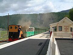
The Llanberis Lake Railway
-
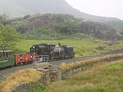
The Welsh Highland Railway


North Wales
- Llangollen Railway: A heritage railway with standard gauge tracks, 16km long.
- Conwy Valley Railway Museum: A museum with a miniature railway and a tramway.
- Penrhyn Castle Railway Museum: A museum dedicated to railway history.
- Bala Lake Railway: A narrow gauge heritage railway, originally standard gauge.
- Ffestiniog Railway: A famous narrow gauge heritage railway, 21.7km long. It also runs the Welsh Highland Railway.
- Llanberis Lake Railway: A narrow gauge heritage railway, 4km long.
- Snowdon Mountain Railway: A tourist railway that climbs up Mount Snowdon.
- Welsh Highland Heritage Railway: A narrow gauge heritage railway, 1.6km long.
- Welsh Highland Railway: A long narrow gauge heritage railway (40.2km), operated by the Ffestiniog Railway.
- Fairbourne Railway: A miniature railway, 3.2km long.
- Rhyl Miniature Railway: A miniature railway, 1.6km long.
- West Shore Miniature Railway: A miniature railway opened in 2018.
- Great Orme Tramway: A unique tramway that climbs the Great Orme.
- Glyn Valley Tramway: An old tramway, now being restored.
Mid Wales
- Corris Railway: A narrow gauge heritage railway, 1.17km long.
- Talyllyn Railway: A narrow gauge heritage railway, 11.67km long. It includes the Narrow Gauge Railway Museum.
- Welshpool and Llanfair Light Railway: A narrow gauge heritage railway, 13.7km long.
- Vale of Rheidol Railway: A narrow gauge heritage railway, 18.91km long.
- Rhiw Valley Light Railway: A miniature railway, 1.265km long.
South Wales
- Barry Tourist Railway: A standard gauge tourist railway, 2.4km long.
- Gwili Railway: A standard gauge heritage railway, 7.24km long.
- Llanelli and Mynydd Mawr Railway: A standard gauge heritage railway, 0.4km long.
- Pontypool and Blaenavon Railway: A standard gauge heritage railway, 5.6km long.
- Brecon Mountain Railway: A narrow gauge tourist railway, 8km long.
- Margam Park Railway: A narrow gauge railway.
- Teifi Valley Railway: A narrow gauge railway, 1km long, reopened in 2016.
- Cefn Mably Farm Park Railway Attraction: A miniature railway.
- Heath Park Electric Tramway: An 18-inch gauge tramway.
- Garw Valley Railway: A standard gauge heritage railway, 8km long.
Crown Dependencies: Island Railways
Isle of Man
- Douglas Bay Horse Tramway: A unique tramway pulled by horses.
- Great Laxey Mine Railway: A narrow gauge heritage railway, 0.4km long.
- Groudle Glen Railway: A narrow gauge heritage railway, 0.9km long.
- Isle of Man Railway: A national railway with a 25km line.
- Manx Electric Railway: A national electric railway, 27km long.
- Snaefell Mountain Railway: A national railway that climbs Snaefell mountain.
- Crogga Valley Railway: A miniature railway, 0.41km long.
- Orchid Line: A miniature railway with multiple track sizes.
Channel Islands
British Overseas Territories
Falkland Islands
- Camber Railway, Stanley (This railway is no longer running.)
Images for kids
-
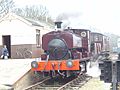
Mixed train on the Mid-Suffolk Light Railway
-
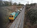
Restored double track section on the Mid-Norfolk Railway
-
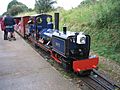
The Wells and Walsingham Light Railway
-
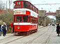
A 1931 Leeds tram seen at Crich Tramway Village in 2004
-
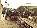
The Ravenglass & Eskdale Railway in 1981
-
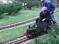
Miniature Railway in Royden Park
-
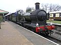
GWR Earl of Berkeley at Horsted Keynes Station, Bluebell Railway
-
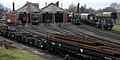
The engine sheds at Didcot Railway Centre
-
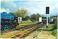
Trains on the Romney, Hythe & Dymchurch Railway
-
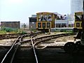
The Volks Electric Railway
-
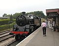
Bishops Lydeard station on the West Somerset Railway
-
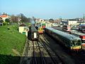
A general view of the Swanage Railway
-
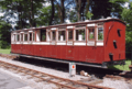
Restored Victorian coach at the Lynton & Barnstaple Railway
-

Exmouth Miniature Railway
-
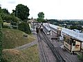
The Beer Heights Light Railway
-
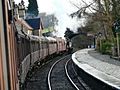
Arley station on the Severn Valley Railway
-
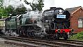
Gloucestershire Warwickshire Railway
-
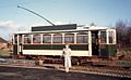
Dudley tram No. 5 of 1920 at Black Country Museum
-
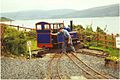
Craignure station on the 260 mm gauge Isle of Mull railway


.jpg)


See also
- British narrow-gauge railways
- British Rail
- Conservation in the United Kingdom
- List of closed railway lines in Great Britain
- List of Conservation topics
- List of funicular railways
- List of heritage railways
- List of heritage railways in the Republic of Ireland
- List of railway companies
- List of Yorkshire railways
- Mainline steam trains in Great Britain
- Mountain railway
- Rail transport in the United Kingdom
- Railways in Norfolk
- Railways of Shropshire
- Ridable miniature railway
