
Greenfield, Massachusetts facts for kids
Quick facts for kids
Greenfield
|
|||
|---|---|---|---|

The Civil War Memorial on Court Square
|
|||
|
|||

Location in Franklin County in Massachusetts
|
|||

Greenfield
Location in the United States
|
|||
| Country | United States | ||
| State | Massachusetts | ||
| County | Franklin | ||
| Settled | 1686 | ||
| Incorporated | 1753 | ||
| Government | |||
| • Type | Mayor-council city | ||
| Area | |||
| • Total | 21.87 sq mi (56.65 km2) | ||
| • Land | 21.41 sq mi (55.46 km2) | ||
| • Water | 0.46 sq mi (1.19 km2) | ||
| Elevation | 302 ft (92 m) | ||
| Population
(2020)
|
|||
| • Total | 17,768 | ||
| • Density | 829.78/sq mi (320.39/km2) | ||
| Time zone | UTC−5 (Eastern) | ||
| • Summer (DST) | UTC−4 (Eastern) | ||
| ZIP Code |
01301
|
||
| Area code(s) | 413 | ||
| FIPS code | 25-27060 | ||
| GNIS feature ID | 0618166 | ||


Greenfield is a city in Franklin County, Massachusetts, United States. It is the main city and county seat of Franklin County. Greenfield was first settled in 1686. In 2020, about 17,768 people lived there.
Greenfield is home to Greenfield Community College. It also hosts the Pioneer Valley Symphony Orchestra, the Franklin County Fair, and the Green River Festival. The city's Main Street has a Historic District with beautiful buildings. These buildings show styles like Federal, Greek Revival, and Victorian architecture.
Greenfield is part of a larger area called the Springfield-Greenfield Town, MA Combined Statistical Area.
Contents
Greenfield's History

Long ago, the Pocumtuck Indians lived in the Greenfield area. They planted crops and fished in the rivers. Tools found here show people lived in this area as far back as 7,000 to 9,000 BCE.
Some stories say the Pocumtucks were defeated by the Mohawks in 1664. Other stories say they joined the Wampanoag chief Metacom in 1675. They fought against the English settlers. The Pocumtuck also played a big part in the Battle of Great Falls in 1676. After this battle, some Pocumtuck people joined the Abenaki people to the north or the Mahican people to the west.
English settlers came to the area in 1686. It was part of Deerfield at that time. In 1753, Greenfield became its own town. It was named after the Green River.
In 1795, the South Hadley Canal opened. This allowed boats to reach Greenfield using the Connecticut River. Greenfield is where the Deerfield, Green, and Connecticut rivers meet. This made it a busy trading center. The rivers also provided water power for factories. Greenfield grew into a successful mill town.
In 1834, John Russell started the Green River Works. This was the first cutlery factory in the country. It hired skilled German workers. Later, the Connecticut River Railroad came to town. Trains replaced the canal for trade. In the 1800s and 1900s, Greenfield was famous for making tools. It was home to the Greenfield Tap & Die Company.
In 1811, Franklin County was created. Greenfield became its county seat.
Greenfield's Geography

Greenfield covers about 21.87 square miles (56.65 square kilometers). Most of this is land. It is in the middle of Franklin County. Neighboring towns include Colrain, Leyden, Bernardston, Gill, Montague, Deerfield, and Shelburne.
Greenfield is about 39 miles (63 km) north of Springfield. It is about 90 miles (140 km) west-northwest of Boston.
The city is where the Deerfield, Green, and Connecticut rivers meet. The Green River flows through town to the Deerfield River. The Deerfield River then joins the Connecticut River. Several smaller streams also flow into these rivers. The city is near the Pocumtuck Range. It is surrounded by hills, and the town center is on a raised area above the rivers.
Greenfield's Climate
Greenfield has a humid continental climate. This means it has cold, snowy winters. Summers are warm and humid. The hottest temperature ever recorded was 100°F (38°C). The coldest was -30°F (-34°C). The city gets a lot of rain, about 41.3 inches (105 cm) per year.
| Climate data for Greenfield, Massachusetts | |||||||||||||
|---|---|---|---|---|---|---|---|---|---|---|---|---|---|
| Month | Jan | Feb | Mar | Apr | May | Jun | Jul | Aug | Sep | Oct | Nov | Dec | Year |
| Mean daily maximum °F (°C) | 32.7 (0.4) |
34.5 (1.4) |
44.2 (6.8) |
57.3 (14.1) |
70.0 (21.1) |
78.4 (25.8) |
83.0 (28.3) |
80.6 (27.0) |
73.2 (22.9) |
62.2 (16.8) |
48.3 (9.1) |
35.7 (2.1) |
58.3 (14.6) |
| Mean daily minimum °F (°C) | 14.0 (−10.0) |
14.5 (−9.7) |
25.0 (−3.9) |
35.2 (1.8) |
45.8 (7.7) |
55.1 (12.8) |
60.2 (15.7) |
58.2 (14.6) |
50.8 (10.4) |
40.1 (4.5) |
30.7 (−0.7) |
18.9 (−7.3) |
37.4 (3.0) |
| Average precipitation inches (mm) | 3.2 (81) |
2.8 (71) |
3.5 (89) |
3.4 (86) |
3.6 (91) |
3.7 (94) |
3.7 (94) |
3.8 (97) |
3.6 (91) |
3.0 (76) |
3.6 (91) |
3.5 (89) |
41.3 (1,050) |
| Average snowfall inches (cm) | 15.3 (39) |
15.1 (38) |
8.8 (22) |
2.0 (5.1) |
0 (0) |
0 (0) |
0 (0) |
0 (0) |
0 (0) |
0 (0) |
2.3 (5.8) |
9.5 (24) |
53.0 (135) |
| Average precipitation days | 10 | 9 | 10 | 10 | 10 | 10 | 10 | 9 | 8 | 8 | 9 | 10 | 113 |
| Source: Weatherbase | |||||||||||||
Greenfield's Population
| Historical population | ||
|---|---|---|
| Year | Pop. | ±% |
| 1850 | 2,580 | — |
| 1860 | 3,198 | +24.0% |
| 1870 | 3,589 | +12.2% |
| 1880 | 3,903 | +8.7% |
| 1890 | 5,252 | +34.6% |
| 1900 | 7,927 | +50.9% |
| 1910 | 10,427 | +31.5% |
| 1920 | 15,462 | +48.3% |
| 1930 | 15,500 | +0.2% |
| 1940 | 15,672 | +1.1% |
| 1950 | 17,349 | +10.7% |
| 1960 | 17,690 | +2.0% |
| 1970 | 18,116 | +2.4% |
| 1980 | 18,436 | +1.8% |
| 1990 | 18,666 | +1.2% |
| 2000 | 18,168 | −2.7% |
| 2010 | 17,456 | −3.9% |
| 2020 | 17,768 | +1.8% |
| 2022 | 17,656 | −0.6% |
Source: United States Census records and Population Estimates Program data. Source: |
||
In 2010, Greenfield's population was 17,456. It is the largest town in Franklin County. It is also the smallest mainland county seat in Massachusetts. Only the island towns of Edgartown and Nantucket are smaller.
In 2000, there were 18,168 people living in Greenfield. About 93% of the people were White. About 1.3% were Black or African American. About 1.1% were Asian. About 3.5% were Hispanic or Latino.
About 21.9% of the people were under 18 years old. About 17.5% were 65 years or older. The average age was 40 years.
Greenfield's Culture
The Bee Connection

Greenfield was once home to Lorenzo Langstroth. He is known as the "Father of Modern Beekeeping." The city celebrates his life and his work with bee-themed events.
Bee Fest Celebration
Bee Fest started in 2010. It was launched by Greenfield's Second Congregational Church. Langstroth was a pastor there in the 1840s. The first Bee Fest celebrated his 200th birthday. It also showed how important honeybees are for our environment and food. Bee Fest is now an annual spring event. It offers fun and learning for everyone.
Downtown Bee Sculptures
Greenfield has nine large bee sculptures. Six were put up in 2021 and three in 2022. A local artist named Rachael Katz designed them. Other local artists painted the bees with bright colors and themes. This project got help from many groups and people in the community.
Other Bee-Themed Fun
Greenfield has a small park with educational displays about bees. There is also a painted crosswalk, special lamppost signs, and parking garage banners. All of these celebrate Langstroth and honeybees. In 2021, the Franklin County Fair Kick-Off Parade was all about bees! Many floats and marchers were decorated like bees.
Things to See and Do in Greenfield


- The Crossroads Cultural District: This area was named a special cultural district in 2016.
- Historical Society of Greenfield: You can visit this society at 43 Church Street to learn about the city's past.
- Guiding Star Grange: This community hall is famous for traditional music and dance. It hosts regular contra dances.
- Greenfield Center School: This is a private school for students from kindergarten to 8th grade.
- Greenfield Energy Park: This park is in downtown Greenfield. It has exhibits about renewable energy, gardens, and public art. It also hosts concerts.
- Leavitt-Hovey House: This historic house was built in 1797. It used to be the Greenfield Public Library.
- Gravity Hill: This is an optical illusion on Shelburne Road. It looks like cars roll uphill when they are actually rolling downhill!
- Rocky Mountain Park: This park has Poet's Seat Tower. This sandstone tower was built in 1912. It is named because poets liked to visit the spot. The city's Fourth of July fireworks are held here.
- Wilson's Department Store: This store opened in 1882. It was one of the few old-style family-owned department stores left in America. It closed in 2020 after 138 years.
Greenfield's Transportation
Greenfield is a meeting point for four major roads. Interstate 91 runs north and south through the city. Massachusetts Route 2 also goes through town. It is known as the Mohawk Trail. U.S. Route 5 and Massachusetts Route 10 also pass through Greenfield. In 2016, the state gave Greenfield money to build a new downtown parking garage.
The closest small airport is in Turners Falls. For bigger flights, the nearest airport is Bradley International Airport in Windsor Locks, Connecticut.
Bus Services
Greyhound buses serve Greenfield. The city is also the main hub for the Franklin Regional Transit Authority (FRTA). The FRTA offers local bus service to nearby towns. The John W. Olver Transit Center is where you can catch FRTA buses and Greyhound buses.
Train Services

Greenfield is where two train lines meet. One line goes east and west towards Albany, New York. The other goes north and south from Springfield to Vermont. Freight trains use these lines.
Passenger train service returned to Greenfield on December 29, 2014. The Vermonter train now stops at the Olver Transit Center. In 2019, new commuter rail service called the Valley Flyer started. It connects Greenfield to New Haven, Connecticut, with links to New York City. There are also plans to extend the MBTA's Fitchburg Line to Greenfield and North Adams.
Greenfield's Schools
Greenfield has its own public school system for about 1,700 students.
- The Academy of Early Learning at North Parish is for pre-kindergarten students.
- Three elementary schools (Four Corners, Federal Street, and Newton) serve students from kindergarten to fourth grade.
- Greenfield Middle School is for students from fifth grade to seventh grade.
- Greenfield High School is for students from eighth to twelfth grade.
Greenfield's sports teams are called the "Green Wave." Their school colors are green and white.
Other Public Schools
Greenfield also has the Poet Seat School. This is an alternative school for students with special needs. In 2009, the city started the Virtual Academy, or "MAVA @ Greenfield." This is a distance learning school for students from kindergarten to 12th grade. Greenfield is also home to the Four Rivers Charter Public School for grades 7–12.
Private Schools
The oldest private school in Greenfield is the Stoneleigh-Burnham School. This is a boarding school for girls in grades 7–12. The Center School, started in 1981, teaches students from preschool to eighth grade.
Colleges and Universities
Greenfield Community College is located in Greenfield. It serves the northern Pioneer Valley. It also offers some classes to Greenfield High students.
The closest state university is the University of Massachusetts Amherst. There are also many private colleges nearby.
Greenfield's Media
Greenfield has several radio stations, a cable TV station, and a daily newspaper.
FM Radio Stations
- 95.3 WPVQ-FM (Country music)
- 98.3 WHAI (Adult contemporary music)
- 100.5 //WIZZ (Adult Standards music)
- 102.9 W275AS (// WYRY-FM Country music)
- 107.9 WMCB-LP (Talk/Information)
- 107.9 WLPV-LP (Religious)
- Note: WMCB-LP and WLPV-LP share the same frequency.
AM Radio Stations
- 1520 WIZZ (Nostalgia music)
Cable TV Station
- Channel 15 (Public Access) Greenfield Community Television
Newspaper
- The Recorder
Notable People from Greenfield
- Charles Allen, a judge
- Christopher Baldwin, a comic strip artist
- Lou Barlow, a musician (from bands like Dinosaur Jr. and Sebadoh)
- Asher Benjamin, an architect
- Peter Bergeron, a baseball player
- Misha Collins, a TV and film actor
- Scott Crago, a musician
- Kelly Doton, a field hockey player
- Tracy Grammer, a singer-songwriter
- Van Hansis, an actor
- Penn Jillette, an illusionist and comedian (half of Penn & Teller)
- Jake Lacy, an actor
- Robin Lane, a musician
- L. L. Langstroth, known as the “Father of American Beekeeping”
- Jonathan Leavitt, a lawyer and judge
- Winter Miller, a playwright
- Michael Moschen, a juggler
- George Ripley, a Transcendentalist and founder of the Brook Farm community
- John E. Russell, a congressman
- Rufus Saxton, an army general
- Charles Pomeroy Stone, an army officer and engineer
- Frederick Goddard Tuckerman, a poet
- William B. Washburn, a congressman and governor
Images for kids
-
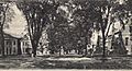
Franklin Street in 1906
-
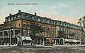
Mansion House c. 1908
-
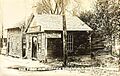
The first post office c. 1910
-
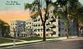
The Weldon Hotel in 1913
-
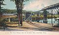
Early bridges over the Deerfield River c. 1915
-
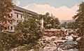
Old Stone Mill c. 1920


See also
 In Spanish: Greenfield (Massachusetts) para niños
