
Santa Clarita, California facts for kids
Quick facts for kids
Santa Clarita, California
|
|||
|---|---|---|---|
|
|
|||
|
|||
| Nickname(s):
SCV
|
|||
| Motto(s):
Where the Good Life Takes You
|
|||
| Country | United States | ||
| State | California | ||
| County | Los Angeles | ||
| Incorporated | December 15, 1987 | ||
| Named for | Santa Clara River | ||
| Government | |||
| • Type | Council–Manager | ||
| Area | |||
| • City | 62.16 sq mi (161 km2) | ||
| • Land | 62.10 sq mi (160.84 km2) | ||
| • Water | 0.06 sq mi (0.16 km2) 0.099% | ||
| Elevation | 1,207 ft (368 m) | ||
| Population
(2020)
|
|||
| • City | 228,673 | ||
| • Rank | 3rd in Los Angeles County 17th in California 103rd in the United States |
||
| • Density | 3,232/sq mi (1,250/km2) | ||
| • Urban | 278,031 (US: 146th) | ||
| • Urban density | 3,571.6/sq mi (1,379.0/km2) | ||
| Demonym(s) | Santa Claritan | ||
| Time zone | UTC−08:00 (Pacific) | ||
| • Summer (DST) | UTC−07:00 (PDT) | ||
| ZIP Codes |
91321–91322, 91350–91351, 91354–91355, 91380, 91385–91387, 91390
|
||
| Area code | 661 | ||
| FIPS code | 06-69088 | ||
| GNIS feature IDs | 1662338, 2411819 | ||
.jpg)

.jpg)


Santa Clarita is a city in northwestern Los Angeles County, California. Its name means "Little St. Clare" in Spanish. In 2020, about 228,673 people lived there. This makes it the third-largest city in Los Angeles County. It is also the 17th-largest city in California. Santa Clarita is about 30 miles (48 km) northwest of downtown Los Angeles. It covers about 70.75 square miles (183.2 km²) of land. The city is located in the Santa Clarita Valley, along the Santa Clara River.
People have lived in the Santa Clarita Valley for a very long time. The Chumash people were here first. Later, the Tataviam arrived around 450 AD. When Spanish colonists came, they created the Rancho San Francisco. This ranch covered much of the valley. In 1875, Henry Mayo Newhall bought the Rancho San Francisco. He then started the towns of Saugus and Newhall. The Newhall Land and Farming Company helped the city grow a lot.
In December 1987, Santa Clarita officially became a city. It included the areas of Canyon Country, Newhall, Saugus, and Valencia. These four areas still have their own unique feel. People often say they are from one of these communities. The Golden State Freeway (I-5) is on the west side of Santa Clarita. The Antelope Valley Freeway (CA-14) runs through the east. These two freeways meet near the city's southern end.
Santa Clarita has three colleges. These are California Institute of the Arts (a private art school), The Master's University (a Christian university), and College of the Canyons (a community college). Many companies have their main offices here. These include Princess Cruises and Sunkist. Six Flags Magic Mountain is a famous theme park nearby. It is just outside the city limits.
Contents
- What's in a Name?
- Santa Clarita's Past: A Look at History
- Exploring Santa Clarita's Geography
- Who Lives in Santa Clarita? Demographics
- Learning in Santa Clarita: Education
- Fun and Games: Parks and Recreation
- Sports in Santa Clarita
- Helping Hands: City Services
- Working in Santa Clarita: Economy
- News and Entertainment: Media
- Getting Around: Transportation
- Culture and Entertainment
- Famous People from Santa Clarita
- Sister Cities: Connecting Globally
- Images for kids
- See also
What's in a Name?
The Santa Clara River was named by Spanish explorers. They named it after Saint Clare of Assisi. The valley and later the city became known as "little Santa Clara." This was to tell it apart from the city of Santa Clara in Northern California. Before the 1950s, people often called the area the "Newhall–Saugus area."
Santa Clarita's Past: A Look at History


Early Days: Native Americans and Spanish Settlers
People have lived in the Santa Clarita Valley for thousands of years. The oldest signs of people are from about 3000 BC. Around 450 AD, the Tataviam arrived. They took the place of the Chumash people. The Tataviam lived in about 20 villages in the valley.
In the 1700s, Spanish colonists came to Southern California. They built mission settlements. The Mission San Fernando was built in 1797. It was just south of what is now Newhall. In 1822, California became part of Mexico. The large Rancho San Francisco was given to Antonio del Valle. It was a farming area for the nearby mission.
Gold, Oil, and Railroads: Growth in the 1800s
In 1842, Francisco Lopez found gold in Placerita Canyon. This was the first time gold was officially found in California. The spot is now marked by the Oak of the Golden Dream. Many places in Santa Clarita are named "Golden Oak" because of this.
The United States took over California in 1848. This happened after the Mexican–American War. Henry Mayo Newhall was a rich businessman. He bought many old Spanish and Mexican land grants. One big part was the Rancho San Francisco. This land became known as Newhall Ranch. He also sold land to the Southern Pacific Railroad. They built the town of Newhall there. Later, he moved the town south. The original spot was named Saugus.
After Henry Newhall died, his family started the Newhall Land and Farming Company in 1883. This company helped build the communities of Santa Clarita. These include Valencia, Canyon Country, Newhall, and Saugus.
In 1876, a special spike was hammered into a railroad track at Lang Southern Pacific Station. This connected Los Angeles to San Francisco by train for the first time.
Oil was also found in the valley. In 1876, Charles Alexander Mentry started the town of Mentryville. Its Pico Number 4 oil well was the first successful oil well in the western U.S. Oil from Mentryville was refined in Newhall. This was at the Pioneer Oil Refinery, the first oil refinery in California. Many streets are named after these early oil pioneers.
The Saugus Cafe opened in 1886. It is the oldest restaurant in Los Angeles County that has been open continuously.
From Early 1900s to Cityhood in 1987
Filmmakers from Los Angeles started shooting movies in Santa Clarita in the early 1900s. Many famous actors like William S. Hart filmed here. Several movie ranches were built in the valley. Hart and Harry Carey lived here. Their homes are now county parks.
A big disaster happened in 1928. The St. Francis Dam collapsed. A huge wave of water rushed through the valley. It destroyed buildings and killed 411 people. This was one of California's deadliest disasters.
In 1945, the Santa Clarita Union High School District was created. It was later named the William S. Hart Union High School District. The first high school was William S. Hart High School.
The name "Santa Clarita" was first used for a housing development in 1947. This was the Rancho Santa Clarita in Saugus.
People tried for many years to make Santa Clarita a city. They wanted more control over their local area. Finally, on December 15, 1987, the City of Santa Clarita was officially formed. Most people voted for it. The first mayor was Buck McKeon.
Santa Clarita Today: 1987 to Present
In 1994, the 1994 Northridge earthquake hit Santa Clarita hard. Freeways collapsed, and many streets were damaged. Power went out, and schools closed. The city suffered a lot of damage.
In the 21st century, Santa Clarita has grown a lot. Many new homes have been built. The city was ranked as one of the best places to live in the U.S. by Money magazine in 2006.
Exploring Santa Clarita's Geography
.jpg)
Santa Clarita covers about 70.82 square miles (183.4 km²). Most of this is land. The city has grown a lot by adding nearby areas. The Newhall Pass is at the southern end of the city.

Santa Clarita is in the Santa Clarita Valley. It is surrounded by mountains. These include the San Gabriel Mountains to the east and the Santa Susana Mountains to the south and west. The Sierra Pelona Mountains are to the north.
The Santa Clara River flows through the city. It is usually dry, but it can have a lot of water after heavy rains. Many of the city's streets are named after the steep canyons formed by the river's branches.
City Boundaries and Natural Features
The city's western edge is along Interstate 5. Its eastern boundary partly follows California State Route 14. However, the city limits go beyond Route 14 in some places. The Angeles National Forest is part of the city's northern and eastern borders.
The official elevation of Santa Clarita is 1,207 feet (368 m). This is the height of the old Newhall Airport. The elevation changes a lot across the city. Most populated areas are between 1,100 and 1,700 feet (335 and 518 m) above sea level.
Santa Clarita is near the San Fernando fault zone. It has been affected by earthquakes. These include the 1971 San Fernando earthquake and the 1994 Northridge earthquake.
Who Lives in Santa Clarita? Demographics
Santa Clarita has become more diverse over the years. In 1990, most people were non-Hispanic White. By 2020, this group made up 44.5% of the population. The number of Hispanic or Latino residents has grown. In 2020, they were 34.4% of the population. Asian Americans also make up a growing part of the population.
Santa Clarita's population has grown faster than the county, state, and national averages. In 2019, it was ranked 20th among U.S. cities for population and economic growth. It is now the third-largest city in Los Angeles County.
Different groups of people tend to live in different areas. The Hispanic population is higher in Canyon Country and Newhall. The non-Hispanic White population is higher in Saugus and Valencia. Families in Santa Clarita have a good income. In 2020, the average household income was $100,932.
Santa Clarita's Population Growth
| Historical population | |||
|---|---|---|---|
| Census | Pop. | %± | |
| 1950 | 2,895 | — | |
| 1960 | 15,212 | 425.5% | |
| 1970 | 50,086 | 229.3% | |
| 1980 | 66,730 | 33.2% | |
| 1990 | 110,642 | 65.8% | |
| 2000 | 151,088 | 36.6% | |
| 2010 | 176,320 | 16.7% | |
| 2020 | 228,673 | 29.7% | |
| 2023 (est.) | 224,028 | 27.1% | |
In 2020, Santa Clarita had 228,673 people. About 56.8% of the people lived north of the Santa Clara River. About 43.2% lived south of the river.
Most people in Santa Clarita speak English at home (65.3%). About 23.4% speak Spanish. Other languages are also spoken.
Religious Life in Santa Clarita
| Religion in Santa Clarita | ||||
|---|---|---|---|---|
| religion | percent | |||
| Christianity | 50.5% | |||
| Roman Catholicism | 37% | |||
| Baptist | 2% | |||
| Pentecostalism | 1.8% | |||
| Mormonism | 1.6% | |||
| Methodism | 1.2% | |||
| Other Christians | 5.2% | |||
| Judaism | 1.1% | |||
| Islam | 0.7% | |||
| Eastern religions | 1.1% | |||
About 53.4% of Santa Clarita's population is religious. Most people are Christians (50.5%). This includes Catholics, Baptists, and others. There are also Jewish and Muslim residents. The city has many churches, synagogues, and mosques.
Learning in Santa Clarita: Education
Santa Clarita has many schools for kids of all ages.
Elementary Schools for Younger Students
Younger students (grades K-6) go to schools in four different districts:
- Castaic Union School District: Serves Castaic and parts of Valencia.
- Newhall School District: Serves Stevenson Ranch, Newhall, and southern Valencia.
- Saugus Union School District: Serves Saugus, central Valencia, and western Canyon Country.
- Sulphur Springs School District: Serves most of Canyon Country.
These districts have 37 elementary schools and one middle school.
Junior High and High Schools for Teens
Most junior high and high schools (grades 7–12) are part of the William S. Hart Union High School District. This district has seven high schools: Canyon, Castaic, Golden Valley, Hart, Saugus, Valencia, and West Ranch. It also has six junior high schools. Many of these schools are in Santa Clarita. The high schools are known for being among the best in the nation.
The Hart District also has special schools. These include a high school on the College of the Canyons campus. There are also alternative high schools and charter schools.
Private Schools for Different Learning Styles
Santa Clarita has several private schools. Some examples are Santa Clarita Christian School, Trinity Classical Academy, and Our Lady of Perpetual Help School.
Colleges and Universities for Higher Education

Santa Clarita is home to three important colleges:
- California Institute of the Arts (CalArts): This is a private art university. It was started by Walt Disney in 1961. It was the first college just for visual and performing arts students. Many famous actors and artists have studied here.
- The Master's University: This is a Christian university. It is located in Newhall. It offers many different subjects.
- College of the Canyons (COC): This is a public community college. It has two campuses. One is in Valencia, and the other is in Canyon Country.
Fun and Games: Parks and Recreation
Six Flags Magic Mountain: Thrills and Rides
.jpg)
One of the most famous places near Santa Clarita is Six Flags Magic Mountain. This huge theme park is just outside the city. It opened in 1971. It has 20 roller coasters, which is more than any other park in the world! Next to it is Six Flags Hurricane Harbor, a waterpark open in the warmer months.
City Parks and Sports Facilities


Santa Clarita has many parks and places for fun. The city has 35 parks. Many have courts for basketball and tennis. They also have fields for baseball, softball, and soccer.
Central Park in Saugus is the largest city park. It has sports fields, a community garden, and a dog park.
The George A. Caravalho Sports Complex in Canyon Country is a big sports area. It has a gym with courts for basketball, pickleball, and volleyball. It also has the Santa Clarita Aquatic Center with swimming pools and water slides. The Trek Bike Park and Santa Clarita Skate Park are also here.
The city also hosts a free summer concert series in Central Park. They offer many classes and programs throughout the year.
The city has two community centers. One is in Newhall, and the other is in Canyon Country.
The Santa Clarita Marathon is a yearly race. It goes through the city's streets and paths. It is a qualifying race for the Boston Marathon.
Santa Clarita has hosted stages of the AMGEN Tour of California bike race many times.
The area is surrounded by mountains, so there are many hiking trails. You can find them in places like Agua Dulce Canyon and Towsley Canyon.
County Parks for Outdoor Adventures
The Los Angeles County Department of Parks and Recreation runs some parks here.
- William S. Hart Regional Park in Newhall: This park has the home of silent film star William S. Hart. It hosts the yearly Santa Clarita Cowboy Festival.
- Placerita Canyon State Park: This park is east of Newhall. It has hiking trails, waterfalls, and the famous Oak of the Golden Dream.
- Tesoro Adobe Historic Park: This was the home of actor Harry Carey. It is in Tesoro del Valle.
Other Fun Spots
The Cube—Ice and Entertainment Center is an ice rink in Valencia. It is used for ice skating and hockey. The UCLA Bruins men's ice hockey team plays its home games here.
MB2 Entertainment in Saugus offers miniature golf, go-karts, and laser tag.
Sports in Santa Clarita
Santa Clarita does not have its own major professional sports teams. However, people here enjoy watching the teams from Los Angeles and Anaheim. These include the Los Angeles Lakers (basketball) and Los Angeles Dodgers (baseball).
The colleges and high schools in Santa Clarita also have popular sports teams.
The Santa Clarita Blue Heat is a women's soccer team. They play their home games at College of the Canyons.
The Santa Clarita Flyers Hockey Club is a youth ice hockey program. They play at The Cube.
The Canyons Aquatic Club is a competitive swim team. They practice at various pools in the city.
The Saugus Speedway was a race track. It closed in 1995.
Central Park has a cross country course. High school and college athletes use it for training and races.
Santa Clarita has four golf courses.
Helping Hands: City Services
Law Enforcement: Keeping the City Safe
Santa Clarita does not have its own police department. Instead, the city uses the Los Angeles County Sheriff's Department (LASD). The Santa Clarita Valley Sheriff's Station is located on Golden Valley Road.
The California Highway Patrol also helps keep the highways safe in the Santa Clarita Valley.
Water for the Community
Santa Clarita gets its water from the Santa Clarita Valley Water Agency (SCV Water). This agency was formed in 2018. It gets water from the California Aqueduct and other local sources.
The Los Angeles Aqueduct also passes through Santa Clarita. However, this water goes to the city of Los Angeles.
Public Libraries: A World of Books
The city runs the Santa Clarita Public Library system. It has three libraries:
- The main office in Valencia.
- The Old Town Newhall Library in Newhall.
- The Jo Anne Darcy Library in Canyon Country.
These libraries have books for all ages. They also offer services like homework help and community events.
Utilities: Electricity and Gas
Southern California Edison provides electricity to Santa Clarita. SoCalGas provides natural gas.
Fire Protection: Emergency Services
The city contracts with the Los Angeles County Fire Department. They have eleven fire stations in Santa Clarita.
Post Offices: Sending Mail
The United States Postal Service has four post offices in the city. They are in Valencia, Newhall, and Canyon Country.
Working in Santa Clarita: Economy
Many companies have their main offices in Santa Clarita. These include Princess Cruises and Honda Performance Development. Other companies like Sunkist are headquartered just outside the city.
Top Employers in Santa Clarita
Here are some of the biggest employers in Santa Clarita:
- Six Flags Magic Mountain
- Henry Mayo Newhall Memorial Hospital
- Princess Cruises
- The Master's University
- Boston Scientific
- Logix
- Advanced Bionics
- Woodward HRT
- Amazon
- AMS Fulfillment
Business Areas and Shopping Centers
Santa Clarita has several industrial areas and office parks. The Valencia Industrial Center is the largest business park.
Valencia Town Center: Shopping and Fun

The biggest shopping center is the Valencia Town Center. It has over 1 million square feet (93,000 m²) of stores and restaurants. It includes major stores like Macy's and JCPenney. There is also a movie theater. The Town Center area is a major business district. It has the city hall and the headquarters of Princess Cruises.
Old Town Newhall: History and Culture
Old Town Newhall is a historic area. It has many local restaurants, stores, and theaters. It is known as Santa Clarita's main arts and entertainment district. You can find the William S. Hart Regional Park and the Newhall Metrolink station here.
Many other shopping centers are located throughout the city.
News and Entertainment: Media
Santa Clarita has several local media groups.
Newspapers: Local News
The main local newspaper is The Santa Clarita Valley Signal. It was started in 1919. It focuses on local news, sports, and entertainment. The Los Angeles Daily News also covers Santa Clarita sometimes.
Radio Stations: On the Air
The main local radio station is KHTS. It broadcasts on FM 98.1 and AM 1220. KHTS covers local news, talk shows, and sports. Another local FM station is FM-101.5 KZNQ-LP, which plays country music.
Television: Local Programs
Local TV programs for Santa Clarita are on a public-access cable TV channel called SCVTV. It shows city council meetings, history shows, and local news. There are no commercial TV stations in the city.
Magazines: Local Stories
Local magazines include Seasons (about city programs), élite, and Santa Clarita Magazine.
Getting Around: Transportation
Highways: Connecting the City
- Interstate 5: This is the main highway on the city's western border. It connects Santa Clarita to Los Angeles and other parts of California.
- California State Route 14: This highway runs through the east side of the city. It connects Santa Clarita to the Antelope Valley.
- California State Route 126: This route follows the Santa Clara River to Ventura. The Santa Clarita Veterans' Parkway connects Route 126 to Route 14.
- Sierra Highway: This road runs parallel to Route 14. It is a surface street that offers another way to travel north.
Bus Service: City of Santa Clarita Transit

City of Santa Clarita Transit provides bus service within Santa Clarita. It also has commuter buses to North Hollywood and Union Station in downtown Los Angeles. This allows people to connect to other transit services.
The bus service also has special routes for schools on weekdays. There is also a Dial-A-Ride service for seniors and people with disabilities.
Rail Service: Metrolink Trains

Metrolink provides train service to the Santa Clarita Valley. Its Antelope Valley Line runs between Lancaster and Union Station. There are three Metrolink stations in the city: Via Princessa station, Santa Clarita station, and Newhall station. A new station, Vista Canyon Multi-Modal Center, opened in 2023.
Biking and Walking: Trails and Paseos
Santa Clarita has many bike trails and walking paths. You can ride from one end of the city to the other on the Santa Clara River Trail. In Valencia, there are special pedestrian bridges called paseos. These paths keep riders and walkers away from car traffic. Santa Clarita has over 77 miles (124 km) of bike routes.
Air Travel: Nearby Airports
There are no airports in Santa Clarita itself. The closest airports are small ones like Agua Dulce Airpark. For commercial flights, people use Bob Hope Airport in Burbank or Los Angeles International Airport in Los Angeles.
Culture and Entertainment
Films and TV: Hollywood North
Santa Clarita is famous for its movie ranches. These are places where movies and TV shows are filmed. The valley has several movie ranches, like Melody Ranch and Golden Oak Ranch. These ranches are important for Santa Clarita's economy. The area is sometimes called "Hollywood North."
Many movies and TV shows have been filmed here. These include Django Unchained, NCIS, and Pirates of the Caribbean. Other filming spots include CalArts, College of the Canyons, and the Valencia Town Center. Vasquez Rocks, a famous rock formation nearby, has also been used in many films.
The horror-comedy show Santa Clarita Diet was set in Santa Clarita. It was about real estate agents whose lives change when one of them becomes undead.
Western Films: A Rich History

Santa Clarita has been home to many famous stars of Western films. These include William S. Hart and Harry Carey. The Walk of Western Stars in Old Town Newhall honors these figures. Each April, new honorees are added to the Walk. This ceremony happens during the Santa Clarita Cowboy Festival.
Packard Humanities Institute: Preserving Movies
The Packard Humanities Institute has a campus in Valencia. It opened in 2014. This campus has a special facility that preserves old films. It holds over 400,000 films from major movie studios.
Famous People from Santa Clarita
Many notable people have lived in or are from Santa Clarita.
Sister Cities: Connecting Globally
Santa Clarita is part of the Sister Cities International program.
Images for kids
-
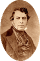
Don Ygnacio del Valle, a Californio ranchero, owned much of Santa Clarita as part of his Rancho San Francisco. He founded the original settlement in Santa Clarita.
-
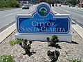
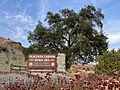
The Santa Clarita welcome sign (on Newhall Avenue in Newhall near the 14 freeway) in May 2010
-
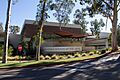
Saugus High School
-

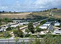
Santa Clarita in July 2016
-
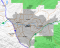
Map of Santa Clarita, showing neighborhoods, city boundaries, freeways, major surface streets, and the Angeles National Forest
-
California Institute of the Arts in Valencia
-
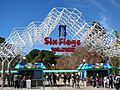
Entrance to Six Flags Magic Mountain in Valencia in 2014
-
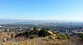
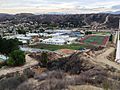
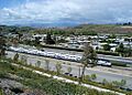
Overlooking Santa Clarita from Ed Davis Park in Newhall and Towsley Canyon
-
Santa Clarita Aquatics Center, part of the larger George A. Caravalho Sports Complex in Canyon Country
-
Entrance sign of Placerita Canyon State Park
-
The Los Angeles Aqueduct emerges from beneath the Santa Clarita Valley Water Agency in Saugus (top right) and crosses the Santa Clara River.
-
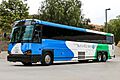
City of Santa Clarita Transit provides "Commuter Express Service" between Santa Clarita and various destinations throughout Greater Los Angeles.
-
A Metrolink Antelope Valley Line train passing through Santa Clarita
-

Princess Cruises headquarters in Valencia
-
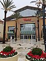
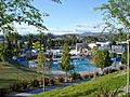
Valencia Town Center in Valencia
-
Walk of Western Stars in Newhall


See also
 In Spanish: Santa Clarita para niños
