
List of Guano Island claims facts for kids

Back in 1856, the United States passed a law called the Guano Islands Act. This law allowed American citizens to claim small, uninhabited islands for the U.S. if they found guano (which is bird or bat poop, used as fertilizer) there. To make a claim, the island had to be empty and not already owned by another country. Private citizens would tell the U.S. government about their discovery. If the government agreed, the island could become a U.S. territory.
As of 2023, only a few of these islands are still U.S. territories. These include the eight islands known as the U.S. Minor Islands, and some islands that are now part of Hawaii and American Samoa. Most other claims have been settled, meaning the islands now belong to other countries. The only exception is Navassa Island, which is still disputed.
Islands Claimed for Guano
This table shows a list of islands that were claimed by the U.S. under the Guano Islands Act. It also explains what happened to each claim.
| Island | Region | Other Name | Location | Who Owns it Now? | What Happened to the U.S. Claim? |
|---|---|---|---|---|---|
| Alto Velo Island | Caribbean | Alta Vela Island; Isla Alto Velo | 17°28′42″N 71°38′05″W / 17.47833°N 71.63472°W | Dominican Republic | The U.S. dropped its claim and agreed the island belongs to the Dominican Republic. |
| Atafu | Oceania | Duke of York Group | 8°33′06″S 172°30′03″W / 8.55167°S 172.50083°W | Tokelau | The U.S. made a claim in 1860 but never acted on it. Britain claimed it in 1899. The U.S. officially gave up its claim with the Treaty of Tokehega. |
| Bajo Nuevo Bank | Caribbean | Petrel Islands | 15°53′N 78°38′W / 15.883°N 78.633°W | Disputed | It's still considered a U.S. territory, but Colombia mostly controls it. Jamaica and Nicaragua also claim it. |
| Baker Island | Oceania | New Nantucket | 0°11′41″N 176°28′46″W / 0.19472°N 176.47944°W | U.S. Minor Islands | It's a U.S. territory. |
| Birnie Island | Oceania | 3°35′S 171°33′W / 3.583°S 171.550°W | Kiribati | The U.S. gave up its claim with the Treaty of Tarawa. | |
| Butaritari | Oceania | Makin Atoll, Makin Island, Touching Island | 3°10′04″N 172°49′33″E / 3.16778°N 172.82583°E | Kiribati | The U.S. gave up its claim with the Treaty of Tarawa. |
| Caroline Island | Oceania | Millennium Island | 9°56′13″S 150°12′42″W / 9.93694°S 150.21167°W | Kiribati | The U.S. gave up its claim with the Treaty of Tarawa. |
| Carondelet Reef | Oceania | 5°34′S 173°51′W / 5.567°S 173.850°W | Kiribati | The U.S. gave up its claim with the Treaty of Tarawa. | |
| Clipperton Island | Pacific Ocean | Passion Island | 10°18′N 109°13′W / 10.300°N 109.217°W | France | The U.S. never officially bonded its claim. France's claim was confirmed in 1931 after a dispute with Mexico. |
| Ducie Island | Oceania | 24°40′09″S 124°47′11″W / 24.66917°S 124.78639°W | British Territory | The U.S. never officially bonded its claim. It is managed by the Pitcairn Islands. | |
| Enderbury Island | Oceania | Guano Island | 3°08′S 171°05′W / 3.133°S 171.083°W | Kiribati | The U.S. gave up its claim with the Treaty of Tarawa. |
| Fakaofo | Oceania | Bowditch Island | 9°21′55″S 171°12′54″W / 9.36528°S 171.21500°W | Tokelau | The U.S. officially gave up any claim with the Treaty of Tokehega. |
| Flint Island | Oceania | 11°25′48″S 151°49′9″W / 11.43000°S 151.81917°W | Kiribati | The U.S. gave up its claim with the Treaty of Tarawa. | |
| French Frigate Shoals | Oceania | Kānemilohaʻi | 23°44′56″N 166°8′46″W / 23.74889°N 166.14611°W | Hawaii | Became part of Hawaii when it joined the U.S. in 1898, and then became a U.S. state in 1959. |
| Funafuti | Oceania | Ellice's Group | 8°31′S 179°13′E / 8.517°S 179.217°E | Tuvalu | The U.S. gave up its claim with the Tuvalu–US Treaty of 1983. |
| Howland Island | Oceania | Worth Island | 0°48′07″N 176°38′3″W / 0.80194°N 176.63417°W | U.S. Minor Islands | It's a U.S. territory. |
| Isla de Aves | Caribbean | Isla de Aves | 15°40′18″N 63°36′59″W / 15.67167°N 63.61639°W | Venezuela | The U.S. gave up its claim with the United States–Venezuela Maritime Boundary Treaty. |
| Îles du Connétable | Atlantic Ocean | Constable Islands | 4°49′25″N 51°56′11″W / 4.82361°N 51.93639°W | France | The U.S. claim was canceled. It is managed by French Guiana. |
| Jarvis Island | Oceania | Bunker Island | 0°22′S 160°01′W / 0.367°S 160.017°W | U.S. Minor Islands | It's a U.S. territory. |
| Johnston Atoll | Oceania | 16°44′13″N 169°31′26″W / 16.73694°N 169.52389°W | U.S. Minor Islands | It's a U.S. territory. | |
| Kanton Island | Oceania | Canton Island | 2°50′S 171°40′W / 2.833°S 171.667°W | Kiribati | The U.S. gave up its claim with the Treaty of Tarawa. |
| Kingman Reef | Oceania | Danger Rock | 6°24′N 162°24′W / 6.400°N 162.400°W | U.S. Minor Islands | It's a U.S. territory. |
| Kiritimati | Oceania | Christmas Island | 1°52′N 157°24′W / 1.867°N 157.400°W | Kiribati | The U.S. gave up its claim with the Treaty of Tarawa. |
| Lacepede Islands | Oceania | Lacapade [sic] Islands | 16°51′55″S 122°08′12″E / 16.86528°S 122.13667°E | Australia | The U.S. made a claim in 1876 but took it back in 1877. |
| Makin (atoll) | Oceania | Little Makin | 3°23′00″N 173°00′00″E / 3.38333°N 173.00000°E | Kiribati | The U.S. gave up its claim with the Treaty of Tarawa. |
| Malden Island | Oceania | Independence Island | 4°01′S 154°56′W / 4.017°S 154.933°W | Kiribati | The U.S. gave up its claim with the Treaty of Tarawa. |
| Manihiki | Oceania | Island of Pearls | 10°24′S 161°00′W / 10.400°S 161.000°W | Cook Islands | The U.S. gave up its claim with the Cook Islands–United States Maritime Boundary Treaty. |
| Manra | Oceania | Sydney Island | 4°27′S 171°16′W / 4.450°S 171.267°W | Kiribati | The U.S. gave up its claim with the Treaty of Tarawa. |
| McKean Island | Oceania | Wigram Island | 3°35′S 174°02′W / 3.583°S 174.033°W | Kiribati | The U.S. gave up its claim with the Treaty of Tarawa. |
| Midway Atoll | Oceania | Middlebrook Islands | 28°12′N 177°21′W / 28.200°N 177.350°W | U.S. Minor Islands | It's a U.S. territory. |
| Minami-Tori-shima | Oceania | Marcus Island | 24°18′N 153°58′E / 24.300°N 153.967°E | Japan | It was given back to Japan in 1968 after being controlled by the U.S. for a while. |
| Navassa Island | Caribbean | Navaza | 18°24′10″N 75°0′45″W / 18.40278°N 75.01250°W | Disputed | It's a U.S. territory, but Haiti also claims it. |
| Nikumaroro | Oceania | Gardner Island | 4°40′S 174°31′W / 4.667°S 174.517°W | Kiribati | The U.S. gave up its claim with the Treaty of Tarawa. |
| Niulakita | Oceania | Sophia Island, Rocky Island, Nurakita | 10°45′S 179°30′E / 10.750°S 179.500°E | Tuvalu | The U.S. gave up its claim with the Tuvalu–US Treaty of 1983. |
| Nukufetau | Oceania | De Peyster's Group | 8°00′S 178°30′E / 8.000°S 178.500°E | Tuvalu | The U.S. gave up its claim with the Tuvalu–US Treaty of 1983. |
| Nukulaelae | Oceania | Mitchell's Group | 9°22′52″S 179°51′08″E / 9.38111°S 179.85222°E | Tuvalu | The U.S. gave up its claim with the Tuvalu–US Treaty of 1983. |
| Nukunonu | Oceania | Duke of Clarence Island | 9°10′06″S 171°48′35″W / 9.16833°S 171.80972°W | Tokelau | The U.S. made a claim in 1860 but never acted on it. Britain claimed it in 1899. The U.S. officially gave up its claim with the Treaty of Tokehega. |
| Orona | Oceania | Hull Island | 4°30′S 172°10′W / 4.500°S 172.167°W | Kiribati | The U.S. gave up its claim with the Treaty of Tarawa. |
| Palmyra Atoll | Oceania | 5°53′N 162°5′W / 5.883°N 162.083°W | U.S. Minor Islands | It's a U.S. territory. It became part of the U.S. when Hawaii was annexed in 1898, but it's not part of the state of Hawaii. | |
| Penrhyn Island | Oceania | Tongareva | 9°00′20″S 157°58′10″W / 9.00556°S 157.96944°W | Cook Islands | The U.S. gave up its claim with the Cook Islands–United States Maritime Boundary Treaty. |
| Providence Island | Indian Ocean | 9°13′7″S 51°1′47″E / 9.21861°S 51.02972°E | Seychelles | The U.S. never officially bonded its claim. It is managed by Seychelles. | |
| Pukapuka | Oceania | San Bernardo Island | 10°53′S 165°40′W / 10.883°S 165.667°W | Cook Islands | The U.S. gave up its claim with the Cook Islands–United States Maritime Boundary Treaty. |
| Quita Sueño Bank | Caribbean | Quitasueño | 14°19′N 81°10′W / 14.317°N 81.167°W | Colombia | The U.S. gave up its claim with the Vásquez–Saccio Treaty of 1972. |
| Rakahanga | Oceania | Grand Duke Alexander Island | 10°02′S 161°05′W / 10.033°S 161.083°W | Cook Islands | The U.S. gave up its claim with the Cook Islands–United States Maritime Boundary Treaty. |
| Rawaki Island | Oceania | Phoenix Island | 3°42′40″S 170°42′43″W / 3.71111°S 170.71194°W | Kiribati | The U.S. gave up its claim with the Treaty of Tarawa. |
| Roncador Bank | Caribbean | 13°34′N 80°05′W / 13.567°N 80.083°W | Colombia | The U.S. gave up its claim with the Vásquez–Saccio Treaty of 1972. | |
| Scorpion Reef | Gulf of Mexico | Arrecife Alacranes (Isla Pérez, Isla Chica, Isla Pájaros) | 22°24′N 89°42′W / 22.400°N 89.700°W | Mexico | The U.S. made claims in 1884 but gave them up in 1894 after Mexico protested. |
| Serrana Bank | Caribbean | 14°20′N 80°20′W / 14.333°N 80.333°W | Colombia | The U.S. gave up its claim with the Vásquez–Saccio Treaty of 1972. | |
| Serranilla Bank | Caribbean | 15°50′N 79°50′W / 15.833°N 79.833°W | Disputed | It's still considered a U.S. territory. Colombia and Jamaica share control of its economic zone, and Nicaragua also claims it. | |
| Starbuck Island | Oceania | Volunteer Island | 5°37′S 155°56′W / 5.617°S 155.933°W | Kiribati | The U.S. gave up its claim with the Treaty of Tarawa. |
| Swains Island | Oceania | Olohega, Olosega, Quirós, Isla de la Gente Hermosa, Jennings Island | 11°03′20″S 171°04′40″W / 11.05556°S 171.07778°W | American Samoa | An American citizen lived there since 1856. The U.S. claimed it in 1860, and Britain agreed in 1910. It became part of American Samoa in 1925, and the U.S. claim was confirmed in the Treaty of Tokehega. |
| Swan Islands | Caribbean | Islas Santanilla | 17°24′38″N 83°55′19″W / 17.41056°N 83.92194°W | Honduras | The U.S. gave up its claim with the Honduras–US Treaty of 1972. |
| Tabuaeran | Oceania | Fanning Island | 3°51′36″N 159°21′52″W / 3.86000°N 159.36444°W | Kiribati | The U.S. gave up its claim with the Treaty of Tarawa. |
| Teraina | Oceania | Washington Island | 4°41′00″N 160°22′40″W / 4.68333°N 160.37778°W | Kiribati | The U.S. gave up its claim with the Treaty of Tarawa. |
| Vostok Island | Oceania | Staver Island | 10°06′S 152°23′W / 10.100°S 152.383°W | Kiribati | The U.S. gave up its claim with the Treaty of Tarawa. |
| Winslow Reef | Oceania | 1°36′S 174°57′W / 1.600°S 174.950°W | Kiribati | The U.S. gave up its claim with the Treaty of Tarawa. |
Images for kids
-
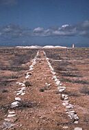
Guano tramway on Jarvis Island
-
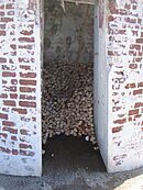
Hermit crabs on Baker Island
-
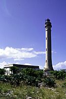
Navassa Island Lighthouse


See also
 In Spanish: Anexo:Reclamos de islas guaneras para niños
