Santa Cruz County, California facts for kids
Quick facts for kids
Santa Cruz County, California
|
|||
|---|---|---|---|
| County of Santa Cruz | |||
|
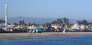
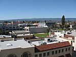
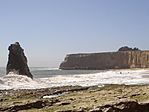
Images, from top down, left to right: The Santa Cruz Beach Boardwalk in 2005, a walkway through redwood groves in Big Basin Redwoods State Park, the Roaring Camp and Big Trees Narrow Gauge Railroad in 2008, Downtown Watsonville in 2010, Davenport Beach in 2006
|
|||
|
|||
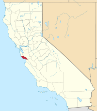
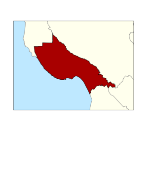
Location in the state of California
|
|||
| Country | United States | ||
| State | California | ||
| Region | Central Coast | ||
| CSA | San Jose-San Francisco-Oakland | ||
| Incorporated | February 18, 1850 | ||
| Named for | Mission Santa Cruz and the city of Santa Cruz, both named after the Exaltation of the Cross | ||
| County seat | Santa Cruz | ||
| Largest city | Santa Cruz | ||
| Government | |||
| • Type | Council–CAO | ||
| • Body | Board of Supervisors | ||
| Area | |||
| • Total | 607 sq mi (1,570 km2) | ||
| • Land | 445 sq mi (1,150 km2) | ||
| • Water | 162 sq mi (420 km2) | ||
| Highest elevation | 3,234 ft (986 m) | ||
| Population
(2020)
|
|||
| • Total | 270,861 | ||
| • Density | 609/sq mi (235/km2) | ||
| GDP | |||
| • Total | $19.176 billion (2022) | ||
| Time zone | UTC−8 (Pacific Time Zone) | ||
| • Summer (DST) | UTC−7 (Pacific Daylight Time) | ||
| Area code | 831 | ||
| FIPS code | 06-087 | ||
| GNIS feature ID | 277308 | ||
| Congressional districts | 18th, 19th | ||
Santa Cruz County is a county located on the Pacific coast of California. Its official name is the County of Santa Cruz. In 2020, about 270,861 people lived here. The main city and county seat is Santa Cruz. This county is part of the larger San Jose–San Francisco–Oakland area. It is found on the California Central Coast, just south of the San Francisco Bay Area. Santa Cruz County forms the northern part of Monterey Bay, while Monterey County is on the southern side.
Contents
History of Santa Cruz County
Santa Cruz County was one of the very first counties in California. It was created in 1850 when California became a state. At first, it was called "Branciforte" after a Spanish town built there in 1797. A creek in the county still has this name. But less than two months later, on April 5, 1850, the name was changed to "Santa Cruz," which means "Holy Cross."
Mission Santa Cruz was built in 1791. It was finished in 1794 but was later destroyed by an earthquake in 1857. A smaller copy of the mission was built in 1931.
Geography of Santa Cruz County
According to the U.S. Census Bureau, Santa Cruz County covers about 607 square miles. About 445 square miles are land, and 162 square miles (27%) are water. It is one of the smallest counties in California by land area. Only San Francisco County is smaller.
The county has a long coastline with over 29 miles of beaches. It is a strip of land about 10 miles wide between the coast and the Santa Cruz Mountains. These mountains are at the northern end of Monterey Bay.
The county can be divided into four main areas:
- The wild "north coast."
- The cities of Santa Cruz, Soquel, Capitola, and Aptos.
- The mountainous areas like Bonny Doon and the San Lorenzo River Valley.
- The rich farming area called the "south county," which includes Watsonville and Corralitos.
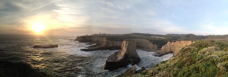
Farming mostly happens in the flat coastal areas at the north and south ends of the county. Much of the north coast has flat lands that end in steep cliffs, like the ones in the picture below.
Animals and Plants of Santa Cruz County
Santa Cruz County is home to many special animals and plants. Some of these are threatened or endangered species, meaning they are at risk of disappearing.
Here are some of them:
- California clapper rail (a bird)
- California red-legged frog
- California tiger salamander
- Coho salmon (a fish)
- Marbled murrelet (a seabird)
- Mount Hermon June beetle (an insect)
- Ohlone tiger beetle (an insect)
- San Francisco garter snake
- Santa Cruz long-toed salamander
- Santa Cruz tarweed (a plant)
- Smith's blue butterfly
- Southern sea otter
- Steelhead (a fish)
- Tidewater goby (a small fish)
- Western snowy plover (a bird)
- Yellow-billed cuckoo (a bird)
- Zayante band-winged grasshopper
Long ago, tule elk lived in the grasslands of Santa Cruz County. Early explorers and local tribes saw these elk. Pronghorn antelope also lived here.
There are also special underwater parks off the coast. These are called Año Nuevo State Marine Conservation Area, Greyhound Rock State Marine Conservation Area, and Natural Bridges State Marine Reserve. They help protect ocean animals and their homes.
Neighboring Counties and Waterways
Santa Cruz County shares borders with four other counties:
- San Mateo to the northwest.
- Santa Clara to the north and east.
- Monterey to the south.
- San Benito has a small border to the south.
Population of Santa Cruz County
| Historical population | |||
|---|---|---|---|
| Census | Pop. | %± | |
| 1850 | 643 | — | |
| 1860 | 4,944 | 668.9% | |
| 1870 | 8,743 | 76.8% | |
| 1880 | 12,802 | 46.4% | |
| 1890 | 19,270 | 50.5% | |
| 1900 | 21,512 | 11.6% | |
| 1910 | 26,140 | 21.5% | |
| 1920 | 26,269 | 0.5% | |
| 1930 | 37,433 | 42.5% | |
| 1940 | 45,057 | 20.4% | |
| 1950 | 66,534 | 47.7% | |
| 1960 | 84,219 | 26.6% | |
| 1970 | 123,790 | 47.0% | |
| 1980 | 188,141 | 52.0% | |
| 1990 | 229,734 | 22.1% | |
| 2000 | 255,602 | 11.3% | |
| 2010 | 262,382 | 2.7% | |
| 2020 | 270,861 | 3.2% | |
| 2023 (est.) | 261,547 | −0.3% | |
| U.S. Decennial Census 1790–1960 1900–1990 1990–2000 2010 2020 |
|||
What the 2020 Census Shows
In 2020, the population of Santa Cruz County was 270,861 people. The county is made up of people from many different backgrounds.
| Race / Ethnicity (NH = Non-Hispanic) | Pop 2010 | Pop 2020 | % 2010 | % 2020 |
|---|---|---|---|---|
| White alone (NH) | 156,397 | 145,551 | 59.61% | 53.74% |
| Black or African American alone (NH) | 2,304 | 2,850 | 0.88% | 1.05% |
| Native American or Alaska Native alone (NH) | 978 | 853 | 0.37% | 0.31% |
| Asian alone (NH) | 10,658 | 12,072 | 4.06% | 4.46% |
| Pacific Islander alone (NH) | 292 | 277 | 0.11% | 0.10% |
| Other Race alone (NH) | 612 | 1,649 | 0.23% | 0.61% |
| Mixed Race or Multi-Racial (NH) | 7,049 | 13,310 | 2.69% | 4.91% |
| Hispanic or Latino (any race) | 84,092 | 94,299 | 32.05% | 34.81% |
| Total | 262,832 | 270,861 | 100.00% | 100.00% |
Many people in Santa Cruz County are well-educated. About 38.3% of adults aged 25 and older have at least a bachelor's degree. This is higher than the national average.
Economy of Santa Cruz County
In the 1800s, Santa Cruz's economy was based on cutting wood, making cement from limestone, and tanning leather. It was once the second-largest manufacturing area in California. As natural resources became less available, tourism became more important.
Today, about 10% of jobs in Santa Cruz County are in food production and processing. Many people who work in Santa Cruz County also live outside of it.
Farming businesses are very important in the county. They have a big say in local decisions about water use and fair working conditions. Santa Cruz County has rules about living wages, which means workers must be paid enough to live comfortably.
Housing in Santa Cruz County
Santa Cruz has been called one of the most expensive places to live in the United States. This is especially true for renters. Many people rent their homes here, and the average monthly rent can be quite high.
One reason housing is expensive is because of rules that protect the environment. These rules limit how much new housing can be built. This creates a challenge between protecting nature and providing enough homes for people.
Some people have found solutions by using "accessory dwelling units." These are like small extra homes on a property. Building these units used to be against the law, but now it is encouraged. This helps create more housing without spreading out too much.
Top Employers in Santa Cruz County
The biggest employers in Santa Cruz County include:
| # | Employer | Product/Service | # of Employees |
|---|---|---|---|
| 1 | University of California, Santa Cruz | Education | 1,000–4,999 |
| 2 | Pajaro Valley Unified School District | Education | 1,000–4,999 |
| 3 | County of Santa Cruz | County Services | 1,000–4,999 |
| 4 | Dominican Hospital | Hospital | 1,000–4,999 |
| 5 | Santa Cruz Governmental Center | City Services | 1,000–4,999 |
| 6 | Graniterock | Excavating Contractors | 500–999 |
| 7 | Plantronics | Telephone Apparatus Mfg. | 500–999 |
| 8 | Watsonville Community Hospital | Hospital | 500–999 |
| 9 | Source Naturals | Vitamin Manufacturer | 500–999 |
| 10 | Santa Cruz Health Center | Clinics | 500–999 |
| 11 | Monterey Mushrooms | Agriculture | 500–999 |
| 12 | Larse Farms Inc | Agriculture | 500–999 |
Winemaking and Wineries
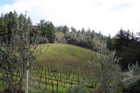
Making wine is an important part of Santa Cruz County's economy and culture. The area is known for its vineyards and wineries. Wines from the David Bruce Winery and Ridge Vineyards were even chosen for a famous wine tasting event in Paris in 1976.
Education in Santa Cruz County
Santa Cruz County offers many educational opportunities.
Four-Year Universities
- University of California, Santa Cruz (public university) in Santa Cruz, California
- Bethany University (private, no longer open) in Scotts Valley, California
Two-Year College
- Cabrillo College (public college) in Aptos, California
K-12 Schools
The county has several school districts for students from kindergarten to 12th grade:
- Unified School Districts:*
- Aromas-San Juan Unified School District
- Pajaro Valley Joint Unified School District
- San Lorenzo Valley Unified School District
- Scotts Valley Unified School District
- Secondary School Districts:*
- Los Gatos-Saratoga Joint Union School District
- Santa Cruz City High School District (for grades 6-12 or 9-12 in some areas)
- Elementary School Districts:*
- Bonny Doon Union Elementary School District
- Happy Valley Elementary School District
- Lakeside Joint Elementary School District
- Live Oak Elementary School District
- Loma Prieta Joint Union Elementary School District
- Mountain Elementary School District
- Pacific Elementary School District
- Santa Cruz City Elementary School District
- Soquel Elementary School District
Transportation in Santa Cruz County
Getting around Santa Cruz County is possible through various ways.
Main Highways
 State Route 1
 State Route 9
 State Route 17
 State Route 35
 State Route 129
 State Route 152
 State Route 236
County Roads
Public Transportation
The Santa Cruz Metropolitan Transit District runs a bus system throughout the county. There is also a special bus service called "Highway 17 Express" that goes between Santa Cruz and San Jose. It is run by Amtrak and local transit groups.
Airports
Watsonville Municipal Airport is a public airport for general aviation. This means it's used for private planes and small charter flights. There are also two companies based there that offer air charter services.
There's a private airport called Monterey Bay Academy Airport, which used to be a military base. For bigger flights, the closest airports are San Jose International Airport, Monterey Regional Airport, San Francisco International Airport, and Oakland International Airport.
Communities in Santa Cruz County
Santa Cruz County has several cities and many smaller communities.
Cities
- Capitola
- Santa Cruz (the main city and county seat)
- Scotts Valley
- Watsonville
Census-Designated Places (CDPs)
CDPs are areas that are like towns but are not officially incorporated as cities.
- Amesti
- Aptos
- Aptos Hills-Larkin Valley
- Ben Lomond
- Bonny Doon
- Boulder Creek
- Brookdale
- Corralitos
- Davenport
- Day Valley
- Felton
- Freedom
- Interlaken
- La Selva Beach
- Live Oak
- Lompico
- Mount Hermon
- Pajaro Dunes
- Paradise Park
- Pasatiempo
- Pleasure Point
- Rio del Mar
- Seacliff
- Soquel
- Twin Lakes
- Zayante
Unincorporated Communities
These are smaller areas that are not part of any city or CDP.
- Branciforte
- Felton Grove
- Opal Cliffs
- Swanton
Community Population Ranking (2010 Census)
This table shows the population of the main communities in Santa Cruz County based on the 2010 Census.
† county seat
| Rank | City/Town/etc. | Municipal type | Population (2010 Census) |
|---|---|---|---|
| 1 | † Santa Cruz | City | 59,946 |
| 2 | Watsonville | City | 51,199 |
| 3 | Live Oak | CDP | 17,158 |
| 4 | Scotts Valley | City | 11,580 |
| 5 | Capitola | City | 9,918 |
| 6 | Soquel | CDP | 9,644 |
| 7 | Rio del Mar | CDP | 9,216 |
| 8 | Interlaken | CDP | 7,321 |
| 9 | Ben Lomond | CDP | 6,234 |
| 10 | Aptos | CDP | 6,220 |
| 11 | Pleasure Point | CDP | 5,846 |
| 12 | Boulder Creek | CDP | 4,923 |
| 13 | Twin Lakes | CDP | 4,917 |
| 14 | Felton | CDP | 4,057 |
| 15 | Amesti | CDP | 3,478 |
| 16 | Day Valley | CDP | 3,409 |
| 17 | Seacliff | CDP | 3,267 |
| 18 | Freedom | CDP | 3,070 |
| 19 | La Selva Beach | CDP | 2,843 |
| 20 | Bonny Doon | CDP | 2,678 |
| 21 | Aptos Hills-Larkin Valley | CDP | 2,381 |
| 22 | Corralitos | CDP | 2,326 |
| 23 | Brookdale | CDP | 1,991 |
| 24 | Lompico | CDP | 1,137 |
| 25 | Pasatiempo | CDP | 1,041 |
| 26 | Mount Hermon | CDP | 1,037 |
| 27 | Zayante | CDP | 705 |
| 28 | Davenport | CDP | 408 |
| 29 | Paradise Park | CDP | 389 |
| 30 | Pajaro Dunes | CDP | 144 |
See also
 In Spanish: Condado de Santa Cruz para niños
 | John T. Biggers |
 | Thomas Blackshear |
 | Mark Bradford |
 | Beverly Buchanan |


