
Territorial evolution of the United States facts for kids


The United States began on July 4, 1776. Thirteen British colonies in North America declared their independence. They called themselves the United States of America. This big step was formalized in a document called the Articles of Confederation in 1781. Great Britain officially recognized their independence in 1783 after the American Revolutionary War. This made the new country much larger, allowing it to stretch west to the Mississippi River.
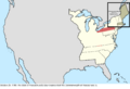
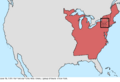
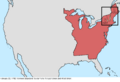
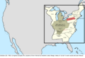
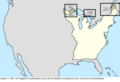
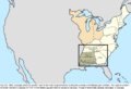
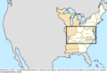
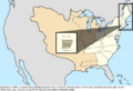
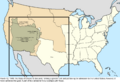
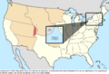
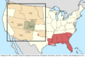
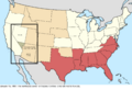
The country grew even more with the Louisiana Purchase in 1803. This huge deal doubled the size of the United States! Later, in 1821, Spanish Florida and claims to the Oregon Country were added. The Oregon Country gave the U.S. access to the Pacific Ocean. In 1845, the Republic of Texas joined the U.S. This led to the Mexican–American War. After winning, the U.S. gained a large part of northern Mexico, including California. As the country expanded west, the issue of slavery became a major problem. Debates and events like the Missouri Compromise caused big arguments. This eventually led to the American Civil War in 1861. The southern states formed the Confederate States of America. The Confederacy was defeated in 1865, and the states rejoined the U.S. Many Americans believed in "Manifest Destiny". This was the idea that the U.S. was meant to expand across the continent.
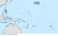
The U.S. also started expanding beyond North America. In 1856, the Guano Islands Act allowed the U.S. to claim small, uninhabited islands. These islands were important for their guano, which is bird droppings used as fertilizer. Many of these claims were later given up. The biggest expansion in the Pacific was the annexation of Hawaii in 1898. This happened after its government was overthrown five years earlier. Alaska was the last major land purchase in North America. It was bought from Russia in 1867.
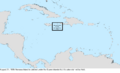
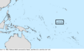
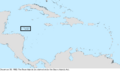
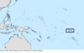
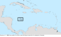
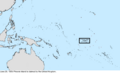
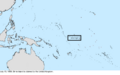
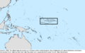
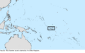
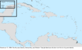
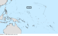
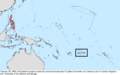
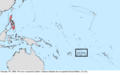
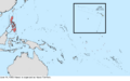
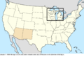
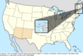
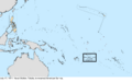
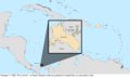
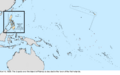
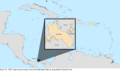
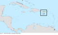
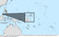
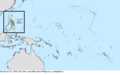
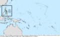
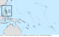
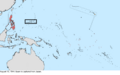
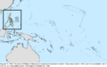
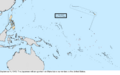
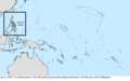
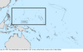
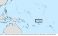
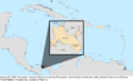
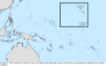
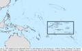
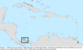
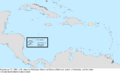
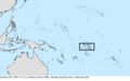
In 1898, the Spanish–American War led to the U.S. gaining Guam, Puerto Rico, and the Philippines. The U.S. also occupied Cuba for several years. American Samoa was acquired in 1900. The United States Virgin Islands were bought from Denmark in 1917. Guam and Puerto Rico are still U.S. territories today. The Philippines became independent in 1946 after World War II. After the war, the United Nations put many islands under U.S. care. Some of these, like the Northern Mariana Islands, are still U.S. territories. Others, like the Marshall Islands, Federated States of Micronesia, and Palau, became independent countries. The Panama Canal Zone was acquired in 1904 to control the Panama Canal. It was returned to Panama in 1979, with full control transferred in 1999.
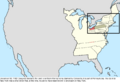
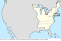
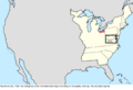
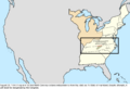
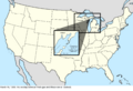
States generally kept their original borders once they were set. Only four states were created from land claimed by other states: Maine, Kentucky, Vermont, and West Virginia. All other states were formed from territories or new land acquisitions. The last state in the main part of the U.S. was admitted in 1912. Hawaii was the fiftieth and most recent state, joining in 1959.
Contents
- How the U.S. Grew: Key Moments
- Early Days: From Colonies to a New Nation (1776–1784)
- Organizing New Lands (1784–1803)
- The Louisiana Purchase and Beyond (1803–1845)
- Expansion to the Pacific (1845–1860)
- The Civil War and Reconstruction (1860–1897)
- Global Reach: Pacific and Caribbean Expansion (1898–1945)
- Modern Era: New States and Changing Borders (1946–Present)
- Images for kids
- See also
How the U.S. Grew: Key Moments
The United States has grown a lot since it began. Here are some of the most important ways the country expanded and changed its shape.
Early Days: From Colonies to a New Nation (1776–1784)
When the U.S. declared independence, it was made up of thirteen colonies. These colonies became the first states. Their borders were not always clear. Great Britain finally recognized the U.S. as independent in 1783. This officially ended the American Revolutionary War. The new country now stretched west to the Mississippi River.
- July 4, 1776: Thirteen British colonies declared independence. They became the first states of the U.S.
- March 1, 1781: The Articles of Confederation became official. This was the first government of the United States.
- May 12, 1784: Great Britain officially recognized the U.S. as an independent country. This ended the Revolutionary War.


Organizing New Lands (1784–1803)
After the Revolutionary War, the U.S. started organizing the new lands it had gained. States began giving up their claims to western lands to the federal government. This helped create new territories that would later become states.
- July 13, 1787: The Northwest Territory was created. This was a large area of land northwest of the Ohio River.
- April 2, 1790: North Carolina gave its western land to the federal government. This land became the Southwest Territory.
- March 4, 1791: Vermont became the 14th state.
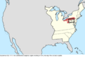
- June 1, 1792: Kentucky became the 15th state. It was formed from land that Virginia had claimed.
- June 1, 1796: The Southwest Territory became the 16th state, Tennessee.
- March 1, 1803: Ohio became the 17th state. It was formed from part of the Northwest Territory.


The Louisiana Purchase and Beyond (1803–1845)
The Louisiana Purchase was a massive expansion. It added a huge amount of land to the U.S. The country continued to grow, adding more states and defining its borders with other nations.
- December 20, 1803: The U.S. bought Louisiana from France. This huge purchase doubled the size of the country.
- April 30, 1812: Most of the Orleans Territory became the 18th state, Louisiana.
- December 11, 1816: Indiana became the 19th state.
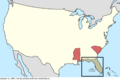
- December 10, 1817: Mississippi became the 20th state.
- December 3, 1818: Illinois became the 21st state.
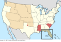
- December 14, 1819: Alabama became the 22nd state.
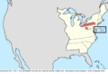
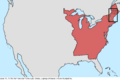
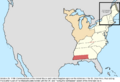
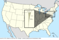
- March 15, 1820: Maine became the 23rd state. It was part of Massachusetts before this.
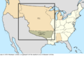
- February 22, 1821: The U.S. signed a treaty with Spain. This treaty defined the border with Spanish lands and gave Florida to the U.S.
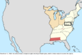
- August 10, 1821: Missouri became the 24th state.
- March 30, 1822: Florida became an official U.S. territory.
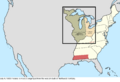
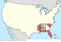
- June 15, 1836: Arkansas became the 25th state.
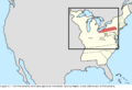
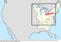
- January 26, 1837: Michigan became the 26th state.
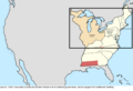
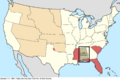
- March 3, 1845: Florida became the 27th state.


Expansion to the Pacific (1845–1860)
The idea of "Manifest Destiny" pushed the U.S. to expand all the way to the Pacific Ocean. This period saw the annexation of Texas and the acquisition of vast lands from Mexico.
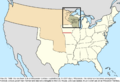
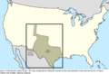
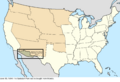
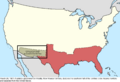
- December 29, 1845: The Republic of Texas was annexed and became the 28th state, Texas. This led to a war with Mexico.
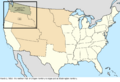
- June 15, 1846: The Oregon Treaty set the border with Great Britain in the Pacific Northwest. This ended the sharing of the Oregon Country.
- December 28, 1846: Iowa became the 29th state.
- May 29, 1848: Wisconsin became the 30th state.
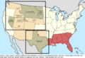
- July 4, 1848: The Mexican–American War ended with the Treaty of Guadalupe Hidalgo. Mexico gave a huge amount of land to the U.S., including what would become California and the Southwest.
- August 14, 1848: Oregon Territory was created.
- March 3, 1849: Minnesota Territory was created.
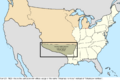
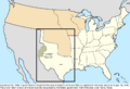
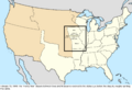
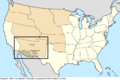
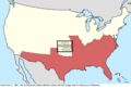
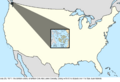
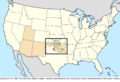
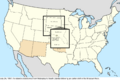
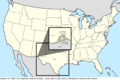
- September 9, 1850: California became the 31st state. Utah Territory was also organized.
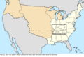
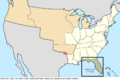
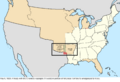
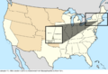
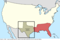
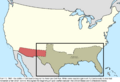
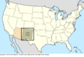
- December 13, 1850: The federal government bought western land claims from Texas. New Mexico Territory was organized from this land.
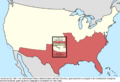
- March 2, 1853: Washington Territory was created from part of Oregon Territory.
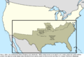
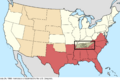
- May 30, 1854: Kansas Territory and Nebraska Territory were organized. Much of the remaining unorganized land became Indian Territory.
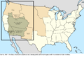
- June 30, 1854: The U.S. bought more land from Mexico in the Gadsden Purchase. This helped create a better route for a southern railroad.
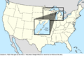
- May 11, 1858: Minnesota became the 32nd state.
- February 14, 1859: Oregon became the 33rd state.


The Civil War and Reconstruction (1860–1897)
The issue of slavery led to the Civil War, which temporarily split the country. After the war, the U.S. reunited and continued to add western states.
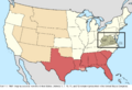
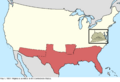
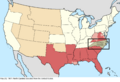
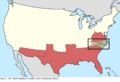
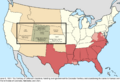
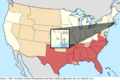
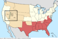
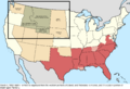
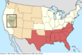
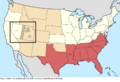
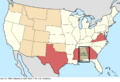
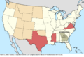
- December 20, 1860 – June 8, 1861: Several southern states, including South Carolina, Mississippi, Florida, Alabama, Georgia, Louisiana, Texas, Virginia, Arkansas, and North Carolina, declared they were leaving the Union. They formed the Confederate States of America.
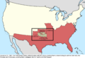
- January 29, 1861: Kansas became the 34th state.
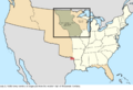
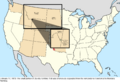
- February 28, 1861: Colorado Territory was created.
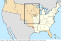
- March 2, 1861: Dakota Territory and Nevada Territory were organized.
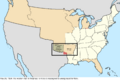
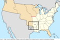
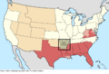
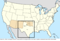
- February 24, 1863: Arizona Territory was created from part of New Mexico Territory.
- March 3, 1863: Idaho Territory was created.
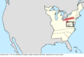
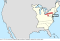
- June 20, 1863: West Virginia became the 35th state. It was formed from the northwestern counties of Virginia that stayed loyal to the Union.
- May 26, 1864: Montana Territory was created.
- October 31, 1864: Nevada became the 36th state.
- May 5, 1865: The Confederate States of America dissolved, ending the Civil War.
- March 1, 1867: Nebraska became the 37th state.
- October 18, 1867: The U.S. purchased Alaska from Russia. This vast land became the Department of Alaska.
- July 25, 1868: Wyoming Territory was organized.
- August 1, 1876: Colorado became the 38th state.
- November 2, 1889: Dakota Territory was split into two states: North Dakota (39th state) and South Dakota (40th state).
- November 8, 1889: Montana became the 41st state.
- November 11, 1889: Washington became the 42nd state.
- May 2, 1890: Oklahoma Territory was organized.
- July 3, 1890: Idaho became the 43rd state.
- July 10, 1890: Wyoming became the 44th state.
- January 4, 1896: Utah became the 45th state.


Global Reach: Pacific and Caribbean Expansion (1898–1945)
At the turn of the 20th century, the U.S. became a global power. It gained new territories in the Pacific and Caribbean, often after wars or purchases.
- August 12, 1898: The Republic of Hawaii was annexed, becoming a U.S. territory.
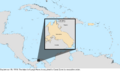
- April 11, 1899: Following the Spanish–American War, Guam, Puerto Rico, and the Philippines were given to the U.S. by Spain.
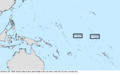
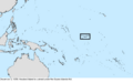
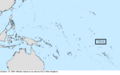
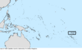
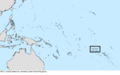
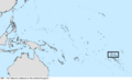
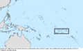
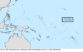
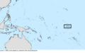
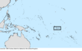
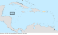
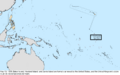
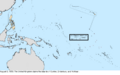
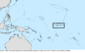
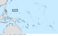
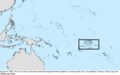
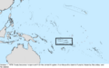
- February 16, 1900: The U.S. took ownership of the Samoan Islands east of 171° west, which became American Samoa.
- May 4, 1904: The U.S. took control of the Panama Canal Zone to build and operate the Panama Canal.
- November 16, 1907: Oklahoma became the 46th state, combining Indian Territory and Oklahoma Territory.
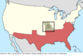
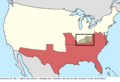
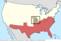
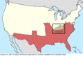
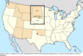
- January 6, 1912: New Mexico became the 47th state.
- February 14, 1912: Arizona became the 48th state.
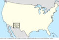
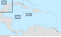
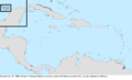
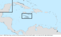
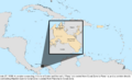
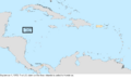
- March 31, 1917: The Danish Virgin Islands were purchased from Denmark and renamed the United States Virgin Islands.
- July 4, 1946: The Philippine Commonwealth became independent as the Philippines.


Modern Era: New States and Changing Borders (1946–Present)
After World War II, the U.S. helped many former territories become independent. The country also added its last two states and continued to adjust its borders.
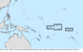
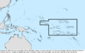
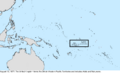
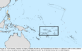
- July 18, 1947: The United Nations placed the Trust Territory of the Pacific Islands under U.S. care.
- January 3, 1959: Alaska became the 49th state.
- August 21, 1959: Hawaii became the 50th state.
- October 1, 1979: The Panama Canal Zone was returned to Panama. The U.S. fully handed over control of the canal in 1999.
- October 21, 1986: The Marshall Islands became an independent country from the Trust Territory of the Pacific Islands.
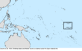
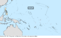
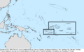
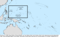
- November 3, 1986: The Federated States of Micronesia became independent. The Northern Mariana Islands became a U.S. territory.
- October 1, 1994: Palau became independent, marking the end of the Trust Territory of the Pacific Islands.
Images for kids
-
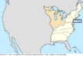
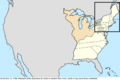
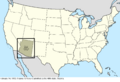
Delaware became "the Delaware State" on September 20, 1776.
-
The Continental Congress moved to Baltimore on December 20, 1776.
-
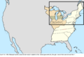
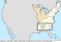
New Connecticut declared independence on January 15, 1777.
-

The Continental Congress returned to Philadelphia on March 4, 1777.
-

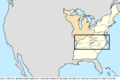
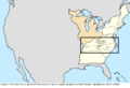
New Connecticut was renamed Vermont on June 4, 1777.
-

The Continental Congress moved to Lancaster, Pennsylvania, on September 27, 1777.
-
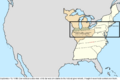
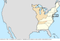
The Continental Congress moved to York, Pennsylvania, on September 30, 1777.
-
Vermont claimed the "East Union" on June 11, 1778.
-

Vermont gave up its claim to the East Union on October 21, 1778.
-
The Continental Congress returned to Philadelphia on July 2, 1779.
-
Virginia gave up its claim to southwest Pennsylvania on August 31, 1779.
-
North Carolina and Virginia surveyed their border further inland in March 1780.
-
Massachusetts Bay became the Commonwealth of Massachusetts on October 25, 1780.
-

Vermont again claimed an East Union on April 4, 1781.
-
Vermont claimed the "West Union" on June 16, 1781.
-
Vermont abandoned its attempts to annex the East and West Unions on February 22, 1782.
-
The federal government accepted New York's western claims on October 29, 1782.
-
The federal government declared Connecticut's claim in northern Pennsylvania was part of Pennsylvania on December 30, 1782.
-
The Continental Congress moved to Princeton, New Jersey, on June 30, 1783.
-
The Continental Congress reconvened in Annapolis, Maryland, on November 26, 1783.
-
The State of Frankland declared independence from North Carolina on August 23, 1784.
-
The Continental Congress moved to Trenton, New Jersey, on November 1, 1784.
-

The Continental Congress moved to New York City on January 11, 1785.
-
The federal government accepted Massachusetts' western claim on April 19, 1785.
-
The State of Frankland was renamed the State of Franklin in June 1785.
-
Connecticut gave up its western claim except for its Western Reserve on September 13, 1786.
-
Massachusetts gave up its claim to western New York on December 16, 1786.
-
South Carolina gave up its western claim on August 9, 1787.
-
The State of Franklin ended its claimed independence in February 1789.
-
The U.S. Congress relocated to Philadelphia on December 6, 1790.
-
The District of Columbia was formed on March 30, 1791.
-
Pennsylvania purchased the Erie Triangle on March 3, 1792.
-
Kentucky became a state on June 1, 1792.
-
Mississippi Territory was created on April 7, 1798.
-
Commissioners agreed on the source of the St. Croix River on October 25, 1798.
-
Connecticut ceded its Western Reserve to the federal government on June 9, 1800.
-
Indiana Territory was organized on July 4, 1800.
-
The U.S. Congress moved to Washington, D.C., on November 17, 1800.
-
The Kingdom of Great Britain united with Ireland on January 1, 1801.
-
Georgia ceded its western half to the federal government on April 26, 1802.
-
The border between Tennessee and Virginia was established on November 3, 1803.
-
The "Southwick Jog" was transferred from Connecticut to Massachusetts in 1804.
-
Land between Tennessee and Mississippi Territory was assigned to Mississippi Territory on March 27, 1804.
-
Orleans Territory was organized on October 1, 1804.
-
Michigan Territory was organized on June 30, 1805.
-
The District of Louisiana was organized as Louisiana Territory on July 4, 1805.
-
Illinois Territory was organized on March 1, 1809.
-
The Republic of West Florida declared independence on September 26, 1810.
-
The U.S. took possession of part of West Florida on December 10, 1810.
-
Part of West Florida was assigned to Mississippi Territory on May 14, 1812.
-
Louisiana Territory was renamed Missouri Territory on June 4, 1812.
-
The remaining part of West Florida was added to Louisiana on August 4, 1812.
-
British forces occupied Detroit on August 16, 1812.
-
American forces regained control over Michigan Territory on September 29, 1813.
-
Alabama Territory was organized on March 3, 1817.
-
Alabama Territory created Tuskaloosa County, overlapping Mississippi, on February 6, 1818.
-
Illinois became a state on December 3, 1818.
-
The Treaty of 1818 went into effect, setting the border with the United Kingdom on January 30, 1819.
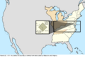
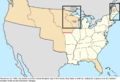
-
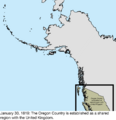
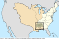
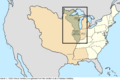
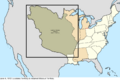
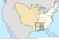
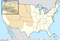
Map showing the Oregon Country in 1819.
-
Arkansaw Territory was organized on July 4, 1819.
-
The name "Arkansas Territory" was officially used on April 21, 1820.
-
The border between Kentucky and Tennessee was established on May 12, 1820.
-
The border overlap between Alabama and Mississippi was resolved on July 19, 1820.
-
Alabama redefined some county borders on December 19, 1820.
-
East Florida was formally transferred to the U.S. on July 10, 1821.
-
West Florida was formally transferred to the U.S. on July 17, 1821.
-
Florida Territory was organized on March 30, 1822.
-
Part of Arkansas Territory was returned to unorganized territory on May 26, 1824.
-
A treaty with the Cherokee moved the western border of Arkansas Territory on May 6, 1828.
-
The Republic of Indian Stream declared independence on July 9, 1832.
-
Michigan Territory gained a large parcel of land on June 28, 1834.
-
The Republic of Indian Stream recognized New Hampshire's jurisdiction on August 5, 1835.
-
Wisconsin Territory was organized on July 3, 1836.
-
Michigan Territory agreed to abandon its claim to the Toledo Strip on December 14, 1836.
-
The Platte Purchase transferred land to northwest Missouri on March 28, 1837.
-
Iowa Territory was organized on July 3, 1838.
-
Missouri claimed an area north of its border with Iowa Territory on February 11, 1839.
-
Surveying concluded that Miller County, Arkansas, belonged to Texas on May 21, 1840.
-
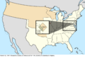
The Webster–Ashburton Treaty defined the border with the United Kingdom on November 10, 1842.
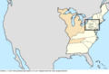
-
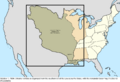
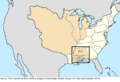
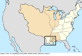
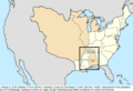
Map showing resolved disputes after the Webster-Ashburton Treaty in 1842.
-
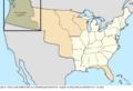
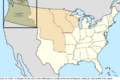
A provisional government was created for Oregon Country on July 5, 1843.
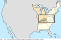
-
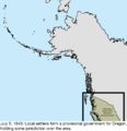
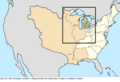
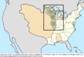
Map showing the provisional government of Oregon in 1843.
-
The Oregon Treaty established the border with the United Kingdom on June 15, 1846.
-
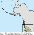
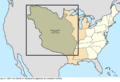
Map showing the Oregon Treaty in 1846.
-

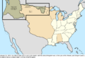
Map showing disputes after the Oregon Treaty in 1846.
-
The Kearny Code was created for Santa Fe de Nuevo México on September 22, 1846.
-
Alexandria County was returned to Virginia on March 13, 1847.
-
Wisconsin became a state on May 29, 1848.
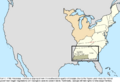
-
Map showing disputes after the Treaty of Guadalupe Hidalgo in 1848.
-
The Honey War dispute between Iowa and Missouri was resolved on February 13, 1849.
-
Minnesota Territory was organized on March 3, 1849.
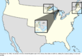
-
The State of Deseret claimed a vast portion of the southwest on March 12, 1849.
-
Horseshoe Reef was ceded to the U.S. on December 9, 1850.
-
The State of Deseret dissolved itself on April 5, 1851.
-
Washington Territory was organized on March 2, 1853.
-
The U.S. purchased the Gadsden Purchase from Mexico on June 30, 1854.
-
Map showing resolved disputes after the Gadsden Purchase in 1854.
-
The Gadsden Purchase was assigned to New Mexico Territory on August 4, 1854.
-
Boston Corner was transferred from Massachusetts to New York on January 11, 1855.
-
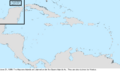
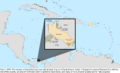
Baker Island and Jarvis Island were claimed on October 28, 1856.
-
Minnesota became a state on May 11, 1858.
-
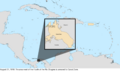
Navassa Island was claimed on August 31, 1858.
-
Howland Island was claimed on December 3, 1858.
-
Oregon became a state on February 14, 1859.
-
The "Middleton Offset" was created in the Kentucky-Tennessee border on July 6, 1859.
-
Johnston Atoll was claimed on September 6, 1859.
-
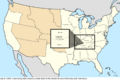
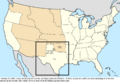
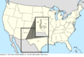
Jefferson Territory was set up on November 7, 1859.
-
Enderbury Island, McKean Island, Phoenix Island, and Starbuck Island were claimed on December 27, 1859.
-
Christmas Island and Malden Island were claimed on December 29, 1859.
-
Texas created Greer County on February 8, 1860.
-
Many islands were claimed under the Guano Islands Act on February 8, 1860.
-
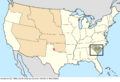
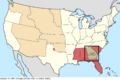
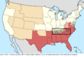
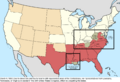
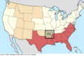
South Carolina proclaimed its secession on December 20, 1860.
-
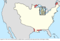
Map showing South Carolina's secession in 1860.
-
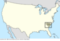
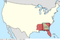
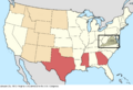
Mississippi proclaimed its secession on January 9, 1861.
-
Map showing Mississippi's secession in 1861.
-
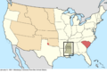
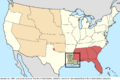
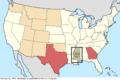
Florida proclaimed its secession on January 10, 1861.
-
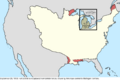
Map showing Florida's secession in 1861.
-
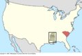
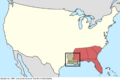
Alabama proclaimed its secession on January 11, 1861.
-
Map showing Alabama's secession in 1861.
-
Georgia proclaimed its secession on January 19, 1861.
-
Map showing Georgia's secession in 1861.
-
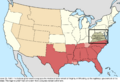
Louisiana proclaimed its secession on January 26, 1861.
-
Map showing Louisiana's secession in 1861.
-
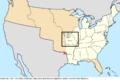
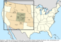
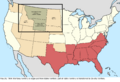
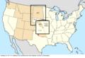
Colorado Territory was organized on February 28, 1861.
-
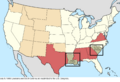
Texas proclaimed its secession on March 2, 1861.
-
Map showing Texas's secession in 1861.
-
Confederate Arizona Territory was proclaimed on March 28, 1861.
-
The Battle of Fort Sumter began the Civil War on April 12, 1861.
-
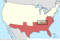
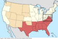
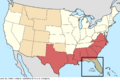
Virginia proclaimed its secession on April 17, 1861.
-

Map showing Virginia's secession in 1861.
-
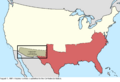
Arkansas proclaimed its secession on May 6, 1861.
-
Map showing Arkansas's secession in 1861.
-
Virginia was admitted to the Confederate States on May 7, 1861.
-
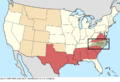
North Carolina proclaimed its secession on May 20, 1861.
-

Map showing North Carolina's secession in 1861.
-
North Carolina was admitted to the Confederate States on May 21, 1861.
-
Jefferson Territory was disbanded on June 6, 1861.
-
Tennessee proclaimed its secession on June 8, 1861.
-

Map showing Tennessee's secession in 1861.
-
The federal government recognized the Restored Government of Virginia on June 25, 1861.
-
Tennessee was admitted to the Confederate States on July 2, 1861.
-
Confederate Arizona Territory was proclaimed part of the Confederate States on August 1, 1861.
-
A splinter government in Missouri declared secession on October 31, 1861.
-
A splinter government in Kentucky declared secession on November 20, 1861.
-
The Neosho government of Missouri was admitted to the Confederate States on November 28, 1861.
-
The Bowling Green government of Kentucky was admitted to the Confederate States on December 10, 1861.
-
The Confederate States ratified treaties with the Osage, Seneca, and Shawnee on December 21, 1861.
-
The Confederate States ratified treaties with the Cherokee and Seminole on December 23, 1861.
-
The Confederate States ratified treaties with the Choctaw, Chickasaw, Comanche, Creek, and Quapaw on December 31, 1861.
-
The border between Massachusetts and Rhode Island was modified on March 1, 1862.
-
Palmyra Atoll was annexed by Hawaii on April 15, 1862.
-
Part of Utah Territory was transferred to Nevada Territory on July 14, 1862.
-
The Swan Islands were claimed on December 30, 1862.
-
Idaho Territory was organized on March 3, 1863.
-
Unionist areas of Louisiana, Tennessee, and Virginia lost representation in Congress on March 4, 1863.
-
Berkeley County was transferred from Virginia to West Virginia on August 5, 1863.
-

Jefferson County was transferred from Virginia to West Virginia on November 2, 1863.
-
Montana Territory was organized on May 26, 1864.
-
Malden Island was claimed by the United Kingdom on October 15, 1864.
-
Nevada became a state on October 31, 1864.
-
The Confederate States cabinet dissolved on May 5, 1865.
-
Part of Utah Territory was transferred to Nevada on May 5, 1866.
-
Tennessee was readmitted to Congress on July 24, 1866.
-
Starbuck Island was claimed by the United Kingdom on December 26, 1866.
-
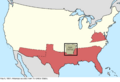
Part of Arizona Territory was transferred to Nevada on January 18, 1867.
-
Canada was formed on July 1, 1867.
-
Midway Atoll was claimed on August 28, 1867.
-
Arkansas was readmitted to Congress on June 22, 1868.
-
Florida was readmitted to Congress on June 25, 1868.
-
North Carolina was readmitted to Congress on July 4, 1868.
-
Louisiana and South Carolina were readmitted to Congress on July 9, 1868.
-
Caroline Island was claimed by the United Kingdom on July 9, 1868.
-
Alabama was readmitted to Congress on July 13, 1868.
-
Wyoming Territory was organized on July 25, 1868.
-
Serrana Bank was claimed on December 11, 1868.
-
Georgia was again expelled from Congress on March 3, 1869.
-
Bajo Nuevo Bank, Pedro Cays, Quita Sueño Bank, and Roncador Bank were claimed on November 22, 1869.
-
Virginia was readmitted to Congress on January 26, 1870.
-
Mississippi was readmitted to Congress on February 23, 1870.
-
Texas was readmitted to Congress on March 30, 1870.
-
Georgia was again readmitted to Congress on July 15, 1870.
-
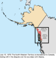
The North-Western Territory was transferred to Canada on July 15, 1870.
-
A small parcel was transferred from Dakota Territory to Nebraska on February 9, 1871.
-
British Columbia joined Canada on July 20, 1871.
-
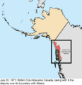
Map showing British Columbia joining Canada in 1871.
-
The San Juan Islands dispute was resolved on October 21, 1872.
-
Vostok Island was claimed by the United Kingdom in 1873.
-
A small portion of Dakota Territory was transferred to Montana Territory on February 17, 1873.
-
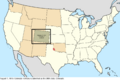
Colorado became a state on August 1, 1876.
-
The British Western Pacific Territories were created on August 13, 1877.
-
Arenas Key, Morant Cays, and Serranilla Bank were claimed on September 8, 1879.
-
Western Triangle Island was claimed on September 13, 1880.
-
Flint Island was claimed by the United Kingdom in 1881.
-
Land was transferred from Dakota Territory to Nebraska on May 23, 1882.
-
The Morant Cays and Pedro Cays were annexed by the United Kingdom on June 1, 1882.
-
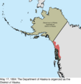
The Department of Alaska was organized into the District of Alaska on May 17, 1884.
-
The Alacrans Islands were claimed on June 21, 1884.
-
Fanning Island was annexed by the United Kingdom on March 15, 1888.
-
Christmas Island was claimed by the United Kingdom on March 17, 1888.
-
The Cook Islands became a protectorate of the United Kingdom on October 26, 1888.
-
Washington Island was annexed by the United Kingdom on May 29, 1889.
-
Jarvis Island was claimed by the United Kingdom on June 3, 1889.
-
Sydney Island was claimed by the United Kingdom on June 26, 1889.
-
Phoenix Island was claimed by the United Kingdom on June 29, 1889.
-
Birnie Island was claimed by the United Kingdom on July 10, 1889.
-
The Gilbert Islands became a protectorate of the United Kingdom on March 8, 1892.
-
Gardner Island was claimed by the United Kingdom on May 28, 1892.
-
The Cherokee Outlet was transferred to Oklahoma Territory on September 16, 1893.
-
Several guano islands were removed from the claimed list on November 17, 1894.
-
The Greer County dispute was resolved on March 16, 1896.
-
An island was transferred from Nebraska to South Dakota on July 24, 1897.
-
Wake Island was claimed on January 17, 1899.
-
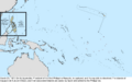
The U.S. took ownership of the Samoan Islands on February 16, 1900.
-
The Samoan islands were established as Naval Station, Tutuila, on February 19, 1900.
-
Hawaii Territory was organized on June 14, 1900.
-
The First Philippine Republic was dissolved, and islands were purchased from Spain on March 23, 1901.
-
The Insular Government of the Philippine Islands was established on July 4, 1901.
-
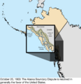
The Alaska boundary dispute was resolved on October 20, 1903.
-
Oklahoma became a state on November 16, 1907.
-
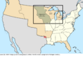
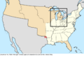
The new Michigan Constitution included some Wisconsin area on January 1, 1909.
-
The maritime border in Passamaquoddy Bay was adjusted on August 20, 1910.
-
Naval Station, Tutuila, was renamed American Samoa on July 17, 1911.
-
New Mexico became a state on January 6, 1912.
-
Arizona became a state on February 14, 1912.
-

The District of Alaska was reorganized as Alaska Territory on August 24, 1912.
-
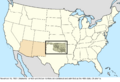
New Mexico filed suit against Texas over the "Country Club Dispute" on January 31, 1913.
-
The borders of the Panama Canal Zone were explicitly defined on May 1, 1915.
-
Land was expropriated from Panama and annexed to the Panama Canal Zone on August 21, 1918.
-
Largo Remo island was annexed to the Panama Canal Zone on September 18, 1919.
-
The "Wedge" dispute between Delaware and Pennsylvania was resolved on June 30, 1921.
-
Michigan expanded its claim to Wisconsin territory on October 8, 1923.
-
The Swan Islands were claimed by Honduras on November 15, 1923.
-
The future area for Madden Lake was annexed to the Panama Canal Zone on February 1, 1924.
-
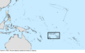
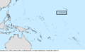
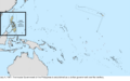
Swains Island was added to American Samoa on March 4, 1925.
-

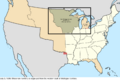
The conflict between Michigan and Wisconsin was resolved on March 1, 1926.
-

The border between Michigan and Wisconsin was defined on November 22, 1926.
-

The "Country Club Dispute" between New Mexico and Texas was resolved on December 5, 1927.
-
The Island of Palmas Case was decided in favor of the Netherlands on April 4, 1928.
-
Additional areas around the Madden Dam were annexed to the Panama Canal Zone on April 15, 1931.
-
Porto Rico was renamed Puerto Rico on May 17, 1932.
-
The Mangsee Islands and seven Turtle Islands were ceded to the Philippines on December 13, 1932.
-
The Insular Government of the Philippine Islands was replaced with the Commonwealth of the Philippines on November 15, 1935.
-
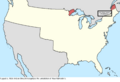
The overlap between Michigan and Wisconsin was resolved on March 16, 1936.
-
Baker Island, Howland Island, and Jarvis Island were formally annexed on May 13, 1936.
-
Canton Island, Enderbury Island, and McKean Island were claimed by the United Kingdom on August 6, 1936.
-
The condominium of the Canton and Enderbury Islands was established on April 6, 1939.
-
Panama gained a sovereign corridor through the Panama Canal Zone on July 27, 1939.
-
The U.S. began claiming several islands on August 16, 1939.
-
Guam was surrendered to the Japanese military on December 10, 1941.
-
The garrison on Wake Island surrendered to the Japanese military on December 23, 1941.
-
The government of the Philippines evacuated on March 26, 1942.
-
The Second Philippine Republic was established on October 14, 1943.
-
Guam was captured from Japan on August 10, 1944.
-
The Second Philippine Republic was dissolved on August 17, 1945.
-
The Japanese garrison on Wake Island surrendered on September 4, 1945.
-
The Commonwealth of the Philippines became independent on July 4, 1946.
-
The United Nations entrusted the Trust Territory of the Pacific Islands to the U.S. on July 18, 1947.
-
The Tokelau Islands were incorporated into New Zealand on January 1, 1949.
-
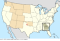
Kansas and Missouri exchanged small portions of land on August 3, 1950.
-
Several border locations of the Panama Canal Zone were redefined on August 23, 1955.
-
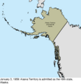
Alaska became a state on January 3, 1959.
-
Hawaii became a state on August 21, 1959.
-
The Chamizal was divided between the U.S. and Mexico on January 14, 1964.
-
The Cook Islands became self-governing on August 4, 1965.
-
The U.S. recognized Honduras's sovereignty over the Swan Islands on September 1, 1972.
-
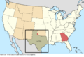
Several parcels were exchanged between Texas and Mexico on May 26, 1977.
-
Tuvalu became independent on October 1, 1978.
-
The Republic of Kiribati became independent on July 12, 1979.
-
The Panama Canal Zone was ceded to Panama on October 1, 1979.
-
The U.S. recognized Colombia's sovereignty over Roncador Bank and Serrana Bank on September 17, 1981.
-
The U.S. recognized Tokelau's sovereignty over Atafu, Fakaofo, and Nukunonu on September 3, 1983.
-
The U.S. recognized the Cook Islands' sovereignty over Pukapuka, Manihiki, Penrhyn, and Rakahanga on September 8, 1983.
-
The U.S. recognized Kiribati's and Tuvalu's sovereignty over various islands on September 23, 1983.
-
The Marshall Islands became independent on October 21, 1986.
-
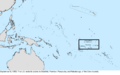
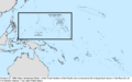
The Federated States of Micronesia became independent, and the Northern Mariana Islands became a U.S. territory on November 3, 1986.
-
Palau became independent on October 1, 1994.


See also
 In Spanish: Historia territorial de los Estados Unidos para niños
