Yorba Linda, California facts for kids
Quick facts for kids
Yorba Linda, California
|
|||
|---|---|---|---|
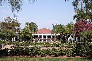
Nixon Library and Gardens (2006)
|
|||
|
|||
| Motto(s):
Land of Gracious Living
|
|||
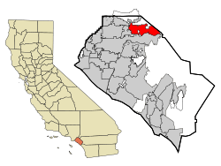
Location within California and Orange County
|
|||
| Country | United States | ||
| State | California | ||
| County | Orange | ||
| Incorporated | November 2, 1967 | ||
| Government | |||
| • Type | Council-Manager | ||
| Area | |||
| • Total | 19.86 sq mi (51.44 km2) | ||
| • Land | 19.84 sq mi (51.39 km2) | ||
| • Water | 0.02 sq mi (0.05 km2) 2.67% | ||
| Elevation | 381 ft (116 m) | ||
| Population
(2020)
|
|||
| • Total | 68,336 | ||
| • Density | 3,440.9/sq mi (1,328.46/km2) | ||
| Demonym(s) | Yorba Lindan | ||
| Time zone | UTC−8 (Pacific) | ||
| • Summer (DST) | UTC−7 (PDT) | ||
| ZIP codes |
92885-92887
|
||
| Area codes | 657/714 | ||
| FIPS code | 06-86832 | ||
| GNIS feature IDs | 1652817, 2412321 | ||
Yorba Linda is a city in northeastern Orange County, California, United States. It is about 37 miles (60 km) southeast of Downtown Los Angeles. Yorba Linda is part of the Los Angeles metropolitan area. In 2020, its population was 68,336 people.
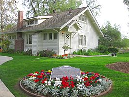
Yorba Linda is famous for its connection to Richard Nixon. He was the 37th president of the United States. His birthplace is a National Historic Landmark in the city. His presidential library and museum are also located there.
Contents
- Yorba Linda's Name and Meaning
- Yorba Linda's History
- Yorba Linda's Geography
- Yorba Linda's Population
- Getting Around Yorba Linda
- Yorba Linda's Economy
- Law Enforcement in Yorba Linda
- City Services and Infrastructure
- Education in Yorba Linda
- Yorba Linda Public Library
- Sister Cities
- Famous People from Yorba Linda
- See also
Yorba Linda's Name and Meaning
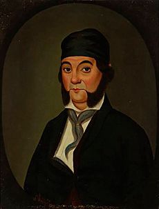
The name Yorba Linda has two parts. "Yorba" comes from Don Bernardo Yorba. He was a rancher who owned this land a long time ago. "Linda" is a Spanish word that means "beautiful."
The Janss Investment Company created the name in 1908. They were selling land in the area.
Yorba Linda's History
Early People of Yorba Linda
The land where Yorba Linda is now was home to the Tongva, Luiseño, and Juaneño tribes. They lived here as far back as 4,000 years ago. The Tongva people called their land Tovaangar. It covered a large area, including all of modern-day Yorba Linda.
When Spanish settlers arrived between 1769 and 1840, they brought diseases and new animals. This changed the natural balance of the area. The Tongva people had to move to areas near Spanish missions. The village of Hutuknga was located in the Yorba Linda area.
How Yorba Linda Began
In 1810, the Spanish king gave José Antonio Yorba a huge piece of land. It covered much of what is now Orange County. In 1834, after Mexico became independent from Spain, José's son, Bernardo Yorba, received 13,328 acres (5,394 ha) of land. This land was called Rancho Cañón de Santa Ana. The city would later be named after Bernardo.
Most of this land stayed with the Yorba family after the Mexican–American War in 1848. Some of the city's land is still owned by the family of Samuel Kraemer. He married Angelina Yorba, who was Bernardo Yorba's great-granddaughter. The site of Bernardo Yorba's home, the Don Bernardo Yorba Ranch House Site, is a California Historical Landmark.
Near this site is the Yorba Cemetery. It is the second oldest private cemetery in Orange County. Bernardo Yorba gave the land to the Roman Catholic Archdiocese of Los Angeles in 1858. The cemetery closed in 1939. Later, the Orange County Board of Supervisors took over the property to fix it. Today, you can take tours there once a month.
Farming Days in Yorba Linda
In 1907, the Yorba family sold some land to Jacob Stern. He used it for growing barley and raising sheep. Stern then sold the land to the Janss Investment Company. They named the area Yorba Linda. They divided the land to sell it for farming and factories. In 1910, the first lemon and orange groves were planted. At that time, fewer than 50 people lived there.
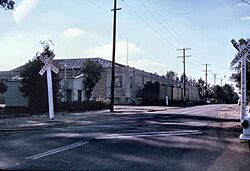
A year later, The Pacific Telephone & Telegraph Company started phone service in Yorba Linda. The first school was also built. In 1912, Yorba Linda got its first post office. The Yorba Linda Citrus Association was started. Southern California Edison Company began providing electricity. The first church was built. The area that became downtown was connected to Los Angeles by train in 1912. This was mainly for moving citrus fruits.
In 1913, Richard Nixon was born in Yorba Linda. The chamber of commerce was set up. A library opened as part of the school. Avocado trees were also planted for the first time. In 1914, a separate library system was created.
The Susanna Bixby Bryant Ranch house was built in 1915. It is now a museum that people can visit.
In 1917, Yorba Linda Boulevard became the first paved street. The Yorba Linda Star newspaper also started. It is now an online section of the OC Register. A printed version is available for free in city buildings and delivered to homes.
By 1920, the population was over 300 people. In 1929, the citrus association's packing house burned down. It was rebuilt and reopened the next year. During this time, the eastern part of Yorba Linda was still mostly cattle and farm ranches. These were owned by pioneer families like the Yorba and Kraemer families.
Yorba Linda's Growth
By the 1960s, the town had grown a lot. More than 1,000 people lived there by 1960. Nearby cities tried to add Yorba Linda to their areas. Brea tried in 1958. Anaheim and Placentia tried in 1963. Because of this, Yorba Linda decided to become its own city in 1967.
The new city created a plan for its growth in 1972. By 1980, the population was almost 30,000. Ten years later, it was over 50,000.
In 1990, the Richard Nixon Presidential Library and Museum opened. It was a private museum and research library. Presidents Richard Nixon, Gerald Ford, Ronald Reagan, and George H.W. Bush attended the opening. The campus included the Birthplace of Richard Nixon. Later, it became part of the national Presidential library system. In 1994, the community center opened.
By 2016, there were over 20,000 homes in the city. Many residents now want to stop new building projects. They also work to reduce traffic congestion. The Yorba Linda Preservation Foundation works to protect old buildings in the city.
Recent Events
In November 2008, eastern Yorba Linda had serious fires. These fires destroyed 113 homes and damaged 50 others. Strong winds caused burning pieces to fly far away, spreading the fire.
On February 3, 2019, a small plane crashed into a house in Yorba Linda. The pilot and four people in the house died.
In October 2020, during the 2020 California wildfires, fires destroyed 1 home and damaged 10 others in the Yorba Linda area. This fire, called the Blue Ridge Fire, quickly grew to 13,964 acres before being put out in November 2020.
Yorba Linda's Geography
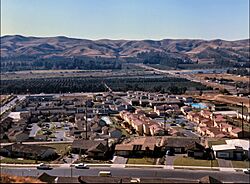
Yorba Linda covers about 20 square miles (51.8 km2). Most of this is land, with a small amount of water.
The city has two main ZIP codes: 92886 for the western part and 92887 for the eastern part. A third ZIP code, 92885, is only for PO Boxes. The city uses area codes 657 and 714. You need to dial all eleven digits for local calls now.
Yorba Linda is next to Anaheim to the south. Placentia is to the west and southwest. Brea is to the northwest. Chino Hills State Park is to the north. Corona is to the east.
The two closest earthquake faults are the Whittier Fault and the Chino Fault. Both are part of the Elsinore Fault Zone.
Yorba Linda's Climate
Yorba Linda gets about 14 to 15 inches (356 to 381 mm) of rain each year. The average temperature in January is 55°F (13°C). In July, it's 71°F (22°C). The average temperature for the whole year is 63°F (17°C). Yorba Linda has a Mediterranean climate. This means it has warm, dry summers and mild, wet winters.
| Climate data for Yorba Linda, California | |||||||||||||
|---|---|---|---|---|---|---|---|---|---|---|---|---|---|
| Month | Jan | Feb | Mar | Apr | May | Jun | Jul | Aug | Sep | Oct | Nov | Dec | Year |
| Mean daily maximum °F (°C) | 71 (22) |
71 (22) |
73 (23) |
76 (24) |
78 (26) |
81 (27) |
87 (31) |
89 (32) |
87 (31) |
82 (28) |
76 (24) |
70 (21) |
78 (26) |
| Mean daily minimum °F (°C) | 48 (9) |
48 (9) |
51 (11) |
53 (12) |
57 (14) |
61 (16) |
65 (18) |
65 (18) |
63 (17) |
58 (14) |
52 (11) |
47 (8) |
56 (13) |
| Average precipitation inches (mm) | 2.86 (73) |
3.18 (81) |
1.90 (48) |
0.80 (20) |
0.28 (7.1) |
0.10 (2.5) |
0.03 (0.76) |
0.01 (0.25) |
0.25 (6.4) |
0.72 (18) |
1.38 (35) |
2.02 (51) |
13.53 (343.01) |
Yorba Linda's Population
| Historical population | |||
|---|---|---|---|
| Census | Pop. | %± | |
| 1960 | 1,198 | — | |
| 1970 | 11,856 | 889.6% | |
| 1980 | 28,254 | 138.3% | |
| 1990 | 52,422 | 85.5% | |
| 2000 | 58,918 | 12.4% | |
| 2010 | 64,234 | 9.0% | |
| 2020 | 68,336 | 6.4% | |
| U.S. Decennial Census | |||
Population in 2010
In 2010, Yorba Linda had 65,237 people. The city had about 3,209 people per square mile (1,239 people per km2).
The people living in Yorba Linda were:
- 48,246 (75.1%) White
- 10,030 (15.6%) Asian
- 9,220 (14.4%) Hispanic or Latino
- 835 (1.3%) African American
- 230 (0.4%) Native American
- 85 (0.1%) Pacific Islander
- 2,256 (3.5%) from other races
- 2,552 (4.0%) from two or more races
Most people (99.7%) lived in homes. There were 21,576 households. About 39.6% of these had children under 18. Most (70.0%) were married couples. The average household had 2.97 people. The average family had 3.29 people.
About 24.6% of the people were under 18. About 11.8% were 65 or older. The average age was 41.7 years. For every 100 females, there were 94.8 males.
Most homes (83.9%) were owned by the people living in them. The rest (16.1%) were rented. In 2009–2013, the average household income was $112,259. Only 3.1% of the people lived below the poverty line.
Getting Around Yorba Linda
Yorba Linda has several important roads. Imperial Highway (SR 90), Bastanchury Road, Esperanza Road, La Palma Avenue, and Yorba Linda Boulevard run east–west. Rose Drive, Fairmont Boulevard, Lakeview Avenue, and others run north–south.
SR 241 starts at the south end of the city. SR 91 goes through the eastern part of the city.
In 2004, the city council decided not to build a Metrolink commuter rail station.
Yorba Linda's Economy
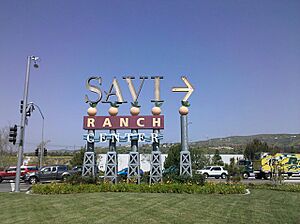
The main shopping area in Yorba Linda is Savi Ranch.
Other smaller shopping centers include:
- Eastlake Village Shopping Center
- Mercado del Rio
- Packing House Square
- Yorba Linda Station Plaza
- Country Club Village
In 2016, construction began on the Yorba Linda Town Center. This is a large shopping and dining area. It opened in April 2019.
Yorba Linda has over 1,000 businesses. There are also 1,500 businesses run from homes. The city owns the Black Gold Golf Club. Non-profit groups in Yorba Linda include International Student Volunteers and STEMpowerment Inc.
Savi Ranch
Savi Ranch gets its name from "Santa Ana Valley Irrigation." This was an early water company.
Today, Savi Ranch has stores, car dealerships, restaurants, hotels, and offices. The city first wanted to build only car dealerships there. But residents wanted a mix of stores, restaurants, hotels, and offices.
The Home Depot is a big store in Savi Ranch. It brings a lot of sales tax money to Yorba Linda. The Home Depot used to be in the Yorba Linda side of Savi Ranch. Later, it moved to the Anaheim side, taking its sales tax revenue with it.
John Force Racing has its headquarters in the Yorba Linda side of Savi Ranch. This is where the famous drag racer John Force and his team operate. There is also a museum about John Force's career.
Top Employers in Yorba Linda
Here are some of the biggest employers in Yorba Linda:
| # | Employer | # of employees |
|---|---|---|
| 1 | Nobel Biocare | 335 |
| 2 | Costco | 308 |
| 3 | Brookdale Yorba Linda | 244 |
| 4 | Vyaire Medical Payroll | 230 |
| 5 | Office Solutions Business | 167 |
| 6 | White House Catering Inc | 135 |
| 7 | Euroline Steel Windows | 127 |
| 8 | Coldwell Banker | 118 |
| 9 | Jondo Ltd | 115 |
| 10 | Robert Moreno Insurance Services | 115 |
| 11 | Tokyo Central | 103 |
| 12 | Vons | 102 |
Law Enforcement in Yorba Linda
Law enforcement in Yorba Linda is handled by the Orange County Sheriff's Department (California) (OCSD). The OCSD has a local office at Arroyo Park. Captain Cory Martino is the Chief of Police Services there.
From 1971 to 2013, the Brea Police Department provided police services. Before that, Yorba Linda worked with the Orange County Sheriff's Department. This is common for cities that don't have their own police departments.
In 2012, the Yorba Linda City Council decided to change police services. They chose to end their contract with the Brea Police Department. They signed a new 5-year contract with the Orange County Sheriff's Department. This new contract started in May 2013.
City Services and Infrastructure
The Orange County Fire Authority provides fire services.
The Yorba Linda Water District provides water to most residents. Golden State Water serves the rest.
Yorba Linda Disposal handles waste collection for the city.
Natural gas comes from Southern California Gas Company. Electricity is provided by Southern California Edison.
Yorba Linda has a long history of equestrianism (horse riding). There are over 100 miles (160 km) of horse trails. There are also plans to build public stables.
Education in Yorba Linda
Yorba Linda is part of the Placentia-Yorba Linda Unified School District. This district had about 25,000 students in the 2015–2016 school year. A small part of Yorba Linda is in the Orange Unified School District.
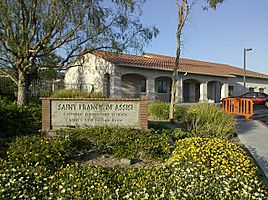
St. Francis of Assisi School is the only Catholic school in the city. Some parents send their children to private schools nearby. These include Heritage Oak Private School for younger students. High school students might go to Lutheran High School of Orange County in Orange, or other schools in Anaheim or Fullerton.
Yorba Linda High School opened in 2009. Its first full graduating class was in 2012. Many Yorba Linda students also attend Esperanza in Anaheim. Others go to Valencia or El Dorado in Placentia. Students can also try to get into Troy High School in Fullerton.
There are several community colleges within 20 miles (32 km). These include Fullerton College and Santiago Canyon College. Nearby four-year universities include California State University, Fullerton and University of California, Irvine.
Yorba Linda also has a few Montessori preschools:
- Arborland Montessori Children's Academy
- IvyCrest Montessori Private School
- Pine Tree Preschool
- Yorba Linda Montessori
The Yorba Linda Spotlight Theater Company is a non-profit theater group. It offers classes and chances to perform for kids and teens. They put on full musical shows.
Yorba Linda Public Library
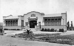
The Yorba Linda Public Library is located at 4852 Lakeview Ave. The old library was built in 1960 and made bigger in 1970. The new library, which also has a Cultural Arts Center, opened in late 2020. It is three blocks from the old one.
The library has two floors. It includes community rooms and study rooms. It also has many special collections and media services.
Library Services and Collections
The Yorba Linda Public Library has programs for all ages. For kids, there are story times for families, infants, toddlers, and preschoolers. There's also the Bookbug Club for grades K-3 and tween events for grades 4–8. Family events like Lego Mania are also popular. For teens and adults, the library offers book clubs, classes, and special events.
The library has unique collections. You can check out musical instruments, vinyl records, and record players from the music lending collection. The seed lending library lets you borrow seeds for gardening. The Healthy U collection has board games, puzzles, hike kits, sewing machines, and story time kits. The library also has a 3D printer.
Sister Cities
Yorba Linda has two sister cities:
Famous People from Yorba Linda
Many notable people have lived in or are from Yorba Linda:
- Tyler Armstrong – A mountain climber, the youngest person to climb Mount Aconcagua.
- Sabrina Bryan – A singer and actress, known from The Cheetah Girls.
- Nathan Choate – A college baseball coach.
- Danielle Fishel – An actress, known for Boy Meets World.
- John Force – A famous drag racer and owner of John Force Racing. He is a 16-time NHRA Funny Car Champion.
- Brittany Force – A drag racer, the 2017 NHRA Top Fuel Champion.
- Courtney Force – A drag racer.
- Ashley Force Hood – A drag racer.
- Ian Fowles – A musician and guitarist for the band The Aquabats.
- Joe Hawley – A player in the National Football League.
- Robert Hight – A drag racer, NHRA Funny Car Champion.
- Matthew Hoppe – A soccer player for Hibernian F.C. and the United States national team.
- Cole Irvin – A Major League Baseball player for the Oakland Athletics.
- Dan Kennedy – A Major League Soccer player.
- Bobby Knoop – A Major League Baseball player.
- Steven Lenhart – A Major League Soccer player.
- Wade Meckler – A baseball outfielder for the San Francisco Giants.
- Alli Mauzey – A Broadway actress.
- David McNab – A senior vice president for the Anaheim Ducks hockey team.
- Dylan Moore – A Major League Baseball player for the Seattle Mariners.
- Marcus Mumford – A musician from the band Mumford and Sons.
- Richard Nixon – The 37th President of the United States. He was born in Yorba Linda in 1913 and lived there until 1922. His childhood home is a National Historic Landmark.
- Audrina Patridge – A reality TV actress from The Hills.
- Chris Pontius – A Major League Soccer player.
- Bob "Buck" Rodgers – A Major League baseball player and manager.
- Beneil Dariush – A UFC Fighter.
- Sergio Santos – A Major League Baseball player.
- Ricky Wells – A speedway rider and 2009 US National Champion.
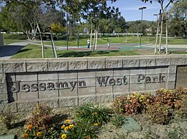
- Jessamyn West – An author, known for her 1945 novel The Friendly Persuasion. A city park is named after her.
See also
 In Spanish: Yorba Linda para niños
 | Jessica Watkins |
 | Robert Henry Lawrence Jr. |
 | Mae Jemison |
 | Sian Proctor |
 | Guion Bluford |


