
Cascades (ecoregion) facts for kids
Quick facts for kids Cascades |
|
|---|---|

Scattered patches of subalpine fir grow below glaciers and permanent snowfields on the south slope of Mount Rainier in ecoregion 4d.
|
|

Level III ecoregions of the Pacific Northwest. The Cascades ecoregion is marked with (4).
|
|
| Ecology | |
| Realm | Nearctic |
| Biome | Temperate coniferous forests |
| Borders |
List
|
| Geography | |
| Area | 44,952 km2 (17,356 sq mi) |
| Country | United States |
| States | Washington, Oregon and California |
| Coordinates | 45°N 122°W / 45°N 122°W |
The Cascades ecoregion is a special natural area in the EPA's list of ecoregions. It stretches across parts of Washington, Oregon, and California. This ecoregion is a bit smaller than the famous Cascade mountain range it's named after.
It goes from Snoqualmie Pass in the north, near Seattle, all the way south to Hayden Pass, close to the Oregon-California border. It includes the tall peaks and western slopes of the High Cascades. There's also a separate part of this ecoregion around Mount Shasta in California.
This mountainous area is made of volcanic rock that formed long ago. Over time, glaciers have shaped its landscape. The eastern part has active and sleeping volcanoes that are part of the Cascades Volcanic Arc. Some of these volcanoes reach heights of up to 4,392 meters (14,411 feet)! The western Cascades are older and lower. They have many steep, narrow valleys carved by streams.
The Cascades ecoregion has a wet, mild climate. This climate helps huge coniferous forests grow. These forests are important for logging and also for fun activities like hiking and camping. Higher up, you'll find subalpine meadows.
Most of this region is public land. It's managed by the government as national forests, parks, and wilderness areas. Some examples include Mount Rainier National Park and Crater Lake National Park.
The Cascades ecoregion has neighbors! To the north is the North Cascades ecoregion. To the south, you'll find the Klamath Mountains ecoregion. The Eastern Cascades Slopes and Foothills are to the east. To the west are the Willamette Valley and Puget Lowland ecoregions.
Many animals call the Cascades home. You might see black bears, deer, elk, bobcats, cougars, coyotes, skunks, raccoons, and chipmunks.
Contents
Exploring the Cascades: Level IV Ecoregions
The Cascades ecoregion is divided into smaller areas called Level IV ecoregions. These help us understand the different types of landscapes and environments within the larger region. Here are the six main ones in Washington and Oregon. Mapping for California's Mount Shasta is still in progress.

Western Cascades Lowlands and Valleys (4a)
This area has many steep ridges and narrow valleys on the lower parts of the Cascade Mountains. It's between 183 and 1,219 meters (600 and 4,000 feet) high. The weather here is mild and wet. This helps thick forests grow, mostly with western hemlock and Douglas-fir trees. Other trees include western redcedar, bigleaf maple, and red alder. You'll also find plants like salal, rhododendron, and huckleberry.
The soil here is warmer than in higher areas. This makes it a very important place for timber production in the Pacific Northwest. The steep valleys have rivers and streams that are home to cold-water fish like Chinook salmon and steelhead. These fish are considered threatened. Many rivers in Oregon and Washington flow through this region. Large Reservoirs here store snowmelt for irrigation and drinking water in the Willamette Valley. This is the biggest subregion of the Cascades.
Western Cascades Montane Highlands (4b)
This ecoregion has very steep, cut-up mountains with fast-flowing streams and lakes formed by glaciers. The elevation ranges from about 914 to 1,981 meters (3,000 to 6,500 feet). These western Cascades are older and more worn down than the tall, snow-covered volcanoes to the east. The rocks here are dark basalt, different from the gray andesite of the High Cascades.
It's colder here and gets more snow in winter than the lowlands to the west. The rich soil supports forests of Douglas-fir and western hemlock. You'll also see mountain hemlock, noble fir, and subalpine fir. The plants on the forest floor include vine maple, rhododendron, and huckleberry. Today, this area is used for logging and recreation. It's also a key source of water for cities and farms at lower elevations. This is the second-largest Cascades subregion.
Cascade Crest Montane Forest (4c)
This ecoregion is like a wavy plateau with volcanic buttes and cones, reaching up to about 1,981 meters (6,500 feet). Volcanoes erupted here long ago, covering older rocks. Later, Pleistocene glaciation created many lakes. Streams here flow gently through the glaciated land.
The forests are full of mountain hemlock, Pacific silver fir, and subalpine fir. You might also find Engelmann spruce and lodgepole pine. Underneath, there are plants like vine maple, huckleberry, and beargrass. Open mountain meadows have sedges and dwarf willows. This region stretches along the main ridge of the Cascades.
Cascades Subalpine/Alpine (4d)
This ecoregion features high, glaciated volcanic peaks that rise above subalpine meadows. You'll see beautiful streams, glacial cirques (bowl-shaped valleys), and tarns (small mountain lakes). Ancient glaciers shaped these mountains above 1,981 meters (6,500 feet). They left behind rocky ridges, glacial lakes, and U-shaped canyons.
Even today, glaciers and permanent snowfields exist on the highest peaks. The plants here are special because they can live in high places with cold winters, short growing seasons, and deep snow. You'll find grassy and shrubby subalpine meadows. There are also scattered groups of mountain hemlock, subalpine fir, and whitebark pine near the timberline (where trees stop growing). Wet meadows have different types of sedges and alpine aster. In other spots, it's just bare rock. This ecoregion includes many famous volcanic peaks like Mount Rainier, Mount Hood, and Mount Jefferson.
High Southern Cascades Montane Forest (4e)
This ecoregion is a wavy, glaciated, volcanic plateau with some isolated buttes and cones. Many tarns (small lakes) are found here. It's an in-between zone, with elevations from about 1,219 to 2,499 meters (4,000 to 8,200 feet). The cold soils support mixed coniferous forests. These are mostly mountain hemlock, lodgepole pine, and Pacific silver fir. You'll also see white fir and Shasta red fir, especially further south and east. Whitebark pine grows at the highest elevations.
Understory plants include woodrush, Prince's pine, and lupine. At the highest points, open meadows have plants like Shasta buckwheat and Brewer's sedge. This area is usually drier than the Cascade Crest Montane Forest. It has a longer summer drought and more streams that dry up sometimes. This region covers parts of Southern Oregon, including the lower areas of Crater Lake National Park.
Southern Cascades (4f)
The Southern Cascades ecoregion is lower and less rugged than the areas around it. It has gently sloping mountains and wide valleys. Elevations range from about 427 to 1,615 meters (1,400 to 5,300 feet). The climate here is drier than other parts of the Cascades. The plants here are used to long summer droughts. Rivers and streams also have much less water than those further north.
Trees like western hemlock and western red cedar, which are common in the northern Cascades, become less common here. Instead, you'll find trees from the Sierra Nevada mountains. These include California incense-cedar, white fir, Shasta red fir, and sugar pine. The understory plants include snowberry, twinflower, and serviceberry. At lower elevations, Douglas-fir and ponderosa pine are common. This region is in Southern Oregon, in the South Umpqua and Rogue River areas.
Gallery
Flora
-
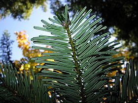
Grand fir in Wenatchee National Forest
-
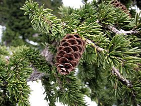
Mountain hemlock in the Mount Baker-Snoqualmie National Forest
-
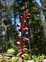
Pink wintergreen in the William O. Douglas Wilderness


Fauna
-
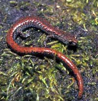
Oregon slender salamander, found in maple, redcedar, and Douglas-fir forests
-
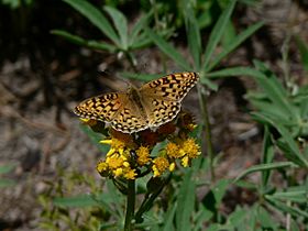
Speyeria zerene in the William O. Douglas Wilderness
-
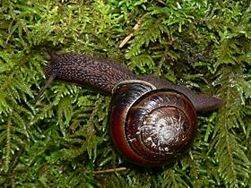
Pacific sideband in Squak Mountain State Park


Landscapes
-
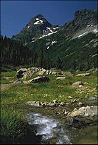
Subalpine meadow in Mount Baker-Snoqualmie National Forest
-
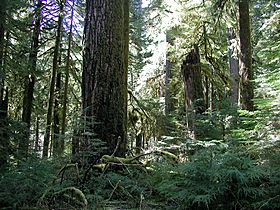
Old-growth forest in the Opal Creek Wilderness
-
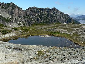
Tarn in Mount Rainier National Park
-
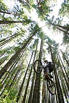
Mt. Hood National Forest receives heavy recreational use
-
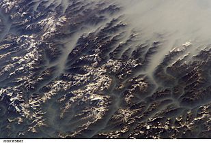
Clouds fill the valleys, but not the mountaintops. From the ISS in June 2006.


