History of Providence, Rhode Island facts for kids
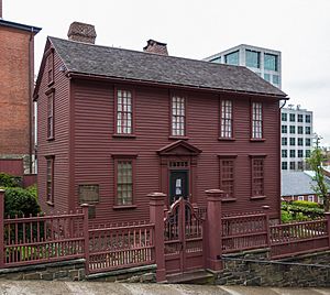
The city of Providence in Rhode Island has a history of almost 400 years. It played a big part in the story of the United States. During the American Revolutionary War, Providence was important. It provided leaders and soldiers. It also housed troops and supplied goods to people. The city even helped get around the British blockade of Newport. Providence is also known for the first bloodshed of the American Revolution. This happened during the Gaspée Affair. Over time, Providence's economy changed a lot. It moved from trading to making things. When manufacturing declined, the city faced tough times. This was especially true during the Great Depression. But Providence eventually recovered by investing public money.
Contents
Founding and Early Days
Providence was started in June 1636 by Puritan leader Roger Williams. It became one of the original Thirteen Colonies. Williams was a minister in the Massachusetts Bay Colony. He believed that church and government should be separate. He also thought colonists should not take land from Native Americans. Because of these ideas, he was found guilty of speaking against the government. He was also accused of having wrong beliefs. So, he was forced to leave the colony.
Roger Williams and others started a settlement in Rumford, Rhode Island, in 1636. The Wampanoag people gave them this land. Soon after, the Plymouth Colony warned Williams he was still too close to their land. So, the group moved down the Seekonk River. They went around Fox Point. Then they went up the Providence River. They stopped where the Moshassuck and Woonasquatucket Rivers meet. Here, they started a new place called "Providence Plantations." They wanted it to be a safe place for people who had different religious ideas.
For the land, Williams made a spoken agreement. He spoke with sachems Canonicus and Miantonomo. These were leaders of the Narragansett who lived there. This agreement was later written down. It became a formal deed on March 24, 1638.
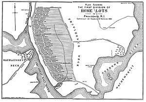
Unlike places like Salem and Boston, Providence did not have a royal charter. So, the settlers organized themselves. They divided land on the east side of the Providence River in 1638. These home lots were about six acres each. They stretched from Towne Street (now South Main Street) up the eastern hill to Hope Street. The land between Towne Street and the river was shared by everyone.
The settlement did not have an official religion. No church building was built in the town until the 1700s. Without a church, settlers met for religious and town matters. They met on the shared land near Roger Williams' home. Later, they met in a mill built by John Smith in 1646.
Over the next 20 years, Providence Plantations grew. It became a place that could feed itself. People farmed and fished. But the land was hard to farm. Also, its borders were argued over with Connecticut and Massachusetts. During this time, the first simple log homes were replaced. New homes were built with wooden siding and stone ends. They had pointed roofs.
On March 29, 1676, during King Philip's War, Native American groups burned Providence. It was one of only two major colonial towns burned down. Only two houses are known to have survived. These were the William Field House and Roger Mowry Tavern. Both of these have since been torn down.
After the town was rebuilt, its economy grew. It started to have more factories and trade. The outer lands of Providence Plantation became new towns. These included Scituate, Glocester, and Smithfield, Rhode Island. This happened in 1731. Later, Cranston, Johnston, and North Providence were also formed from Providence's land.
In 1700, the first church building was put up in the city. It was a Baptist church. It stood on the corner of Smith and North Main Streets.

In the early days, leaders in Providence tried to stop the enslavement of Black people and Native Americans. This was in 1652 and 1676. But in 1703, the Rhode Island General Assembly changed these rules. They made slavery legal throughout the colony. Merchants in Providence sent enslaved people to sugar farms in the West Indies. They also sent animals, dairy, fish, candles, and wood. In return, they received molasses for rum. This trade grew a lot after 1730. It helped Providence become a major port city. By 1755, about 8 percent of Providence's people were enslaved.
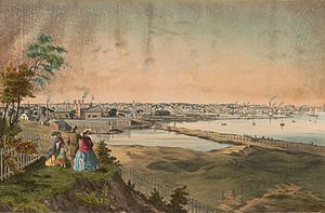
By the 1760s, about 4,000 people lived in the main part of the city.
In 1770, Brown University moved to Providence. It came from nearby Warren. At that time, the college was called Rhode Island College. It had one building on College Hill. The college chose Providence over Newport. This showed that Providence was becoming more important than Newport in the colony.
American Revolution
In 1776, Providence had a population of 4,321 people.
In the 1770s, the British government added taxes. These taxes made it hard for Providence's businesses. This included shipping, fishing, and farming. These were the main ways the city made money. For example, the Sugar Act affected rum making and trade. These taxes and other British actions made the Colony of Rhode Island decide to break away from Britain. It was the first of the Thirteen Colonies to do so. People in Providence were also among the first to fight in the American Revolution. This happened during the Gaspée Affair in 1772. This was an open act of defiance. It happened more than a year before the famous Boston Tea Party.
Providence was not taken over by the British during the American Revolutionary War. However, the British did capture Newport. They also blocked the port, which hurt Newport's economy.
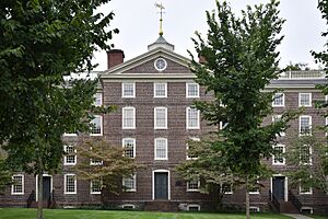
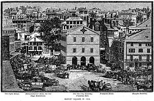
During the war, American soldiers stayed in Providence. Brown University's University Hall was used as a place for soldiers to live. It was also a hospital for American soldiers. French troops stayed in the city's Market House.
Late 1700s and Early 1800s
Economic Changes
In the late 1700s and early 1800s, Providence became a center for the profitable China Trade. From 1789 to 1841, Providence was one of America's main ports trading directly with China. During this time, three of the seven US consuls to China came from Providence. Trading with Canton and the East Indies made Providence merchants very rich. With their new wealth, many of these merchants built large homes on College Hill. Examples include the Nightingale–Brown House (1792) and Corliss–Carrington House (1812). After 1830, Providence's trade shifted to Canada. Canada supplied the growing city with coal and wood for its factories.
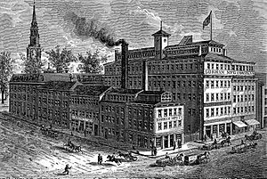
In the early 1800s, the economy started to change. It moved from sea trade to manufacturing. This included making machines, tools, silverware, jewelry, and fabrics. At one time, Providence had some of the largest factories in the country. These included Brown & Sharpe, Nicholson File, and Gorham Manufacturing Company. The city's industries attracted many new people. They came from Ireland, Germany, Sweden, England, Italy, Portugal, Cape Verde, and French Canada.
These economic and population changes sometimes caused social problems. Hard Scrabble and Snow Town were places where conflicts between groups happened in 1824 and 1831.
Providence residents approved a city charter in 1831. By then, the population was over 17,000.
Jewelry Making
During the 1800s and 1900s, making jewelry and costume jewelry became a very important local business. Jewelry making started in Providence in 1794. By 1880, Rhode Island's jewelry industry made more than a quarter of all jewelry in the country. By 1890, the city had 200 jewelry companies. They employed 7,000 workers.
In the 1960s, jewelry magazines called Providence “the jewelry capital of the world.” The industry reached its highest point in 1978 with 32,500 workers. After that, it started to decline quickly. By 1996, the number of jewelry workers dropped to 13,500.
In the years that followed, the large jewelry factories in the city's Jewelry District closed or became empty. Many of these buildings have since been fixed up and used for new purposes. They are now used for shops, homes, and schools. This shows how the city changed from making things to providing services.
Late 1800s
City Growth
Providence grew a lot in the late 1800s. New people moving in increased the population. It went from 54,595 in 1865 to 175,597 by 1900.
In 1871, Betsey Williams gave 102 acres of land to the city. She was the last family member of Roger Williams. This land was used to create Roger Williams Park. The park was designed by Horace Cleveland. It was meant to be a green escape for factory workers in Providence. This idea was part of the City Beautiful movement.
By 1890, Providence's Union Railroad had a large network. It included over 300 horse-drawn streetcars and 1,515 horses. Two years later, the first electric streetcars were used in Providence. Soon, the city had an electric streetcar network. It stretched from Crescent Park to Pawtuxet in the south. It also went to Pawtucket in the north. According to journalist Mike Stanton, "Providence was one of the richest cities in America in the early 1900s."
More people living close together caused health problems. In 1854, a serious illness called cholera spread through the city. A city study looked at living conditions. It found unhealthy crowding among new arrivals and workers. In one case, 29 people lived in a single-story house. In another, 47 people shared a two-story home. The study found many outdoor toilets in the city. Fewer than half were cleaned each year. 1854 was known as "The Year of Cholera" for the next 30 years.
Sole Capital City
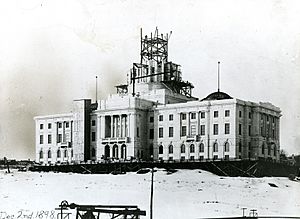
The Rhode Island General Assembly used to meet in different buildings. These were located throughout the Colony of Rhode Island and Providence Plantations. In 1900, the assembly passed a new law. It made Providence the state's only capital. It also made the State House the permanent home for the legislature. This happened while the Rhode Island State House was being built. It was finished in 1904.
Early 1900s
An "Industrial Wonder"
At the start of the 1900s, Providence had grown a lot. It became one of the ten largest industrial centers in the United States. Providence was first in the country for wealth per person. Its Board of Trade proudly talked about what it called the Five Industrial Wonders of the World:
- Brown & Sharpe, the world's largest tool factory.
- Nicholson File, the world's largest file factory.
- American Screw, the world's largest screw factory.
- Gorham, the world's largest silverware factory.
- Corliss, the world's largest engine factory.
The city was also first in the nation for making jewelry. It was also first for making woolen and worsted fabrics. And it was third for making basic metals.
Influenza Outbreak
In early September 1918, the first cases of the Spanish flu appeared in Providence. By the end of the month, public health leader Charles V. Chapin found over 2,500 cases. Chapin and other officials ordered more hospital beds and staff. On October 6, the Providence Board of Health ordered many places to close. This included all public and private schools, theaters, movie houses, and dance halls. The flu spread the most from October 3–9, with 6,700 cases reported. The closure order was lifted on October 25. The flu returned for a smaller second wave in January 1919. This wave affected schools especially hard. By February 5, no new cases were reported. The illness was declared over.
Early Decline
The city started to decline by the mid-1920s. Factories began to close down. In 1922, the city was affected by the 1922 New England Textile Strike. This strike shut down mills in the city. Workers were protesting a proposed wage cut and longer hours.
The city was hit hard by the Great Depression. More than a third of the workers lost their jobs. The Recession of 1937–1938 followed right after. Then came the New England Hurricane of 1938. This storm flooded the city's downtown. The hurricane was very damaging to the struggling fabric industry. Many mills never reopened after the storm.
Mid-Late 1900s
Urban Challenges
From the 1940s to the 1970s, many middle-class residents left Providence. This happened faster than in almost any other American city, except Detroit. The people who stayed were often poor and elderly.
Starting in 1956, construction began on Interstate 195 and Interstate 95. This meant hundreds of homes and dozens of businesses had to be torn down. These highways ended up cutting off Downtown from the South Side, the West End, Federal Hill, and Smith Hill. In the following years, the Providence Redevelopment Authority tore down more blocks west of Downtown. This was an unsuccessful attempt to attract new businesses.
Downtown Decline
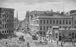
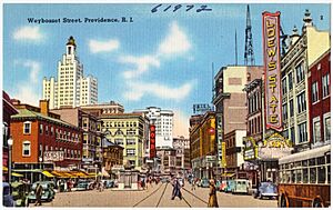
Providence's population dropped from its highest point of 253,504 in 1940 to only 179,213 in 1970. Many middle-class families moved to the suburbs. Those who remained often faced financial difficulties and needed social support. Stores, movie theaters, and businesses also left. Providence's downtown was seen as dirty, unsafe after dark, and lacking parking. As hotels and department stores failed, many important downtown buildings were torn down, boarded up, or left empty. In 1964, Westminster Street was made into a walking-only area. This was a failed attempt to attract shoppers. Within ten years, all the street's major stores had closed except one.
"Renaissance City"
In the late 1970s and early 1980s, a lot of money was invested in the city. Over $606 million was used for community development. The declining population started to become stable.
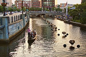
In the 1990s, Mayor Buddy Cianci promoted the city's arts. He also pushed for more improvements. Cianci's government uncovered parts of the city's rivers that had been paved over. They moved a large section of the railroad underground. They created Waterplace Park and river walks. They also built the 1.4 million square-foot Providence Place Mall.
In 1980, Providence's population, which had been decreasing, started to grow again.
2000s and Beyond
First Decades of the 2000s
From the mid-2000s to early 2010s, Providence worked to move parts of Interstate 95 and 195. The goal was to reconnect neighborhoods on the city's West Side that had been separated. This project cost over $620 million. But it freed up 19 acres of land in and near the city's Jewelry District. The city and state have called this new area Providence's "Innovation & Design District." They want to make it a center for science, technology, and education. This will help strengthen the city's knowledge-based economy.
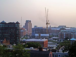
During the 2000s and early 2010s, new investments came into the city. There was new construction, including many apartment and hotel projects. A new office high-rise was also built. The city attracted companies like Virgin Pulse and GE Digital. It offered tax breaks and advertised a lower cost of living than nearby Boston.
Ongoing Challenges
Financial difficulties remain a problem in Providence. About 26 percent of the city's population lives below the federal poverty line. A 2020 report from Brandeis University said that the "opportunity gap" between white and Latino children in Providence was very high. It was the third-highest among 100 cities studied.
From 2004 to 2005, Providence had the biggest increase in average housing prices of any city in the United States.
Bike and Walkway Projects
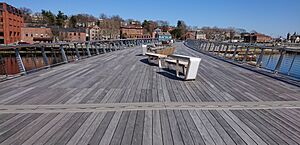
The late 2010s saw many improvements for bikes and people walking. A greenway opened in Roger Williams Park in 2017. In August 2019, the Providence River Pedestrian and Bicycle Bridge opened. It connects the east and west sides of downtown. The bridge was built on the old stone supports of the former Route 195 bridge.
A program for sharing bicycles started in September 2018. But it stopped within a year because of damage and theft.
In January 2020, Mayor Jorge Elorza started a "Great Streets" plan. This plan aims to improve public spaces. It encourages walking, biking, and using public transportation. The plan includes creating an "Urban Trail Network." This network will have 60 miles of bike paths, bike lanes, and greenways within Providence.
 | Mary Eliza Mahoney |
 | Susie King Taylor |
 | Ida Gray |
 | Eliza Ann Grier |


