List of places of worship in Rother facts for kids
The area of Rother in East Sussex is home to over 130 places of worship, both old and new. This includes 83 active churches and chapels, one mosque, and one Buddhist centre. There are also 50 buildings that used to be places of worship but are now used for other things.
Rother has big towns like Bexhill-on-Sea (a Victorian seaside town) and historic towns like Battle and Rye. These towns have many churches, some of them very old. Smaller villages and hamlets across the Wealden hills and marshes also have churches. Even tiny villages have parish churches for the Church of England, which is England's official church.
Roman Catholicism is not as common here as in nearby West Sussex. However, Protestant Nonconformist groups have been important for hundreds of years. Methodism was very popular, and many chapels were built in the 1700s and 1800s. Some of these chapels are now closed. Most people in Rother are Christian. The mosque and Buddhist centre in Bexhill-on-Sea are the only non-Christian places of worship.
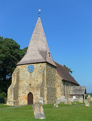
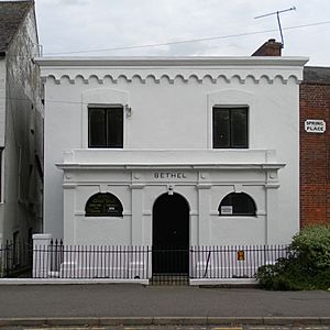
Many buildings have been given "listed status" by English Heritage. This means they are special because of their history or design. These buildings include very old Saxon-era churches in villages like Beckley and Guestling. There's also the St Anthony of Padua Church in Rye, built in the 1920s in a Mediterranean style. Even simple chapels, like the former Bethel Chapel in Robertsbridge, and grand ones, like the United Reformed Church next door, have been listed.
Different Christian groups like the Church of England, Roman Catholic Church, United Reformed Church, Baptists, and Methodists have their own ways of organizing their churches in Rother. They use terms like dioceses, archdeaconries, and circuits.
Contents
Exploring Rother's Places of Worship
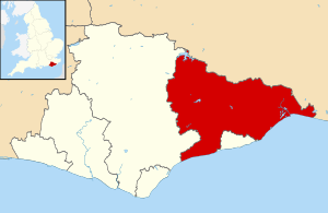
Rother district covers about 200 square miles (520 square kilometres) in eastern East Sussex. It's one of five districts and boroughs in the county. To the west is the Wealden area, and it surrounds Hastings to the south. To the north and east, Rother borders Kent. The district is named after the River Rother, which flows into the English Channel at Rye.
Around 90,000 people live in Rother. About half of them live in Bexhill-on-Sea, the largest town. The other main towns are Rye and Battle, both very old. The rest of the district is mostly rolling countryside with small, historic villages.
A Look Back: How Churches Grew
Sussex, once called the Kingdom of the South Saxons, was one of the last parts of England to become Christian. It was hard to reach because of thick forests. When St Wilfrid and his missionaries brought Christianity in the 600s, they came by sea. The new religion spread quickly. The oldest churches in the Rother area are thought to be St Peter's in Bexhill's old town and All Saints in Icklesham, both started in 772. However, no parts of the original 700s buildings remain.
Many more churches were built during the Saxon period. Most were either replaced by larger Norman buildings between the 1000s and 1200s (like in Sedlescombe and Whatlington) or had big additions (like in Icklesham). Many places also got their first church during this time. Some churches, like Ticehurst and Salehurst, were very grand, showing how wealthy the area was from the iron industry back then. Some early parishes were huge; for example, Bodiam and Etchingham were part of Salehurst's church until they got their own churches in the 1300s.
By the 1800s, almost every village had an Anglican church. People then focused on fixing up and rebuilding old churches. Some new churches were also built, often as chapels of ease (smaller churches for people far from the main parish church). While some old churches still look medieval, others like Dallington and Northiam were so heavily rebuilt in the mid-1800s that they now look mostly Victorian. This kind of "wholesale restoration" in the popular Gothic Revival style was common but also criticized during the Victorian era.
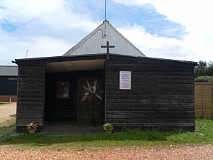
In the 1900s, more Anglican churches were built as towns grew along the coast. Building styles varied a lot. For example, at Winchelsea Beach, a church built in 1962 used old-fashioned brick and timber. At Fairlight Cove, a simple wooden box-like church was put up in 1970, meant to be temporary. In Camber, the 1956 church replaced one bombed in the war and looks like an early 1900s building. An unusual building was bought and reused at Cliff End on Pett Level. The Admiralty had built a Lifesaving Rocket Apparatus Station there, and in 1935, it became the tiny St Nicholas' Church.
After the English Reformation, Roman Catholic worship was against the law in England for nearly 250 years until 1791. It grew slowly in Rother compared to West Sussex, where many large land owners secretly kept their Catholic faith. People in Battle still felt negative towards Catholics in the 1800s. The Church of Our Lady Immaculate and St Michael, built in 1886, was hidden away in the garden of its priest's house and didn't look like a typical church.
In the early 1900s, Catholic churches became bolder. The Gothic Revival church in Bexhill-on-Sea and the grand Italian Romanesque-style church in Rye are both listed buildings. Most other Roman Catholic churches in Rother are simpler buildings from the mid-1900s. Some have interesting features, like a modern entrance at the former church in Sidley, special glass at Burwash, or a tower with blank arches at Little Common.
Among the different Protestant Nonconformist groups, Methodism has been very important since the 1700s. Many chapels were built for Wesleyan Methodists in villages, though many have closed. Methodist worship has been declining across the country since the early 1900s. John Wesley, who founded Methodism, often visited the area. The church he started in Rye in 1789 was the main base for a huge area covering much of Sussex and Kent. His very last outdoor sermon was preached near Winchelsea Methodist Chapel.
In 1947, records showed Wesleyan chapels in many villages, including Battle, Bexhill, Rye, and Winchelsea. There were also United Methodist chapels (originally Bible Christian) and a Primitive Methodist chapel in Bexhill. Most of these buildings still stand. However, only a few remain in use by Methodists today, along with a new church centre in Battle that opened in 2014.
Rye was a hub for Nonconformist worship. A survey in 1676 found 300 Nonconformists there, which was ten times more than in the much larger parish of Salehurst. By 1847, Rye had chapels for Methodists, Presbyterians, Independents, Baptists, Quakers, and Unitarians. Later, Congregationalists, the Salvation Army, and Jehovah's Witnesses also set up places of worship. The Baptists even split into several groups and have used five different buildings over the years, all of which are still standing.
Elsewhere, Baptist churches can be found in Battle, Bexhill, and Sidley. Quakers now meet in Bexhill. Members of the United Reformed Church, which formed in 1972 from the Congregational and Presbyterian churches, worship in Ashburnham, Bexhill, and Sedlescombe. They also used a chapel in Robertsbridge until 2015. In the second half of the 1900s, Pentecostal churches started in Beckley (1956), Bexhill, and Crowhurst (1991).
Who Lives in Rother? Religious Groups
The 2011 UK Census showed that 90,588 people lived in Rother.
- 64.81% said they were Christian.
- 0.51% were Muslim.
- 0.19% were Jewish.
- 0.32% were Buddhist.
- 0.19% were Hindu.
- 0.01% were Sikh.
- 0.58% followed another religion.
- 25.24% said they had no religion.
- 8.16% did not state their religion.
The number of Christians in Rother was higher than the average for England (59.38%). More people in Rother also said they had no religion or followed another religion compared to the national average. However, other religions like Islam, Hinduism, Sikhism, and Judaism had fewer followers in Rother than in England overall.
How Churches are Organized
All Anglican (Church of England) churches in Rother are part of the Diocese of Chichester. Their main church, or cathedral, is in Chichester. This diocese is divided into smaller areas called Archdeaconries, and then into even smaller areas called deaneries. For example, churches in Flimwell, Stonegate, and Ticehurst are in the Rotherfield Deanery. The Rye Deanery covers 23 churches in the district, including those in Beckley, Bodiam, Rye, and Winchelsea.
The six Roman Catholic churches in Rother are part of the Roman Catholic Diocese of Arundel and Brighton, with its cathedral in Arundel. Most of these churches, including those in Battle, Bexhill-on-Sea, and Rye, are in the Eastbourne and St Leonards-on-Sea Deanery. The church in Burwash is in the Mayfield Deanery.
The Hastings, Bexhill and Rye Methodist Circuit is an area that includes 13 Methodist churches. Eight of these are in Rother, such as those in Battle, Bexhill-on-Sea, Pett, Rye, and Winchelsea.
As of 2011, the four United Reformed Churches in Rother (Ashburnham, Bexhill-on-Sea, Robertsbridge, and Sedlescombe) were part of the West Kent and East Sussex Synod Area. The Robertsbridge United Reformed Church closed in 2015. Ashburnham Chapel closed in 2013 but is still used as a non-denominational church.
Of the five Baptist churches in Rother, four are part of the East Sussex Network of the South Eastern Baptist Association. These are the churches in Battle, Rye, Sidley, and Beulah Baptist Church in Bexhill-on-Sea. The former Bethel Strict Baptist Chapel in Rye, which closed in 2018, was linked to the Gospel Standard movement.
Special Buildings: Listed Status
English Heritage has given "listed status" to over 50 current and former church buildings in Rother. A building gets listed if it's considered to have "special architectural or historic interest." This is decided by a government department, with advice from English Heritage.
There are three levels of listed status:
- Grade I: For buildings of "exceptional interest" (the highest level).
- Grade II*: For "particularly important buildings of more than special interest."
- Grade II: For buildings of "special interest" (the most common level).
As of February 2001, Rother had 40 Grade I listed buildings, 75 with Grade II* status, and 1,991 Grade II listed buildings.
Current Places of Worship
| Name | Image | Location' | Denomination/ Affiliation |
Grade | Notes | Refs |
|---|---|---|---|---|---|---|
| St Peter's Church (More images) |
 |
Ashburnham 50°54′21″N 0°24′06″E / 50.9057°N 0.4016°E |
Anglican | I | The Earls of Ashburnham built Ashburnham Place and this church in the 1400s. Only the tower, with its castle-like top, remains from that time. The 1st Baron Ashburnham rebuilt most of the church in 1665 using sandstone to match other buildings. | |
| St Mary the Virgin Church (More images) |
 |
Battle 50°54′54″N 0°29′19″E / 50.9151°N 0.4885°E |
Anglican | I | An abbot from the nearby abbey founded Battle's large church in the early 1100s. It was largely rebuilt in the next 300 years. The main part of this "really splendid church" is its long five-section nave. | |
| Zion Chapel (More images) |
 |
Battle 50°55′06″N 0°29′03″E / 50.9183°N 0.4843°E |
Baptist | II | Battle's first Baptist chapel was built in 1798. Some members left in 1820 and built their own chapel next door, which is still standing. It has a white, Neoclassical front with a triangle-shaped top. The chapel was registered for weddings in December 1851. | |
| Emmanuel Centre (Battle Methodist Church) (More images) |
 |
Battle 50°54′48″N 0°29′58″E / 50.9134°N 0.4994°E |
Methodist | – | Battle's original Methodist chapel was from 1826. The church moved to this new, much larger building in 2014. It's a church and community centre combined. The new building, designed by Pinelog Ltd, can seat 150 people for worship. | |
| Church of Our Lady Immaculate and St Michael (More images) |
 |
Battle 50°55′06″N 0°29′03″E / 50.9182°N 0.4841°E |
Roman Catholic | – | Battle's Roman Catholic church was started in 1882 by the 5th Earl of Ashburnham and built in 1886. It's hidden behind the priest's house and looks like a Romanesque/Italian building made of red brick. The church was registered for weddings in September 1928. | |
| All Saints Church (More images) |
 |
Beckley 50°59′01″N 0°37′26″E / 50.9835°N 0.6239°E |
Anglican | I | The "dominant" tower is partly from the 1000s and has a herringbone pattern of stones, typical of the Norman era. Side sections were added in the 1200s and 1300s. A chapel on the south side was added during the Victorian era. | |
| St Peter's Church (More images) |
 |
Bexhill-on-Sea 50°50′46″N 0°28′44″E / 50.8460°N 0.4789°E |
Anglican | II* | Records say that King Offa started a church here on August 15, 772. The only remaining 700s feature is a preserved lid for a reliquary (a container for holy relics). The low, strong tower from the late 1000s is the oldest part. Victorian repairs replaced the 1200s chancel and added two sections to the nave. | |
| St Barnabas' Church (More images) |
 |
Bexhill-on-Sea 50°50′22″N 0°28′39″E / 50.8394°N 0.4775°E |
Anglican | II | Arthur Blomfield designed this large Early English Gothic Revival flint church in 1890–91. Side aisles were added 17 years later. Leslie Moore built a Lady chapel (a chapel dedicated to the Virgin Mary) on the south side in 1939. The inside is made of brick. | |
| St Michael and All Angels Church (More images) |
 |
Bexhill-on-Sea 50°50′49″N 0°29′48″E / 50.8470°N 0.4966°E |
Anglican | – | This brick church, with a "pretty" tile-hung pyramid-shaped spire, has served the Pebsham area since it was made sacred in October 1933. The foundation stone of John B. Mendham's Decorated Gothic Revival church was laid in 1929. The church members paid for and built a church hall in 1961. | |
| St Stephen's Church (More images) |
 |
Bexhill-on-Sea 50°50′59″N 0°27′42″E / 50.8496°N 0.4618°E |
Anglican | – | The "Church on the Down" was designed by local architect Henry Ward in 1898 and opened in 1900. It replaced a small mission hut built in 1885. The tower, which was planned to have a spire but doesn't, is Perpendicular Gothic Revival, but the rest of the brick building is Early English. | |
| Christchurch Methodist Church (More images) |
 |
Bexhill-on-Sea 50°51′06″N 0°28′32″E / 50.8517°N 0.4755°E |
Methodist | – | Also known as Springfield Road Methodist Church, this church replaced a small chapel from 1873. The land was bought to stop a pub from being built there. Henry Harper designed the church in 1906, and services started in March 1907. It is Perpendicular Gothic Revival in style, made of red brick with fancy tops and gables. | |
| Sackville Road Methodist Church (More images) |
 |
Bexhill-on-Sea 50°50′22″N 0°28′12″E / 50.8395°N 0.4701°E |
Methodist | – | Christchurch was originally a Primitive Methodist church. The Sackville Road building, finished in 1896, served Wesleyan Methodists. The nearby Parkhurst Hall was used as a temporary chapel until this red-brick Gothic Revival church, designed by W.W. Pocock, opened in July 1896. | |
| Living Word Church (More images) |
 |
Bexhill-on-Sea 50°50′39″N 0°27′40″E / 50.8442°N 0.4612°E |
Assemblies of God | – | A tin tabernacle (a church made of corrugated iron) was built here in 1898 for Wesleyan Methodists. Later, Plymouth Brethren bought it and used it as Bexhill Christian Assembly. The metal building was expanded with brick in 1949. It's now an Assemblies of God Pentecostal church. | |
| Beulah Baptist Church (More images) |
 |
Bexhill-on-Sea 50°50′31″N 0°28′26″E / 50.8420°N 0.4740°E |
Baptist | – | The Baptist church came late to Bexhill. Progress was made when Charles Spurgeon's widow got involved. She bought land, asked Resta Moore to design a church, and brought in the first pastor. Moore's Early English red-brick building from 1896–97 has a corner tower. | |
| Maitreya Buddhist Centre (More images) |
 |
Bexhill-on-Sea 50°50′27″N 0°28′39″E / 50.8408°N 0.4774°E |
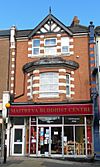
Buddhist | – | This centre opened in December 2005 in Bexhill. It offers meditation, courses about Buddhism, and worship. It follows the Kadampa tradition. | |
| St Paul's Free Church (More images) |
 |
Bexhill-on-Sea 50°50′21″N 0°27′48″E / 50.8393°N 0.4632°E |
Evangelical | – | This church is now home to a Reformed Protestant Evangelical group. It was originally linked to the Free Church of England. It reopened in April 1963 after the original timber church from 1924 was made bigger. | |
| Kingdom Hall (More images) |
 |
Bexhill-on-Sea 50°50′27″N 0°28′04″E / 50.8408°N 0.4677°E |
Jehovah's Witnesses | – | The town's first Kingdom Hall was in Station Road. A new building on Terminus Road replaced it in the 1980s. This was then replaced by the current building on the same site in 2010. It serves the Little Common and Pebsham Congregations. | |
| Bexhill Masjid and Islamic Centre (More images) |
 |
Bexhill-on-Sea 50°50′29″N 0°28′27″E / 50.8414°N 0.4742°E |
Muslim | – | Permission was given in 2010 to turn part of a house into a community centre for the Bexhill Islamic Association. It was then registered as a place of worship in 2019. | |
| Friends Meeting House (More images) |
 |
Bexhill-on-Sea 50°50′19″N 0°28′24″E / 50.8385°N 0.4732°E |
Quaker | – | A bus strike in 1957 led to the creation of a Quaker meeting house in Bexhill. After using houses and a hotel, the Quakers bought land in 1965. The brick meeting house was finished in November 1965. It was officially registered in February 1982. | |
| St Mary Magdalene's Church (More images) |
 |
Bexhill-on-Sea 50°50′29″N 0°28′41″E / 50.8414°N 0.4780°E |
Roman Catholic | II | Arthur Young's design for Bexhill's Roman Catholic church, finished in 1907, uses Decorated and Perpendicular Gothic styles. The tower with its castle-like top is very noticeable. A small chapel had opened on the site in July 1893. | |
| Bexhill Christian Spiritualist Church (More images) |
 |
Bexhill-on-Sea 50°50′32″N 0°28′07″E / 50.8421°N 0.4686°E |
Spiritualist | – | This church moved to Victoria Road in Bexhill-on-Sea. It was originally in Station Road. The current church was registered for worship in January 1985 and for weddings eight years later. | |
| Bexhill United Reformed Church (More images) |
 |
Bexhill-on-Sea 50°50′25″N 0°29′03″E / 50.8403°N 0.4842°E |
United Reformed Church | – | This was originally a Presbyterian church. The 8th Earl de la Warr gave land for it, and G.H. Gray's Perpendicular Gothic Revival flint and stone church opened in 1901. It was first registered for weddings in September 1902 as Presbyterian Hall. | |
| St Giles' Church (More images) |
 |
Bodiam 51°00′27″N 0°32′21″E / 51.0074°N 0.5392°E |
Anglican | II* | This mostly 1300s church is almost hidden north of the village and its castle. Richard Cromwell Carpenter restored it in 1845–46. The original Early English chancel and Perpendicular Gothic tower remain. | |
| St George's Church (More images) |
 |
Brede 50°56′06″N 0°35′47″E / 50.9349°N 0.5964°E |
Anglican | I | Monks from Fécamp Abbey in Normandy founded a church here in 1180. Over the next 300 years, side aisles, a new chancel, and a tower with castle-like tops were added. The church now looks entirely Perpendicular Gothic. | |
| St Thomas a Becket's Church (More images) |
 |
Brightling 50°57′50″N 0°23′46″E / 50.9639°N 0.3961°E |
Anglican | I | This 1200s church is famous for the huge pyramid in its churchyard. It holds the remains of the unusual Squire of Brightling, "Mad Jack" Fuller. The church is an Early English building with a short tower and Decorated Gothic windows. | |
| Trinity Methodist Church (More images) |
 |
Broad Oak, Brede 50°56′55″N 0°36′06″E / 50.9487°N 0.6016°E |
Methodist | II | This Early English-style chapel, built in 1855 for Wesleyan Methodists, replaced an earlier place of worship from 1833. It has a graveyard with tombstones from 1845. The front has a triangle-shaped top and pointed-arch windows. | |
| St Bartholomew's Church (More images) |
 |
Burwash 50°59′52″N 0°23′19″E / 50.9977°N 0.3887°E |
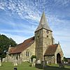
Anglican | II* | The thick-walled tower survives from the original church, built in 1090. Most of the church was rebuilt in 1856. In the south aisle, a 1300s cast-iron memorial slab is the oldest in England. Burwash was a centre for the Wealden iron industry. | |
| Church of Christ the King (More images) |
 |
Burwash 50°59′51″N 0°22′53″E / 50.9975°N 0.3814°E |
Roman Catholic | – | A Roman Catholic church dedicated to St Joseph stood outside the village from 1887 to 1989. Around 1968, the small brick and concrete Church of Christ the King was built closer to the village centre. It has a rounded end and special glass windows. | |
| St Philip's Church (More images) |
 |
Burwash Common 50°59′20″N 0°20′06″E / 50.9889°N 0.3350°E |
Anglican | – | This stone church from 1867 was designed by William Slater and Richard Herbert Carpenter. It was their only new church, though they restored many. It has tall, narrow windows, a small bell tower, and a vaulted rounded end. | |
| St Thomas the Apostle's Church (More images) |
 |
Camber 50°56′12″N 0°47′41″E / 50.9366°N 0.7948°E |
Anglican | – | In 1944, a flying bomb destroyed the chapel of ease that served Camber since 1906. The new church, a "nice and neat" brick building with wooden siding and tile-hanging, was designed by L. Keir Hett. Many items from the old church were saved and used here. | |
| St Laurence's Church (More images) |
 |
Catsfield 50°53′38″N 0°27′23″E / 50.8939°N 0.4565°E |
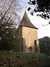
Anglican | II* | Catsfield's "humble" and ancient Anglican church is outside the village. Its nave (main part) is from the 900s and 1000s, with early Norman herringbone masonry. The north aisle was added in 1845 by Richard Cromwell Carpenter. | |
| St Nicholas' Church (More images) |
 |
Cliff End, Pett 50°53′22″N 0°41′13″E / 50.8894°N 0.6869°E |
Anglican | – | This tiny building was built by the Admiralty as a Lifesaving Rocket Apparatus Station to rescue sailors. The Diocese of Chichester bought it, and it opened as a church on April 26, 1935. It's a whitewashed building with a wooden porch added in 1959. | |
| St Augustine's Church (More images) |
 |
Cooden, Bexhill-on-Sea 50°50′14″N 0°27′21″E / 50.8373°N 0.4558°E |
Anglican | – | William H. Randoll Blacking's red-brick church was extended between 1960 and 1963. It was made sacred in May 1963. It's on a large site surrounded by houses built for retired clergy. John Skelton created a sculpture of St Augustine above the door. | |
| St George's Church (More images) |
 |
Crowhurst 50°53′02″N 0°29′49″E / 50.8838°N 0.4969°E |
Anglican | I | William Milford Teulon redesigned the church in a 1200s/1300s Gothic style in 1856. However, the short, strong 1400s tower remains. A yew tree in the churchyard is said to be the oldest and largest in Sussex. | |
| Crowhurst Chapel (More images) |
 |
Crowhurst 50°52′43″N 0°29′57″E / 50.8787°N 0.4993°E |
Assemblies of God | – | This red-brick chapel was built in 1884 for Wesleyan Methodists. It was used by Methodists until 1990. In September 1991, it was re-registered for a Pentecostal group called the Crowhurst Chapel Fellowship. It is part of the Assemblies of God. | |
| Crowhurst Christian Healing Centre (More images) |
 |
Crowhurst 50°53′23″N 0°30′09″E / 50.8898°N 0.5025°E |
Non-denominational | – | This centre was founded in 1928 at the village's old rectory. Daily worship and prayer services are open to the public. It is also a place for spiritual retreats. | |
| St Giles' Church (More images) |
 |
Dallington 50°56′50″N 0°21′31″E / 50.9471°N 0.3586°E |
Anglican | II* | The church was originally dedicated to St Margaret. As in Crowhurst, a mid-1800s Gothic Revival nave and chancel have been added to a 1400s Perpendicular Gothic tower. The original building was from the 1200s. The stone spire is one of only three in Sussex. | |
| St Mary's Church (More images) |
 |
East Guldeford 50°57′39″N 0°45′24″E / 50.9609°N 0.7567°E |
Anglican | II* | This church has an unusual design, more like churches in Kent than Sussex. It has a double hipped roof that makes it look "hunchback." It was founded in 1499 and made sacred six years later. There is no arch separating the nave and chancel; instead, a fancy roof beam marks the division. | |
| Church of the Assumption and St Nicolas (More images) |
 |
Etchingham 51°00′35″N 0°26′29″E / 51.0096°N 0.4413°E |
Anglican | I | Etchingham's "large and proud" parish church has remained mostly unchanged since the 1360s. It was built in the Decorated style, possibly by a French architect. It has a central tower and a tall interior. | |
| St James's Church (More images) |
 |
Ewhurst Green 50°59′33″N 0°33′26″E / 50.9925°N 0.5572°E |
Anglican | I | The ironstone tower, with its "ungainly" two-pitched, sugarloaf-shaped spire, is from the 1100s. Most other parts of this church on a ridge are two centuries newer. The nave was made taller at that time, and the 1300s king post roof still survives. | |
| St Andrew's Church (More images) |
 |
Fairlight 50°52′37″N 0°38′33″E / 50.8769°N 0.6425°E |
Anglican | II | London architect Thomas Little's only Sussex church, built in 1845, replaced a smaller building. The tall square tower, whose top is 618 feet (188 metres) above sea level, is a landmark for ships. The church is Early English Gothic Revival in style. | |
| St Peter's Church (More images) |
 |
Fairlight Cove 50°52′40″N 0°39′47″E / 50.8779°N 0.6630°E |
Anglican | – | This simple timber-built square church serves the seaside village of Fairlight Cove. It was built in 1970 because residents and the Sussex Churches Campaign asked for it. A cross on the roof shows it's a church. | |
| St Augustine of Canterbury's Church (More images) |
 |
Flimwell 51°03′05″N 0°27′33″E / 51.0514°N 0.4592°E |
Anglican | II | Decimus Burton's stone church from 1839 was extended in 1879 when the chancel was added. The Perpendicular Gothic Revival building has a tower with a spire, tall, narrow windows in the nave, and a hammerbeam roof. | |
| Beckley Full Gospel Mission (More images) |
 |
Four Oaks, Beckley 50°59′02″N 0°39′06″E / 50.9838°N 0.6516°E |
Assemblies of God | – | This building houses an Assemblies of God Pentecostal church and holds several services a week. It was registered for worship in May 1956 and for weddings the following June. | |
| St Laurence's Church (More images) |
 |
Guestling Green 50°54′00″N 0°38′15″E / 50.9000°N 0.6375°E |
Anglican | I | This isolated church was built between the 1000s and 1300s. The inside had to be restored in 1890 because of fire damage. An entrance porch was added to the tower around this time. | |
| St Theresa of Lisieux Church |  |
Horns Cross, Northiam 50°57′57″N 0°35′46″E / 50.9657°N 0.5961°E |
Roman Catholic | – | Writer and Roman Catholic convert Sheila Kaye-Smith gave the land for this church. It was built in the Vernacular style (like local traditional buildings) in 1935. Inside is a "delightful carved stone relief" by Joseph Cribb. The church was registered for weddings in December 1936. | |
| Holy Trinity Church (More images) |
 |
Hurst Green 51°01′13″N 0°28′09″E / 51.0202°N 0.4691°E |
Anglican | – | This red-brick church doesn't have a tall tower or spire. Instead, it has a two-level bellcote (a small structure holding bells) at the west end of the roof. The Early English Gothic Revival building also has some stone decorations and tall, narrow windows. | |
| All Saints Church (More images) |
 |
Icklesham 50°55′02″N 0°40′26″E / 50.9171°N 0.6739°E |
Anglican | I | This large, "surprisingly grand" and "interesting" ancient church is at the edge of a long village. All Saints has Saxon origins and still has many early Norman parts. Next to the long chancel is a large chapel dedicated to St Nicholas. | |
| All Saints Church (More images) |
 |
Iden 50°58′53″N 0°43′39″E / 50.9813°N 0.7275°E |
Anglican | I | The Norman church was extended between the 1200s and 1400s, giving it a Perpendicular Gothic look. The original south aisle is gone, but you can still see traces of its arches on the wall. The noticeable tower has a stair-turret and a single window from the Norman era. | |
| St Mark's Church (More images) |
 |
Little Common, Bexhill-on-Sea 50°50′45″N 0°26′14″E / 50.8458°N 0.4372°E |
Anglican | – | A Martello tower (a small defensive fort) at Bulverhythe was knocked down in 1842. Stones from it were used to build St Mark's Church on land given by the owner of Battle Abbey. Henry Woodyer added the chancel in 1857 and a south aisle in 1883. Another aisle was built on the north side in 1962. | |
| Little Common Methodist Church (More images) |
 |
Little Common, Bexhill-on-Sea 50°50′40″N 0°26′05″E / 50.8444°N 0.4348°E |
Methodist | – | Turf Chapel (1837), the first Methodist chapel here, and another chapel were sold to buy a new site in 1915. After a break for World War I, construction started in 1926, and the new church opened in July that year. C.F. Callow's red-brick building was expanded with a church hall in 1953. | |
| St Martha's Church (More images) |
 |
Little Common, Bexhill-on-Sea 50°50′36″N 0°26′03″E / 50.8433°N 0.4342°E |
Roman Catholic | – | Founded in 1939 and finished in 1940, Little Common's Roman Catholic church is a red-brick building. Its unique front combines a Mediterranean-style Romanesque Revival tower with a low, cap-shaped spire in the Sussex Vernacular style. Local architect Marshall Wood designed it. | |
| All Saints Church (More images) |
 |
Mountfield 50°57′21″N 0°28′07″E / 50.9558°N 0.4686°E |
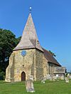
Anglican | II* | This Early English church has a strong, heavily supported tower with a low, pointed spire. There has been a church here since the 1100s. Some medieval wall paintings survive, though they are faded. The wooden entrance porch on the south side was added in the 1300s. | |
| St John's Church (More images) |
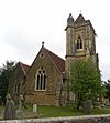 |
Netherfield 50°56′25″N 0°27′05″E / 50.9404°N 0.4513°E |
Anglican | II* | Samuel Sanders Teulon designed this church in 1859 for the hamlet of Netherfield. It's an Early English Gothic Revival stone building. The architect also designed the pulpit (speaker's stand) and reredos (altar screen), the latter being a "spiky" and unique piece. | |
| St Mary's Church (More images) |
 |
Northiam 50°59′28″N 0°36′23″E / 50.9910°N 0.6063°E |
Anglican | II* | This church is somewhat hidden behind its tall, spire-topped tower, which is the oldest part and has Norman (and possibly Saxon) features. The rest of the church was rebuilt in 1836. A large chapel-cum-mausoleum (a building for burials) was added in 1845–46 for the Frewen family. | |
| St Peter and St Paul's Church (More images) |
 |
Peasmarsh 50°57′55″N 0°41′10″E / 50.9652°N 0.6862°E |
Anglican | I | This Norman church stands about a mile from its village. It's thought the village moved away due to things like the Black Death or marshy land. Side aisles were added later in the Early English style. The Transitional Norman tower is from 1170. | |
| St Michael's Church (More images) |
 |
Penhurst 50°55′25″N 0°24′33″E / 50.9236°N 0.4093°E |
Anglican | I | Only minor restoration has happened at this isolated church, which has been part of a group with the nearby manor house and farm for centuries. The tower, with a large window and a pyramid-shaped cap, is Perpendicular Gothic. The interior fittings are high quality, some from the 1400s. | |
| St Mary and St Peter's Church (More images) |
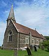 |
Pett 50°53′40″N 0°39′42″E / 50.8944°N 0.6616°E |
Anglican | – | Benjamin Ferrey's Decorated Gothic Revival stone church from 1864 replaced an older building. The building, which cost £2,000, was called "dull" by Nikolaus Pevsner. He also noted the "curious" tower, which changes shape from square to octagonal. | |
| Pett Methodist Chapel (More images) |
 |
Pett 50°53′41″N 0°39′27″E / 50.8947°N 0.6576°E |
Methodist | II | Built as the Mount Calvary Bible Christian Chapel in 1848, this red-brick building still serves Methodists. It's in a small graveyard. The front has a porch, three sections, and a triangle-shaped top. | |
| St Michael's Church (More images) |
 |
Playden 50°57′45″N 0°43′59″E / 50.9625°N 0.7331°E |
Anglican | I | This church is mostly from the early 1200s, dominated by its central tower with a very tall, "elegant" pointed spire (added later). The spire needs complex internal timber framing to support it. Unique triangular buttresses also support the side aisles. | |
| Ashburnham Chapel (More images) |
 |
Ponts Green, Ashburnham 50°55′00″N 0°23′16″E / 50.9166°N 0.3879°E |
Non-denominational | – | This red-brick building is from 1866. When the former Congregational chapel closed, it became a chapel for that group. It was part of the United Reformed Church until 2013, and is now an independent chapel. | |
| Robertsbridge Mission Room (More images) |
 |
Robertsbridge 50°59′09″N 0°28′31″E / 50.9857°N 0.4754°E |
Anglican | – | Robertsbridge, the largest village in Salehurst parish, didn't have its own Anglican church until 1904. This "featureless brick building" was built then. Its outside is now painted white. | |
| St Mary's Church (More images) |
 |
Rye 50°57′00″N 0°44′03″E / 50.9501°N 0.7342°E |
Anglican | I | This large cross-shaped building was founded by monks from Fécamp Abbey. It has many Norman parts from its main building period (1150–1180). Side chapels were added in the 1200s. French raiders caused much damage in 1377. | |
| Rye Baptist Church (More images) |
 |
Rye 50°57′07″N 0°43′56″E / 50.9519°N 0.7321°E |
Baptist | – | Baptists who used to worship at the former chapel on Mermaid Street and the Independent Chapel on Landgate moved to this new Perpendicular Gothic Revival building. It's mostly stone-built and was started on May 25, 1909. | |
| Kingdom Hall (More images) |
 |
Rye 50°56′50″N 0°44′07″E / 50.9471°N 0.7353°E |
Jehovah's Witnesses | – | Jehovah's Witnesses first worshipped in Rye in the 1950s. They moved to the current Kingdom Hall on Rye Harbour Road in the 1970s. They later built a new Kingdom Hall on the same site in 2006. | |
| Rye Methodist Church (More images) |
 |
Rye 50°56′59″N 0°44′06″E / 50.9498°N 0.7349°E |
Methodist | – | John Wesley founded Rye's first Methodist chapel in 1789. It was changed in 1814 and again in 1852. It was destroyed by World War II bombs. The nearby Sunday School from 1901 survived and was turned into a new church, which opened in August 1954. | |
| St Anthony of Padua's Church (More images) |
 |
Rye 50°56′57″N 0°43′58″E / 50.9492°N 0.7329°E |
Roman Catholic | II | St Walburga's Church, a red-brick church from 1900, was renamed and redesigned in 1927–29 by John B. Mendham. It became an "unusual" example of early Lombardic Romanesque style. The church is served by members of the nearby Friary. | |
| Church of the Holy Spirit (More images) |
 |
Rye Harbour 50°56′20″N 0°45′24″E / 50.9388°N 0.7568°E |
Anglican | II | Gothic Revival architect Samuel Sanders Teulon designed this church in 1848–49. C. Spooner extended it in 1912. It is Early English in style, with a rounded end, tall, narrow windows, and an octagonal tower. A memorial remembers the Mary Stanford lifeboat disaster of 1928. | |
| St Mary the Virgin Church (More images) |
 |
Salehurst 50°59′28″N 0°29′28″E / 50.9910°N 0.4912°E |
Anglican | I | The size of this church, compared to the small village it serves, shows it was founded by monks from nearby Robertsbridge Abbey. It also served a huge area, including places like Bodiam and Etchingham. The building is from about 1250, though there's a 1300s wooden porch. | |
| St John the Baptist's Church (More images) |
 |
Sedlescombe 50°56′29″N 0°31′41″E / 50.9413°N 0.5281°E |
Anglican | II | This might be the third church on this site. A wooden Saxon church is believed to have existed before the Norman building. The Norman building was almost completely replaced between the 1400s and 1800s, with major restoration from 1866 to 1874. | |
| Sedlescombe United Reformed Church (More images) |
 |
Sedlescombe 50°55′40″N 0°32′12″E / 50.9277°N 0.5368°E |
United Reformed Church | – | This chapel, built in 1879 as a Congregational chapel, is thought to be by local architect Henry Ward. It was founded by Rev. Charles New of the Robertson Street church in Hastings. John Catt built the red-brick and terracotta chapel, which has a large rose window. | |
| All Saints Church (More images) |
 |
Sidley 50°51′23″N 0°28′04″E / 50.8565°N 0.4679°E |
Anglican | II | Both T.E.C. and G.E.S. Streatfield worked on Sidley's parish church. The former designed the nave, which opened in October 1909. The latter added the chancel and strong tower between 1927 and 1930. The style is Gothic Revival with Arts and Crafts elements. | |
| Sidley Baptist Church (More images) |
Sidley 50°51′26″N 0°28′15″E / 50.8573°N 0.4708°E |
Baptist | – | The current building is from 1956. Beulah Baptist Church started a chapel in Sidley in 1907. A new tin tabernacle (a church made of corrugated iron) replaced this in 1913. W. Howell Lewis's new church opened in February 1957. | ||
| St Mark's Church (More images) |
 |
Staplecross 50°58′27″N 0°32′23″E / 50.9743°N 0.5397°E |
Anglican | – | This "unpretentious mission church" for St James's Church at Ewhurst Green opened on May 24, 1894. The land was given in 1873. It has tall, narrow windows and a small bell tower with a bell installed in 2009. | |
| St Peter's Church (More images) |
 |
Stonegate 51°01′49″N 0°22′29″E / 51.0303°N 0.3748°E |
Anglican | II | George Courthorpe founded the village's original church in 1838; this is now the chancel of the current building. It's an Early English Gothic Revival design with Arts and Crafts elements. It has a large, unique tower with wooden siding and a small spire. | |
| Church of the Ascension |  |
Telham 50°54′03″N 0°31′08″E / 50.9008°N 0.5188°E |
Anglican | – | This Anglican church, in the parish of Battle, was built next to the Battle–Hastings road in Telham in 1876. It's a red-brick Gothic Revival building in the Early English style, with a tiny spire on the roof. | |
| St Mary's Church (More images) |
 |
Ticehurst 51°02′43″N 0°24′28″E / 51.0454°N 0.4078°E |
Anglican | II* | Ticehurst was a centre of the Wealden iron industry by the 1300s, when this large church was built. It's in a big churchyard with tombstones from the 1600s. The tower with its spire has a large arch inside, and various medieval items survive inside. | |
| Compass Park Gospel Hall | Udiam, Staplecross 50°59′11″N 0°31′13″E / 50.9865°N 0.5202°E |
Plymouth Brethren Christian Church | – | Permission was sought in 2009 to build a Brethren meeting room here as part of a small industrial development. It was in use by April 2019 and registered for weddings in March 2020. | ||
| St Mary's Church (More images) |
 |
Udimore 50°56′24″N 0°39′03″E / 50.9400°N 0.6509°E |
Anglican | I | The nave of this isolated church, serving a tiny hamlet, is Norman; parts might be from the 1000s. It originally had two sections, but a third was added later. A south aisle was also built later but has now disappeared, leaving traces on the wall. The tower is low and heavily supported. | |
| St John the Baptist's Church (More images) |
 |
Westfield 50°54′29″N 0°34′22″E / 50.9080°N 0.5729°E |
Anglican | I | This 1100s church is "beautifully proportioned" despite the many buttresses (supports) on its walls. It stands at the southern entrance to the large village of Westfield. Tall, narrow windows were added to the chancel in the 1200s. Victorian architect Charles Edward Davis built a north aisle in 1860. | |
| Sanctuary of Christ the Holy Redeemer (More images) |
 |
Westfield 50°55′09″N 0°34′40″E / 50.9193°N 0.5778°E |
Non-denominational | – | This place offers two public services each week, as well as counselling and healing. It has a large baptistery (a place for baptisms) with free-flowing water, guest rooms, and a rehabilitation room. It was registered for worship and weddings in March 1975. | |
| St Mary Magdalen's Church (More images) |
 |
Whatlington 50°56′12″N 0°30′15″E / 50.9366°N 0.5043°E |
Anglican | II* | This small, "odd-looking" Early English church had a spire-topped tower and rounded vestry (a room for clergy robes) added in 1862. The rest of the building is mostly from the 1200s. A Saxon church here might have been destroyed during the Battle of Hastings nearby. A fire in July 2010 badly damaged the building. | |
| St Thomas the Martyr's Church (More images) |
 |
Winchelsea 50°55′27″N 0°42′33″E / 50.9242°N 0.7092°E |
Anglican | I | Built in the 1200s on a huge scale, this church was "the finest example of the Decorated style in Sussex." But in the 1360s, invaders from France partly destroyed it. The current building is only the original chancel. A large tower, possibly meant as a watch-tower, was knocked down in 1790. The large windows have modern stained glass. | |
| St Richard's Church (More images) |
 |
Winchelsea Beach 50°54′56″N 0°43′26″E / 50.9155°N 0.7240°E |
Anglican | – | Phyllis Biddle, a former missionary, paid for this new church in the seaside resort of Winchelsea Beach. It was built in 1962, mostly of red brick. Other features include wooden siding, a tower with a unique cap, and a tiled roof. |
Former Places of Worship
| Name | Image | Location | Denomination/ Affiliation |
Grade | Notes | Refs |
|---|---|---|---|---|---|---|
| Ashburnham Congregational Mission Chapel (More images) |
 |
Ashburnham 50°55′56″N 0°22′24″E / 50.9321°N 0.3734°E |
Congregational | II | This two-storey cottage-style building, from about 1849, stands on a remote lane. It has red and grey brickwork and a hipped roof of slate. It became a house after closing in 1964. | |
| Battle Congregational Church (More images) |
 |
Battle 50°55′01″N 0°29′03″E / 50.9170°N 0.4843°E |
Congregational | – | This building on the High Street, now used for businesses, was designed in 1881 by Thomas Elworthy. It was one of several Nonconformist chapels in Battle in the 1800s. It closed in November 1972. | |
| Kingdom Hall (More images) |
 |
Battle 50°54′58″N 0°29′09″E / 50.9160°N 0.4858°E |
Jehovah's Witnesses | – | This Kingdom Hall was behind Battle High Street. The Battle Congregation of Jehovah's Witnesses now shares a Kingdom Hall in Bexhill-on-Sea. The building's registration for worship was cancelled in May 2014. | |
| Battle Methodist Church (More images) |
 |
Battle 50°54′41″N 0°29′32″E / 50.9114°N 0.4922°E |
Methodist | II | Built in 1826, this building has changed little, except for a porch added in 1887. It has a central triangle-shaped top and pointed-arch windows. It was used for worship until November 2011 and became a house in 2014. | |
| Little Church of St Francis (More images) |
 |
Battle 50°54′57″N 0°29′03″E / 50.9158°N 0.4842°E |
Spiritualist | – | This Spiritualist church was behind Battle High Street. It was registered for weddings in November 2000. | |
| Beckley Methodist Chapel (More images) |
 |
Beckley 50°59′07″N 0°38′12″E / 50.9852°N 0.6368°E |
Methodist | II | This red-brick building is from 1840. It has a gabled porch and tall, narrow windows. It was still open in 1999, but the former church members have now joined Trinity Methodist Church at Broad Oak. | |
| Mission Church of the Good Shepherd (More images) |
 |
Bexhill-on-Sea 50°50′45″N 0°28′07″E / 50.8459°N 0.4686°E |
Anglican | – | The Malet Memorial Hall (1912–13) was on the ground floor of this building. Upstairs was the small mission church, which replaced a nearby hut. It has Tudor Revival elements. It opened in 1913 and was used until after 1971. | |
| St Andrew's Church (More images) |
 |
Bexhill-on-Sea 50°50′24″N 0°28′06″E / 50.8401°N 0.4682°E |
Anglican | – | This church was always a chapel of ease (a smaller church). It was built in 1899–1900. Financial problems led to its closure after a final service on January 8, 2012. Plans to knock it down for flats were rejected in March 2017. | |
| Victoria Hall Congregational Church | 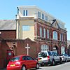 |
Bexhill-on-Sea 50°50′31″N 0°28′09″E / 50.8419°N 0.4692°E |
Congregational | – | Victoria Hall was built in 1887 as a multi-purpose building. In 1887, John Stewart, a Congregationalist, bought the building and turned it into a chapel. It was used as the church hall after a new church was built nearby in 1898. | |
| Belle Hill Methodist Chapel (More images) |
 |
Bexhill-on-Sea 50°50′47″N 0°28′18″E / 50.8464°N 0.4718°E |
Methodist | – | This Classical-style building, with arched windows, was built in 1825 for the town's first Wesleyan Methodists. Its members joined Christchurch Methodist Church in 1938, and a nursery school later opened in the building. | |
| London Road Citadel (More images) |
 |
Bexhill-on-Sea 50°50′39″N 0°28′09″E / 50.8443°N 0.4692°E |
Salvation Army | – | The Salvation Army started in Bexhill in 1892. After meeting in various places, they built this permanent place of worship on London Road in 1914. The last service was held on September 24, 2006. | |
| St John's Church (More images) |
 |
Bexhill-on-Sea 50°50′31″N 0°28′10″E / 50.8419°N 0.4694°E |
United Reformed Church | – | Henry Ward designed this red-brick and stone Perpendicular Gothic Revival church in 1897. It closed in 2007, and members moved to St George's Church. The building was saved from demolition in 2009 and is planned to become a youth centre. | |
| Providence Strict Baptist Chapel | 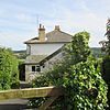 |
Burwash 50°59′49″N 0°23′07″E / 50.9970°N 0.3853°E |
Baptist | – | Founded in 1829 as a Calvinistic chapel, this brick building was used for Strict Baptist worship until 1944. It was then turned into a house called Chant Meadow. Little of its original church appearance remains. | |
| Catsfield Methodist Church (More images) |
 |
Catsfield 50°53′49″N 0°27′05″E / 50.8970°N 0.4515°E |
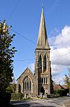
Methodist | II | Henry Blackman's unique Early English/Perpendicular Gothic Revival church from 1912 has a very tall spire. Blackman paid £4,000 for its construction as a memorial to his parents. Falling numbers of churchgoers made it unviable in the 1990s, and it became a house. | |
| Bethlehem Strict Baptist Chapel (More images) |
 |
Dallington 50°57′01″N 0°22′55″E / 50.9504°N 0.3820°E |
Baptist | – | This small wooden chapel, which closed after 1988, is now a house. It's outside the village on the Battle–Heathfield road. The church started in a house in 1851. | |
| Dallington Calvinistic Methodist Chapel (More images) |
 |
Dallington 50°57′04″N 0°21′12″E / 50.9512°N 0.3532°E |
Methodist | – | Also on the Battle–Heathfield road, this "Chapel in the Valley" was used until 1989, when it was sold to become a house. It's a wooden building with decorative boards. | |
| Etchingham Methodist Chapel (More images) |
 |
Etchingham 51°00′32″N 0°26′15″E / 51.0088°N 0.4376°E |
Methodist | – | This building has been greatly changed since it became a house. For most of the 1900s, it served Methodists in Etchingham village. The red-brick chapel was finished in 1900 and closed in 1970. | |
| Ewhurst Congregational Chapel (More images) |
 |
Ewhurst Green 50°59′34″N 0°33′21″E / 50.9928°N 0.5558°E |
Congregational | II | Now two cottages, this building was originally a single house built in the 1700s. In 1895, half of it became a chapel. The walls are a mix of brick and cut stone. A new window and some supports were added where the chapel's door used to be. | |
| Providence Strict Baptist Chapel (More images) |
 |
Flimwell 51°03′18″N 0°26′24″E / 51.0550°N 0.4401°E |
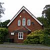
Baptist | – | The first chapel in this village was a wooden building from the 1820s. The current chapel, which closed in the 1970s, is from 1902. It has a front with three tall, narrow windows and a porch. | |
| Guestling Gospel Hall (More images) |
 |
Guestling 50°53′32″N 0°38′09″E / 50.8921°N 0.6358°E |
Open Brethren | – | This building was later known as Guestling Chapel. Under this name, the building on Chapel Lane was no longer registered as a place of worship in March 1995. | |
| Hollingrove Congregational Chapel (More images) |
 |
Hollingrove 50°57′45″N 0°24′26″E / 50.9625°N 0.4073°E |
Congregational | – | This chapel was built next to a thatched cottage (now gone) in the hamlet of Hollingrove. By the 1980s, it had been sold and turned into a house. It was designed in 1909 by Henry Ward and has a unique curved gable on the front. | |
| Church of Our Lady Help of Christians (More images) |
 |
Hurst Green 51°01′03″N 0°28′03″E / 51.0175°N 0.4676°E |
Roman Catholic | – | Francis Pollen designed this church in 1959. The land was given by Lord Longford. The modern, many-sided building closed in 2008 due to structural problems. Villagers have tried to turn it into a shop or community centre. | |
| Iden Methodist Church (More images) |
 |
Iden 50°58′54″N 0°43′53″E / 50.9817°N 0.7314°E |
Methodist | – | The village's first Wesleyan Methodist chapel was destroyed by bombing in World War II. This new chapel was in a more central location and was used until the 1960s. Its wedding registration was officially cancelled in March 1971. | |
| Mountfield Methodist Chapel (More images) |
 |
Mountfield 50°57′05″N 0°28′45″E / 50.9513°N 0.4793°E |
Methodist | – | Built in 1894 and open until 1970, this red-brick chapel is known for its crow-stepped gable (a stepped roof edge). The front has a porch and some stonework. After closing, it was sold to become a house. | |
| Pevensey Sluice Mission Hall |  |
Normans Bay 50°49′36″N 0°23′41″E / 50.8266°N 0.3948°E |
Non-denominational | – | A Wesleyan Methodist chapel was here by 1836. Around 1886, it became a non-denominational mission hall. The building was sold to become a house in 1965. | |
| Northiam Wesleyan Chapel (More images) |
 |
Northiam 50°59′39″N 0°35′59″E / 50.9943°N 0.5997°E |
Methodist | – | The front of this 1814 chapel has been completely changed since it became a shop and house in 1974. Its arched windows and doorway are gone. The chapel was used until December 1975. | |
| Northiam Unitarian Chapel (More images) |
 |
Northiam 50°59′45″N 0°35′51″E / 50.9957°N 0.5976°E |
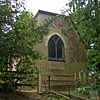
Unitarian | II | William Vidler, who founded a Baptist chapel in Battle, started a chapel here in 1795. The original wooden building collapsed 15 years later. The current building, which closed in the early 2000s, was built on the site. It became Unitarian in the early 1800s. | |
| Peasmarsh Methodist Chapel (More images) |
 |
Peasmarsh 50°58′25″N 0°41′16″E / 50.9736°N 0.6879°E |
Methodist | – | A chapel from 1842 was replaced in 1900 by this Early English Gothic Revival building of red brick. It was used until December 1996. | |
| Bethel Strict Baptist Chapel (More images) |
 |
Robertsbridge 50°59′10″N 0°28′29″E / 50.9861°N 0.4748°E |
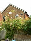
Baptist | II | This "quaint old chapel" was founded by James Weller in 1842. It became linked to the Gospel Standard movement and closed around 1999. It has large windows and a small porch. | |
| Robertsbridge Wesleyan Chapel (More images) |
 |
Robertsbridge 50°59′09″N 0°28′34″E / 50.9857°N 0.4760°E |
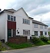
Methodist | – | John Wesley often preached in Robertsbridge in the late 1700s. A permanent chapel was in place by 1812. It was expanded in 1842 and 1874. Members joined the nearby Congregational church in 1960, and the old chapel became flats. | |
| Robertsbridge United Reformed Church (More images) |
 |
Robertsbridge 50°59′08″N 0°28′29″E / 50.9856°N 0.4747°E |
United Reformed Church | II | "Rich and fruity" and "very Victorian" are some descriptions of Thomas Elworthy's chapel from 1881. It stands out among old timber-framed buildings. It closed on September 5, 2015, and was put up for sale in March 2016. | |
| Congregational Independent Chapel (More images) |
 |
Rye 50°56′58″N 0°43′57″E / 50.9494°N 0.7326°E |
Congregational | II | Founded in 1817, this chapel was used by Independent Baptists who later joined the church in Cinque Ports Street. The front has red brickwork, round-headed windows, and a covered entrance. It has been a house for over a century. | |
| Rye United Reformed Church (More images) |
 |
Rye 50°57′08″N 0°44′04″E / 50.9521°N 0.7344°E |
United Reformed Church | – | This chapel was built for Rye's Congregational community in 1882. In 1973, it was sold and became Rye Community Centre. The Early English-style building has red brickwork and terracotta. | |
| Augustianian Friary Chapel (More images) |
 |
Rye 50°57′06″N 0°44′04″E / 50.9518°N 0.7345°E |
Pre-Reformation | II | This chapel, part of a vanished friary, dates from about 1380. Between the early 1890s and 1903, the Salvation Army used it for worship. After that, it became a business. New windows were added in 1906. | |
| Carmelite Chapel (More images) |
 |
Rye 50°56′58″N 0°44′02″E / 50.9495°N 0.7339°E |
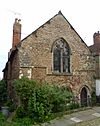
Pre-Reformation | II | Now a house called The Old Stone House, this was the chapel of the Order of Friars Repentant of Jesus Christ, started in 1263. The chapel went out of use in the 1300s after Rye was attacked by French invaders. | |
| Rye Particular Baptist Chapel (More images) |
 |
Rye 50°56′59″N 0°43′52″E / 50.9498°N 0.7312°E |
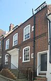
Baptist | II | Quakers started a meeting house here in the 1700s. By 1753, Strict Baptists bought the old building, knocked it down, and built the current one. It was used as a chapel until 1910. | |
| Independent Chapel (More images) |
 |
Rye 50°57′16″N 0°44′09″E / 50.9544°N 0.7358°E |
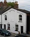
Independent | – | This small chapel was started on Landgate in 1844. It closed in the early 1900s when its members, who had become Baptists, joined the new church on Cinque Ports Street. | |
| Rye Citadel (More images) |
 |
Rye 50°57′10″N 0°44′00″E / 50.9528°N 0.7334°E |
Salvation Army | – | After using the former Augustinian Friary chapel, Rye's Salvation Army built a citadel on Rope Walk in 1903. The building has been turned into a shop. It was registered as a place of worship from March 1905 until April 1971. | |
| Bethel Strict Baptist Chapel (More images) |
 |
Rye 50°57′18″N 0°44′09″E / 50.9551°N 0.7359°E |
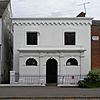
Baptist | – | This unique Neoclassical building, with the name bethel above the porch, still looks as it did when built in 1858. Charlotte Smith, the wife of a former Mayor of Rye, founded it. The chapel closed in December 2018. | |
| Rye Harbour Mission Hall (More images) |
 |
Rye Harbour 50°56′19″N 0°45′38″E / 50.9385°N 0.7606°E |
Methodist | – | This chapel was part of the Hastings, Bexhill and Rye Methodist Circuit. It was open for most of the 1900s. | |
| Sedlescombe Congregational Chapel (More images) |
 |
Sedlescombe 50°55′39″N 0°32′12″E / 50.9274°N 0.5368°E |
Congregational | – | The 1879 Congregational chapel had only been open for about five years when a disagreement led some members to leave. They built a local-style brick chapel next door. It closed in 1907 when the groups reunited, and became the village police station, then two houses. | |
| Sedlescombe Wesleyan Chapel (More images) |
 |
Sedlescombe 50°55′57″N 0°32′06″E / 50.9326°N 0.5351°E |
Methodist | – | This building was used for worship between 1812 and 1924. It has since been a shop, a wartime cinema, an engineering workshop, and is now a house. Farmer Henry Freeland founded it during Methodism's popular period in the 1800s. | |
| Our Lady of the Rosary Church (More images) |
 |
Sidley 50°51′32″N 0°27′45″E / 50.8589°N 0.4625°E |
Roman Catholic | – | Fr Geoffrey Smith and architect Alex Watson designed this brown-brick church in the 1950s for the growing Sidley area. The land was donated by a wealthy resident. It opened in 1954. It closed on October 6, 2019, having lasted longer than its expected 50 years. | |
| Three Oaks Methodist Church (More images) |
 |
Three Oaks 50°54′10″N 0°37′02″E / 50.9028°N 0.6173°E |
Methodist | – | Now a house, this church was still in use in 1999. It was part of a group of mostly rural churches managed from Rye. | |
| Ticehurst Methodist Church (More images) |
 |
Ticehurst 51°02′44″N 0°24′44″E / 51.0456°N 0.4122°E |
Methodist | – | A.W. Pocock's Decorated Gothic Revival chapel, with gabled side windows and a large rose window, was built in 1897. Earlier Methodist chapels in the village were from 1821 and 1840. It was used for worship until the mid-1900s and is now a house. | |
| Udimore Methodist Chapel (More images) |
 |
Udimore 50°56′18″N 0°40′00″E / 50.9382°N 0.6668°E |
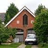
Methodist | – | This building's outside has been changed since it closed in 1960. H. and C. Coleman built it in 1882. It originally had a white front with decorative tops. Another Methodist chapel was in Udimore parish between 1863 and 1907. | |
| Beulah Methodist Chapel (More images) |
 |
Westfield 50°54′42″N 0°34′34″E / 50.9118°N 0.5760°E |
Methodist | – | Closed after 1999 and turned into a house, this brick chapel is from 1851. The entrance porch was added much later, but the decorative boards and flat-arched windows are original. | |
| Winchelsea Methodist Chapel (More images) |
 |
Winchelsea 50°55′28″N 0°42′25″E / 50.9244°N 0.7070°E |
Methodist | II | This plain brick building from 1785, built onto an older house, has links to John Wesley, who preached here in 1789 and 1790. The tiled mansard roof (a roof with four sloping sides) is distinctive. Original features like the pulpit and gallery remain. | |
| Grey Friars Monastery Church (More images) |
 |
Winchelsea 50°55′18″N 0°42′38″E / 50.9218°N 0.7105°E |
Pre-Reformation | I | Only a stair-turret, the chancel walls, and the chancel arch of this 1300s church still stand. They are Decorated Gothic in style and are described as "one of the most impressive [sets of Franciscan remains] there are" in England. The ruins are in the garden of a private house. | |
| Whatlington Methodist Church (More images) |
 |
Woodman's Green, Whatlington 50°56′48″N 0°30′30″E / 50.9468°N 0.5082°E |
Methodist | II | This unique Gothic Revival chapel has a tall tower with a spire. The walls are white, and all windows have pointed arches. It also had schoolrooms when built in 1872. It became a workshop after closing around 1936. |
See also
 | John T. Biggers |
 | Thomas Blackshear |
 | Mark Bradford |
 | Beverly Buchanan |


