
Portage County, Ohio facts for kids
Quick facts for kids
Portage County
|
|||
|---|---|---|---|

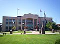
Portage County Courthouse
|
|||
|
|||

Location within the U.S. state of Ohio
|
|||
 Ohio's location within the U.S. |
|||
| Country | |||
| State | |||
| Founded | June 7, 1808 | ||
| Named for | the portage between the Cuyahoga and Tuscarawas Rivers | ||
| Seat | Ravenna | ||
| Largest city | Kent | ||
| Area | |||
| • Total | 504 sq mi (1,310 km2) | ||
| • Land | 487 sq mi (1,260 km2) | ||
| • Water | 17 sq mi (40 km2) 3.3% | ||
| Population
(2020)
|
|||
| • Total | 161,791 |
||
| • Density | 320/sq mi (120/km2) | ||
| Time zone | UTC−5 (Eastern) | ||
| • Summer (DST) | UTC−4 (EDT) | ||
| Congressional districts | 13th, 14th | ||


Portage County is a county in the state of Ohio, in the United States. In 2020, about 161,791 people lived here. It is located in Northeast Ohio and is part of the larger Akron region.
The main city and government center is Ravenna. The biggest city is Kent. The county is named after an old path called a "portage." This path connected the Cuyahoga and Tuscarawas rivers. Portage County was officially created in 1807 and started its government in 1808. Besides Kent and Ravenna, other cities in the county include Aurora and Streetsboro. There are also five villages and 18 townships. Parts of Tallmadge and Mogadore are also in Portage County, but most of those towns are in Summit County.
Contents
History of Portage County
The name "Portage" comes from an old Native American trail. This trail was called the "Portage Path." It connected the Cuyahoga and Tuscarawas rivers. Travelers would carry their canoes across this land, which is called a portage. Today, this path is in Summit County, which is next to Portage County.
Around the year 1600, the Whittlesey Culture lived in this area. They were a Native American group. Later, other tribes like the Wyandot, Lenape, Seneca, and Shawnee used this land. They often used it as a shared hunting ground.
After Europeans arrived, the land became part of a French colony called New France. In 1763, it became part of Great Britain. Later, it was part of the Connecticut Western Reserve. This land was then bought by the Connecticut Land Company in 1795.
The first European settlers came to what is now Portage County in the late 1790s. Abraham Honey arrived in 1798 in the area now called Mantua Township. Asa Hall came in 1799 to Atwater Township. In June 1799, Benjamin Tappan, Jr. started the town of Ravenna. Other settlers came to Palmyra Township and Aurora.

When it was first settled, Portage County was part of Jefferson County. Then it became part of Trumbull County in 1800. On February 10, 1807, Ohio decided to create Portage County from Trumbull County. This change happened on June 7, 1807. The first elections for Portage County were held on June 8, 1808.
At first, Portage County was much larger. It included parts of what are now Summit, Medina, Huron, Lorain, and Ashland counties. Over time, its size changed. The county's current borders were set in 1840. This happened after Medina County and Summit County were created.
Portage County was also the site of the Kent State incident in 1970. This was a sad event where four students were killed during a protest.
Geography of Portage County

Portage County covers about 504 square miles. About 487 square miles of this is land, and 17 square miles (3.3%) is water.
West Branch State Park is a very large park in the middle of Portage County. It has a big lake and green areas. There are also many smaller state and local parks throughout the county.
Neighboring Counties
Portage County shares borders with these counties:
- Geauga County (north)
- Trumbull County (east)
- Mahoning County (southeast)
- Stark County (south)
- Summit County (west)
- Cuyahoga County (northwest)
Main Roads and Highways
Many important roads and highways pass through Portage County. These include:
 I-76
I-76
 I-80 / Ohio Turnpike
 I-480
I-480 US 224
 US 422
 SR 5
SR 5 SR 14
SR 14 SR 43
SR 43 SR 44
SR 44 SR 59
SR 59 SR 82
SR 82 SR 88
SR 88 SR 183
 SR 225
 SR 261
 SR 282
 SR 303
 SR 305
 SR 306
 SR 700
People and Population
| Historical population | |||
|---|---|---|---|
| Census | Pop. | %± | |
| 1810 | 2,995 | — | |
| 1820 | 10,095 | 237.1% | |
| 1830 | 18,826 | 86.5% | |
| 1840 | 22,965 | 22.0% | |
| 1850 | 24,419 | 6.3% | |
| 1860 | 24,208 | −0.9% | |
| 1870 | 24,584 | 1.6% | |
| 1880 | 27,500 | 11.9% | |
| 1890 | 27,868 | 1.3% | |
| 1900 | 29,246 | 4.9% | |
| 1910 | 30,307 | 3.6% | |
| 1920 | 36,369 | 20.0% | |
| 1930 | 42,682 | 17.4% | |
| 1940 | 46,660 | 9.3% | |
| 1950 | 63,984 | 37.1% | |
| 1960 | 91,798 | 43.5% | |
| 1970 | 125,868 | 37.1% | |
| 1980 | 135,856 | 7.9% | |
| 1990 | 142,585 | 5.0% | |
| 2000 | 152,061 | 6.6% | |
| 2010 | 161,419 | 6.2% | |
| 2020 | 161,791 | 0.2% | |
| U.S. Decennial Census 1790-1960 1900-1990 1990-2000 2020 |
|||
In 2010, there were 161,419 people living in Portage County. There were 62,222 households. The population density was about 331 people per square mile.
Most people (92.3%) were white. About 4.1% were Black or African American. About 1.4% were Asian. People of Hispanic or Latino origin made up 1.3% of the population. Many people had ancestors from Germany (30.7%), Ireland (17.1%), England (11.5%), or Italy (11.0%).
The average age of people in the county was 37.4 years. About 29.6% of households had children under 18 living with them.
Education in Portage County
Portage County has many schools and libraries. It also has two colleges.
Libraries

The Portage County Library Consortium connects several libraries. These include Kent Free Library in Kent and Reed Memorial Library in Ravenna. There are also five branches of the Portage County Library District. These are in Aurora, Garrettsville, Randolph, Streetsboro, and Windham. If you have a library card from one of these, you can use it at any of the others. You can also borrow books from many university libraries across Ohio.
Kent State University also has a large library system in Kent. It has over 2.5 million books. This system includes a 12-story main library. It also has special libraries for architecture, fashion, and maps. There are also libraries at the university's other campuses.
Public School Districts
Portage County has eleven public school districts. These districts serve different towns and areas.
| District | Location | Communities served |
|---|---|---|
| Aurora City School District | Aurora | Aurora, small part of Reminderville |
| Crestwood Local School District | Mantua | Mantua, Mantua Township, Hiram, most of Hiram Township, most of Shalersville Township |
| James A Garfield Local School District | Garrettsville | Garrettsville, Nelson Township, Freedom Township, part of Hiram Township, small part of Charlestown Township |
| Field Local School District | Brimfield | Most of Brimfield and Suffield Townships, parts of Tallmadge and Kent annexed from Brimfield |
| Kent City School District | Kent | Sugar Bush Knolls, most of Kent and Franklin Township, small portion of Streetsboro |
| Ravenna School District | Ravenna | Ravenna, Ravenna Township, small portion of Shalersville Township |
| Rootstown Local School District | Rootstown | Rootstown Township and small portion of Brimfield Township |
| Southeast Local School District | Palmyra | Edinburg Township, Palmyra Township, Paris Township, most of Charlestown Township, most of Deerfield Township |
| Streetsboro City School District | Streetsboro | most of Streetsboro |
| Waterloo Local School District | Atwater | Atwater Township, Randolph Township, small portion of Deerfield Township |
| Windham Exempted Village School District | Windham | Windham, Windham Township |

Some parts of Portage County are also served by school districts from neighboring counties.
| District | Location | Communities served in Portage County |
|---|---|---|
| Lake Local School District | Uniontown | small part of Suffield Township |
| Mogadore Local School District | Mogadore | Mogadore, small part of Suffield Township |
| Springfield Local School District | Springfield | small part of Suffield Township |
| Stow-Munroe Falls City School District | Stow | small part of Franklin Township |
| Tallmadge City School District | Tallmadge | small part of Tallmadge in Portage County |
| West Branch Local School District | Beloit | small part of Deerfield Township |
Portage County also has two special public schools:
- Maplewood Career Center in Ravenna: This school helps students in grades 11 and 12 learn job skills.
- Bio-Med Science Academy: This is a high school focused on science, technology, engineering, math, and medicine (STEM+M). It is located at Northeast Ohio Medical University in Rootstown.
Private Schools
Portage County has several private schools:
- Crossroads Christian Academy in Streetsboro (grades K4–12)
- St. Joseph School in St. Joseph (grades PK–8)
- St. Patrick School in Kent (grades K–8)
- Valley Christian Academy in Aurora (grades PK–8)
Colleges and Universities
Portage County is home to three places for higher education:
- Kent State University: A large public university in Kent. It has about 40,000 students and is the county's biggest employer.
- Hiram College: A smaller college in Hiram with about 1,200 students.
- Northeast Ohio Medical University (NEOMED): A public medical school in Rootstown. It offers degrees in medicine, pharmacy, and graduate studies.
Culture and Arts
Theater
Museums
- Kelso House Museum, Brimfield
- Kent Historical Society Museum, Kent
- Kent State University Museum, Kent
- Kent State School of Art Galleries, Kent
- Cowrie-Lowrie-Beatty Portage County Historical Society Museum, Ravenna
Media
- Record-Courier: A newspaper based in Ravenna that covers news for the entire county.
- The Portager: An online news source based in Randolph that covers the whole county.
- KentWired: An online news source from Kent State University students.
- Weekly Villager: An online news source based in Garrettsville that covers news from Portage and nearby counties.
Communities in Portage County

Portage County is divided into a grid of 20 areas. It has 18 civil townships, five cities, and six villages. In Ohio, areas are either part of a city or village, or they are part of a township. Townships have their own local government, but it's not as big as a city government.
The United States Census Bureau also names four "census-designated places" (CDPs) in Portage County. These are just for counting people and do not have their own governments. There are also 17 other named places in the county. These places are part of the township or city they are in.
Camp James A. Garfield is a large military training area. It covers much of Charlestown, Paris, and Windham townships. The U.S. federal government manages this land.
Cities
- Aurora
- Kent
- Ravenna (county seat)
- Streetsboro
- Tallmadge
Villages
Townships
Census-Designated Places (CDPs)
- Atwater (in Atwater Township)
- Brady Lake (in Franklin Township)
- Brimfield (in Brimfield Township)
- Suffield (in Suffield Township)
Other Unincorporated Communities
Notable People from Portage County
- Nettie Sanford Chapin (1830–1901): A teacher, historian, author, and newspaper publisher.
- Peter J. Barber (1830-1905): An architect known for his work in California.
Images for kids
-
Portage County Courthouse
See also
 In Spanish: Condado de Portage (Ohio) para niños
