San Mateo Creek (Southern California) facts for kids
Quick facts for kids San Mateo Creek |
|
|---|---|
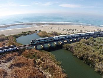
San Mateo Creek Lagoon at the mouth
|
|
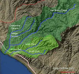
Map of San Mateo Creek and Arroyo San Onofre drainage basins. San Mateo Creek basin is in dark green.
|
|
| Other name(s) | Arroyo de San Mateo, Rio San Mateo |
| Country | United States |
| State | California |
| Region | San Diego County, Riverside County |
| District | Marine Corps Base Camp Pendleton |
| Physical characteristics | |
| Main source | canyon on the west face of San Mateo Peak Elsinore Mountains, within the Santa Ana Mountains, Cleveland National Forest, Riverside County, California, United States 2,800 ft (850 m) 33°37′12″N 117°23′17″W / 33.62000°N 117.38806°W |
| River mouth | San Mateo Creek (Southern California) Pacific Ocean, San Onofre State Beach, San Diego County 0 ft (0 m) 33°23′05″N 117°35′34″W / 33.38472°N 117.59278°W |
| Length | 22 mi (35 km) |
| Basin features | |
| Basin size | 139 sq mi (360 km2) |
| Tributaries |
|
San Mateo Creek is a stream in Southern California, United States. Its water flows mostly through Orange and San Diego Counties. The creek is about 22 miles (35 km) long and flows southwest.
It drains a wide valley between the Santa Ana Mountains and Santa Margarita Mountains. San Mateo Creek is special because it is one of the last streams in Southern California that has not been changed by human-made channels. This means it still flows naturally.
The area around San Mateo Creek is one of the least developed on the South Coast. Its basin covers 139 square miles (360 km2). This area includes parts of the Cleveland National Forest and Marine Corps Base Camp Pendleton. Long ago, Native Americans like the Acjachemen and Luiseño lived here. Later, Spanish settlers built large farms called ranchos. The creek's steady flow of water was important for farming. In the late 1800s, people even looked for gold in the upper parts of the creek. Today, most of the development in the area is still related to agriculture.
The San Mateo Creek area includes smaller streams that flow into it. These are Los Alamos Canyon Creek, Tenaja Canyon Creek, Devil Canyon Creek, and Cristianitos Creek. Even though some grazing (animals eating plants) has affected the area, it still has many different plants and animals. You can find riparian zones (areas along the water), grasslands, and coastal sage scrub. Recently, a type of fish called steelhead trout was found in the creek.
Contents
Where San Mateo Creek Flows
San Mateo Creek is about 22 miles (35 km) long. It starts in a canyon at the very end of the Santa Ana Mountains in Riverside County. At first, the creek flows through a deep, narrow gorge. Then, it moves into a wider, shallower valley. It gets water from four main streams and many smaller ones as it travels southwest to the Pacific Ocean.
The creek starts high up, at 2,800 ft (850 m), on the west side of San Mateo Peak. This area is inside the Cleveland National Forest. From there, San Mateo Creek flows south through a valley called Rancho Potrero de la Cienaga. This area has many springs that feed the creek. The canyon gets wider and deeper, about 600 feet (180 m) deep.
After flowing south for a few miles, the creek turns southeast to the Tenaja Falls. Here, it meets Los Alamos Canyon Creek, which flows in from the left. This creek and its smaller streams drain the southern slopes of Elsinore Peak. Another stream from the Santa Rosa Plateau also joins the creek where it turns west.
From Los Alamos Canyon Creek, San Mateo Creek turns southwest. It cuts a deep canyon between the Santa Ana and Santa Margarita Mountains. About 18 miles (29 km) from the ocean, Tenaja Canyon Creek joins from the left. Soon after, Bluewater Canyon Creek flows in from the right. Then, Nickel Canyon Creek also joins from the right, just north of the Riverside – San Diego County line.
The creek continues south. Devil Canyon Creek joins from the left about 15 miles (24 km) from the ocean. This is roughly where San Mateo Creek leaves the Cleveland National Forest. The narrow, 2,500-foot (760 m)-deep canyon then opens into a wide, flat valley. San Mateo Creek flows past Marine Corps Base Camp Pendleton, which is a training base for the United States Marine Corps. About 3.7 miles (6.0 km) from the ocean, Cristianitos Creek, the largest stream flowing into San Mateo Creek, joins from the right. Cristianitos Creek starts in Orange County and drains about 29 square miles (75 km2) of land.
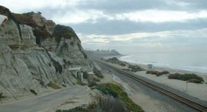
Finally, San Mateo Creek flows under Interstate 5 and into a small, freshwater lagoon. This lagoon is blocked by a sandbar at San Onofre State Beach. The lagoon only connects to the ocean during the rainy season. This part of the creek is very close to San Clemente. The lagoon is still quite natural, but it is being affected by pollution.
How the Land Formed
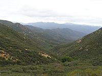
The San Mateo Creek area is shaped by the Santa Ana Mountains. These mountains are made of very old igneous (volcanic) and sedimentary (layered) rocks. On top of these are layers of granite, gabbro, and tonalite. The San Mateo Creek valley itself has hundreds of feet of alluvial deposits (sand, silt, and clay carried by water). Underneath these deposits are layers of sandstone, limestone, siltstone, mudstone, shale, and conglomerate.
These rock formations are found along most streams flowing from the west side of the Santa Ana Mountains. They are similar for many miles north.
The alluvial deposits came from the Wisconsinian glaciation. This was a time about 60,000 years ago when huge glaciers covered much of North America. The climate in Southern California changed a lot, with up to 80 inches (2,000 mm) of rain each year. At the same time, the sea level dropped by 300 to 400 feet (91 to 122 m). As the sea level fell, streams flowing into the Pacific Ocean dug deep canyons into their floodplains.
The rivers carved out channels about 400 feet (120 m) lower than before. When the Wisconsinian period ended, the sea level rose again. This filled the deep canyons, turning them into long, narrow inlets. Since the heavy rains stopped, the rivers became slow-moving again. Over thousands of years, these calm inlets filled with sediments, creating the flat valley floors we see today. Later, the sea level dropped slightly again. This allowed the rivers to cut new channels into their floodplains, forming the wide river terraces along San Mateo Creek.
Soil Types
Most of the soil in the San Mateo Creek area is loamy. This means it's a mix of sand, silt, and clay. The soil drains well and is very fertile in the lowlands. In the mountains, the soil is thin, with many exposed cliffs and large rocks. In the lower valley, the soils are sandy or silty loams with a clay layer underneath. These soils are considered "highly fertile," and there are some farms on the hills and flat areas near the creek.
San Mateo Creek's Watershed
The drainage basin of San Mateo Creek covers 139 square miles (360 km2). Most of it is in San Diego County, with a part in Orange County. It borders other creek areas, like Segunda Deshecha Cañada to the west and Arroyo San Onofre to the southeast. It is a bit larger than the nearby San Juan Creek watershed.
The upper parts of the watershed have canyons that are 200 to 2,500 feet (61 to 762 m) deep and 0.5 to 1 mile (0.80 to 1.61 km) wide. The lower part is a valley about 2.5 to 3 miles (4.0 to 4.8 km) wide and less than 1,000 feet (300 m) deep. The biggest stream that flows into San Mateo Creek is Cristianitos Creek. It is about 10 miles (16 km) long and drains 29 square miles (75 km2) of land. Other important areas that feed the creek include Talega Canyon, La Paz Creek, and Gabino Creek.
The Santa Ana Mountains separate San Mateo Creek from San Juan Creek to the northwest. The Santa Margarita Mountains separate San Mateo Creek from the Arroyo San Onofre to the southeast. Much of the upper San Mateo Creek watershed is in the Cleveland National Forest. The lower part is mostly within Marine Corps Base Camp Pendleton. The closest city is San Clemente, which is northwest of where the creek meets the ocean.
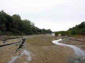
San Mateo Creek used to flow only during the rainy season. It would dry up by summer and start flowing again in the fall. Even though there are springs in the mountains, the water would sink into the ground once it reached the flat valley. Now, water from farms and a sewage treatment plant has made the creek flow all year. However, it doesn't get as much runoff as other Southern California streams.
Plants and Animals
The San Mateo Creek area has many different plants and animals. This is because it has a variety of elevations and plant types. These include riparian zones (areas along the water), woodlands near the streams, grasslands in the valleys, and chaparral and coastal sage scrub on the hills. The plants here are very similar to those found in the San Juan Creek area. The main difference is that San Mateo Creek does not have large residential areas.
Plants Along the Creek
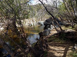
The mouth of the creek and its lower parts have many riparian plants. At the mouth, there is a freshwater lagoon and marshes. These areas have willow, sycamore, live oak, and cottonwood trees. The lower San Mateo Creek valley and its gentle slopes are home to coastal sage scrub plants. These include coast goldenbush, coyote brush, California sagebrush, mulefat, toyon, poison oak, California mugwort, Mexican elderberry, and California encelia. Where groundwater comes to the surface, you can find wild cucumber and gooseberry.
The freshwater marshes along San Mateo Creek are only a few hundred feet wide. They get their water mainly from groundwater. The most common plants here are bulrush (especially California bulrush) and cattail. There are also different types of burweeds and ferns. On the edges of the marshes and in small meadows, you can find goldenrod, hedge-nettle, fleshy jaumea, Mexican rush, saltgrass, and iceplant.
Amazing Animals
In February 1999, steelhead (Oncorhyncus mykiss irideus) were found in the creek. This made San Mateo Creek the only place south of Malibu Creek in Los Angeles County with these endangered fish. Steelhead have historically laid their eggs in the creek. The upper parts of the creek also have coastal rainbow trout, which are the same species but live in the stream all the time. About 11 miles (18 km) of streams in the area are good places for steelhead to live.
DNA tests have shown that the steelhead in San Mateo Creek are native to the area. They are not fish that were raised in a hatchery and then released. Steelhead lay their eggs mainly in winter. This is when heavy rain from the Santa Ana and Santa Margarita Mountains makes the creek flow strongly enough to break through the sandbar at San Onofre State Park. For a few weeks or months after, the steelhead lay their eggs, and then the adults go back to the ocean. In dry months, the streams in the lowlands shrink to small pools. These pools still support amphibians and small fish, including young steelhead, which need to live in freshwater for about a year. Recently, more steelhead have been seen in the creek.
Other fish and amphibians in the area include the endangered tidewater goby and arroyo toad. Tidewater gobies live in small, salty marshes near the mouth of the creek. Many birds also live here. Endangered bird species include the least Bell's vireo, California gnatcatcher, and willow flycatcher.
In early 2010, a golden beaver (Castor canadensis subauratus) was found near the mouth of San Mateo Creek. State Parks officials said that beavers used to live in the San Mateo Creek area but were thought to be gone. Beavers were also seen in a study of the lagoon near the creek mouth in 1987. An old report from 1866 mentioned that beavers were present in the county. The beaver may have come from the Santa Margarita River area, where golden beavers were brought back around 1940. There is even a creek named Beaver Hollow in San Diego County, which suggests beavers were there long ago.
History of the Creek
Evidence shows that Native Americans lived in the lower San Mateo Creek area for at least 8,000 years. One of their biggest villages was Panhe. It was located where San Mateo Creek and Cristianitos Canyon meet, about 3.7 miles (6.0 km) from the Pacific Ocean. The Native Americans fished in the creek's freshwater marshes. They lived by hunting and gathering. The village of Panhe may have had about 300 people before the first Spanish explorers arrived. It is still a sacred place for Native Americans today. Another Native American group, the Luiseño, lived in the upper parts of the creek.
The first non-native people to see the creek were Spanish explorers. They were part of the Gaspar de Portolá expedition in 1769. They camped near the creek on July 22. Padre Juan Crespi wrote in his diary that they found two young girls dying in a nearby native village. The Franciscan missionaries were allowed to baptize the girls. So, Crespi called the place "Los Christianos." The name was later changed to "Christianitos" (meaning "little Christians") and given to the creek. Many other creeks and canyons in the area were also given Spanish names, like San Juan Creek and Arroyo San Onofre.
After Mission San Juan Capistrano was built, the San Mateo Creek Valley was settled by the Spanish. They farmed and irrigated the land a lot. These practices affected the groundwater and water flow in the area. The land is slowly recovering from these changes.
Mexico became independent from Spain in 1822. In 1833, the missions were closed. This ended the mission period. Thousands of acres of land that belonged to the missions were divided into large land grants called ranchos. The 133,441-acre (540.02 km2) Rancho Santa Margarita y Las Flores was given to Pio and Andres Pico in 1841. They grew non-native crops, pumped water from the ground, and raised cattle. This greatly damaged the grasslands and areas along the creek. By 1860, people found gold, zinc, lead, and silver in the upper San Mateo Creek area. American miners came to the area. The rancho changed hands many times, and there were conflicts with Native Americans. In 1941, the U.S. Navy bought most of the land for Marine Corps Base Camp Pendleton for about $6.5 million.
Recently, there has been a discussion about extending California State Route 241 south through the lower San Mateo Creek valley. This road would connect to Interstate 5 near the creek's mouth. The project was suggested to help with traffic flow between Orange and San Diego Counties. Supporters say it would ease traffic and not harm the natural environment. However, others argue that the road would increase dirt in the creek, damage the waves at San Onofre State Beach, cause water pollution, and hurt endangered animals. Because of this project, American Rivers listed San Mateo Creek as the "nation's second-most imperiled waterway." No final decision has been made about the project yet.
 | Lonnie Johnson |
 | Granville Woods |
 | Lewis Howard Latimer |
 | James West |


