Timeline of town creation in Downstate New York facts for kids
The towns and cities of Downstate New York were created by the U.S. state of New York. These areas, called municipalities, were set up to give local people more say in their own government.
Long ago, from 1664 to 1683 (with a short break when the Dutch were in charge), the areas we now know as Westchester, Bronx, New York, Richmond, Kings, Queens, Nassau, and Suffolk counties were all part of something called York Shire.
York Shire was split into three parts: the East, West, and North Ridings. In 1683, New York changed its system. It got rid of shires and ridings. Instead, it created counties. The East Riding became Suffolk County. The West Riding became Richmond and Kings counties. The North Riding became Westchester (which included today's Bronx), New York, and Queens (which included today's Nassau).
New York tried different ways to organize its local areas. Finally, it settled on the system we have now: towns and cities. These towns and cities cover all the land in a county. In 1788, all of New York State was divided into towns. Before that, there were other types of local governments like land patents, districts, precincts, and boroughs.
At first, towns were just seen as simple parts of the state. They helped the state government do its job for all citizens. But in 1964, towns gained more power. This power is called "home rule." It means towns could make more of their own decisions. Now, a town is like its own local company. It includes all the people within its borders. Its goal is to use powers and do duties for local government and public matters, as allowed by law.
The charts below show how the current towns were created. They trace back to the very first local areas. These charts show which older towns helped create a new town. They do not show when land was added to or taken from existing towns. Unless noted, all places listed are towns. Some are marked as patent, township, borough, district, or city.
Contents
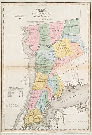
Westchester and Bronx Counties: How They Grew
| Bedford, Connecticut [A] Patent 1697–1704 |
Bedford [B] Patent 1704–1788 |
Bedford [B] 1788 |
|||||||||||||||||||||||||||
| North Castle [B] 1788 |
New Castle [B] 1791 |
Mount Kisco [B] 1978 |
|||||||||||||||||||||||||||
| Cortlandt [B] 1788 |
Peekskill [B] City 1940 |
||||||||||||||||||||||||||||
| Eastchester [B] 1788 |
Mount Vernon [B] City 1892 |
||||||||||||||||||||||||||||
| Greenburgh [B] 1788 |
|||||||||||||||||||||||||||||
| Harrison [B] 1788 |
|||||||||||||||||||||||||||||
| Mamaroneck [B] 1788 |
|||||||||||||||||||||||||||||
| Morrissania [B] 1788–1791 |
|||||||||||||||||||||||||||||
| Mount Pleasant [B] 1788 |
Ossining [B] 1845 |
||||||||||||||||||||||||||||
| North Salem [B] 1788 |
|||||||||||||||||||||||||||||
| Pelham [B] 1788 |
|||||||||||||||||||||||||||||
| Pound Ridge [B] 1788 |
|||||||||||||||||||||||||||||
| New Rochelle [B] 1788–1899 |
New Rochelle [B] City 1899 |
||||||||||||||||||||||||||||
| Rye [B] 1788 |
Rye City 1942 |
||||||||||||||||||||||||||||
| Salem [B] 1788 (South Salem from 1806 Lewisboro from 1840) |
|||||||||||||||||||||||||||||
| Scarsdale [B] 1788 |
|||||||||||||||||||||||||||||
| Stephentown [B] 1788 (Somers from 1808) |
|||||||||||||||||||||||||||||
| Westchester Borough 1696-1788 |
Westchester [C] 1788–1895 |
West Farms [C] 1846–1874 |
Morrisania [C] 1855–1874 |
||||||||||||||||||||||||||
| White Plains 1788–1915 |
White Plains [B] City 1915 |
||||||||||||||||||||||||||||
| Kings Bridge [C] 1872–1874 |
|||||||||||||||||||||||||||||
| Yonkers [B] 1788–1872 |
Yonkers [B] City 1872 |
||||||||||||||||||||||||||||
| Yorktown [B] 1788 |
|||||||||||||||||||||||||||||
New York County: The Story of New York City
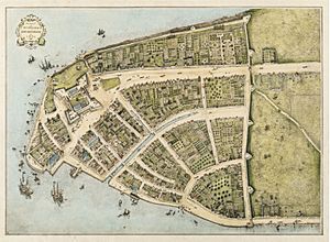
| Niew Amsterdam [A] City 1652 (New York from 1664) |
|||||
Richmond County: Staten Island's Past
| Northfield [A] 1788–1898 |
|||||||||||||
| Castleton [A] 1788–1898 |
|||||||||||||
| Middletown [A] 1860-1898 |
|||||||||||||
| Southfield [A] 1788–1898 |
|||||||||||||
| Westfield [A] 1788–1898 |
|||||||||||||
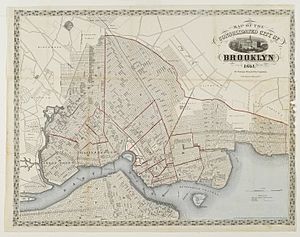
Kings County: The History of Brooklyn
| Brooklyn [B] Patent 1667–1788 |
Brooklyn [C] 1788–1834 |
Brooklyn [C] City 1834–1898 |
|||||||||||||||||||||||||||
| Bushwick [C] Patent 1708–1788 |
Bushwick [C] 1788–1854 |
Williamsburgh [C] 1840–1851 |
Williamsburgh [C] City 1851–1854 |
||||||||||||||||||||||||||
| Midwout [A] Patent 1652–1788 (Flatbush from 1667) |
Flatbush [C] 1788–1894 |
New Lots [C] 1852–1886 |
|||||||||||||||||||||||||||
| Flatlands [B] Patent 1667–1788 |
Flatlands [C] 1788–1896 |
||||||||||||||||||||||||||||
| Gravesend [A] Patent 1645–1788 |
Gravesend [C] 1788–1894 |
||||||||||||||||||||||||||||
| New Utrecht [A] Patent 1662–1788 |
New Utrecht [C] 1788–1894 |
||||||||||||||||||||||||||||
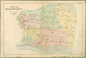
Queens and Nassau Counties: From Old to New Towns
| Oyster Bay [B] Patent 1667–1788 |
Oyster Bay [C] 1788 |
Glen Cove [D] City 1917 |
|||||||||||||||||||
| Hempstead [A] Patent 1644–1788 (South Hempstead from 1784) |
South Hempstead [C] 1788 (Hempstead from 1796) |
Long Beach [D] City 1923 |
|||||||||||||||||||
| North Hempstead [C] Patent 1784–1788 |
North Hempstead [C] 1788 |
||||||||||||||||||||
| Vlissengen [A] Patent 1645–1788 (Flushing from 1664) |
Flushing [E] 1788–1898 |
||||||||||||||||||||
| Jamaica [A] Patent 1660–1788 |
Jamaica [E] 1788–1898 |
||||||||||||||||||||
| Middelburgh [A] Patent 1652–1788 (Newtown from 1664) |
Newtown [E] 1788–1898 |
Long Island City [E] City 1870–1898 |
|||||||||||||||||||
Suffolk County: Eastern Long Island's Beginnings
| Brookhaven [A] Patent 1666–1788 |
Brookhaven [A] 1788 |
||||||||||||||||||||
| East Hampton [A] Patent 1666–1788 |
East Hampton [A] 1788 |
||||||||||||||||||||
| Huntington [A] Patent1666–1788 |
Huntington [A] 1788 |
Babylon [A] 1872 |
|||||||||||||||||||
| Precincts of Islip [A] 1710–1788 |
Islip [A] 1788 |
||||||||||||||||||||
| Shelter Island [A] Patent 1666–1788 (United government with Southold until 1730) |
Shelter Island [A] 1788 |
||||||||||||||||||||
| Smithtown [A] Patent 1677–1788 |
Smithtown [A] 1788 |
||||||||||||||||||||
| Southampton [A] Patent 1676–1788 |
Southampton [A] 1788 |
||||||||||||||||||||
| Southold [A] Patent 1676–1788 |
Southold [A] 1788 |
Riverhead [A] 1792 |
|||||||||||||||||||
 | Charles R. Drew |
 | Benjamin Banneker |
 | Jane C. Wright |
 | Roger Arliner Young |


