Dorchester, Boston facts for kids
Quick facts for kids
Dorchester, Boston
|
||
|---|---|---|
|
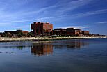
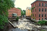
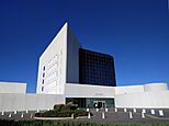
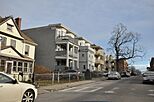
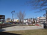
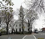
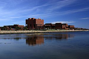
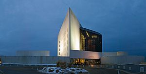
Left-right from top: University of Massachusetts Boston campus, Neponset River at Lower Mills , JFK Presidential Library, Lawrence Avenue Historic District, Edward Everett Square, First Parish Church of Dorchester
|
||
|
||
| Nickname(s):
Dot
|
||
| Motto(s):
Pietate, Literis, Industria (Latin)
"Piety, Learning, [and] Industry" |
||
| Country | United States | |
| State | Massachusetts | |
| County | Suffolk | |
| Neighborhood of | Boston | |
| Settled | May 1630 | |
| Incorporated | June 1, 1630 | |
| Annexed by Boston | January 4, 1870 | |
| Named for | Dorchester, Dorset | |
| Population
(2010)
|
||
| • Total | 91,982 to 134,000 | |
| Time zone | UTC-5 (Eastern) | |
| • Summer (DST) | UTC-4 (Eastern) | |
| ZIP Codes |
02121, 02122, 02124, 02125, 02126 (part of 02126 includes the Dorchester Lower Mills section of Dorchester)
|
|
| Area code(s) | 617 and 857 | |
Dorchester (/ˈdɔːrtʃɛstər/) is a large neighborhood in Boston, Massachusetts, United States. It covers more than 6 square miles (16 km²). Dorchester was first settled in 1630 by Puritans from Dorchester, Dorset, England. It was a separate town for many years.
Later, in 1870, Dorchester became part of Boston. It is now Boston's biggest neighborhood. City planners sometimes divide it into two parts because it is so large. The neighborhood is named after the English town where its first settlers came from.
Dorchester was founded just a few months before Boston itself. When it joined Boston, it was mostly a rural area with about 12,000 people. As railroads and streetcars were built, the population grew quickly. By 1920, about 150,000 people lived there. In 2010, the population was around 92,115.
Today, Dorchester is known for its diverse population. Many different groups live here, including African Americans, European Americans (especially those with Irish, German, Italian, and Polish backgrounds). More recently, people have moved here from the Caribbean, Central and South America, and East and Southeast Asian Americans.
Dorchester also has a notable LGBT community. It has one of the largest numbers of same-sex couples in Boston. Most adults over 25 in Dorchester have finished high school.
Contents
- History of Dorchester
- Geography of Dorchester
- People of Dorchester
- Getting Around Dorchester
- Economy of Dorchester
- Education in Dorchester
- Housing in Dorchester
- Community Safety
- Community Life
- Fun Things to Do in Dorchester
- Parks and Outdoor Activities
- Interesting Places to See
- Famous People from Dorchester
History of Dorchester
Early People of the Land
Before Europeans arrived, the Massachusett lived in the Dorchester area. They settled near the Neponset River, which provided plenty of fish. They also gathered shellfish and hunted animals like beaver and deer. They had farms on the nearby hills.
When Puritan settlers came, the Massachusett people faced many challenges. Their population quickly dropped due to new diseases. The Massachusett leader, Chickatawbut, made land agreements with the Puritans. He died in 1633 from smallpox. His brother, Cutshamekin, continued to give land to the settlers. Some Massachusett people, including Cutshamekin, later moved to a "praying town" called Natick.
European Settlement in the 1600s
In 1623, fishermen from England set up a fishing spot in Dorchester. Later, in 1626, David Thompson and his family settled on Thompson Island. This was before the main Puritan migration in 1630.
On May 30, 1630, the ship Mary and John arrived in Boston Harbor. On June 17, 1630, eight men landed on the Dorchester shore. This spot is now called Columbia Point. These settlers helped found the town. The first settlement was near what is now Columbia Road and Massachusetts Avenue. Even though Dorchester is part of Boston now, residents still celebrate its founding on Dorchester Day each year. This includes a parade down Dorchester Avenue.
Most early Dorchester settlers came from western England. Many were from Dorchester, Dorset, where Rev. John White supported a Puritan settlement in America. The town grew around the First Parish Church of Dorchester. This church is now the oldest religious group in Boston.
The first Town Meeting in what would become the United States happened in Dorchester on October 8, 1633. Today, October 8 is celebrated as Town Meeting Day in Massachusetts. Dorchester is also home to America's first public elementary school, Mather School, founded in 1639. It is still the oldest elementary school in the U.S.
In 1634, Israel Stoughton built one of America's first mills on the Neponset River. Richard Callicott started a trading post nearby. In 1641, Dorcas ye blackmore, an enslaved person, was the first African American to join a church in New England.
In 1649, missionaries like John Eliot began to teach Christianity to the Indigenous people in Dorchester. The town gave Eliot land for his mission, where he started a church and school.
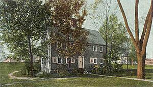
The James Blake House, built in 1661, is the oldest house still standing in Boston. It is located near Edward Everett Square.
The 1700s in Dorchester
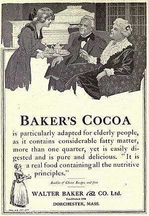
In 1765, an Irish chocolate maker named John Hannon brought cocoa beans from the West Indies. He worked with Dr. James Baker to open America's first chocolate factory in the Lower Mills area of Dorchester. The Walter Baker Chocolate Factory operated until 1965.
Before the American Revolution, the Sons of Liberty met in Dorchester. Dorchester was also where the Battle of Dorchester Heights took place in 1776. This battle led the British to leave Boston.
Dorchester was first part of Suffolk County. In 1793, it moved to Norfolk County. Later, parts of Dorchester that joined Boston became part of Suffolk County again.
The 1800s: Growth and Change
During the Victorian era, Dorchester became a popular place for wealthy Boston families to visit. It grew into a "bedroom community" where people lived and traveled to the city for work. John F. Kennedy's mother and grandparents lived in the Ashmont Hill area.
The poet Oliver Wendell Holmes Sr. wrote a poem about "Roxbury puddingstone," a special stone from Dorchester. This stone was used to build churches in Boston.
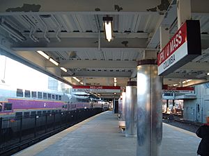
In 1845, the Old Colony Railroad came through Dorchester, connecting Boston and Plymouth, Massachusetts. The train station here is now called JFK/UMASS. It serves both the Red Line subway and commuter rail lines.
In the 1840s and 1850s, new homes were built along Dorchester Bay. This area, known as Clam Point, became a summer resort by the 1890s.
In the 1880s, a large pumping station was built on Columbia Point to treat Boston's sewage. This station was a model for other cities around the world. It is now a historic building.
Dorchester Joins Boston
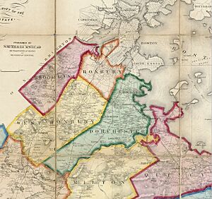
Dorchester became part of Boston in several steps. The process started in 1804 and finished on January 3, 1870. This is why Dorchester Heights is now considered part of South Boston, not modern Dorchester. Other parts of Dorchester also became separate towns like Hyde Park, Milton, and Stoughton.
In 1895, Frederick Law Olmsted, who designed the Boston Public Garden and Central Park in New York City, created Dorchester Park. It was meant to be a green space for the growing community.
In 1904, the Dorchester Historical Society started "Dorchester Day." This day celebrates the town's founding in 1630. It includes community events and a parade.
The Early 1900s
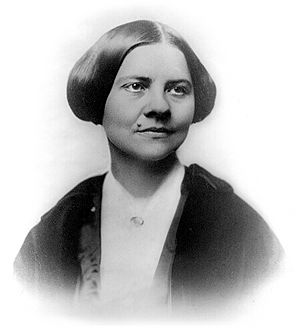
In the late 1800s and early 1900s, Dorchester was a place for community action. The first neighborhood where people of different races lived together developed on Jones Hill. William Monroe Trotter, who lived there, helped start the Niagara Movement. This group was a step toward forming the National Association for the Advancement of Colored People. Many important women who fought for voting rights, like Lucy Stone, also lived in Dorchester.
In the early 1900s, many Catholic immigrants from Ireland, Italy, and Poland moved to Dorchester. Also, thousands of African Americans moved from the South to northern cities like Boston for work. Many "three-decker" apartment buildings were built in Dorchester to house these new residents.
From the 1950s to Today
In the early 1950s, Dorchester became a center for civil rights efforts by African Americans. Martin Luther King Jr. lived here while studying for his PhD at Boston University.
From the 1960s to the 1980s, the groups of people living in Dorchester changed a lot. Many families of Jewish, Italian, and Irish backgrounds moved to the suburbs. New immigrants from Africa, Asia, and the Caribbean moved into the older homes.
The first community health center in the United States opened in Dorchester in 1965. It was called the Columbia Point Health Center. It served the large public housing complex nearby. This center is still open today as the Geiger-Gibson Community Health Center.
In 1974, the University of Massachusetts Boston moved to Columbia Point in Dorchester. The university has grown a lot since then. It has hosted important events, like a presidential debate in 2000.
In 1977, the John F. Kennedy Presidential Library and Museum was built on Columbia Point. It was designed by architect I. M. Pei and opened in 1979.
By the 1980s, the Blue Hill Avenue area of Dorchester was mostly a Black community. In the 1990s, the city worked to improve safety and invested in the area.
On March 30, 2015, the Edward M. Kennedy Institute for the United States Senate was opened by President Barack Obama.
Geography of Dorchester
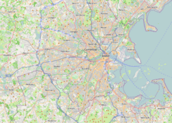
Dorchester is located south of downtown Boston. It is next to neighborhoods like South Boston, Roxbury, and Hyde Park. The Neponset River separates Dorchester from the cities of Quincy and Milton.
Sections and Squares
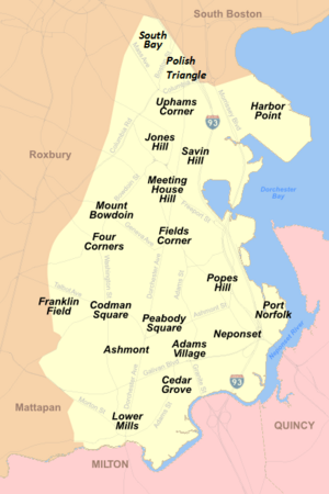
Dorchester is Boston's largest neighborhood. It has many smaller sections and squares. Because it's so big, it's often split into North and South Dorchester for planning.
North Dorchester is the part north of Quincy, East, and Freeport streets. The main shopping area here is Uphams Corner.
South Dorchester is next to Dorchester Bay on the east and the Neponset River on the south. Key shopping areas include Fields Corner and Codman Square.
Dorchester Avenue is a main road that runs through all of Dorchester. The southern part of Dorchester is mostly homes. The northern part is more city-like, with more apartments and business areas. South Bay and the Newmarket industrial area offer many jobs.
The Harbor Point area, once called Columbia Point, has several large employers. These include the University of Massachusetts Boston, the Massachusetts Archives and Commonwealth Museum, the Edward M. Kennedy Institute for the United States Senate, and the John F. Kennedy Presidential Library and Museum.
Other important areas include Bowdoin/Geneva, Fields Corner, Codman Square, Peabody Square, Adams Village, and Lower Mills. Residential areas include Savin Hill, Jones Hill, Four Corners, Franklin Field, Ashmont, Meeting House Hill, Neponset, Popes Hill, and Port Norfolk.
People of Dorchester
Dorchester has a very diverse population. Different parts of the neighborhood have different groups of people. For example, the eastern areas have many Irish Americans and Vietnamese Americans. The western and central parts are mostly African American. The Neponset area has a strong Irish-American identity.
The Polish Triangle in northern Dorchester has many recent Polish immigrants. Savin Hill and Fields Corner have large Vietnamese-American populations. Uphams Corner is home to a big Cape Verdean-American community. Western and central Dorchester have many people from the Caribbean, like Haiti, Jamaica, and Trinidad and Tobago.
In recent years, many young people, gay men and women, and artists have moved to Dorchester.
Getting Around Dorchester
Dorchester has good public transportation. It has five stations on the Massachusetts Bay Transportation Authority Red Line (MBTA) subway. It also has stations on the Mattapan Line and the Fairmount Commuter Rail Line. Many bus routes also serve the neighborhood.
The Dorchester part of the Red Line has been updated. Four stations were rebuilt: Savin Hill, Fields Corner, Shawmut, and Ashmont. At Ashmont station, a new building called The Carruth was built. It is one of the first projects in the state that combines housing with public transit.
Interstate 93 runs through Dorchester, connecting it to Quincy, Massachusetts, and downtown Boston. Other state roads like Route 203 and Route 28 also go through the neighborhood. The "Dorchester Turnpike," now called "Dorchester Avenue," was once used by horse-drawn streetcars.
Some of Dorchester's oldest streets have changed names many times over the years.
Economy of Dorchester
Dorchester has seen ups and downs in its economy. In the 1960s and 1970s, it faced economic challenges.
In 1953, Carney Hospital moved to Dorchester. It serves the communities of Dorchester, Mattapan, Milton, and Quincy.
Also in 1953, a large public housing project was built on the Columbia Point peninsula. It had many apartments. Over time, it faced difficulties. In 1984, the city gave control to a private company. They turned it into a mixed-income community called Harbor Point Apartments. This was the first time a federal housing project was changed into private, mixed-income housing in the U.S. Harbor Point has won many awards for this change.
In 2008, there were plans to redevelop the Bayside Exposition Center site on Columbia Point. The idea was to create a new village with shops and homes. However, the property was later bought by the University of Massachusetts Boston for future campus buildings.
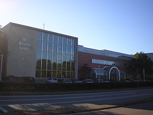
The main office of The Boston Globe newspaper was in Dorchester from 1958 until 2017. Many labor unions in Boston have also moved their offices to Dorchester.
Education in Dorchester
Schools for Kids
Students in Dorchester go to schools run by Boston Public Schools (BPS). BPS places students based on their choices and other factors.
Dorchester High School was around even before Dorchester joined Boston. It first opened in 1852 for boys. In 1870, Boston took over its schools. The high school moved to a new building in 1901 and then again in 1925. In 1953, it became a school for both boys and girls.
Some BPS schools in Dorchester include:
- Boston Arts Academy (grades 9–12)
- Boston International Newcomers Academy (grades 9–12)
- Boston Latin Academy (grades 7–12)
- Jeremiah E. Burke High School (grades 9–12)
- Mather Elementary (grades K1–5), which is the oldest elementary school in the United States.
- TechBoston Academy (grades 6–12)
There are also several charter schools in Dorchester, like Boston Collegiate Charter School and Codman Academy Charter Public School.
Catholic Schools
Some Catholic schools in Dorchester have closed over the years. The ones still open include:
- Boston College High School (grades 7–12)
- Cristo Rey Boston High School (grades 9–12)
- St. Brendan School (grades K-6)
- Pope John Paul II Catholic Academy, which has three locations.
Colleges and Universities
- The University of Massachusetts Boston is a public research university. It is the second largest campus in the University of Massachusetts system. It is located on Columbia Point in Dorchester. The university offers many different degrees. It has a diverse student population of about 13,000 students.
- Labouré College is a Catholic college that offers degrees in nursing and health sciences. It is located near the Carney Hospital campus in the Lower Mills area.
Public Libraries
The Boston Public Library has six branches in Dorchester:
- Adams Street Branch
- Codman Square Branch
- Fields Corner Branch
- Grove Hall Branch
- Lower Mills Branch
- Uphams Corner Branch
Housing in Dorchester
Most people in Dorchester, about 63%, live in rented homes. The average monthly rent is around $1,450. About 35% of people own their homes.
Dorchester has many types of homes. About 27% are single-family homes, 23% are two-family homes, and 24% are three-family homes. About 25% are condo units.
Community Safety
The Boston Police District C-11 is located in Dorchester. They work to build trust and help the neighborhood. They hold many community meetings each month. This allows the police to work with residents, businesses, and faith leaders. They also share tips on how to prevent crime and stay safe.
Community Life
Dorchester has a total population of about 114,235 people. Around 15,530 of them are under 18 years old.
The former president of Trader Joe's opened a non-profit food shop called the Daily Table in Dorchester.
Ella J. Baker House
The Ella J. Baker House was a community youth center in the Four Corners area of Dorchester. It used to co-host the W. E. B. Du Bois Society, a program for African American high school students. The Ella J. Baker House is now closed.
Fun Things to Do in Dorchester
Dorchester has many attractions for visitors and residents. These include:
- The John F. Kennedy Presidential Library and Museum
- The Edward M. Kennedy Institute for the United States Senate
- Boston Winery and Boston Harbor Distillery
- The Strand Theatre
- The Commonwealth Museum
- The Franklin Park Zoo
- The Neponset River Greenway and Lower Neponset River Trail
Fields Corner is a busy commercial area in Dorchester. It has many restaurants, pubs, and unique clothing stores. It is known for its Irish pubs and Vietnamese restaurants. Near Fields Corner is Hilltop Park, an 11-acre park with great views of Dorchester Bay.
Parks and Outdoor Activities
Parks
- Pope John Paul II Park Reservation: This park is about 66 acres. It used to be a landfill and a drive-in theater. Now, it has picnic areas, soccer fields, play areas, and walking paths. It's open all year.
- Dorchester Park: Established in 1861, this 30-acre park is in the southern part of Dorchester. It is across from the Neponset River. The park hosts events like the Annual Classic Car Show and Family Fun Day. Dorchester Park is listed on the National Register of Historic Places.
- Franklin Park: This large park, established in 1885, covers 485 acres. It has paths for walking and running, tennis courts, baseball fields, golf courses, and basketball courts. The Franklin Park Zoo is also located here, with over 220 different animal species. The Kite and Bike festival is held here every year.
Bike Trails
- Lower Neponset River Trail: This 2.4-mile path is great for running, biking, and walking. It goes from the Port Norfolk neighborhood, through Pope John Paul II Park, and along the Neponset River.
- Neponset River Green way: This trail is 5 miles long. It offers views of the salt marsh in Pope John Paul Park II and Tenan Beach. You can easily reach it from several MBTA Red Line stations.
- DotGreenway: There are plans for a new greenway for walkers and bikers. It would connect Talbot Avenue and Park Street along the MBTA Red Line tunnel.
Interesting Places to See
Dorchester has many places listed on the National Register of Historic Places.
| Name on the Register | Date listed | Location |
| All Saints' Church | June 16, 1980 | 211 Ashmont St. |
| James Blake House | May 1, 1974 | 735 Columbia Rd. |
| Calf Pasture Pumping Station Complex | August 2, 1990 | 435 Mount Vernon St. |
| Clapp Houses | May 2, 1974 | 199 and 195 Boston St. |
| Codman Square District | June 23, 1983 | Norfolk, Talbot, Epping, Lithgow, Centre, and Moultrie Sts. |
| Dorchester North Burying Ground | April 18, 1974 | Stoughton St. and Columbia Rd. |
| Dorchester Park | February 20, 2008 | Bounded by Dorchester Ave., Richmond, Adams, and Richview Sts. |
| Dorchester Pottery Works | February 21, 1985 | 101–105 Victory Rd. |
| Dorchester South Burying Ground | June 27, 2014 | 2095 Dorchester Ave. |
| Dorchester-Milton Lower Mills Industrial District | April 2, 1980 | Both sides of the Neponset River; also Adams, River, and Medway Sts., Millers Lane, and Eliot and Adams Sts. |
| Fields Corner Municipal Building | November 12, 1981 | 1 Arcadia St., 195 Adams St. |
| Harrison Square Historic District | October 22, 2002 | Bounded by MBTA Braintree line embankment, Park, Everett, Freeport, Mill, Asland, Blanche Sts., Victory Rd. |
| The Peabody | August 8, 2001 | 195–197 Ashmont St. |
| Pierce House | April 26, 1974 | 24 Oakton Ave. |
| Pilgrim Congregational Church | December 18, 2013 | 540–544 Columbia Road |
| Savin Hill Historic District | May 9, 2003 | Roughly bounded by Savin Hill Ave., Morrissey Boulevard, Dorchester Bay, and Interstate 93 |
| William Monroe Trotter House | May 11, 1976 | 97 Sawyer Ave. |
| Upham's Corner Market | October 11, 1990 | 600 Columbia Rd. |
Other interesting places include:
- Bayside Expo Center (now owned by University of Massachusetts Boston)
- Captain Lemuel Clap House
- Commonwealth Museum
- Dorchester Park
- Edward M. Kennedy Institute for the United States Senate
- First Parish Church of Dorchester
- Franklin Park Zoo
- James Blake House
- John F. Kennedy Presidential Library and Museum
- Neponset River State Reservation
- University of Massachusetts Boston Harbor Campus
- William Clapp House
- William Monroe Trotter House
- Eire Pub, visited by presidents
Famous People from Dorchester
- Sheldon Adelson – businessman
- Ray Bolger – actor, played the Scarecrow in The Wizard of Oz
- William M. Bulger – politician
- Herb Chambers – car dealership owner
- James B. Conant – former president of Harvard University
- Norm Crosby – entertainer
- Ayo Edebiri – actress and comedian
- Mike Gorman – TV announcer for the Boston Celtics
- Kay Hanley – singer for Letters to Cleo
- Kevin Hayes – professional ice hockey player
- Joseph P. Kennedy – father of President John F. Kennedy
- Rose Kennedy – mother of President John F. Kennedy
- John King – journalist for CNN
- Jonathan Knight – singer, New Kids on the Block
- Jordan Knight – singer, New Kids on the Block
- Dennis Lehane – author of Mystic River
- John Mason – colonial military officer
- Increase Mather – Puritan minister
- Albert and David Maysles – documentary filmmakers
- Leonard Nimoy – actor, played Spock on Star Trek
- Lawrence O'Donnell – TV host on MSNBC
- Richard Scarry – children's books author and illustrator
- Lucy Stone – fought for women's rights
- Donna Summer – pop and disco singer
- Donnie Wahlberg – singer and actor
- Mark Wahlberg – actor and producer
- Marty Walsh – former Mayor of Boston
- Danny Wood – singer, New Kids on the Block
 | William L. Dawson |
 | W. E. B. Du Bois |
 | Harry Belafonte |


