Amarillo, Texas facts for kids
Quick facts for kids
Amarillo, Texas
|
|||
|---|---|---|---|
|
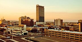
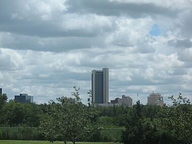
Downtown Amarillo
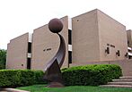
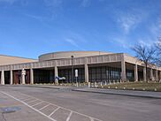
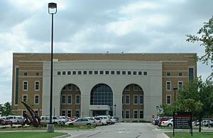
Amarillo High School
|
|||
|
|||
| Country | United States | ||
| State | Texas | ||
| Counties | Potter and Randall | ||
| Named for | Amarillo Lake | ||
| Government | |||
| • Type | Council-Manager | ||
| • Body | City Council | ||
| Area | |||
| • City | 103.86 sq mi (268.99 km2) | ||
| • Land | 102.30 sq mi (264.97 km2) | ||
| • Water | 1.56 sq mi (4.03 km2) | ||
| Elevation | 3,662 ft (1,116 m) | ||
| Population
(2020)
|
|||
| • City | 200,393 | ||
| • Density | 1,948.81/sq mi (752.44/km2) | ||
| • Urban | 205,860 (US: 187th) | ||
| • Urban density | 2,450.9/sq mi (946.3/km2) | ||
| • Metro | 269,703 (US: 182nd) | ||
| Demonym(s) | Amarilloan | ||
| Time zone | UTC−6 (CST) | ||
| • Summer (DST) | UTC−5 (CDT) | ||
| ZIP Codes |
79101–79111, 79114, 79116–79121, 79123–79124, 79159, 79163, 79166–79168, 79171–79172, 79174, 79178, 79182, 79185, 79187, 79189
|
||
| Area code | 806 | ||
| FIPS code | 48-03000 | ||
| GNIS feature ID | 2409694 | ||
Amarillo (pronounced AM-ə-RIL-oh) is a city in Texas, USA. It is the main city in the Texas Panhandle region. Amarillo is also the county seat of Potter County. A small part of the city is in Randall County. In 2020, about 200,393 people lived in Amarillo. This is almost half the population of the entire Panhandle area. The larger Amarillo metropolitan area had about 308,297 people in 2020.
The city was first called Oneida. It is located in the Llano Estacado region. The arrival of the Fort Worth and Denver City Railroad helped Amarillo grow. It became a big center for selling cattle in the late 1800s.
Amarillo was once known as the "Helium Capital of the World." This was because it had one of the best helium fields in the country. The city is also called "The Yellow Rose of Texas" or "Yellow City." This is because "Amarillo" means "yellow" in Spanish. It's also known as "Rotor City, USA" because of a special aircraft factory there. Amarillo is a major center for meat-packing in the U.S. Pantex, the only place in the country that assembles and disassembles nuclear weapons, is also a big employer. This facility led to the nickname "Bomb City."
Contents
History of Amarillo
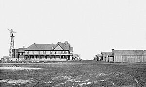
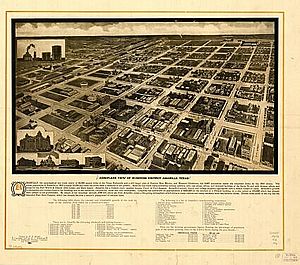
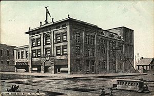
Amarillo started in April 1887. J. I. Berry picked a spot near the Fort Worth and Denver City Railroad. He wanted this new town to be the main trading hub. On August 30, 1887, Berry's town became the county seat of Potter County. The railroad helped the town quickly grow into a cattle-marketing center.
The settlement was first named Oneida. Later, it changed to Amarillo. This name likely came from yellow wildflowers or nearby Amarillo Lake and Creek. These were named for the yellow soil around them. "Amarillo" is the Spanish word for yellow.
In June 1888, Henry B. Sanborn started buying land to the east. He thought Berry's site was too low and would flood. Sanborn offered land in the new spot to businesses. He even helped them move their buildings. Slowly, people began to move to Sanborn's location. Heavy rains in 1889 almost flooded Berry's area, making more people move. In 1893, Sanborn's town became the new county seat.
By the late 1890s, Amarillo was a very busy cattle-shipping point. Its population grew a lot. The city also became a center for grain, milling, and feed production. This happened after wheat and other small grains became more common in the early 1900s. In 1918, natural gas was found, and oil three years later. This brought many oil and gas companies to Amarillo.
The U.S. government bought the Cliffside Gas Field in 1927. It had a lot of helium. The Federal Bureau of Mines started the Amarillo Helium plant in 1929. For many years, this plant was the only place in the world producing commercial helium. The U.S. National Helium Reserve is still stored nearby.
Other railroads, like the Atchison, Topeka and Santa Fe Railway and Chicago, Rock Island and Pacific Railroad, also came to Amarillo. These companies had large freight and passenger stations. They were big employers in the city for most of the 20th century.
Amarillo was affected by the Dust Bowl and a tough economic time. But it became a major stop for tourists. This was because U.S. Routes 60, 87, 287, and 66 all met there. Many motels, restaurants, and souvenir shops opened. During World War II, the Amarillo Army Air Field and the Pantex Army Ordnance Plant opened. Pantex made bombs and ammunition. Both closed after the war. But the Pantex Plant reopened in 1950. It made nuclear weapons during the Cold War.
On May 15, 1949, a powerful F4 tornado hit Amarillo. It caused a lot of damage and sadly, seven people died. The tornado touched down near Hereford and moved towards Amarillo. It ripped through busy parts of the city, causing widespread destruction.
In 1951, the army air base became Amarillo Air Force Base again. It grew to hold Strategic Air Command B-52 Stratofortress planes. Many military families moved to Amarillo, helping the city's economy. Between 1950 and 1960, Amarillo's population almost doubled. However, when the Air Force Base closed in 1968, the population dropped.
In the 1980s, large companies like ASARCO, Iowa Beef Processors (now Tyson Foods), and Owens-Corning built plants in Amarillo. Many immigrants from countries like Vietnam and Laos moved to the Eastridge neighborhood. They found jobs at the Iowa Beef Processors plant. The Interstate 27 highway, connecting Lubbock to Amarillo, was mostly built in the 1980s.
In May 1982, another strong tornado hit Amarillo's western suburbs. It caused damage but no deaths were reported.
Geography of Amarillo
Amarillo is located in the middle of the Texas Panhandle. Its weather is different from south and east Texas. It sits in the grasslands of the Panhandle, surrounded by open prairie. Amarillo is known for its unpredictable weather. Temperatures can change a lot in one day. It can have strong winds, big hailstorms, droughts, and even spring tornadoes.
Even with city growth and farming, much of the native grasslands remain. Amarillo is closer to the state capitals of Oklahoma, New Mexico, and Colorado than it is to Austin. The land here is mostly flat. Rain often evaporates or collects in small playa lakes because there isn't much natural drainage. The city covers about 90.3 square miles (233.9 square kilometers). Most of this is land, with a small amount of water. The Amarillo metropolitan area includes four counties: Armstrong, Carson, Potter, and Randall.
About 20 miles (32 km) northeast of Amarillo is the Canadian River. This river divides the Western High Plains region. South of the High Plains is the Llano Estacado (Staked Plains). The Canadian River is dammed to form Lake Meredith. This lake is a main source of drinking water for the Texas Panhandle. The city is also near the Panhandle Field. This area is rich in gas and oil. It covers 200,000 acres (809 square kilometers) across several counties. The Potter County part once had the largest natural gas reserve in the U.S. About 25 miles (40 km) south of Amarillo is the Palo Duro Canyon system.
Amarillo's Climate
| Weather chart for Amarillo, Texas | |||||||||||||||||||||||||||||||||||||||||||||||
|---|---|---|---|---|---|---|---|---|---|---|---|---|---|---|---|---|---|---|---|---|---|---|---|---|---|---|---|---|---|---|---|---|---|---|---|---|---|---|---|---|---|---|---|---|---|---|---|
| J | F | M | A | M | J | J | A | S | O | N | D | ||||||||||||||||||||||||||||||||||||
|
0.7
52
25
|
0.5
56
28
|
1.3
65
35
|
1.5
72
43
|
2.3
81
53
|
2.9
90
62
|
2.8
93
66
|
2.9
91
65
|
1.7
84
58
|
1.8
73
45
|
0.8
61
34
|
0.7
52
26
|
||||||||||||||||||||||||||||||||||||
| temperatures in °F precipitation totals in inches |
|||||||||||||||||||||||||||||||||||||||||||||||
|
Metric conversion
|
|||||||||||||||||||||||||||||||||||||||||||||||
Amarillo has a temperate semi-arid climate. This means it's usually dry but not a desert. Winters have big temperature changes between day and night. The weather can change quickly, with sudden cold fronts called "blue northers." Blizzards can happen, but snowfall is usually light. Summers are hot with low humidity.
The city gets about 20.4 inches (518 mm) of rain each year. Most of the rain comes from heavy thunderstorms in late spring and summer. Amarillo is in "Tornado Alley." This means it can have severe weather, especially from April to July. These storms can bring strong winds, large hail, tornadoes, and flash floods. The strongest tornado to hit Amarillo was an F4 in 1949.
The average temperature in January is 38.6°F (3.7°C). In July, it's 79.6°F (26.4°C). Amarillo gets almost 3300 hours of sunshine every year. It is also known as the windiest city in the U.S.
| Climate data for Amarillo, Texas, 1991–2020 normals, extremes 1892–present | |||||||||||||
|---|---|---|---|---|---|---|---|---|---|---|---|---|---|
| Month | Jan | Feb | Mar | Apr | May | Jun | Jul | Aug | Sep | Oct | Nov | Dec | Year |
| Record high °F (°C) | 83 (28) |
89 (32) |
96 (36) |
99 (37) |
104 (40) |
111 (44) |
110 (43) |
108 (42) |
105 (41) |
99 (37) |
88 (31) |
83 (28) |
111 (44) |
| Mean maximum °F (°C) | 71.4 (21.9) |
76.5 (24.7) |
83.5 (28.6) |
88.6 (31.4) |
94.7 (34.8) |
99.7 (37.6) |
100.3 (37.9) |
98.2 (36.8) |
95.2 (35.1) |
88.6 (31.4) |
79.7 (26.5) |
71.8 (22.1) |
102.4 (39.1) |
| Mean daily maximum °F (°C) | 52.2 (11.2) |
56.1 (13.4) |
64.8 (18.2) |
72.4 (22.4) |
80.9 (27.2) |
89.7 (32.1) |
92.9 (33.8) |
91.0 (32.8) |
84.0 (28.9) |
73.0 (22.8) |
61.3 (16.3) |
51.9 (11.1) |
72.5 (22.5) |
| Daily mean °F (°C) | 38.6 (3.7) |
41.8 (5.4) |
49.8 (9.9) |
57.5 (14.2) |
66.8 (19.3) |
76.1 (24.5) |
79.6 (26.4) |
78.1 (25.6) |
70.9 (21.6) |
59.2 (15.1) |
47.4 (8.6) |
38.8 (3.8) |
58.7 (14.8) |
| Mean daily minimum °F (°C) | 24.9 (−3.9) |
27.5 (−2.5) |
34.8 (1.6) |
42.5 (5.8) |
52.6 (11.4) |
62.4 (16.9) |
66.4 (19.1) |
65.3 (18.5) |
57.8 (14.3) |
45.4 (7.4) |
33.5 (0.8) |
25.7 (−3.5) |
44.9 (7.2) |
| Mean minimum °F (°C) | 7.4 (−13.7) |
8.6 (−13.0) |
16.8 (−8.4) |
27.2 (−2.7) |
37.5 (3.1) |
50.4 (10.2) |
57.4 (14.1) |
56.6 (13.7) |
41.8 (5.4) |
29.0 (−1.7) |
16.0 (−8.9) |
6.8 (−14.0) |
0.3 (−17.6) |
| Record low °F (°C) | −11 (−24) |
−16 (−27) |
−3 (−19) |
13 (−11) |
26 (−3) |
38 (3) |
51 (11) |
48 (9) |
30 (−1) |
12 (−11) |
0 (−18) |
−8 (−22) |
−16 (−27) |
| Average precipitation inches (mm) | 0.71 (18) |
0.53 (13) |
1.27 (32) |
1.45 (37) |
2.27 (58) |
2.85 (72) |
2.82 (72) |
2.86 (73) |
1.69 (43) |
1.75 (44) |
0.75 (19) |
0.71 (18) |
19.66 (499) |
| Average snowfall inches (cm) | 4.0 (10) |
3.5 (8.9) |
1.9 (4.8) |
0.5 (1.3) |
0.2 (0.51) |
0.0 (0.0) |
0.0 (0.0) |
0.0 (0.0) |
0.0 (0.0) |
0.7 (1.8) |
2.6 (6.6) |
3.8 (9.7) |
17.2 (44) |
| Average precipitation days (≥ 0.01 in) | 3.9 | 4.3 | 6.0 | 5.6 | 7.7 | 8.5 | 7.2 | 8.2 | 6.3 | 5.3 | 4.0 | 4.7 | 71.7 |
| Average snowy days (≥ 0.1 in) | 2.6 | 2.2 | 1.9 | 0.4 | 0.0 | 0.0 | 0.0 | 0.0 | 0.0 | 0.1 | 1.1 | 2.8 | 11.1 |
| Average relative humidity (%) | 58.1 | 58.5 | 51.7 | 48.3 | 54.2 | 56.3 | 53.3 | 58.4 | 61.0 | 55.9 | 58.6 | 59.1 | 56.1 |
| Average dew point °F (°C) | 18.1 (−7.7) |
21.9 (−5.6) |
25.9 (−3.4) |
32.9 (0.5) |
44.1 (6.7) |
54.3 (12.4) |
57.6 (14.2) |
58.1 (14.5) |
52.2 (11.2) |
39.4 (4.1) |
28.8 (−1.8) |
20.5 (−6.4) |
37.8 (3.2) |
| Mean monthly sunshine hours | 222.1 | 215.2 | 268.7 | 301.1 | 325.1 | 343.0 | 353.6 | 323.5 | 264.5 | 266.4 | 211.5 | 201.5 | 3,296.2 |
| Percent possible sunshine | 71 | 70 | 72 | 77 | 75 | 79 | 80 | 78 | 71 | 76 | 68 | 66 | 74 |
| Source: NOAA (sun, relative humidity, and dew point 1961–1990) | |||||||||||||
- Notes
Amarillo's Population and People
| Historical population | |||
|---|---|---|---|
| Census | Pop. | %± | |
| 1890 | 482 | — | |
| 1900 | 1,442 | 199.2% | |
| 1910 | 9,957 | 590.5% | |
| 1920 | 15,494 | 55.6% | |
| 1930 | 43,132 | 178.4% | |
| 1940 | 51,686 | 19.8% | |
| 1950 | 74,246 | 43.6% | |
| 1960 | 137,969 | 85.8% | |
| 1970 | 127,010 | −7.9% | |
| 1980 | 149,230 | 17.5% | |
| 1990 | 157,571 | 5.6% | |
| 2000 | 173,627 | 10.2% | |
| 2010 | 190,695 | 9.8% | |
| 2020 | 200,393 | 5.1% | |
| U.S. Decennial Census Texas Almanac: 1850–2000 |
|||
Population in 2020
| Race / Ethnicity (NH = Non-Hispanic) | Pop 2000 | Pop 2010 | Pop 2020 | % 2000 | % 2010 | % 2020 |
|---|---|---|---|---|---|---|
| White alone (NH) | 118,821 | 113,929 | 104,026 | 68.43% | 59.74% | 51.91% |
| Black or African American alone (NH) | 10,067 | 11,977 | 13,808 | 5.80% | 6.28% | 6.89% |
| Native American or Alaska Native alone (NH) | 948 | 928 | 1,053 | 0.55% | 0.49% | 0.53% |
| Asian alone (NH) | 3,484 | 5,883 | 8,205 | 2.01% | 3.09% | 4.09% |
| Pacific Islander alone (NH) | 42 | 62 | 55 | 0.02% | 0.03% | 0.03% |
| Some Other Race alone (NH) | 117 | 208 | 851 | 0.07% | 0.11% | 0.42% |
| Mixed race or Multiracial (NH) | 2,201 | 2,827 | 7,093 | 1.27% | 1.48% | 3.54% |
| Hispanic or Latino (any race) | 37,947 | 54,881 | 65,302 | 21.86% | 28.78% | 32.59% |
| Total | 173,627 | 190,695 | 200,393 | 100.00% | 100.00% | 100.00% |
In 2020, Amarillo had 200,393 people. This was a 5.1% increase since 2010. There were 76,778 households. On average, 2.57 people lived in each home.
About 60.8% of homes were owned by the people living in them. The average value of an owned home was $140,030. The average rent was $876. The average household income was $52,941. About 15.4% of the population lived below the poverty line.
In 2020, about 26.8% of the population was under 18 years old. About 13.8% were 65 years or older. The average age in Amarillo was 34.1 years.
Religion in Amarillo
Amarillo is part of the Bible Belt. This means Christianity is the main religion here. In 2013, there were over 200 churches in the area.
In 2021, about 77.83% of people in Amarillo said they were religious. Most of them (74.53%) were Christian. Baptists were the largest Christian group. Catholics were the next largest. Other Christian groups included Methodists and Pentecostals. A small number of people followed Judaism, Islam, or Eastern religions like Buddhism or Hinduism.
Amarillo's Economy
Amarillo is the main economic hub for the Texas Panhandle. It also serves parts of New Mexico and the Oklahoma Panhandle. The meat packing industry is very important here. About one-quarter of all beef in the United States is processed in this area. The Texas Cattle Feeders Association also has its main office in Amarillo.
Getting oil from the ground is another big industry. The helium industry used to be very important. However, it became less significant after the government made it private in the late 1990s. Bell Helicopter Textron opened a helicopter assembly plant near the airport in 1999.
In 2005, the biggest employer in Amarillo was Tyson Foods. They had 3,700 employees. Other major employers included the Amarillo Independent School District, Pantex, and local hospitals. Amarillo College, Wal-mart, and United Supermarkets also employed many people.
Around Amarillo, about 14 million acres (5.7 million hectares) are used for farming. The main crops are corn, wheat, and cotton. Other crops include sorghum, silage, hay, and soybeans. The Texas Panhandle is also a fast-growing area for milk production. Many modern dairies were built here in the early 2000s.
The Amarillo Economic Development Corporation (AEDC) helps bring new businesses to the city. It uses money from a city sales tax. In the 1990s, the AEDC became well-known for its efforts. They sent fake checks to businesses and placed ads in The Wall Street Journal. They also paid American Airlines to keep jet service to Amarillo. The AEDC helped bring Bell Helicopter Textron's V-22 Osprey aircraft development to Amarillo.
From 2020 to 2021, Amarillo saw its biggest economic growth in 30 years. Companies like Amazon and the Texas Tech University Vet School helped the city's economy grow. Even during the COVID-19 pandemic in Texas, the Amarillo Chamber of Commerce worked to help local businesses recover. Tourism also bounced back.
Arts and Culture in Amarillo
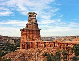
Amarillo has many natural attractions nearby. The Palo Duro Canyon State Park is the second largest canyon system in the U.S. It is located south of Amarillo. The canyon is popular for mountain biking. It also hosts an annual 50-mile trail run. Palo Duro has a unique rock formation called a hoodoo that looks like a lighthouse.
Another natural site is the Alibates Flint Quarries National Monument. It is about 30 miles (48 km) north of Amarillo. This was a place where ancient people got flint for tools and weapons. About 100 miles (160 km) southeast of Amarillo is Caprock Canyons State Park and Trailway. This park is home to the official Texas State Bison Herd.
Local millionaire Stanley Marsh 3 funded many public art projects. One famous project is the Cadillac Ranch. It is located west of Amarillo on Interstate 40. It features painted Cadillac cars buried nose-first in the ground. Marsh also created the Dynamite Museum. This project has thousands of fake traffic signs with funny messages scattered around the city.
Amarillo celebrates its cowboy and Texas culture. The Tri-State Fair & Rodeo happens every September. People from Oklahoma, New Mexico, and Texas come to Amarillo for it. The Amarillo National Center hosts events like national horse competitions and rodeos. The World Championship Ranch Rodeo is held every November at the Amarillo Civic Center. You can also watch a free cattle auction at the Amarillo Livestock Auction on Tuesdays.
The Big Texan Steak Ranch is a famous restaurant. It offers a free 72-ounce (2 kg) beef steak if you can eat it and the side dishes in under an hour.
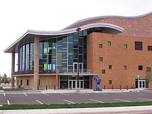
The Globe-News Center for the Performing Arts opened in 2006. It is home to the Amarillo Opera, Amarillo Symphony, and Lone Star Ballet. This building is near the Amarillo Civic Center. It has a 1,300-seat auditorium. The Amarillo Little Theatre is a local community theater group. They perform from September to May.
The Pioneer Amphitheater is in Palo Duro Canyon. It hosts an outdoor musical drama called Texas every summer. The musical tells a story about the history of Texas Panhandle settlers.
The Amarillo Public Library is part of the Harrington Library Consortium. This group shares resources with other libraries in the Texas Panhandle. The main library is downtown, and there are four smaller branches.
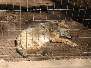
Wonderland Amusement Park is in northern Amarillo at Thompson Park. The park also has the Amarillo zoo and places for picnicking.
Famous people from Amarillo are called Amarilloans. They include astronaut Rick Husband, golfer Ryan Palmer, and singer-songwriter JD Souther.
Museums and Art Collections
The American Quarter Horse Association (AQHA) is an international group for the American Quarter Horse breed. Its headquarters are in Amarillo and it has a museum. The museum also features an American Quarter Horse Hall of Fame. The AQHA and Center City of Amarillo also sponsor "Hoof Prints of the American Quarter Horse." This project places horse statues, painted by local artists, in front of businesses around the city.
Two higher education schools in Amarillo have museums. The Amarillo Art Center, opened in 1972, includes the Amarillo Museum of Art (AMoA). It is on the Amarillo College campus. The Panhandle-Plains Historical Museum is on the West Texas A&M University campus. It is said to be the largest historical museum in Texas.
The Don Harrington Discovery Center is a science center with many hands-on exhibits. Outside, there is a steel structure called the Helium Monument. It has time capsules and calls Amarillo the "Helium Capital of the World." Near the Discovery Center are the Amarillo Botanical Gardens. They have gardens, indoor exhibits, and a library.
The Texas Pharmacy Museum is also in Amarillo. It focuses on the history of pharmacy. The Amarillo Historical Museum, founded in 2013, features only local history.
Other museums include the Kwahadi Kiva Indian Museum. It has Native American artifacts and dance performances. The English Field Air & Space Museum (now Texas Air & Space Museum) has aircraft and space exhibits.
Amarillo's Cityscape
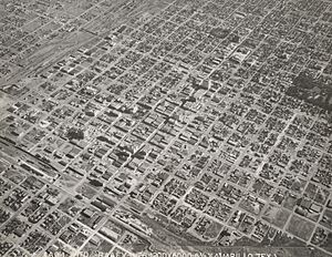
Most of Amarillo's growth is happening in the southern and northwestern parts of the city. Like many towns in the Texas Panhandle, the downtown area has faced economic challenges. To help it, the Center City of Amarillo organization was formed. They have sponsored public art projects and started block parties downtown.
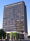
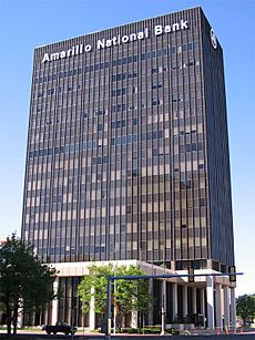
The 31-story FirstBank Southwest Tower opened in downtown Amarillo in 1971. The Amarillo National Bank Plaza One building, also finished in 1971, is the headquarters for the city's largest bank. The Santa Fe Building, completed in 1930, was once a railroad office. Potter County bought it in 1995 for new office space.
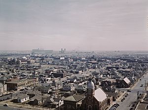
Amarillo's historic homes and buildings show the city's growth from around 1900 to World War II. Polk Street has many historic downtown buildings and homes. The large historic homes on this street were built close to downtown.
The city of Amarillo's Parks and Recreation Department manages over 50 parks. This includes a skatepark west of the city. Amarillo's largest parks are Medical Park, Thompson Memorial Park, and Memorial Park.
Tallest Buildings in Amarillo
| Rank | Name | Image | Height ft (m) |
Floors | Year | Coordinates | Notes |
|---|---|---|---|---|---|---|---|
| 1 | FirstBank Southwest Tower |  |
374 (114) | 31 | 1971 | 35°12′26.54″N 101°50′19.67″W / 35.2073722°N 101.8387972°W | |
| 2 | Amarillo National Bank | 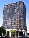 |
220 (67) | 16 | 1971 | 35°12′32.46″N 101°50′9.13″W / 35.2090167°N 101.8358694°W | |
| 3 | Santa Fe Building |  |
188 (57) | 13 | 1930 | 35°12′15.91″N 101°50′17.02″W / 35.2044194°N 101.8380611°W | |
| 4 | Herring Hotel |  |
164 (50) | 13 | 1926 | ||
| 5 | Fisk Medical Arts Building |  |
152 (46) | 12 | 1927 or 1928 |
Sports in Amarillo
The Amarillo Civic Center is home to several sports teams. These include the National Arena League team Amarillo Dusters, the Major League Indoor Soccer team the Amarillo Bombers, and the NAHL Jr. A hockey team, the Amarillo Bulls.
Amarillo also has a professional baseball team, the Amarillo Sod Poodles. They play at Hodgetown. Before them, the city had the Amarillo Thunderheads and the Amarillo Gold Sox.
West Texas A&M University has many NCAA Division II sports teams. Amarillo College plays in a different division, NJCAA Division 2. From 1968 to 1996, Amarillo hosted the annual National Women's Invitational Tournament (NWIT) for college basketball.
For high school football, Amarillo Independent School District teams play at Dick Bivins Stadium. Randall High School plays at Kimbrough Memorial Stadium in Canyon.
Amarillo also has a history in professional wrestling. Famous wrestlers like Dory Funk, Jr. and Terry Funk came from Amarillo.
Education in Amarillo
About 23.3% of adults aged 25 and older in Amarillo have a bachelor's degree. About 85% have a high school diploma.
Amarillo has several higher education schools:
- Amarillo College: A two-year community college with over 10,000 students.
- Wayland Baptist University: A private university with a branch campus in Amarillo.
- Texas Tech University Health Sciences Center: Has a campus in Amarillo for pharmacy and health professions.
- Texas Tech University at Amarillo: Offers some master's degree programs.
- West Texas A&M University: A regional university with a campus building in downtown Amarillo.
Primary and secondary education in Amarillo is handled by five different school districts:
- Amarillo ISD
- Bushland ISD
- Canyon ISD
- Highland Park ISD
- River Road ISD
Media in Amarillo
The main local newspaper is the Amarillo Globe-News. It used to be three different newspapers. Other publications include Accent West, a monthly magazine about the city. The Amarillo Pioneer is a daily online paper. The American Quarter Horse Association publishes two monthly magazines.
Amarillo has several major TV stations:
Amarillo is also a market for radio stations. Some popular stations include:
- KXGL-FM − 100.9 FM (Classic Hits)
- KGNC-FM − 97.9 FM (Country music)
- KGNC − 710 AM (News/Talk/Sports)
- KXSS-FM − 96.9 FM (Top 40/CHR)
- KQIZ-FM − 93.1 FM (Rhythmic Top 40/CHR)
The regional public radio network, High Plains Public Radio, operates KJJP-FM 105.7.
Amarillo's Infrastructure
Air Transportation
Rick Husband Amarillo International Airport is located 10 miles (16 km) east of downtown Amarillo. Part of the old Amarillo Air Force Base became part of this airport. The airport is named after NASA astronaut Rick Husband. He was from Amarillo and was the commander of the Space Shuttle Columbia on its last flight. The airport has flights to cities like Dallas, Houston, Austin, and Denver.
Tradewind Airport is a public airport for general aviation. It is 3 nautical miles (5.6 km) south of downtown Amarillo. It has two paved runways.
Buffalo Airport is another public airport for general aviation. It is 9 nautical miles (17 km) south of downtown Amarillo. It has two grass runways.
Ground Transportation
Amarillo has local bus services provided by Amarillo City Transit (ACT). ACT has fixed bus routes and services for people with disabilities. They transport many passengers each year.
Amarillo does not have passenger train service anymore. The last passenger train left the city in 1971. However, Amarillo is still an important part of the rail freight system. The BNSF Railway complex in Amarillo handles about 100–110 trains every day. The Union Pacific Railroad also sends many shipments through Amarillo. These shipments include grains and coal.
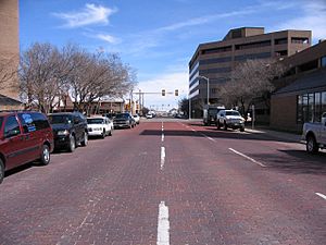
The streets in downtown Amarillo are set up in a grid pattern. The north-south streets are named after past U.S. presidents. The east-west streets are numbered. Some streets in the downtown area are still paved with bricks. In 2002, the city spent money to restore one block of brick street.
Major Highways
Amarillo is served by two interstate highways: I-27 and I-40. I-27 ends in Amarillo, connecting to I-40. It also connects to U.S. 60, 87, and 287.
Interstate 40 is the main east-west highway through Amarillo. It was completed in 1968. Before that, Route 66 was the main east-west highway. Route 66 generally followed Amarillo Boulevard. Amarillo is also mentioned in the song "(Get Your Kicks on) Route 66".
Loop 335 goes around Amarillo in all directions. It has four lanes in some parts and two lanes in others.
Future Freeways
In 2015, the Texas Department of Transportation (TxDOT) shared plans for a new Loop 335 freeway. This freeway will go all around Amarillo. TxDOT plans to build several multi-level interchanges. These will connect the loop to Interstate 40, Interstate 27, and U.S. 287 and 87.
The loop will be rebuilt to be an Interstate-Grade freeway. It will have four lanes and no cross-traffic at intersections. It will also include a large interchange to connect to the future I-27 Ports to Plains Corridor. Construction started in 2016. The whole project is expected to be finished by 2024.
Medical Centers and Hospitals
Amarillo has many medical facilities. These include Baptist St. Anthony's and Northwest Texas Hospitals. There is also the Don & Sybil Harrington Cancer Center. These are all located in the Harrington Regional Medical Center. This was the first area in Texas specifically for city hospitals.
Baptist St. Anthony's (BSA) has been recognized as one of the "Top 50 Hospitals" by U.S. News & World Report. BSA was formed when two hospitals merged in 1996. The BSA Hospice & Life Enrichment Center provides important care.
Northwest Texas Hospital has the area's only Level III trauma center. This means it can handle very serious injuries.
The Thomas E. Creek Department of Veterans Affairs Medical Center is east of the Harrington Regional Medical Center. It opened in 1940. In 2005, it was renamed to honor Thomas E. Creek, an Amarillo Marine who received the Medal of Honor. A new Texas State Veterans Home opened in northwest Amarillo in 2007.
Utilities
The City of Amarillo provides drinking water. Amarillo's water used to come from Lake Meredith and the Ogallala Aquifer. Now, due to low water levels in the lake, water comes only from the aquifer. Lake Meredith is northeast of Amarillo. Recent rainfall has helped the lake regain some water. The city usually produces between 40 and 50 million US gallons (150 to 190 million liters) of water daily.
The city also handles trash and garbage collection. Amarillo's non-hazardous waste is buried in the city's landfill. The city also has recycling centers.
Other services are provided by private companies. Atmos Energy distributes natural gas. Xcel Energy provides electric power. AT&T provides wired telephone service. Suddenlink Communications provides cable television.
|
See also
 In Spanish: Amarillo (Texas) para niños


