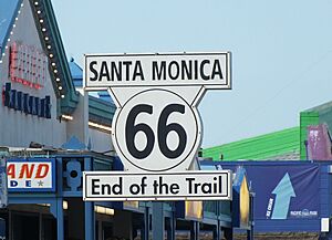
U.S. Route 66 facts for kids
Quick facts for kids
U.S. Route 66 |
||||
|---|---|---|---|---|
| Will Rogers Memorial Highway | ||||
|
The final alignments of U.S. Route 66 in red, with older alignments in pink
|
||||
| Route information | ||||
| Length | 2,448 mi (3,940 km) | |||
| Existed | November 11, 1926–June 26, 1985 | |||
| Tourist routes |
||||
| Major junctions | ||||
| West end | Santa Monica, California | |||
| East end | Chicago, Illinois | |||
| Location | ||||
| States: | California, Arizona, New Mexico, Texas, Oklahoma, Kansas, Missouri, Illinois | |||
| Highway system | ||||
| United States Numbered Highways List • Bannered • Divided • Replaced
|
||||
U.S. Route 66, also known as Route 66, is one of America's most famous roads. It was created on November 11, 1926. This highway stretched for about 2,448 miles (3,940 km) from Chicago, Illinois, all the way to Santa Monica, California. It passed through eight states: Illinois, Missouri, Kansas, Oklahoma, Texas, New Mexico, Arizona, and California.
Route 66 became super famous in movies, songs, and TV shows. You might know it from the song " (Get Your Kicks on) Route 66" or the Route 66 TV series. It even showed up in the Disney/Pixar Cars movies! The writer John Steinbeck called it the Mother Road because so many people traveled on it. Other nicknames include the Will Rogers Highway and the Main Street of America.
This highway was very important for people moving west, especially during the Dust Bowl in the 1930s when many families left their farms. It also helped small towns along the way grow and become successful. Businesses like diners and gas stations popped up everywhere. Even when new, faster highways (called Interstates) were built, people fought to keep Route 66 alive.
Route 66 changed a lot over the years, with new parts being built to make it safer and faster. But in 1985, it was officially removed from the U.S. Highway System because the Interstates had replaced it. Today, many parts of the old road are called "Historic Route 66" and are popular for tourists who want to experience a piece of American history. Some parts are even being turned into a bike path called U.S. Bicycle Route 66.
Contents
- History of Route 66
- How Long is Route 66 in Each State?
- Early Roads Before Route 66
- How Did Route 66 Get Its Name?
- The "Bunion Derby" and Early Fame
- Route 66 During the Great Depression and WWII
- Vacation Fun on Route 66
- How Route 66 Changed Over Time
- Why Did Route 66 Decline?
- What Happened After Route 66 Was Removed?
- The Revival of Route 66
- Route 66 in Museums
- What Was Route 66 Like?
- Special Routes of Route 66
- See also
History of Route 66
How Long is Route 66 in Each State?
Route 66 was a very long road! Here's how many miles it covered in each state when it first opened in 1926:
| mi | km | |
|---|---|---|
| California | 316 | 509 |
| Arizona | 401 | 645 |
| New Mexico | 487 | 784 |
| Texas | 186 | 299 |
| Oklahoma | 432 | 695 |
| Kansas | 13 | 21 |
| Missouri | 317 | 510 |
| Illinois | 301 | 484 |
| Total | 2,448 | 3,940 |
Early Roads Before Route 66
Long before Route 66 got its name, parts of the path were already used. In 1857, a U.S. Army officer named Lt. Edward Fitzgerald Beale was told to build a wagon road. He even tested using camels to carry supplies in the desert! This road became part of what would later be Route 66.
Before the U.S. had numbered highways, private groups marked "auto trails" for cars. The path that became Route 66 followed parts of three main trails:
- The Lone Star Route
- The National Old Trails Road
- The Ozark Trails system
People like Cyrus Avery from Oklahoma and John Woodruff from Missouri really pushed for a road connecting Chicago and Los Angeles. They wanted it to help small towns by giving them access to a major national road.
How Did Route 66 Get Its Name?
The number "66" was given to the Chicago-to-Los Angeles road on April 30, 1926. This happened in Springfield, Missouri. Cyrus Avery really wanted the highway to have a nice round number like "60." But other states wanted "60" for their roads. After some debate, they settled on "66" because it was available.
Even after it was named, Route 66 wasn't fully paved until 1938. Cyrus Avery helped create the U.S. Highway 66 Association in 1927. This group worked to get the whole road paved and to encourage people to travel on it.
The "Bunion Derby" and Early Fame
In 1928, the Route 66 Association held a big footrace called the "Bunion Derby." Runners went from Los Angeles to New York City, and part of their path was on Route 66. Famous people like Will Rogers cheered them on! This race helped make Route 66 well-known.
The association also put ads in magazines, inviting people to drive Route 66 to the 1932 Summer Olympics in Los Angeles. This made even more people interested in the road. The association helped businesses along the highway until it closed down in 1976.
Route 66 During the Great Depression and WWII
Route 66 became a very busy road, especially for trucks, because it was mostly flat. During the Dust Bowl in the 1930s, many families from states like Oklahoma and Texas lost their farms. They traveled west on Route 66, hoping to find new jobs in California. This is why it was called the "Mother Road."
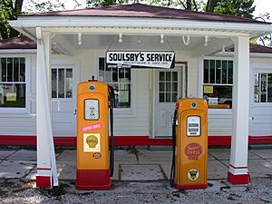
The growing traffic helped small businesses thrive. Gas stations, restaurants, and motels popped up everywhere, making it easy for travelers to stop.
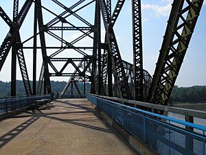
At first, much of Route 66 was just gravel or dirt. But thanks to the U.S. Highway 66 Association, it became the first highway to be completely paved in 1938. Some parts were dangerous, with sharp turns, and were even called "Bloody 66." Over time, these parts were fixed. One very steep section through the Black Mountains in Arizona was so scary that some travelers hired locals to drive their cars through it!
During World War II, even more people moved west for war jobs in California. Route 66 was a main route for them and also used to move military equipment.
Vacation Fun on Route 66
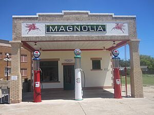
In the 1950s, Route 66 became the perfect road for families going on vacation to Los Angeles. It passed by amazing sights like the Painted Desert, the Grand Canyon, and Meteor Crater in Arizona.
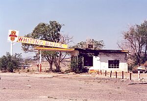
This boom in tourism led to all sorts of fun roadside attractions! You could see teepee-shaped motels, try frozen custard, buy souvenirs from Indian shops, or visit reptile farms. The Meramec Caverns in Missouri advertised themselves as the "Jesse James hideout" on barns. The Big Texan restaurant offered a free 72-ounce steak dinner if you could eat it all in an hour!
Route 66 also saw the birth of fast food. The first drive-through restaurant, Red's Giant Hamburg, opened in Springfield, Missouri. And the very first McDonald's was in San Bernardino, California, right on Route 66. All these things made Route 66 a symbol of American culture and car travel.
How Route 66 Changed Over Time
Route 66 was often changed to make it better. For example, in 1930, a part of Route 66 in Illinois was moved further east to make it straighter. In Oklahoma, a new, straighter path was built in 1933, bypassing some towns and a old toll bridge.
A big change happened in New Mexico in 1937. The road used to go north through Santa Fe and then south. A new, straight route was built that saved travelers about four hours!
In 1940, the first freeway in Los Angeles, the Arroyo Seco Parkway, became part of Route 66. Later, in 1953, the very twisty and steep Oatman Highway in Arizona was bypassed by a new, easier route. This caused the town of Oatman, Arizona to become almost a ghost town.
As the new Interstate highways were built in the 1950s and 60s, they often took over parts of Route 66. This meant that the old businesses on Route 66 were harder for travelers to find, and many of them closed down.
In 1936, Route 66 was extended all the way to Santa Monica, California, ending near the ocean. Route 66 was also rerouted around bigger cities like St. Louis and Oklahoma City to help drivers avoid traffic.
Why Did Route 66 Decline?
The decline of Route 66 began in 1956 when President Dwight D. Eisenhower signed the Interstate Highway Act. He had seen Germany's fast Autobahn highways and wanted something similar for the U.S. for defense and travel.
Over its nearly 60 years, Route 66 was always changing. Engineers kept trying to find more direct routes. After World War II, many parts of Route 66 were widened to four lanes and had bypasses built around towns. Later, these four-lane sections were often turned into freeways.
For example, in Oklahoma, new toll roads like the Turner Turnpike (1953) and the Will Rogers Turnpike (1957) were built. These new roads ran parallel to Route 66 and bypassed many towns. They later became parts of I-44.
Sometimes, the new Interstate highway actually used parts of the old Route 66. They would build one new set of lanes, move traffic to it, and then build another set of lanes. The old lanes might become a frontage road or be abandoned.
Some towns didn't want the new Interstates to bypass them because they feared losing business. In New Mexico, a law was even passed to stop bypasses, but it didn't last long. Eventually, towns like Tucumcari agreed to have the Interstate built close by so travelers could still easily visit.
The last section of Route 66 to be bypassed by an Interstate was in Arizona, near Williams, Arizona, in 1984. Finally, in 1985, Route 66 was officially removed from the U.S. Highway System. No single Interstate replaced it; instead, different Interstates cover its path, like Interstate 55 and Interstate 44 in the east, and Interstate 40 in the west.
What Happened After Route 66 Was Removed?
When Route 66 was decommissioned, different parts of the road became different things. Some sections became "business loops" for the Interstates, state roads, local roads, or even private driveways. Some parts were just left abandoned.
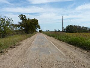
Even though you can't drive the entire Route 66 without interruption anymore, much of the original road is still there! You can still drive on many old sections if you plan carefully. Some parts are very well preserved, like a section between Springfield, Missouri, and Tulsa, Oklahoma. Some old sections are very narrow, called "sidewalk highways," with just one paved lane and gravel shoulders.
Many states kept the "66" number for parts of the old highway, but as state roads. For example, in Missouri, you can find Route 366 and Route 266. In Oklahoma, SH-66 is an alternate "free" route near the turnpikes. A long part of Route 66 in Arizona is now State Route 66. In California, SR 66 still exists in some areas.
The Revival of Route 66
People missed Route 66, so groups started forming to bring it back to life! The first "Route 66 associations" were created in Arizona in 1987, and then in Missouri and Illinois in 1989. In 1990, Missouri even declared Route 66 a "State Historic Route."
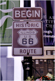
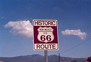
Today, you can find "Historic Route 66" markers along the entire 2,400-mile road. In many towns, local groups have even painted the "66" shield right onto the road! This helps travelers find the old route, especially since the official signs are sometimes stolen by souvenir collectors.
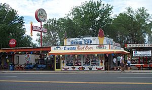
Many parts of the road have been added to the National Register of Historic Places, which helps protect them. Some sections, like the Arroyo Seco Parkway in Los Angeles and parts of Route 66 in New Mexico, have been made into National Scenic Byways because they are so beautiful and historic.
Cities along the route have also embraced its history. Glendora, California, renamed its section of Route 66 "Route 66." Flagstaff, Arizona, renamed most of its main street "Route 66." Festivals are held every year, like the "International Route 66 Mother Road Festival" in Springfield, Illinois.
Many groups are working to save and restore old motels and neon signs along the road. In 1999, President Bill Clinton signed a bill that provided $10 million to help preserve and restore historic sites along Route 66.
In 2008, the World Monuments Fund added Route 66 to its list of important sites around the world. This is because many old gas stations, motels, and diners are in danger of being destroyed or falling apart. The National Park Service has even created a travel guide to help people explore over a hundred historic sites on Route 66.
Some groups want to make Route 66 an official U.S. Highway again, using a mix of old and new roads. Also, in 2018, the first parts of the U.S. Bicycle Route 66 were created in Kansas and Missouri, allowing people to bike along the historic path.
Route 66 in Museums
The National Museum of American History in Washington, D.C. has a special section about Route 66. You can see a piece of the actual pavement from Bridgeport, Oklahoma, and old cars and trucks from the 1930s. They also have old neon signs from gas stations and motels, and postcards sent by travelers.
Oklahoma has several museums dedicated to Route 66:
- The National Route 66 & Transportation Museum in Elk City, Oklahoma covers all eight states.
- The Oklahoma Route 66 Museum in Clinton shows the famous ideas and images of the Mother Road.
- In Sapulpa, the Heart of Route 66 Auto Museum has a giant 66-foot-tall gas pump!
- Tulsa has the Cyrus Avery Centennial Plaza with a huge sculpture called "East Meets West." It shows the Avery family in a Model T car meeting a horse-drawn carriage. Tulsa also has a "neon park" with glowing replicas of old motel signs.
In Illinois, the Route 66 Association of Illinois has its Museum and Hall of Fame in Pontiac. It's a free museum with lots of items related to Route 66, especially in Illinois.
What Was Route 66 Like?
Route 66 had many nicknames over the years. At first, it was called "The Great Diagonal Way" because it ran diagonally from Chicago to Oklahoma City. Later, the U.S. Highway 66 Association called it "The Main Street of America." But the most famous name, "The Mother Road," came from John Steinbeck's book The Grapes of Wrath. In 1952, it was also unofficially named "The Will Rogers Highway." You can still find plaques dedicated to Will Rogers in places like Santa Monica, California, and Galena, Kansas.
California's Route 66
Route 66 started (or ended!) in California, covering about 315 miles (507 km) in the state. It went through big cities like Santa Monica, Los Angeles, Pasadena, and San Bernardino. San Bernardino is home to one of the two remaining Wigwam Motels on Route 66. The highway crossed other major roads like US 101 and I-5.
Arizona's Route 66
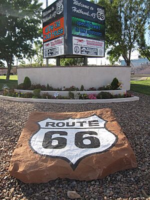
In Arizona, Route 66 was about 401 miles (645 km) long. It often ran alongside I-40. It passed through towns like Oatman and Kingman. The section between Kingman and Seligman is still signed as SR 66. Williams was the very last town on Route 66 to be bypassed by an Interstate. Holbrook has another one of the two remaining Wigwam Motels.
New Mexico's Route 66
Route 66 covered about 380 miles (612 km) in New Mexico. It went through many Indian reservations in the western part of the state. Further east, it passed through big cities like Albuquerque and Santa Fe. Like in Arizona, Route 66 in New Mexico often ran next to I-40.
Texas's Route 66
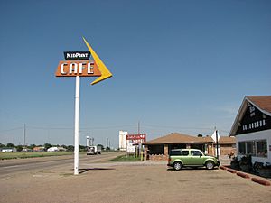
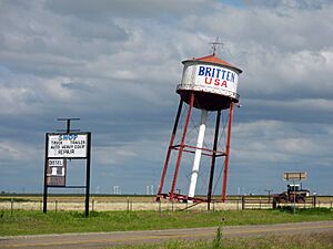
In the Texas Panhandle, Route 66 was about 178 miles (286 km) long, running east to west. Adrian is famous for being the exact midpoint of the entire Route 66! East of Adrian, the highway went through Amarillo, known for the Cadillac Ranch, and towns like Shamrock.
Oklahoma and Kansas's Route 66
Route 66 was about 376 miles (605 km) long in Oklahoma. Today, parts of it are marked by I-40 and SH-66. After entering Oklahoma, it passed through towns like Sayre and Elk City before reaching Oklahoma City. Beyond Oklahoma City, it went through Tulsa and then into Kansas.
Kansas has the shortest section of Route 66, only about 13.2 miles (21.2 km) long! It passes through just three towns: Galena, Riverton, and Baxter Springs.
Missouri's Route 66
Route 66 covered about 292 miles (470 km) in Missouri. After entering from Kansas, it went through Joplin and Carthage. It then passed through Springfield, where the world's first drive-thru restaurant, Red's Giant Hamburg, is located. The road continued through towns like Lebanon and Rolla before reaching St. Louis.
Illinois's Route 66
Route 66 was about 301 miles (484 km) long in Illinois. It entered Illinois from East St. Louis after crossing the Mississippi River. Near there, it passed by Cahokia Mounds, a very old Native American site. The highway then went through Springfield, past the Illinois State Capitol, and through towns like Pontiac. Finally, it entered the Chicago area and ended in Chicago itself.
Special Routes of Route 66
Over the years, Route 66 had many special routes to help with traffic. These included:
- Business routes (BUS): Roads that went through the center of a town.
- Bypass routes (BYP): Roads that went around a town to avoid traffic.
- Alternate routes (ALT): Other paths that travelers could take.
Some examples of these special routes include:
- U.S. Route 66 Alternate: Bolingbrook–Gardner, Illinois
- U.S. Route 66 Business: Springfield, Illinois
- U.S. Route 66 Bypass: Mitchell, Illinois–Sunset Hills, Missouri
- U.S. Route 66 Business: Tulsa, Oklahoma
- U.S. Route 66 Business: Oklahoma City, Oklahoma
- U.S. Route 66 Business: Amarillo, Texas
- U.S. Route 66 Business: San Bernardino, California
- U.S. Route 66 Alternate: Pasadena–Los Angeles, California
See also
 In Spanish: U.S. Ruta 66 para niños


